Exhibit 4.55
ELEVENTH SUPPLEMENTAL INDENTURE
between
MICHIGAN ELECTRIC TRANSMISSION COMPANY, LLC
and
The Bank of New York Mellon Trust Company, N.A.
Trustee
Dated as of July 19, 2021
Supplementing the First Mortgage Indenture dated as of December 10, 2003, as heretofore supplemented
THIS INSTRUMENT CONTAINS AFTER-ACQUIRED PROPERTY PROVISIONS
Establishing a series of Securities designated 2.90% Series A Senior Secured Notes due 2051
and a series of Securities designated 3.05% Series B Senior Secured Notes due 2052
TABLE OF CONTENTS
| | | | Page |
| | | | |
| ARTICLE One DEFINITIONS AND OTHER PROVISIONS OF GENERAL APPLICATION | 7 |
| | | | |
| ARTICLE Two TITLE, FORM AND TERMS AND CONDITIONS OF THE NOTES | 14 |
| | | | |
| | Section 2.01. | The Notes | 14 |
| | Section 2.02. | Payment on the Notes | 15 |
| | Section 2.03. | Mandatory Redemption of the Notes | 16 |
| | Section 2.04. | Optional Redemption | 17 |
| | Section 2.05. | Purchase of Notes | 18 |
| | Section 2.06. | Payment upon Event of Default | 18 |
| | Section 2.07. | Transfers | 18 |
| | | | |
| ARTICLE Three ADDITIONAL COVENANTS | 18 |
| | | | |
| | Section 3.01. | Affirmative Covenants of the Company | 18 |
| | Section 3.02. | Negative Covenants of the Company | 20 |
| | | | |
| ARTICLE Four ADDITIONAL EVENTS OF DEFAULT; REMEDIES | 20 |
| | | | |
| | Section 4.01. | Events of Default | 20 |
| | Section 4.02. | Acceleration of Maturity | 21 |
| | | | |
| ARTICLE Five MISCELLANEOUS PROVISIONS | 21 |
| | | | |
| | Section 5.01. | Execution of Eleventh Supplemental Indenture | 21 |
| | Section 5.02. | Effect of Headings | 22 |
| | Section 5.03. | Successors and Assigns | 22 |
| | Section 5.04. | Severability Clause | 22 |
| | Section 5.05. | Benefit of Eleventh Supplemental Indenture | 22 |
| | Section 5.06. | Execution and Counterparts; Electronic Contracting | 22 |
| | Section 5.07. | Conflict with Mortgage Indenture | 23 |
| | Section 5.08. | Recitals | 23 |
| | Section 5.09. | Governing Law | 23 |
| | Section 5.10. | Interpretation of Financial Covenants | 23 |
| Schedule 1 | | Recording Information |
| | | |
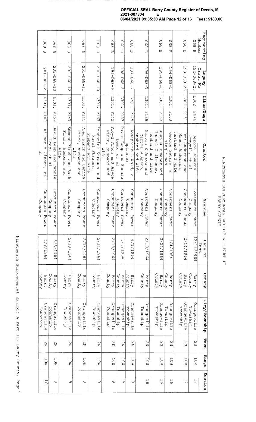
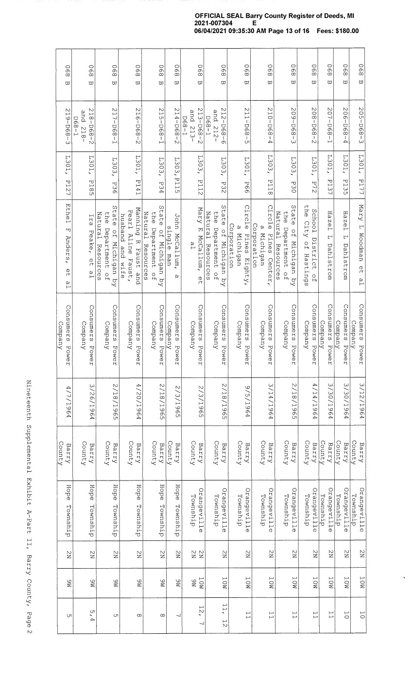
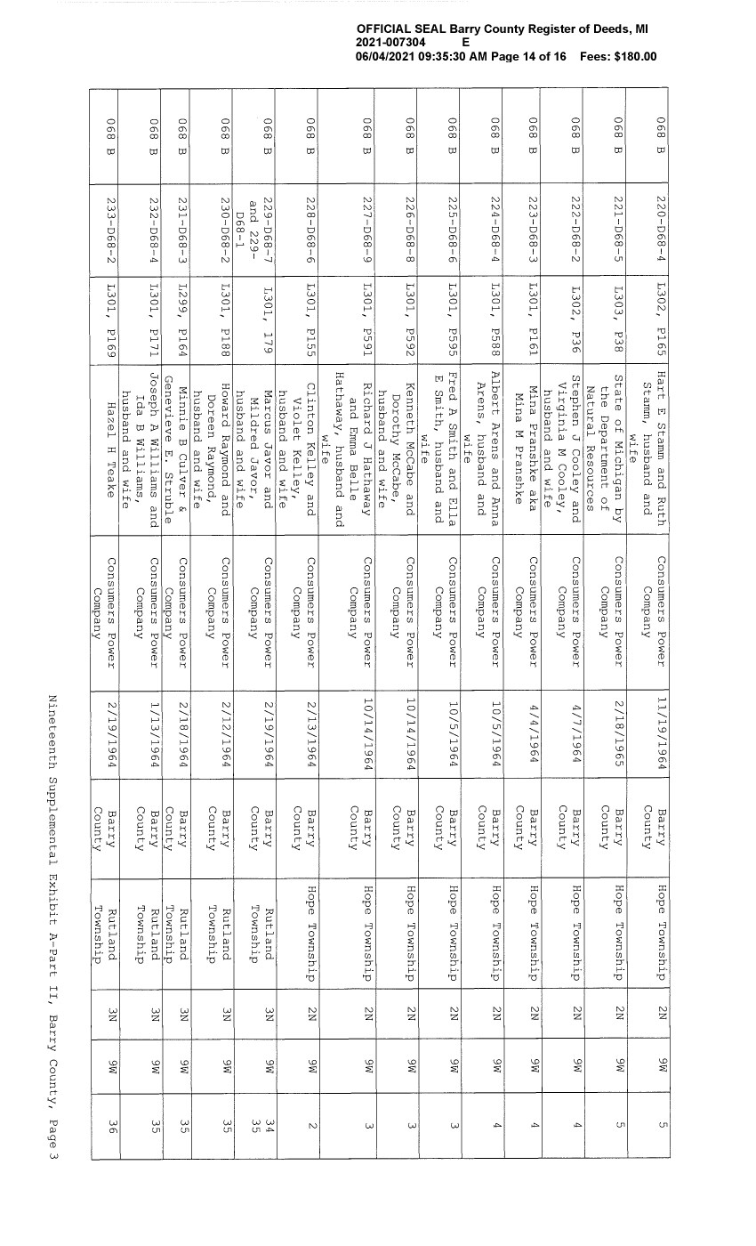
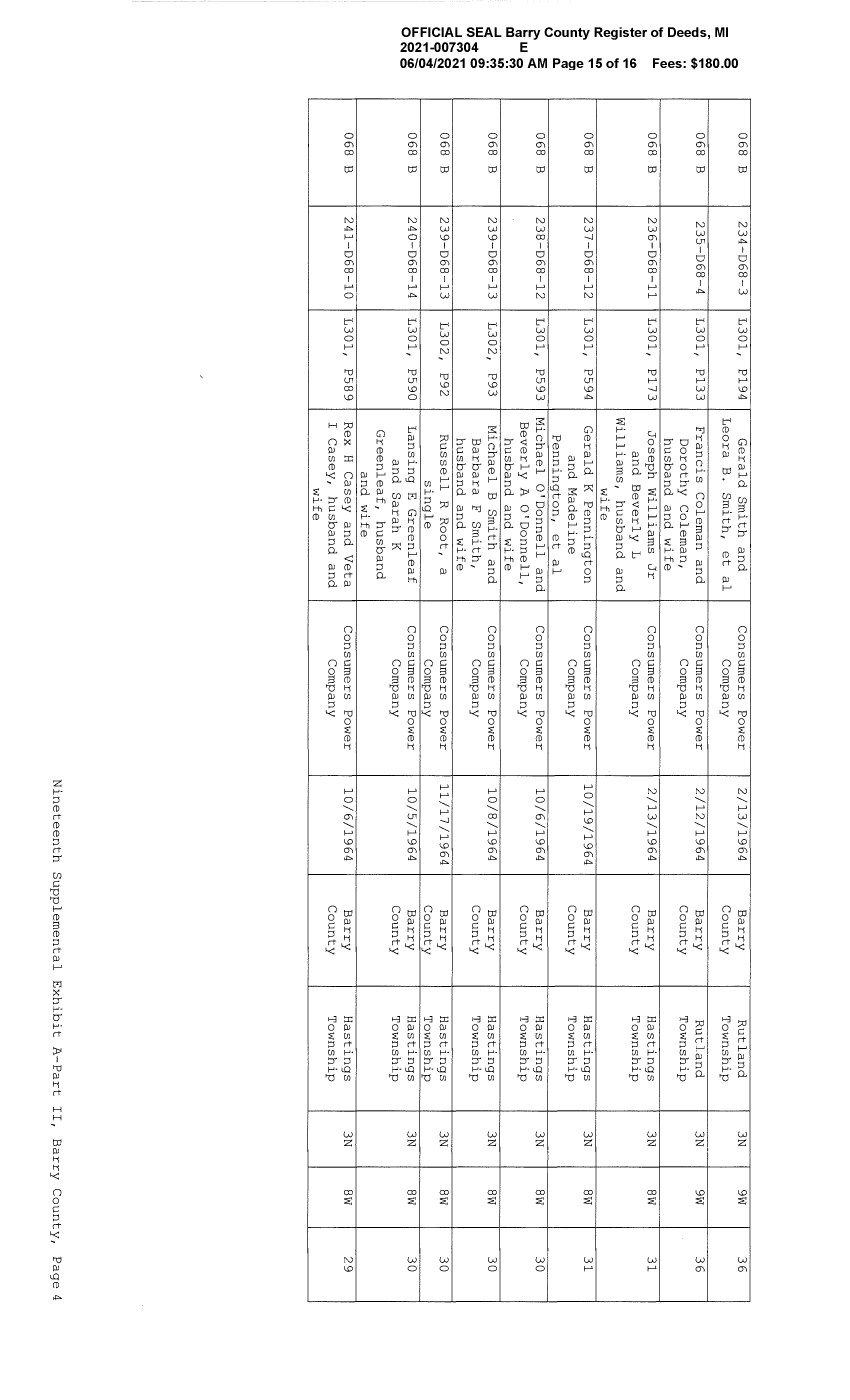
| Exhibit A | | Description of Properties |
| Exhibit B | | Subordination Terms |
| Exhibit C | | Form of Series A Note |
| Exhibit D | | Form of Series B Note |
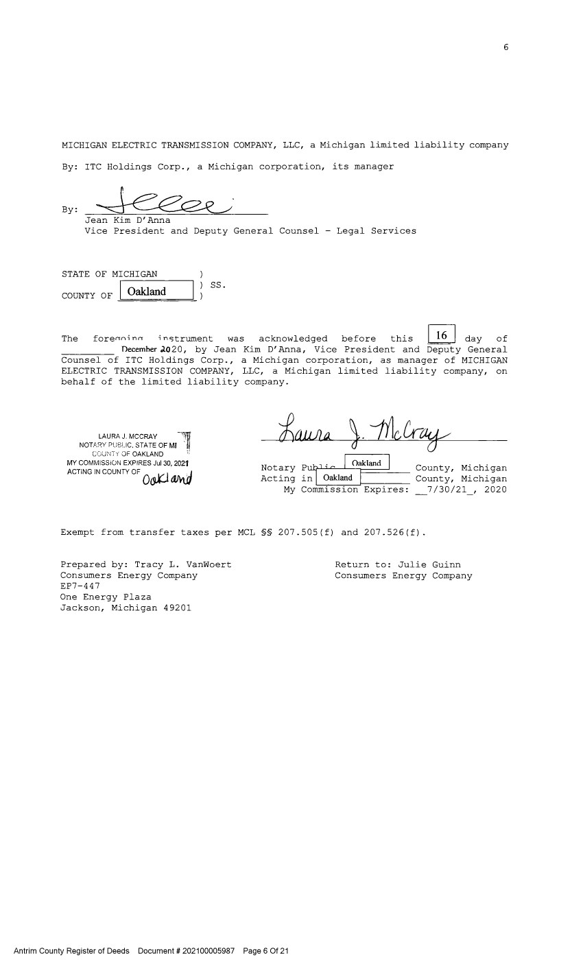
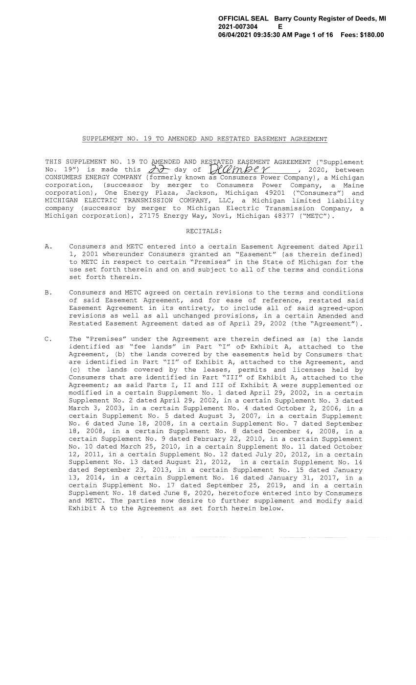
ELEVENTH SUPPLEMENTAL INDENTURE (this “ELEVENTH SUPPLEMENTAL INDENTURE”), dated as of July 19, 2021, between MICHIGAN ELECTRIC TRANSMISSION COMPANY, LLC, a limited liability company organized and existing under the laws of the State of Michigan (herein called the “Company”), having its principal office at 27175 Energy Way, Novi, Michigan 48377, and The Bank of New York Mellon Trust Company, N.A. (as successor to JPMorgan Chase Bank, N.A.), a national banking association organized under the laws of the United States, as trustee (herein called the “Trustee”), the office of the Trustee at which on the date hereof its corporate trust business is administered being 2 N. LaSalle, Suite 700, Chicago, Illinois 60602.
RECITALS OF THE COMPANY
WHEREAS, the Company has heretofore executed and delivered to the Trustee a First Mortgage Indenture dated as of December 10, 2003 (the “Original Mortgage Indenture”), as amended and supplemented by the Third Supplemental Indenture thereto, dated as of November 25, 2008, (together with the Original Mortgage Indenture, the “Mortgage Indenture”) encumbering the real property interests as more particularly described on Exhibit A and Exhibit B attached to the Original Mortgage Indenture, on Exhibit A to the Fourth Supplemental Indenture thereto, Exhibit A to the Fifth Supplemental Indenture thereto, Exhibit A to the Sixth Supplemental Indenture thereto, Exhibit A to the Seventh Supplemental Indenture thereto, Exhibit A to the Eighth Supplemental Indenture thereto, Exhibit A to the Ninth Supplemental Indenture thereto and Exhibit A to the Tenth Supplemental Indenture thereto, and providing for (i) the issuance by the Company from time to time of its bonds, notes or other evidences of indebtedness (in the Mortgage Indenture and herein called the “Debt Securities”) to be issued in one or more series and to provide security for the payment of the principal of and premium (including any Make-Whole Amount), if any, and interest, if any, on the Debt Securities and (ii) the issuance from time to time of Collateral Securities (as defined in the Mortgage Indenture) (together with the Debt Securities, in the Mortgage Indenture and herein called the “Securities”); and
WHEREAS, the Company has heretofore executed and delivered the following supplemental indentures, each dated as hereinafter set forth:
| Instrument | Date |
| | |
| First Supplemental Indenture | December 10, 2003 |
| | |
| Second Supplemental Indenture | December 10, 2003 |
| | |
| Third Supplemental Indenture | November 25, 2008 |
| | |
| Fourth Supplemental Indenture | December 11, 2008 |
| | |
| Fifth Supplemental Indenture | April 20, 2010 |
| | |
| Sixth Supplemental Indenture | October 5, 2012 |
| | |
| Seventh Supplemental Indenture | December 4, 2014 |
| | |
| Eighth Supplemental Indenture | March 31, 2016 |
| | |
| Ninth Supplemental Indenture | November 28, 2018 |
| | |
| Tenth Supplemental Indenture | August 12, 2020 |
WHEREAS, the Original Mortgage Indenture, the First Supplemental Indenture, the Second Supplemental Indenture, the Fourth Supplemental Indenture, the Fifth Supplemental Indenture, the Sixth Supplemental Indenture, the Seventh Supplemental Indenture, the Eighth Supplemental Indenture, the Ninth Supplemental Indenture and the Tenth Supplemental Indenture listed in the foregoing paragraph were recorded in the offices set forth in Schedule 1 attached hereto; and
WHEREAS, there have heretofore been issued under the Indenture the following Securities in the principal amounts as follows:
| Title | | Issued | | | Principal Amount | |
| 5.75% Senior Secured Notes, due 2015 | | | December 10, 2003 (Discharged on December 10, 2015) | | | $ | 175,000,000 | |
| | | | | | | | | |
| Senior Secured Bonds, Collateral Series A | | | December 10, 2003 (Discharged on March 29, 2007) | | | $ | 35,000,000 | |
| | | | | | | | | |
| 6.63% Senior Secured Notes due 2014 | | | December 11, 2008 (Discharged on December 18, 2014) | | | $ | 50,000,000 | |
| | | | | | | | | |
| 5.64% Senior Secured Notes due 2040 | | | May 6, 2010 | | | $ | 50,000,000 | |
| | | | | | | | | |
| 3.98% Senior Secured Notes due 2042 | | | October 26, 2012 | | | $ | 75,000,000 | |
| | | | | | | | | |
| 4.19% Senior Secured Notes due 2044 | | | December 17, 2014 | | | $ | 150,000,000 | |
| | | | | | | | | |
| 3.90% Senior Secured Notes due 2046 | | | April 26, 2016 | | | $ | 200,000,000 | |
| | | | | | | | | |
| 4.55% Series A Secured Notes due 2049 | | | January 15, 2019 | | | $ | 50,000,000 | |
| | | | | | | | | |
| 4.65% Series B Secured Notes due 2049 | | | July 10, 2019 | | | $ | 50,000,000 | |
| | | | | | | | | |
| 3.02% Senior Secured Notes due 2055 | | | October 14, 2020 | | | $ | 150,000,000 | |
WHEREAS, in addition to the property described in the Original Mortgage Indenture, the Fourth Supplemental Indenture, the Fifth Supplemental Indenture, the Sixth Supplemental Indenture, the Seventh Supplemental Indenture, the Eighth Supplemental Indenture, the Ninth Supplemental Indenture and the Tenth Supplemental Indenture, the Company has acquired certain other property, rights, and interests in property; and
WHEREAS, the Company, in the exercise of the power and authority conferred upon and reserved to it under the provisions of the Mortgage Indenture and pursuant to a Company Resolution, has duly determined to make, execute and deliver to the Trustee this Eleventh Supplemental Indenture to the Mortgage Indenture as permitted by Sections 201, 301 and 1201 of the Mortgage Indenture in order to establish the form and terms of, and to provide for the creation and issuance of, two series of Securities under the Mortgage Indenture in an aggregate principal amount of $150,000,000 and to amend and supplement the Mortgage Indenture as herein provided; and
WHEREAS, all things necessary to make the Notes (as defined herein), when executed by the Company and authenticated and delivered by the Trustee or any Authenticating Agent and issued upon the terms and subject to the conditions hereinafter and in the Mortgage Indenture set forth against payment therefor the valid, binding and legal obligations of the Company and to make this Eleventh Supplemental Indenture a valid, binding and legal agreement of the Company, have been done;
GRANTING CLAUSES
NOW, THEREFORE, THIS ELEVENTH SUPPLEMENTAL INDENTURE WITNESSETH that, in order to establish the terms of two series of Securities, and for and in consideration of the premises and of the covenants contained in the Mortgage Indenture and in this Eleventh Supplemental Indenture and for other good and valuable consideration the receipt and sufficiency of which are hereby acknowledged, and in order to secure the payment of the principal of and premium, if any, and interest, if any, on, and all other amounts (including, without limitation, fees, expenses and indemnities) in connection with, all Securities from time to time Outstanding and the performance of the covenants therein and herein contained and to declare the terms and conditions on which such Securities are secured, the Company hereby grants, bargains, sells, conveys, assigns, transfers, mortgages, pledges, sets over and confirms to the Trustee, and grants to the Trustee, for itself and for the benefit of the Holders, with power of sale, a lien upon and a security interest in, the following (subject, however, to the terms and conditions set forth in the Mortgage Indenture and herein):
GRANTING CLAUSE FIRST
All right, title and interest of the Company, as of the date of the execution and delivery of this Eleventh Supplemental Indenture, as originally executed and delivered, in and to all of the following property:
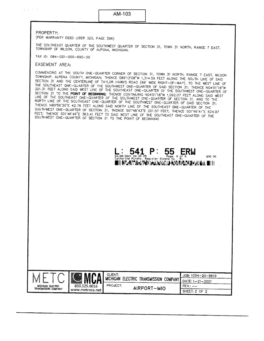
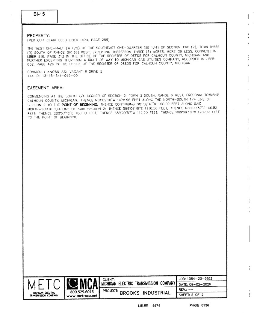
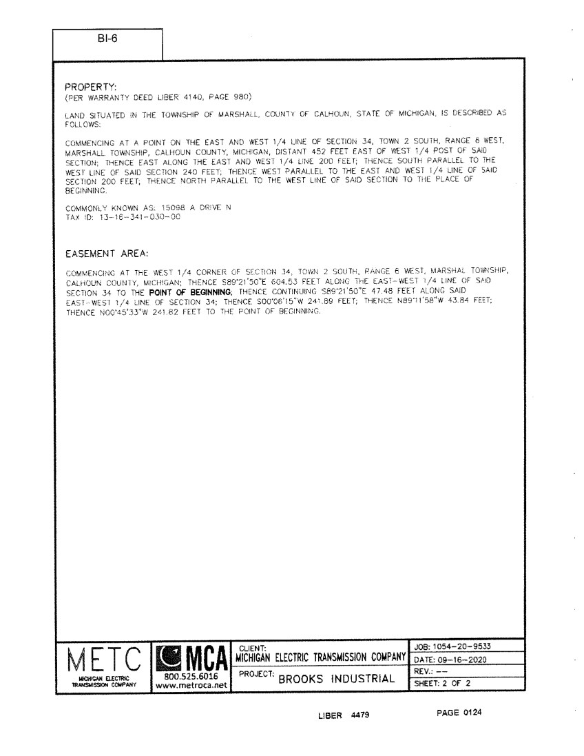
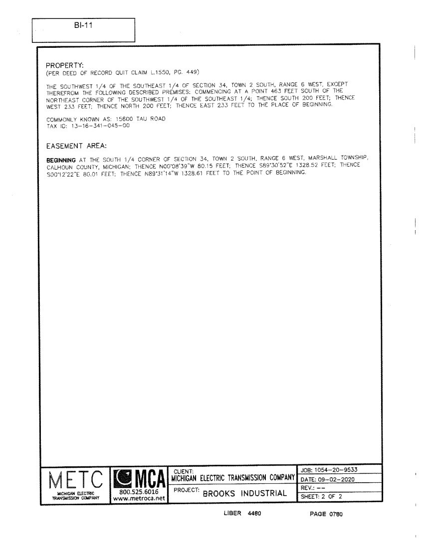
(a) all real property owned in fee and other interests in real property located in the State of Michigan or wherever else situated including, but not limited to, such property as described in Exhibit A and Exhibit B attached to the Original Mortgage Indenture, Exhibit A attached to the Fourth Supplemental Indenture, Exhibit A attached to the Fifth Supplemental Indenture, Exhibit A attached to the Sixth Supplemental Indenture, Exhibit A attached to the Seventh Supplemental Indenture, Exhibit A attached to the Eighth Supplemental Indenture, Exhibit A attached to the Ninth Supplemental Indenture, Exhibit A attached to the Tenth Supplemental Indenture and Exhibit A attached hereto;
(b) the entire easement estate created under and by virtue of the Easement Agreement (as defined in Section 101 of the Original Mortgage Indenture), including any interest in any fee, or greater or lesser title to such easement estate, including, without limitation, the Company’s interest in the parcels of real property described in Exhibit B attached to the Original Mortgage Indenture for purposes of local recording of the Indenture (collectively, the “Easement Land”) and the Improvements (as defined below) that the Company may own or hereafter acquire (whether acquired pursuant to a right or option contained in the Easement Agreement or otherwise) and all credits, deposits, options, privileges and rights of the Company under the Easement Agreement (including all rights of use, occupancy and enjoyment) and under any amendments, supplements, extensions, renewals, restatements, replacements and modifications thereof (including, without limitation, (i) the right to give consents, (ii) the right to receive moneys payable to the Company, (iii) the right to renew or extend the Easement Agreement for a succeeding term or terms, (iv) the right, if any, to purchase the Real Estate (as defined below) and (v) the right to terminate or modify the Easement Agreement); all of the Company’s claims and rights to the payment of damages arising under the Bankruptcy Code (as defined in Section 101 of the Original Mortgage Indenture) from any rejection of the Easement Agreement by the grantor thereunder or any other party (such parcel(s) of real property (including the real property owned in fee and the Easement Land and the Company’s easement estate), together with all of the buildings, improvements, structures and fixtures now or subsequently located thereon (the “Improvements”) are collectively referred to as the “Real Estate”);
(c) the Improvements or any part thereof (whether owned in fee by the Company or held pursuant to the Easement Agreement or otherwise) and all the estate, right, title, claim or demand whatsoever of the Company, in possession or expectancy, in and to the Real Estate or any part thereof;
(d) all rights of way, gores of land, streets, ways, alleys, passages, sewer rights, waters, water courses, water and riparian rights, development rights, air rights, mineral rights and all estates, rights, titles, interests, privileges, licenses, tenements, hereditaments and appurtenances belonging, relating or appertaining to the Real Estate, and any reversions, remainders, rents, issues, profits and revenue thereof and all land lying in the bed of any street, road or avenue, in front of or adjoining the Real Estate to the center line thereof (the assets described in clauses (a), (b) and (c) above and this clause (d) are collectively referred to as the “Real Property”);
(e) all fixtures, towers, pole structures, poles, crossarms, wires, cables, conduits, guys, anchors, transformers, insulators, substations, switching stations, chattels, business machines, machinery, apparatus, equipment, furnishings, fittings and articles of personal property of every kind and nature whatsoever, and all appurtenances and additions thereto and substitutions or replacements thereof (together with, in each case, attachments, components, parts and accessories) currently owned or subsequently acquired by the Company and now or subsequently attached to, or contained in or used or usable in any way in connection with any operation or letting of the Real Estate, including but without limiting the generality of the foregoing, all screens, awnings, shades, blinds, curtains, draperies, artwork, carpets, rugs, storm doors and windows, furniture and furnishings, heating, electrical, and mechanical equipment, lighting, switchboards, plumbing, ventilating, air conditioning and air-cooling apparatus, refrigerating, and incinerating equipment, escalators, elevators, loading and unloading equipment and systems, stoves, ranges, laundry equipment, cleaning systems (including window cleaning apparatus), telephones, communication systems (including satellite dishes and antennae), televisions, computers, sprinkler systems and other fire prevention and extinguishing apparatus and materials, security systems, motors, engines, machinery, pipes, pumps, tanks, conduits, appliances, fittings and fixtures of every kind and description and all other assets that constitute “Equipment” as defined in the Uniform Commercial Code (all of the foregoing in this clause (e), collectively being referred to as the “Equipment”);
(f) all substitutes and replacements of, and all additions and improvements to, the Real Estate and the Equipment, subsequently acquired by or released to the Company or constructed, assembled or placed by the Company on the Real Estate, immediately upon such acquisition, release, construction, assembling or placement, including, without limitation, any and all building materials whether stored at the Real Estate or offsite, and, in each such case, without any further mortgage, conveyance, assignment or other act by the Company;
(g) all leases, subleases, underlettings, concession agreements, management agreements, licenses and other agreements relating to the use or occupancy of the Real Estate or the Equipment or any part thereof, now existing or subsequently entered into by the Company and whether written or oral and all guarantees of any of the foregoing (collectively, as any of the foregoing may be amended, restated, extended, renewed or modified from time to time, the “Leases”), and all rights of the Company in respect of cash and securities deposited thereunder and the right to receive and collect the revenues, income, rents, issues and profits thereof, together with all other rents, royalties, issues, profits, revenue, income and other benefits arising from the use and enjoyment of the Mortgaged Property (collectively, the “Rents”), including, but not limited to, all rights conferred by Act No. 210 of the Michigan Public Acts of 1953 as amended by Act No. 151 of the Michigan Public Acts of 1966 (MCLA 554.231 et seq.), and Act No. 228 of the Michigan Public Acts of 1925 as amended by Act No. 55 of the Michigan Public Acts of 1933 (MCLA 554.211 et seq.);
(h) all trade names, trade marks, logos, copyrights, good will and books and records relating to or used in connection with the operation of the Real Estate or the Equipment or any part thereof, all rights, priorities and privileges relating to intellectual property, whether arising under United States, multinational or foreign laws or otherwise, including copyrights, copyright licenses, patents, patent licenses, trademarks, trademark licenses, technology, know-how and processes, and all rights to sue at law or in equity for any infringement or other impairment thereof, including the right to receive all proceeds and damages therefrom; all general intangibles related to the operation of the Improvements now existing or hereafter arising and all other assets that constitute “Intellectual Property” as defined in the Uniform Commercial Code (all of the foregoing in this clause (h), collectively being referred to as “Intellectual Property”);
(i) all unearned premiums under insurance policies now or subsequently obtained by the Company relating to the Real Estate or Equipment and the Company’s interest in and to all proceeds of any such insurance policies (including title insurance policies) including the right to collect and receive such proceeds, subject to the provisions relating to insurance generally set forth below; and all awards and other compensation, including the interest payable thereon and the right to collect and receive the same, made to the present or any subsequent owner of the Real Estate or Equipment for the taking by eminent domain, condemnation or otherwise, of all or any part of the Real Estate or any easement or other right therein;
(j) all contracts from time to time executed by the Company or any Manager or agent on its behalf relating to the ownership, construction, maintenance, repair, operation, occupancy, sale or financing of the Real Estate or Equipment or any part thereof and all agreements relating to the purchase or lease of any portion of the Real Estate or any property which is adjacent or peripheral to the Real Estate, together with the right to exercise such options and all leases of Equipment; all consents, licenses, building permits, certificates of occupancy and other Governmental Approvals (to the extent constituting property) relating to construction, completion, occupancy, use or operation of the Real Estate or any part thereof; and all drawings, plans, specifications and similar or related items relating to the Real Estate (all of the foregoing in this clause (j) being referred to as “Real Estate Contracts”);
(k) any and all moneys now or subsequently on deposit for the payment of real estate taxes or special assessments against the Real Estate or for the payment of premiums on insurance policies covering the foregoing property or otherwise on deposit with or held by the Company as provided in the Indenture;
(l) any right to payment of a monetary obligation, whether or not earned by performance, (i) for property that has been or is to be sold, leased, licensed, assigned or otherwise disposed of, (ii) for services rendered or to be rendered, (iii) for a policy of insurance issued or to be issued, (iv) for a secondary obligation incurred or to be incurred, (v) for energy provided or to be provided, (vi) for the use or hire of a vessel under a charter or other contract, (vii) arising out of the use of a credit or charge card or information contained on or for use with the card, or (viii) as winnings in a lottery or other game of chance operated or sponsored by a state, governmental unit of a state, or person licensed or authorized to operate the game by a state or governmental unit of the state;
(m) all Accounts;
(n) all Chattel Paper;
(o) all Contracts;
(p) all Deposit Accounts;
(q) all Documents;
(r) all General Intangibles;
(s) all Instruments;
(t) all Inventory;
(u) all Investment Property;
(v) all Letter of Credit Rights;
(w) all other property not otherwise described above;
(x) all books and records pertaining to the Mortgaged Property; and
(y) to the extent not otherwise included, all Proceeds, Supporting Obligations and products of any and all of the foregoing and all collateral security and guarantees given by any Person with respect to any of the foregoing.
GRANTING CLAUSE SECOND
All right, title and interest of the Company in all property described in the foregoing Granting Clause First, which may be hereafter acquired by the Company, it being the intention of the Company that all such property and all such rights, title and interests acquired by the Company after the date of the execution and delivery of this Eleventh Supplemental Indenture, as originally executed and delivered, shall be as fully embraced within and subjected to the Lien hereof as if such property were owned by the Company as of the date of the execution and delivery of this Eleventh Supplemental Indenture, as originally executed and delivered;
GRANTING CLAUSE THIRD
All tenements, hereditaments, servitudes and appurtenances belonging or in any way appertaining to the aforesaid property, with the reversions and remainders thereof;
TO HAVE AND TO HOLD all such property, unto the Trustee, its successors in trust and their assigns forever;
IN TRUST, for the equal and ratable benefit and security of the Holders from time to time of all Outstanding Securities without any priority of any such Security over any other such Security;
PROVIDED, HOWEVER, that the right, title and interest of the Trustee in and to the Mortgaged Property shall cease, terminate and become void in accordance with, and subject to the conditions set forth in, Article Seven or Article Twelve of the Original Mortgage Indenture, and if, thereafter, the principal of and premium, if any, and interest, if any, on, and any other amounts (including, without limitation, fees, expenses and indemnities) in connection with, the Securities shall have been paid to the Holders thereof, or shall have been paid to the Company pursuant to Section 603 of the Original Mortgage Indenture, then and in that case the Indenture shall terminate, and the Trustee shall execute and deliver to the Company such instruments as the Company shall require to evidence such termination; otherwise the Indenture, and the estate and rights hereby granted, shall be and remain in full force and effect;
IT IS HEREBY COVENANTED AND AGREED by and between the Company and the Trustee that all the Securities are to be authenticated and delivered, and that the Mortgaged Property is to be held, subject to the further covenants, conditions and trusts set forth in the Indenture; and
THE PARTIES HEREBY COVENANT AND AGREE as follows:
ARTICLE One
DEFINITIONS AND OTHER PROVISIONS
OF GENERAL APPLICATION
(a) Mortgage Indenture Definitions. Each capitalized term that is used herein and is defined in the Mortgage Indenture shall have the meaning specified in the Mortgage Indenture unless such term is otherwise defined herein; provided, however, that any reference to a “Section” or “Article” refers to a Section or Article, as the case may be, of this Eleventh Supplemental Indenture, unless otherwise expressly stated.
(b) Additional Definitions. For purposes of this Eleventh Supplemental Indenture, except as otherwise expressly provided or unless the context otherwise requires, the following capitalized terms shall have the meanings set forth below:
“Capital Stock” means, with respect to any Person, any and all shares, interests, participations or other equivalents (however designated, whether voting or non-voting) in the equity of such Person, including, without limitation, all partnership interests, limited liability company membership or other interests, common stock and preferred stock and beneficial interests in a trust and any and all warrants, rights or options to purchase any of the foregoing.
“Closing Date” has the meaning assigned to that term in Schedule B to the Note Agreement.
“Change in Ownership” means and shall be deemed to have occurred if Holdco ceases to own, directly or indirectly, 85% of the Capital Stock of the Company.
“Dispose” or “Disposition” means a sale, lease, transfer or other disposition of any assets of the Company.
“Easement Agreement” means the Amended and Restated Easement Agreement, dated as of April 29, 2002, between the Company and Consumers, as amended and supplemented to date.
“Eleventh Supplemental Indenture” has the meaning assigned to that term in the introductory paragraph hereof.
“Environmental Laws” means any and all federal, state, local, and foreign statutes, laws, regulations, ordinances, rules, judgments, orders, decrees, permits, licenses or legally enforceable governmental restrictions relating to pollution and the protection of the environment or the release of any Hazardous Materials into the environment.
“Event of Default” has the meaning assigned to that term in Article Four of this Eleventh Supplemental Indenture.
“FERC” means the United States Federal Energy Regulatory Commission.
“Financing Agreements” means the Mortgage Indenture, including this Eleventh Supplemental Indenture, the Note Agreement and the Notes.
“Hazardous Material” means any and all pollutants, toxic or hazardous wastes or other substances that could be reasonably expected to pose a hazard to health and safety, the removal of which could be reasonably expected to be required or the generation, manufacture, refining, production, processing, treatment, storage, handling, transportation, transfer, use, disposal, release, discharge, spillage, seepage or filtration of which is restricted, prohibited or penalized by any applicable law including, but not limited to, asbestos, urea formaldehyde foam insulation, polychlorinated biphenyls, petroleum, petroleum products, lead based paint, radon gas or similar restricted, prohibited or penalized substances.
“Holdco” means ITC Holdings Corp., a Michigan corporation.
“Indenture” means the Original Mortgage Indenture, as supplemented and modified by any and all indentures supplemental thereto, including this Eleventh Supplemental Indenture.
“Initial Noteholder” means each Noteholder listed on Schedule A to the Note Agreement purchasing any Notes on a Closing Date.
“Institutional Investor” means (a) any Initial Noteholder, (b) any holder of more than $5,000,000 of the aggregate principal amount of the Notes and (c) any bank, trust company, other financial institution, pension plan, investment company, insurance company, or similar financial institution.
“Investment” or “Invest” means (a) a purchase or acquisition of, or an investment or reinvestment in, Rate Base Assets or (b) without duplication, the making of a firm, good faith contractual commitment, in the ordinary course of business and not subject to any conditions in the Company’s control, to purchase or acquire, or invest or reinvest in, Rate Base Assets.
“Make-Whole Amount” means, with respect to any Note, an amount, as determined by the Company, equal to the excess, if any, of the Discounted Value of the Remaining Scheduled Payments with respect to the Called Principal of such Note over the amount of such Called Principal; provided that the Make-Whole Amount may in no event be less than zero. For the purposes of determining any Make-Whole Amount, the following terms have the following meanings:
“Called Principal” means, with respect to any Note, the principal of such Note that is to be redeemed pursuant to Section 2.03 or Section 2.04 hereof or has become or is declared to be immediately due and payable pursuant to Section 802 of the Mortgage Indenture, as the context requires.
“Discounted Value” means, with respect to the Called Principal of any Note, the amount obtained by discounting all Remaining Scheduled Payments with respect to such Called Principal from their respective scheduled due dates to the Settlement Date with respect to such Called Principal, in accordance with accepted financial practice and at a discount factor (applied on the same periodic basis as that on which interest on the Notes is payable) equal to the Reinvestment Yield with respect to such Called Principal.
“Reinvestment Yield” means, with respect to the Called Principal of any Note, 0.50% over the yield to maturity implied by (i) the yields reported, as of 10:00 a.m. (New York City time) on the second Business Day preceding the Settlement Date with respect to such Called Principal, on the display designated as “Page PX1” on the Bloomberg Financial Markets Services Screen (or such other display as may replace Page PX1 on the Bloomberg Financial Markets Services Screen) for the most recently issued actively traded on the run U.S. Treasury securities having a maturity equal to the Remaining Average Life of such Called Principal as of such Settlement Date, or (ii) if such yields are not reported as of such time or the yields reported as of such time are not ascertainable (including by way of interpolation), the Treasury Constant Maturity Series Yields reported, for the latest day for which such yields have been so reported as of the second Business Day preceding the Settlement Date with respect to such Called Principal, in Federal Reserve Statistical Release H.15 (or any comparable successor publication) for actively traded on the run U.S. Treasury securities having a constant maturity equal to the Remaining Average Life of such Called Principal as of such Settlement Date. In the case of each determination under clause (i) or clause (ii), as the case may be, of the preceding sentence, such implied yield will be determined, if necessary, by (a) converting U.S. Treasury bill quotations to bond-equivalent yields in accordance with accepted financial practice and (b) interpolating linearly between (1) the applicable actively traded on the run U.S. Treasury security with the maturity closest to and greater than such Remaining Average Life and (2) the applicable actively traded on the run U.S. Treasury security with the maturity closest to and less than such Remaining Average Life. The Reinvestment Yield shall be rounded to the number of decimal places as appears in the interest rate of the applicable Note.
“Remaining Average Life” means, with respect to any Called Principal, the number of years (calculated to the nearest one-twelfth year) obtained by dividing (i) such Called Principal into (ii) the sum of the products obtained by multiplying (a) the principal component of each Remaining Scheduled Payment with respect to such Called Principal by (b) the number of years (calculated to the nearest one-twelfth year) that will elapse between the Settlement Date with respect to such Called Principal and the scheduled due date of such Remaining Scheduled Payment.
“Remaining Scheduled Payments” means, with respect to the Called Principal of any Note, all payments of such Called Principal and interest thereon that would be due after the Settlement Date with respect to such Called Principal if no payment of such Called Principal were made prior to its scheduled due date; provided that if such Settlement Date is not a date on which interest payments are due to be made under the terms of the Notes, then the amount of the next succeeding scheduled interest payment will be reduced by the amount of interest accrued to such Settlement Date and required to be paid on such Settlement Date pursuant to Section 2.03 or Section 2.04 hereof or Section 802 of the Mortgage Indenture.
“Settlement Date” means, with respect to the Called Principal of any Note, the date on which such Called Principal is to be redeemed pursuant to Section 2.03 or Section 2.04 hereof or has become or is declared to be immediately due and payable pursuant to Section 802 of the Mortgage Indenture, as the context requires.
“Material” means material in relation to the business, operations, affairs, financial condition, assets or properties of the Company.
“Material Adverse Effect” means a material adverse effect on (a) the business, operations, affairs, financial condition, assets or properties of the Company, (b) the ability of the Company to perform its obligations under any Financing Agreement (including, the timely payments of principal of, or Make-Whole Amount, if any, and interest on, the Notes), (c) the legality, validity or enforceability of the Financing Agreements or (d) the perfection or priority of the Liens purported to be created pursuant to the Indenture or the rights and remedies of the Noteholders with respect thereto.
“MISO” means the Midcontinent Independent System Operator, Inc. (formerly known as the Midwest Independent Transmission System Operator, Inc.).
“Mortgage Indenture” has the meaning assigned to that term in the first Recital.
“Net Proceeds” means, with respect to any Disposition of assets, the gross proceeds thereof (including any such proceeds received by way of deferred payment, installment, price adjustment or otherwise), whether in cash or otherwise, net of any taxes paid or reasonably estimated to be paid as a result thereof (after taking into account any available tax credits or deductions applicable thereto).
“Note” has the meaning assigned to that term in Section 2.01(a) hereof.
“Note Agreement” means that certain Note Purchase Agreement, to be dated as of or about August 3, 2021, between the Company and the Initial Noteholders.
“Noteholders” means (a) the Initial Noteholders and (b) each subsequent holder of a Note as shown on the register maintained by the Company pursuant to Section 305 of the Mortgage Indenture.
“OATT” means, at any given time, the open access transmission tariff of MISO that is applicable to the Company, approved by the FERC and then in effect.
“Original Mortgage Indenture” has the meaning assigned to that term in the first Recital.
“Rate Base Assets” means assets of the Company which are included in FERC’s determination of the Company’s revenue requirement under the OATT.
“Reputable Insurer” means any financially sound and responsible insurance provider permitted to do business in the State of Michigan rated “A-” or better by A.M. Best Company (or if such ratings cease to be published generally for the insurance industry, meeting comparable financial standards then applicable to the insurance industry).
“Responsible Officer”, when used with respect to the Company, means any Senior Financial Officer or any vice president of the Company or Holdco and any other officer of the Company or Holdco with responsibility for the administration of the relevant Financing Agreement, or portion thereof.
“Senior Financial Officer” means the chief financial officer, principal accounting officer, treasurer, comptroller or any vice president of Holdco.
“Series A Closing Date” has the meaning assigned to that term in Schedule B to the Note Agreement.
“Series A Notes” has the meaning assigned to that term in Section 2.01(a) hereof.
“Series B Closing Date” means the date on which the Series B Closing occurs.
“Series B Notes” has the meaning assigned to that term in Section 2.01(a) hereof.
“Subordinated Debt” means unsecured Debt of the Company fully subordinated in right of payment to the Notes and other Senior Secured Debt substantially on the terms set forth in Exhibit B attached hereto.
“Subsidiary” means, as to any Person, any Corporation or other business entity in which such Person beneficially owns, directly or indirectly, a majority of the outstanding voting securities thereof.
“Transmission Documents” shall have the meaning assigned to such term in the Note Agreement.
(c) For purposes of the Notes, pursuant to Section 301(22) of the Mortgage Indenture, the Mortgage Indenture is hereby amended and supplemented as follows:
(i) The following Section 116 shall be added immediately following Section 115:
Section 116. Jurisdiction; Waiver of Trial by Jury.
(a) The Company irrevocably submits to the non-exclusive jurisdiction of any New York State or federal court sitting in the Borough of Manhattan, the City of New York, over any suit, action or proceeding arising out of or relating to this Indenture. To the fullest extent permitted by applicable law, the Company irrevocably waives and agrees not to assert, by way of motion, as a defense or otherwise, any claim that it is not subject to the jurisdiction of any such court, any objection that it may now or hereafter have to the laying of the venue of any such suit, action or proceeding brought in any such court and any claim that any such suit, action or proceeding brought in any such court has been brought in an inconvenient forum.
(b) The Company consents to process being served by or on behalf of the Trustee or any Holder in any suit, action or proceeding of the nature referred to in Section 116(a) by mailing a copy thereof by registered or certified mail (or any substantially similar form of mail), postage prepaid, return receipt requested, to it at its address specified in Section 15 of the Note Agreement or at such other address of which the Trustee or any such Holder shall then have been notified pursuant to said Section 15. The Company agrees that such service upon receipt (i) shall be deemed in every respect effective service of process upon it in any such suit, action or proceeding and (ii) shall, to the fullest extent permitted by applicable law, be taken and held to be valid personal service upon and personal delivery to it. Notices hereunder shall be conclusively presumed received as evidenced by a delivery receipt furnished by the United States Postal Service or any reputable commercial delivery service.
(c) Nothing in this Section 116 shall affect the right of the Trustee or any Holder to serve process in any manner permitted by law, or limit any right that the Trustee or any Holder may have to bring proceedings against the Company in the courts of any appropriate jurisdiction or to enforce in any lawful manner a judgment obtained in one jurisdiction in any other jurisdiction.
(d) THE PARTIES HERETO, AND EACH HOLDER OF A SECURITY BY ITS ACCEPTANCE HEREOF, HEREBY WAIVE TRIAL BY JURY IN ANY ACTION BROUGHT ON OR WITH RESPECT TO THIS AGREEMENT.
(ii) Section 903(11) of the Mortgage Indenture is hereby amended by deleting the provision in its entirety and replacing it with the following:
(11) the Trustee is not required to take notice or deemed to have notice of any Default or Event of Default hereunder, except Events of Default relating to any failure of payment with respect to any Outstanding Debt Securities while the Trustee is the Paying Agent hereunder, unless (i) in the case of a Default, a Responsible Officer of the Trustee has received notice in writing of such Default from the Company or a Holder of any of the Securities then Outstanding or (ii) in the case of an Event of Default, either (1) a Responsible Officer of the Trustee has received notice in writing of such Event of Default from the Company or a Holder of any of the Securities then Outstanding or (2) a Responsible Officer of the Trustee shall have actual knowledge of such Event of Default, as the case may be;
(iii) The following provisions shall be added immediately following Section 903(13):
(14) the Trustee shall not be responsible or liable for any failure or delay in the performance of its obligations under this Indenture arising out of or caused, directly or indirectly, by circumstances beyond its control, including, without limitation, any provision of any law or regulation or any act of any governmental authority; acts of God; earthquakes; fire; flood; terrorism; wars and other military disturbances; sabotage; epidemics or pandemics; riots; interruptions; loss or malfunctions of utilities, computer (hardware or software) or communication services (it being understood that the Trustee shall maintain a business continuity plan and otherwise use reasonable efforts which are consistent with accepted practices in the banking industry to avoid and mitigate the effects of such occurrences and to resume performance as soon as practicable under the circumstances); accidents; labor disputes; acts of civil or military authority and governmental action; and
(15) in no event shall the Trustee be responsible or liable for special, indirect, punitive, or consequential loss or damage of any kind whatsoever (including, but not limited to, loss of profit) irrespective of whether the Trustee has been advised of the likelihood of such loss or damage and regardless of the form of action.
(16) the Trustee shall have the right to accept and act upon instructions, including funds transfer instructions (for the purposes of this Section, “Instructions”) given pursuant to the Indenture and delivered using Electronic Means; provided, however, that the Company shall provide to the Trustee an incumbency certificate listing authorized officers and containing specimen signatures of such authorized officers, which incumbency certificate shall be amended by the Company whenever a person is to be added or deleted from the listing. If the Company elects to give the Trustee Instructions using Electronic Means and the Trustee in its discretion elects to act upon such Instructions, the Trustee’s understanding of such Instructions shall be deemed controlling. The Company understands and agrees that the Trustee cannot determine the identity of the actual sender of such Instructions and that the Trustee shall conclusively presume that directions that purport to have been sent by an authorized officer listed on the incumbency certificate provided to the Trustee have been sent by such authorized officer. The Company shall be responsible for ensuring that only authorized officers transmit such Instructions to the Trustee and that the Company and all authorized officers are solely responsible to safeguard the use and confidentiality of applicable user and authorization codes, passwords and/or authentication keys upon receipt by the Company. The Trustee shall not be liable for any losses, costs or expenses arising directly or indirectly from the Trustee’s reliance upon and compliance with such Instructions notwithstanding such directions conflict or are inconsistent with a subsequent written instruction. The Company agrees: (i) to assume all risks arising out of the use of Electronic Means to submit Instructions to the Trustee, including without limitation the risk of the Trustee acting on unauthorized Instructions, and the risk of interception and misuse by third parties; (ii) that it is fully informed of the protections and risks associated with the various methods of transmitting Instructions to the Trustee and that there may be more secure methods of transmitting Instructions than the method(s) selected by the Company; (iii) that the security procedures (if any) to be followed in connection with its transmission of Instructions provide to it a commercially reasonable degree of protection in light of its particular needs and circumstances; and (iv) to notify the Trustee immediately upon learning of any compromise or unauthorized use of the security procedures.
“Electronic Means” shall mean the following communications methods: e-mail, facsimile transmission, secure electronic transmission containing applicable authorization codes, passwords and/or authentication keys issued by the Trustee, or another method or system specified by the Trustee as available for use in connection with its services hereunder.
(iv) For the purposes of the Notes, Section 907 is hereby supplemented by the addition of the following paragraph immediately following the last paragraph of Section 907:
The Trustee shall have a lien prior to the Securities as to all property and funds held by it hereunder for any amount owing it or any predecessor Trustee pursuant to this Section 907, except with respect to funds held in trust for the benefit of the Holders of particular Securities.
(v) The following sentence shall be added immediately following the last sentence of Section 1004:
Delivery of such information, documents and other reports to the Trustee is for informational purposes only and the Trustee’s receipt of such shall not constitute actual or constructive knowledge or notice of any information contained therein or determinable from information contained therein, including the Company’s compliance with any of its covenants hereunder (as to which the Trustee is entitled to rely exclusively on Officer’s Certificates).
(e) For all purposes under this Agreement in connection with any division or plan of division under Delaware law (or any comparable event under a different jurisdiction’s laws), (a) if any obligation or liability of any Person becomes the asset, right, obligation or liability of a different Person, then it shall be deemed to have been transferred from the original Person to the subsequent Person, and (b) if any new Person comes into existence, such new Person shall be deemed to have been organized on the first date of its existence by the holders of its Capital Stock at such time.
ARTICLE Two
TITLE, FORM AND TERMS AND CONDITIONS OF THE NOTES
Section 2.01. The Notes.
(a) The Securities of these series to be issued under the Mortgage Indenture pursuant to this Eleventh Supplemental Indenture shall be designated as “2.90% Series A Senior Secured Notes due 2051” (the “Series A Notes”) or “3.05% Series B Senior Secured Notes due 2052” (the “Series B Notes” and together with the Series A Notes, the “Notes”) and shall be Debt Securities issued under the Indenture.
(b) The Trustee shall authenticate and deliver (i) the Series A Notes for original issue on the Series A Closing Date in an aggregate principal amount of $75,000,000, upon a Company Order for the authentication and delivery thereof pursuant to Section 401 of the Mortgage Indenture and (ii) the Series B Notes for original issue on the Series B Closing Date in an aggregate principal amount of $75,000,000, upon a Company Order for the authentication and delivery thereof pursuant to Section 401 of the Mortgage Indenture.
(c) Interest on the Notes shall be payable to the Persons in whose names such Notes are registered at the close of business on the Regular Record Date for such interest (as specified in Section 2.01(e) below), except as otherwise expressly provided in the form of such Notes attached hereto as Exhibit C or Exhibit D, as applicable.
(d) The Series A Notes shall mature and the principal thereof shall be due and payable together with all accrued and unpaid interest thereon on August 3, 2051. The Series B Notes shall mature and the principal thereof shall be due and payable together with all accrued and unpaid interest thereon on May 10, 2052.
(e) The Series A Notes shall bear interest at the rate of 2.90% per annum; provided that, to the extent permitted by law, any overdue payment (including any overdue prepayment) of principal, any overdue payment of interest and any overdue payment of any Make-Whole Amount shall bear interest at a rate per annum from time to time equal to the greater of (i) 4.90% and (ii) 2.00% over the rate of interest publicly announced by JPMorgan Chase Bank, N.A. from time to time in New York, New York as its “base” or “prime” rate. Interest shall accrue on the Series A Notes from the Series A Closing Date, or the most recent date to which interest has been paid or duly provided for. The Interest Payment Dates for the Series A Notes shall be February 3 and August 3 in each year, commencing February 3, 2022, and the Regular Record Dates with respect to the Interest Payment Dates for the Series A Notes shall be the 15th calendar day preceding each Interest Payment Date (whether or not a Business Day); provided, however, that interest payable at Maturity will be payable to the Noteholder to whom principal is payable.
(f) The Series B Notes shall bear interest at the rate of 3.05% per annum; provided that, to the extent permitted by law, any overdue payment (including any overdue prepayment) of principal, any overdue payment of interest and any overdue payment of any Make-Whole Amount shall bear interest at a rate per annum from time to time equal to the greater of (i) 5.05% and (ii) 2.00% over the rate of interest publicly announced by JPMorgan Chase Bank, N.A. from time to time in New York, New York as its “base” or “prime” rate. Interest shall accrue on the Series B Notes from the Series B Closing Date, or the most recent date to which interest has been paid or duly provided for. The Interest Payment Dates for the Series B Notes shall be May 10 and November 10 in each year, commencing November 10, 2022, and the Regular Record Dates with respect to the Interest Payment Dates for the Series B Notes shall be the 15th calendar day preceding each Interest Payment Date (whether or not a Business Day); provided, however, that interest payable at Maturity will be payable to the Noteholder to whom principal is payable.
(g) Subject to Section 2.02 hereof, the office or agency of the Trustee, which as of the date hereof is located at c/o The Bank of New York Mellon, 111 Sanders Creek Parkway, East Syracuse, NY 13057, Attention: Corporate Trust Operations, shall be the place at which the principal of and Make-Whole Amount, if any, and interest on the Notes shall be payable. The office or agency of the Trustee, which as of the date hereof is located at c/o The Bank of New York Mellon, 111 Sanders Creek Parkway, East Syracuse, NY 13057, Attention: Corporate Trust Operations, shall be the place at which registration of transfer of the Notes may be effected; and The Bank of New York Mellon Trust Company, N.A. shall be the Security Registrar and the Paying Agent for the Notes; provided, however, that the Company reserves the right to designate, by one or more Officer’s Certificates, its principal office in Novi, Michigan as any such place or itself as the Security Registrar; provided, however, that there shall be only a single Security Registrar for the Notes.
(h) The Notes shall be issuable in registered form in denominations of at least $250,000 or any integral multiple thereof.
(i) The Notes shall not be defeasible pursuant to Section 702 of the Mortgage Indenture and such Section 702 of the Mortgage Indenture shall not apply to the Notes.
(j) The Notes shall have such other terms and provisions as are provided in the form thereof attached hereto as Exhibit C or Exhibit D, as applicable, and shall be issued in substantially such form.
(j) For the avoidance of doubt, the Notes may be authenticated by the Trustee or an Authenticating Agent by electronic signature, and any such signature shall constitute a facsimile signature for purposes of Section 3.03 of the Mortgage Indenture.
Section 2.02. Payment on the Notes.
(a) Subject to Section 2.02(b) hereof, payments of principal, Make-Whole Amount, if any, and interest becoming due and payable on the Notes shall be made at the Place of Payment designated in Section 2.01(f) hereof or such place as the Company may at any time, by notice, specify to each Noteholder, so long as such Place of Payment shall be either the principal office of the Company or the principal office of a bank or trust company in New York, New York.
(b) So long as any Initial Noteholder or its nominee shall be a Noteholder, and notwithstanding anything contained in the Mortgage Indenture, Section 2.02(a) hereof or in such Note to the contrary, the Company will pay all sums becoming due on such Note for principal, Make-Whole Amount, if any, and interest by the method and at the address specified for such purpose below such Initial Noteholder’s name in Schedule A to the Note Agreement, or by such other method or at such other address as such Initial Noteholder shall have from time to time specified to the Company and the Trustee in writing for such purpose in accordance with the Note Agreement, without the presentation or surrender of such Note or the making of any notation thereon, except that concurrently with or reasonably promptly after payment or redemption in full of any Note, such Initial Noteholder shall surrender such Note for cancellation to the Company at its principal office or at the Place of Payment most recently designated by the Company pursuant to Section 2.02(a) hereof. Prior to any sale or other disposition of any Note held by such Initial Noteholder or its nominee such Initial Noteholder will, at its election, either endorse thereon the amount of principal paid thereon and the last date to which interest has been paid thereon or surrender such Note to the Company in exchange for a new Note or Notes pursuant to Section 305 of the Indenture; provided, that a transfer by endorsement shall not constitute a registration of transfer for purposes of the Indenture and the Trustee and any agent of the Trustee shall be entitled to the protections of Section 308 of the Indenture with respect to any Note, the transfer of which has not been so registered. The Company will afford the benefits of this Section 2.02(b) to any Institutional Investor that is the direct or indirect transferee of any Note purchased by such Initial Noteholder under the Indenture. The Company agrees and acknowledges that the Trustee shall not be liable for any Noteholder’s failure to perform its obligations under this Section 2.02(b). Each Initial Noteholder and any such Institutional Investor by its purchase of its Note agrees to indemnify the Trustee for, and to hold it harmless against, any loss, liability or expense incurred without negligence, willful misconduct or bad faith on its part, arising out of or in connection with such Noteholder’s or Institutional Investor’s failure to comply with the provisions of this Section 2.02(b), including the costs and expenses of defending itself against any claim or liability in connection therewith, such indemnity to survive the payment of such Notes and the resignation or removal of the Trustee.
(c) Notwithstanding anything to the contrary in Section 113 of the Mortgage Indenture, if the Stated Maturity or any Redemption Date of the Notes shall not be a Business Day at any Place of Payment, then (notwithstanding any other provision of the Mortgage Indenture or this Eleventh Supplemental Indenture) payment of interest on or principal (and premium, if any) of the Notes due at the Stated Maturity or on any Redemption Date thereof need not be made at such Place of Payment on such date, but may be made on the next succeeding Business Day at such Place of Payment with the same force and effect as if made on the Stated Maturity or on any Redemption Date thereof, provided that interest shall accrue on the outstanding principal amount of the Notes due at the Stated Maturity or on any Redemption Date thereof at the rate set forth in the Notes until the date of actual payment.
Section 2.03. Mandatory Redemption of the Notes.
In addition to the mandatory redemption required by Section 501(a) of the Mortgage Indenture, which Section 501(a) shall apply to the Notes, in the event that any one or more Dispositions during any consecutive 12-month period (except, subject to compliance with Section 610 of the Mortgage Indenture, Dispositions in the ordinary course of business of obsolete or worn out Property and real estate interests not needed by the Company for its Transmission System or for the conduct of its business and Dispositions of assets that would be permitted under Article Eleven of the Mortgage Indenture) yield Net Proceeds in excess of $10,000,000, in the aggregate, the Net Proceeds of such Disposition or Dispositions shall be used for the mandatory redemption of the Notes, and/or the redemption or prepayment of other Senior Secured Debt in accordance with its terms, on a date which is no more than nine months following a Disposition that, when aggregated with any other Dispositions, requires compliance with this Section 2.03 unless (x) during the nine-month period immediately preceding the date of such Disposition, the Company Invested in any Rate Base Assets in which case an amount of such Net Proceeds equal to the excess, if any, of (A) the total aggregate amount of all such Investments made during such preceding nine-month period (excluding, however, the amount of any Investments made pursuant to clause (b) of the definition of “Investment” that were not expended for Rate Base Assets during such nine-month period) over (B) the aggregate amount of Debt incurred by the Company (which, with respect to any Debt incurred under any permitted credit facility of a revolving nature, shall be calculated on a net basis after taking into account any borrowings, prepayments, repayments, reborrowings or other extensions of credit made by or in favor of the Company thereunder), in each case, during such preceding nine-month period, need not be applied to such redemption or prepayment, as the case may be, or (y) during the nine-month period following the date of such Disposition, the Company shall Invest in Rate Base Assets, in which case an amount of such Net Proceeds so Invested during such following nine-month period need not be applied to such redemption or prepayment, as the case may be; provided, however, that in the event that any such amounts referred to in this clause (y) Invested pursuant to clause (b) of the definition of “Investment” are not expended for Rate Base Assets within a period of six months from the end of such following nine-month period, any such amounts not so expended shall be used for the mandatory redemption of the Notes, and/or the redemption or prepayment of other Senior Secured Debt in accordance with its terms, on a date not later than the last day of such six month period. Any redemption of the Notes pursuant to this Section 2.03 shall be made (i) at a redemption price equal to the principal amount of the Notes being redeemed and shall be accompanied by payment of accrued and unpaid interest on the principal amount of the Notes so redeemed to the redemption date and a Make-Whole Amount and (ii) in accordance with the procedures for optional redemption set forth in Section 2.04(c) hereof. Notwithstanding anything to the contrary in this Section 2.03, any amounts utilized pursuant to clauses (x) or (y) above to reduce the amount of Net Proceeds required to be applied to redemption of the Notes and/or redemption or prepayment of other Senior Secured Debt in accordance with its terms may be utilized no more than once with respect to the Net Proceeds of any one or more Dispositions occurring in any consecutive twelve month period.
Section 2.04. Optional Redemption.
(a) Pursuant to Section 501(b) of the Mortgage Indenture, the Notes may be redeemed at the option of Company, in whole or in part, at any time or from time to time at a redemption price equal to the principal amount of such Notes plus the Make-Whole Amount plus accrued and unpaid interest thereon to the redemption date; provided, however, that if the Notes are redeemed in part, the Notes shall not be redeemed in an amount less than $5,000,000 of the aggregate principal amount of the Notes then Outstanding.
(b) Pursuant to Section 501(b) of the Mortgage Indenture, (i) the Series A Notes may be redeemed at the option of the Company, in whole, on or after February 3, 2051 and (ii) the Series B Notes may be redeemed at the option of the Company, in whole, on or after November 10, 2051, each at a redemption price equal to the principal amount of such Notes plus accrued and unpaid interest thereon to the redemption date.
(c) Notwithstanding anything to the contrary in Article Five of the Mortgage Indenture, the redemption of the Notes shall take place in accordance with the procedures and requirements set forth in this Section 2.04(c), without prejudice to the requirements of Section 502 of the Mortgage Indenture (which shall for purposes of this Eleventh Supplemental Indenture also be applicable to a redemption under Section 2.03 hereof) and Sections 505 through 507 of the Mortgage Indenture. The Company (or the Trustee, if so requested pursuant to Section 504 of the Mortgage Indenture) shall give each Noteholder written notice of each optional redemption under this Section 2.04, or a mandatory redemption under Section 2.03 hereof, as the case may be, not less than ten (10) days and not more than sixty (60) days prior to the date fixed for such redemption. Each such notice shall specify such date, the aggregate principal amount of the Notes to be redeemed on such date, the principal amount of each Note held by such Noteholder to be redeemed (determined in accordance with Section 2.04(d) hereof) and the interest to be paid on the redemption date with respect to such principal amount being redeemed, and shall be accompanied by a certificate of a Senior Financial Officer as to the estimated Make-Whole Amount, if applicable, due in connection with such redemption (calculated as if the date of such notice were the date of the redemption), setting forth the details of such computation. Two (2) Business Days prior to such redemption, the Company shall deliver to each Noteholder and the Trustee a certificate of a Senior Financial Officer specifying the calculation of such Make-Whole Amount, if applicable, as of the specified redemption date. The Trustee shall have no responsibility for such calculation. From and after the date of such redemption, unless the Company shall fail to pay such principal amount when so due and payable, together with the interest and Make-Whole Amount, if any, as aforesaid, interest on such principal amount shall cease to accrue.
(d) Notwithstanding anything to the contrary in Article Five of the Mortgage Indenture, in the case of each partial redemption of the Notes pursuant to Section 2.04(c) hereof, the Company shall redeem the same percentage of the unpaid principal amount of each of the Notes of each series, and the principal amount of each of the Notes of each series to be so redeemed shall be allocated by the Trustee among all of the Notes of such series at the time Outstanding in proportion, as nearly as practicable, to the respective unpaid principal amounts of each of the Notes not theretofor called for redemption.
Section 2.05. Purchase of Notes.
Except as may be agreed to by a Noteholder or Noteholders in connection with an offer made to all Noteholders on the same terms and conditions, the Company shall not and shall not permit any Affiliate to purchase, redeem or otherwise acquire, directly or indirectly, any of the Outstanding Notes, except upon the payment or redemption of the Notes in accordance with the terms of the Indenture. The Company will promptly cause the Trustee to cancel all Notes acquired by it or any Affiliate pursuant to any payment, redemption or purchase of Notes pursuant to any provision of the Indenture and no Notes may be issued in substitution or exchange for any such Notes.
Section 2.06. Payment upon Event of Default.
Upon any Notes becoming due and payable under Section 802 of the Indenture, whether automatically or by declaration, such Notes will forthwith mature and the entire unpaid principal amount of such Notes, plus (x) all accrued and unpaid interest thereon (including, without limitation, interest accrued thereon at the applicable rate for overdue payments) and (y) the Make-Whole Amount determined in respect of such principal amount, shall all be immediately due and payable, in each and every case without presentment, demand, protest or further notice, all of which are hereby waived. The Company acknowledges that each holder of a Note has the right to maintain its investment in the Notes free from repayment by the Company (except as herein specifically provided for) and that the provision for payment of a Make-Whole Amount by the Company in the event that the Notes have become due and payable under Section 802 of the Indenture, whether automatically or by declaration, as a result of an Event of Default, is intended to provide compensation for the deprivation of such right under such circumstances.
Section 2.07. Transfers.
In registering the transfer of any Note in accordance with Section 305 of the Mortgage Indenture, the Security Registrar and the Trustee shall have no responsibility to monitor securities law compliance in connection with any such transfer.
ARTICLE Three
ADDITIONAL COVENANTS
Section 3.01. Affirmative Covenants of the Company.
For purposes of the Notes, pursuant to Section 301(20) of the Mortgage Indenture, Article Six of the Mortgage Indenture is hereby supplemented by (i) deeming each reference to the phrase “Material Adverse Effect” in Article Six of the Mortgage Indenture to be a reference to the phrase “Material Adverse Effect” as defined in this Eleventh Supplemental Indenture and (ii) incorporating therein the following additional affirmative covenants which the Company shall observe solely for the benefit of the Noteholders for so long as any Note is Outstanding:
(a) Maintenance and Operation of Properties. The Company shall maintain and preserve, develop, and operate in substantial conformity with all Transmission Documents, applicable Law, Good Utility Practices, and all material Governmental Approvals, all elements of the Transmission System which are used or necessary in the conduct of its businesses in good working order and condition, ordinary wear and tear excepted, except where the failure to so maintain and preserve, develop and operate the Transmission System would not reasonably be expected to have a Material Adverse Effect.
(b) Maintenance of Insurance. At any time and from time to time, the Company shall provide or cause to be provided, for itself and its assets (including the Transmission System and related equipment), insurance with Reputable Insurers (or self-insurance, if adequate reserves are maintained with respect thereto) in amounts and within the limits and coverages (including deductibles and co-insurance) customarily obtained for comparable businesses under similar circumstances.
(c) Use of Proceeds. The Company will allocate an amount equal to the net proceeds of the sale of the Series A Notes to finance or refinance, in whole or in part, one or more new or existing eligible projects which meet the eligibility criteria of renewable energy projects defined as investments for projects that have increased or would increase the renewable energy available in power networks, specifically transmission infrastructure to support the connection of wind generation and/or solar generation facilities and will apply the net proceeds of the sale of the Series B Notes to repay indebtedness under its Revolving Credit Agreement, dated as of October 23, 2017 (as amended and restated as of January 10, 2020 and as further amended on May 17, 2021 and as otherwise amended, modified, supplemented, restated and replaced from time to time), to partially fund capital expenditures, and for general corporate purposes.
(d) Compliance with Laws and Regulations. The Company shall comply with all Laws (including Environmental Laws) to which its Property or assets may be subject, except where failure to comply would not, individually or in the aggregate, reasonably be expected to result in a Material Adverse Effect. In addition, the Company shall immediately pay or cause to be paid when due all costs and expenses incurred in such compliance, except to the extent that the same is being contested in good faith by the Company through appropriate means under circumstances where none of the Mortgaged Property or the Liens thereon will be endangered.
(e) Real Estate Filings. To the extent that any filing required to perfect any security interest in real property or fixtures constituting Mortgaged Property is not made on or prior to the Series A Closing Date, the Company shall undertake to present all such documents for filing with the appropriate registers of deeds as soon as practicable after the Series A Closing Date, but in no event shall any such presentation for filing take place more than five (5) Business Days after the Series A Closing Date; provided that the Company shall confirm by an Officer’s Certificate delivered to the Trustee (if not delivered prior to the Series A Closing Date) within six (6) weeks after the Series A Closing Date that each such document has been recorded with the applicable registers of deeds and the security interests created or purported to be created in real property or fixtures by such documents have been fully perfected by recording in the land records, except for documents to be recorded in the registers of deeds in the Counties of Oakland, Kent, Calhoun and Genesee in the State of Michigan, in which case the Company shall confirm by an Officer’s Certificate delivered to the Trustee (if not delivered prior to the Series A Closing Date) no more than three (3) months after the Series A Closing Date with respect to the County of Kent, and no more than five (5) months after the Series A Closing Date with respect to the Counties of Oakland, Calhoun and Genesee, that such documents have been so recorded.
(f) Delivery of Opinions of Counsel. The Company shall deliver, or cause to be delivered, to the Trustee the opinions of counsel required pursuant to Section 4.4(a) of the Note Agreement.
Section 3.02. Negative Covenants of the Company.
For purposes of the Notes, pursuant to Section 301(20) of the Mortgage Indenture, Article Six of the Mortgage Indenture is hereby supplemented by incorporating therein the following negative covenants which the Company shall observe solely for the benefit of the Noteholders for so long as any Note is Outstanding:
(a) Limitation on Lines of Business. As of the Series A Closing Date, the Company is in the business of owning electric transmission facilities and providing electric transmission service over such facilities. From the Series A Closing Date onward, the Company shall not engage in any business, if as a result, the general nature of the business engaged in by the Company taken as a whole would be substantially changed from the general nature of the business the Company is engaged in on the Series A Closing Date.
(b) Amendments to Exhibit B Hereto. The Company shall not make any amendments or changes to the subordination terms and conditions set forth in Exhibit B hereto that adversely affect the Noteholders without the prior consent of the Noteholders of all the Outstanding Notes.
ARTICLE Four
ADDITIONAL EVENTS OF DEFAULT; REMEDIES
Section 4.01. Events of Default.
For purposes of the Notes, pursuant to Section 301(21) of the Mortgage Indenture, Section 801 of the Mortgage Indenture shall be supplemented to include as “Events of Default” thereunder the occurrence of any of the following events (each such event, together with those “Events of Default” in Section 801 of the Mortgage Indenture, an “Event of Default”):
(a) Material Covenants. The Company shall fail to perform or observe any covenant set forth in Section 3.02 hereof or its obligation to provide notice to the Noteholders under Section 7.1(b) of the Note Agreement and such failure is not cured within thirty (30) days after earlier to occur of (i) a Responsible Officer of the Company obtaining actual knowledge of such failure and (ii) the Company receiving written notice of such failure from the Trustee or any Noteholder in accordance with the terms of the Indenture or the Note Agreement;
(b) Other Covenants. The Company shall fail to perform or observe any of its obligations or covenants (other than a failure to comply with the events that constitute an Event of Default under Section 4.01(a) hereof or under Section 801(a), Section 801(b) or Section 801(e) of the Mortgage Indenture) contained in any of the Financing Agreements, including Section 7 of the Note Agreement (or in any modification or supplement thereto), and such failure is not cured within sixty (60) days after the earlier to occur of (i) a Responsible Officer of the Company obtaining actual knowledge of such failure and (ii) the Company receiving written notice of such failure from the Trustee or any Noteholder in accordance with the terms of the Mortgage Indenture or the Note Agreement;
(c) Representations. Any representation, warranty or certification by the Company in any of the Financing Agreements or in any certificate furnished to the Trustee or any Noteholder pursuant to the provisions of this Eleventh Supplemental Indenture or any other Financing Agreement shall prove to have been false in any Material respect as of the time made or furnished, as the case may be;
(d) Debt.
(i) The Company shall be in Default in the payment of any principal, premium, including any make-whole amount, if any, or interest on any Debt (other than Subordinated Debt) in the aggregate principal amount of $30,000,000 or more beyond the expiration of any applicable grace or cure period relating thereto;
(ii) The Company shall be in Default in the performance or compliance with any term (other than those referred to in Section 4.01(d)(i) hereof) of any agreement or instrument evidencing any Debt (other than Subordinated Debt) in the aggregate principal amount of $30,000,000 or more or any other document relating thereto or any condition exists and, as a consequence, such Debt has become or has been declared (or the holder or beneficiary of such Debt or a trustee or agent on behalf of such holder or beneficiary is entitled to declare such Debt to be) due and payable before its stated maturity or before its regularly scheduled dates of payment; or
(iii) As a consequence of the occurrence or continuation of any event or condition (other than the passage of time or the right of the holder of Debt to convert such Debt into equity interests), other than as provided in Section 2.03 or Section 2.04 hereof or Section 501(a) of the Mortgage Indenture, (x) the Company shall have become obligated to purchase or repay any Debt before its regularly scheduled maturity date in the aggregate principal amount of $30,000,000 or more or (y) one or more Persons have the right to require such Debt to be purchased or repaid;
(e) Judgments. Any judgment or judgments for the payment of money in excess of $30,000,000 (or its equivalent in any other currency) in the aggregate by the Company, which is, or are, not covered by insurance, shall be rendered by one or more courts, administrative tribunals or other bodies having jurisdiction over the Company and the same shall not be discharged (or provision shall not be made for such discharge), bonded or a stay of execution thereof shall not be procured, within 60 days from the date of entry thereof and the Company shall not, within said period of 60 days, or such longer period during which execution of the same shall have been stayed, appeal therefrom and cause the execution thereof to be stayed during such appeal; or
(f) Change in Ownership. A Change in Ownership shall occur.
Section 4.02. Acceleration of Maturity.
Pursuant to Section 301(21) of the Mortgage Indenture, in addition to the provisions set forth in Section 802 of the Mortgage Indenture, if an Event of Default arising from the failure to pay principal of, or interest on, or any Make-Whole Amount relating to the Notes shall have occurred and be continuing, then in every such case each Holder of Notes may declare the principal amount of the Notes held by it to be due and payable immediately, by a notice in writing to the Company and to the Trustee, and upon receipt by the Company or the Trustee of such notice of such declaration, such principal amount, together with Make-Whole Amount and accrued interest, if any, thereon (including, without limitation, interest accrued thereon at the applicable rate for overdue payments), shall become immediately due and payable (subject to Section 821 of the Indenture).
ARTICLE Five
MISCELLANEOUS PROVISIONS
Section 5.01. Execution of Eleventh Supplemental Indenture.
Except as expressly amended and supplemented hereby, the Mortgage Indenture shall continue in full force and effect in accordance with the provisions thereof and the Mortgage Indenture is in all respects hereby ratified and confirmed. This Eleventh Supplemental Indenture and all of its provisions shall be deemed a part of the Mortgage Indenture in the manner and to the extent herein and therein provided. The Notes executed, authenticated and delivered under this Eleventh Supplemental Indenture constitute a series of Securities and shall not be considered to be a part of a series of Securities executed, authenticated and delivered under any other supplemental indenture entered into pursuant to the Mortgage Indenture.
Section 5.02. Effect of Headings.
The Article and Section headings herein are for convenience only and shall not affect the construction hereof.
Section 5.03. Successors and Assigns.
All covenants and agreements in this Eleventh Supplemental Indenture by the Company shall bind its successors and assigns, whether so expressed or not.
Section 5.04. Severability Clause.
In case any provision in this Eleventh Supplemental Indenture or in the Notes shall be invalid, illegal or unenforceable, the validity, legality and enforceability of the remaining provisions shall not in any way be affected or impaired thereby.
Section 5.05. Benefit of Eleventh Supplemental Indenture.
Except as otherwise provided in the Mortgage Indenture, nothing in this Eleventh Supplemental Indenture or in the Notes, express or implied, shall give to any person, other than the parties hereto and their successors hereunder and the Noteholders, any benefit or any legal or equitable right, remedy or claim under this Eleventh Supplemental Indenture.
Section 5.06. Execution and Counterparts; Electronic Contracting.
(a) This Eleventh Supplemental Indenture may be executed in any number of counterparts, each of which shall be deemed to be an original, but all such counterparts shall together constitute but one and the same instrument. Any such counterpart, as recorded or filed in any jurisdiction, may omit such portions of Exhibit A hereto as shall not describe or refer to properties located in such jurisdiction. The parties agree to electronic contracting and signatures with respect to this Eleventh Supplemental Indenture and the documents related hereto. Delivery of an electronic signature to, or a signed copy of, this Eleventh Supplemental Indenture and such other documents by facsimile, email or other electronic transmission shall be fully binding on the parties to the same extent as the delivery of the signed originals and shall be admissible into evidence for all purposes. The words “execution,” “execute”, “signed,” “signature,” “delivery” and words of like import in or related to this Eleventh Supplemental Indenture or any document to be signed in connection with this Eleventh Supplemental Indenture shall be deemed to include electronic signatures, the electronic matching of assignment terms and contract formations on electronic platforms approved by the Company, or the keeping of records in electronic form, each of which shall be of the same legal effect, validity or enforceability as a manually executed signature or the use of a paper-based recordkeeping system, as the case may be, to the extent and as provided for in any applicable law, including the Federal Electronic Signatures in Global and National Commerce Act, the New York State Electronic Signatures and Records Act, or any other similar state laws based on the Uniform Electronic Transactions Act.
(b) The parties agree to electronic contracting and signatures with respect to each Note delivered hereunder in registered form. Any such signature shall constitute a facsimile signature for purposes of Section 3.03 of the Mortgage Indenture. Delivery of an electronic signature to, or a signed copy of, any Note in the name of a particular Noteholder by facsimile, email or other electronic transmission shall be fully binding on the Company to the same extent as the delivery of the signed original of any such Note and shall be admissible into evidence for all purposes, and the Company hereby expressly waives any defense related to a Noteholder’s failure to present an original Note. Notwithstanding the foregoing, at the request of the Company, the Trustee has agreed to the production of a manually signed Note for delivery to each Initial Noteholder that has requested such a Note. Such manually signed Notes shall be delivered to counsel for the Initial Noteholders, who shall deliver such Notes to each applicable Initial Noteholder in accordance with the instructions provided by such Initial Noteholders. Such manually signed Notes shall be delivered to counsel for the Initial Noteholders so that such Notes may thereafter be delivered to the applicable Initial Noteholders as soon as reasonably practicable (but in any event within 60 days of such Initial Noteholder’s request therefor or such longer period as the requesting Initial Noteholder and the Company may mutually agree).
Section 5.07. Conflict with Mortgage Indenture.
If any provision hereof limits, qualifies or conflicts with another provision of the Mortgage Indenture, such provision of this Eleventh Supplemental Indenture shall control, insofar as the rights between the Company and the Noteholders are concerned.
Section 5.08. Recitals.
The recitals and statements contained herein shall be taken as the statements of the Company, and the Trustee assumes no responsibility for their correctness and makes no representations as to the validity or sufficiency of this Eleventh Supplemental Indenture.
Section 5.09. Governing Law.
This Eleventh Supplemental Indenture shall be governed by and construed in accordance with the law of the State of New York, except that (i) to the extent that the Trust Indenture Act shall be applicable, this Eleventh Supplemental Indenture shall be governed by and construed in accordance with the Trust Indenture Act and (ii) if the law of any jurisdiction wherein any portion of the Mortgaged Property that is Real Property is located shall govern the creation of a mortgage lien on and security interest in, or perfection, priority or enforcement of the Lien of the Indenture or exercise of remedies with respect to, such portion of the Mortgaged Property, this Eleventh Supplemental Indenture shall be governed by and construed in accordance with the law of such jurisdiction to the extent mandatory.
Section 5.10. Interpretation of Financial Covenants.
For purposes of determining compliance with the financial covenants set out in the Indenture, any election by the Company to measure an item of Debt using fair value (as permitted by Accounting Standards Codification 825-10-25 (previously referred to as Statement of Financial Accounting Standards No. 159) or any other Accounting Standards Codification or Financial Accounting Standard having a similar result or effect) shall be disregarded and such determination shall be made by valuing Debt at 100% of the outstanding principal amount thereof (except to the extent such Debt was issued at a discount or premium in which case the value of such Debt shall be valued at 100% of the outstanding principal amount thereof, less any unamortized discount or plus any unamortized premium, as the case may be). All terms of an accounting or financial nature used herein or in the Mortgage Indenture shall be construed, and all computations of amounts and ratios referred to herein shall be made without giving effect to Accounting Standards Codification 842 (or any other Accounting Standards Codification or Financial Accounting Standard having a similar effect or result) (and related interpretations) (collectively, “ASC 842”) to the extent the effect of which would be to cause leases which would be treated as operating leases under GAAP immediately prior to the effectiveness of ASC 842 to be recorded as a liability/debt on the Company’s statement of financial position under GAAP.
Section 5.11. Sanctions Representations.
(a) The Company covenants and represents that neither it nor any of its affiliates, subsidiaries, directors or officers are the target or subject of any sanctions enforced by the US Government, (including, without limitation, the Office of Foreign Assets Control of the US Department of the Treasury (“OFAC”) or the US Department of State), the United Nations Security Council, the European Union, Her Majesty’s Treasury, or other relevant sanctions authority (collectively “Sanctions”);
(b) The Company covenants and represents that neither it nor any of its affiliates, subsidiaries, directors or officers will directly or knowingly indirectly use any funds transferred pursuant to this Eleventh Supplemental Indenture, for the purpose of (i) funding or facilitating any activities of or business with any person who, at the time of such funding or facilitation, is the subject or target of Sanctions, (ii) funding or facilitating any activities of or business with any country or territory that is the target or subject of Sanctions, or (iii) in any other manner that will result in a violation of Sanctions by any person.
Drafted by:
Milbank LLP
55 Hudson Yards
New York, NY 10001
Phone: (212) 530-5000
Return to:
Joseph R. DeHont
Dykema Gossett PLLC
39577 Woodward Avenue
Suite 300
Bloomfield Hills, MI 48304
IN WITNESS WHEREOF, the parties hereto have caused this Eleventh Supplemental Indenture to be duly executed as of the day and year first above written.
| | MICHIGAN ELECTRIC TRANSMISSION COMPANY, LLC, a Michigan limited liability company |
| | |
| | By: | ITC Holdings Corp., its sole manager |
| | |
| | By: | /s/ Gretchen L. Holloway |
| | | Name: Gretchen L. Holloway |
| | | Title: Senior Vice President and Chief Financial Officer |
| | The Bank of New York Mellon Trust Company, N.A., as Trustee |
| | |
| | By: | /s/ Nathan Turner |
| | | Name: Nathan Turner |
| | | Title: Vice President |
| ACKNOWLEDGMENT | | |
| | | |
| STATE OF MICHIGAN | | ) |
| | | ) ss. |
| COUNTY OF WAYNE | | ) |
On the 7th day of July, 2021, before me, the undersigned notary public, personally came Gretchen L. Holloway, to me known to be Senior Vice President and Chief Financial Officer of ITC Holdings Corp., a corporation organized under the laws of the State of Michigan, the sole manager of Michigan Electric Transmission Company, LLC, a limited liability company organized under the laws of the State of Michigan, and acknowledged that he executed the foregoing instrument in his authorized capacity, and that by his signature on the instrument he, or the entity upon behalf of which he acted, executed the instrument.
| | | /s/ Sandira Darshini Stevens |
| | |
| | By: | Sandira Darshini Stevens, Notary Public |
| | | State of Michigan, County of Wayne |
| | | My Commission Expires September 16, 2027 |
| | | Acting in the County of Wayne |
| ACKNOWLEDGMENT | | |
| | | |
| STATE OF FLORIDA | | ) |
| | | ) ss. |
| COUNTY OF DUVAL | | ) |
On the 15th day of July, 2021, before me, the undersigned notary public, personally came Nathan Turner, a Vice President of The Bank of New York Mellon Trust Company, N.A., a national banking association organized under the laws of the United States, and acknowledged to me that he executed the foregoing instrument in his authorized capacity, and that by his signature on the instrument he, or the entity upon behalf of which he acted, executed the instrument.
| | | /s/ Joshua P. Kakareka |
| | | |
| | By: | Joshua P. Kakareka, Notary Public |
Schedule 1
The recording information for the Original Mortgage Indenture, the First Supplemental Indenture, the Second Supplemental Indenture, the Fourth Supplemental Indenture, the Fifth Supplemental Indenture, the Sixth Supplemental Indenture, the Seventh Supplemental Indenture, the Eighth Supplemental Indenture, the Ninth Supplemental Indenture and the Tenth Supplemental Indenture, each recorded in the Offices of the Register of Deeds in the Michigan counties as indicated, is as follows:
| County | Original
Mortgage
Indenture | First
Supplemental
Indenture | Second
Supplemental
Indenture | Fourth
Supplemental
Indenture | Fifth
Supplemental
Indenture | Sixth
Supplemental
Indenture | Seventh
Supplemental
Indenture | Eighth
Supplemental
Indenture | Ninth
Supplemental
Indenture | Tenth
Supplemental
Indenture |
| Alcona | Instr.No.
200300006636 L395, P141 | Instrument No.
200300006637; L395, P270 | Instrument No.
200300006638; L395, P336 | Instrument No.
200800003865; L457, P1036 | L470, P107 | Instrument No.
201200003532 | Instrument No.
201400003993; L512, P1 | Instrument No.
201600001128;
L522, P295 | Instrument No.
201800003770L546, P844 | Inst. No.
202000002536 |
| Allegan | L2609, P654 | L2610, P1 | L2610, P194 | Instrument No.
2008023175 L3281, P602 | L3414, P1 | L3667, P564 | Instrument No.
2014021720; L3889, P1 | L4016, P492
#2016005498 | L4304, P171 #2018021324 | L4497, P37 2020015932 |
| Alpena | L431, P340 | L431, P341 | L431, P342 | Instrument No. 03078018 L468, P684 | L476, P998 | L491, P968 | L505, P248 | L512, P611 | L527, P427 | L536 P681 |
| Antrim | L00697, P0280 | L00697, P0404 | L00697, P0465 | Instrument No. 200800010254 L786, P2867 | L803, P942 | Instrument No.
201200008597 | Instrument No.
201400009066; L854, P1009 | Instrument No.
201600002967 | Instrument No.
201800009006 | Inst. No.
202000006950 |
| Arenac | L423, P301 | L423, P444 | L423, P524 | L541, P212 | L561, P725 | Instrument No.
201204242 | Doc #: 201404104 | Doc# 201600992 | Doc#. 201804144 | Inst. No.
202002984 |
| Barry | Instrument No. 1120018 | Instrument No. 1120019 | Instrument No. 1120020 | Inst.No.
2008-12150011782 | Inst.No.
2010-04230004212 | Instrument No. 2012-006335 | Instrument No.
2014-011622 | Instrument No.
2016-003191 | Instrument No.
2018-011645 | Inst. No.
2020-008427 |
| Bay | L2156, P585 | L2157, P249 | L2157, P004 | L2647, P508 | L2734, P912 | L2912, P194 | L3065, P44 | L3144 P647 | Instrument No.
201816456 | Inst. No.
202012032 |
| County | Original
Mortgage
Indenture | First
Supplemental
Indenture | Second
Supplemental
Indenture | Fourth
Supplemental
Indenture | Fifth
Supplemental
Indenture | Sixth
Supplemental
Indenture | Seventh
Supplemental
Indenture | Eighth
Supplemental
Indenture | Ninth
Supplemental
Indenture | Tenth
Supplemental
Indenture |
| Branch | L01000, P0600 | L01000, P0737 | L01000, P0811 | Instrument No. 2008-08600 | Instrument No. 2010-02696 | Instrument No. 2012-07163 | Instrument No.
2014-07400 | Instrument No.
2016-02345 | Instrument No.
2018-07804 | Inst. No. 2020-05261 |
| Calhoun | L2765, P587 | L2765, P829 | L2766, P1 | L3421, P892 | L3538, P553 | L3745, P545 | L3935, P365 | L4042, P931 | L4281, P0451 | L4445, P0667 |
| Charlevoix | L591, P042 | L591, P156 | L591, P207 | L0869, P0414 | L0919, P0518 | L1008, P0001 | L1082, P336 | L1122, P554 | L1210, P159 | L1267, P253 |
| Cheboygan | L925, P483 | L925, P637 | L925, P727 | L1112, P918 | L1149, P529 | L1215, P350 | L1272, P432 | L1303, P272 | L1374, P844 | L1421, P679 |
| Clare | L890, P333 | L890, P443 | L890, P490 | Instrument No. 200800009719 L1098, P156 | L1139, P464 | L1212, P1-327 | Instrument No.
201400008992 L1274, P670-753 | Instrument No.
201600002194
L1311, P506-574 | Instrument No.
201800009138 L1400, P462 | L1454, P339 |
| Clinton | Instrument No.
5048529 | Instrument No.
5048530 | Instrument No.
5048531 | Instrument No. 5138207 | Instrument No. 5156341 | Instrument No. 5191159 | Instrument No.
5222414 | Instrument No.
5239524 | Instrument No.
5273864 | Inst. No.
5296637 |
| Crawford | L663, P4 | L663, P115 | L663, P163 | L694, P129 | L700, P257 | L711, P39 | L720, P538 | L726, P497 | L737, P663 | L744, P806 |
| Eaton | L1775, P271 | L1775, P449 | L1775, P564 | L2207, P0903 | L2278, P834 | L2421, P0728 | L2547, P0918 | L2614, P1064 | L2764, P0322 | L2865, P0001 |
| Emmet | L1032, P537 | L1032, P669 | L1032, P738 | Instrument No. 5060620 B1108, P168 | L1122, P870 | L1149, P727 | L1172, P246 | L1184, P387 | L1208, P403 | L1224, P075 |
| Genesee | Inst. No.
2003-12160161714 | Inst. No.
2003-12160161715 | Inst. No.
2003-12160161716 | Inst. No.
2008-12160082181 | Inst. No.
2010-04270037454 | Inst. No.
2012-11010081960 | Inst. No.
2014-12230086281 | Inst. No.
2016-04080033057 | Inst. No.
2018-12060101176 | Inst. No.
2020 08180057499 |
| County | Original
Mortgage
Indenture | First
Supplemental
Indenture | Second
Supplemental
Indenture | Fourth
Supplemental
Indenture | Fifth
Supplemental
Indenture | Sixth
Supplemental
Indenture | Seventh
Supplemental
Indenture | Eighth
Supplemental
Indenture | Ninth
Supplemental
Indenture | Tenth
Supplemental
Indenture |
| Gladwin | L709, P27 | L709, P151 | L709, P212 | L883, P873 | L917, P533 | L983, P35 | L1038, P29 | L1072, P449 | L1144, P225 | L1188, P287 |
| Grand Traverse | L2049, P508 | L2049, P652 | L2049, P733 | Instrument No.
2008R-20555 | Instrument No.
2010R-07137 | Instrument No.
2012R-19757 | Instrument No.
2014R-20480 | Instrument No.
2016R-05337 | Instrument No.
2018R-18756 | Inst. No. 2020R-14703 |
| Gratiot | L740, P595 | L740, P752 | L740, P846 | L858, P1452 | L883, P563 | L929, P1022 | L966, P734 | L985, P1132 | L01033
P00605-00709 | L01065,
P00524-00744 |
| Hillsdale | L1125, P517 | L1125, P643 | L1125, P706 | L1373, P218 | L1422, P469 | L1506, P0001 | L1579, P0001 | L1619, P0157 | L1709, P0251 | L1771, P0171 |
| Ingham | L3084, P73 | L3084, P74 | L3084, P75 | Instrument No.
2008-047041 B3327, P1040 | B3382, P132 | Instrument No.
2012-044038 | Instrument No.
2014-046389 | Instrument No.
2016-013703 | Instrument No.
2018-040457 | Inst. No.
2020-026708 |
| Ionia | L577, P7152 | L577, P7299 | L577, P7383 | L610, P4348 | L0616, P1388 | L0626, P6502 | L0636, P1185 | L0641, P3632 | L0652, P7999 | L0660, P9180 |
| Iosco | L781, P793 | L782, P1 | L782, P79 | L964, P582 | L997, P895 | L1062, P178 | L1120, P865 | L1151, P322 | Instrument No.
2018007181 | Inst. No.
2020004580 |
| Isabella | L1216, P4 | L1216, P122 | L1216, P177 | L1458, P591 | L1515, P139 | L1685, P680 | L1685, P680 | L1727
P59-127 | L1832
P440-544 | L1881, P2984 |
| Jackson | L1767, P119 | L1767, P117 | L1767, P118 | Instrument No.
2524184 L1911, P696 | L1941, P1155 | L1995, P0646 | L2045, P0612 | L2074, P0615 | L2131, P1083 | L2168, P0528 |
| County | Original
Mortgage
Indenture | First
Supplemental
Indenture | Second
Supplemental
Indenture | Fourth
Supplemental
Indenture | Fifth
Supplemental
Indenture | Sixth
Supplemental
Indenture | Seventh
Supplemental
Indenture | Eighth
Supplemental
Indenture | Ninth
Supplemental
Indenture | Tenth
Supplemental
Indenture |
| Kalamazoo | Instrument No.
2003-087140 | Instrument No.
2003-087142 | Instrument No.
2003-087141 | Instrument No.
2008-039292 | Instrument No.
2010-013218 | Instrument No.
2012-040528 | Instrument No.
2014-040469 | Instrument No.
2016-009462 | Instrument No.
2018-037578 | Inst. No.
2020-026783 |
| Kalkaska | Instrument No.
3053445 | Instrument No.
3053446 | Instrument No.
3053447 | Instrument No.
3088499 | Instrument No.
3095622 | Instrument No.
3110845 | Instrument No.
3122483 | Instrument No.
3129616 | Instrument No.
3143431 | Inst. No.
3151939 |
| Kent | Instrument No.
20040105-0000653 | Instrument No.
20040105-0000654 | Instrument No.
20040105-0000655 | Instrument No.
20081216-0106138 | Instrument No.
20100426-0037103 | Instrument No.
2012-10250098599 | Instrument No.
2014-12160103454 | Instrument No.
20160405-0028385 | Instrument No.
2018-12040094254 | Inst. No.
2020 08270077917 |
| Lake | L281, P477 | L281, P598 | L281, P656 | L330, P319 | L339, P1857 | L358, P587 | L374, P716 | L383, P1066 | L405, P1466 | L420, P832 |
| Leelanau | L1045, P258 | L1045, P258 | L1045, P258 | L1045, P258 | L1046, P153 | L1141, P97 | L1216, P446 | L1256, P532 | L1347
P 530-634 | Inst. No.
2020005301 |
| Lenawee | L2258, P769 | L2258, P770 | L2258, P771 | L2375, P632 | L2403, P35 | L2454, P 0531 | L2498, P879 | L2524, P0580 | L2572, P0303 | L2602, P0981 |
| Livingston | L4282, P0464 | L4282, P0602 | L4282, P0677 | Instrument No.
2008R-033965 | Instrument No.
2010R-012370 | Instrument No.
2012R-036572 | Instrument No.
2014R-034929 | Instrument No.
#2016R-009549 | Instrument No.
2018R-032074 | Inst. No.
2020R-029069 |
| Manistee | L890, P415 | L890, P578 | L890, P678 | Instrument No.
2008R007239 | Instrument No.
2010R002229 | Instrument No.
2012R006468 | Instrument No.
2014R006160 | Instrument No.
2016R001454 | Instrument No.
2018R006378 | Inst. No.
2020R004576 |
| Mason | L555, P2265 | L555, P2419 | L555, P2510 | Instrument No.
2008R06641 | Instrument No.
2010R02375 | Instrument No.
2012R06587 | Instrument No.
2014R06378 | Instrument No.
2016R02093 | Instrument No.
2018R06510 | Inst. No.
2020R05083 |
| County | Original
Mortgage
Indenture | First
Supplemental
Indenture | Second
Supplemental
Indenture | Fourth
Supplemental
Indenture | Fifth
Supplemental
Indenture | Sixth
Supplemental
Indenture | Seventh
Supplemental
Indenture | Eighth
Supplemental
Indenture | Ninth
Supplemental
Indenture | Tenth
Supplemental
Indenture |
| Mecosta | L705, P2593 | L705, P2707 | L705, P2758 | Instrument No.
200800009891
L0782, P2850 | L799, P795 | Instrument No.
201200008472 | Instrument No.
201400008610; L850 P444 | Instrument No.
201600002738 | Instrument No.
201800009117 | Inst. No.
202000006142 |
| Midland | L1206, P4 | L1206, P160 | L1206, P253 | L1451, P208 | L1507, P721 | L1559, P279 | L01582, P00531 | L01595, 00402 | L01620, P00719 | L01637, P00026 |
| Missaukee | Instrument No.
2003-06377 | Instrument No.
2003-06378 | Instrument No.
2003-06379 | Instrument No.
2008-04378 | Instrument No.
2010-01327 | Instrument No.
2012-03374 | Instrument No.
2014-04080 | Instrument No.
2016-01039 | Instrument No.
2018-03929 | Inst. No.
2020-02342 |
| Monroe | L2647, P657 | L2647, P833 | L2647, P935 | Instrument No.
2008R22325 | Instrument No.
2010 R08054 | Instrument No.
2012R23743 | Instrument No.
2014R23271 | Instrument No.
2016R06262 | Instrument No.
2018R21868 | Inst. No.
2020R17893 |
| Montcalm | L1149, P293 | L1149, P442 | L1149, P528 | L1426, P510 | L1475, P1019 | L1560, P0241 | 2014R-05875 | Instrument No.
2016R-04727 | Instrument No.
2018R-12851 | Inst. No.
2020R-09260 |
| Montmorency | L244, P679 | L244, P804 | L244, P866 | Instrument No.
200800037674 L305, P573 | L314, P926 | L331, P1 | Instrument No.
201400061153; L345, P109-192 | L353, P607
Instrument No.
201600065925 | Instrument No.
201800076539 | Inst. No.
202000082910 |
| Muskegon | L3581, P921 | L3581, P922 | L3581, P923 | L3797, P757 | L3845, P318 | L3927, P897 | L4039; P277 | L4084, P426 | L4173, P584 | L4231, P367 |
| Newaygo | L404, P5495 | L404, P5687 | L404, P5816 | L433, P3422 | L438, P5704 | L448, P73 | L456; P4372 | L461, P1947 | L472, P1395 | L479, P5073 |
| Oakland | L31677, P1 | L31677, P128 | L31677, P196 | Instrument No.
215217 L40774, P814 | B42014, P518 | L44916, P001 | L47694; P274 | L49238, P496 | L52426, P513 | L54790, P523 |
| County | Original
Mortgage
Indenture | First
Supplemental
Indenture | Second
Supplemental
Indenture | Fourth
Supplemental
Indenture | Fifth
Supplemental
Indenture | Sixth
Supplemental
Indenture | Seventh
Supplemental
Indenture | Eighth
Supplemental
Indenture | Ninth
Supplemental
Indenture | Tenth
Supplemental
Indenture |
| Oceana | GR 2004/822 | GR 2004/976 | GR 2004/1067 | GR2008/24361 | GR 2010/6790 | Instrument No.
201200007779 | Instrument No.
201400007004; L2014, P19533-9616 | Instrument No.
201600001612
L2016,
P5043-5111 | L2018
P23664-3768 | L2020,
P18398-8624 |
| Ogemaw | Instrument No.
3044799 | Instrument No.
3044800 | Instrument No.
3044801 | Instrument No.
3083352 | Instrument No.
3092393 | Instrument No.
3108917 | Instrument No.
3125180 | Instrument No.
3133177 | Instrument No.
3151087 | Inst. No.
3162247 |
| Oscoda | L204, P332 | L204, P479 | L204, P563 | L208, P03034 | L210, P00987 | L212, P02739 | Instrument No.
214-02898 | Instrument No.
216-00676 | Instrument No.
218-02958 | Inst. No.
220-02201 |
| Otsego | L0976, P078 | L0976, P222 | L0976, P303 | L1187, P72 | L1228, P493 | L1302, P547 | L1363, P1 | L1399, P341 | L1480, P603 | L1533,
P176 |
| Ottawa | L4372, P557 | L4373, P001 | L4373, P221 | Instrument No.
0044941 L5754, P426 | Instrument No.
2010-0015611 | Instrument No.
2012-0044504 | Instrument No.
2014-0044009 | Instrument No.
2016-0011683 | Instrument No.
2018-0042863 | Inst. No.
2020-0036473 |
| Presque Isle | L383, P100 | L383, P232 | L383, P301 | Instrument No.
200800008708 L469, P933 | L489, P842 | L527, P17 | Instrument No.
201400004381;
L557, P843 | Instrument No.
201600001010
L575, P914 | Instrument No.
201800004081 | Inst. No.
202000003364 |
| Roscommon | L997, P1285 | L997, P1404 | L997, P1460 | Instrument No.
200800008515 L1079, P21 | L1092, P2232 | L1120, P1653 | L1145, P1812 | Instrument No.
#201600002667
L1158, P1628 | L1167, P2442 | L1173,
P1815 |
| County | Original
Mortgage
Indenture | First
Supplemental
Indenture | Second
Supplemental
Indenture | Fourth
Supplemental
Indenture | Fifth
Supplemental
Indenture | Sixth
Supplemental
Indenture | Seventh
Supplemental
Indenture | Eighth
Supplemental
Indenture | Ninth
Supplemental
Indenture | Tenth
Supplemental
Indenture |
| Saginaw | L2269, P1263 | L2269, P1264 | L2269, P1265 | Instrument No.
2008035230 L2516, P2158 | Instrument No.
2010010027 L2575, P1024 | Instrument No.
201203390 L2696, P1532 | Instrument No.
2014034005;
L2796, P1029 | Instrument No.
2016008085
L2851, P1800 | Instrument No.
2018030414 | Inst. No.
2020021362 |
| Shiawassee | L1052, P721 | L1052, P722 | L1052, P723 | L1130, P0333 | L1146, P0786 | L1177, P0738 | L1205, P466 | L1220, P0734 | L1252, P0287 | L1272, P0366 |
| St. Joseph | L1205, P86 | L1205, P196 | L1205, P243 | L1510, P1 | L1571, P810 | L1674, P465 | L1768, P226 | L1819, P623 | L1941, P223 | Inst. No.
2020005106 |
| Tuscola | Instrument No.
200400846443
L980, P619 | Instrument No.
200400846444,
L980, P772 | Instrument No.
200400846445,
L980, P862 | Instrument No.
200800914506 L1163, P891 | L1196, P1456 | L1263, P160 | L1320, P1179 | L1348, P1047 | L01411
P01404-01508 | L01456, P00594 |
| Van Buren | L1403, P256 | L1403, P257 | L1403, P258 | Instrument No.
LR-3191975 L1511, P5 | L1534, P360 | L1575, P308 | Instrument No.
LR-3293460; L1612, P118 | L1633, P433 | L1677, P18 | L1705, P424 |
| Washtenaw | L4352, P238 | L4352, P239 | L4352, P240 | Instrument No.
5876781 L4710, P182 | L4786, P271 | L4934, P697 | L5070, P814 | L5145, P236 | L5286, P367 | L5373, P417 |
| Wexford | L530, P704 | L530, P834 | L531, P001 | Instrument No.
200800007690 L616, P1393 | L629, P2044 | L652, P2040 | L672, P2456 | L677, P645 | L683, P2948 | L688, P412 |
Exhibit A
DESCRIPTION OF PROPERTIES
The following properties of the Company, owned as of the date hereof, have been acquired by the Company subsequent to the date of the Tenth Supplemental Indenture:
[See Attached.]
| Company | | Project | | Agent Track Number | | Landowner | | Rights Acquired | | Date of Title | | County | | Section | | Twp | | Range | | State | | Tax ID | | Use | | Recorded At |
| METC | | Airport - Mio | | AM-113 | | Mark & Carol Kolnowski | | Easement | | 3/17/2021 | | Alpena | | 25 | | 31N | | 6E | | MI | | 083-025-000-010-00 | | 138kV Transmission Line | | L541 P54 |
| METC | | Airport - Mio | | AM-112 | | Matthew and Kristine Howard | | Easement | | 3/18/2021 | | Alpena | | 25 | | 31N | | 6E | | MI | | 083-025-000-020-00 | | 138kV Transmission Line | | L541 P53 |
| METC | | Airport - Mio | | AM-111 | | Curtis and Michael Bartz | | Easement | | 4/13/2021 | | Alpena | | 8 | | 31N | | 6E | | MI | | 083-025-000-760-00 | | 138kV Transmission Line | | L541 P440 |
| METC | | Airport - Mio | | AM-110 | | Theodore and Christine Manning | | Easement | | 4/8/2021 | | Alpena | | 25 | | 31N | | 6E | | MI | | 083-025-000-935-00 | | 138kV Transmission Line | | L541 P443 |
| METC | | Airport - Mio | | AM-109 | | Benjamin and Ashley Wedge | | Easement | | 4/13/2021 | | Alpena | | 36 | | 31N | | 6E | | MI | | 083-036-000-005-00 | | 138kV Transmission Line | | L541 P442 |
| METC | | Airport - Mio | | AM-108 | | Wesley and Deana Crawford | | Easement | | 4/23/2021 | | Alpena | | 31 | | 31N | | 7E | | MI | | 084-030-000-270-00 | | 138kV Transmission Line | | L541 P441 |
| METC | | Airport - Mio | | AM-105, 106 | | Jacob W St. John | | Easement | | 4/1/2021 | | Alpena | | 31 | | 31N | | 6E | | MI | | 084-031-000-510-00 & 084-031-000-260-00 | | 138kV Transmission Line | | L541 P444, 445 |
| METC | | Airport - Mio | | AM-103 | | Anthony and Janice Grochowski | | Easement | | 3/18/2021 | | Alpena | | 31 | | 31N | | 6E | | MI | | 084-031-000-690-00 | | 138kV Transmission Line | | L541 P55 |
| METC | | Brooks Industrial Interconnect | | BI-15 | | Jack L. Haman and Joyce Ruth Haman Living Trust | | Easement | | 10/29/2020 | | Calhoun | | 2 | | 03S | | 06W | | MI | | 11-102-045-00 | | 138kV Transmission Line | | L 4474 pp 0132-0136 |
| METC | | Brooks Industrial Interconnect | | BI-6 | | Jennifer Boroughf | | Easement | | 11/12/2020 | | Calhoun | | 34 | | 02S | | 06W | | MI | | 13-16-341-030-00 | | 138kV Transmission Line | | L 4479 pp 0120-0124 |
| METC | | Brooks Industrial Interconnect | | BI-11 | | Samuel J. McKeever and Joanne K. McKeever, Trustees of the Samuel | | Easement | | 11/16/2020 | | Calhoun | | 34 | | 02S | | 06W | | MI | | 13-16-341-045-00 | | 138kV Transmission Line | | L 4480 pp 0776-0780 |
| METC | | Brooks Industrial Interconnect | | BI-4 | | Joel T. Laupp, Trustee of Joel T. Laupp Living Trust | | Easement | | 11/12/2020 | | Calhoun | | 34 | | 02S | | 06W | | MI | | 16-340-084-00 | | 138kV Transmission Line | | L 4479 pp 0115-0119 |
| METC | | Brooks Industrial Interconnect | | BI-12 | | Rodney & Mary Horton | | Easement | | 5/14/2021 | | Calhoun | | 34 | | 3S | | 6W | | MI | | 59-11-103-003-00 | | 138kV Transmission Line | | L4541 P0813 |
| METC | | Brooks Industrial Interconnect | | BI-3 | | Roger J. Howard | | Easement | | 5/11/2021 | | Calhoun | | 34 | | 2S | | 6W | | MI | | 59-16-340-075-00 | | 138kV Transmission Line | | L4538 P0744 |
| METC | | Brooks Industrial Interconnect | | BI-2 | | Roger J. Howard | | Easement | | 5/11/2021 | | Calhoun | | 34 | | 2S | | 6W | | MI | | 59-16-340-075-05 | | 138kV Transmission Line | | L4538 P0739 |
| METC | | Meyer Cut-In | | AK-5 | | Glen Ira Thoms and Bonnie S. Thoms, Trustees of the Thoms | | Easement | | 4/5/2021 | | Ottawa | | 22 | | T8N | | R13W | | MI | | 70-06-22-400-004 | | 345kV Transmission Line | | 2021-0019926 |
| METC | | Meyer Cut-In | | AK-4 | | Charles J. Clayton Trust | | Easement | | 3/8/2021 | | Ottawa | | 23 | | T8N | | R13W | | MI | | 70-06-23-300-001 | | 345kV Transmission Line | | 2021-0018250 |
| METC | | Meyer Cut-In | | AK-3 | | Charles J. Clayton Trust William G. Gavin and Frances J. | | Easement | | 3/8/2021 | | Ottawa | | 23 | | T8N | | R13W | | MI | | 70-06-23-300-002 | | 345kV Transmission Line | | 2021-0018251 |
| METC | | Meyer Cut-In | | AK-2 | | Gavin, Trustees of the William G. and Frances J. Gavin Trust | | Easement | | 3/16/2021 | | Ottawa | | 23 | | T8N | | R13W | | MI | | 70-06-23-400-020 | | 345kV Transmission Line | | 2021-0018249 |
| METC | | Meyer Cut-In | | AK-1 | | William G. Gavin and Frances J. Gavin, Trustees of the William G | | Easement | | 3/16/2021 | | Ottawa | | 23 | | T8N | | R13W | | MI | | 70-06-23-400-023 | | 345kV Transmission Line | | 2021-0018248 |
| METC | | Argenta-Scott Lake | | 1-E195-23 | | Consumers Power Company | | Deed | | 12/22/2020 | | Allegan | | 29 | | T1N | | R13W | | MI | | see county supplement | | 138kV Transmission Line | | N/A-recorded at county |
| METC | | Argenta-Scott Lake | | 460-D87-24 | | Consumers Power Company | | Easement | | 12/22/2020 | | Allegan | | 29 | | T1N | | R13W | | MI | | see county supplement | | 138kV Transmission Line | | N/A-recorded at county |
| METC | | Beals Road-Hazelwood | | 1-G170-1 | | Michigan Railway Engineering Co. | | Deed | | 12/22/2020 | | Allegan | | 6 | | T3N | | R11W | | MI | | see county supplement | | 138kV Transmission Line | | N/A-recorded at county |
| METC | | Beals Road-Hazelwood | | 2-G170-2 | | Michigan Railway Engineering Co. | | Deed | | 12/22/2020 | | Allegan | | 6 | | T3N | | R11W | | MI | | see county supplement | | 138kV Transmission Line | | N/A-recorded at county |
| METC | | Miles Road-Stover | | 367-D114-16 | | Consumers Power Company | | Easement | | 12/22/2020 | | Antrim | | 2 | | T29N | | R7W | | MI | | see county supplement | | 138kV Transmission Line | | N/A-recorded at county |
| METC | | Miles Road-Stover | | 368-D114-17 | | Consumers Power Company | | Easement | | 12/22/2020 | | Antrim | | 2 | | T29N | | R7W | | MI | | see county supplement | | 138kV Transmission Line | | N/A-recorded at county |
| METC | | Miles Road-Stover | | 369-D114-18 | | Consumers Power Company | | Easement | | 12/22/2020 | | Antrim | | 2 | | T29N | | R7W | | MI | | see county supplement | | 138kV Transmission Line | | N/A-recorded at county |
| METC | | Miles Road-Stover | | 370-D114-15 | | Consumers Power Company | | Easement | | 12/22/2020 | | Antrim | | 35 | | T30N | | R7W | | MI | | see county supplement | | 138kV Transmission Line | | N/A-recorded at county |
| METC | | Miles Road-Stover | | 371-D114-3371-D114-16 | | Consumers Power Company | | Easement | | 12/22/2020 | | Antrim | | 2635 | | T30N | | R7W | | MI | | see county supplement | | 138kV Transmission Line | | N/A-recorded at county |
| METC | | Miles Road-Stover | | 372-D114-4 | | Consumers Power Company | | Easement | | 12/22/2020 | | Antrim | | 26 | | T30N | | R7W | | MI | | see county supplement | | 138kV Transmission Line | | N/A-recorded at county |
| METC | | Miles Road-Stover | | 373-D114-5 | | Consumers Power Company | | Easement | | 12/22/2020 | | Antrim | | 26 | | T30N | | R7W | | MI | | see county supplement | | 138kV Transmission Line | | N/A-recorded at county |
| METC | | Miles Road-Stover | | 374-D114-1 | | Consumers Power Company | | Easement | | 12/22/2020 | | Antrim | | 23 | | T30N | | R7W | | MI | | see county supplement | | 138kV Transmission Line | | N/A-recorded at county |
| METC | | Miles Road-Stover | | 375-D114-2 | | Consumers Power Company | | Easement | | 12/22/2020 | | Antrim | | 23 | | T30N | | R7W | | MI | | see county supplement | | 138kV Transmission Line | | N/A-recorded at county |
| METC | | Miles Road-Stover | | 376-D114-3 | | Consumers Power Company | | Easement | | 12/22/2020 | | Antrim | | 23 | | T30N | | R7W | | MI | | see county supplement | | 138kV Transmission Line | | N/A-recorded at county |
| METC | | Miles Road-Stover | | 377-D114-4 | | Consumers Power Company | | Easement | | 12/22/2020 | | Antrim | | 23 | | T30N | | R7W | | MI | | see county supplement | | 138kV Transmission Line | | N/A-recorded at county |
| METC | | Miles Road-Stover | | 378-D114-1 | | Consumers Power Company | | Easement | | 12/22/2020 | | Antrim | | 14 | | T30N | | R7W | | MI | | see county supplement | | 138kV Transmission Line | | N/A-recorded at county |
| METC | | Miles Road-Stover | | 379.1-D114-3 | | Consumers Power Company | | Easement | | 12/22/2020 | | Antrim | | 14 | | T30N | | R7W | | MI | | see county supplement | | 138kV Transmission Line | | N/A-recorded at county |
| METC | | Miles Road-Stover | | 379-D114-2 | | Consumers Power Company | | Easement | | 12/22/2020 | | Antrim | | 14 | | T30N | | R7W | | MI | | see county supplement | | 138kV Transmission Line | | N/A-recorded at county |
| METC | | Miles Road-Stover | | 380-D114-4 | | Consumers Power Company | | Easement | | 12/22/2020 | | Antrim | | 14 | | T30N | | R7W | | MI | | see county supplement | | 138kV Transmission Line | | N/A-recorded at county |
| METC | | Miles Road-Stover | | 381-D114-1 | | Consumers Power Company | | Easement | | 12/22/2020 | | Antrim | | 11 | | T30N | | R7W | | MI | | see county supplement | | 138kV Transmission Line | | N/A-recorded at county |
| METC | | Miles Road-Stover | | 382-D114-2382-D114-5 | | Consumers Power Company | | Easement | | 12/22/2020 | | Antrim | | 1114 | | T30N | | R7W | | MI | | see county supplement | | 138kV Transmission Line | | N/A-recorded at county |
| METC | | Miles Road-Stover | | 383-D114-3 | | Consumers Power Company | | Easement | | 12/22/2020 | | Antrim | | 11 | | T30N | | R7W | | MI | | see county supplement | | 138kV Transmission Line | | N/A-recorded at county |
| METC | | Miles Road-Stover | | 384-D114-4 | | Consumers Power Company | | Easement | | 12/22/2020 | | Antrim | | 11 | | T30N | | R7W | | MI | | see county supplement | | 138kV Transmission Line | | N/A-recorded at county |
| METC | | Miles Road-Stover | | 385-D114-5 | | Consumers Power Company | | Easement | | 12/22/2020 | | Antrim | | 11 | | T30N | | R7W | | MI | | see county supplement | | 138kV Transmission Line | | N/A-recorded at county |
| METC | | Miles Road-Stover | | 386-D114-6 | | Consumers Power Company | | Easement | | 12/22/2020 | | Antrim | | 11 | | T30N | | R7W | | MI | | see county supplement | | 138kV Transmission Line | | N/A-recorded at county |
| METC | | Miles Road-Stover | | 387-D114-7 | | Consumers Power Company | | Easement | | 12/22/2020 | | Antrim | | 11 | | T30N | | R7W | | MI | | see county supplement | | 138kV Transmission Line | | N/A-recorded at county |
| METC | | Miles Road-Stover | | 388-D114-1 | | Consumers Power Company | | Easement | | 12/22/2020 | | Antrim | | 2 | | T30N | | R7W | | MI | | see county supplement | | 138kV Transmission Line | | N/A-recorded at county |
| METC | | Miles Road-Stover | | 389-D114-1 | | Consumers Power Company | | Easement | | 12/22/2020 | | Antrim | | 3 | | T30N | | R7W | | MI | | see county supplement | | 138kV Transmission Line | | N/A-recorded at county |
| METC | | Miles Road-Stover | | 390-D114-2 | | Consumers Power Company | | Easement | | 12/22/2020 | | Antrim | | 3 | | T30N | | R7W | | MI | | see county supplement | | 138kV Transmission Line | | N/A-recorded at county |
| METC | | Miles Road-Stover | | 391-D114-3 | | Consumers Power Company | | Easement | | 12/22/2020 | | Antrim | | 3 | | T30N | | R7W | | MI | | see county supplement | | 138kV Transmission Line | | N/A-recorded at county |
| METC | | Miles Road-Stover | | 392-D114-1 | | Consumers Power Company | | Easement | | 12/22/2020 | | Antrim | | 35 | | T31N | | R7W | | MI | | see county supplement | | 138kV Transmission Line | | N/A-recorded at county |
| METC | | Miles Road-Stover | | 393-D114-1 | | Consumers Power Company | | Easement | | 12/22/2020 | | Antrim | | 34 | | T31N | | R7W | | MI | | see county supplement | | 138kV Transmission Line | | N/A-recorded at county |
| METC | | Miles Road-Stover | | 394-D114-2 | | Consumers Power Company | | Easement | | 12/22/2020 | | Antrim | | 34 | | T31N | | R7W | | MI | | see county supplement | | 138kV Transmission Line | | N/A-recorded at county |
| METC | | Miles Road-Stover | | 395-D114-1395-D114-3 | | Consumers Power Company | | Easement | | 12/22/2020 | | Antrim | | 2734 | | T31N | | R7W | | MI | | see county supplement | | 138kV Transmission Line | | N/A-recorded at county |
| METC | | Miles Road-Stover | | 396-D114-2 | | Consumers Power Company | | Easement | | 12/22/2020 | | Antrim | | 27 | | T31N | | R7W | | MI | | see county supplement | | 138kV Transmission Line | | N/A-recorded at county |
| METC | | Miles Road-Stover | | 397-D114-3 | | Consumers Power Company | | Easement | | 12/22/2020 | | Antrim | | 27 | | T31N | | R7W | | MI | | see county supplement | | 138kV Transmission Line | | N/A-recorded at county |
| METC | | Miles Road-Stover | | 398-D114-4 | | Consumers Power Company | | Easement | | 12/22/2020 | | Antrim | | 27 | | T31N | | R7W | | MI | | see county supplement | | 138kV Transmission Line | | N/A-recorded at county |
| METC | | Miles Road-Stover | | 399-D114-1 | | Consumers Power Company | | Easement | | 12/22/2020 | | Antrim | | 22 | | T31N | | R7W | | MI | | see county supplement | | 138kV Transmission Line | | N/A-recorded at county |
| Company | | Project | | Agent Track Number | | Landowner | | Rights Acquired | | Date of Title | | County | | Section | | Twp | | Range | | State | | Tax ID | | Use | | Recorded At |
| METC | | Miles Road-Stover | | 400-D114-2 | | Consumers Power Company | | Easement | | 12/22/2020 | | Antrim | | 22 | | T31N | | R7W | | MI | | see county supplement | | 138kV Transmission Line | | N/A-recorded at county |
| METC | | Miles Road-Stover | | 401-D114-1 | | Consumers Power Company | | Easement | | 12/22/2020 | | Antrim | | 15 | | T31N | | R7W | | MI | | see county supplement | | 138kV Transmission Line | | N/A-recorded at county |
| METC | | Miles Road-Stover | | 402-D114-2 | | Consumers Power Company | | Easement | | 12/22/2020 | | Antrim | | 15 | | T31N | | R7W | | MI | | see county supplement | | 138kV Transmission Line | | N/A-recorded at county |
| METC | | Miles Road-Stover | | 403-D114-1 | | Consumers Power Company | | Easement | | 12/22/2020 | | Antrim | | 16 | | T31N | | R7W | | MI | | see county supplement | | 138kV Transmission Line | | N/A-recorded at county |
| METC | | Miles Road-Stover | | 404-D114-2404-D114-3 | | Consumers Power Company | | Easement | | 12/22/2020 | | Antrim | | 1615 | | T31N | | R7W | | MI | | see county supplement | | 138kV Transmission Line | | N/A-recorded at county |
| METC | | Miles Road-Stover | | 405-D114-1 | | Consumers Power Company | | Easement | | 12/22/2020 | | Antrim | | 9 | | T31N | | R7W | | MI | | see county supplement | | 138kV Transmission Line | | N/A-recorded at county |
| METC | | Miles Road-Stover | | 406-D114-2 | | Consumers Power Company | | Easement | | 12/22/2020 | | Antrim | | 9 | | T31N | | R7W | | MI | | see county supplement | | 138kV Transmission Line | | N/A-recorded at county |
| METC | | Miles Road-Stover | | 407-D114-3 | | Consumers Power Company | | Easement | | 12/22/2020 | | Antrim | | 9 | | T31N | | R7W | | MI | | see county supplement | | 138kV Transmission Line | | N/A-recorded at county |
| METC | | Miles Road-Stover | | 408-D114-4 | | Consumers Power Company | | Easement | | 12/22/2020 | | Antrim | | 9 | | T31N | | R7W | | MI | | see county supplement | | 138kV Transmission Line | | N/A-recorded at county |
| METC | | Miles Road-Stover | | 409-D114-5 | | Consumers Power Company | | Easement | | 12/22/2020 | | Antrim | | 9 | | T31N | | R7W | | MI | | see county supplement | | 138kV Transmission Line | | N/A-recorded at county |
| METC | | Miles Road-Stover | | 410-D114-1 | | Consumers Power Company | | Easement | | 12/22/2020 | | Antrim | | 4 | | T31N | | R7W | | MI | | see county supplement | | 138kV Transmission Line | | N/A-recorded at county |
| METC | | Miles Road-Stover | | 411-D114-2411-D114-6 | | Consumers Power Company | | Easement | | 12/22/2020 | | Antrim | | 49 | | T31N | | R7W | | MI | | see county supplement | | 138kV Transmission Line | | N/A-recorded at county |
| METC | | Miles Road-Stover | | 412-D114-1 | | Consumers Power Company | | Easement | | 12/22/2020 | | Antrim | | 5 | | T31N | | R7W | | MI | | see county supplement | | 138kV Transmission Line | | N/A-recorded at county |
| METC | | Miles Road-Stover | | 413-D114-2 | | Consumers Power Company | | Easement | | 12/22/2020 | | Antrim | | 5 | | T31N | | R7W | | MI | | see county supplement | | 138kV Transmission Line | | N/A-recorded at county |
| METC | | Bradley-Warner | | 192-D68-25 | | Consumers Power Company | | Easement | | 12/22/2020 | | Barry | | 17 | | 2N | | 10W | | MI | | see county supplement | | 138kV Transmission Line | | N/A-recorded at county |
| METC | | Bradley-Warner | | 193-D68-26 | | Consumers Power Company | | Easement | | 12/22/2020 | | Barry | | 17 | | 2N | | 10W | | MI | | see county supplement | | 138kV Transmission Line | | N/A-recorded at county |
| METC | | Bradley-Warner | | 194-D68-5 | | Consumers Power Company | | Easement | | 12/22/2020 | | Barry | | 16 | | 2N | | 10W | | MI | | see county supplement | | 138kV Transmission Line | | N/A-recorded at county |
| METC | | Bradley-Warner | | 195-D68-6 | | Consumers Power Company | | Easement | | 12/22/2020 | | Barry | | 16 | | 2N | | 10W | | MI | | see county supplement | | 138kV Transmission Line | | N/A-recorded at county |
| METC | | Bradley-Warner | | 196-D68-7 | | Consumers Power Company | | Easement | | 12/22/2020 | | Barry | | 16 | | 2N | | 10W | | MI | | see county supplement | | 138kV Transmission Line | | N/A-recorded at county |
| METC | | Bradley-Warner | | 197-D68-7 | | Consumers Power Company | | Easement | | 12/22/2020 | | Barry | | 9 | | 2N | | 10W | | MI | | see county supplement | | 138kV Transmission Line | | N/A-recorded at county |
| METC | | Bradley-Warner | | 198-D68-8 | | Consumers Power Company | | Easement | | 12/22/2020 | | Barry | | 9 | | 2N | | 10W | | MI | | see county supplement | | 138kV Transmission Line | | N/A-recorded at county |
| METC | | Bradley-Warner | | 199-D68-9 | | Consumers Power Company | | Easement | | 12/22/2020 | | Barry | | 9 | | 2N | | 10W | | MI | | see county supplement | | 138kV Transmission Line | | N/A-recorded at county |
| METC | | Bradley-Warner | | 1-E64-11 | | Consumers Power Company | | Deed | | 12/22/2020 | | Barry | | 29 | | 3N | | 8W | | MI | | see county supplement | | 138kV Transmission Line | | N/A-recorded at county |
| METC | | Bradley-Warner | | 200-D68-10 | | Consumers Power Company | | Easement | | 12/22/2020 | | Barry | | 9 | | 2N | | 10W | | MI | | see county supplement | | 138kV Transmission Line | | N/A-recorded at county |
| METC | | Bradley-Warner | | 201-D68-11 | | Consumers Power Company | | Easement | | 12/22/2020 | | Barry | | 9 | | 2N | | 10W | | MI | | see county supplement | | 138kV Transmission Line | | N/A-recorded at county |
| METC | | Bradley-Warner | | 202-D68-12 | | Consumers Power Company | | Easement | | 12/22/2020 | | Barry | | 9 | | 2N | | 10W | | MI | | see county supplement | | 138kV Transmission Line | | N/A-recorded at county |
| METC | | Bradley-Warner | | 203-D68-13 | | Consumers Power Company | | Easement | | 12/22/2020 | | Barry | | 9 | | 2N | | 10W | | MI | | see county supplement | | 138kV Transmission Line | | N/A-recorded at county |
| METC | | Bradley-Warner | | 204-D68-2 | | Consumers Power Company | | Easement | | 12/22/2020 | | Barry | | 10 | | 2N | | 10W | | MI | | see county supplement | | 138kV Transmission Line | | N/A-recorded at county |
| METC | | Bradley-Warner | | 205-D68-3 | | Consumers Power Company | | Easement | | 12/22/2020 | | Barry | | 10 | | 2N | | 10W | | MI | | see county supplement | | 138kV Transmission Line | | N/A-recorded at county |
| METC | | Bradley-Warner | | 206-D68-4 | | Consumers Power Company | | Easement | | 12/22/2020 | | Barry | | 10 | | 2N | | 10W | | MI | | see county supplement | | 138kV Transmission Line | | N/A-recorded at county |
| METC | | Bradley-Warner | | 207-D68-1 | | Consumers Power Company | | Easement | | 12/22/2020 | | Barry | | 11 | | 2N | | 10W | | MI | | see county supplement | | 138kV Transmission Line | | N/A-recorded at county |
| METC | | Bradley-Warner | | 208-D68-2 | | Consumers Power Company | | Easement | | 12/22/2020 | | Barry | | 11 | | 2N | | 10W | | MI | | see county supplement | | 138kV Transmission Line | | N/A-recorded at county |
| METC | | Bradley-Warner | | 209-D68-3 | | Consumers Power Company | | Easement | | 12/22/2020 | | Barry | | 11 | | 2N | | 10W | | MI | | see county supplement | | 138kV Transmission Line | | N/A-recorded at county |
| METC | | Bradley-Warner | | 210-D68-4 | | Consumers Power Company | | Easement | | 12/22/2020 | | Barry | | 11 | | 2N | | 10W | | MI | | see county supplement | | 138kV Transmission Line | | N/A-recorded at county |
| METC | | Bradley-Warner | | 211-D68-5 | | Consumers Power Company | | Easement | | 12/22/2020 | | Barry | | 11 | | 2N | | 10W | | MI | | see county supplement | | 138kV Transmission Line | | N/A-recorded at county |
| METC | | Bradley-Warner | | 212-D68-6 and 212-D68-1 | | Consumers Power Company | | Easement | | 12/22/2020 | | Barry | | 11, 12 | | 2N | | 10W | | MI | | see county supplement | | 138kV Transmission Line | | N/A-recorded at county |
| METC | | Bradley-Warner | | 213-D68-2 and 213-D68-1 | | Consumers Power Company | | Easement | | 12/22/2020 | | Barry | | 12, 7 | | 2N | | 10W | | MI | | see county supplement | | 138kV Transmission Line | | N/A-recorded at county |
| METC | | Bradley-Warner | | 214-D68-2 | | Consumers Power Company | | Easement | | 12/22/2020 | | Barry | | 7 | | 2N | | 9W | | MI | | see county supplement | | 138kV Transmission Line | | N/A-recorded at county |
| METC | | Bradley-Warner | | 215-D68-1 | | Consumers Power Company | | Easement | | 12/22/2020 | | Barry | | 8 | | 2N | | 9W | | MI | | see county supplement | | 138kV Transmission Line | | N/A-recorded at county |
| METC | | Bradley-Warner | | 216-D68-2 | | Consumers Power Company | | Easement | | 12/22/2020 | | Barry | | 8 | | 2N | | 9W | | MI | | see county supplement | | 138kV Transmission Line | | N/A-recorded at county |
| METC | | Bradley-Warner | | 217-D68-1 | | Consumers Power Company | | Easement | | 12/22/2020 | | Barry | | 5 | | 2N | | 9W | | MI | | see county supplement | | 138kV Transmission Line | | N/A-recorded at county |
| METC | | Bradley-Warner | | 218-D68-2 and 218-D68-1 | | Consumers Power Company | | Easement | | 12/22/2020 | | Barry | | 5 | | 2N | | 9W | | MI | | see county supplement | | 138kV Transmission Line | | N/A-recorded at county |
| METC | | Bradley-Warner | | 219-D68-3 | | Consumers Power Company | | Easement | | 12/22/2020 | | Barry | | 5 | | 2N | | 9W | | MI | | see county supplement | | 138kV Transmission Line | | N/A-recorded at county |
| METC | | Bradley-Warner | | 220-D68-4 | | Consumers Power Company | | Easement | | 12/22/2020 | | Barry | | 5 | | 2N | | 9W | | MI | | see county supplement | | 138kV Transmission Line | | N/A-recorded at county |
| METC | | Bradley-Warner | | 221-D68-5 | | Consumers Power Company | | Easement | | 12/22/2020 | | Barry | | 5 | | 2N | | 9W | | MI | | see county supplement | | 138kV Transmission Line | | N/A-recorded at county |
| METC | | Bradley-Warner | | 222-D68-2 | | Consumers Power Company | | Easement | | 12/22/2020 | | Barry | | 4 | | 2N | | 9W | | MI | | see county supplement | | 138kV Transmission Line | | N/A-recorded at county |
| METC | | Bradley-Warner | | 223-D68-3 | | Consumers Power Company | | Easement | | 12/22/2020 | | Barry | | 4 | | 2N | | 9W | | MI | | see county supplement | | 138kV Transmission Line | | N/A-recorded at county |
| METC | | Bradley-Warner | | 224-D68-4 | | Consumers Power Company | | Easement | | 12/22/2020 | | Barry | | 4 | | 2N | | 9W | | MI | | see county supplement | | 138kV Transmission Line | | N/A-recorded at county |
| METC | | Bradley-Warner | | 225-D68-6 | | Consumers Power Company | | Easement | | 12/22/2020 | | Barry | | 3 | | 2N | | 9W | | MI | | see county supplement | | 138kV Transmission Line | | N/A-recorded at county |
| METC | | Bradley-Warner | | 226-D68-8 | | Consumers Power Company | | Easement | | 12/22/2020 | | Barry | | 3 | | 2N | | 9W | | MI | | see county supplement | | 138kV Transmission Line | | N/A-recorded at county |
| METC | | Bradley-Warner | | 227-D68-9 | | Consumers Power Company | | Easement | | 12/22/2020 | | Barry | | 3 | | 2N | | 9W | | MI | | see county supplement | | 138kV Transmission Line | | N/A-recorded at county |
| METC | | Bradley-Warner | | 228-D68-6 | | Consumers Power Company | | Easement | | 12/22/2020 | | Barry | | 2 | | 2N | | 9W | | MI | | see county supplement | | 138kV Transmission Line | | N/A-recorded at county |
| METC | | Bradley-Warner | | 229-D68-7 and 229-D68-1 | | Consumers Power Company | | Easement | | 12/22/2020 | | Barry | | 3435 | | 3N | | 9W | | MI | | see county supplement | | 138kV Transmission Line | | N/A-recorded at county |
| METC | | Bradley-Warner | | 230-D68-2 | | Consumers Power Company | | Easement | | 12/22/2020 | | Barry | | 35 | | 3N | | 9W | | MI | | see county supplement | | 138kV Transmission Line | | N/A-recorded at county |
| METC | | Bradley-Warner | | 231-D68-3 | | Consumers Power Company | | Easement | | 12/22/2020 | | Barry | | 35 | | 3N | | 9W | | MI | | see county supplement | | 138kV Transmission Line | | N/A-recorded at county |
| METC | | Bradley-Warner | | 232-D68-4 | | Consumers Power Company | | Easement | | 12/22/2020 | | Barry | | 35 | | 3N | | 9W | | MI | | see county supplement | | 138kV Transmission Line | | N/A-recorded at county |
| METC | | Bradley-Warner | | 233-D68-2 | | Consumers Power Company | | Easement | | 12/22/2020 | | Barry | | 36 | | 3N | | 9W | | MI | | see county supplement | | 138kV Transmission Line | | N/A-recorded at county |
| METC | | Bradley-Warner | | 234-D68-3 | | Consumers Power Company | | Easement | | 12/22/2020 | | Barry | | 36 | | 3N | | 9W | | MI | | see county supplement | | 138kV Transmission Line | | N/A-recorded at county |
| METC | | Bradley-Warner | | 235-D68-4 | | Consumers Power Company | | Easement | | 12/22/2020 | | Barry | | 36 | | 3N | | 9W | | MI | | see county supplement | | 138kV Transmission Line | | N/A-recorded at county |
| Company | | Project | | Agent Track Number | | Landowner | | Rights Acquired | | Date of Title | | County | | Section | | Twp | | Range | | State | | Tax ID | | Use | | Recorded At |
| METC | | Bradley-Warner | | 236-D68-11 | | Consumers Power Company | | Easement | | 12/22/2020 | | Barry | | 31 | | 3N | | 8W | | MI | | see county supplement | | 138kV Transmission Line | | N/A-recorded at county |
| METC | | Bradley-Warner | | 237-D68-12 | | Consumers Power Company | | Easement | | 12/22/2020 | | Barry | | 31 | | 3N | | 8W | | MI | | see county supplement | | 138kV Transmission Line | | N/A-recorded at county |
| METC | | Bradley-Warner | | 238-D68-12 | | Consumers Power Company | | Easement | | 12/22/2020 | | Barry | | 30 | | 3N | | 8W | | MI | | see county supplement | | 138kV Transmission Line | | N/A-recorded at county |
| METC | | Bradley-Warner | | 239-D68-13 | | Consumers Power Company | | Easement | | 12/22/2020 | | Barry | | 30 | | 3N | | 8W | | MI | | see county supplement | | 138kV Transmission Line | | N/A-recorded at county |
| METC | | Bradley-Warner | | 239-D68-13 | | Consumers Power Company | | Easement | | 12/22/2020 | | Barry | | 30 | | 3N | | 8W | | MI | | see county supplement | | 138kV Transmission Line | | N/A-recorded at county |
| METC | | Bradley-Warner | | 240-D68-14 | | Consumers Power Company | | Easement | | 12/22/2020 | | Barry | | 30 | | 3N | | 8W | | MI | | see county supplement | | 138kV Transmission Line | | N/A-recorded at county |
| METC | | Bradley-Warner | | 241-D68-10 | | Consumers Power Company | | Easement | | 12/22/2020 | | Barry | | 29 | | 3N | | 8W | | MI | | see county supplement | | 138kV Transmission Line | | N/A-recorded at county |
| METC | | Duquite - Sagnaw River | | 1-E67-28 | | Consumers Power Company | | Deed | | 12/22/2020 | | Bay | | 2 | | T16N | | R4E | | MI | | see county supplement | | 138kV Transmission Line | | N/A-recorded at county |
| METC | | Duquite - Sagnaw River | | 2-E67-28 | | Consumers Power Company | | Deed | | 12/22/2020 | | Bay | | 2 | | T16N | | R4E | | MI | | see county supplement | | 138kV Transmission Line | | N/A-recorded at county |
| METC | | Duquite - Sagnaw River | | 620-D5-29 | | Consumers Power Company | | Easement | | 12/22/2020 | | Bay | | 2 | | T16N | | R4E | | MI | | see county supplement | | 138kV Transmission Line | | N/A-recorded at county |
| METC | | Elm Street-Verona | | 556-D61-4 | | Consumers Energy Company | | Easement | | 12/22/2020 | | Calhoun | | 7 | | T2S | | R7W | | MI | | see county supplement | | 138kV Transmission Line | | N/A-recorded at county |
| METC | | Elm Street-Verona | | 1-E138-1P, 1-E138-6 | | Consumers Energy Company | | Deed | | 12/22/2020 | | Calhoun | | 7 | | T2S | | R7W | | MI | | see county supplement | | 138kV Transmission Line | | N/A-recorded at county |
| METC | | Elm Street-Verona | | 541-D61-13
541-D61-3 | | Consumers Energy Company | | Deed | | 12/22/2020 | | Calhoun | | 32 | | T1S | | R7W | | MI | | see county supplement | | 138kV Transmission Line | | N/A-recorded at county |
| METC | | Elm Street-Verona | | 542-D61-4 | | Consumers Energy Company | | Deed | | 12/22/2020 | | Calhoun | | 5 | | T2S | | R7W | | MI | | see county supplement | | 138kV Transmission Line | | N/A-recorded at county |
| METC | | Elm Street-Verona | | 544-D61-5 | | Consumers Energy Company | | Easement | | 12/22/2020 | | Calhoun | | 5 | | T2S | | R7W | | MI | | see county supplement | | 138kV Transmission Line | | N/A-recorded at county |
| METC | | Elm Street-Verona | | 545-D61-6 | | Consumers Energy Company | | Deed | | 12/22/2020 | | Calhoun | | 5 | | T2S | | R7W | | MI | | see county supplement | | 138kV Transmission Line | | N/A-recorded at county |
| METC | | Elm Street-Verona | | 549-D61-10 | | Consumers Energy Company | | Deed | | 12/22/2020 | | Calhoun | | 5 | | T2S | | R7W | | MI | | see county supplement | | 138kV Transmission Line | | N/A-recorded at county |
| METC | | Elm Street-Verona | | 550-D61-11 | | Consumers Energy Company | | Deed | | 12/22/2020 | | Calhoun | | 5 | | T2S | | R7W | | MI | | see county supplement | | 138kV Transmission Line | | N/A-recorded at county |
| METC | | Elm Street-Verona | | 551.1-DX61-6 | | Consumers Energy Company | | Easement | | 12/22/2020 | | Calhoun | | 7 | | T2S | | R7W | | MI | | see county supplement | | 138kV Transmission Line | | N/A-recorded at county |
| METC | | Elm Street-Verona | | 551-D61-12
551-D61-1 | | Consumers Energy Company | | Deed | | 12/22/2020 | | Calhoun | | 5 | | T2S | | R7W | | MI | | see county supplement | | 138kV Transmission Line | | N/A-recorded at county |
| METC | | Elm Street-Verona | | 552-D61-13 | | Consumers Energy Company | | Deed | | 12/22/2020 | | Calhoun | | 5 | | T2S | | R7W | | MI | | see county supplement | | 138kV Transmission Line | | N/A-recorded at county |
| METC | | Elm Street-Verona | | 553-D61-14
553-D61-1 | | Consumers Energy Company | | Deed | | 12/22/2020 | | Calhoun | | 5 | | T2S | | R7W | | MI | | see county supplement | | 138kV Transmission Line | | N/A-recorded at county |
| METC | | Elm Street-Verona | | 554-D61-2 | | Consumers Energy Company | | Deed | | 12/22/2020 | | Calhoun | | 6, 7 | | T2S | | R7W | | MI | | see county supplement | | 138kV Transmission Line | | N/A-recorded at county |
| METC | | Elm Street-Verona | | 555-D61-3 | | Consumers Energy Company | | Deed | | 12/22/2020 | | Calhoun | | 7 | | T2S | | R6W | | MI | | see county supplement | | 138kV Transmission Line | | N/A-recorded at county |
| METC | | Elm Street-Verona | | 557-D61-1P
557-D61-4
557-D61-5 | | Consumers Energy Company | | Deed | | 12/22/2020 | | Calhoun | | 7 | | T2S | | R7W | | MI | | see county supplement | | 138kV Transmission Line | | N/A-recorded at county |
| METC | | Elm Street-Verona | | 558-D61-5 | | Consumers Energy Company | | Easement | | 12/22/2020 | | Calhoun | | 6 | | T2S | | R7W | | MI | | see county supplement | | 138kV Transmission Line | | N/A-recorded at county |
| METC | | Elm Street-Verona | | 559-D61-1P | | Consumers Energy Company | | Easement | | 12/22/2020 | | Calhoun | | 6 | | T2S | | R7W | | MI | | see county supplement | | 138kV Transmission Line | | N/A-recorded at county |
| METC | | Elm Street-Verona | | 560-D61-1P | | Consumers Energy Company | | Easement | | 12/22/2020 | | Calhoun | | 6 | | T2S | | R7W | | MI | | see county supplement | | 138kV Transmission Line | | N/A-recorded at county |
| METC | | Elm Street-Verona | | 561-D61-6 | | Consumers Energy Company | | Easement | | 12/22/2020 | | Calhoun | | 6 | | T2S | | R7W | | MI | | see county supplement | | 138kV Transmission Line | | N/A-recorded at county |
| METC | | Elm Street-Verona | | 562-D61-7 | | Consumers Energy Company | | Easement | | 12/22/2020 | | Calhoun | | 6 | | T2S | | R7W | | MI | | see county supplement | | 138kV Transmission Line | | N/A-recorded at county |
| METC | | Foundry-Verona | | 2-E162-36 | | Consumers Energy Company | | Deed | | 12/22/2020 | | Calhoun | | 3 | | T3S | | R4W | | MI | | see county supplement | | 138kV Transmission Line | | N/A-recorded at county |
| METC | | Foundry-Verona | | 2-E162-36 | | Consumers Power Company | | Deed | | 12/22/2020 | | Calhoun | | 3 | | T3S | | R4W | | MI | | see county supplement | | 138kV Transmission Line | | N/A-recorded at county |
| METC | | Foundry-Verona | | 306.1-D74-68 | | Consumers Power Company | | Easement | | 12/22/2020 | | Calhoun | | 34 | | T2S | | R4W | | MI | | see county supplement | | 138kV Transmission Line | | N/A-recorded at county |
| METC | | Foundry-Verona | | 306.1-DX74-62 | | City of Albion | | Easement | | 12/22/2020 | | Calhoun | | 34 | | T2S | | R4W | | MI | | see county supplement | | 138kV Transmission Line | | N/A-recorded at county |
| METC | | Foundry-Verona | | 306-D74-64 | | Consumers Power Company | | Easement | | 12/22/2020 | | Calhoun | | 34 | | T2S | | R4W | | MI | | see county supplement | | 138kV Transmission Line | | N/A-recorded at county |
| METC | | Foundry-Verona | | 307-D74-65 | | Consumers Power Company | | Easement | | 12/22/2020 | | Calhoun | | 34 | | T2S | | R4W | | MI | | see county supplement | | 138kV Transmission Line | | N/A-recorded at county |
| METC | | Foundry-Verona | | 3-E162-38 | | Consumers Energy Company | | Deed | | 12/22/2020 | | Calhoun | | 3 | | T3S | | R4W | | MI | | see county supplement | | 138kV Transmission Line | | N/A-recorded at county |
| METC | | Foundry-Verona | | 3-E162-38 | | Consumers Power Company | | Deed | | 12/22/2020 | | Calhoun | | 3 | | T3S | | R4W | | MI | | see county supplement | | 138kV Transmission Line | | N/A-recorded at county |
| METC | | Marshall X-Verona (Gemini has Verona - Marshall) | | 1-E103-20 | | Consumers Energy Company | | Deed | | 12/22/2020 | | Calhoun | | 27 | | T2S | | R6W | | MI | | see county supplement | | 138kV Transmission Line | | N/A-recorded at county |
| METC | | Verona-Batavia Sect Alder Creek-Verona | | 175-D83-10 | | Consumers Energy Company | | Easement | | 12/22/2020 | | Calhoun | | 36 | | T2S | | R8W | | MI | | see county supplement | | 138kV Transmission Line | | N/A-recorded at county |
| METC | | Verona-Batavia Sect Alder Creek-Verona | | 176-D83-11 | | Consumers Energy Company | | Easement | | 12/22/2020 | | Calhoun | | 36 | | T2S | | R8W | | MI | | see county supplement | | 138kV Transmission Line | | N/A-recorded at county |
| METC | | Verona-Batavia Sect Alder Creek-Verona | | 177-D83-30 | | Consumers Energy Company | | Easement | | 12/22/2020 | | Calhoun | | 36 | | T2S | | R8W | | MI | | see county supplement | | 138kV Transmission Line | | N/A-recorded at county |
| METC | | Verona-Batavia Sect Alder Creek-Verona | | 184-D83-48 | | Consumers Energy Company | | Easement | | 12/22/2020 | | Calhoun | | 36 | | T2S | | R8W | | MI | | see county supplement | | 138kV Transmission Line | | N/A-recorded at county |
| METC | | Verona-Batavia Sect Alder Creek-Verona | | 185-D83-9 | | Consumers Energy Company | | Easement | | 12/22/2020 | | Calhoun | | 36 | | T2S | | R8W | | MI | | see county supplement | | 138kV Transmission Line | | N/A-recorded at county |
| METC | | Verona-Batavia Sect Alder Creek-Verona | | 186-D83-16 | | Consumers Energy Company | | Easement | | 12/22/2020 | | Calhoun | | 36 | | T2S | | R8W | | MI | | see county supplement | | 138kV Transmission Line | | N/A-recorded at county |
| METC | | Verona-Batavia Sect Alder Creek-Verona | | 187-D83-20 | | Consumers Energy Company | | Easement | | 12/22/2020 | | Calhoun | | 36 | | T2S | | R8W | | MI | | see county supplement | | 138kV Transmission Line | | N/A-recorded at county |
| METC | | Verona-Batavia Sect Alder Creek-Verona | | 188-D83-25 | | Consumers Energy Company | | Easement | | 12/22/2020 | | Calhoun | | 36 | | T2S | | R8W | | MI | | see county supplement | | 138kV Transmission Line | | N/A-recorded at county |
| METC | | Verona-Batavia Sect Alder Creek-Verona | | 190-D83-49 | | Consumers Energy Company | | Easement | | 12/22/2020 | | Calhoun | | 36 | | T2S | | R8W | | MI | | see county supplement | | 138kV Transmission Line | | N/A-recorded at county |
| METC | | Verona-Batavia Sect Alder Creek-Verona | | 191-D83-50 | | Consumers Energy Company | | Easement | | 12/22/2020 | | Calhoun | | 36 | | T2S | | R8W | | MI | | see county supplement | | 138kV Transmission Line | | N/A-recorded at county |
| METC | | Verona-Batavia Sect Alder Creek-Verona | | 192-D83-34 | | Consumers Energy Company | | Easement | | 12/22/2020 | | Calhoun | | 25 | | T2S | | R8W | | MI | | see county supplement | | 138kV Transmission Line | | N/A-recorded at county |
| METC | | Verona-Batavia Sect Alder Creek-Verona | | 193-D83-17 | | Consumers Energy Company | | Easement | | 12/22/2020 | | Calhoun | | 25 | | T2S | | R8W | | MI | | see county supplement | | 138kV Transmission Line | | N/A-recorded at county |
| METC | | Verona-Batavia Sect Alder Creek-Verona | | 194-D83-35 | | Consumers Energy Company | | Easement | | 12/22/2020 | | Calhoun | | 25 | | T2S | | R8W | | MI | | see county supplement | | 138kV Transmission Line | | N/A-recorded at county |
| METC | | Verona-Batavia Sect Alder Creek-Verona | | 195-D83-36 | | Consumers Energy Company | | Easement | | 12/22/2020 | | Calhoun | | 25 | | T2S | | R8W | | MI | | see county supplement | | 138kV Transmission Line | | N/A-recorded at county |
| METC | | Verona-Batavia Sect Alder Creek-Verona | | 196-D83-19 | | Consumers Energy Company | | Easement | | 12/22/2020 | | Calhoun | | 25 | | T2S | | R8W | | MI | | see county supplement | | 138kV Transmission Line | | N/A-recorded at county |
| METC | | Verona-Batavia Sect Alder Creek-Verona | | 197-D83-37 | | Consumers Energy Company | | Easement | | 12/22/2020 | | Calhoun | | 25 | | T2S | | R8W | | MI | | see county supplement | | 138kV Transmission Line | | N/A-recorded at county |
| METC | | Verona-Batavia Sect Alder Creek-Verona | | 198-D83-25 | | Consumers Energy Company | | Easement | | 12/22/2020 | | Calhoun | | 26 | | T2S | | R8W | | MI | | see county supplement | | 138kV Transmission Line | | N/A-recorded at county |
| METC | | Verona-Batavia Sect Alder Creek-Verona | | 199-D83-26 | | Consumers Energy Company | | Easement | | 12/22/2020 | | Calhoun | | 26 | | T2S | | R8W | | MI | | see county supplement | | 138kV Transmission Line | | N/A-recorded at county |
| METC | | Verona-Batavia Sect Alder Creek-Verona | | 1-E224-7 | | Consumers Energy Company | | Deed | | 12/22/2020 | | Calhoun | | 31 | | T2S | | R7W | | MI | | see county supplement | | 138kV Transmission Line | | N/A-recorded at county |
| Company | | Project | | Agent Track Number | | Landowner | | Rights Acquired | | Date of Title | | County | | Section | | Twp | | Range | | State | | Tax ID | | Use | | Recorded At |
| METC | | Verona-Batavia Sect Alder Creek-Verona | | 1-E224-7 | | Consumers Energy Company | | Deed | | 12/22/2020 | | Calhoun | | 31 | | T2S | | R7W | | MI | | see county supplement | | 138kV Transmission Line | | N/A-recorded at county |
| METC | | Verona-Batavia Sect Alder Creek-Verona | | 1-G658-17 | | Consumers Energy Company | | Deed | | 12/22/2020 | | Calhoun | | 26 | | T2S | | R8W | | MI | | see county supplement | | 138kV Transmission Line | | N/A-recorded at county |
| METC | | Verona-Batavia Sect Alder Creek-Verona | | 1-RE223-24 | | Consumers Energy Company | | Deed | | 12/22/2020 | | Calhoun | | 27 | | T2S | | R8W | | MI | | see county supplement | | 138kV Transmission Line | | N/A-recorded at county |
| METC | | Verona-Batavia Sect Alder Creek-Verona | | 200-D83-27 | | Consumers Energy Company | | Easement | | 12/22/2020 | | Calhoun | | 26 | | T2S | | R8W | | MI | | see county supplement | | 138kV Transmission Line | | N/A-recorded at county |
| METC | | Verona-Batavia Sect Alder Creek-Verona | | 201-D83-28 | | Consumers Energy Company | | Easement | | 12/22/2020 | | Calhoun | | 26 | | T2S | | R8W | | MI | | see county supplement | | 138kV Transmission Line | | N/A-recorded at county |
| METC | | Verona-Batavia Sect Alder Creek-Verona | | 202-D83-1* | | Consumers Power Company | | Easement | | 12/22/2020 | | Calhoun | | 26 | | T2S | | R8W | | MI | | see county supplement | | 138kV Transmission Line | | N/A-recorded at county |
| METC | | Verona-Batavia Sect Alder Creek-Verona | | 203-D83-9* | | Consumers Energy Company | | Easement | | 12/22/2020 | | Calhoun | | 26 | | T2S | | R8W | | MI | | see county supplement | | 138kV Transmission Line | | N/A-recorded at county |
| METC | | Verona-Batavia Sect Alder Creek-Verona | | 204-D83-8* | | Consumers Energy Company | | Easement | | 12/22/2020 | | Calhoun | | 26 | | T2S | | R8W | | MI | | see county supplement | | 138kV Transmission Line | | N/A-recorded at county |
| METC | | Verona-Batavia Sect Alder Creek-Verona | | 205-D83-7
205-D83-8 | | Consumers Energy Company | | Easement | | 12/22/2020 | | Calhoun | | 26 | | T2S | | R8W | | MI | | see county supplement | | 138kV Transmission Line | | N/A-recorded at county |
| METC | | Verona-Batavia Sect Alder Creek-Verona | | 206-D83-40* | | Consumers Energy Company | | Easement | | 12/22/2020 | | Calhoun | | 26 | | T2S | | R8W | | MI | | see county supplement | | 138kV Transmission Line | | N/A-recorded at county |
| METC | | Verona-Batavia Sect Alder Creek-Verona | | 207-D83-39* | | Consumers Power Company | | Easement | | 12/22/2020 | | Calhoun | | 26 | | T2S | | R8W | | MI | | see county supplement | | 138kV Transmission Line | | N/A-recorded at county |
| METC | | Verona-Batavia Sect Alder Creek-Verona | | 208-D83-38* | | Consumers Energy Company | | Easement | | 12/22/2020 | | Calhoun | | 26 | | T2S | | R8W | | MI | | see county supplement | | 138kV Transmission Line | | N/A-recorded at county |
| METC | | Verona-Batavia Sect Alder Creek-Verona | | 209-D83-37* | | Consumers Power Company | | Easement | | 12/22/2020 | | Calhoun | | 26 | | T2S | | R8W | | MI | | see county supplement | | 138kV Transmission Line | | N/A-recorded at county |
| METC | | Verona-Batavia Sect Alder Creek-Verona | | 209-D83-37P | | Consumers Power Company | | Easement | | 12/22/2020 | | Calhoun | | 26 | | T2S | | R8W | | MI | | see county supplement | | 138kV Transmission Line | | N/A-recorded at county |
| METC | | Verona-Batavia Sect Alder Creek-Verona | | 210-D83-6* | | Consumers Power Company | | Easement | | 12/22/2020 | | Calhoun | | 26 | | T2S | | R8W | | MI | | see county supplement | | 138kV Transmission Line | | N/A-recorded at county |
| METC | | Verona-Batavia Sect Alder Creek-Verona | | 211-D83-5* | | Consumers Power Company | | Easement | | 12/22/2020 | | Calhoun | | 26 | | T2S | | R8W | | MI | | see county supplement | | 138kV Transmission Line | | N/A-recorded at county |
| METC | | Verona-Batavia Sect Alder Creek-Verona | | 212-D83-36* | | Consumers Energy Company | | Easement | | 12/22/2020 | | Calhoun | | 26 | | T2S | | R8W | | MI | | see county supplement | | 138kV Transmission Line | | N/A-recorded at county |
| METC | | Verona-Batavia Sect Alder Creek-Verona | | 213-D83-35* | | Consumers Power Company | | Easement | | 12/22/2020 | | Calhoun | | 26 | | T2S | | R8W | | MI | | see county supplement | | 138kV Transmission Line | | N/A-recorded at county |
| METC | | Verona-Batavia Sect Alder Creek-Verona | | 214-D83-34* | | Consumers Energy Company | | Easement | | 12/22/2020 | | Calhoun | | 26 | | T2S | | R8W | | MI | | see county supplement | | 138kV Transmission Line | | N/A-recorded at county |
| METC | | Verona-Batavia Sect Alder Creek-Verona | | 215-D83-33* | | Consumers Power Company | | Easement | | 12/22/2020 | | Calhoun | | 26 | | T2S | | R8W | | MI | | see county supplement | | 138kV Transmission Line | | N/A-recorded at county |
| METC | | Verona-Batavia Sect Alder Creek-Verona | | 216-D83-32* | | Consumers Energy Company | | Easement | | 12/22/2020 | | Calhoun | | 26 | | T2S | | R8W | | MI | | see county supplement | | 138kV Transmission Line | | N/A-recorded at county |
| METC | | Verona-Batavia Sect Alder Creek-Verona | | 217-D83-30*
217-D83-31* | | Consumers Energy Company | | Easement | | 12/22/2020 | | Calhoun | | 26 | | T2S | | R8W | | MI | | see county supplement | | 138kV Transmission Line | | N/A-recorded at county |
| METC | | Verona-Batavia Sect Alder Creek-Verona | | 218-D83-29* | | Consumers Energy Company | | Easement | | 12/22/2020 | | Calhoun | | 26 | | T2S | | R8W | | MI | | see county supplement | | 138kV Transmission Line | | N/A-recorded at county |
| METC | | Verona-Batavia Sect Alder Creek-Verona | | 219-D83-20 | | Consumers Power Company | | Easement | | 12/22/2020 | | Calhoun | | 26 | | T2S | | R8W | | MI | | see county supplement | | 138kV Transmission Line | | N/A-recorded at county |
| METC | | Verona-Batavia Sect Alder Creek-Verona | | 220-D83-19 | | Consumers Energy Company | | Easement | | 12/22/2020 | | Calhoun | | 26 | | T2S | | R8W | | MI | | see county supplement | | 138kV Transmission Line | | N/A-recorded at county |
| METC | | Verona-Batavia Sect Alder Creek-Verona | | 222-D83-19* | | Consumers Energy Company | | Easement | | 12/22/2020 | | Calhoun | | 26 | | T2S | | R8W | | MI | | see county supplement | | 138kV Transmission Line | | N/A-recorded at county |
| METC | | Verona-Batavia Sect Alder Creek-Verona | | 223-D83-20* | | Consumers Energy Company | | Easement | | 12/22/2020 | | Calhoun | | 26 | | T2S | | R8W | | MI | | see county supplement | | 138kV Transmission Line | | N/A-recorded at county |
| METC | | Verona-Batavia Sect Alder Creek-Verona | | 224-D83-21* | | Consumers Energy Company | | Easement | | 12/22/2020 | | Calhoun | | 26 | | T2S | | R8W | | MI | | see county supplement | | 138kV Transmission Line | | N/A-recorded at county |
| METC | | Verona-Batavia Sect Alder Creek-Verona | | 225-D83-22* | | Consumers Energy Company | | Easement | | 12/22/2020 | | Calhoun | | 26 | | T2S | | R8W | | MI | | see county supplement | | 138kV Transmission Line | | N/A-recorded at county |
| METC | | Verona-Batavia Sect Alder Creek-Verona | | 226-D83-23* | | Consumers Energy Company | | Easement | | 12/22/2020 | | Calhoun | | 26 | | T2S | | R8W | | MI | | see county supplement | | 138kV Transmission Line | | N/A-recorded at county |
| METC | | Verona-Batavia Sect Alder Creek-Verona | | 227-D83-24* | | Consumers Energy Company | | Easement | | 12/22/2020 | | Calhoun | | 26 | | T2S | | R8W | | MI | | see county supplement | | 138kV Transmission Line | | N/A-recorded at county |
| METC | | Verona-Batavia Sect Alder Creek-Verona | | 228-D83-25* | | Consumers Energy Company | | Easement | | 12/22/2020 | | Calhoun | | 26 | | T2S | | R8W | | MI | | see county supplement | | 138kV Transmission Line | | N/A-recorded at county |
| METC | | Verona-Batavia Sect Alder Creek-Verona | | 229-D83-1* | | Consumers Power Company | | Easement | | 12/22/2020 | | Calhoun | | 27 | | T2S | | R8W | | MI | | see county supplement | | 138kV Transmission Line | | N/A-recorded at county |
| METC | | Verona-Batavia Sect Alder Creek-Verona | | 229-D83-14* | | Consumers Power Company | | Easement | | 12/22/2020 | | Calhoun | | 27 | | T2S | | R8W | | MI | | see county supplement | | 138kV Transmission Line | | N/A-recorded at county |
| METC | | Verona-Batavia Sect Alder Creek-Verona | | 229-D83-15* | | Consumers Power Company | | Easement | | 12/22/2020 | | Calhoun | | 27 | | T2S | | R8W | | MI | | see county supplement | | 138kV Transmission Line | | N/A-recorded at county |
| METC | | Verona-Batavia Sect Alder Creek-Verona | | 230-D83-20 | | Consumers Power Company | | Easement | | 12/22/2020 | | Calhoun | | 27 | | T2S | | R8W | | MI | | see county supplement | | 138kV Transmission Line | | N/A-recorded at county |
| METC | | Verona-Batavia Sect Alder Creek-Verona | | 231-D83-21 | | Consumers Power Company | | Easement | | 12/22/2020 | | Calhoun | | 27 | | T2S | | R8W | | MI | | see county supplement | | 138kV Transmission Line | | N/A-recorded at county |
| METC | | Verona-Batavia Sect Alder Creek-Verona | | 232-D83-22 | | Consumers Power Company | | Easement | | 12/22/2020 | | Calhoun | | 27 | | T2S | | R8W | | MI | | see county supplement | | 138kV Transmission Line | | N/A-recorded at county |
| METC | | Verona-Batavia Sect Alder Creek-Verona | | 233-D83-23 | | Consumers Power Company | | Easement | | 12/22/2020 | | Calhoun | | 27 | | T2S | | R8W | | MI | | see county supplement | | 138kV Transmission Line | | N/A-recorded at county |
| METC | | Verona-Batavia Sect Alder Creek-Verona | | R00000041565 | | Consumers Energy Company | | Easement | | 12/22/2020 | | Calhoun | | 31 | | T2S | | R7W | | MI | | see county supplement | | 138kV Transmission Line | | N/A-recorded at county |
| METC | | Verona-Batavia Sect Alder Creek-Verona | | R00000041566 | | Consumers Energy Company | | Easement | | 12/22/2020 | | Calhoun | | 31 | | T2S | | R7W | | MI | | see county supplement | | 138kV Transmission Line | | N/A-recorded at county |
| METC | | Verona-Batavia Sect Alder Creek-Verona | | R00000041571 | | Consumers Energy Company | | Easement | | 12/22/2020 | | Calhoun | | 31 & 32 | | T2S | | R7W | | MI | | see county supplement | | 138kV Transmission Line | | N/A-recorded at county |
| METC | | Verona-Batavia Sect Alder Creek-Verona | | R00000041576 | | Consumers Energy Company | | Easement | | 12/22/2020 | | Calhoun | | 31 | | T2S | | R7W | | MI | | see county supplement | | 138kV Transmission Line | | N/A-recorded at county |
| METC | | Verona-Batavia Sect Alder Creek-Verona | | R00000041577 | | Consumers Energy Company | | Easement | | 12/22/2020 | | Calhoun | | 31 | | T2S | | R7W | | MI | | see county supplement | | 138kV Transmission Line | | N/A-recorded at county |
| METC | | Verona-Batavia Sect Alder Creek-Verona | | R00000041579 | | Consumers Energy Company | | Deed | | 12/22/2020 | | Calhoun | | 32 | | T2S | | R7W | | MI | | see county supplement | | 138kV Transmission Line | | N/A-recorded at county |
| METC | | Verona-Batavia Sect Alder Creek-Verona | | R00000041582 | | Consumers Energy Company | | Easement | | 12/22/2020 | | Calhoun | | 32 | | T2S | | R7W | | MI | | see county supplement | | 138kV Transmission Line | | N/A-recorded at county |
| METC | | Verona-Batavia Sect Alder Creek-Verona | | R00000041583 | | Consumers Energy Company | | Easement | | 12/22/2020 | | Calhoun | | 32 | | T2S | | R7W | | MI | | see county supplement | | 138kV Transmission Line | | N/A-recorded at county |
| METC | | Verona-Batavia Sect Alder Creek-Verona | | R00000041584 | | Consumers Energy Company | | Easement | | 12/22/2020 | | Calhoun | | 32 | | T2S | | R7W | | MI | | see county supplement | | 138kV Transmission Line | | N/A-recorded at county |
| METC | | Verona-Batavia Sect Alder Creek-Verona | | R00000041585 | | Consumers Energy Company | | Easement | | 12/22/2020 | | Calhoun | | 32 | | T2S | | R7W | | MI | | see county supplement | | 138kV Transmission Line | | N/A-recorded at county |
| METC | | Verona-Batavia Sect Alder Creek-Verona | | R00000041589 | | Consumers Energy Company | | Easement | | 12/22/2020 | | Calhoun | | 33 | | T2S | | R7W | | MI | | see county supplement | | 138kV Transmission Line | | N/A-recorded at county |
| METC | | Verona-Batavia Sect Alder Creek-Verona | | R00000041590 | | Consumers Energy Company | | Easement | | 12/22/2020 | | Calhoun | | 33 | | T2S | | R7W | | MI | | see county supplement | | 138kV Transmission Line | | N/A-recorded at county |
| METC | | Verona-Batavia Sect Alder Creek-Verona | | R00000041591 | | Consumers Energy Company | | Easement | | 12/22/2020 | | Calhoun | | 33 | | T2S | | R7W | | MI | | see county supplement | | 138kV Transmission Line | | N/A-recorded at county |
| METC | | Verona-Batavia Sect Alder Creek-Verona | | R00000041592 | | Consumers Energy Company | | Easement | | 12/22/2020 | | Calhoun | | 33 | | T2S | | R7W | | MI | | see county supplement | | 138kV Transmission Line | | N/A-recorded at county |
| METC | | Verona-Batavia Sect Alder Creek-Verona | | R00000041593 | | Consumers Energy Company | | Easement | | 12/22/2020 | | Calhoun | | 33 | | T2S | | R7W | | MI | | see county supplement | | 138kV Transmission Line | | N/A-recorded at county |
| METC | | McNally-Emmet | | 1-G578-9 | | Consumers Power Company | | Deed | | 12/22/2020 | | Charlevoix | | 9 | | T34N | | R7W | | MI | | see county supplement | | 138kV Transmission Line | | N/A-recorded at county |
| METC | | McNally-Emmet | | 1-G810-10 | | Consumers Power Company | | Deed | | 12/22/2020 | | Charlevoix | | 9 | | T34N | | R7W | | MI | | see county supplement | | 138kV Transmission Line | | N/A-recorded at county |
| METC | | McNally-Emmet | | 340-D114-2 | | Consumers Power Company | | Easement | | 12/22/2020 | | Charlevoix | | 12 | | T34N | | R7W | | MI | | see county supplement | | 138kV Transmission Line | | N/A-recorded at county |
| METC | | McNally-Emmet | | 342-D114-2 | | Consumers Power Company | | Easement | | 12/22/2020 | | Charlevoix | | 12 | | T34N | | R7W | | MI | | see county supplement | | 138kV Transmission Line | | N/A-recorded at county |
| METC | | McNally-Emmet | | 343-D114-3 | | Consumers Power Company | | Easement | | 12/22/2020 | | Charlevoix | | 12 | | T34N | | R7W | | MI | | see county supplement | | 138kV Transmission Line | | N/A-recorded at county |
| Company | | Project | | Agent Track Number | | Landowner | | Rights Acquired | | Date of Title | | County | | Section | | Twp | | Range | | State | | Tax ID | | Use | | Recorded At |
| METC | | McNally-Emmet | | 344-D114-4 | | Consumers Power Company | | Easement | | 12/22/2020 | | Charlevoix | | 12 | | T34N | | R7W | | MI | | see county supplement | | 138kV Transmission Line | | N/A-recorded at county |
| METC | | McNally-Emmet | | 345-D114-5 | | Consumers Power Company | | Easement | | 12/22/2020 | | Charlevoix | | 12 | | T34N | | R7W | | MI | | see county supplement | | 138kV Transmission Line | | N/A-recorded at county |
| METC | | McNally-Emmet | | 346-D114-6 | | Consumers Power Company | | Easement | | 12/22/2020 | | Charlevoix | | 12 | | T34N | | R7W | | MI | | see county supplement | | 138kV Transmission Line | | N/A-recorded at county |
| METC | | McNally-Emmet | | 347-D114-7 | | Consumers Power Company | | Easement | | 12/22/2020 | | Charlevoix | | 12 | | T34N | | R7W | | MI | | see county supplement | | 138kV Transmission Line | | N/A-recorded at county |
| METC | | McNally-Emmet | | 348-D114-8 | | Consumers Power Company | | Easement | | 12/22/2020 | | Charlevoix | | 12 | | T34N | | R7W | | MI | | see county supplement | | 138kV Transmission Line | | N/A-recorded at county |
| METC | | McNally-Emmet | | 349-D114-9 | | Consumers Power Company | | Easement | | 12/22/2020 | | Charlevoix | | 12 | | T34N | | R7W | | MI | | see county supplement | | 138kV Transmission Line | | N/A-recorded at county |
| METC | | McNally-Emmet | | 350-D114-1 | | Consumers Power Company | | Easement | | 12/22/2020 | | Charlevoix | | 11 | | T34N | | R7W | | MI | | see county supplement | | 138kV Transmission Line | | N/A-recorded at county |
| METC | | McNally-Emmet | | 351-D114-2 | | Consumers Power Company | | Easement | | 12/22/2020 | | Charlevoix | | 11 | | T34N | | R7W | | MI | | see county supplement | | 138kV Transmission Line | | N/A-recorded at county |
| METC | | McNally-Emmet | | 352-D114-3 | | Consumers Power Company | | Easement | | 12/22/2020 | | Charlevoix | | 11 | | T34N | | R7W | | MI | | see county supplement | | 138kV Transmission Line | | N/A-recorded at county |
| METC | | McNally-Emmet | | 353-D114-4 | | Consumers Power Company | | Easement | | 12/22/2020 | | Charlevoix | | 11 | | T34N | | R7W | | MI | | see county supplement | | 138kV Transmission Line | | N/A-recorded at county |
| METC | | McNally-Emmet | | 354-D114-1 | | Consumers Power Company | | Easement | | 12/22/2020 | | Charlevoix | | 10 | | T34N | | R7W | | MI | | see county supplement | | 138kV Transmission Line | | N/A-recorded at county |
| METC | | McNally-Emmet | | 355-D114-2 | | Consumers Power Company | | Easement | | 12/22/2020 | | Charlevoix | | 10 | | T34N | | R7W | | MI | | see county supplement | | 138kV Transmission Line | | N/A-recorded at county |
| METC | | McNally-Emmet | | 356-D114-3 | | Consumers Power Company | | Easement | | 12/22/2020 | | Charlevoix | | 10 | | T34N | | R7W | | MI | | see county supplement | | 138kV Transmission Line | | N/A-recorded at county |
| METC | | McNally-Emmet | | 357-D114-4 | | Consumers Power Company | | Easement | | 12/22/2020 | | Charlevoix | | 10 | | T34N | | R7W | | MI | | see county supplement | | 138kV Transmission Line | | N/A-recorded at county |
| METC | | McNally-Emmet | | 358-D114-5 | | Consumers Power Company | | Easement | | 12/22/2020 | | Charlevoix | | 10 | | T34N | | R7W | | MI | | see county supplement | | 138kV Transmission Line | | N/A-recorded at county |
| METC | | McNally-Emmet | | 359-D114-1 | | Consumers Power Company | | Easement | | 12/22/2020 | | Charlevoix | | 9 | | T34N | | R7W | | MI | | see county supplement | | 138kV Transmission Line | | N/A-recorded at county |
| METC | | McNally-Emmet | | 360-D114-2 | | Consumers Power Company | | Easement | | 12/22/2020 | | Charlevoix | | 9 | | T34N | | R7W | | MI | | see county supplement | | 138kV Transmission Line | | N/A-recorded at county |
| METC | | McNally-Emmet | | 361-D114-3 | | Consumers Power Company | | Easement | | 12/22/2020 | | Charlevoix | | 9 | | T34N | | R7W | | MI | | see county supplement | | 138kV Transmission Line | | N/A-recorded at county |
| METC | | McNally-Emmet | | 362-D114-4 | | Consumers Power Company | | Easement | | 12/22/2020 | | Charlevoix | | 9 | | T34N | | R7W | | MI | | see county supplement | | 138kV Transmission Line | | N/A-recorded at county |
| METC | | Miles Road-Stover | | 1-E82-7 | | Consumers Power Company | | Deed | | 12/22/2020 | | Charlevoix | | 29 | | T32N | | R7W | | MI | | see county supplement | | 138kV Transmission Line | | N/A-recorded at county |
| METC | | Miles Road-Stover | | 414-D114-1 | | Consumers Power Company | | Easement | | 12/22/2020 | | Charlevoix | | 32 | | T32N | | R7W | | MI | | see county supplement | | 138kV Transmission Line | | N/A-recorded at county |
| METC | | Miles Road-Stover | | 415-D114-2 | | Consumers Power Company | | Easement | | 12/22/2020 | | Charlevoix | | 32 | | T32N | | R7W | | MI | | see county supplement | | 138kV Transmission Line | | N/A-recorded at county |
| METC | | Miles Road-Stover | | 416-D114-3 | | Consumers Power Company | | Easement | | 12/22/2020 | | Charlevoix | | 32 | | T32N | | R7W | | MI | | see county supplement | | 138kV Transmission Line | | N/A-recorded at county |
| METC | | Miles Road-Stover | | 417-D114-4 | | Consumers Power Company | | Easement | | 12/22/2020 | | Charlevoix | | 32 | | T32N | | R7W | | MI | | see county supplement | | 138kV Transmission Line | | N/A-recorded at county |
| METC | | Miles Road-Stover | | 418-D114-5 | | Consumers Power Company | | Easement | | 12/22/2020 | | Charlevoix | | 32 | | T32N | | R7W | | MI | | see county supplement | | 138kV Transmission Line | | N/A-recorded at county |
| METC | | Miles Road-Stover | | 419-D114-4419-D114-6 | | Consumers Power Company | | Easement | | 12/22/2020 | | Charlevoix | | 2932 | | T32N | | R7W | | MI | | see county supplement | | 138kV Transmission Line | | N/A-recorded at county |
| METC | | Miles Road-Stover | | 420-D114-5 | | Consumers Power Company | | Easement | | 12/22/2020 | | Charlevoix | | 29 | | T32N | | R7W | | MI | | see county supplement | | 138kV Transmission Line | | N/A-recorded at county |
| METC | | Miles Road-Stover | | 575-D114-6 | | Consumers Power Company | | Easement | | 12/22/2020 | | Charlevoix | | 29 | | T32N | | R7W | | MI | | see county supplement | | 138kV Transmission Line | | N/A-recorded at county |
| METC | | Bingham Substation | | 1-E33-1 | | Consumers Power Company | | Deed | | 12/22/2020 | | Clinton | | 10 | | T7N | | R2W | | MI | | see county supplement | | 138kV Transmission Line | | N/A-recorded at county |
| METC | | Looking Glass-Bingham | | 1-E33-1 | | Consumers Power Company | | Deed | | 12/22/2020 | | Clinton | | 10 | | T7N | | R2W | | MI | | see county supplement | | 138kV Transmission Line | | N/A-recorded at county |
| METC | | Looking Glass-Bingham | | 1-E79-15 | | Consumers Power Company | | Deed | | 12/22/2020 | | Clinton | | 22 | | T5N | | R3W | | MI | | see county supplement | | 138kV Transmission Line | | N/A-recorded at county |
| METC | | Looking Glass-Bingham | | 559-D28-20 | | Consumers Power Company | | Deed | | 12/22/2020 | | Clinton | | 10 | | T7N | | R2W | | MI | | see county supplement | | 138kV Transmission Line | | N/A-recorded at county |
| METC | | Looking Glass-Bingham | | 612-D77-38 | | Consumers Power Company | | Easement | | 12/22/2020 | | Clinton | | 10 | | T7N | | R2W | | MI | | see county supplement | | 138kV Transmission Line | | N/A-recorded at county |
| METC | | Looking Glass-Bingham | | 613-D77-13 | | Consumers Power Company | | Easement | | 12/22/2020 | | Clinton | | 15 | | T7N | | R2W | | MI | | see county supplement | | 138kV Transmission Line | | N/A-recorded at county |
| METC | | Looking Glass-Bingham | | 614-D77-14 | | Consumers Power Company | | Easement | | 12/22/2020 | | Clinton | | 15 | | T7N | | R2W | | MI | | see county supplement | | 138kV Transmission Line | | N/A-recorded at county |
| METC | | Looking Glass-Bingham | | 615-D77-15 | | Consumers Power Company | | Easement | | 12/22/2020 | | Clinton | | 15 | | T7N | | R2W | | MI | | see county supplement | | 138kV Transmission Line | | N/A-recorded at county |
| METC | | Looking Glass-Bingham | | 616-D77-16 | | Consumers Power Company | | Easement | | 12/22/2020 | | Clinton | | 15 | | T7N | | R2W | | MI | | see county supplement | | 138kV Transmission Line | | N/A-recorded at county |
| METC | | Looking Glass-Bingham | | 617-D77-17 | | Consumers Power Company | | Easement | | 12/22/2020 | | Clinton | | 15 | | T7N | | R2W | | MI | | see county supplement | | 138kV Transmission Line | | N/A-recorded at county |
| METC | | Looking Glass-Bingham | | 618-D77-18 | | Consumers Power Company | | Easement | | 12/22/2020 | | Clinton | | 15 | | T7N | | R2W | | MI | | see county supplement | | 138kV Transmission Line | | N/A-recorded at county |
| METC | | Looking Glass-Bingham | | 619-D77-14 | | Consumers Power Company | | Easement | | 12/22/2020 | | Clinton | | 22 | | T7N | | R2W | | MI | | see county supplement | | 138kV Transmission Line | | N/A-recorded at county |
| METC | | Looking Glass-Bingham | | 620-D77-15 | | Consumers Power Company | | Easement | | 12/22/2020 | | Clinton | | 22 | | T7N | | R2W | | MI | | see county supplement | | 138kV Transmission Line | | N/A-recorded at county |
| METC | | Looking Glass-Bingham | | 621-D77-16 | | Consumers Power Company | | Easement | | 12/22/2020 | | Clinton | | 22 | | T7N | | R2W | | MI | | see county supplement | | 138kV Transmission Line | | N/A-recorded at county |
| METC | | Looking Glass-Bingham | | 622-D77-13 | | Consumers Power Company | | Easement | | 12/22/2020 | | Clinton | | 27 | | T7N | | R2W | | MI | | see county supplement | | 138kV Transmission Line | | N/A-recorded at county |
| METC | | Looking Glass-Bingham | | 623-D77-14 | | Consumers Power Company | | Easement | | 12/22/2020 | | Clinton | | 27 | | T7N | | R2W | | MI | | see county supplement | | 138kV Transmission Line | | N/A-recorded at county |
| METC | | Looking Glass-Bingham | | 624-D77-15 | | Consumers Power Company | | Easement | | 12/22/2020 | | Clinton | | 27 | | T7N | | R2W | | MI | | see county supplement | | 138kV Transmission Line | | N/A-recorded at county |
| METC | | Looking Glass-Bingham | | 625-D77-16 | | Consumers Power Company | | Easement | | 12/22/2020 | | Clinton | | 27 | | T7N | | R2W | | MI | | see county supplement | | 138kV Transmission Line | | N/A-recorded at county |
| METC | | Looking Glass-Bingham | | 626-D77-17 | | Consumers Power Company | | Easement | | 12/22/2020 | | Clinton | | 27 | | T7N | | R2W | | MI | | see county supplement | | 138kV Transmission Line | | N/A-recorded at county |
| METC | | Looking Glass-Bingham | | 627-D77-8 | | Consumers Power Company | | Easement | | 12/22/2020 | | Clinton | | 34 | | T7N | | R2W | | MI | | see county supplement | | 138kV Transmission Line | | N/A-recorded at county |
| METC | | Looking Glass-Bingham | | 628-D77-9 | | Consumers Power Company | | Easement | | 12/22/2020 | | Clinton | | 34 | | T7N | | R2W | | MI | | see county supplement | | 138kV Transmission Line | | N/A-recorded at county |
| METC | | Looking Glass-Bingham | | 629-D77-10 | | Consumers Power Company | | Easement | | 12/22/2020 | | Clinton | | 34 | | T7N | | R2W | | MI | | see county supplement | | 138kV Transmission Line | | N/A-recorded at county |
| METC | | Looking Glass-Bingham | | 630-D77-21 | | Consumers Power Company | | Easement | | 12/22/2020 | | Clinton | | 33 | | T7N | | R2W | | MI | | see county supplement | | 138kV Transmission Line | | N/A-recorded at county |
| METC | | Looking Glass-Bingham | | 631-D77-22 | | Consumers Power Company | | Easement | | 12/22/2020 | | Clinton | | 33 | | T7N | | R2W | | MI | | see county supplement | | 138kV Transmission Line | | N/A-recorded at county |
| METC | | Looking Glass-Bingham | | 632-DX77-9 | | Consumers Power Company | | Easement | | 12/22/2020 | | Clinton | | 4 | | T6N | | R2W | | MI | | see county supplement | | 138kV Transmission Line | | N/A-recorded at county |
| METC | | Looking Glass-Bingham | | 633-D77-10 | | Consumers Power Company | | Easement | | 12/22/2020 | | Clinton | | 4 | | T6N | | R2W | | MI | | see county supplement | | 138kV Transmission Line | | N/A-recorded at county |
| METC | | Looking Glass-Bingham | | 634-D77-11 | | Consumers Power Company | | Easement | | 12/22/2020 | | Clinton | | 4 | | T6N | | R2W | | MI | | see county supplement | | 138kV Transmission Line | | N/A-recorded at county |
| METC | | Looking Glass-Bingham | | 635-D77-12 | | Consumers Power Company | | Easement | | 12/22/2020 | | Clinton | | 4 | | T6N | | R2W | | MI | | see county supplement | | 138kV Transmission Line | | N/A-recorded at county |
| METC | | Looking Glass-Bingham | | 636-D77-13 | | Consumers Power Company | | Easement | | 12/22/2020 | | Clinton | | 4 | | T6N | | R2W | | MI | | see county supplement | | 138kV Transmission Line | | N/A-recorded at county |
| METC | | Looking Glass-Bingham | | 637-D77-14 | | Consumers Power Company | | Easement | | 12/22/2020 | | Clinton | | 4 | | T6N | | R2W | | MI | | see county supplement | | 138kV Transmission Line | | N/A-recorded at county |
| METC | | Looking Glass-Bingham | | 638-D77-15 | | Consumers Power Company | | Easement | | 12/22/2020 | | Clinton | | 4 | | T6N | | R2W | | MI | | see county supplement | | 138kV Transmission Line | | N/A-recorded at county |
| Company | | Project | | Agent Track Number | | Landowner | | Rights Acquired | | Date of Title | | County | | Section | | Twp | | Range | | State | | Tax ID | | Use | | Recorded At |
| METC | | Looking Glass-Bingham | | 639-D77-8 | | Consumers Power Company | | Easement | | 12/22/2020 | | Clinton | | 9 | | T6N | | R2W | | MI | | see county supplement | | 138kV Transmission Line | | N/A-recorded at county |
| METC | | Looking Glass-Bingham | | 640-D77-9 | | Consumers Power Company | | Easement | | 12/22/2020 | | Clinton | | 9 | | T6N | | R2W | | MI | | see county supplement | | 138kV Transmission Line | | N/A-recorded at county |
| METC | | Looking Glass-Bingham | | 641-D77-11 | | Consumers Power Company | | Easement | | 12/22/2020 | | Clinton | | 16 | | T6N | | R2W | | MI | | see county supplement | | 138kV Transmission Line | | N/A-recorded at county |
| METC | | Looking Glass-Bingham | | 642-D77-12 | | Consumers Power Company | | Easement | | 12/22/2020 | | Clinton | | 16 | | T6N | | R2W | | MI | | see county supplement | | 138kV Transmission Line | | N/A-recorded at county |
| METC | | Looking Glass-Bingham | | 643-D77-13 | | Consumers Power Company | | Easement | | 12/22/2020 | | Clinton | | 16 | | T6N | | R2W | | MI | | see county supplement | | 138kV Transmission Line | | N/A-recorded at county |
| METC | | Looking Glass-Bingham | | 644-D77-14 | | Consumers Power Company | | Easement | | 12/22/2020 | | Clinton | | 16 | | T6N | | R2W | | MI | | see county supplement | | 138kV Transmission Line | | N/A-recorded at county |
| METC | | Looking Glass-Bingham | | 645-D77-13 | | Consumers Power Company | | Easement | | 12/22/2020 | | Clinton | | 21 | | T6N | | R2W | | MI | | see county supplement | | 138kV Transmission Line | | N/A-recorded at county |
| METC | | Looking Glass-Bingham | | 646-D77-14 | | Consumers Power Company | | Easement | | 12/22/2020 | | Clinton | | 21 | | T6N | | R2W | | MI | | see county supplement | | 138kV Transmission Line | | N/A-recorded at county |
| METC | | Looking Glass-Bingham | | 647-D77-15 | | Consumers Power Company | | Easement | | 12/22/2020 | | Clinton | | 21 | | T6N | | R2W | | MI | | see county supplement | | 138kV Transmission Line | | N/A-recorded at county |
| METC | | Looking Glass-Bingham | | 648-D77-16 | | Consumers Power Company | | Easement | | 12/22/2020 | | Clinton | | 21 | | T6N | | R2W | | MI | | see county supplement | | 138kV Transmission Line | | N/A-recorded at county |
| METC | | Looking Glass-Bingham | | 649-D77-16; 649-D77-17 | | Consumers Power Company | | Easement | | 12/22/2020 | | Clinton | | 21 , 20 | | T6N | | R2W | | MI | | see county supplement | | 138kV Transmission Line | | N/A-recorded at county |
| METC | | Looking Glass-Bingham | | 650-D77-17 | | Consumers Power Company | | Easement | | 12/22/2020 | | Clinton | | 20 | | T6N | | R2W | | MI | | see county supplement | | 138kV Transmission Line | | N/A-recorded at county |
| METC | | Looking Glass-Bingham | | 651-D77-18 | | Consumers Power Company | | Easement | | 12/22/2020 | | Clinton | | 20 | | T6N | | R2W | | MI | | see county supplement | | 138kV Transmission Line | | N/A-recorded at county |
| METC | | Looking Glass-Bingham | | 652-D77-8 | | Consumers Power Company | | Easement | | 12/22/2020 | | Clinton | | 19 | | T6N | | R2W | | MI | | see county supplement | | 138kV Transmission Line | | N/A-recorded at county |
| METC | | Looking Glass-Bingham | | 653-D77-9 | | Consumers Power Company | | Easement | | 12/22/2020 | | Clinton | | 19 | | T6N | | R2W | | MI | | see county supplement | | 138kV Transmission Line | | N/A-recorded at county |
| METC | | Looking Glass-Bingham | | 654-D77-10 | | Consumers Power Company | | Easement | | 12/22/2020 | | Clinton | | 19 | | T6N | | R2W | | MI | | see county supplement | | 138kV Transmission Line | | N/A-recorded at county |
| METC | | Looking Glass-Bingham | | 655-D77-9 | | Consumers Power Company | | Easement | | 12/22/2020 | | Clinton | | 24 | | T6N | | R3W | | MI | | see county supplement | | 138kV Transmission Line | | N/A-recorded at county |
| METC | | Looking Glass-Bingham | | 656-D77-10 | | Consumers Power Company | | Easement | | 12/22/2020 | | Clinton | | 24 | | T6N | | R3W | | MI | | see county supplement | | 138kV Transmission Line | | N/A-recorded at county |
| METC | | Looking Glass-Bingham | | 657-D77-11 | | Consumers Power Company | | Easement | | 12/22/2020 | | Clinton | | 24 | | T6N | | R3W | | MI | | see county supplement | | 138kV Transmission Line | | N/A-recorded at county |
| METC | | Looking Glass-Bingham | | 658-D77-12 | | Consumers Power Company | | Easement | | 12/22/2020 | | Clinton | | 24 | | T6N | | R3W | | MI | | see county supplement | | 138kV Transmission Line | | N/A-recorded at county |
| METC | | Looking Glass-Bingham | | 659-D77-7 | | Consumers Power Company | | Easement | | 12/22/2020 | | Clinton | | 23 | | T6N | | R3W | | MI | | see county supplement | | 138kV Transmission Line | | N/A-recorded at county |
| METC | | Looking Glass-Bingham | | 660-D77-11 | | Consumers Power Company | | Easement | | 12/22/2020 | | Clinton | | 26 | | T6N | | R3W | | MI | | see county supplement | | 138kV Transmission Line | | N/A-recorded at county |
| METC | | Looking Glass-Bingham | | 661-D77-12 | | Consumers Power Company | | Easement | | 12/22/2020 | | Clinton | | 26 | | T6N | | R3W | | MI | | see county supplement | | 138kV Transmission Line | | N/A-recorded at county |
| METC | | Looking Glass-Bingham | | 662-D77-13 | | Consumers Power Company | | Easement | | 12/22/2020 | | Clinton | | 26 | | T6N | | R3W | | MI | | see county supplement | | 138kV Transmission Line | | N/A-recorded at county |
| METC | | Looking Glass-Bingham | | 663-D77-14 | | Consumers Power Company | | Easement | | 12/22/2020 | | Clinton | | 26 | | T6N | | R3W | | MI | | see county supplement | | 138kV Transmission Line | | N/A-recorded at county |
| METC | | Looking Glass-Bingham | | 664-D77-15 | | Consumers Power Company | | Easement | | 12/22/2020 | | Clinton | | 26 | | T6N | | R3W | | MI | | see county supplement | | 138kV Transmission Line | | N/A-recorded at county |
| METC | | Looking Glass-Bingham | | 665-D77-16 | | Consumers Power Company | | Easement | | 12/22/2020 | | Clinton | | 26 | | T6N | | R3W | | MI | | see county supplement | | 138kV Transmission Line | | N/A-recorded at county |
| METC | | Looking Glass-Bingham | | 666-D77-17 | | Consumers Power Company | | Easement | | 12/22/2020 | | Clinton | | 26 | | T6N | | R3W | | MI | | see county supplement | | 138kV Transmission Line | | N/A-recorded at county |
| METC | | Looking Glass-Bingham | | 667-D77-18; 667-D77-3 | | Consumers Power Company | | Easement | | 12/22/2020 | | Clinton | | 26, 35 | | T6N | | R3W | | MI | | see county supplement | | 138kV Transmission Line | | N/A-recorded at county |
| METC | | Looking Glass-Bingham | | 668-D77-4 | | Consumers Power Company | | Easement | | 12/22/2020 | | Clinton | | 35 | | T6N | | R3W | | MI | | see county supplement | | 138kV Transmission Line | | N/A-recorded at county |
| METC | | Looking Glass-Bingham | | 669-D77-7 | | Consumers Power Company | | Easement | | 12/22/2020 | | Clinton | | 2 | | T5N | | R3W | | MI | | see county supplement | | 138kV Transmission Line | | N/A-recorded at county |
| METC | | Looking Glass-Bingham | | 670-D77-8 | | Consumers Power Company | | Easement | | 12/22/2020 | | Clinton | | 2 | | T5N | | R3W | | MI | | see county supplement | | 138kV Transmission Line | | N/A-recorded at county |
| METC | | Looking Glass-Bingham | | 671-D77-5 | | Consumers Power Company | | Easement | | 12/22/2020 | | Clinton | | 11 | | T5N | | R3W | | MI | | see county supplement | | 138kV Transmission Line | | N/A-recorded at county |
| METC | | Looking Glass-Bingham | | 672-D77_6 | | Consumers Power Company | | Easement | | 12/22/2020 | | Clinton | | 11 | | T5N | | R3W | | MI | | see county supplement | | 138kV Transmission Line | | N/A-recorded at county |
| METC | | Looking Glass-Bingham | | 673-D77-7 | | Consumers Power Company | | Easement | | 12/22/2020 | | Clinton | | 11 | | T5N | | R3W | | MI | | see county supplement | | 138kV Transmission Line | | N/A-recorded at county |
| METC | | Looking Glass-Bingham | | 674-D77-8 | | Consumers Power Company | | Easement | | 12/22/2020 | | Clinton | | 11 | | T5N | | R3W | | MI | | see county supplement | | 138kV Transmission Line | | N/A-recorded at county |
| METC | | Looking Glass-Bingham | | 675-D77-14 | | Consumers Power Company | | Easement | | 12/22/2020 | | Clinton | | 14 | | T5N | | R3W | | MI | | see county supplement | | 138kV Transmission Line | | N/A-recorded at county |
| METC | | Looking Glass-Bingham | | 676-D77-15 | | Consumers Power Company | | Easement | | 12/22/2020 | | Clinton | | 14 | | T5N | | R3W | | MI | | see county supplement | | 138kV Transmission Line | | N/A-recorded at county |
| METC | | Looking Glass-Bingham | | 677.1-D77-16 | | Consumers Power Company | | Easement | | 12/22/2020 | | Clinton | | 23 | | T5N | | R3W | | MI | | see county supplement | | 138kV Transmission Line | | N/A-recorded at county |
| METC | | Looking Glass-Bingham | | 677.2-D77-25 | | Consumers Power Company | | Easement | | 12/22/2020 | | Clinton | | 23 | | T5N | | R3W | | MI | | see county supplement | | 138kV Transmission Line | | N/A-recorded at county |
| METC | | Looking Glass-Bingham | | 677.3-D77-26 | | Consumers Power Company | | Easement | | 12/22/2020 | | Clinton | | 23 | | T5N | | R3W | | MI | | see county supplement | | 138kV Transmission Line | | N/A-recorded at county |
| METC | | Looking Glass-Bingham | | 677-D77-15 | | Consumers Power Company | | Easement | | 12/22/2020 | | Clinton | | 23 | | T5N | | R3W | | MI | | see county supplement | | 138kV Transmission Line | | N/A-recorded at county |
| METC | | Looking Glass-Bingham | | 679-D77-18 | | Consumers Power Company | | Deed | | 12/22/2020 | | Clinton | | 23 | | T5N | | R3W | | MI | | see county supplement | | 138kV Transmission Line | | N/A-recorded at county |
| METC | | Looking Glass-Bingham | | 680-D77-19 | | Consumers Power Company | | Deed | | 12/22/2020 | | Clinton | | 23 | | T5N | | R3W | | MI | | see county supplement | | 138kV Transmission Line | | N/A-recorded at county |
| METC | | Looking Glass-Bingham | | 681-D77-20 | | Consumers Power Company | | Easement | | 12/22/2020 | | Clinton | | 23 | | T5N | | R3W | | MI | | see county supplement | | 138kV Transmission Line | | N/A-recorded at county |
| METC | | Looking Glass-Bingham | | 682-D77-21 | | Consumers Power Company | | Easement | | 12/22/2020 | | Clinton | | 23 | | T5N | | R3W | | MI | | see county supplement | | 138kV Transmission Line | | N/A-recorded at county |
| METC | | Looking Glass-Bingham | | 843-D77-16 | | Consumers Power Company | | Easement | | 12/22/2020 | | Clinton | | 22 | | T5N | | R3W | | MI | | see county supplement | | 138kV Transmission Line | | N/A-recorded at county |
| METC | | Beaver Creek-Higgins | | 1-G786-7 | | Consumers Power Company | | Deed | | 12/22/2020 | | Crawford | | 5 | | T25N | | R3W | | MI | | see county supplement | | 138kV Transmission Line | | N/A-recorded at county |
| METC | | Beaver Creek-Higgins | | A00000266161 | | Consumers Power Company | | Deed | | 12/22/2020 | | Crawford | | 8 | | T25N | | R3W | | MI | | see county supplement | | 138kV Transmission Line | | N/A-recorded at county |
| METC | | Beaver Creek-Higgins | | R00000034284 | | Consumers Power Company | | Easement | | 12/22/2020 | | Crawford | | 5 | | T25N | | R3W | | MI | | see county supplement | | 138kV Transmission Line | | N/A-recorded at county |
| METC | | Beaver Creek-Higgins | | R00000034290 | | Consumers Power Company | | Easement | | 12/22/2020 | | Crawford | | 8 | | T25N | | R3W | | MI | | see county supplement | | 138kV Transmission Line | | N/A-recorded at county |
| METC | | Beaver Creek-Higgins | | R00000034291 | | Consumers Power Company | | Easement | | 12/22/2020 | | Crawford | | 8 | | T25N | | R3W | | MI | | see county supplement | | 138kV Transmission Line | | N/A-recorded at county |
| METC | | Beaver Creek-Higgins | | R00000034292 | | Consumers Power Company | | Easement | | 12/22/2020 | | Crawford | | 8 | | T25N | | R3W | | MI | | see county supplement | | 138kV Transmission Line | | N/A-recorded at county |
| METC | | Beaver Creek-Higgins | | R00000034293 | | Consumers Power Company | | Easement | | 12/22/2020 | | Crawford | | 8, 17,16, 21 | | T25N | | R3W | | MI | | see county supplement | | 138kV Transmission Line | | N/A-recorded at county |
| METC | | Beaver Creek-Higgins | | R00000034303 | | Consumers Power Company | | Easement | | 12/22/2020 | | Crawford | | 20 | | T25N | | R3W | | MI | | see county supplement | | 138kV Transmission Line | | N/A-recorded at county |
| METC | | Beaver Creek-Higgins | | R00000034305 | | Consumers Power Company | | Easement | | 12/22/2020 | | Crawford | | 21 | | T25N | | R3W | | MI | | see county supplement | | 138kV Transmission Line | | N/A-recorded at county |
| METC | | Beaver Creek-Higgins | | R00000034306 | | Consumers Power Company | | Easement | | 12/22/2020 | | Crawford | | 28 | | T25N | | R3W | | MI | | see county supplement | | 138kV Transmission Line | | N/A-recorded at county |
| METC | | Beaver Creek-Higgins | | R00000034336 | | Consumers Power Company | | Easement | | 12/22/2020 | | Crawford | | 33 | | T25N | | R3W | | MI | | see county supplement | | 138kV Transmission Line | | N/A-recorded at county |
| METC | | Beaver Creek-Higgins | | R00000034337 | | Consumers Power Company | | Easement | | 12/22/2020 | | Crawford | | 33 | | T25N | | R3W | | MI | | see county supplement | | 138kV Transmission Line | | N/A-recorded at county |
| Company | | Project | | Agent Track Number | | Landowner | | Rights Acquired | | Date of Title | | County | | Section | | Twp | | Range | | State | | Tax ID | | Use | | Recorded At |
| METC | | Beaver Creek-Higgins | | R00000034338 | | Consumers Power Company | | Easement | | 12/22/2020 | | Crawford | | 33 | | T25N | | R3W | | MI | | see county supplement | | 138kV Transmission Line | | N/A-recorded at county |
| METC | | Beaver Creek-Higgins | | R00000034339 | | Consumers Power Company | | Easement | | 12/22/2020 | | Crawford | | 33 | | T25N | | R3W | | MI | | see county supplement | | 138kV Transmission Line | | N/A-recorded at county |
| METC | | Beaver Creek-Higgins | | R00000034340 | | Consumers Power Company | | Easement | | 12/22/2020 | | Crawford | | 33 | | T25N | | R3W | | MI | | see county supplement | | 138kV Transmission Line | | N/A-recorded at county |
| METC | | Beaver Creek-Higgins | | R00000034341 | | Consumers Power Company | | Easement | | 12/22/2020 | | Crawford | | 33 | | T25N | | R3W | | MI | | see county supplement | | 138kV Transmission Line | | N/A-recorded at county |
| METC | | McNally-Emmet | | 308-D114-5 | | Consumers Power Company | | Easement | | 12/22/2020 | | Emmet | | 9 | | T34N | | R5W | | MI | | see county supplement | | 138kV Transmission Line | | N/A-recorded at county |
| METC | | McNally-Emmet | | 309-D114-6 | | Consumers Power Company | | Easement | | 12/22/2020 | | Emmet | | 9 | | T34N | | R5W | | MI | | see county supplement | | 138kV Transmission Line | | N/A-recorded at county |
| METC | | McNally-Emmet | | 310-D114-7 | | Consumers Power Company | | Easement | | 12/22/2020 | | Emmet | | 9 | | T34N | | R5W | | MI | | see county supplement | | 138kV Transmission Line | | N/A-recorded at county |
| METC | | McNally-Emmet | | 311-D114-5 | | Consumers Power Company | | Easement | | 12/22/2020 | | Emmet | | 8 | | T34N | | R5W | | MI | | see county supplement | | 138kV Transmission Line | | N/A-recorded at county |
| METC | | McNally-Emmet | | 312-D114-6, 312-D114-1 | | Consumers Power Company | | Easement | | 12/22/2020 | | Emmet | | 8, 17 | | T34N | | R5W | | MI | | see county supplement | | 138kV Transmission Line | | N/A-recorded at county |
| METC | | McNally-Emmet | | 313-D114-7, 313-D114-2 | | Consumers Power Company | | Easement | | 12/22/2020 | | Emmet | | 8, 17 | | T34N | | R5W | | MI | | see county supplement | | 138kV Transmission Line | | N/A-recorded at county |
| METC | | McNally-Emmet | | 314-D114-8, 314-D114-3 | | Consumers Power Company | | Easement | | 12/22/2020 | | Emmet | | 8, 17 | | T34N | | R5W | | MI | | see county supplement | | 138kV Transmission Line | | N/A-recorded at county |
| METC | | McNally-Emmet | | 315-D114-4 | | Consumers Power Company | | Easement | | 12/22/2020 | | Emmet | | 17 | | T34N | | R5W | | MI | | see county supplement | | 138kV Transmission Line | | N/A-recorded at county |
| METC | | McNally-Emmet | | 316-D114-5 | | Consumers Power Company | | Easement | | 12/22/2020 | | Emmet | | 17 | | T34N | | R5W | | MI | | see county supplement | | 138kV Transmission Line | | N/A-recorded at county |
| METC | | McNally-Emmet | | 317-D114-1 | | Consumers Power Company | | Easement | | 12/22/2020 | | Emmet | | 18 | | T34N | | R5W | | MI | | see county supplement | | 138kV Transmission Line | | N/A-recorded at county |
| METC | | McNally-Emmet | | 318-D114-2 | | Consumers Power Company | | Easement | | 12/22/2020 | | Emmet | | 18 | | T34N | | R5W | | MI | | see county supplement | | 138kV Transmission Line | | N/A-recorded at county |
| METC | | McNally-Emmet | | 319-D114-3 | | Consumers Power Company | | Easement | | 12/22/2020 | | Emmet | | 18 | | T34N | | R5W | | MI | | see county supplement | | 138kV Transmission Line | | N/A-recorded at county |
| METC | | McNally-Emmet | | 320-D114-10 | | Consumers Power Company | | Easement | | 12/22/2020 | | Emmet | | 7 | | T34N | | R5W | | MI | | see county supplement | | 138kV Transmission Line | | N/A-recorded at county |
| METC | | McNally-Emmet | | 321-D114-4 | | Consumers Power Company | | Easement | | 12/22/2020 | | Emmet | | 18 | | T34N | | R5W | | MI | | see county supplement | | 138kV Transmission Line | | N/A-recorded at county |
| METC | | McNally-Emmet | | 322-D114-5 | | Consumers Power Company | | Easement | | 12/22/2020 | | Emmet | | 18 | | T34N | | R5W | | MI | | see county supplement | | 138kV Transmission Line | | N/A-recorded at county |
| METC | | McNally-Emmet | | 323-D114-11 | | Consumers Power Company | | Deed | | 12/22/2020 | | Emmet | | 7 | | T34N | | R5W | | MI | | see county supplement | | 138kV Transmission Line | | N/A-recorded at county |
| METC | | McNally-Emmet | | 324-D114-12 transferred to 324-DZ114-12 | | Consumers Power Company | | Deed | | 12/22/2020 | | Emmet | | 7 | | T34N | | R5W | | MI | | see county supplement | | 138kV Transmission Line | | N/A-recorded at county |
| METC | | McNally-Emmet | | 325-D114-6 | | Consumers Power Company | | Easement | | 12/22/2020 | | Emmet | | 12 | | T34N | | R6W | | MI | | see county supplement | | 138kV Transmission Line | | N/A-recorded at county |
| METC | | McNally-Emmet | | 326-D114-7 | | Consumers Power Company | | Easement | | 12/22/2020 | | Emmet | | 12 | | T34N | | R6W | | MI | | see county supplement | | 138kV Transmission Line | | N/A-recorded at county |
| METC | | McNally-Emmet | | 327-D114-8 | | Consumers Power Company | | Easement | | 12/22/2020 | | Emmet | | 12 | | T34N | | R6W | | MI | | see county supplement | | 138kV Transmission Line | | N/A-recorded at county |
| METC | | McNally-Emmet | | 328-D114-9 | | Consumers Power Company | | Easement | | 12/22/2020 | | Emmet | | 12 | | T34N | | R6W | | MI | | see county supplement | | 138kV Transmission Line | | N/A-recorded at county |
| METC | | McNally-Emmet | | 329-D114-11 | | Consumers Power Company | | Easement | | 12/22/2020 | | Emmet | | 11 | | T34N | | R6W | | MI | | see county supplement | | 138kV Transmission Line | | N/A-recorded at county |
| METC | | McNally-Emmet | | 330-D114-10, 330-D114-2 | | Consumers Power Company | | Easement | | 12/22/2020 | | Emmet | | 11, 10 | | T34N | | R6W | | MI | | see county supplement | | 138kV Transmission Line | | N/A-recorded at county |
| METC | | McNally-Emmet | | 331-D114-3 | | Consumers Power Company | | Easement | | 12/22/2020 | | Emmet | | 10 | | T34N | | R6W | | MI | | see county supplement | | 138kV Transmission Line | | N/A-recorded at county |
| METC | | McNally-Emmet | | 332-D114-4 | | Consumers Power Company | | Easement | | 12/22/2020 | | Emmet | | 10 | | T34N | | R6W | | MI | | see county supplement | | 138kV Transmission Line | | N/A-recorded at county |
| METC | | McNally-Emmet | | 333-D114-5 | | Consumers Power Company | | Easement | | 12/22/2020 | | Emmet | | 10 | | T34N | | R6W | | MI | | see county supplement | | 138kV Transmission Line | | N/A-recorded at county |
| METC | | McNally-Emmet | | 334-D114-1 | | Consumers Power Company | | Easement | | 12/22/2020 | | Emmet | | 9 | | T34N | | R6W | | MI | | see county supplement | | 138kV Transmission Line | | N/A-recorded at county |
| METC | | McNally-Emmet | | 335-D114-2 | | Consumers Power Company | | Easement | | 12/22/2020 | | Emmet | | 9 | | T34N | | R6W | | MI | | see county supplement | | 138kV Transmission Line | | N/A-recorded at county |
| METC | | McNally-Emmet | | 336-D114-3 | | Consumers Power Company | | Easement | | 12/22/2020 | | Emmet | | 9 | | T34N | | R6W | | MI | | see county supplement | | 138kV Transmission Line | | N/A-recorded at county |
| METC | | McNally-Emmet | | 337-D114-1 | | Consumers Power Company | | Easement | | 12/22/2020 | | Emmet | | 8 | | T34N | | R6W | | MI | | see county supplement | | 138kV Transmission Line | | N/A-recorded at county |
| METC | | McNally-Emmet | | 338-D114-2 | | Consumers Power Company | | Easement | | 12/22/2020 | | Emmet | | 8 | | T34N | | R6W | | MI | | see county supplement | | 138kV Transmission Line | | N/A-recorded at county |
| METC | | McNally-Emmet | | 339-D114-3 | | Consumers Power Company | | Easement | | 12/22/2020 | | Emmet | | 8 | | T34N | | R6W | | MI | | see county supplement | | 138kV Transmission Line | | N/A-recorded at county |
| METC | | McNally-Emmet | | 341-D114-2 | | Consumers Power Company | | Easement | | 12/22/2020 | | Emmet | | 7 | | T34N | | R6W | | MI | | see county supplement | | 138kV Transmission Line | | N/A-recorded at county |
| METC | | McNally-Emmet | | 365-D114-6 | | Consumers Power Company | | Easement | | 12/22/2020 | | Emmet | | 10 | | T34N | | R6W | | MI | | see county supplement | | 138kV Transmission Line | | N/A-recorded at county |
| METC | | McNally-Emmet | | 340-D114-1 | | Consumers Power Company | | Easement | | 12/22/2020 | | Emmett | | 7, 12 | | T34N | | R6W | | MI | | see county supplement | | 138kV Transmission Line | | N/A-recorded at county |
| METC | | Dort-Beveridge | | 1-E115-5 | | Consumers Power Company | | Deed | | 12/22/2020 | | Genesee | | 33 | | T8N | | R5E | | MI | | see county supplement | | 138kV Transmission Line | | N/A-recorded at county |
| METC | | Dort-Beveridge | | 684-D61-12 | | Consumers Power Company | | Deed | | 12/22/2020 | | Genesee | | 33 | | T8N | | R5E | | MI | | see county supplement | | 138kV Transmission Line | | N/A-recorded at county |
| METC | | Dort-Beveridge | | 78-D61-1 | | Consumers Power Company | | Easement | | 12/22/2020 | | Genesee | | 6 | | T7N | | R6E | | MI | | see county supplement | | 138kV Transmission Line | | N/A-recorded at county |
| METC | | Dort-Beveridge | | 79-D61-2 | | Consumers Power Company | | Easement | | 12/22/2020 | | Genesee | | 6 | | T7N | | R6E | | MI | | see county supplement | | 138kV Transmission Line | | N/A-recorded at county |
| METC | | Dort-Beveridge | | 80-D61-3 | | Consumers Power Company | | Easement | | 12/22/2020 | | Genesee | | 6 | | T7N | | R6E | | MI | | see county supplement | | 138kV Transmission Line | | N/A-recorded at county |
| METC | | Dort-Beveridge | | 82-D61-1 | | Consumers Power Company | | Easement | | 12/22/2020 | | Genesee | | 36 | | T8N | | R5E | | MI | | see county supplement | | 138kV Transmission Line | | N/A-recorded at county |
| METC | | Dort-Beveridge | | 83-D61-2 | | Consumers Power Company | | Easement | | 12/22/2020 | | Genesee | | 36 | | T8N | | R5E | | MI | | see county supplement | | 138kV Transmission Line | | N/A-recorded at county |
| METC | | Dort-Beveridge | | 84-D61-1 | | Consumers Power Company | | Easement | | 12/22/2020 | | Genesee | | 1 | | T7N | | R5E | | MI | | see county supplement | | 138kV Transmission Line | | N/A-recorded at county |
| METC | | Dort-Beveridge | | 85-D61-2 | | Consumers Power Company | | Easement | | 12/22/2020 | | Genesee | | 1 | | T7N | | R5E | | MI | | see county supplement | | 138kV Transmission Line | | N/A-recorded at county |
| METC | | Dort-Beveridge | | 86-D61-1 | | Consumers Power Company | | Easement | | 12/22/2020 | | Genesee | | 2 | | T7N | | R5E | | MI | | see county supplement | | 138kV Transmission Line | | N/A-recorded at county |
| METC | | Dort-Beveridge | | 87-D61-1 | | Consumers Power Company | | Easement | | 12/22/2020 | | Genesee | | 35 | | T8N | | R5E | | MI | | see county supplement | | 138kV Transmission Line | | N/A-recorded at county |
| METC | | Dort-Beveridge | | 88-D61-2 | | Consumers Power Company | | Easement | | 12/22/2020 | | Genesee | | 35 | | T8N | | R5E | | MI | | see county supplement | | 138kV Transmission Line | | N/A-recorded at county |
| METC | | Dort-Beveridge | | 89-D61-1 | | Consumers Power Company | | Easement | | 12/22/2020 | | Genesee | | 34 | | T8N | | R5E | | MI | | see county supplement | | 138kV Transmission Line | | N/A-recorded at county |
| METC | | Dort-Beveridge | | 90-D61-2 | | Consumers Power Company | | Easement | | 12/22/2020 | | Genesee | | 34 | | T8N | | R5E | | MI | | see county supplement | | 138kV Transmission Line | | N/A-recorded at county |
| METC | | Dort-Beveridge | | 91-D61-3 | | Consumers Power Company | | Easement | | 12/22/2020 | | Genesee | | 34 | | T8N | | R5E | | MI | | see county supplement | | 138kV Transmission Line | | N/A-recorded at county |
| METC | | Dort-Beveridge | | 92-D61-4 | | Consumers Power Company | | Easement | | 12/22/2020 | | Genesee | | 34 | | T8N | | R5E | | MI | | see county supplement | | 138kV Transmission Line | | N/A-recorded at county |
| METC | | Dort-Beveridge | | 93-D61-1 | | Consumers Power Company | | Easement | | 12/22/2020 | | Genesee | | 33 | | T8N | | R5E | | MI | | see county supplement | | 138kV Transmission Line | | N/A-recorded at county |
| METC | | Dort-Beveridge | | 94-D61-2 | | Consumers Power Company | | Easement | | 12/22/2020 | | Genesee | | 33 | | T8N | | R5E | | MI | | see county supplement | | 138kV Transmission Line | | N/A-recorded at county |
| METC | | Goss-Dort | | 10-G59-15* | | Consumers Energy Company | | Deed | | 12/22/2020 | | Genesee | | 2 | | T7N | | R6E | | MI | | see county supplement | | 138kV Transmission Line | | N/A-recorded at county |
| METC | | Goss-Dort | | 11-G59-16* | | Consumers Energy Company | | Deed | | 12/22/2020 | | Genesee | | 2 | | T7N | | R6E | | MI | | see county supplement | | 138kV Transmission Line | | N/A-recorded at county |
| Company | | Project | | Agent Track Number | | Landowner | | Rights Acquired | | Date of Title | | County | | Section | | Twp | | Range | | State | | Tax ID | | Use | | Recorded At |
| METC | | Goss-Dort | | 1-035-3 | | Consumers Energy Company | | Deed | | 12/22/2020 | | Genesee | | 2 | | T7N | | R6E | | MI | | see county supplement | | 138kV Transmission Line | | N/A-recorded at county |
| METC | | Goss-Dort | | 21-D61-6* | | Consumers Energy Company | | Deed | | 12/22/2020 | | Genesee | | 2 | | T7N | | R6E | | MI | | see county supplement | | 138kV Transmission Line | | N/A-recorded at county |
| METC | | Goss-Dort | | 25-D61-19* | | Consumers Energy Company | | Easement | | 12/22/2020 | | Genesee | | 2 | | T7N | | R6E | | MI | | see county supplement | | 138kV Transmission Line | | N/A-recorded at county |
| METC | | Goss-Dort | | 26-D61-20* | | Consumers Energy Company | | Deed | | 12/22/2020 | | Genesee | | 2 | | T7N | | R6E | | MI | | see county supplement | | 138kV Transmission Line | | N/A-recorded at county |
| METC | | Goss-Dort | | 27-D61-21* | | Consumers Energy Company | | Deed | | 12/22/2020 | | Genesee | | 2 | | T7N | | R6E | | MI | | see county supplement | | 138kV Transmission Line | | N/A-recorded at county |
| METC | | Goss-Dort | | 28-D61-22* | | Consumers Energy Company | | Deed | | 12/22/2020 | | Genesee | | 2 | | T7N | | R6E | | MI | | see county supplement | | 138kV Transmission Line | | N/A-recorded at county |
| METC | | Goss-Dort | | 29-D61-23* | | Consumers Energy Company | | Deed | | 12/22/2020 | | Genesee | | 2 | | T7N | | R6E | | MI | | see county supplement | | 138kV Transmission Line | | N/A-recorded at county |
| METC | | Goss-Dort | | 2-G59-2* | | Consumers Energy Company | | Deed | | 12/22/2020 | | Genesee | | 2 | | T7N | | R6E | | MI | | see county supplement | | 138kV Transmission Line | | N/A-recorded at county |
| METC | | Goss-Dort | | 30-D61-1* | | Consumers Energy Company | | Deed | | 12/22/2020 | | Genesee | | 2 | | T7N | | R6E | | MI | | see county supplement | | 138kV Transmission Line | | N/A-recorded at county |
| METC | | Goss-Dort | | 31-D61-2* | | Consumers Energy Company | | Deed | | 12/22/2020 | | Genesee | | 2 | | T7N | | R6E | | MI | | see county supplement | | 138kV Transmission Line | | N/A-recorded at county |
| METC | | Goss-Dort | | 32-D61-1* | | Consumers Energy Company | | Deed | | 12/22/2020 | | Genesee | | 2 | | T7N | | R6E | | MI | | see county supplement | | 138kV Transmission Line | | N/A-recorded at county |
| METC | | Goss-Dort | | 33-D61-4* | | Consumers Energy Company | | Deed | | 12/22/2020 | | Genesee | | 2 | | T7N | | R6E | | MI | | see county supplement | | 138kV Transmission Line | | N/A-recorded at county |
| METC | | Goss-Dort | | 34-D61-2* | | Consumers Energy Company | | Deed | | 12/22/2020 | | Genesee | | 2 | | T7N | | R6E | | MI | | see county supplement | | 138kV Transmission Line | | N/A-recorded at county |
| METC | | Goss-Dort | | 35-D61-3* | | Consumers Energy Company | | Deed | | 12/22/2020 | | Genesee | | 2 | | T7N | | R6E | | MI | | see county supplement | | 138kV Transmission Line | | N/A-recorded at county |
| METC | | Goss-Dort | | 36-D61-4* | | Consumers Energy Company | | Deed | | 12/22/2020 | | Genesee | | 2 | | T7N | | R6E | | MI | | see county supplement | | 138kV Transmission Line | | N/A-recorded at county |
| METC | | Goss-Dort | | 37-D61-5* | | Consumers Energy Company | | Deed | | 12/22/2020 | | Genesee | | 2 | | T7N | | R6E | | MI | | see county supplement | | 138kV Transmission Line | | N/A-recorded at county |
| METC | | Goss-Dort | | 38-D61-6* | | Consumers Energy Company | | Deed | | 12/22/2020 | | Genesee | | 2 | | T7N | | R6E | | MI | | see county supplement | | 138kV Transmission Line | | N/A-recorded at county |
| METC | | Goss-Dort | | 39-D61-7* | | Consumers Energy Company | | Deed | | 12/22/2020 | | Genesee | | 2 | | T7N | | R6E | | MI | | see county supplement | | 138kV Transmission Line | | N/A-recorded at county |
| METC | | Goss-Dort | | 3-G59-18* | | Consumers Energy Company | | Deed | | 12/22/2020 | | Genesee | | 2 | | T7N | | R6E | | MI | | see county supplement | | 138kV Transmission Line | | N/A-recorded at county |
| METC | | Goss-Dort | | 40-D61-8* | | Consumers Energy Company | | Deed | | 12/22/2020 | | Genesee | | 2 | | T7N | | R6E | | MI | | see county supplement | | 138kV Transmission Line | | N/A-recorded at county |
| METC | | Goss-Dort | | 41-D61-1* | | Consumers Energy Company | | Deed | | 12/22/2020 | | Genesee | | 2 | | T7N | | R6E | | MI | | see county supplement | | 138kV Transmission Line | | N/A-recorded at county |
| METC | | Goss-Dort | | 42-D61-2* | | Consumers Energy Company | | Deed | | 12/22/2020 | | Genesee | | 2 | | T7N | | R6E | | MI | | see county supplement | | 138kV Transmission Line | | N/A-recorded at county |
| METC | | Goss-Dort | | 43-D61-3* | | Consumers Energy Company | | Deed | | 12/22/2020 | | Genesee | | 2 | | T7N | | R6E | | MI | | see county supplement | | 138kV Transmission Line | | N/A-recorded at county |
| METC | | Goss-Dort | | 44-D61-2* | | Consumers Energy Company | | Deed | | 12/22/2020 | | Genesee | | 2 | | T7N | | R6E | | MI | | see county supplement | | 138kV Transmission Line | | N/A-recorded at county |
| METC | | Goss-Dort | | 45-D61-1* | | Consumers Energy Company | | Deed | | 12/22/2020 | | Genesee | | 2 | | T7N | | R6E | | MI | | see county supplement | | 138kV Transmission Line | | N/A-recorded at county |
| METC | | Goss-Dort | | 46-D61-2* | | Consumers Energy Company | | Deed | | 12/22/2020 | | Genesee | | 2 | | T7N | | R6E | | MI | | see county supplement | | 138kV Transmission Line | | N/A-recorded at county |
| METC | | Goss-Dort | | 47-D61-3* | | Consumers Energy Company | | Deed | | 12/22/2020 | | Genesee | | 2 | | T7N | | R6E | | MI | | see county supplement | | 138kV Transmission Line | | N/A-recorded at county |
| METC | | Goss-Dort | | 48-D61-4* | | Consumers Energy Company | | Deed | | 12/22/2020 | | Genesee | | 2 | | T7N | | R6E | | MI | | see county supplement | | 138kV Transmission Line | | N/A-recorded at county |
| METC | | Goss-Dort | | 49-D61-5* | | Consumers Energy Company | | Easement | | 12/22/2020 | | Genesee | | 2 | | T7N | | R6E | | MI | | see county supplement | | 138kV Transmission Line | | N/A-recorded at county |
| METC | | Goss-Dort | | 4-G59-17* | | Consumers Energy Company | | Deed | | 12/22/2020 | | Genesee | | 2 | | T7N | | R6E | | MI | | see county supplement | | 138kV Transmission Line | | N/A-recorded at county |
| METC | | Goss-Dort | | 50-D61-6* | | Consumers Energy Company | | Deed | | 12/22/2020 | | Genesee | | 2 | | T7N | | R6E | | MI | | see county supplement | | 138kV Transmission Line | | N/A-recorded at county |
| METC | | Goss-Dort | | 51-D61-7* | | Consumers Energy Company | | Easement | | 12/22/2020 | | Genesee | | 2 | | T7N | | R6E | | MI | | see county supplement | | 138kV Transmission Line | | N/A-recorded at county |
| METC | | Goss-Dort | | 52-D61-8* | | Consumers Energy Company | | Deed | | 12/22/2020 | | Genesee | | 2 | | T7N | | R6E | | MI | | see county supplement | | 138kV Transmission Line | | N/A-recorded at county |
| METC | | Goss-Dort | | 53-D61-9* | | Consumers Energy Company | | Deed | | 12/22/2020 | | Genesee | | 2 | | T7N | | R6E | | MI | | see county supplement | | 138kV Transmission Line | | N/A-recorded at county |
| METC | | Goss-Dort | | 54-D61-10* | | Consumers Energy Company | | Deed | | 12/22/2020 | | Genesee | | 2 | | T7N | | R6E | | MI | | see county supplement | | 138kV Transmission Line | | N/A-recorded at county |
| METC | | Goss-Dort | | 55-D61-11* | | Consumers Energy Company | | Deed | | 12/22/2020 | | Genesee | | 2 | | T7N | | R6E | | MI | | see county supplement | | 138kV Transmission Line | | N/A-recorded at county |
| METC | | Goss-Dort | | 56-D61-12* | | Consumers Energy Company | | Deed | | 12/22/2020 | | Genesee | | 2 | | T7N | | R6E | | MI | | see county supplement | | 138kV Transmission Line | | N/A-recorded at county |
| METC | | Goss-Dort | | 57-D61-13* | | Consumers Energy Company | | Deed | | 12/22/2020 | | Genesee | | 2 | | T7N | | R6E | | MI | | see county supplement | | 138kV Transmission Line | | N/A-recorded at county |
| METC | | Goss-Dort | | 58-D61-14* | | Consumers Energy Company | | Easement | | 12/22/2020 | | Genesee | | 2 | | T7N | | R6E | | MI | | see county supplement | | 138kV Transmission Line | | N/A-recorded at county |
| METC | | Goss-Dort | | 59-D61-15* | | Consumers Energy Company | | Easement | | 12/22/2020 | | Genesee | | 2 | | T7N | | R6E | | MI | | see county supplement | | 138kV Transmission Line | | N/A-recorded at county |
| METC | | Goss-Dort | | 5-G59-10* | | Consumers Energy Company | | Deed | | 12/22/2020 | | Genesee | | 2 | | T7N | | R6E | | MI | | see county supplement | | 138kV Transmission Line | | N/A-recorded at county |
| METC | | Goss-Dort | | 60-D61-16* | | Consumers Energy Company | | Deed | | 12/22/2020 | | Genesee | | 2 | | T7N | | R6E | | MI | | see county supplement | | 138kV Transmission Line | | N/A-recorded at county |
| METC | | Goss-Dort | | 61.1-D61-26* | | Consumers Energy Company | | Easement | | 12/22/2020 | | Genesee | | 2 | | T7N | | R6E | | MI | | see county supplement | | 138kV Transmission Line | | N/A-recorded at county |
| METC | | Goss-Dort | | 61-D61-17* | | Consumers Energy Company | | Deed | | 12/22/2020 | | Genesee | | 2 | | T7N | | R6E | | MI | | see county supplement | | 138kV Transmission Line | | N/A-recorded at county |
| METC | | Goss-Dort | | 62-D61-18* | | Consumers Energy Company | | Deed | | 12/22/2020 | | Genesee | | 2 | | T7N | | R6E | | MI | | see county supplement | | 138kV Transmission Line | | N/A-recorded at county |
| METC | | Goss-Dort | | 63-D61-19* | | Consumers Energy Company | | Deed | | 12/22/2020 | | Genesee | | 2 | | T7N | | R6E | | MI | | see county supplement | | 138kV Transmission Line | | N/A-recorded at county |
| METC | | Goss-Dort | | 64-DX61-1* | | Consumers Energy Company | | Easement | | 12/22/2020 | | Genesee | | 3 | | T7N | | R6E | | MI | | see county supplement | | 138kV Transmission Line | | N/A-recorded at county |
| METC | | Goss-Dort | | 65-D61-2* | | Consumers Energy Company | | Deed | | 12/22/2020 | | Genesee | | 3 | | T7N | | R6E | | MI | | see county supplement | | 138kV Transmission Line | | N/A-recorded at county |
| METC | | Goss-Dort | | 66-D61-3* | | Consumers Energy Company | | Deed | | 12/22/2020 | | Genesee | | 3 | | T7N | | R6E | | MI | | see county supplement | | 138kV Transmission Line | | N/A-recorded at county |
| METC | | Goss-Dort | | 67-D61-4* | | Consumers Energy Company | | Deed | | 12/22/2020 | | Genesee | | 3 | | T7N | | R6E | | MI | | see county supplement | | 138kV Transmission Line | | N/A-recorded at county |
| METC | | Goss-Dort | | 68-D61-5* | | Consumers Energy Company | | Deed | | 12/22/2020 | | Genesee | | 3 | | T7N | | R6E | | MI | | see county supplement | | 138kV Transmission Line | | N/A-recorded at county |
| METC | | Goss-Dort | | 69-DX61-6* | | Consumers Energy Company | | Easement | | 12/22/2020 | | Genesee | | 3 | | T7N | | R6E | | MI | | see county supplement | | 138kV Transmission Line | | N/A-recorded at county |
| METC | | Goss-Dort | | 6-G59-11* | | Consumers Energy Company | | Deed | | 12/22/2020 | | Genesee | | 2 | | T7N | | R6E | | MI | | see county supplement | | 138kV Transmission Line | | N/A-recorded at county |
| METC | | Goss-Dort | | 70-D61-7* | | Consumers Energy Company | | Deed | | 12/22/2020 | | Genesee | | 3 | | T7N | | R6E | | MI | | see county supplement | | 138kV Transmission Line | | N/A-recorded at county |
| METC | | Goss-Dort | | 71-D61-1 | | Consumers Energy Company | | Deed | | 12/22/2020 | | Genesee | | 3 | | T7N | | R6E | | MI | | see county supplement | | 138kV Transmission Line | | N/A-recorded at county |
| METC | | Goss-Dort | | 73-D61-1
73-D61-3
74-D61-1 | | Consumers Energy Company | | Easement | | 12/22/2020 | | Genesee | | 4 | | T7N | | R6E | | MI | | see county supplement | | 138kV Transmission Line | | N/A-recorded at county |
| METC | | Goss-Dort | | 74-D61-1 | | Consumers Energy Company | | Easement | | 12/22/2020 | | Genesee | | 33, 34 | | T8N | | R6E | | MI | | see county supplement | | 138kV Transmission Line | | N/A-recorded at county |
| METC | | Goss-Dort | | 75-D61-2 | | Consumers Energy Company | | Easement | | 12/22/2020 | | Genesee | | 4 | | T7N | | R6E | | MI | | see county supplement | | 138kV Transmission Line | | N/A-recorded at county |
| Company | | Project | | Agent Track Number | | Landowner | | Rights Acquired | | Date of Title | | County | | Section | | Twp | | Range | | State | | Tax ID | | Use | | Recorded At |
| METC | | Goss-Dort | | 76-D61-1 | | Consumers Energy Company | | Easement | | 12/22/2020 | | Genesee | | 5 | | T7N | | R6E | | MI | | see county supplement | | 138kV Transmission Line | | N/A-recorded at county |
| METC | | Goss-Dort | | 77-D61-2* | | Consumers Energy Company | | Easement | | 12/22/2020 | | Genesee | | | | T7N | | R6E | | MI | | see county supplement | | 138kV Transmission Line | | N/A-recorded at county |
| METC | | Goss-Dort | | 7-G59-12* | | Consumers Energy Company | | Deed | | 12/22/2020 | | Genesee | | 2 | | T7N | | R6E | | MI | | see county supplement | | 138kV Transmission Line | | N/A-recorded at county |
| METC | | Goss-Dort | | 8-G59-13* | | Consumers Energy Company | | Deed | | 12/22/2020 | | Genesee | | 2 | | T7N | | R6E | | MI | | see county supplement | | 138kV Transmission Line | | N/A-recorded at county |
| METC | | Goss-Dort | | 9-G59-14* | | Consumers Energy Company | | Deed | | 12/22/2020 | | Genesee | | 2 | | T7N | | R6E | | MI | | see county supplement | | 138kV Transmission Line | | N/A-recorded at county |
| METC | | Gallagher-Bard Road | | 10-D33-4 | | Consumers Power Company | | Easement | | 12/22/2020 | | Gladwin | | 36 | | T19N | | R2W | | MI | | see county supplement | | 138kV Transmission Line | | N/A-recorded at county |
| METC | | Gallagher-Bard Road | | 1-E167-22 | | Consumers Power Company | | Deed | | 12/22/2020 | | Gladwin | | 1 | | T18N | | R2W | | MI | | see county supplement | | 138kV Transmission Line | | N/A-recorded at county |
| METC | | Gallagher-Bard Road | | 829-D5-9 | | Consumers Power Company | | Easement | | 12/22/2020 | | Gladwin | | 13 | | T19N | | R2W | | MI | | see county supplement | | 138kV Transmission Line | | N/A-recorded at county |
| METC | | Gallagher-Bard Road | | 830-D5-20 1 OF 2 | | Consumers Power Company | | Easement | | 12/22/2020 | | Gladwin | | 24 | | T19N | | R2W | | MI | | see county supplement | | 138kV Transmission Line | | N/A-recorded at county |
| METC | | Gallagher-Bard Road | | 830-D5-202OF 2 | | Consumers Power Company | | Easement | | 12/22/2020 | | Gladwin | | 24 | | T19N | | R2W | | MI | | see county supplement | | 138kV Transmission Line | | N/A-recorded at county |
| METC | | Gallagher-Bard Road | | 831-D5-21 | | Consumers Power Company | | Easement | | 12/22/2020 | | Gladwin | | 24 | | T19N | | R2W | | MI | | see county supplement | | 138kV Transmission Line | | N/A-recorded at county |
| METC | | Gallagher-Bard Road | | 832-D5-22 | | Consumers Power Company | | Easement | | 12/22/2020 | | Gladwin | | 24 | | T19N | | R2W | | MI | | see county supplement | | 138kV Transmission Line | | N/A-recorded at county |
| METC | | Gallagher-Bard Road | | 833-D5-23 | | Consumers Power Company | | Easement | | 12/22/2020 | | Gladwin | | 24 | | T19N | | R2W | | MI | | see county supplement | | 138kV Transmission Line | | N/A-recorded at county |
| METC | | Gallagher-Bard Road | | 834-D5-8 | | Consumers Power Company | | Easement | | 12/22/2020 | | Gladwin | | 25 | | T19N | | R2W | | MI | | see county supplement | | 138kV Transmission Line | | N/A-recorded at county |
| METC | | Gallagher-Bard Road | | 835-D5-9 | | Consumers Power Company | | Easement | | 12/22/2020 | | Gladwin | | 25 | | T19N | | R2W | | MI | | see county supplement | | 138kV Transmission Line | | N/A-recorded at county |
| METC | | Gallagher-Bard Road | | 836-D5-10 | | Consumers Power Company | | Easement | | 12/22/2020 | | Gladwin | | 25 | | T19N | | R2W | | MI | | see county supplement | | 138kV Transmission Line | | N/A-recorded at county |
| METC | | Gallagher-Bard Road | | 837-D5-11 | | Consumers Power Company | | Easement | | 12/22/2020 | | Gladwin | | 25 | | T19N | | R2W | | MI | | see county supplement | | 138kV Transmission Line | | N/A-recorded at county |
| METC | | Gallagher-Bard Road | | 838-D5-12 | | Consumers Power Company | | Easement | | 12/22/2020 | | Gladwin | | 25 | | T19N | | R2W | | MI | | see county supplement | | 138kV Transmission Line | | N/A-recorded at county |
| METC | | Gallagher-Bard Road | | 839-D5-13 | | Consumers Power Company | | Easement | | 12/22/2020 | | Gladwin | | 25 | | T19N | | R2W | | MI | | see county supplement | | 138kV Transmission Line | | N/A-recorded at county |
| METC | | Gallagher-Bard Road | | 840-D5-14 | | Consumers Power Company | | Easement | | 12/22/2020 | | Gladwin | | 25 | | T19N | | R2W | | MI | | see county supplement | | 138kV Transmission Line | | N/A-recorded at county |
| METC | | Gallagher-Bard Road | | 841-D5-15 | | Consumers Power Company | | Easement | | 12/22/2020 | | Gladwin | | 25 | | T19N | | R2W | | MI | | see county supplement | | 138kV Transmission Line | | N/A-recorded at county |
| METC | | Gallagher-Bard Road | | 842-D5-18 | | Consumers Power Company | | Easement | | 12/22/2020 | | Gladwin | | 26 | | T19N | | R2W | | MI | | see county supplement | | 138kV Transmission Line | | N/A-recorded at county |
| METC | | Gallagher-Bard Road | | 843-D5-261 of 2 | | Consumers Power Company | | Easement | | 12/22/2020 | | Gladwin | | 36 | | T19N | | R2W | | MI | | see county supplement | | 138kV Transmission Line | | N/A-recorded at county |
| METC | | Gallagher-Bard Road | | 843-D5-262 of 2 | | Consumers Power Company | | Easement | | 12/22/2020 | | Gladwin | | 36 | | T19N | | R2W | | MI | | see county supplement | | 138kV Transmission Line | | N/A-recorded at county |
| METC | | Gallagher-Bard Road | | 844-D5-27 | | Consumers Power Company | | Easement | | 12/22/2020 | | Gladwin | | 36 | | T19N | | R2W | | MI | | see county supplement | | 138kV Transmission Line | | N/A-recorded at county |
| METC | | Gallagher-Bard Road | | 845-D5-28 | | Consumers Power Company | | Easement | | 12/22/2020 | | Gladwin | | 36 | | T19N | | R2W | | MI | | see county supplement | | 138kV Transmission Line | | N/A-recorded at county |
| METC | | Gallagher-Bard Road | | 846-D5-13 | | Consumers Power Company | | Easement | | 12/22/2020 | | Gladwin | | 35 | | T19N | | R2W | | MI | | see county supplement | | 138kV Transmission Line | | N/A-recorded at county |
| METC | | Gallagher-Bard Road | | 847-D5-141 of 2 | | Consumers Power Company | | Easement | | 12/22/2020 | | Gladwin | | 35 | | T19N | | R2W | | MI | | see county supplement | | 138kV Transmission Line | | N/A-recorded at county |
| METC | | Gallagher-Bard Road | | 847-D5-142 of 2 | | Consumers Power Company | | Easement | | 12/22/2020 | | Gladwin | | 35 | | T19N | | R2W | | MI | | see county supplement | | 138kV Transmission Line | | N/A-recorded at county |
| METC | | Gallagher-Bard Road | | 848-D5-15 | | Consumers Power Company | | Easement | | 12/22/2020 | | Gladwin | | 35 | | T19N | | R2W | | MI | | see county supplement | | 138kV Transmission Line | | N/A-recorded at county |
| METC | | Gallagher-Bard Road | | 849-D5-29 | | Consumers Power Company | | Easement | | 12/22/2020 | | Gladwin | | 36 | | T19N | | R2W | | MI | | see county supplement | | 138kV Transmission Line | | N/A-recorded at county |
| METC | | Gallagher-Bard Road | | 850-D5-30 | | Consumers Power Company | | Easement | | 12/22/2020 | | Gladwin | | 36 | | T19N | | R2W | | MI | | see county supplement | | 138kV Transmission Line | | N/A-recorded at county |
| METC | | Gallagher-Bard Road | | 851-D5-31 | | Consumers Power Company | | Easement | | 12/22/2020 | | Gladwin | | 36 | | T19N | | R2W | | MI | | see county supplement | | 138kV Transmission Line | | N/A-recorded at county |
| METC | | Gallagher-Bard Road | | 9.1-D33-33 | | Consumers Power Company | | Easement | | 12/22/2020 | | Gladwin | | 36 | | T19N | | R2W | | MI | | see county supplement | | 138kV Transmission Line | | N/A-recorded at county |
| METC | | Gallagher-Bard Road | | 9-D33-3 | | Consumers Power Company | | Easement | | 12/22/2020 | | Gladwin | | 36 | | T19N | | R2W | | MI | | see county supplement | | 138kV Transmission Line | | N/A-recorded at county |
| METC | | High Lake - Plum | | 1-E108-22 and 1-E108-9 | | Consumers Power Company | | Easement | | 12/22/2020 | | Grand Traverse | | 34 | | T27N | | R11W | | MI | | see county supplement | | 138kV Transmission Line | | N/A-recorded at county |
| METC | | High Lake - Plum | | 1-E29-5 | | Consumers Power Company | | Easement | | 12/22/2020 | | Grand Traverse | | 34 | | T27N | | R11W | | MI | | see county supplement | | 138kV Transmission Line | | N/A-recorded at county |
| METC | | High Lake - Plum | | 1-G249-1 | | Michigan Public Service Company | | Deed | | 12/22/2020 | | Grand Traverse | | 31 | | T28N | | R9W | | MI | | see county supplement | | 138kV Transmission Line | | N/A-recorded at county |
| METC | | High Lake - Plum | | 1-RE248-13 | | Consumers Power Company | | Deed | | 12/22/2020 | | Grand Traverse | | 31 | | T28N | | R9W | | MI | | see county supplement | | 138kV Transmission Line | | N/A-recorded at county |
| METC | | High Lake - Plum | | 2-E29-6 | | Consumers Power Company | | Easement | | 12/22/2020 | | Grand Traverse | | 34 | | T27N | | R11W | | MI | | see county supplement | | 138kV Transmission Line | | N/A-recorded at county |
| METC | | High Lake - Plum | | 2-G249-9 | | Consumers Power Company | | Deed | | 12/22/2020 | | Grand Traverse | | 31 | | T28N | | R9W | | MI | | see county supplement | | 138kV Transmission Line | | N/A-recorded at county |
| METC | | High Lake - Plum | | 9.2-D119-4 | | Consumers Power Company | | Easement | | 12/22/2020 | | Grand Traverse | | 6 | | T27N | | R9W | | MI | | see county supplement | | 138kV Transmission Line | | N/A-recorded at county |
| METC | | High Lake - Plum | | MI00000002283 | | Consumers Power Company | | Easement | | 12/22/2020 | | Grand Traverse | | 6 | | T27N | | R9W | | MI | | see county supplement | | 138kV Transmission Line | | N/A-recorded at county |
| METC | | High Lake - Plum | | R00000035580 | | Consumers Power Company | | Easement | | 12/22/2020 | | Grand Traverse | | 6 | | T27N | | R9W | | MI | | see county supplement | | 138kV Transmission Line | | N/A-recorded at county |
| METC | | High Lake - Plum | | R00000035581 | | Consumers Power Company | | Easement | | 12/22/2020 | | Grand Traverse | | 6 | | T27N | | R9W | | MI | | see county supplement | | 138kV Transmission Line | | N/A-recorded at county |
| METC | | High Lake - Plum | | R00000035582 | | Consumers Power Company | | Easement | | 12/22/2020 | | Grand Traverse | | 6 | | T27N | | R9W | | MI | | see county supplement | | 138kV Transmission Line | | N/A-recorded at county |
| METC | | High Lake - Plum | | R00000035583 | | Consumers Power Company | | Easement | | 12/22/2020 | | Grand Traverse | | 6 | | T27N | | R9W | | MI | | see county supplement | | 138kV Transmission Line | | N/A-recorded at county |
| METC | | High Lake - Plum | | R00000035584 | | Consumers Power Company | | Easement | | 12/22/2020 | | Grand Traverse | | 6 | | T27N | | R9W | | MI | | see county supplement | | 138kV Transmission Line | | N/A-recorded at county |
| METC | | High Lake - Plum | | R00000035585 | | Consumers Power Company | | Easement | | 12/22/2020 | | Grand Traverse | | 6 | | T27N | | R9W | | MI | | see county supplement | | 138kV Transmission Line | | N/A-recorded at county |
| METC | | High Lake - Plum | | R00000035587 | | Consumers Power Company | | Easement | | 12/22/2020 | | Grand Traverse | | 7 & 18 | | T27N | | R9W | | MI | | see county supplement | | 138kV Transmission Line | | N/A-recorded at county |
| METC | | High Lake - Plum | | R00000035608 | | Consumers Power Company | | Easement | | 12/22/2020 | | Grand Traverse | | 18 | | T27N | | R9W | | MI | | see county supplement | | 138kV Transmission Line | | N/A-recorded at county |
| METC | | Begole-Regal | | 1-E52-8 | | Consumers Power Company | | Deed | | 12/22/2020 | | Gratiot | | 23 | | T12N | | R3W | | MI | | see county supplement | | 138kV Transmission Line | | N/A-recorded at county |
| METC | | Delhi-Tompkins (Gemini has it as #1 or #2) | | 1-E222-17 | | Consumers Energy Company | | Deed | | 12/22/2020 | | Ingham | | 5 | | T1N | | R1W | | MI | | see county supplement | | 138kV Transmission Line | | N/A-recorded at county |
| METC | | Delhi-Tompkins (Gemini has it as #1 or #2) | | 2-E222-18 | | Consumers Energy Company | | Deed | | 12/22/2020 | | Ingham | | 5 | | T1N | | R1W | | MI | | see county supplement | | 138kV Transmission Line | | N/A-recorded at county |
| METC | | Delhi-Tompkins (Gemini has it as #1 or #2) | | 442-D4-20 | | Consumers Energy Company | | Easement | | 12/22/2020 | | Ingham | | 6 | | T1N | | R1W | | MI | | see county supplement | | 138kV Transmission Line | | N/A-recorded at county |
| METC | | Delhi-Tompkins (Gemini has it as #1 or #2) | | 443-D4-19, 443-D4-21 | | Consumers Energy Company | | Easement | | 12/22/2020 | | Ingham | | 6, 5 | | T1N | | R1W | | MI | | see county supplement | | 138kV Transmission Line | | N/A-recorded at county |
| METC | | Marquette-Bingham | | 1-E128-9 | | Consumers Power Company | | Deed | | 12/22/2020 | | Ionia | | 10 | | T6N | | R5W | | MI | | see county supplement | | 138kV Transmission Line | | N/A-recorded at county |
| METC | | Marquette-Bingham | | 856-D77-11856-D77-7 | | Consumers Energy Company | | Easement | | 12/22/2020 | | Ionia | | 11 10 | | T7N | | R5W | | MI | | see county supplement | | 138kV Transmission Line | | N/A-recorded at county |
| METC | | Marquette-Bingham | | 857-D77-12857-D77-8 | | Consumers Energy Company | | Easement | | 12/22/2020 | | Ionia | | 11 11 | | T7N | | R5W | | MI | | see county supplement | | 138kV Transmission Line | | N/A-recorded at county |
| Company | | Project | | Agent Track Number | | Landowner | | Rights Acquired | | Date of Title | | County | | Section | | Twp | | Range | | State | | Tax ID | | Use | | Recorded At |
| METC | | Marquette-Bingham | | 858-D77-9 | | Consumers Power Company | | Easement | | 12/22/2020 | | Ionia | | 11 | | T7N | | R5W | | MI | | see county supplement | | 138kV Transmission Line | | N/A-recorded at county |
| METC | | Marquette-Bingham | | 859-D77-25 | | Consumers Power Company | | Easement | | 12/22/2020 | | Ionia | | 14 | | T7N | | R5W | | MI | | see county supplement | | 138kV Transmission Line | | N/A-recorded at county |
| METC | | Marquette-Bingham | | 860-D77-7 | | Consumers Power Company | | Easement | | 12/22/2020 | | Ionia | | 15 | | T7N | | R5W | | MI | | see county supplement | | 138kV Transmission Line | | N/A-recorded at county |
| METC | | Marquette-Bingham | | 861-D77-8 | | Consumers Power Company | | Easement | | 12/22/2020 | | Ionia | | 16 | | T7N | | R5W | | MI | | see county supplement | | 138kV Transmission Line | | N/A-recorded at county |
| METC | | Marquette-Bingham | | 862-D77-26 | | Consumers Power Company | | Easement | | 12/22/2020 | | Ionia | | 14 | | T7N | | R5W | | MI | | see county supplement | | 138kV Transmission Line | | N/A-recorded at county |
| METC | | Marquette-Bingham | | 862-D77-26 | | Consumers Power Company | | Easement | | 12/22/2020 | | Ionia | | 14 | | T7N | | R5W | | MI | | see county supplement | | 138kV Transmission Line | | N/A-recorded at county |
| METC | | Marquette-Bingham | | 863-D77-27 | | Consumers Power Company | | Easement | | 12/22/2020 | | Ionia | | 14 | | T7N | | R5W | | MI | | see county supplement | | 138kV Transmission Line | | N/A-recorded at county |
| METC | | Marquette-Bingham | | 864-D77-6864-D77-28 | | Consumers Power Company | | Easement | | 12/22/2020 | | Ionia | | 14 15 | | T7N | | R5W | | MI | | see county supplement | | 138kV Transmission Line | | N/A-recorded at county |
| METC | | Marquette-Bingham | | 865.1-D77-9 | | Consumers Energy Company | | Easement | | 12/22/2020 | | Ionia | | 22 | | T7N | | R5W | | MI | | see county supplement | | 138kV Transmission Line | | N/A-recorded at county |
| METC | | Marquette-Bingham | | 865-D77-9 | | Consumers Power Company | | Easement | | 12/22/2020 | | Ionia | | 23 | | T7N | | R5W | | MI | | see county supplement | | 138kV Transmission Line | | N/A-recorded at county |
| METC | | Marquette-Bingham | | 866-D77-10 | | Consumers Power Company | | Easement | | 12/22/2020 | | Ionia | | 23 | | T7N | | R5W | | MI | | see county supplement | | 138kV Transmission Line | | N/A-recorded at county |
| METC | | Marquette-Bingham | | 867-D77-11 | | Consumers Power Company | | Easement | | 12/22/2020 | | Ionia | | 23 | | T7N | | R5W | | MI | | see county supplement | | 138kV Transmission Line | | N/A-recorded at county |
| METC | | Marquette-Bingham | | 868-D77-12 | | Consumers Power Company | | Easement | | 12/22/2020 | | Ionia | | 23 | | T7N | | R5W | | MI | | see county supplement | | 138kV Transmission Line | | N/A-recorded at county |
| METC | | Marquette-Bingham | | 869-D77-13 | | Consumers Power Company | | Easement | | 12/22/2020 | | Ionia | | 23 | | T7N | | R5W | | MI | | see county supplement | | 138kV Transmission Line | | N/A-recorded at county |
| METC | | Marquette-Bingham | | 870-D77-7 | | Consumers Power Company | | Easement | | 12/22/2020 | | Ionia | | 26 | | T7N | | R5W | | MI | | see county supplement | | 138kV Transmission Line | | N/A-recorded at county |
| METC | | Marquette-Bingham | | 871-D77-8 | | Consumers Power Company | | Easement | | 12/22/2020 | | Ionia | | 26 | | T7N | | R5W | | MI | | see county supplement | | 138kV Transmission Line | | N/A-recorded at county |
| METC | | Marquette-Bingham | | 872-D77-11 | | Consumers Power Company | | Easement | | 12/22/2020 | | Ionia | | 27 | | T7N | | R5W | | MI | | see county supplement | | 138kV Transmission Line | | N/A-recorded at county |
| METC | | Marquette-Bingham | | 873-D77-12 | | Consumers Power Company | | Easement | | 12/22/2020 | | Ionia | | 27 | | T7N | | R5W | | MI | | see county supplement | | 138kV Transmission Line | | N/A-recorded at county |
| METC | | Marquette-Bingham | | 874-D77-9 | | Consumers Power Company | | Easement | | 12/22/2020 | | Ionia | | 26 | | T7N | | R5W | | MI | | see county supplement | | 138kV Transmission Line | | N/A-recorded at county |
| METC | | Marquette-Bingham | | 875-D77-10 | | Consumers Power Company | | Easement | | 12/22/2020 | | Ionia | | 26 | | T7N | | R5W | | MI | | see county supplement | | 138kV Transmission Line | | N/A-recorded at county |
| METC | | Marquette-Bingham | | 876-D77-11 | | Consumers Power Company | | Easement | | 12/22/2020 | | Ionia | | 26 | | T7N | | R5W | | MI | | see county supplement | | 138kV Transmission Line | | N/A-recorded at county |
| METC | | Marquette-Bingham | | 877-D77-27 | | Consumers Energy Company | | Easement | | 12/22/2020 | | Ionia | | 34 | | T7N | | R5W | | MI | | see county supplement | | 138kV Transmission Line | | N/A-recorded at county |
| METC | | Marquette-Bingham | | 877-D77-27 | | Consumers Power Company | | Easement | | 12/22/2020 | | Ionia | | 34 | | T7N | | R5W | | MI | | see county supplement | | 138kV Transmission Line | | N/A-recorded at county |
| METC | | Marquette-Bingham | | 878-D77-12 | | Consumers Power Company | | Easement | | 12/22/2020 | | Ionia | | 35 | | T7N | | R5W | | MI | | see county supplement | | 138kV Transmission Line | | N/A-recorded at county |
| METC | | Marquette-Bingham | | 879-D77-13 | | Consumers Power Company | | Easement | | 12/22/2020 | | Ionia | | 35 | | T7N | | R5W | | MI | | see county supplement | | 138kV Transmission Line | | N/A-recorded at county |
| METC | | Marquette-Bingham | | 880-D77-14 | | Consumers Energy Company | | Easement | | 12/22/2020 | | Ionia | | 35 | | T7N | | R5W | | MI | | see county supplement | | 138kV Transmission Line | | N/A-recorded at county |
| METC | | Marquette-Bingham | | 881-D77-15 | | Consumers Energy Company | | Easement | | 12/22/2020 | | Ionia | | 35 | | T7N | | R5W | | MI | | see county supplement | | 138kV Transmission Line | | N/A-recorded at county |
| METC | | Marquette-Bingham | | 882-D77-16 | | Consumers Energy Company | | Easement | | 12/22/2020 | | Ionia | | 35 | | T7N | | R5W | | MI | | see county supplement | | 138kV Transmission Line | | N/A-recorded at county |
| METC | | Marquette-Bingham | | 883-D77-17 | | Consumers Energy Company | | Easement | | 12/22/2020 | | Ionia | | 35 | | T7N | | R5W | | MI | | see county supplement | | 138kV Transmission Line | | N/A-recorded at county |
| METC | | Marquette-Bingham | | 884-D77-18 | | Consumers Energy Company | | Easement | | 12/22/2020 | | Ionia | | 35 | | T7N | | R5W | | MI | | see county supplement | | 138kV Transmission Line | | N/A-recorded at county |
| METC | | Marquette-Bingham | | 885-D77-19 | | Consumers Energy Company | | Easement | | 12/22/2020 | | Ionia | | 35 | | T7N | | R5W | | MI | | see county supplement | | 138kV Transmission Line | | N/A-recorded at county |
| METC | | Marquette-Bingham | | 886-D77-20 | | Consumers Energy Company | | Easement | | 12/22/2020 | | Ionia | | 35 | | T7N | | R5W | | MI | | see county supplement | | 138kV Transmission Line | | N/A-recorded at county |
| METC | | Marquette-Bingham | | 887-D77-21 | | Consumers Energy Company | | Easement | | 12/22/2020 | | Ionia | | 35 | | T7N | | R5W | | MI | | see county supplement | | 138kV Transmission Line | | N/A-recorded at county |
| METC | | Marquette-Bingham | | 888-D77-22 | | Consumers Energy Company | | Easement | | 12/22/2020 | | Ionia | | 35 | | T7N | | R5W | | MI | | see county supplement | | 138kV Transmission Line | | N/A-recorded at county |
| METC | | Marquette-Bingham | | 889-D77-23 | | Consumers Energy Company | | Easement | | 12/22/2020 | | Ionia | | 35 | | T7N | | R5W | | MI | | see county supplement | | 138kV Transmission Line | | N/A-recorded at county |
| METC | | Marquette-Bingham | | 890-D77_24 | | Consumers Energy Company | | Easement | | 12/22/2020 | | Ionia | | 35 | | T7N | | R5W | | MI | | see county supplement | | 138kV Transmission Line | | N/A-recorded at county |
| METC | | Marquette-Bingham | | 891-D77-28 | | Consumers Energy Company | | Easement | | 12/22/2020 | | Ionia | | 34 | | T7N | | R5W | | MI | | see county supplement | | 138kV Transmission Line | | N/A-recorded at county |
| METC | | Marquette-Bingham | | 892-D77-26 (30) | | Consumers Power Company | | Deed | | 12/22/2020 | | Ionia | | 34 | | T7N | | R5W | | MI | | see county supplement | | 138kV Transmission Line | | N/A-recorded at county |
| METC | | Marquette-Bingham | | 894-D77-26 (29) | | Consumers Power Company | | Deed | | 12/22/2020 | | Ionia | | 34 | | T7N | | R5W | | MI | | see county supplement | | 138kV Transmission Line | | N/A-recorded at county |
| METC | | Marquette-Bingham | | 894-D77-29 | | Consumers Power Company | | Easement | | 12/22/2020 | | Ionia | | 34 | | T7N | | R5W | | MI | | see county supplement | | 138kV Transmission Line | | N/A-recorded at county |
| METC | | Marquette-Bingham | | 895-D77_25 | | Consumers Power Company | | Easement | | 12/22/2020 | | Ionia | | 35 | | T7N | | R5W | | MI | | see county supplement | | 138kV Transmission Line | | N/A-recorded at county |
| METC | | Marquette-Bingham | | 896-D77-3 | | Consumers Power Company | | Easement | | 12/22/2020 | | Ionia | | 2 | | T6N | | R5W | | MI | | see county supplement | | 138kV Transmission Line | | N/A-recorded at county |
| METC | | Marquette-Bingham | | 897-D77-15 | | Consumers Power Company | | Easement | | 12/22/2020 | | Ionia | | 3 | | T6N | | R5W | | MI | | see county supplement | | 138kV Transmission Line | | N/A-recorded at county |
| METC | | Marquette-Bingham | | 898-D77-16 | | Consumers Power Company | | Easement | | 12/22/2020 | | Ionia | | 3 | | T6N | | R5W | | MI | | see county supplement | | 138kV Transmission Line | | N/A-recorded at county |
| METC | | Marquette-Bingham | | 899-D77-17 | | Consumers Power Company | | Easement | | 12/22/2020 | | Ionia | | 3 | | T6N | | R5W | | MI | | see county supplement | | 138kV Transmission Line | | N/A-recorded at county |
| METC | | Marquette-Bingham | | 900-D77-4 | | Consumers Power Company | | Easement | | 12/22/2020 | | Ionia | | 2 | | T6N | | R5W | | MI | | see county supplement | | 138kV Transmission Line | | N/A-recorded at county |
| METC | | Marquette-Bingham | | 901-D77-18 | | Consumers Power Company | | Easement | | 12/22/2020 | | Ionia | | 3 | | T6N | | R5W | | MI | | see county supplement | | 138kV Transmission Line | | N/A-recorded at county |
| METC | | Marquette-Bingham | | 902-D77-6 | | Consumers Power Company | | Easement | | 12/22/2020 | | Ionia | | 11 | | T6N | | R5W | | MI | | see county supplement | | 138kV Transmission Line | | N/A-recorded at county |
| METC | | Marquette-Bingham | | 903-D77-12 | | Consumers Power Company | | Easement | | 12/22/2020 | | Ionia | | 10 | | T6N | | R5W | | MI | | see county supplement | | 138kV Transmission Line | | N/A-recorded at county |
| METC | | Thompson Road-Gaines | | R00000006854 | | Consumers Energy Company | | Easement | | 12/22/2020 | | Ionia | | 16 | | T5N | | R8W | | MI | | see county supplement | | 138kV Transmission Line | | N/A-recorded at county |
| METC | | Thompson Road-Gaines | | R00000006855 | | Consumers Energy Company | | Easement | | 12/22/2020 | | Ionia | | 16 | | T5N | | R8W | | MI | | see county supplement | | 138kV Transmission Line | | N/A-recorded at county |
| METC | | Thompson Road-Gaines | | R00000006856 | | Consumers Energy Company | | Easement | | 12/22/2020 | | Ionia | | 16 | | T5N | | R8W | | MI | | see county supplement | | 138kV Transmission Line | | N/A-recorded at county |
| METC | | Thompson Road-Gaines | | R00000006857 | | Consumers Energy Company | | Easement | | 12/22/2020 | | Ionia | | 16 | | T5N | | R8W | | MI | | see county supplement | | 138kV Transmission Line | | N/A-recorded at county |
| METC | | Thompson Road-Gaines | | R00000006865 | | Consumers Energy Company | | Easement | | 12/22/2020 | | Ionia | | 17 | | T5N | | R8W | | MI | | see county supplement | | 138kV Transmission Line | | N/A-recorded at county |
| METC | | Thompson Road-Gaines | | R00000006869 | | Consumers Energy Company | | Easement | | 12/22/2020 | | Ionia | | 18 | | T5N | | R8W | | MI | | see county supplement | | 138kV Transmission Line | | N/A-recorded at county |
| METC | | Thompson Road-Gaines | | R00000006870 | | Consumers Energy Company | | Easement | | 12/22/2020 | | Ionia | | 18 | | T5N | | R8W | | MI | | see county supplement | | 138kV Transmission Line | | N/A-recorded at county |
| METC | | Thompson Road-Gaines | | R00000006871 | | Consumers Energy Company | | Easement | | 12/22/2020 | | Ionia | | 18 | | T5N | | R8W | | MI | | see county supplement | | 138kV Transmission Line | | N/A-recorded at county |
| METC | | Thompson Road-Gaines | | R00000006879 | | Consumers Energy Company | | Easement | | 12/22/2020 | | Ionia | | 21 | | T5N | | R8W | | MI | | see county supplement | | 138kV Transmission Line | | N/A-recorded at county |
| METC | | Thompson Road-Gaines | | R00000006880 | | Consumers Energy Company | | Easement | | 12/22/2020 | | Ionia | | 21 | | T5N | | R8W | | MI | | see county supplement | | 138kV Transmission Line | | N/A-recorded at county |
| Company | | Project | | Agent Track Number | | Landowner | | Rights Acquired | | Date of Title | | County | | Section | | Twp | | Range | | State | | Tax ID | | Use | | Recorded At |
| METC | | Thompson Road-Gaines | | R00000006881 | | Consumers Energy Company | | Easement | | 12/22/2020 | | Ionia | | 21 | | T5N | | R8W | | MI | | see county supplement | | 138kV Transmission Line | | N/A-recorded at county |
| METC | | Thompson Road-Gaines | | R00000006882 | | Consumers Energy Company | | Easement | | 12/22/2020 | | Ionia | | 21 | | T5N | | R8W | | MI | | see county supplement | | 138kV Transmission Line | | N/A-recorded at county |
| METC | | Thompson Road-Gaines | | R00000006883 | | Consumers Energy Company | | Easement | | 12/22/2020 | | Ionia | | 16 | | T5N | | R8W | | MI | | see county supplement | | 138kV Transmission Line | | N/A-recorded at county |
| METC | | Thompson Road-Gaines | | R00000006884 | | Consumers Energy Company | | Easement | | 12/22/2020 | | Ionia | | 21 | | T5N | | R8W | | MI | | see county supplement | | 138kV Transmission Line | | N/A-recorded at county |
| METC | | Thompson Road-Gaines | | R00000006885 | | Consumers Energy Company | | Easement | | 12/22/2020 | | Ionia | | 21 | | T5N | | R8W | | MI | | see county supplement | | 138kV Transmission Line | | N/A-recorded at county |
| METC | | Bard Road-Warren | | 1-RE231-22 | | Consumers Energy Company | | Deed | | 12/22/2020 | | Isabella | | 2 | | T16N | | R4W | | MI | | see county supplement | | 138kV Transmission Line | | N/A-recorded at county |
| METC | | Bard Road-Warren | | 744-D6-9 | | Consumers Power Company | | Easement | | 12/22/2020 | | Isabella | | 1 | | T16N | | R3W | | MI | | see county supplement | | 138kV Transmission Line | | N/A-recorded at county |
| METC | | Bard Road-Warren | | 745-D6-10 | | Consumers Power Company | | Easement | | 12/22/2020 | | Isabella | | 1 | | T16N | | R3W | | MI | | see county supplement | | 138kV Transmission Line | | N/A-recorded at county |
| METC | | Bard Road-Warren | | 746-D6-11 | | Consumers Power Company | | Easement | | 12/22/2020 | | Isabella | | 1 | | T16N | | R3W | | MI | | see county supplement | | 138kV Transmission Line | | N/A-recorded at county |
| METC | | Bard Road-Warren | | 747-D6-12 | | Consumers Power Company | | Easement | | 12/22/2020 | | Isabella | | 1 | | T16N | | R3W | | MI | | see county supplement | | 138kV Transmission Line | | N/A-recorded at county |
| METC | | Bard Road-Warren | | 748-D6-3 | | Consumers Power Company | | Easement | | 12/22/2020 | | Isabella | | 2 | | T16N | | R3W | | MI | | see county supplement | | 138kV Transmission Line | | N/A-recorded at county |
| METC | | Bard Road-Warren | | 749-D6-4 | | Consumers Power Company | | Easement | | 12/22/2020 | | Isabella | | 2 | | T16N | | R3W | | MI | | see county supplement | | 138kV Transmission Line | | N/A-recorded at county |
| METC | | Bard Road-Warren | | 750-D6-5 | | Consumers Power Company | | Easement | | 12/22/2020 | | Isabella | | 2 | | T16N | | R3W | | MI | | see county supplement | | 138kV Transmission Line | | N/A-recorded at county |
| METC | | Bard Road-Warren | | 751-D6-6 | | Consumers Power Company | | Easement | | 12/22/2020 | | Isabella | | 2 | | T16N | | R3W | | MI | | see county supplement | | 138kV Transmission Line | | N/A-recorded at county |
| METC | | Bard Road-Warren | | 752-D6-7 | | Consumers Power Company | | Easement | | 12/22/2020 | | Isabella | | 2 | | T16N | | R3W | | MI | | see county supplement | | 138kV Transmission Line | | N/A-recorded at county |
| METC | | Bard Road-Warren | | 753-D6-19 | | Consumers Power Company | | Easement | | 12/22/2020 | | Isabella | | 3 | | T16N | | R3W | | MI | | see county supplement | | 138kV Transmission Line | | N/A-recorded at county |
| METC | | Bard Road-Warren | | 754-D6-20 | | Consumers Power Company | | Easement | | 12/22/2020 | | Isabella | | 3 | | T16N | | R3W | | MI | | see county supplement | | 138kV Transmission Line | | N/A-recorded at county |
| METC | | Bard Road-Warren | | 755-D6-21 | | Consumers Power Company | | Easement | | 12/22/2020 | | Isabella | | 3 | | T16N | | R3W | | MI | | see county supplement | | 138kV Transmission Line | | N/A-recorded at county |
| METC | | Bard Road-Warren | | 756-D6-22 | | Consumers Power Company | | Easement | | 12/22/2020 | | Isabella | | 3 | | T16N | | R3W | | MI | | see county supplement | | 138kV Transmission Line | | N/A-recorded at county |
| METC | | Bard Road-Warren | | 757-D6-3 | | Consumers Power Company | | Easement | | 12/22/2020 | | Isabella | | 10 | | T16N | | R3W | | MI | | see county supplement | | 138kV Transmission Line | | N/A-recorded at county |
| METC | | Bard Road-Warren | | 758-D6-20 | | Consumers Power Company | | Easement | | 12/22/2020 | | Isabella | | 9 | | T16N | | R3W | | MI | | see county supplement | | 138kV Transmission Line | | N/A-recorded at county |
| METC | | Bard Road-Warren | | 759-D6-21 | | Consumers Power Company | | Easement | | 12/22/2020 | | Isabella | | 9 | | T16N | | R3W | | MI | | see county supplement | | 138kV Transmission Line | | N/A-recorded at county |
| METC | | Bard Road-Warren | | 760-D6-22 | | Consumers Power Company | | Easement | | 12/22/2020 | | Isabella | | 9 | | T16N | | R3W | | MI | | see county supplement | | 138kV Transmission Line | | N/A-recorded at county |
| METC | | Bard Road-Warren | | 761-D6-13 | | Consumers Power Company | | Easement | | 12/22/2020 | | Isabella | | 8 | | T16N | | R3W | | MI | | see county supplement | | 138kV Transmission Line | | N/A-recorded at county |
| METC | | Bard Road-Warren | | 762-D6-3 | | Consumers Power Company | | Easement | | 12/22/2020 | | Isabella | | 5 | | T16N | | R3W | | MI | | see county supplement | | 138kV Transmission Line | | N/A-recorded at county |
| METC | | Bard Road-Warren | | 763-D6-14 | | Consumers Power Company | | Easement | | 12/22/2020 | | Isabella | | 8 | | T16N | | R3W | | MI | | see county supplement | | 138kV Transmission Line | | N/A-recorded at county |
| METC | | Bard Road-Warren | | 764-D6-15 | | Consumers Power Company | | Easement | | 12/22/2020 | | Isabella | | 8 | | T16N | | R3W | | MI | | see county supplement | | 138kV Transmission Line | | N/A-recorded at county |
| METC | | Bard Road-Warren | | 765-D6-16 | | Consumers Power Company | | Easement | | 12/22/2020 | | Isabella | | 8 | | T16N | | R3W | | MI | | see county supplement | | 138kV Transmission Line | | N/A-recorded at county |
| METC | | Bard Road-Warren | | 766-D6-6 | | Consumers Power Company | | Easement | | 12/22/2020 | | Isabella | | 6 | | T16N | | R3W | | MI | | see county supplement | | 138kV Transmission Line | | N/A-recorded at county |
| METC | | Bard Road-Warren | | 767-D6-24 | | Consumers Power Company | | Easement | | 12/22/2020 | | Isabella | | 7 | | T16N | | R3W | | MI | | see county supplement | | 138kV Transmission Line | | N/A-recorded at county |
| METC | | Bard Road-Warren | | 768-D6-25 | | Consumers Power Company | | Easement | | 12/22/2020 | | Isabella | | 7 | | T16N | | R3W | | MI | | see county supplement | | 138kV Transmission Line | | N/A-recorded at county |
| METC | | Bard Road-Warren | | 769-D6-26 | | Consumers Power Company | | Easement | | 12/22/2020 | | Isabella | | 7 | | T16N | | R3W | | MI | | see county supplement | | 138kV Transmission Line | | N/A-recorded at county |
| METC | | Bard Road-Warren | | 770-D6-27 | | Consumers Power Company | | Easement | | 12/22/2020 | | Isabella | | 7 | | T16N | | R3W | | MI | | see county supplement | | 138kV Transmission Line | | N/A-recorded at county |
| METC | | Bard Road-Warren | | 771-D6-7 | | Consumers Power Company | | Easement | | 12/22/2020 | | Isabella | | 6 | | T16N | | R3W | | MI | | see county supplement | | 138kV Transmission Line | | N/A-recorded at county |
| METC | | Bard Road-Warren | | 772-D6-28 | | Consumers Power Company | | Easement | | 12/22/2020 | | Isabella | | 7 | | T16N | | R3W | | MI | | see county supplement | | 138kV Transmission Line | | N/A-recorded at county |
| METC | | Bard Road-Warren | | 773-D6-8 | | Consumers Power Company | | Easement | | 12/22/2020 | | Isabella | | 6 | | T16N | | R3W | | MI | | see county supplement | | 138kV Transmission Line | | N/A-recorded at county |
| METC | | Bard Road-Warren | | 774-D6-7 | | Consumers Power Company | | Easement | | 12/22/2020 | | Isabella | | 12 | | T16N | | R4W | | MI | | see county supplement | | 138kV Transmission Line | | N/A-recorded at county |
| METC | | Bard Road-Warren | | 775-D6-8 | | Consumers Power Company | | Easement | | 12/22/2020 | | Isabella | | 1 | | T16N | | R4W | | MI | | see county supplement | | 138kV Transmission Line | | N/A-recorded at county |
| METC | | Bard Road-Warren | | 776-D6-9 | | Consumers Power Company | | Easement | | 12/22/2020 | | Isabella | | 1 | | T16N | | R4W | | MI | | see county supplement | | 138kV Transmission Line | | N/A-recorded at county |
| METC | | Bard Road-Warren | | 777-D6-10 | | Consumers Power Company | | Easement | | 12/22/2020 | | Isabella | | 1 | | T16N | | R4W | | MI | | see county supplement | | 138kV Transmission Line | | N/A-recorded at county |
| METC | | Bard Road-Warren | | 778-D6-11 | | Consumers Power Company | | Easement | | 12/22/2020 | | Isabella | | 1 | | T16N | | R4W | | MI | | see county supplement | | 138kV Transmission Line | | N/A-recorded at county |
| METC | | Bard Road-Warren | | 779-D6-10 | | Consumers Power Company | | Easement | | 12/22/2020 | | Isabella | | 2 | | T16N | | R4W | | MI | | see county supplement | | 138kV Transmission Line | | N/A-recorded at county |
| METC | | Bard Road-Warren | | 780-D6-11 | | Consumers Power Company | | Easement | | 12/22/2020 | | Isabella | | 2 | | T16N | | R4W | | MI | | see county supplement | | 138kV Transmission Line | | N/A-recorded at county |
| METC | | Bard Road-Warren | | 781-D6-12 | | Consumers Power Company | | Easement | | 12/22/2020 | | Isabella | | 2 | | T16N | | R4W | | MI | | see county supplement | | 138kV Transmission Line | | N/A-recorded at county |
| METC | | Bard Road-Warren | | 782-D6-13 | | Consumers Power Company | | Easement | | 12/22/2020 | | Isabella | | 2 | | T16N | | R4W | | MI | | see county supplement | | 138kV Transmission Line | | N/A-recorded at county |
| METC | | Bard Road-Warren | | 783-D6-2P | | Consumers Power Company | | Easement | | 12/22/2020 | | Isabella | | 2 | | T16N | | R4W | | MI | | see county supplement | | 138kV Transmission Line | | N/A-recorded at county |
| METC | | Bard Road-Warren | | 784-D6-14 | | Consumers Power Company | | Easement | | 12/22/2020 | | Isabella | | 2 | | T16N | | R4W | | MI | | see county supplement | | 138kV Transmission Line | | N/A-recorded at county |
| METC | | Bard Road-Warren | | 785-D6-15 | | Consumers Powers Company | | Easement | | 12/22/2020 | | Isabella | | 2 | | T16N | | R4W | | MI | | see county supplement | | 138kV Transmission Line | | N/A-recorded at county |
| METC | | Bard Road-Warren | | T-26 | | Consumers Energy | | Easement | | 12/22/2020 | | Isabella | | 2 | | T16N | | R4W | | MI | | see county supplement | | 138kV Transmission Line | | N/A-recorded at county |
| METC | | Bard Road-Warren | | T-27 | | Consumers Energy | | Easement | | 12/22/2020 | | Isabella | | 2 | | T16N | | R4W | | MI | | see county supplement | | 138kV Transmission Line | | N/A-recorded at county |
| METC | | Bard Road-Warren | | T-28 | | Consumers Energy | | Easement | | 12/22/2020 | | Isabella | | 2 | | T16N | | R4W | | MI | | see county supplement | | 138kV Transmission Line | | N/A-recorded at county |
| METC | | Bard Road-Warren | | T-29 | | Consumers Energy | | Easement | | 12/22/2020 | | Isabella | | 2 | | T16N | | R4W | | MI | | see county supplement | | 138kV Transmission Line | | N/A-recorded at county |
| METC | | Beecher-Seamless | | 1-E3-6 | | Consumers Power Company | | Deed | | 12/22/2020 | | Jackson | | 32 | | T4S | | R1E | | MI | | see county supplement | | 138kV Transmission Line | | N/A-recorded at county |
| METC | | Page Avenue-Leoni | | 1-E35-11 | | Consumers Power Company | | Deed | | 12/23/2020 | | Jackson | | 6 | | T3S | | R1E | | MI | | see county supplement | | 138kV Transmission Line | | N/A-recorded at county |
| METC | | Page Avenue-Leoni | | 3-E35-13 | | Consumers Power Company | | Deed | | 12/24/2020 | | Jackson | | 6 | | T3S | | R1E | | MI | | see county supplement | | 138kV Transmission Line | | N/A-recorded at county |
| METC | | Clearwater-Plum | | 1-E129-8 | | Consumers Power Company | | Warranty Deed | | 12/22/2020 | | Kalkaska | | 12 | | T28N | | R8W | | MI | | see county supplement | | 138kV Transmission Line | | N/A-recorded at county |
| METC | | Clearwater-Plum | | 643-D114-9 | | Consumers Power Company | | Easement | | 12/22/2020 | | Kalkaska | | 12 | | T28N | | R8W | | MI | | see county supplement | | 138kV Transmission Line | | N/A-recorded at county |
| METC | | Clearwater-Plum | | 644-D114-10 | | Consumers Power Company | | Easement | | 12/22/2020 | | Kalkaska | | 12 | | T28N | | R8W | | MI | | see county supplement | | 138kV Transmission Line | | N/A-recorded at county |
| METC | | Croton - Four Mile | | 1-E102-25 | | Consumers Power Company | | Deed | | 12/22/2020 | | Kent | | 7 | | T9N | | R11W | | MI | | see county supplement | | 138kV Transmission Line | | N/A-recorded at county |
| Company | | Project | | Agent Track Number | | Landowner | | Rights Acquired | | Date of Title | | County | | Section | | Twp | | Range | | State | | Tax ID | | Use | | Recorded At |
| METC | | Four Mile-North Belding | | 1-E157-19 | | Consumers Power Company | | Deed | | 12/22/2020 | | Kent | | 6 | | T8N | | R10W | | MI | | see county supplement | | 138kV Transmission Line | | N/A-recorded at county |
| METC | | Four Mile-North Belding | | 671-D2-21 | | Consumers Power Company | | Easement | | 12/22/2020 | | Kent | | 6 | | T8N | | R10W | | MI | | see county supplement | | 138kV Transmission Line | | N/A-recorded at county |
| METC | | Palisades-Vergennes | | 1-E176-21 | | Consumers Power Company | | Easement | | 12/22/2020 | | Kent | | 13 | | T5N | | R11W | | MI | | see county supplement | | 138kV Transmission Line | | N/A-recorded at county |
| METC | | Palisades-Vergennes | | 1-E176-25 | | Consumers Power Company | | Easement | | 12/22/2020 | | Kent | | 13 | | T5N | | R11W | | MI | | see county supplement | | 138kV Transmission Line | | N/A-recorded at county |
| METC | | Thompson Road-Gaines | | R00000006954 | | Consumers Energy Company | | Easement | | 12/22/2020 | | Kent | | 14 | | T5N | | R9W | | MI | | see county supplement | | 138kV Transmission Line | | N/A-recorded at county |
| METC | | Elmwood-Gray Road | | 1-E168-4 | | Consumers Power Company | | Deed | | 12/22/2020 | | Leelanau | | 25 | | T28N | | R12W | | MI | | see county supplement | | 138kV Transmission Line | | N/A-recorded at county |
| METC | | Elmwood-Gray Road | | 602-D114-6 | | Consumers Power Company | | Easement | | 12/22/2020 | | Leelanau | | 31 | | T28N | | R11W | | MI | | see county supplement | | 138kV Transmission Line | | N/A-recorded at county |
| METC | | Elmwood-Gray Road | | 603-D114-7 | | Consumers Power Company | | Easement | | 12/22/2020 | | Leelanau | | 31 | | T28N | | R11W | | MI | | see county supplement | | 138kV Transmission Line | | N/A-recorded at county |
| METC | | Elmwood-Gray Road | | 604-D114-1 | | Consumers Power Company | | Easement | | 12/22/2020 | | Leelanau | | 36 | | T28N | | R12W | | MI | | see county supplement | | 138kV Transmission Line | | N/A-recorded at county |
| METC | | Elmwood-Gray Road | | 605.1-D114-4 | | Consumers Power Company | | Easement | | 12/22/2020 | | Leelanau | | 36 | | T28N | | R12W | | MI | | see county supplement | | 138kV Transmission Line | | N/A-recorded at county |
| METC | | Elmwood-Gray Road | | 605-D114-2 | | Consumers Power Company | | Court Order | | 12/22/2020 | | Leelanau | | 36 | | T28N | | R12W | | MI | | see county supplement | | 138kV Transmission Line | | N/A-recorded at county |
| METC | | Elmwood-Gray Road | | 606-D114-5, 606-D114-3 | | Consumers Power Company | | Easement | | 12/22/2020 | | Leelanau | | 25, 36 | | T28N | | R12W | | MI | | see county supplement | | 138kV Transmission Line | | N/A-recorded at county |
| METC | | Elmwood-Gray Road | | 607.1-D114-8 | | Consumers Power Company | | Easement | | 12/22/2020 | | Leelanau | | 25 | | T28N | | R12W | | MI | | see county supplement | | 138kV Transmission Line | | N/A-recorded at county |
| METC | | Elmwood-Gray Road | | 607.2-D114-9 | | Consumers Power Company | | Easement | | 12/22/2020 | | Leelanau | | 25 | | T28N | | R12W | | MI | | see county supplement | | 138kV Transmission Line | | N/A-recorded at county |
| METC | | Moore Rd-Beecher | | 1-E107-10 | | Consumers Power Company | | Deed | | 12/22/2020 | | Lenawee | | 22 | | T7S | | R1E | | MI | | see county supplement | | 138kV Transmission Line | | N/A-recorded at county |
| METC | | Parr Road-Whiting | | 173-D84-4 | | Consumers Power Company | | Easement | | 12/22/2020 | | Lenawee | | 28 | | T5S | | R5E | | MI | | see county supplement | | 138kV Transmission Line | | N/A-recorded at county |
| METC | | Parr Road-Whiting | | 174-D84-5 | | Consumers Power Company | | Easement | | 12/22/2020 | | Lenawee | | 28 | | T5S | | R5E | | MI | | see county supplement | | 138kV Transmission Line | | N/A-recorded at county |
| METC | | Parr Road-Whiting | | 175-D84-6 | | Consumers Power Company | | Easement | | 12/22/2020 | | Lenawee | | 28 | | T5S | | R5E | | MI | | see county supplement | | 138kV Transmission Line | | N/A-recorded at county |
| METC | | Parr Road-Whiting | | 176-D84-7 | | Consumers Power Company | | Easement | | 12/22/2020 | | Lenawee | | 28 | | T5S | | R5E | | MI | | see county supplement | | 138kV Transmission Line | | N/A-recorded at county |
| METC | | Parr Road-Whiting | | 177-D84-8 | | Consumers Power Company | | Easement | | 12/22/2020 | | Lenawee | | 28 | | T5S | | R5E | | MI | | see county supplement | | 138kV Transmission Line | | N/A-recorded at county |
| METC | | Parr Road-Whiting | | 178-D84-1 | | Consumers Power Company | | Easement | | 12/22/2020 | | Lenawee | | 29 | | T5S | | R5E | | MI | | see county supplement | | 138kV Transmission Line | | N/A-recorded at county |
| METC | | Parr Road-Whiting | | 179-D84-2 | | Consumers Power Company | | Easement | | 12/22/2020 | | Lenawee | | 29 | | T5S | | R5E | | MI | | see county supplement | | 138kV Transmission Line | | N/A-recorded at county |
| METC | | Parr Road-Whiting | | 180-D84-3 | | Consumers Power Company | | Easement | | 12/22/2020 | | Lenawee | | 29 | | T5S | | R5E | | MI | | see county supplement | | 138kV Transmission Line | | N/A-recorded at county |
| METC | | Parr Road-Whiting | | 181-D84-4 | | Consumers Power Company | | Easement | | 12/22/2020 | | Lenawee | | 29 | | T5S | | R5E | | MI | | see county supplement | | 138kV Transmission Line | | N/A-recorded at county |
| METC | | Parr Road-Whiting | | 182-D84-5 | | Consumers Power Company | | Easement | | 12/22/2020 | | Lenawee | | 29 | | T5S | | R5E | | MI | | see county supplement | | 138kV Transmission Line | | N/A-recorded at county |
| METC | | Parr Road-Whiting | | 183-D84-1 | | Consumers Power Company | | Easement | | 12/22/2020 | | Lenawee | | 30 | | T5S | | R5E | | MI | | see county supplement | | 138kV Transmission Line | | N/A-recorded at county |
| METC | | Parr Road-Whiting | | 184-D84-2 | | Consumers Power Company | | Easement | | 12/22/2020 | | Lenawee | | 30 | | T5S | | R5E | | MI | | see county supplement | | 138kV Transmission Line | | N/A-recorded at county |
| METC | | Parr Road-Whiting | | 185-D84-1 | | Consumers Power Company | | Easement | | 12/22/2020 | | Lenawee | | 31 | | T5S | | R5E | | MI | | see county supplement | | 138kV Transmission Line | | N/A-recorded at county |
| METC | | Parr Road-Whiting | | 186-D84-2 | | Consumers Power Company | | Easement | | 12/22/2020 | | Lenawee | | 31 | | T5S | | R5E | | MI | | see county supplement | | 138kV Transmission Line | | N/A-recorded at county |
| METC | | Parr Road-Whiting | | 187-D84-3 | | Consumers Power Company | | Easement | | 12/22/2020 | | Lenawee | | 31 | | T5S | | R5E | | MI | | see county supplement | | 138kV Transmission Line | | N/A-recorded at county |
| METC | | Parr Road-Whiting | | 188-D84-4 | | Consumers Power Company | | Easement | | 12/22/2020 | | Lenawee | | 31 | | T5S | | R5E | | MI | | see county supplement | | 138kV Transmission Line | | N/A-recorded at county |
| METC | | Parr Road-Whiting | | 188-D84-4 | | Consumers Power Company | | Easement | | 12/22/2020 | | Lenawee | | 31 | | T5S | | R5E | | MI | | see county supplement | | 138kV Transmission Line | | N/A-recorded at county |
| METC | | Parr Road-Whiting | | 189-D84-1 | | Consumers Power Company | | Easement | | 12/22/2020 | | Lenawee | | 6 | | T6S | | R5E | | MI | | see county supplement | | 138kV Transmission Line | | N/A-recorded at county |
| METC | | Parr Road-Whiting | | 190-D84-2 | | Consumers Power Company | | Easement | | 12/22/2020 | | Lenawee | | 6 | | T6S | | R5E | | MI | | see county supplement | | 138kV Transmission Line | | N/A-recorded at county |
| METC | | Parr Road-Whiting | | 191-D84-3 | | Consumers Power Company | | Easement | | 12/22/2020 | | Lenawee | | 6 | | T6S | | R5E | | MI | | see county supplement | | 138kV Transmission Line | | N/A-recorded at county |
| METC | | Parr Road-Whiting | | 192-D84-1 | | Consumers Power Company | | Easement | | 12/22/2020 | | Lenawee | | 1 | | T6S | | R4E | | MI | | see county supplement | | 138kV Transmission Line | | N/A-recorded at county |
| METC | | Parr Road-Whiting | | 193-D84-2 | | Consumers Power Company | | Court Order | | 12/22/2020 | | Lenawee | | 1 | | T6S | | R4E | | MI | | see county supplement | | 138kV Transmission Line | | N/A-recorded at county |
| METC | | Parr Road-Whiting | | 194-D84-5 | | Consumers Power Company | | Easement | | 12/22/2020 | | Lenawee | | 2 | | T6S | | R4E | | MI | | see county supplement | | 138kV Transmission Line | | N/A-recorded at county |
| METC | | Parr Road-Whiting | | 195-D84-6 | | Consumers Power Company | | Easement | | 12/22/2020 | | Lenawee | | 2 | | T6S | | R4E | | MI | | see county supplement | | 138kV Transmission Line | | N/A-recorded at county |
| METC | | Parr Road-Whiting | | 196-D84-5 | | Consumers Power Company | | Easement | | 12/22/2020 | | Lenawee | | 3 | | T6S | | R4E | | MI | | see county supplement | | 138kV Transmission Line | | N/A-recorded at county |
| METC | | Parr Road-Whiting | | 197-D84-6 | | Consumers Power Company | | Easement | | 12/22/2020 | | Lenawee | | 3 | | T6S | | R4E | | MI | | see county supplement | | 138kV Transmission Line | | N/A-recorded at county |
| METC | | Parr Road-Whiting | | 1-E219-11 | | Consumers Power Company | | Deed | | 12/22/2020 | | Lenawee | | 1 | | T6S | | R4E | | MI | | see county supplement | | 138kV Transmission Line | | N/A-recorded at county |
| METC | | Parr Road-Whiting | | 1-E71-7 | | Consumers Power Company | | Deed | | 12/22/2020 | | Lenawee | | 3 | | T6S | | R4E | | MI | | see county supplement | | 138kV Transmission Line | | N/A-recorded at county |
| METC | | Parr Road-Whiting | | 2-E71-8 | | Consumers Power Company | | Deed | | 12/22/2020 | | Lenawee | | 3 | | T6S | | R4E | | MI | | see county supplement | | 138kV Transmission Line | | N/A-recorded at county |
| METC | | Keystone-Tippy | | 100-B20-2 | | Consumers Power Company | | Deed | | 12/22/2020 | | Manistee | | 25 | | T23N | | R13W | | MI | | see county supplement | | 138kV Transmission Line | | N/A-recorded at county |
| METC | | Stronach-Tippy | | 1-E114-9 | | Consumers Power Company | | Deed | | 12/22/2020 | | Manistee | | 1 | | T22N | | R16W | | MI | | see county supplement | | 138kV Transmission Line | | N/A-recorded at county |
| METC | | Stronach-Tippy | | 2-E114-10 | | Consumers Power Company | | Deed | | 12/22/2020 | | Manistee | | 1 | | T22N | | R16W | | MI | | see county supplement | | 138kV Transmission Line | | N/A-recorded at county |
| METC | | Stronach-Tippy | | 350-D1-11 | | Consumers Power Company | | Easement | | 12/22/2020 | | Manistee | | 12 | | T21N | | R16W | | MI | | see county supplement | | 138kV Transmission Line | | N/A-recorded at county |
| METC | | Stronach-Tippy | | 351-D1-12 | | Consumers Power Company | | Easement | | 12/22/2020 | | Manistee | | 1 | | T21N | | R16W | | MI | | see county supplement | | 138kV Transmission Line | | N/A-recorded at county |
| METC | | Stronach-Tippy | | 352-D1-13 | | Consumers Power Company | | Easement | | 12/22/2020 | | Manistee | | 1 | | T21N | | R16W | | MI | | see county supplement | | 138kV Transmission Line | | N/A-recorded at county |
| METC | | Stronach-Tippy | | 353-D1-14 | | Consumers Power Company | | Easement | | 12/22/2020 | | Manistee | | 1 | | T21N | | R16W | | MI | | see county supplement | | 138kV Transmission Line | | N/A-recorded at county |
| METC | | Stronach-Tippy | | 354-D1-15 | | Consumers Power Company | | Easement | | 12/22/2020 | | Manistee | | 1 | | T21N | | R16W | | MI | | see county supplement | | 138kV Transmission Line | | N/A-recorded at county |
| METC | | Stronach-Tippy | | 355-D1-16 | | Consumers Power Company | | Easement | | 12/22/2020 | | Manistee | | 1 | | T21N | | R16W | | MI | | see county supplement | | 138kV Transmission Line | | N/A-recorded at county |
| METC | | Stronach-Tippy | | 356-D1-17 | | Consumers Power Company | | Easement | | 12/22/2020 | | Manistee | | 1 | | T21N | | R16W | | MI | | see county supplement | | 138kV Transmission Line | | N/A-recorded at county |
| METC | | Stronach-Tippy | | 357-D1-18 | | Consumers Power Company | | Easement | | 12/22/2020 | | Manistee | | 1 | | T21N | | R16W | | MI | | see county supplement | | 138kV Transmission Line | | N/A-recorded at county |
| | | | | | | | | | | | | | | | | | | | | | | | | | | |
| Company | | Project | | Agent Track Number | | Landowner | | Rights Acquired | | Date of Title | | County | | Section | | Twp | | Range | | State | | Tax ID | | Use | | Recorded At |
| METC | | Stronach-Tippy | | 358-D1-7 | | Consumers Power Company | | Easement | | 12/22/2020 | | Manistee | | 36 | | T22N | | R16W | | MI | | see county supplement | | 138kV Transmission Line | | N/A-recorded at county |
| METC | | Stronach-Tippy | | 359-D1-8 | | Consumers Power Company | | Easement | | 12/22/2020 | | Manistee | | 36 | | T22N | | R16W | | MI | | see county supplement | | 138kV Transmission Line | | N/A-recorded at county |
| METC | | Stronach-Tippy | | 360-D1-9 | | Consumers Power Company | | Easment | | 12/22/2020 | | Manistee | | 36 | | T22N | | R16W | | MI | | see county supplement | | 138kV Transmission Line | | N/A-recorded at county |
| METC | | Stronach-Tippy | | 361-D1-10 | | Consumers Power Company | | Easement | | 12/22/2020 | | Manistee | | 36 | | T22N | | R16W | | MI | | see county supplement | | 138kV Transmission Line | | N/A-recorded at county |
| METC | | Stronach-Tippy | | 362-D1-1 | | Consumers Power Company | | Easement | | 12/22/2020 | | Manistee | | 25 | | T22N | | R16W | | MI | | see county supplement | | 138kV Transmission Line | | N/A-recorded at county |
| METC | | Stronach-Tippy | | 363-D1-4 and 363-D1-1 | | Consumers Power Company | | Easement | | 12/22/2020 | | Manistee | | and 24 | | T22N | | R16W | | MI | | see county supplement | | 138kV Transmission Line | | N/A-recorded at county |
| METC | | Stronach-Tippy | | 364-D1-5 | | Consumers Power Company | | Easement | | 12/22/2020 | | Manistee | | 23 | | T22N | | R16W | | MI | | see county supplement | | 138kV Transmission Line | | N/A-recorded at county |
| METC | | Stronach-Tippy | | 365-D1-6 | | Consumers Power Company | | Easement | | 12/22/2020 | | Manistee | | 23 | | T22N | | R16W | | MI | | see county supplement | | 138kV Transmission Line | | N/A-recorded at county |
| METC | | Stronach-Tippy | | 366-D1-7 | | Consumers Power Company | | Easement | | 12/22/2020 | | Manistee | | 23 | | T22N | | R16W | | MI | | see county supplement | | 138kV Transmission Line | | N/A-recorded at county |
| METC | | Stronach-Tippy | | 367-D1-8 | | Consumers Power Company | | Easement | | 12/22/2020 | | Manistee | | 14 | | T22N | | R16W | | MI | | see county supplement | | 138kV Transmission Line | | N/A-recorded at county |
| METC | | Stronach-Tippy | | 368-D1-9 | | Consumers Power Company | | Easement | | 12/22/2020 | | Manistee | | 14 | | T22N | | R16W | | MI | | see county supplement | | 138kV Transmission Line | | N/A-recorded at county |
| METC | | Stronach-Tippy | | 369-D1-10 | | Consumers Power Company | | Easement | | 12/22/2020 | | Manistee | | 14 | | T22N | | R16W | | MI | | see county supplement | | 138kV Transmission Line | | N/A-recorded at county |
| METC | | Stronach-Tippy | | 370-D1-11 | | Consumers Power Company | | Easement | | 12/22/2020 | | Manistee | | 14 | | T22N | | R16W | | MI | | see county supplement | | 138kV Transmission Line | | N/A-recorded at county |
| METC | | Stronach-Tippy | | 371-D1-6 | | Consumers Power Company | | Easement | | 12/22/2020 | | Manistee | | 13 | | T22N | | R16W | | MI | | see county supplement | | 138kV Transmission Line | | N/A-recorded at county |
| METC | | Stronach-Tippy | | 372-D1-7 | | Consumers Power Company | | Easement | | 12/22/2020 | | Manistee | | 13 | | T22N | | R16W | | MI | | see county supplement | | 138kV Transmission Line | | N/A-recorded at county |
| METC | | Stronach-Tippy | | 373-D1-5 | | Consumers Power Company | | Easement | | 12/22/2020 | | Manistee | | 12 | | T22N | | R16W | | MI | | see county supplement | | 138kV Transmission Line | | N/A-recorded at county |
| METC | | Stronach-Tippy | | 374-D1-6 | | Consumers Power Company | | Easement | | 12/22/2020 | | Manistee | | 12 | | T22N | | R16W | | MI | | see county supplement | | 138kV Transmission Line | | N/A-recorded at county |
| METC | | Stronach-Tippy | | 375.1-D18-17 | | Consumers Power Company | | Easement | | 12/22/2020 | | Manistee | | 1 | | T22N | | R16W | | MI | | see county supplement | | 138kV Transmission Line | | N/A-recorded at county |
| METC | | Stronach-Tippy | | 375-D1-11 | | Consumers Power Company | | Easement | | 12/22/2020 | | Manistee | | 1 | | T22N | | R16W | | MI | | see county supplement | | 138kV Transmission Line | | N/A-recorded at county |
| METC | | Stronach-Tippy | | 376-D1-12 | | Consumers Power Company | | Easement | | 12/22/2020 | | Manistee | | 1 | | T22N | | R16W | | MI | | see county supplement | | 138kV Transmission Line | | N/A-recorded at county |
| METC | | Stronach-Tippy | | 377-D1-13 | | Consumers Power Company | | Easement | | 12/22/2020 | | Manistee | | 1 | | T22N | | R16W | | MI | | see county supplement | | 138kV Transmission Line | | N/A-recorded at county |
| METC | | Bard Road-Warren | | 740-D6-9 | | Consumers Power Company | | Easement | | 12/22/2020 | | Midland | | 7 | | T16N | | R2W | | MI | | see county supplement | | 138kV Transmission Line | | N/A-recorded at county |
| METC | | Bard Road-Warren | | 741-D6-10 | | Consumers Power Company | | Easement | | 12/22/2020 | | Midland | | 7 | | T16N | | R2W | | MI | | see county supplement | | 138kV Transmission Line | | N/A-recorded at county |
| METC | | Bard Road-Warren | | 742-D6-11 | | Consumers Power Company | | Easement | | 12/22/2020 | | Midland | | 7 | | T16N | | R2W | | MI | | see county supplement | | 138kV Transmission Line | | N/A-recorded at county |
| METC | | Bard Road-Warren | | 743-D6-9 | | Consumers Power Company | | Easement | | 12/22/2020 | | Midland | | 6 | | T16N | | R2W | | MI | | see county supplement | | 138kV Transmission Line | | N/A-recorded at county |
| METC | | Warren-Bullock | | 155-D6-1 | | Consumers Power Company | | Easement | | 12/22/2020 | | Midland | | 4 | | T14N | | R1E | | MI | | see county supplement | | 138kV Transmission Line | | N/A-recorded at county |
| METC | | Warren-Bullock | | 157-D6-3 | | Consumers Power Company | | Easement | | 12/22/2020 | | Midland | | 4 | | T14N | | R1E | | MI | | see county supplement | | 138kV Transmission Line | | N/A-recorded at county |
| METC | | Warren-Bullock | | 158-D6-4 | | Consumers Power Company | | Deed | | 12/22/2020 | | Midland | | 4 | | T14N | | R1E | | MI | | see county supplement | | 138kV Transmission Line | | N/A-recorded at county |
| METC | | Warren-Bullock | | 160-D6-1 | | Consumers Power Company | | Deed | | 12/22/2020 | | Midland | | 33 | | T15N | | R1E | | MI | | see county supplement | | 138kV Transmission Line | | N/A-recorded at county |
| METC | | Warren-Bullock | | 161-D6-2 | | Consumers Power Company | | Deed | | 12/22/2020 | | Midland | | 33 | | T15N | | R1E | | MI | | see county supplement | | 138kV Transmission Line | | N/A-recorded at county |
| METC | | Warren-Bullock | | 162.1-D6-8 | | Consumers Power Company | | Easement | | 12/22/2020 | | Midland | | 28 | | T15N | | R1E | | MI | | see county supplement | | 138kV Transmission Line | | N/A-recorded at county |
| METC | | Warren-Bullock | | 162-D6-1 | | Consumers Power Company | | Easement | | 12/22/2020 | | Midland | | 28 | | T15N | | R1E | | MI | | see county supplement | | 138kV Transmission Line | | N/A-recorded at county |
| METC | | Warren-Bullock | | 162-D6-3 | | Consumers Power Company | | Easement | | 12/22/2020 | | Midland | | 33 | | T15N | | R1E | | MI | | see county supplement | | 138kV Transmission Line | | N/A-recorded at county |
| METC | | Warren-Bullock | | 163-D6-4 | | Consumers Power Company | | Easement | | 12/22/2020 | | Midland | | 33 | | T15N | | R1E | | MI | | see county supplement | | 138kV Transmission Line | | N/A-recorded at county |
| METC | | Warren-Bullock | | 164-D6-2 | | Consumers Power Company | | Easement | | 12/22/2020 | | Midland | | 28 | | T15N | | R1E | | MI | | see county supplement | | 138kV Transmission Line | | N/A-recorded at county |
| METC | | Warren-Bullock | | 165-D6-3 | | Consumers Power Company | | Easement | | 12/22/2020 | | Midland | | 28 | | T15N | | R1E | | MI | | see county supplement | | 138kV Transmission Line | | N/A-recorded at county |
| METC | | Warren-Bullock | | 166-D6-4 | | Consumers Power Company | | Easement | | 12/22/2020 | | Midland | | 28 | | T15N | | R1E | | MI | | see county supplement | | 138kV Transmission Line | | N/A-recorded at county |
| METC | | Warren-Bullock | | 166-D6-4 | | Consumers Power Company | | Easement | | 12/22/2020 | | Midland | | 28 | | T15N | | R1E | | MI | | see county supplement | | 138kV Transmission Line | | N/A-recorded at county |
| METC | | Warren-Bullock | | 167-D6-5 | | Consumers Power Company | | Easement | | 12/22/2020 | | Midland | | 28 | | T15N | | R1E | | MI | | see county supplement | | 138kV Transmission Line | | N/A-recorded at county |
| | | | | | | | | | | | | | | | | | | | | | | | | | | |
| METC | | Warren-Bullock | | 167-D6-5 | | Consumers Power Company | | Easement | | 12/22/2020 | | Midland | | 28 | | T15N | | R1E | | MI | | see county supplement | | 138kV Transmission Line | | N/A-recorded at county |
| METC | | Warren-Bullock | | 168-D6-2 | | Consumers Power Company | | Deed | | 12/22/2020 | | Midland | | 21 | | T15N | | R1E | | MI | | see county supplement | | 138kV Transmission Line | | N/A-recorded at county |
| METC | | Warren-Bullock | | 169-D6-3 | | Consumers Power Company | | Deed | | 12/22/2020 | | Midland | | 21 | | T15N | | R1E | | MI | | see county supplement | | 138kV Transmission Line | | N/A-recorded at county |
| METC | | Warren-Bullock | | 170-D6-4 | | Consumers Power Company | | Easement | | 12/22/2020 | | Midland | | 21 | | T15N | | R1E | | MI | | see county supplement | | 138kV Transmission Line | | N/A-recorded at county |
| METC | | Warren-Bullock | | 171-D6-5 | | Consumers Power Company | | Easement | | 12/22/2020 | | Midland | | 21 | | T15N | | R1E | | MI | | see county supplement | | 138kV Transmission Line | | N/A-recorded at county |
| METC | | Warren-Bullock | | 172-D6-6 | | Consumers Power Company | | Easement | | 12/22/2020 | | Midland | | 21 | | T15N | | R1E | | MI | | see county supplement | | 138kV Transmission Line | | N/A-recorded at county |
| METC | | Warren-Bullock | | 173-D6-1 | | Consumers Power Company | | Deed | | 12/22/2020 | | Midland | | 16 | | T15N | | R1E | | MI | | see county supplement | | 138kV Transmission Line | | N/A-recorded at county |
| METC | | Warren-Bullock | | 174-D6-2 | | Consumers Power Company | | Deed | | 12/22/2020 | | Midland | | 16 | | T15N | | R1E | | MI | | see county supplement | | 138kV Transmission Line | | N/A-recorded at county |
| METC | | Warren-Bullock | | 175-D6-3 | | Consumers Power Company | | Deed | | 12/22/2020 | | Midland | | 16 | | T15N | | R1E | | MI | | see county supplement | | 138kV Transmission Line | | N/A-recorded at county |
| METC | | Warren-Bullock | | 176-D6-1 | | Consumers Power Company | | Easement | | 12/22/2020 | | Midland | | 9 | | T15N | | R1E | | MI | | see county supplement | | 138kV Transmission Line | | N/A-recorded at county |
| METC | | Warren-Bullock | | 177-D6-5 | | Consumers Power Company | | Easement | | 12/22/2020 | | Midland | | 16 | | T15N | | R1E | | MI | | see county supplement | | 138kV Transmission Line | | N/A-recorded at county |
| METC | | Warren-Bullock | | 178-D6-6 | | Consumers Power Company | | Easement | | 12/22/2020 | | Midland | | 16 | | T15N | | R1E | | MI | | see county supplement | | 138kV Transmission Line | | N/A-recorded at county |
| Company | | Project | | Agent Track Number | | Landowner | | Rights Acquired | | Date of Title | | County | | Section | | Twp | | Range | | State | | Tax ID | | Use | | Recorded At |
| METC | | Warren-Bullock | | 179-D6-2 | | Consumers Power Company | | Deed | | 12/22/2020 | | Midland | | 9 | | T15N | | R1E | | MI | | see county supplement | | 138kV Transmission Line | | N/A-recorded at county |
| METC | | Warren-Bullock | | 180-D6-3 | | Consumers Power Company | | Easement | | 12/22/2020 | | Midland | | 9 | | T15N | | R1E | | MI | | see county supplement | | 138kV Transmission Line | | N/A-recorded at county |
| METC | | Warren-Bullock | | 181-D6-4 | | Consumers Power Company | | Deed | | 12/22/2020 | | Midland | | 9 | | T15N | | R1E | | MI | | see county supplement | | 138kV Transmission Line | | N/A-recorded at county |
| METC | | Warren-Bullock | | 182-D6-1 | | Consumers Power Company | | Easement | | 12/22/2020 | | Midland | | 4 | | T15N | | R1E | | MI | | see county supplement | | 138kV Transmission Line | | N/A-recorded at county |
| METC | | Warren-Bullock | | 183-D6-2 | | Consumers Power Company | | Deed | | 12/22/2020 | | Midland | | 4 | | T15N | | R1E | | MI | | see county supplement | | 138kV Transmission Line | | N/A-recorded at county |
| METC | | Warren-Bullock | | 184-D6-3 | | Consumers Power Company | | Deed | | 12/22/2020 | | Midland | | 4 | | T15N | | R1E | | MI | | see county supplement | | 138kV Transmission Line | | N/A-recorded at county |
| METC | | Warren-Bullock | | 184-DX6-3 | | Consumers Power Company | | Easement | | 12/22/2020 | | Midland | | 4 | | T15N | | R1E | | MI | | see county supplement | | 138kV Transmission Line | | N/A-recorded at county |
| METC | | Warren-Bullock | | 185-D6-4 | | Consumers Power Company | | Easement | | 12/22/2020 | | Midland | | 4 | | T15N | | R1E | | MI | | see county supplement | | 138kV Transmission Line | | N/A-recorded at county |
| METC | | Warren-Bullock | | 186-D6-1 | | Consumers Power Company | | Easement | | 12/22/2020 | | Midland | | 33 | | T16N | | R1E | | MI | | see county supplement | | 138kV Transmission Line | | N/A-recorded at county |
| METC | | Warren-Bullock | | 187-D6-1 | | Consumers Power Company | | Easement | | 12/22/2020 | | Midland | | 28 | | T16N | | R1E | | MI | | see county supplement | | 138kV Transmission Line | | N/A-recorded at county |
| METC | | Warren-Bullock | | 188-D6-2 | | Consumers Power Company | | Easement | | 12/22/2020 | | Midland | | 28 | | T16N | | R1E | | MI | | see county supplement | | 138kV Transmission Line | | N/A-recorded at county |
| METC | | Warren-Bullock | | 189-D6-4 | | Consumers Power Company | | Easement | | 12/22/2020 | | Midland | | 33 | | T16N | | R1E | | MI | | see county supplement | | 138kV Transmission Line | | N/A-recorded at county |
| METC | | Warren-Bullock | | 190-D6-5 | | Consumers Power Company | | Deed | | 12/22/2020 | | Midland | | 33 | | T16N | | R1E | | MI | | see county supplement | | 138kV Transmission Line | | N/A-recorded at county |
| METC | | Warren-Bullock | | 191-D6-6 | | Consumers Power Company | | Easement | | 12/22/2020 | | Midland | | 33 | | T16N | | R1E | | MI | | see county supplement | | 138kV Transmission Line | | N/A-recorded at county |
| METC | | Warren-Bullock | | 192-D6-3 | | Consumers Power Company | | Easement | | 12/22/2020 | | Midland | | 28 | | T16N | | R1E | | MI | | see county supplement | | 138kV Transmission Line | | N/A-recorded at county |
| METC | | Warren-Bullock | | 193-D6-4 | | Consumers Power Company | | Easement | | 12/22/2020 | | Midland | | 28 | | T16N | | R1E | | MI | | see county supplement | | 138kV Transmission Line | | N/A-recorded at county |
| METC | | Warren-Bullock | | 194-D6-5 | | Consumers Power Company | | Easement | | 12/22/2020 | | Midland | | 28 | | T16N | | R1E | | MI | | see county supplement | | 138kV Transmission Line | | N/A-recorded at county |
| METC | | Warren-Bullock | | 195-D6-6 | | Consumers Power Company | | Easement | | 12/22/2020 | | Midland | | 28 | | T16N | | R1E | | MI | | see county supplement | | 138kV Transmission Line | | N/A-recorded at county |
| METC | | Warren-Bullock | | 196-D6-1 | | Consumers Power Company | | Easement | | 12/22/2020 | | Midland | | 21 | | T16N | | R1E | | MI | | see county supplement | | 138kV Transmission Line | | N/A-recorded at county |
| METC | | Warren-Bullock | | 197-D6-2 | | Consumers Power Company | | Easement | | 12/22/2020 | | Midland | | 21 | | T16N | | R1E | | MI | | see county supplement | | 138kV Transmission Line | | N/A-recorded at county |
| METC | | Warren-Bullock | | 198-D6-3 | | Consumers Power Company | | Easement | | 12/22/2020 | | Midland | | 21 | | T16N | | R1E | | MI | | see county supplement | | 138kV Transmission Line | | N/A-recorded at county |
| METC | | Warren-Bullock | | 199-D6-4 | | Consumers Power Company | | Easement | | 12/22/2020 | | Midland | | 21 | | T16N | | R1E | | MI | | see county supplement | | 138kV Transmission Line | | N/A-recorded at county |
| METC | | Warren-Bullock | | 1-E5-1 | | Consumers Power Company | | Deed | | 12/22/2020 | | Midland | | 1 | | T16N | | R1W | | MI | | see county supplement | | 138kV Transmission Line | | N/A-recorded at county |
| METC | | Warren-Bullock | | 1-G662-16 | | Consumers Power Company | | Deed | | 12/22/2020 | | Midland | | 28 | | T15N | | R1E | | MI | | see county supplement | | 138kV Transmission Line | | N/A-recorded at county |
| METC | | Warren-Bullock | | 200-D6-5 | | Consumers Power Company | | Easement | | 12/22/2020 | | Midland | | 21 | | T16N | | R1E | | MI | | see county supplement | | 138kV Transmission Line | | N/A-recorded at county |
| METC | | Warren-Bullock | | 201-D6-6 | | Consumers Power Company | | Easement | | 12/22/2020 | | Midland | | 21 | | T16N | | R1E | | MI | | see county supplement | | 138kV Transmission Line | | N/A-recorded at county |
| METC | | Warren-Bullock | | 202-D6-1 | | Consumers Power Company | | Easement | | 12/22/2020 | | Midland | | 16 | | T16N | | R1E | | MI | | see county supplement | | 138kV Transmission Line | | N/A-recorded at county |
| METC | | Warren-Bullock | | 203-D6-2 | | Consumers Power Company | | Easement | | 12/22/2020 | | Midland | | 16 | | T16N | | R1E | | MI | | see county supplement | | 138kV Transmission Line | | N/A-recorded at county |
| METC | | Warren-Bullock | | 204-D6-3 | | Consumers Power Company | | Easement | | 12/22/2020 | | Midland | | 16 | | T16N | | R1E | | MI | | see county supplement | | 138kV Transmission Line | | N/A-recorded at county |
| METC | | Warren-Bullock | | 205-D6-4 | | Consumers Power Company | | Easement | | 12/22/2020 | | Midland | | 16 | | T16N | | R1E | | MI | | see county supplement | | 138kV Transmission Line | | N/A-recorded at county |
| METC | | Warren-Bullock | | 207-D6-1 | | Consumers Power Company | | Easement | | 12/22/2020 | | Midland | | 9 | | T16N | | R1E | | MI | | see county supplement | | 138kV Transmission Line | | N/A-recorded at county |
| METC | | Warren-Bullock | | 208-D6-2 | | Consumers Power Company | | Easement | | 12/22/2020 | | Midland | | 9 | | T16N | | R1E | | MI | | see county supplement | | 138kV Transmission Line | | N/A-recorded at county |
| METC | | Warren-Bullock | | 209-D6-3 | | Consumers Power Company | | Easement | | 12/22/2020 | | Midland | | 9 | | T16N | | R1E | | MI | | see county supplement | | 138kV Transmission Line | | N/A-recorded at county |
| METC | | Warren-Bullock | | 210-D6-4 | | Consumers Power Company | | Easement | | 12/22/2020 | | Midland | | 9 | | T16N | | R1E | | MI | | see county supplement | | 138kV Transmission Line | | N/A-recorded at county |
| METC | | Warren-Bullock | | 211-D6-2 | | Consumers Power Company | | Easement | | 12/22/2020 | | Midland | | 1 | | T16N | | R1W | | MI | | see county supplement | | 138kV Transmission Line | | N/A-recorded at county |
| METC | | Warren-Bullock | | 212-D6-3 | | Consumers Power Company | | Easement | | 12/22/2020 | | Midland | | 1 | | T16N | | R1W | | MI | | see county supplement | | 138kV Transmission Line | | N/A-recorded at county |
| METC | | Warren-Bullock | | 2-G662-17 | | Consumers Power Company | | Deed | | 12/22/2020 | | Midland | | 28 | | T15N | | R1E | | MI | | see county supplement | | 138kV Transmission Line | | N/A-recorded at county |
| METC | | Warren-Bullock | | 3-G662-18 | | Consumers Power Company | | Deed | | 12/22/2020 | | Midland | | 28 | | T15N | | R1E | | MI | | see county supplement | | 138kV Transmission Line | | N/A-recorded at county |
| METC | | Warren-Bullock | | MI29107 | | Consumers Power Company | | Deed | | 12/22/2020 | | Midland | | 4 | | T14N | | R1E | | MI | | see county supplement | | 138kV Transmission Line | | N/A-recorded at county |
| METC | | Warren-Bullock | | W-11 | | Consumers Power Company | | Easement | | 12/22/2020 | | Midland | | 4 | | T14N | | R1E | | MI | | see county supplement | | 138kV Transmission Line | | N/A-recorded at county |
| METC | | Eureka-Vestaburg | | 1-E63-9 | | Consumers Power Company | | Deed | | 12/22/2020 | | Montcalm | | 11 | | T11N | | R6W | | MI | | see county supplement | | 138kV Transmission Line | | N/A-recorded at county |
| METC | | Eureka-Vestaburg | | 561-D2-10 | | Consumers Power Company | | Easement | | 12/22/2020 | | Montcalm | | 10 | | T11N | | R6W | | MI | | see county supplement | | 138kV Transmission Line | | N/A-recorded at county |
| METC | | Eureka-Vestaburg | | 562-D2-8 | | Consumers Power Company | | Easement | | 12/22/2020 | | Montcalm | | 11 | | T11N | | R6W | | MI | | see county supplement | | 138kV Transmission Line | | N/A-recorded at county |
| METC | | Hile Road-Sternberg | | 1-E217-16 | | Consumers Energy Company | | Deed | | 12/22/2020 | | Muskegon | | 13 | | T9N | | R16W | | MI | | see county supplement | | 138kV Transmission Line | | N/A-recorded at county |
| METC | | Hile Road-Sternberg | | 449-D87-26 | | Consumers Energy Company | | Easement | | 12/22/2020 | | Muskegon | | 13 | | T9N | | R16W | | MI | | see county supplement | | 138kV Transmission Line | | N/A-recorded at county |
| METC | | Hile Road-Sternberg | | 450-D87-27 | | Consumers Energy Company | | Easement | | 12/22/2020 | | Muskegon | | 13 | | T9N | | R16W | | MI | | see county supplement | | 138kV Transmission Line | | N/A-recorded at county |
| METC | | Hile Road-Sternberg | | 451-D87-28 | | Consumers Energy Company | | Easement | | 12/22/2020 | | Muskegon | | 13 | | T9N | | R16W | | MI | | see county supplement | | 138kV Transmission Line | | N/A-recorded at county |
| METC | | Hile Road-Sternberg | | 452-D87-29 | | Consumers Energy Company | | Easement | | 12/22/2020 | | Muskegon | | 13 | | T9N | | R16W | | MI | | see county supplement | | 138kV Transmission Line | | N/A-recorded at county |
| METC | | Hile Road-Sternberg | | 453-D87-30 | | Consumers Energy Company | | Easement | | 12/22/2020 | | Muskegon | | 13 | | T9N | | R16W | | MI | | see county supplement | | 138kV Transmission Line | | N/A-recorded at county |
| METC | | Hile Road-Sternberg | | 454-D87-31 | | Consumers Energy Company | | Easement | | 12/22/2020 | | Muskegon | | 13 | | T9N | | R16W | | MI | | see county supplement | | 138kV Transmission Line | | N/A-recorded at county |
| METC | | Hile Road-Sternberg | | 455-D87-32 | | Consumers Energy Company | | Easement | | 12/22/2020 | | Muskegon | | 13 | | T9N | | R16W | | MI | | see county supplement | | 138kV Transmission Line | | N/A-recorded at county |
| METC | | Hile Road-Sternberg | | 456-D87-33 | | Consumers Energy Company | | Easement | | 12/22/2020 | | Muskegon | | 13 | | T9N | | R16W | | MI | | see county supplement | | 138kV Transmission Line | | N/A-recorded at county |
| METC | | Hile Road-Sternberg | | 457-D87-34 | | Consumers Energy Company | | Easement | | 12/22/2020 | | Muskegon | | 13 | | T9N | | R16W | | MI | | see county supplement | | 138kV Transmission Line | | N/A-recorded at county |
| METC | | Hile Road-Sternberg | | 458-D87-35 | | Consumers Energy Company | | Easement | | 12/22/2020 | | Muskegon | | 13 | | T9N | | R16W | | MI | | see county supplement | | 138kV Transmission Line | | N/A-recorded at county |
| METC | | Hile Road-Sternberg | | 459-D87-36 | | Consumers Energy Company | | Easement | | 12/22/2020 | | Muskegon | | 13 | | T9N | | R16W | | MI | | see county supplement | | 138kV Transmission Line | | N/A-recorded at county |
| METC | | Hile Road-Sternberg | | R00000017573 | | Consumers Energy Company | | Easement | | 12/22/2020 | | Muskegon | | 18 | | T9N | | R15W | | MI | | see county supplement | | 138kV Transmission Line | | N/A-recorded at county |
| METC | | Hile Road-Sternberg | | R00000017589 | | Consumers Energy Company | | Easement | | 12/22/2020 | | Muskegon | | 19 | | T9N | | R15W | | MI | | see county supplement | | 138kV Transmission Line | | N/A-recorded at county |
| Company | | Project | | Agent Track Number | | Landowner | | Rights Acquired | | Date of Title | | County | | Section | | Twp | | Range | | State | | Tax ID | | Use | | Recorded At |
| METC | | Hile Road-Sternberg | | R00000017592 | | Consumers Energy Company | | Easement | | 12/22/2020 | | Muskegon | | 19 | | T9N | | R15W | | MI | | see county supplement | | 138kV Transmission Line | | N/A-recorded at county |
| METC | | Hile Road-Sternberg | | R00000017593 | | Consumers Energy Company | | Easement | | 12/22/2020 | | Muskegon | | 19 | | T9N | | R15W | | MI | | see county supplement | | 138kV Transmission Line | | N/A-recorded at county |
| METC | | Hile Road-Sternberg | | R00000017594 | | Consumers Energy Company | | Easement | | 12/22/2020 | | Muskegon | | 19 | | T9N | | R15W | | MI | | see county supplement | | 138kV Transmission Line | | N/A-recorded at county |
| METC | | Hile Road-Sternberg | | R00000017595 | | Consumers Energy Company | | Easement | | 12/22/2020 | | Muskegon | | 19 | | T9N | | R15W | | MI | | see county supplement | | 138kV Transmission Line | | N/A-recorded at county |
| METC | | Hile Road-Sternberg | | R00000017596 | | Consumers Energy Company | | Easement | | 12/22/2020 | | Muskegon | | 19 | | T9N | | R15W | | MI | | see county supplement | | 138kV Transmission Line | | N/A-recorded at county |
| METC | | Hile Road-Sternberg | | R00000017597 | | Consumers Energy Company | | Easement | | 12/22/2020 | | Muskegon | | 19 | | T9N | | R15W | | MI | | see county supplement | | 138kV Transmission Line | | N/A-recorded at county |
| METC | | Hile Road-Sternberg | | R0000017590 | | Consumers Energy Company | | Easement | | 12/22/2020 | | Muskegon | | 19 | | T9N | | R15W | | MI | | see county supplement | | 138kV Transmission Line | | N/A-recorded at county |
| METC | | Hile Road-Sternberg | | R0000017591 | | Consumers Energy Company | | Easement | | 12/22/2020 | | Muskegon | | 19 | | T9N | | R15W | | MI | | see county supplement | | 138kV Transmission Line | | N/A-recorded at county |
| METC | | Muskegon Heights-Cobb #2 | | 157-D3-3 | | Consumers Power Company | | Deed | | 12/22/2020 | | Muskegon | | 2 | | T9N | | R16W | | MI | | see county supplement | | 138kV Transmission Line | | N/A-recorded at county |
| METC | | Muskegon Heights-Cobb #2 | | 158-D3-4 | | Consumers Power Company | | Easement | | 12/22/2020 | | Muskegon | | 2 | | T9N | | R16W | | MI | | see county supplement | | 138kV Transmission Line | | N/A-recorded at county |
| METC | | Muskegon Heights-Cobb #2 | | 159-D3-5 | | Consumers Power Company | | Easement | | 12/22/2020 | | Muskegon | | 2 | | T9N | | R16W | | MI | | see county supplement | | 138kV Transmission Line | | N/A-recorded at county |
| METC | | Muskegon Heights-Cobb #2 | | 160-D3-6 | | Consumers Power Company | | Easement | | 12/22/2020 | | Muskegon | | 2 | | T9N | | R16W | | MI | | see county supplement | | 138kV Transmission Line | | N/A-recorded at county |
| METC | | Muskegon Heights-Cobb #2 | | 192-D37-20 | | Consumers Power Company | | Easement | | 12/22/2020 | | Muskegon | | 35 | | T10N | | R16W | | MI | | see county supplement | | 138kV Transmission Line | | N/A-recorded at county |
| METC | | Muskegon Heights-Cobb #2 | | 1-A8-1, 1-A8-10P | | Consumers Power Company | | Deed | | 12/22/2020 | | Muskegon | | 17 | | T10N | | R16W | | MI | | see county supplement | | 138kV Transmission Line | | N/A-recorded at county |
| METC | | Muskegon Heights-Cobb #2 | | 278.1-D3-11 | | Consumers Power Company | | Easement | | 12/22/2020 | | Muskegon | | 2 | | | | R16W | | MI | | see county supplement | | 138kV Transmission Line | | N/A-recorded at county |
| METC | | Muskegon Heights-Cobb #2 | | 278-D3-1, 278-D3-7, 278-D3-10 | | Consumers Power Company | | Easement | | 12/22/2020 | | Muskegon | | 34 | | T10N | | R16W | | MI | | see county supplement | | 138kV Transmission Line | | N/A-recorded at county |
| METC | | Muskegon Heights-Cobb #2 | | 279-D3-8 | | Consumers Power Company | | Easement | | 12/22/2020 | | Muskegon | | 2 | | T9N | | R16W | | MI | | see county supplement | | 138kV Transmission Line | | N/A-recorded at county |
| METC | | Muskegon Heights-Cobb #2 | | 280-D3-9 | | Consumers Power Company | | Easement | | 12/22/2020 | | Muskegon | | 2 | | T9N | | R16W | | MI | | see county supplement | | 138kV Transmission Line | | N/A-recorded at county |
| METC | | Muskegon Heights-Cobb #2 | | 281-D3-10 | | Consumers Power Company | | Deed | | 12/22/2020 | | Muskegon | | 2 | | T9N | | R16W | | MI | | see county supplement | | 138kV Transmission Line | | N/A-recorded at county |
| METC | | Muskegon Heights-Cobb #2 | | 282.1-D3-16 | | Consumers Power Company | | Deed | | 12/22/2020 | | Muskegon | | 33 | | T10N | | R16W | | MI | | see county supplement | | 138kV Transmission Line | | N/A-recorded at county |
| METC | | Muskegon Heights-Cobb #2 | | 282.2-D3-56 | | Consumers Power Company | | Easement | | 12/22/2020 | | Muskegon | | 33 | | T10N | | R16W | | MI | | see county supplement | | 138kV Transmission Line | | N/A-recorded at county |
| METC | | Muskegon Heights-Cobb #2 | | 282.2-D3-56 | | Consumers Power Company | | Easement | | 12/22/2020 | | Muskegon | | 33 | | T10N | | R16W | | MI | | see county supplement | | 138kV Transmission Line | | N/A-recorded at county |
| METC | | Muskegon Heights-Cobb #2 | | 282-D3-1, 282-D3-2 | | Consumers Power Company | | Deed | | 12/22/2020 | | Muskegon | | | | T10N | | R16W | | MI | | see county supplement | | 138kV Transmission Line | | N/A-recorded at county |
| METC | | Muskegon Heights-Cobb #2 | | 283-D3-3 | | Consumers Power Company | | Deed | | 12/22/2020 | | Muskegon | | 34 | | T10N | | R16W | | MI | | see county supplement | | 138kV Transmission Line | | N/A-recorded at county |
| METC | | Muskegon Heights-Cobb #2 | | 284-D3-4 | | Consumers Power Company | | Deed/Easement reservation | | 12/22/2020 | | Muskegon | | 34 | | T10N | | R16W | | MI | | see county supplement | | 138kV Transmission Line | | N/A-recorded at county |
| METC | | Muskegon Heights-Cobb #2 | | 285.1-D3-18 | | Consumers Power Company | | Easement | | 12/22/2020 | | Muskegon | | 33 | | T10N | | R16W | | MI | | see county supplement | | 138kV Transmission Line | | N/A-recorded at county |
| METC | | Muskegon Heights-Cobb #2 | | 285-D3-2, 285-D3-5 | | Consumers Power Company | | Deed/Easement reservation | | 12/22/2020 | | Muskegon | | 33 34 | | T10N | | R16W | | MI | | see county supplement | | 138kV Transmission Line | | N/A-recorded at county |
| METC | | Muskegon Heights-Cobb #2 | | 286-D3-3 | | Consumers Power Company | | Deed | | 12/22/2020 | | Muskegon | | 33 | | T10N | | R16W | | MI | | see county supplement | | 138kV Transmission Line | | N/A-recorded at county |
| METC | | Muskegon Heights-Cobb #2 | | 287-D3-4 | | Consumers Power Company | | Deed | | 12/22/2020 | | Muskegon | | 33 | | T10N | | R16W | | MI | | see county supplement | | 138kV Transmission Line | | N/A-recorded at county |
| METC | | Muskegon Heights-Cobb #2 | | 288-D3-5 | | Consumers Power Company | | Deed | | 12/22/2020 | | Muskegon | | 33 | | T10N | | R16W | | MI | | see county supplement | | 138kV Transmission Line | | N/A-recorded at county |
| METC | | Muskegon Heights-Cobb #2 | | 289.2-D3-20 | | Consumers Power Company | | Deed | | 12/22/2020 | | Muskegon | | 33 | | T10N | | R16W | | MI | | see county supplement | | 138kV Transmission Line | | N/A-recorded at county |
| METC | | Muskegon Heights-Cobb #2 | | 289-D3-6 | | Consumers Power Company | | Easement | | 12/22/2020 | | Muskegon | | 33 | | T10N | | R16W | | MI | | see county supplement | | 138kV Transmission Line | | N/A-recorded at county |
| METC | | Muskegon Heights-Cobb #2 | | 290.1-D3-30P | | Consumers Power Company | | Deed | | 12/22/2020 | | Muskegon | | 32 | | T10N | | R16W | | MI | | see county supplement | | 138kV Transmission Line | | N/A-recorded at county |
| METC | | Muskegon Heights-Cobb #2 | | 290-D3-1P | | Consumers Power Company | | Deed | | 12/22/2020 | | Muskegon | | 32 | | T10N | | R16W | | MI | | see county supplement | | 138kV Transmission Line | | N/A-recorded at county |
| METC | | Muskegon Heights-Cobb #2 | | 291-D3-2P | | Consumers Power Company | | Deed | | 12/22/2020 | | Muskegon | | 32 | | T10N | | R16W | | MI | | see county supplement | | 138kV Transmission Line | | N/A-recorded at county |
| METC | | Muskegon Heights-Cobb #2 | | 292.1-D3-35P | | Consumers Power Company | | Deed | | 12/22/2020 | | Muskegon | | 32 | | T10N | | R16W | | MI | | see county supplement | | 138kV Transmission Line | | N/A-recorded at county |
| METC | | Muskegon Heights-Cobb #2 | | 292-D3-3P | | Consumers Power Company | | Deed | | 12/22/2020 | | Muskegon | | 32 | | T10N | | R16W | | MI | | see county supplement | | 138kV Transmission Line | | N/A-recorded at county |
| METC | | Muskegon Heights-Cobb #2 | | 293.1-D3-33P | | Consumers Power Company | | Deed | | 12/22/2020 | | Muskegon | | 32 | | T10N | | R16W | | MI | | see county supplement | | 138kV Transmission Line | | N/A-recorded at county |
| METC | | Muskegon Heights-Cobb #2 | | 293-D3-4P | | Consumers Power Company | | Deed | | 12/22/2020 | | Muskegon | | 32 | | T10N | | R16W | | MI | | see county supplement | | 138kV Transmission Line | | N/A-recorded at county |
| METC | | Muskegon Heights-Cobb #2 | | 294.1-D3-36P | | Consumers Power Company | | Deed | | 12/22/2020 | | Muskegon | | 32 | | T10N | | R16W | | MI | | see county supplement | | 138kV Transmission Line | | N/A-recorded at county |
| METC | | Muskegon Heights-Cobb #2 | | 294-D3-5P | | Consumers Power Company | | Deed | | 12/22/2020 | | Muskegon | | 32 | | T10N | | R16W | | MI | | see county supplement | | 138kV Transmission Line | | N/A-recorded at county |
| METC | | Muskegon Heights-Cobb #2 | | 295-D3-6P | | Consumers Power Company | | Deed | | 12/22/2020 | | Muskegon | | 32 | | T10N | | R16W | | MI | | see county supplement | | 138kV Transmission Line | | N/A-recorded at county |
| METC | | Muskegon Heights-Cobb #2 | | 296-D3-7P | | Consumers Power Company | | Deed | | 12/22/2020 | | Muskegon | | 32 | | T10N | | R16W | | MI | | see county supplement | | 138kV Transmission Line | | N/A-recorded at county |
| METC | | Muskegon Heights-Cobb #2 | | 297.1-D3-37P | | Consumers Power Company | | Deed | | 12/22/2020 | | Muskegon | | 32 | | T10N | | R16W | | MI | | see county supplement | | 138kV Transmission Line | | N/A-recorded at county |
| METC | | Muskegon Heights-Cobb #2 | | 297.2-D3-43P | | Consumers Power Company | | Deed | | 12/22/2020 | | Muskegon | | 32 | | T10N | | R16W | | MI | | see county supplement | | 138kV Transmission Line | | N/A-recorded at county |
| METC | | Muskegon Heights-Cobb #2 | | 297-D3-8P | | Consumers Power Company | | Deed | | 12/22/2020 | | Muskegon | | 32 | | T10N | | R16W | | MI | | see county supplement | | 138kV Transmission Line | | N/A-recorded at county |
| METC | | Muskegon Heights-Cobb #2 | | 298-D3-9P | | Consumers Power Company | | Deed | | 12/22/2020 | | Muskegon | | 32 | | T10N | | R16W | | MI | | see county supplement | | 138kV Transmission Line | | N/A-recorded at county |
| METC | | Muskegon Heights-Cobb #2 | | 299.1-D3-38P | | Consumers Power Company | | Deed | | 12/22/2020 | | Muskegon | | 32 | | T10N | | R16W | | MI | | see county supplement | | 138kV Transmission Line | | N/A-recorded at county |
| METC | | Muskegon Heights-Cobb #2 | | 299-D3-10P | | Consumers Power Company | | Deed | | 12/22/2020 | | Muskegon | | 32 | | T10N | | R16W | | MI | | see county supplement | | 138kV Transmission Line | | N/A-recorded at county |
| METC | | Muskegon Heights-Cobb #2 | | 300-D3-11P | | Consumers Power Company | | Deed | | 12/22/2020 | | Muskegon | | 32 | | T10N | | R16W | | MI | | see county supplement | | 138kV Transmission Line | | N/A-recorded at county |
| METC | | Muskegon Heights-Cobb #2 | | 301.1-D3-31P | | Consumers Power Company | | Deed | | 12/22/2020 | | Muskegon | | 32 | | T10N | | R16W | | MI | | see county supplement | | 138kV Transmission Line | | N/A-recorded at county |
| METC | | Muskegon Heights-Cobb #2 | | 301-D3-12P | | Consumers Power Company | | Deed | | 12/22/2020 | | Muskegon | | 32 | | T10N | | R16W | | MI | | see county supplement | | 138kV Transmission Line | | N/A-recorded at county |
| METC | | Muskegon Heights-Cobb #2 | | 302-D3-13P | | Consumers Power Company | | Deed | | 12/22/2020 | | Muskegon | | 32 | | T10N | | R16W | | MI | | see county supplement | | 138kV Transmission Line | | N/A-recorded at county |
| METC | | Muskegon Heights-Cobb #2 | | 303-D3-14P | | Consumers Power Company | | Deed | | 12/22/2020 | | Muskegon | | 32 | | T10N | | R16W | | MI | | see county supplement | | 138kV Transmission Line | | N/A-recorded at county |
| METC | | Muskegon Heights-Cobb #2 | | 304-D3-15P | | Consumers Power Company | | Deed | | 12/22/2020 | | Muskegon | | 32 | | T10N | | R16W | | MI | | see county supplement | | 138kV Transmission Line | | N/A-recorded at county |
| METC | | Muskegon Heights-Cobb #2 | | 305-D3-16P | | Consumers Power Company | | Deed | | 12/22/2020 | | Muskegon | | 32 | | T10N | | R16W | | MI | | see county supplement | | 138kV Transmission Line | | N/A-recorded at county |
| METC | | Muskegon Heights-Cobb #2 | | 306.1-D3-39P | | Consumers Power Company | | Deed | | 12/22/2020 | | Muskegon | | 32 | | T10N | | R16W | | MI | | see county supplement | | 138kV Transmission Line | | N/A-recorded at county |
| METC | | Muskegon Heights-Cobb #2 | | 306-D3-17P | | Consumers Power Company | | Deed | | 12/22/2020 | | Muskegon | | 32 | | T10N | | R16W | | MI | | see county supplement | | 138kV Transmission Line | | N/A-recorded at county |
| METC | | Muskegon Heights-Cobb #2 | | 307-D3-18P | | Consumers Power Company | | Deed | | 12/22/2020 | | Muskegon | | 32 | | T10N | | R16W | | MI | | see county supplement | | 138kV Transmission Line | | N/A-recorded at county |
| METC | | Muskegon Heights-Cobb #2 | | 308-D3-19P | | Consumers Power Company | | Deed | | 12/22/2020 | | Muskegon | | 32 | | T10N | | R16W | | MI | | see county supplement | | 138kV Transmission Line | | N/A-recorded at county |
| METC | | Muskegon Heights-Cobb #2 | | 309-D3-20P | | Consumers Power Company | | Deed | | 12/22/2020 | | Muskegon | | 32 | | T10N | | R16W | | MI | | see county supplement | | 138kV Transmission Line | | N/A-recorded at county |
| Company | | Project | | Agent Track Number | | Landowner | | Rights Acquired | | Date of Title | | County | | Section | | Twp | | Range | | State | | Tax ID | | Use | | Recorded At |
| METC | | Muskegon Heights-Cobb #2 | | 310-D3-21P | | Consumers Power Company | | Deed | | 12/22/2020 | | Muskegon | | 32 | | T10N | | R16W | | MI | | see county supplement | | 138kV Transmission Line | | N/A-recorded at county |
| METC | | Muskegon Heights-Cobb #2 | | 311.1-D3-40P | | Consumers Power Company | | Deed | | 12/22/2020 | | Muskegon | | 32 | | T10N | | R16W | | MI | | see county supplement | | 138kV Transmission Line | | N/A-recorded at county |
| METC | | Muskegon Heights-Cobb #2 | | 311-D3-22P | | Consumers Power Company | | Deed | | 12/22/2020 | | Muskegon | | 32 | | T10N | | R16W | | MI | | see county supplement | | 138kV Transmission Line | | N/A-recorded at county |
| METC | | Muskegon Heights-Cobb #2 | | 312-D3-23P | | Consumers Power Company | | Deed | | 12/22/2020 | | Muskegon | | 32 | | T10N | | R16W | | MI | | see county supplement | | 138kV Transmission Line | | N/A-recorded at county |
| METC | | Muskegon Heights-Cobb #2 | | 313-D3-24P | | Consumers Power Company | | Deed | | 12/22/2020 | | Muskegon | | 32 | | T10N | | R16W | | MI | | see county supplement | | 138kV Transmission Line | | N/A-recorded at county |
| METC | | Muskegon Heights-Cobb #2 | | 314-D3-25P | | Consumers Power Company | | Deed | | 12/22/2020 | | Muskegon | | 32 | | T10N | | R16W | | MI | | see county supplement | | 138kV Transmission Line | | N/A-recorded at county |
| METC | | Muskegon Heights-Cobb #2 | | 315-D3-26P | | Consumers Power Company | | Deed | | 12/22/2020 | | Muskegon | | 32 | | T10N | | R16W | | MI | | see county supplement | | 138kV Transmission Line | | N/A-recorded at county |
| METC | | Muskegon Heights-Cobb #2 | | 316-D3-27P | | Consumers Power Company | | Deed | | 12/22/2020 | | Muskegon | | 32 | | T10N | | R16W | | MI | | see county supplement | | 138kV Transmission Line | | N/A-recorded at county |
| METC | | Muskegon Heights-Cobb #2 | | 317.1-D3-32P | | Consumers Power Company | | Deed | | 12/22/2020 | | Muskegon | | 32 | | T10N | | R16W | | MI | | see county supplement | | 138kV Transmission Line | | N/A-recorded at county |
| METC | | Muskegon Heights-Cobb #2 | | 317.2-D3-34P | | Consumers Power Company | | Deed | | 12/22/2020 | | Muskegon | | 32 | | T10N | | R16W | | MI | | see county supplement | | 138kV Transmission Line | | N/A-recorded at county |
| METC | | Muskegon Heights-Cobb #2 | | 317-D3-28P | | Consumers Power Company | | Deed | | 12/22/2020 | | Muskegon | | 32 | | T10N | | R16W | | MI | | see county supplement | | 138kV Transmission Line | | N/A-recorded at county |
| METC | | Muskegon Heights-Cobb #2 | | 318.1-D3-41P | | Consumers Power Company | | Deed | | 12/22/2020 | | Muskegon | | 32 | | T10N | | R16W | | MI | | see county supplement | | 138kV Transmission Line | | N/A-recorded at county |
| METC | | Muskegon Heights-Cobb #2 | | 318-D3-29P | | Consumers Power Company | | Deed | | 12/22/2020 | | Muskegon | | 32 | | T10N | | R16W | | MI | | see county supplement | | 138kV Transmission Line | | N/A-recorded at county |
| METC | | Muskegon Heights-Cobb #2 | | 319.1-D3-9P | | Consumers Power Company | | Deed | | 12/22/2020 | | Muskegon | | 32 | | T10N | | R16W | | MI | | see county supplement | | 138kV Transmission Line | | N/A-recorded at county |
| METC | | Muskegon Heights-Cobb #2 | | 319.2-D3-10P | | Consumers Power Company | | Deed | | 12/22/2020 | | Muskegon | | 32 | | T10N | | R16W | | MI | | see county supplement | | 138kV Transmission Line | | N/A-recorded at county |
| METC | | Muskegon Heights-Cobb #2 | | 319.3-D3-11P | | Consumers Power Company | | Deed | | 12/22/2020 | | Muskegon | | 32 | | T10N | | R16W | | MI | | see county supplement | | 138kV Transmission Line | | N/A-recorded at county |
| METC | | Muskegon Heights-Cobb #2 | | 319.4-D3-12P | | Consumers Power Company | | Deed | | 12/22/2020 | | Muskegon | | 32 | | T10N | | R16W | | MI | | see county supplement | | 138kV Transmission Line | | N/A-recorded at county |
| METC | | Muskegon Heights-Cobb #2 | | 319.5-D3-13P | | Consumers Power Company | | Deed | | 12/22/2020 | | Muskegon | | 32 | | T10N | | R16W | | MI | | see county supplement | | 138kV Transmission Line | | N/A-recorded at county |
| METC | | Muskegon Heights-Cobb #2 | | 319.6-D3-14P | | Consumers Power Company | | Deed | | 12/22/2020 | | Muskegon | | 32 | | T10N | | R16W | | MI | | see county supplement | | 138kV Transmission Line | | N/A-recorded at county |
| METC | | Muskegon Heights-Cobb #2 | | 319.7-D3-15P | | Consumers Power Company | | Deed | | 12/22/2020 | | Muskegon | | 32 | | T10N | | R16W | | MI | | see county supplement | | 138kV Transmission Line | | N/A-recorded at county |
| METC | | Muskegon Heights-Cobb #2 | | 319-D3-6P | | Consumers Power Company | | Deed | | 12/22/2020 | | Muskegon | | 32 | | T10N | | R16W | | MI | | see county supplement | | 138kV Transmission Line | | N/A-recorded at county |
| METC | | Muskegon Heights-Cobb #2 | | 320.1-D3-23 | | Consumers Power Company | | Deed | | 12/22/2020 | | Muskegon | | 34 | | T10N | | R16W | | MI | | see county supplement | | 138kV Transmission Line | | N/A-recorded at county |
| METC | | Muskegon Heights-Cobb #2 | | 320-D3-11, 320-D3-6 | | Consumers Power Company | | Deed/Easement reservation | | 12/22/2020 | | Muskegon | | 35,34,36 | | T10N | | R16W | | MI | | see county supplement | | 138kV Transmission Line | | N/A-recorded at county |
| METC | | Muskegon Heights-Cobb #2 | | 321-D3-12 | | Consumers Power Company | | Deed | | 12/22/2020 | | Muskegon | | 35 | | T10N | | R16W | | MI | | see county supplement | | 138kV Transmission Line | | N/A-recorded at county |
| METC | | Muskegon Heights-Cobb #2 | | 322-D3-13 | | Eastern Michigan Power transferred to CP in L183, P85 | | Easement | | 12/22/2020 | | Muskegon | | 35 | | T10N | | R16W | | MI | | see county supplement | | 138kV Transmission Line | | N/A-recorded at county |
| | | | | | | | | | | | | | | | | | | | | | | | | | | |
| METC | | Muskegon Heights-Cobb #2 | | 323-D3-7 | | Consumers Power Company | | Deed | | 12/22/2020 | | Muskegon | | 34 | | T10N | | R16W | | MI | | see county supplement | | 138kV Transmission Line | | N/A-recorded at county |
| METC | | Muskegon Heights-Cobb #2 | | MI50768 | | Consumers Power Company | | Deed/Easement reservation | | 12/22/2020 | | Muskegon | | 34 | | T10N | | R16W | | MI | | see county supplement | | 138kV Transmission Line | | N/A-recorded at county |
| METC | | Muskegon Heights-Cobb #2 | | MI50771 | | Consumers Power Company | | Deed/Easement reservation | | 12/22/2020 | | Muskegon | | 34 | | T10N | | R16W | | MI | | see county supplement | | 138kV Transmission Line | | N/A-recorded at county |
| METC | | Muskegon Heights-Cobb #2A | | 10-H26-6P | | Consumers Power Company | | Deed | | 12/22/2020 | | Muskegon | | 32 | | T10N | | R16W | | MI | | see county supplement | | 138kV Transmission Line | | N/A-recorded at county |
| METC | | Muskegon Heights-Cobb #2A | | 11-H26-7P | | Consumers Power Company | | Deed | | 12/22/2020 | | Muskegon | | 32 | | T10N | | R16W | | MI | | see county supplement | | 138kV Transmission Line | | N/A-recorded at county |
| METC | | Muskegon Heights-Cobb #2A | | 12-H26-8P | | Consumers Power Company | | Deed | | 12/22/2020 | | Muskegon | | 32 | | T10N | | R16W | | MI | | see county supplement | | 138kV Transmission Line | | N/A-recorded at county |
| METC | | Muskegon Heights-Cobb #2A | | 1-H26-1P | | Consumers Power Company | | Deed | | 12/22/2020 | | Muskegon | | 32 | | T10N | | R16W | | MI | | see county supplement | | 138kV Transmission Line | | N/A-recorded at county |
| METC | | Muskegon Heights-Cobb #2A | | 2-H26-2P | | Consumers Power Company | | Deed | | 12/22/2020 | | Muskegon | | 32 | | T10N | | R16W | | MI | | see county supplement | | 138kV Transmission Line | | N/A-recorded at county |
| METC | | Muskegon Heights-Cobb #2A | | 3-H26-3P | | Consumers Power Company | | Deed | | 12/22/2020 | | Muskegon | | 32 | | T10N | | R16W | | MI | | see county supplement | | 138kV Transmission Line | | N/A-recorded at county |
| METC | | Muskegon Heights-Cobb #2A | | 4-H26-4P | | Consumers Power Company | | Deed | | 12/22/2020 | | Muskegon | | 32 | | T10N | | R16W | | MI | | see county supplement | | 138kV Transmission Line | | N/A-recorded at county |
| METC | | Muskegon Heights-Cobb #2A | | 5-H26-5P | | Consumers Power Company | | Deed | | 12/22/2020 | | Muskegon | | 32 | | T10N | | R16W | | MI | | see county supplement | | 138kV Transmission Line | | N/A-recorded at county |
| METC | | Muskegon Heights-Cobb #2A | | 6-H26-1P | | Consumers Power Company | | Deed | | 12/22/2020 | | Muskegon | | 32 | | T10N | | R16W | | MI | | see county supplement | | 138kV Transmission Line | | N/A-recorded at county |
| METC | | Muskegon Heights-Cobb #2A | | 7-H26-2P | | Consumers Power Company | | Deed | | 12/22/2020 | | Muskegon | | 32 | | T10N | | R16W | | MI | | see county supplement | | 138kV Transmission Line | | N/A-recorded at county |
| METC | | Muskegon Heights-Cobb #2A | | 8-H26-3P | | Consumers Power Company | | Deed | | 12/22/2020 | | Muskegon | | 32 | | T10N | | R16W | | MI | | see county supplement | | 138kV Transmission Line | | N/A-recorded at county |
| METC | | Muskegon Heights-Cobb #2A | | 9-H26-4P | | Consumers Power Company | | Deed | | 12/22/2020 | | Muskegon | | 32 | | T10N | | R16W | | MI | | see county supplement | | 138kV Transmission Line | | N/A-recorded at county |
| METC | | Sternberg Substation | | R17597 | | Consumers Power Company | | Easement | | 12/22/2020 | | Muskegon | | 19 | | T9N | | R15W | | MI | | see county supplement | | 138kV Transmission Line | | N/A-recorded at county |
| METC | | Donaldson-Creek | | NA | | Consumers Energy Company | | Deed | | 12/22/2020 | | Oceana | | 16 | | T15N | | R17W | | MI | | see county supplement | | 138kV Transmission Line | | N/A-recorded at county |
| METC | | Ogemaw-Gallagher | | 1-E92-13 | | Consumers Power Company | | Deed | | 12/22/2020 | | Ogemaw | | 33 | | T22N | | R2E | | MI | | see county supplement | | 138kV Transmission Line | | N/A-recorded at county |
| METC | | Ogemaw-Gallagher | | 621-D5-6 | | Consumers Power Company | | Easement | | 12/22/2020 | | Ogemaw | | 34 | | T22N | | R2E | | MI | | see county supplement | | 138kV Transmission Line | | N/A-recorded at county |
| METC | | Ogemaw-Gallagher | | 622-D5-7 | | Consumers Power Company | | Easement | | 12/22/2020 | | Ogemaw | | 34 | | T22N | | R2E | | MI | | see county supplement | | 138kV Transmission Line | | N/A-recorded at county |
| METC | | Ogemaw-Gallagher | | 623-D5-8 | | Consumers Power Company | | Easement | | 12/22/2020 | | Ogemaw | | 34 | | T22N | | R2E | | MI | | see county supplement | | 138kV Transmission Line | | N/A-recorded at county |
| METC | | Ogemaw-Gallagher | | 624-D5-6 | | Consumers Power Company | | Easement | | 12/22/2020 | | Ogemaw | | 27 | | T22N | | R2E | | MI | | see county supplement | | 138kV Transmission Line | | N/A-recorded at county |
| METC | | Ogemaw-Gallagher | | 625-D5-7 | | Consumers Power Company | | Easement | | 12/22/2020 | | Ogemaw | | 27 | | T22N | | R2E | | MI | | see county supplement | | 138kV Transmission Line | | N/A-recorded at county |
| METC | | Ogemaw-Gallagher | | 626-D5-5 | | Consumers Power Company | | Easement | | 12/22/2020 | | Ogemaw | | 26 | | T22N | | R2E | | MI | | see county supplement | | 138kV Transmission Line | | N/A-recorded at county |
| METC | | Ogemaw-Gallagher | | 627-D5-6 | | Consumers Power Company | | Easement | | 12/22/2020 | | Ogemaw | | 26 | | T22N | | R2E | | MI | | see county supplement | | 138kV Transmission Line | | N/A-recorded at county |
| METC | | Ogemaw-Gallagher | | 628-D5-7 | | Consumers Power Company | | Easement | | 12/22/2020 | | Ogemaw | | 26 | | T22N | | R2E | | MI | | see county supplement | | 138kV Transmission Line | | N/A-recorded at county |
| METC | | Ogemaw-Gallagher | | no tract # on PLR Map | | Consumers Power Company | | Easement | | 12/22/2020 | | Ogemaw | | 25 | | T22N | | R2E | | MI | | see county supplement | | 138kV Transmission Line | | N/A-recorded at county |
| METC | | Ogemaw-Gallagher | | no tract # on PLR Map | | Consumers Power Company | | Easement | | 12/22/2020 | | Ogemaw | | 25 | | T22N | | R2E | | MI | | see county supplement | | 138kV Transmission Line | | N/A-recorded at county |
| METC | | Bass Creek-Sternberg | | 1-E28-1 | | Consumers Power Company | | Deed | | 12/22/2020 | | Ottawa | | 13 | | T8N | | R16W | | MI | | see county supplement | | 138kV Transmission Line | | N/A-recorded at county |
| METC | | Blendon-Four Mile | | 1-RE241-33 | | Consumers Energy Company | | Deed | | 12/22/2020 | | Ottawa | | 19 | | T7N | | R13W | | MI | | see county supplement | | 138kV Transmission Line | | N/A-recorded at county |
| METC | | Campbell-Beals Road | | 20-A12-13 | | Consumers Energy Company | | Deed | | 12/22/2020 | | Ottawa | | 15 | | T6N | | R13W | | MI | | see county supplement | | 138kV Transmission Line | | N/A-recorded at county |
| METC | | Campbell-Beals Road | | 21-A12-14 | | Consumers Energy Company | | Deed | | 12/22/2020 | | Ottawa | | 15 | | T6N | | R13W | | MI | | see county supplement | | 138kV Transmission Line | | N/A-recorded at county |
| METC | | Campbell-Beals Road | | 22-A12-15 | | Consumers Energy Company | | Deed | | 12/22/2020 | | Ottawa | | 15 | | T6N | | R13W | | MI | | see county supplement | | 138kV Transmission Line | | N/A-recorded at county |
| METC | | Campbell-Beals Road | | 2-E28-2 | | Consumers Energy Company | | Deed | | 12/22/2020 | | Ottawa | | 13 | | T8N | | R16W | | MI | | see county supplement | | 138kV Transmission Line | | N/A-recorded at county |
| METC | | Beaver Creek-Higgins | | 1-E27-1 | | Consumers Power Company | | Deed | | 12/22/2020 | | Roscommon | | 31 | | T24N | | R2W | | MI | | see county supplement | | 138kV Transmission Line | | N/A-recorded at county |
| METC | | Beaver Creek-Higgins | | 2-E27-2 | | Consumers Power Company | | Deed | | 12/22/2020 | | Roscommon | | 31 | | T24N | | R2W | | MI | | see county supplement | | 138kV Transmission Line | | N/A-recorded at county |
| Company | | Project | | Agent Track Number | | Landowner | | Rights Acquired | | Date of Title | | County | | Section | | Twp | | Range | | State | | Tax ID | | Use | | Recorded At |
| METC | | Beaver Creek-Higgins | | 3-E27-3 | | Consumers Power Company | | Deed | | 12/22/2020 | | Roscommon | | 31 | | T24N | | R2W | | MI | | see county supplement | | 138kV Transmission Line | | N/A-recorded at county |
| METC | | Beaver Creek-Higgins | | 4-E27-11 | | Consumers Power Company | | Deed | | 12/22/2020 | | Roscommon | | 31 | | T24N | | R2W | | MI | | see county supplement | | 138kV Transmission Line | | N/A-recorded at county |
| METC | | Beaver Creek-Higgins | | R00000033040 | | Consumers Power Company | | Easement | | 12/22/2020 | | Roscommon | | 36 | | T24N | | R3W | | MI | | see county supplement | | 138kV Transmission Line | | N/A-recorded at county |
| METC | | Beaver Creek-Higgins | | R00000033701 | | Consumers Power Company | | Easement | | 12/22/2020 | | Roscommon | | 3 | | T24N | | R3W | | MI | | see county supplement | | 138kV Transmission Line | | N/A-recorded at county |
| METC | | Beaver Creek-Higgins | | R00000033702 | | Consumers Power Company | | Easement | | 12/22/2020 | | Roscommon | | 23 | | T24N | | R3W | | MI | | see county supplement | | 138kV Transmission Line | | N/A-recorded at county |
| METC | | Beaver Creek-Higgins | | R00000033710 | | Consumers Power Company | | Easement | | 12/22/2020 | | Roscommon | | 3 | | T24N | | R3W | | MI | | see county supplement | | 138kV Transmission Line | | N/A-recorded at county |
| METC | | Beaver Creek-Higgins | | R00000033711 | | Consumers Power Company | | Easement | | 12/22/2020 | | Roscommon | | 3 | | T24N | | R3W | | MI | | see county supplement | | 138kV Transmission Line | | N/A-recorded at county |
| METC | | Beaver Creek-Higgins | | R00000033712 | | Consumers Power Company | | Easement | | 12/22/2020 | | Roscommon | | 23 | | T24N | | R3W | | MI | | see county supplement | | 138kV Transmission Line | | N/A-recorded at county |
| METC | | Beaver Creek-Higgins | | R00000033713 | | Consumers Power Company | | Easement | | 12/22/2020 | | Roscommon | | 4 | | T24N | | R3W | | MI | | see county supplement | | 138kV Transmission Line | | N/A-recorded at county |
| METC | | Beaver Creek-Higgins | | R00000033714 | | Consumers Power Company | | Easement | | 12/22/2020 | | Roscommon | | 4 | | T24N | | R3W | | MI | | see county supplement | | 138kV Transmission Line | | N/A-recorded at county |
| METC | | Beaver Creek-Higgins | | R00000033715 | | Consumers Power Company | | Easement | | 12/22/2020 | | Roscommon | | 4 | | T24N | | R3W | | MI | | see county supplement | | 138kV Transmission Line | | N/A-recorded at county |
| METC | | Beaver Creek-Higgins | | R00000033716 | | Consumers Power Company | | Easement | | 12/22/2020 | | Roscommon | | 4 | | T24N | | R3W | | MI | | see county supplement | | 138kV Transmission Line | | N/A-recorded at county |
| METC | | Beaver Creek-Higgins | | R00000033717 | | Consumers Power Company | | Easement | | 12/22/2020 | | Roscommon | | 4 | | T24N | | R3W | | MI | | see county supplement | | 138kV Transmission Line | | N/A-recorded at county |
| METC | | Beaver Creek-Higgins | | R00000033718 | | Consumers Power Company | | Easement | | 12/22/2020 | | Roscommon | | 4 | | T24N | | R3W | | MI | | see county supplement | | 138kV Transmission Line | | N/A-recorded at county |
| METC | | Beaver Creek-Higgins | | R00000033719 | | Consumers Power Company | | Easement | | 12/22/2020 | | Roscommon | | 4 | | T24N | | R3W | | MI | | see county supplement | | 138kV Transmission Line | | N/A-recorded at county |
| METC | | Beaver Creek-Higgins | | R00000033720 | | Consumers Power Company | | Easement | | 12/22/2020 | | Roscommon | | 4 | | T24N | | R3W | | MI | | see county supplement | | 138kV Transmission Line | | N/A-recorded at county |
| METC | | Beaver Creek-Higgins | | R00000033721 | | Consumers Power Company | | Easement | | 12/22/2020 | | Roscommon | | 4 | | T24N | | R3W | | MI | | see county supplement | | 138kV Transmission Line | | N/A-recorded at county |
| METC | | Beaver Creek-Higgins | | R00000033722 | | Consumers Power Company | | Easement | | 12/22/2020 | | Roscommon | | 4 | | T24N | | R3W | | MI | | see county supplement | | 138kV Transmission Line | | N/A-recorded at county |
| METC | | Beaver Creek-Higgins | | R00000033724 | | Consumers Power Company | | Easement | | 12/22/2020 | | Roscommon | | 4 | | T24N | | R3W | | MI | | see county supplement | | 138kV Transmission Line | | N/A-recorded at county |
| METC | | Beaver Creek-Higgins | | R00000033725 | | Consumers Power Company | | Easement | | 12/22/2020 | | Roscommon | | 4 | | T24N | | R3W | | MI | | see county supplement | | 138kV Transmission Line | | N/A-recorded at county |
| METC | | Beaver Creek-Higgins | | R00000033736 | | Consumers Power Company | | Easement | | 12/22/2020 | | Roscommon | | 10, 11, 14, 23, | | T24N | | R3W | | MI | | see county supplement | | 138kV Transmission Line | | N/A-recorded at county |
| | | | | | | | | | | | | | | | | | | | | | | | | | | |
| METC | | Beaver Creek-Higgins | | R00000033737 | | Consumers Power Company | | Easement | | 12/22/2020 | | Roscommon | | 10 | | T24N | | R3W | | MI | | see county supplement | | 138kV Transmission Line | | N/A-recorded at county |
| METC | | Beaver Creek-Higgins | | R00000033738 | | Consumers Power Company | | Easement | | 12/22/2020 | | Roscommon | | 10 | | T24N | | R3W | | MI | | see county supplement | | 138kV Transmission Line | | N/A-recorded at county |
| METC | | Beaver Creek-Higgins | | R00000033739 | | Consumers Power Company | | Easement | | 12/22/2020 | | Roscommon | | 10 | | T24N | | R3W | | MI | | see county supplement | | 138kV Transmission Line | | N/A-recorded at county |
| METC | | Beaver Creek-Higgins | | R00000033740 | | Consumers Power Company | | Easement | | 12/22/2020 | | Roscommon | | 10 | | T24N | | R3W | | MI | | see county supplement | | 138kV Transmission Line | | N/A-recorded at county |
| METC | | Beaver Creek-Higgins | | R00000033741 | | Consumers Power Company | | Easement | | 12/22/2020 | | Roscommon | | 10 | | T24N | | R3W | | MI | | see county supplement | | 138kV Transmission Line | | N/A-recorded at county |
| METC | | Beaver Creek-Higgins | | R00000033742 | | Consumers Power Company | | Easement | | 12/22/2020 | | Roscommon | | 10 | | T24N | | R3W | | MI | | see county supplement | | 138kV Transmission Line | | N/A-recorded at county |
| METC | | Beaver Creek-Higgins | | R00000033743 | | Consumers Power Company | | Easement | | 12/22/2020 | | Roscommon | | 10 | | T24N | | R3W | | MI | | see county supplement | | 138kV Transmission Line | | N/A-recorded at county |
| METC | | Beaver Creek-Higgins | | R00000033744 | | Consumers Power Company | | Easement | | 12/22/2020 | | Roscommon | | 11 | | T24N | | R3W | | MI | | see county supplement | | 138kV Transmission Line | | N/A-recorded at county |
| METC | | Beaver Creek-Higgins | | R00000033749 | | Consumers Power Company | | Easement | | 12/22/2020 | | Roscommon | | 14 | | T24N | | R3W | | MI | | see county supplement | | 138kV Transmission Line | | N/A-recorded at county |
| METC | | Beaver Creek-Higgins | | R00000033750 | | Consumers Power Company | | Easement | | 12/22/2020 | | Roscommon | | 14 | | T24N | | R3W | | MI | | see county supplement | | 138kV Transmission Line | | N/A-recorded at county |
| METC | | Beaver Creek-Higgins | | R00000033751 | | Consumers Power Company | | Easement | | 12/22/2020 | | Roscommon | | 14 | | T24N | | R3W | | MI | | see county supplement | | 138kV Transmission Line | | N/A-recorded at county |
| METC | | Beaver Creek-Higgins | | R00000033766 | | Consumers Power Company | | Easement | | 12/22/2020 | | Roscommon | | 23 | | T24N | | R3W | | MI | | see county supplement | | 138kV Transmission Line | | N/A-recorded at county |
| METC | | Beaver Creek-Higgins | | R00000033767 | | Consumers Power Company | | Easement | | 12/22/2020 | | Roscommon | | 31 | | T24N | | R2W | | MI | | see county supplement | | 138kV Transmission Line | | N/A-recorded at county |
| METC | | Beaver Creek-Higgins | | R00000033768 | | Consumers Power Company | | Easement | | 12/22/2020 | | Roscommon | | 31 | | T24N | | R2W | | MI | | see county supplement | | 138kV Transmission Line | | N/A-recorded at county |
| METC | | Beaver Creek-Higgins | | R00000033769 | | Consumers Power Company | | Easement | | 12/22/2020 | | Roscommon | | 23 | | T24N | | R3W | | MI | | see county supplement | | 138kV Transmission Line | | N/A-recorded at county |
| METC | | Beaver Creek-Higgins | | R00000033771 | | Consumers Power Company | | Easement | | 12/22/2020 | | Roscommon | | 24 | | T24N | | R3W | | MI | | see county supplement | | 138kV Transmission Line | | N/A-recorded at county |
| METC | | Beaver Creek-Higgins | | R00000033773 | | Consumers Power Company | | Easement | | 12/22/2020 | | Roscommon | | 25 | | T24N | | R3W | | MI | | see county supplement | | 138kV Transmission Line | | N/A-recorded at county |
| METC | | Beaver Creek-Higgins | | R00000033774 | | Consumers Power Company | | Easement | | 12/22/2020 | | Roscommon | | 25 | | T24N | | R3W | | MI | | see county supplement | | 138kV Transmission Line | | N/A-recorded at county |
| METC | | Beaver Creek-Higgins | | R00000033775 | | Consumers Power Company | | Easement | | 12/22/2020 | | Roscommon | | 25 | | T24N | | R3W | | MI | | see county supplement | | 138kV Transmission Line | | N/A-recorded at county |
| METC | | Beaver Creek-Higgins | | R00000033775 | | Consumers Power Company | | Easement | | 12/22/2020 | | Roscommon | | 25 | | T24N | | R3W | | MI | | see county supplement | | 138kV Transmission Line | | N/A-recorded at county |
| METC | | Beaver Creek-Higgins | | R00000033775 | | Consumers Power Company | | Easement | | 12/22/2020 | | Roscommon | | 25 | | T24N | | R3W | | MI | | see county supplement | | 138kV Transmission Line | | N/A-recorded at county |
| METC | | Beaver Creek-Higgins | | R00000033776 | | Consumers Power Company | | Easement | | 12/22/2020 | | Roscommon | | 25 | | T24N | | R3W | | MI | | see county supplement | | 138kV Transmission Line | | N/A-recorded at county |
| METC | | Beaver Creek-Higgins | | R00000033777 | | Consumers Power Company | | Easement | | 12/22/2020 | | Roscommon | | 25 | | T24N | | R3W | | MI | | see county supplement | | 138kV Transmission Line | | N/A-recorded at county |
| METC | | Beaver Creek-Higgins | | R00000033778 | | Consumers Power Company | | Easement | | 12/22/2020 | | Roscommon | | 25 | | T24N | | R3W | | MI | | see county supplement | | 138kV Transmission Line | | N/A-recorded at county |
| METC | | Beaver Creek-Higgins | | R00000033779 | | Consumers Power Company | | Easement | | 12/22/2020 | | Roscommon | | 25 | | T24N | | R3W | | MI | | see county supplement | | 138kV Transmission Line | | N/A-recorded at county |
| METC | | Beaver Creek-Higgins | | R00000033785 | | Consumers Power Company | | Easement | | 12/22/2020 | | Roscommon | | 36 | | T24N | | R3W | | MI | | see county supplement | | 138kV Transmission Line | | N/A-recorded at county |
| METC | | Beaver Creek-Higgins | | R00000033786 | | Consumers Power Company | | Easement | | 12/22/2020 | | Roscommon | | 36 | | T24N | | R3W | | MI | | see county supplement | | 138kV Transmission Line | | N/A-recorded at county |
| METC | | Bullock-Saginaw River | | 1-E86-8 | | Consumers Power Company | | Deed | | 12/22/2020 | | Saginaw | | 29 | | T10N | | R6E | | MI | | see county supplement | | 138kV Transmission Line | | N/A-recorded at county |
| METC | | Hemphill-Weadock | | 1-E80-23 | | Consumers Power Company | | Deed | | 12/22/2020 | | Saginaw | | 30 | | T13N | | R3E | | MI | | see county supplement | | 138kV Transmission Line | | N/A-recorded at county |
| METC | | Owosso-Cornell | | 193.1-D77-32 | | Consumers Power Company | | Easement | | 12/22/2020 | | Shiawassee | | 29 | | T7N | | R3E | | MI | | see county supplement | | 138kV Transmission Line | | N/A-recorded at county |
| METC | | Owosso-Cornell | | 193-D77-1 | | Consumers Power Company | | Deed | | 12/22/2020 | | Shiawassee | | 19, 30 | | T7N | | R3E | | MI | | see county supplement | | 138kV Transmission Line | | N/A-recorded at county |
| METC | | Owosso-Cornell | | 194-D77-2 | | Consumers Power Company | | Easement | | 12/22/2020 | | Shiawassee | | 19 | | T7N | | R3E | | MI | | see county supplement | | 138kV Transmission Line | | N/A-recorded at county |
| METC | | Owosso-Cornell | | 195.1-D77-19* | | Consumers Power Company | | Deed | | 12/22/2020 | | Shiawassee | | 19 | | T7N | | R3E | | MI | | see county supplement | | 138kV Transmission Line | | N/A-recorded at county |
| METC | | Owosso-Cornell | | 195.2-D77-20* | | Consumers Power Company | | Deed | | 12/22/2020 | | Shiawassee | | 19 | | T7N | | R3E | | MI | | see county supplement | | 138kV Transmission Line | | N/A-recorded at county |
| METC | | Owosso-Cornell | | 195-D77-1* | | Consumers Power Company | | Deed | | 12/22/2020 | | Shiawassee | | 19 | | T7N | | R3E | | MI | | see county supplement | | 138kV Transmission Line | | N/A-recorded at county |
| METC | | Owosso-Cornell | | 196-D77-1* | | Consumers Power Company | | Easement | | 12/22/2020 | | Shiawassee | | 19 | | T7N | | R3E | | MI | | see county supplement | | 138kV Transmission Line | | N/A-recorded at county |
| METC | | Owosso-Cornell | | 197-D77-2* | | Consumers Power Company | | Deed | | 12/22/2020 | | Shiawassee | | 19 | | T7N | | R3E | | MI | | see county supplement | | 138kV Transmission Line | | N/A-recorded at county |
| METC | | Owosso-Cornell | | 198-D77-3 | | Consumers Power Company | | Deed | | 12/22/2020 | | Shiawassee | | 19 | | T7N | | R3E | | MI | | see county supplement | | 138kV Transmission Line | | N/A-recorded at county |
| METC | | Owosso-Cornell | | 199-D77-4 | | Consumers Power Company | | Easement | | 12/22/2020 | | Shiawassee | | 19 | | T7N | | R3E | | MI | | see county supplement | | 138kV Transmission Line | | N/A-recorded at county |
| Company | | Project | | Agent Track Number | | Landowner | | Rights Acquired | | Date of Title | | County | | Section | | Twp | | Range | | State | | Tax ID | | Use | | Recorded At |
| METC | | Owosso-Cornell | | 200-D77-5 | | Consumers Power Company | | Easement | | 12/22/2020 | | Shiawassee | | 19 | | T7N | | R3E | | MI | | see county supplement | | 138kV Transmission Line | | N/A-recorded at county |
| METC | | Owosso-Cornell | | 201-D77_6 | | Consumers Power Company | | Easement | | 12/22/2020 | | Shiawassee | | 19 | | T7N | | R3E | | MI | | see county supplement | | 138kV Transmission Line | | N/A-recorded at county |
| METC | | Owosso-Cornell | | 202-D77-7 | | Consumers Power Company | | Easement | | 12/22/2020 | | Shiawassee | | 19 | | T7N | | R3E | | MI | | see county supplement | | 138kV Transmission Line | | N/A-recorded at county |
| METC | | Owosso-Cornell | | 203-D77-8 | | Consumers Power Company | | Easement | | 12/22/2020 | | Shiawassee | | 19 | | T7N | | R3E | | MI | | see county supplement | | 138kV Transmission Line | | N/A-recorded at county |
| METC | | Owosso-Cornell | | 204-D77-9 | | Consumers Power Company | | Easement | | 12/22/2020 | | Shiawassee | | 19 | | T7N | | R3E | | MI | | see county supplement | | 138kV Transmission Line | | N/A-recorded at county |
| METC | | Owosso-Cornell | | 205-D77-10 | | Consumers Power Company | | Easement | | 12/22/2020 | | Shiawassee | | 19 | | T7N | | R3E | | MI | | see county supplement | | 138kV Transmission Line | | N/A-recorded at county |
| METC | | Owosso-Cornell | | 206-D77-11 | | Consumers Power Company | | Easement | | 12/22/2020 | | Shiawassee | | 19 | | T7N | | R3E | | MI | | see county supplement | | 138kV Transmission Line | | N/A-recorded at county |
| METC | | Owosso-Cornell | | 207-D77-12 | | Consumers Power Company | | Deed | | 12/22/2020 | | Shiawassee | | 19 | | T7N | | R3E | | MI | | see county supplement | | 138kV Transmission Line | | N/A-recorded at county |
| METC | | Owosso-Cornell | | 208-D77-13 | | Consumers Power Company | | Deed | | 12/22/2020 | | Shiawassee | | 19 | | T7N | | R3E | | MI | | see county supplement | | 138kV Transmission Line | | N/A-recorded at county |
| METC | | Owosso-Cornell | | 209-D77-1* | | Consumers Power Company | | Easement | | 12/22/2020 | | Shiawassee | | 19 | | T7N | | R3E | | MI | | see county supplement | | 138kV Transmission Line | | N/A-recorded at county |
| METC | | Owosso-Cornell | | 210-D77-2* | | Consumers Power Company | | Easement | | 12/22/2020 | | Shiawassee | | 19 | | T7N | | R3E | | MI | | see county supplement | | 138kV Transmission Line | | N/A-recorded at county |
| METC | | Owosso-Cornell | | 211-D77-3* | | Consumers Power Company | | Easement | | 12/22/2020 | | Shiawassee | | 19 | | T7N | | R3E | | MI | | see county supplement | | 138kV Transmission Line | | N/A-recorded at county |
| METC | | Owosso-Cornell | | 212-D77-4* | | Consumers Power Company | | Easement | | 12/22/2020 | | Shiawassee | | 19 | | T7N | | R3E | | MI | | see county supplement | | 138kV Transmission Line | | N/A-recorded at county |
| METC | | Owosso-Cornell | | 213-D77-5* | | Consumers Power Company | | Easement | | 12/22/2020 | | Shiawassee | | 19 | | T7N | | R3E | | MI | | see county supplement | | 138kV Transmission Line | | N/A-recorded at county |
| METC | | Owosso-Cornell | | 214-D77-6* | | Consumers Power Company | | Easement | | 12/22/2020 | | Shiawassee | | 19 | | T7N | | R3E | | MI | | see county supplement | | 138kV Transmission Line | | N/A-recorded at county |
| METC | | Owosso-Cornell | | 215-D77-7* | | Consumers Power Company | | Easement | | 12/22/2020 | | Shiawassee | | 19 | | T7N | | R3E | | MI | | see county supplement | | 138kV Transmission Line | | N/A-recorded at county |
| METC | | Owosso-Cornell | | 216.1-D77-70 | | Consumers Power Company | | Easement | | 12/22/2020 | | Shiawassee | | 19 | | T7N | | R3E | | MI | | see county supplement | | 138kV Transmission Line | | N/A-recorded at county |
| METC | | Owosso-Cornell | | 216-D77-8* | | Consumers Power Company | | Easement | | 12/22/2020 | | Shiawassee | | 19 | | T7N | | R3E | | MI | | see county supplement | | 138kV Transmission Line | | N/A-recorded at county |
| METC | | Owosso-Cornell | | 2-E8-2* | | Consumers Power Company | | Deed | | 12/22/2020 | | Shiawassee | | 19 | | T7N | | R3E | | MI | | see county supplement | | 138kV Transmission Line | | N/A-recorded at county |
| METC | | Owosso-Cornell | | 3-E8-3* | | Consumers Power Company | | Deed | | 12/22/2020 | | Shiawassee | | 19 | | T7N | | R3E | | MI | | see county supplement | | 138kV Transmission Line | | N/A-recorded at county |
| METC | | Batavia-Morrow | | 1-E133-12 | | Consumers Power Company | | Deed | | 12/22/2020 | | St. Joseph | | 35 | | T5S | | R10W | | MI | | see county supplement | | 138kV Transmission Line | | N/A-recorded at county |
| METC | | Batavia-Morrow | | 874-D8-14 | | Consumers Power Company | | Easement | | 12/22/2020 | | St. Joseph | | 35 | | T5S | | R10W | | MI | | see county supplement | | 138kV Transmission Line | | N/A-recorded at county |
| METC | | Lark-Washtenaw-Leoni | | 100-D10-15 | | Consumers Power Company | | Easement | | 12/22/2020 | | Washtenaw | | 28 | | T3S | | R3E | | MI | | see county supplement | | 138kV Transmission Line | | N/A-recorded at county |
| METC | | Lark-Washtenaw-Leoni | | 101-D10-8 | | Consumers Power Company | | Easement | | 12/22/2020 | | Washtenaw | | 21 | | T3S | | R3E | | MI | | see county supplement | | 138kV Transmission Line | | N/A-recorded at county |
| METC | | Lark-Washtenaw-Leoni | | 102-D10-9 | | Consumers Power Company | | Easement | | 12/22/2020 | | Washtenaw | | 21 | | T3S | | R3E | | MI | | see county supplement | | 138kV Transmission Line | | N/A-recorded at county |
| METC | | Lark-Washtenaw-Leoni | | 103-D10-10 | | Consumers Power Company | | Easement | | 12/22/2020 | | Washtenaw | | 21 | | T3S | | R3E | | MI | | see county supplement | | 138kV Transmission Line | | N/A-recorded at county |
| METC | | Lark-Washtenaw-Leoni | | 104-D10-5 | | Consumers Power Company | | Easement | | 12/22/2020 | | Washtenaw | | 16 | | T3S | | R3E | | MI | | see county supplement | | 138kV Transmission Line | | N/A-recorded at county |
| METC | | Lark-Washtenaw-Leoni | | 105-D10-6 | | Consumers Power Company | | Easement | | 12/22/2020 | | Washtenaw | | 16 | | T3S | | R3E | | MI | | see county supplement | | 138kV Transmission Line | | N/A-recorded at county |
| METC | | Lark-Washtenaw-Leoni | | 106-D10-7 | | Consumers Power Company | | Easement | | 12/22/2020 | | Washtenaw | | 16 | | T3S | | R3E | | MI | | see county supplement | | 138kV Transmission Line | | N/A-recorded at county |
| METC | | Lark-Washtenaw-Leoni | | 107-D10-4 | | Consumers Power Company | | Deed | | 12/22/2020 | | Washtenaw | | 16 | | T3S | | R3E | | MI | | see county supplement | | 138kV Transmission Line | | N/A-recorded at county |
| METC | | Lark-Washtenaw-Leoni | | 108-D10-8, 108-D10-13 | | Consumers Power Company | | Easement | | 12/22/2020 | | Washtenaw | | 16, 9 | | T3S | | R3E | | MI | | see county supplement | | 138kV Transmission Line | | N/A-recorded at county |
| METC | | Lark-Washtenaw-Leoni | | 109-D10-14 | | Consumers Power Company | | Easement | | 12/22/2020 | | Washtenaw | | 9 | | T3S | | R3E | | MI | | see county supplement | | 138kV Transmission Line | | N/A-recorded at county |
| METC | | Lark-Washtenaw-Leoni | | 110-D10-15, 110-D10-5 | | Consumers Power Company | | Easement | | 12/22/2020 | | Washtenaw | | 9, 4 | | T3S | | R3E | | MI | | see county supplement | | 138kV Transmission Line | | N/A-recorded at county |
| METC | | Lark-Washtenaw-Leoni | | 111-D10-6 | | Consumers Power Company | | Easement | | 12/22/2020 | | Washtenaw | | 4 | | T3S | | R3E | | MI | | see county supplement | | 138kV Transmission Line | | N/A-recorded at county |
| METC | | Lark-Washtenaw-Leoni | | 112-D10-10 | | Consumers Power Company | | Easement | | 12/22/2020 | | Washtenaw | | 33 | | T2S | | R3E | | MI | | see county supplement | | 138kV Transmission Line | | N/A-recorded at county |
| METC | | Lark-Washtenaw-Leoni | | 113-D10-11 | | Consumers Power Company | | Easement | | 12/22/2020 | | Washtenaw | | 33 | | T2S | | R3E | | MI | | see county supplement | | 138kV Transmission Line | | N/A-recorded at county |
| METC | | Lark-Washtenaw-Leoni | | 114-D10-10 | | Consumers Power Company | | Easement | | 12/22/2020 | | Washtenaw | | 28 | | T2S | | R3E | | MI | | see county supplement | | 138kV Transmission Line | | N/A-recorded at county |
| METC | | Lark-Washtenaw-Leoni | | 116-D10-8, 116-D10-30 | | Consumers Power Company | | Deed | | 12/22/2020 | | Washtenaw | | 28, 21 | | T2S | | R3E | | MI | | see county supplement | | 138kV Transmission Line | | N/A-recorded at county |
| METC | | Lark-Washtenaw-Leoni | | 117-D10-31 | | Consumers Power Company | | Deed | | 12/22/2020 | | Washtenaw | | 21 | | T2S | | R3E | | MI | | see county supplement | | 138kV Transmission Line | | N/A-recorded at county |
| METC | | Lark-Washtenaw-Leoni | | 118-D10-32 | | Consumers Power Company | | Deed | | 12/22/2020 | | Washtenaw | | 21 | | T2S | | R3E | | MI | | see county supplement | | 138kV Transmission Line | | N/A-recorded at county |
| METC | | Lark-Washtenaw-Leoni | | 118-D10-32 | | Frances E and Patricia B Shoemaker, husband and wife | | Land contract reservation | | 12/22/2020 | | Washtenaw | | 21 | | T2S | | R3E | | MI | | see county supplement | | 138kV Transmission Line | | N/A-recorded at county |
| | | | | | | | | | | | | | | | | | | | | | | | | | | |
| METC | | Lark-Washtenaw-Leoni | | 118-DX10-32 | | William E Shoemaker | | Deed | | 12/22/2020 | | Washtenaw | | 21 | | T2S | | R3E | | MI | | see county supplement | | 138kV Transmission Line | | N/A-recorded at county |
| METC | | Lark-Washtenaw-Leoni | | 119-D10-39, 119-D110-17, 119-D10-20 | | Consumers Power Company | | Easement | | 12/22/2020 | | Washtenaw | | 21, 15, 16 | | T2S | | R3E | | MI | | see county supplement | | 138kV Transmission Line | | N/A-recorded at county |
| METC | | Lark-Washtenaw-Leoni | | 120-D10-22 | | Consumers Power Company | | Easement | | 12/22/2020 | | Washtenaw | | 16, 21 | | T2S | | R3E | | MI | | see county supplement | | 138kV Transmission Line | | N/A-recorded at county |
| METC | | Lark-Washtenaw-Leoni | | 121-D10-19 | | Consumers Power Company | | Easement | | 12/22/2020 | | Washtenaw | | 15 | | T2S | | R3E | | MI | | see county supplement | | 138kV Transmission Line | | N/A-recorded at county |
| METC | | Lark-Washtenaw-Leoni | | 122-D10-20 | | Consumers Power Company | | Easement | | 12/22/2020 | | Washtenaw | | 15 | | T2S | | R3E | | MI | | see county supplement | | 138kV Transmission Line | | N/A-recorded at county |
| METC | | Lark-Washtenaw-Leoni | | 122-D10-20 | | Consumers Power Company | | Easement | | 12/22/2020 | | Washtenaw | | 15 | | T2S | | R3E | | MI | | see county supplement | | 138kV Transmission Line | | N/A-recorded at county |
| METC | | Lark-Washtenaw-Leoni | | 123-D10-21 | | Consumers Power Company | | Easement | | 12/22/2020 | | Washtenaw | | 15 | | T2S | | R3E | | MI | | see county supplement | | 138kV Transmission Line | | N/A-recorded at county |
| METC | | Lark-Washtenaw-Leoni | | 124-D10-16 | | Consumers Power Company | | Deed | | 12/22/2020 | | Washtenaw | | 15 | | T2S | | R3E | | MI | | see county supplement | | 138kV Transmission Line | | N/A-recorded at county |
| METC | | Lark-Washtenaw-Leoni | | 125-D10-22, 125-D10-24 | | Consumers Power Company | | Easement | | 12/22/2020 | | Washtenaw | | 15, 14 | | T2S | | R3E | | MI | | see county supplement | | 138kV Transmission Line | | N/A-recorded at county |
| METC | | Lark-Washtenaw-Leoni | | 126-D10-25 | | Consumers Power Company | | Easement | | 12/22/2020 | | Washtenaw | | 14 | | T2S | | R3E | | MI | | see county supplement | | 138kV Transmission Line | | N/A-recorded at county |
| METC | | Lark-Washtenaw-Leoni | | 127-D10-17 | | Consumers Power Company | | Easement | | 12/22/2020 | | Washtenaw | | 11 | | T2S | | R3E | | MI | | see county supplement | | 138kV Transmission Line | | N/A-recorded at county |
| METC | | Lark-Washtenaw-Leoni | | 128-D10-18 | | Consumers Power Company | | Easement | | 12/22/2020 | | Washtenaw | | 11 | | T2S | | R3E | | MI | | see county supplement | | 138kV Transmission Line | | N/A-recorded at county |
| METC | | Lark-Washtenaw-Leoni | | 129-D10-16 | | Consumers Power Company | | Deed | | 12/22/2020 | | Washtenaw | | 11, 12 | | T2S | | R3E | | MI | | see county supplement | | 138kV Transmission Line | | N/A-recorded at county |
| METC | | Lark-Washtenaw-Leoni | | 129-D10-4 | | Consumers Power Company | | Easement | | 12/22/2020 | | Washtenaw | | 11 | | T2S | | R3E | | MI | | see county supplement | | 138kV Transmission Line | | N/A-recorded at county |
| Company | | Project | | Agent Track Number | | Landowner | | Rights Acquired | | Date of Title | | County | | Section | | Twp | | Range | | State | | Tax ID | | Use | | Recorded At |
| METC | | Lark-Washtenaw-Leoni | | 1-E77-39 | | Consumers Power Company | | Deed | | 12/22/2020 | | Washtenaw | | 12 | | T2S | | R3E | | MI | | see county supplement | | 138kV Transmission Line | | N/A-recorded at county |
| METC | | Lark-Washtenaw-Leoni | | 98-D10-13 | | Consumers Power Company | | Easement | | 12/22/2020 | | Washtenaw | | 28 | | T3S | | R3E | | MI | | see county supplement | | 138kV Transmission Line | | N/A-recorded at county |
| METC | | Lark-Washtenaw-Leoni | | 99-D10-14 | | Consumers Power Company | | Easement | | 12/22/2020 | | Washtenaw | | 28 | | T3S | | R3E | | MI | | see county supplement | | 138kV Transmission Line | | N/A-recorded at county |
| METC | | Keystone-Tippy | | 90-B20-3 | | Consumers Power Company | | Deed | | 12/22/2020 | | Wexford | | 30 | | T23N | | R12W | | MI | | see county supplement | | 138kV Transmission Line | | N/A-recorded at county |
| METC | | Keystone-Tippy | | 91-B20-3 | | Consumers Power Company | | Deed | | 12/22/2020 | | Wexford | | 30 | | T23N | |
R12W | | MI | | see county supplement | | 138kV Transmission Line | | N/A-recorded at county |
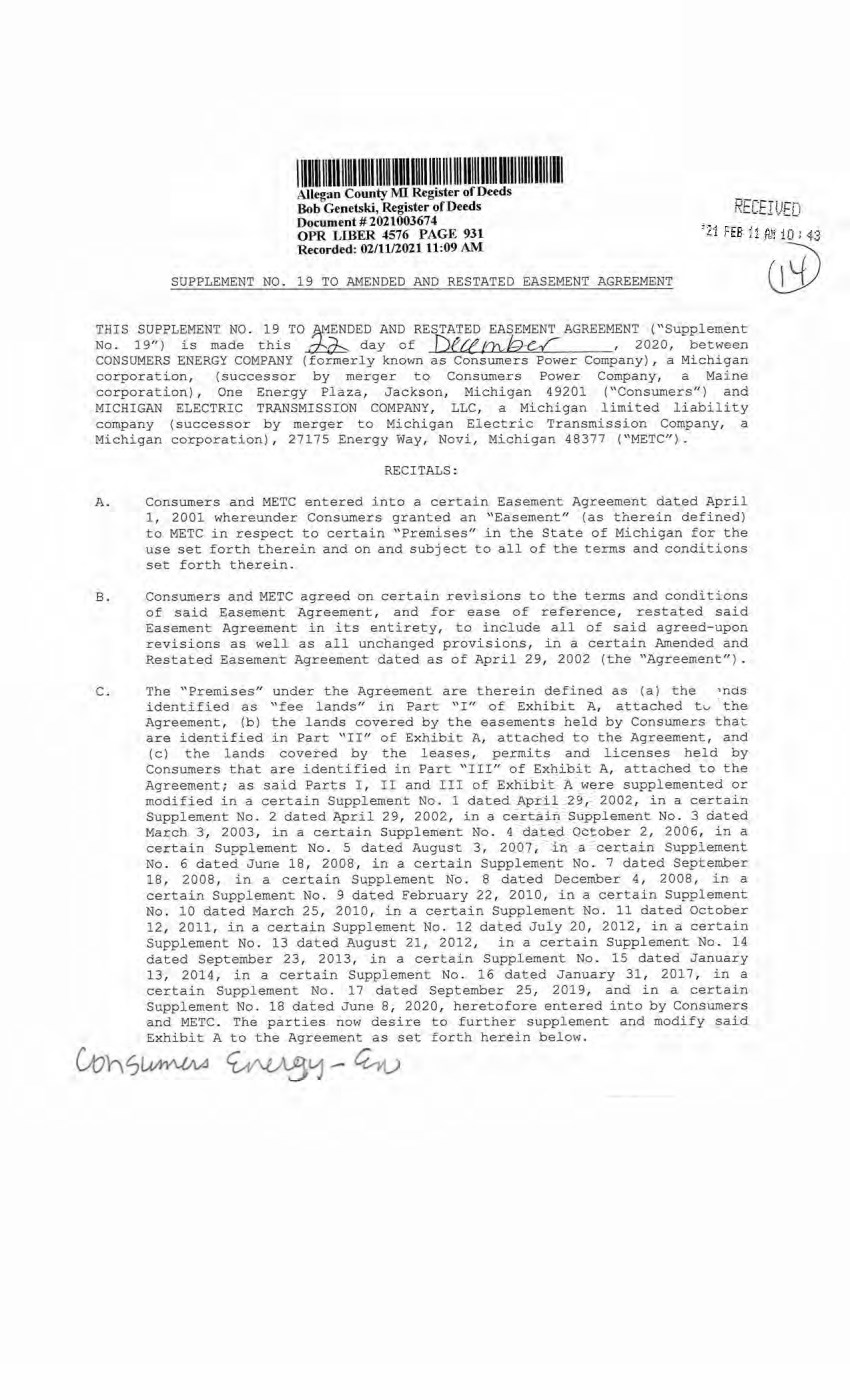
| Allegan County MI Register of Deeds Bob Genetski, Register of Deeds Document # 2021003674 OPR LIBER 4576 PAGE 931 Recorded: 02/11/2021 11:09 AM ht >’ .h T1J SUPPLEMENT NO. 19 TO AMENDED AND RESTATED EASEMENT AGREEMENT THIS SUPPLEMENT NO. 19 TO AMENDED AND RESTATED EASEMENT AGREEMENT ("Supplement No. 19") is made this day of XXX (Ox r 2020, between CONSUMERS ENERGY COMPANY (formerly known as Consumers Power Company), a Michigan corporation, (successor by merger to Consumers Power Company, a Maine corporation), One Energy Plaza, Jackson, Michigan 49201 ("Consumers") and MICHIGAN ELECTRIC TRANSMISSION COMPANY, LLC, a Michigan limited liability company (successor by merger to Michigan Electric Transmission Company, a Michigan corporation), 27175 Energy Way, Novi, Michigan 48377 ("METC"). RECITALS: A. Consumers and METC entered into a certain Easement Agreement dated April 1, 2001 whereunder Consumers granted an "Easement" (as therein defined) to METC in respect to certain "Premises" in the State of Michigan for the use set forth therein and on and subject to all of the terms and conditions set forth therein. B. Consumers and METC agreed on certain revisions to the terms and conditions of said Easement Agreement, and for ease of reference, restated said Easement Agreement in its entirety, to include all of said agreed-upon revisions as well as all unchanged provisions, in a certain Amended and Restated Easement Agreement dated as of April 29, 2002 (the "Agreement") . C. The "Premises" under the Agreement are therein defined as (a) the 5nds identified as "fee lands" in Part "I" of Exhibit A, attached to the Agreement, (b) the lands covered by the easements held by Consumers that are identified in Part "II" of Exhibit A, attached to the Agreement, and (c) the lands covered by the leases, permits and licenses held by Consumers that are identified in Part "III" of Exhibit A, attached to the Agreement; as said Parts I, II and III of Exhibit A were supplemented or modified in a certain Supplement No. 1 dated April 29, 2002, in a certain Supplement No. 2 dated April 29, 2002, in a certain Supplement No. 3 dated March 3, 2003, in a certain Supplement No. 4 dated October 2, 2006, in a certain Supplement No. 5 dated August 3, 2007, in a certain Supplement No. 6 dated June 18, 2008, in a certain Supplement No. 7 dated September 18, 2008, in a certain Supplement No. 8 dated December 4, 2008, in a certain Supplement No. 9 dated February 22, 2010, in a certain Supplement No. 10 dated March 25, 2010, in a certain Supplement No. 11 dated October 12, 2011, in a certain Supplement No. 12 dated July 20, 2012, in a certain Supplement No. 13 dated August 21, 2012, in a certain Supplement No. 14 dated September 23, 2013, in a certain Supplement No. 15 dated January 13, 2014, in a certain Supplement No. 16 dated January 31, 2017, in a certain Supplement No. 17 dated September 25, 2019, and in a certain Supplement No. 18 dated June 8, 2020, heretofore entered into by Consumers and METC. The parties now desire to further supplement and modify said Exhibit A to the Agreement as set forth herein below. |

| 2 D. References, in regard to historical matters, to "METC" in the foregoing recitals will be deemed to mean METC's predecessor, Michigan Electric Transmission Company, a Michigan corporation, where relevant. NOW, THEREFORE, for good and valuable consideration, the receipt of which is acknowledged, Consumers and METC agree as follows: 1. Exhibit A to the Agreement, as heretofore supplemented and/or modified, is hereby further supplemented and modified as set forth in "Nineteenth Supplemental Exhibit A", attached hereto. It is expressly understood that any lands, easements, or leases/permits/licenses that are indicated in said attached Nineteenth Supplemental Exhibit A as being added are, on and subject to the terms and conditions of the Agreement (as supplemented and amended by this Supplement No. 19), hereby deemed added to Part I, Part IT and Part III, respectively, of Exhibit A to the Agreement. However, it is further expressly understood that in addition to all rights granted to METC by the Agreement, METC shall have the following rights as to the lands identified as "Consumers Energy Equipment / Joint Asset Area Easement" on the accompanying NINETEENTH Supplemental Exhibit A sheets, inclusive of Parts I, II and III, which rights are also subject to the terms of the Parties' Amended and Restated Transmission Interconnection Agreement (the "DTIA"): (a) the right to maintain any and all existing components of the Transmission System, as defined in the DTIA, and wiring or conduit connections for the same that currently exist over, on or under these lands; and (b)the right to connect its currently sited or future approved wiring or conduits for communications, station power, or control, operating at 600 volts or less, and any Jointly Owned Assets, as defined in the DTIA, over, on or under these lands. It is also expressly understood that, with respect to any lands, easements, or leases/permits/licenses now covered by Part I, Part II or Part III of Exhibit A that are indicated in said attached Nineteenth Supplemental Exhibit A as being deleted, the Easement is hereby deemed RELEASED with respect thereto and the Agreement shall hereafter no longer apply thereto (provided, however, that all rights and obligations under the Agreement with respect to periods prior to the date of this Supplement No. 19 shall remain unaffected). 2. It is expressly understood and agreed that in respect to the additional Premises represented by the land(s), easement(s), lease(s), permit(s) and/or license (s) that are added to Part I, Part II and Part III of Exhibit A to the Agreement pursuant to this Supplement No. 19 (the "Additional Premises"): (a) All references to "Commencement Date" that are found in Article 1 ("Grant of Easement"), Article 2 ("Term"), Article 5 ("Additions/Alterations"), Article 6 ("Consumers' Reserved Rights to Use the Premises and Transmission Facilities"), Article 7 ("METC Approval of Compatible Uses"), Article 8 ("Certain Obligations of Consumers and Authorized Users; Etc.") and Article 14 ("Environmental Matters") of the Agreement shall be deemed to mean the date of this Supplement No. 19 and not the date that is identified in the Agreement as the "Commencement Date". |
| 3 (b) Except as expressly otherwise indicated in the immediately following sentence, all references to "Restated Agreement Date" that are found in Article 1 ("Grant of Easement") , Article 6 ("Consumers' Reserved Rights to Use the Premises and Transmission Facilities") , and Article 12 ("Compliance With Applicable Laws") of the Agreement shall also be deemed to mean the date of this Supplement No. 19 and not the date that is identified in the Agreement as the "Restated Agreement Date". Notwithstanding the foregoing: (i) the preceding sentence does not apply to the purely historical statement in clause "(c)" of Section 1.2 of the Agreement that Trans-Elect, Inc. is "an affiliate of the entity which has become METC's parent company as of the Restated Agreement Date"; and (ii) the parenthetical in the first sentence of the first paragraph of Section 7.1 of the Agreement reading "(see below regarding a certain period prior to the Restated Agreement Date)", along with the fourth paragraph of said Section 7.1 reading "Consumers shall submit to METC within twenty (20) days of the Restated Agreement Date a list of all material Compatible Uses other than additions or modifications to Distribution Facilities that have been authorized between February 1, 2001 and the Restated Agreement Date for METC's approval per the METC Compatible Use approval process described in this Section 7.1.", both referred to a one-time historical matter and have no application to the Additional Premises or any other further effect or application whatsoever. 3. In addition to the original Transmission Facilities and Additions/Alterations thereto as referred to in Recital "A" of the Agreement, it is understood that such electric Transmission towers, pole structures, poles, crossarms, wires, cables, conduits, guys, anchors, transformers, insulators and/or other fixtures and equipment as may be owned by METC and located on the Additional Premises as of the date of this Supplement No. 19, and future Additions/Alternations made thereto on and subject to the terms and conditions of the Agreement, are included in the "Transmission Facilities" under the Agreement. Note: This Supplement No. 19 will not be recorded in all counties in which the Agreement itself, or Supplements Nos. 1 through 18, may have been recorded. This Supplement No. 19 (as were each of Supplements Nos. 1 through 18), will be recorded only in the county(ies) in which relevant Premises are located; being, in the case of this Supplement No. 19, only the following: |

| 4 Allegan County Antrim County Barry County Bay County Calhoun County Charlevoix County Clinton County Crawford County Emmet County Genesee County Gladwin County Grand Traverse County Gratiot County Ingham County Ionia County Isabella County Jackson County Kalkaska County Kent County Leelanau County Lenawee County Manistee County Midland County Montcalm County Muskegon County Oceana County Ogemaw County Ottawa County Roscommon County Saginaw County Shiawassee County St. Joseph County Washtenaw County Wexford County The fact that this Supplement No. 19 will be recorded only in the particular county(ies> identified above will in no way restrict, limit or otherwise affect the interpretation, application or enforcement of the Agreement; and the terms and conditions of the Agreement shall at all times be read, interpreted and applied in the manner provided for in Section 24.6 of the Agreement. |
| 5 IN WITNESS WHEREOF, Consumers and METC have executed this Supplement No. 19 as of the date first above written. CONSUMERS ENERGY COMPANY, a Michigan corporation STATE OF MICHIGAN ) COUNTY OF ) The foregoing instrument was acknowledged before this 2020, by Mary Anne Marr, Director of Real Estate of CONSUMERS ENERGY COMPANY, a Michigan corporation, on behalf of the corporation. I JULIE C GUINN I Notary Public - State of Michigan County of Jackson • My Commission Expires Dec 29, 2020 S Acting in the County of Clttfl&hA. .. '» ■■ ■ ■ » w Notary Public, ( County, Michigan Acting in County, Michigan My Commission Expires: j9-^] , 20 |
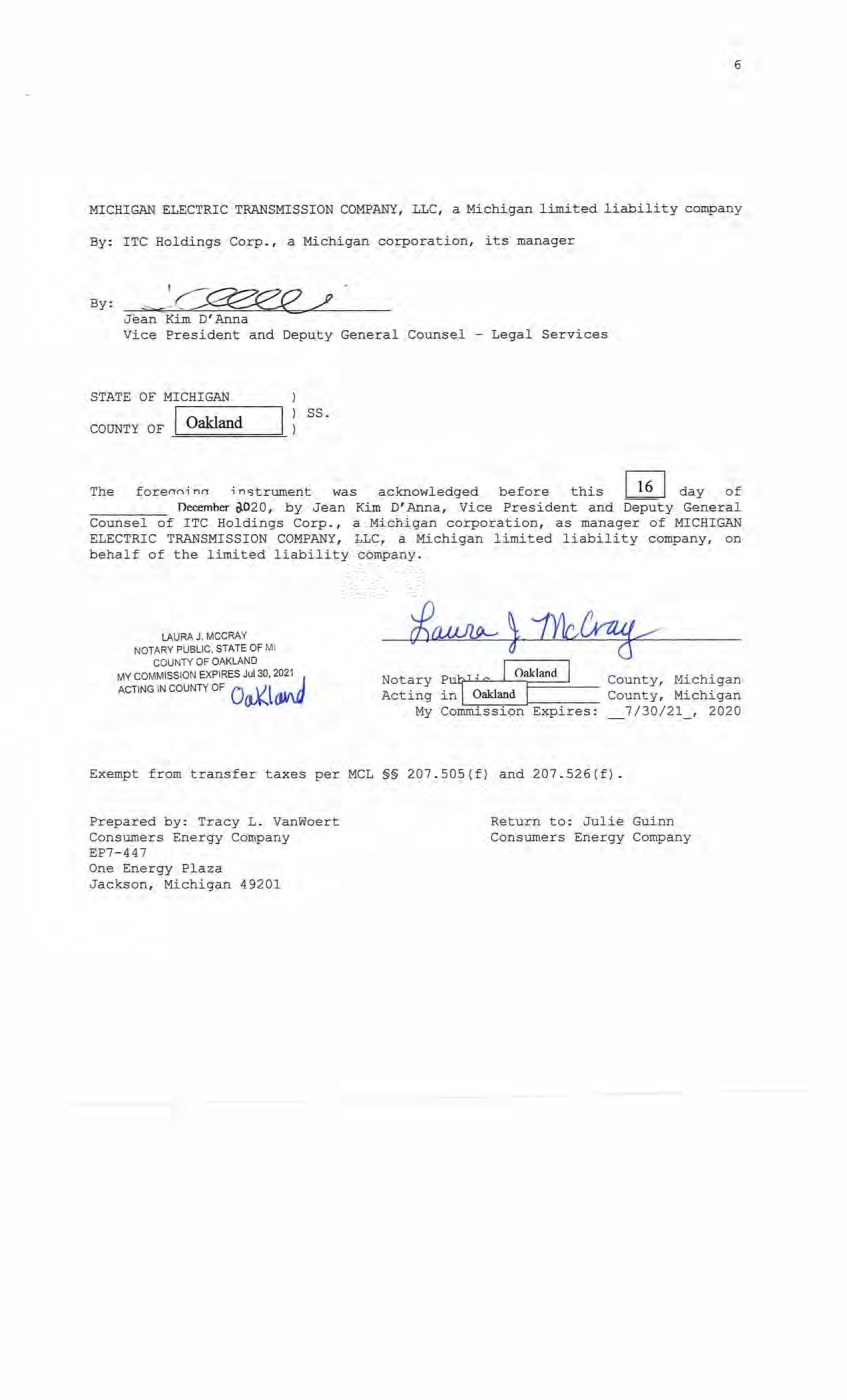
| 6 MICHIGAN ELECTRIC TRANSMISSION COMPANY, LLC, a Michigan limited liability company By: ITC Holdings Corp., a Michigan corporation, its manager By: Jean Kim D'Anna Vice President and Deputy General Counsel - Legal Services STATE OF MICHIGAN COUNTY OF Oakland ss. The forenn-i nrr instrument was acknowledged before this 10 day of December 8-020, by Jean Kim D'Anna, Vice President and Deputy General Counsel of ITC Holdings Corp., a Michigan corporation, as manager of MICHIGAN ELECTRIC TRANSMISSION COMPANY, LLC, a Michigan limited liability company, on behalf of the limited liability company. LAURA J. MCCRAY NOTARY PUBLIC, STATE OF Ml COUNTY OF OAKLAND MY COMMISSION EXPIRES Jul 30, 2021 ACTING IN COUNTY OF Oakland Oakland County, Michigan County, Michigan 7/30/21 , 2020 Notary Putj^-1 Acting in My Commission Expires: Exempt from transfer taxes per MCL §§ 207.505(f) and 207.526(f). Prepared by: Tracy L. VanWoert Consumers Energy Company EP7-447 One Energy Plaza Jackson, Michigan 49201 Return to: Julie Guinn Consumers Energy Company |

| 7 THE ATTACHED COPY OF THE NINETEENTH SUPPLEMENTAL EXHIBIT A THAT WAS PREPARED FOR RECORDATION IN ALLEGAN COUNTY, MICHIGAN, AND CONTAINS THE PORTIONS OF EACH OF PARTS I, II, AND III OF THE NINETEENTH SUPPLEMENT EXHIBIT A THAT RELATE TO PREMISES IN THAT COUNTY ONLY. SEE SECTION 24.6 OF THE AGREEMENT. |
| NINETEENTH SUPPLEMENTAL EXHIBIT A I. Fee Lands: See sheet(s) labeled "NINETEENTH Supplemental Exhibit A-Part I", attached hereto and made a part hereof. Said attached sheet(s) labeled NINETEENTH Supplemental Exhibit A-Part I consist of the following: 3 Pages for Allegan County 6 Pages for Antrim County 2 Pages for Barry County 2 Pages for Bay County 13 Pages for Calhoun County 2 Pages for Charlevoix County 6 Pages for Clinton County 4 Pages for Crawford County 7 Pages for Genesee County 1 Page for Gladwin County 6 Pages for Grand Traverse County 1 Page for Gratiot County 2 Pages for Ingham County 2 Pages for Ionia County 1 Page for Isabella County 2 Pages for Jackson County 1 Page for Kalkaska County 4 Pages for Kent County 1 Page for Leelanau County 3 Pages for Lenawee County 2 Pages for Manistee County 4 Pages for Midland County 1 Page for Montcalm County 17 Pages for Muskegon County 1 Pages for Oceana County 1 Page for Ogemaw County 4 Pages for Ottawa County 3 Pages for Roscommon County 2 Pages for Saginaw County 3 Pages for Shiawassee County 1 Page for St. Joseph County 3 Pages for Washtenaw County 2 Pages for Wexford County Nineteenth Supplemental Exhibit A - Introductory Page 1 of 2 |
| II. Easements: See sheet(s) labeled "NINETEENTH Supplemental Exhibit A-Part II", attached hereto and made a part hereof. Said attached sheet(s) labeled NINETEENTH Supplemental Exhibit A-Part II consist of the following: 1 Page for Allegan County 5 Pages for Antrim County 4 Pages for Barry County 1 Pages for Bay County 9 Pages for Calhoun County 4 Pages for Charlevoix County 9 Pages for Clinton County 2 Pages for Crawford County 6 Pages for Emmet County 8 Pages for Genesee County 3 Pages for Gladwin County 1 Page for Grand Traverse County 1 Page for Ingham County 6 Pages for Ionia County 5 Pages for Isabella County 1 Page for Kalkaska County 1 Page for Kent County 2 Pages for Leelanau County 3 Pages for Lenawee County 3 Pages for Manistee County 12 Pages for Midland County 1 Page for Montcalm County 5 Pages for Muskegon County 1 Page for Ogemaw County 4 Pages for Roscommon County 2 Pages for Shiawassee County 1 Page for St. Joseph County 2 Pages for Washtenaw County III. Leases, Permits and Licenses: See sheet(s) labeled "NINETEENTH Supplemental Exhibit A-Part III", attached hereto and made a part hereof. Said attached sheet(s) labeled Nineteenth Supplemental Exhibit A-Part III consist of the following: NA Nothing in this NINETEENTH Supplemental Exhibit A shall be deemed to affect, limit or waive any of the provisions of Sections 1.2 ("Title Limitations") and 1.3 ("No Warranties") of the Agreement. Nineteenth Supplemental Exhibit A - Introductory Page 2 of 2 |
| SUPPLEMENTAL 19 EXHIBIT A - PART I ALLEGAN COUNTY ADD THE FOLLOWING LAND DESCRIPTIONS: 1-E195-23, Line 871 A strip of land 72 feet in width being 36 feet on each side of the centerline of an existing electric line, known as line segment 871, as currently located and running in an Easterly and Westerly direction to the center of the Substation Rack, across a parcel of land described as: Land in the Township of Trowbridge County of Allegan and State of Michigan, described as follows: The South 660 feet of the North 993 feet of the East 1/2 of the Southwest 1/4 of Section 29, Town 1 North Range 13 West, more particularly described as follows: Commencing at the South 1/4 corner of said Section 29; thence North 00°22'14" East, 1657.63 feet along the North and South 1/4 line of said Section 29 to the point of beginning of this description; thence continuing along said North and South 1/4 line North 00°22'14" East, 660.23 feet; thence North 88°07'44" West, 1322.44 feet to the West line of the East 1/2 of the Southwest 1/4 of said Section 29; thence along said West line South 00°08'18" West, 660.30 feet; thence South 88°07'44" East, 1319.76 feet to the point of beginning. Bearings are based on the South line of Section 29 from the Southwest corner to the South 1/4 corner assumed as South 88“OS'53" East. Note: It is understood that a portion of the above-described strip of land lies within the fenced premises of Consumers Trowbridge Substation, in the Southwest 1/4 of Section 29, Town 1 North, Range 13 West. It is also understood that an electric line, which is part of METC’s Transmission Facilities covered by this Agreement and is located on said strip of land, presently connects to the substation within said fenced area; but that no part of the substation itself, or its associated structures and facilities is part of METC's Transmission Facilities covered by this Agreement. With respect to that portion of the above-described strip of land that is within said substation fence (as now or hereafter existing), it is expressly understood, any other provision of this Agreement notwithstanding, that unless otherwise expressly approved in writing by Consumers, METC shall make no entry thereon and shall have no right to authorize others to enter thereon; and METC shall make separate arrangements and agreements with Consumers regarding the performance of any work on the portion of METC's Transmission Facilities located therein. Nineteenth Supplemental Exhibit A-Part I, Allegan County, Page 1 |
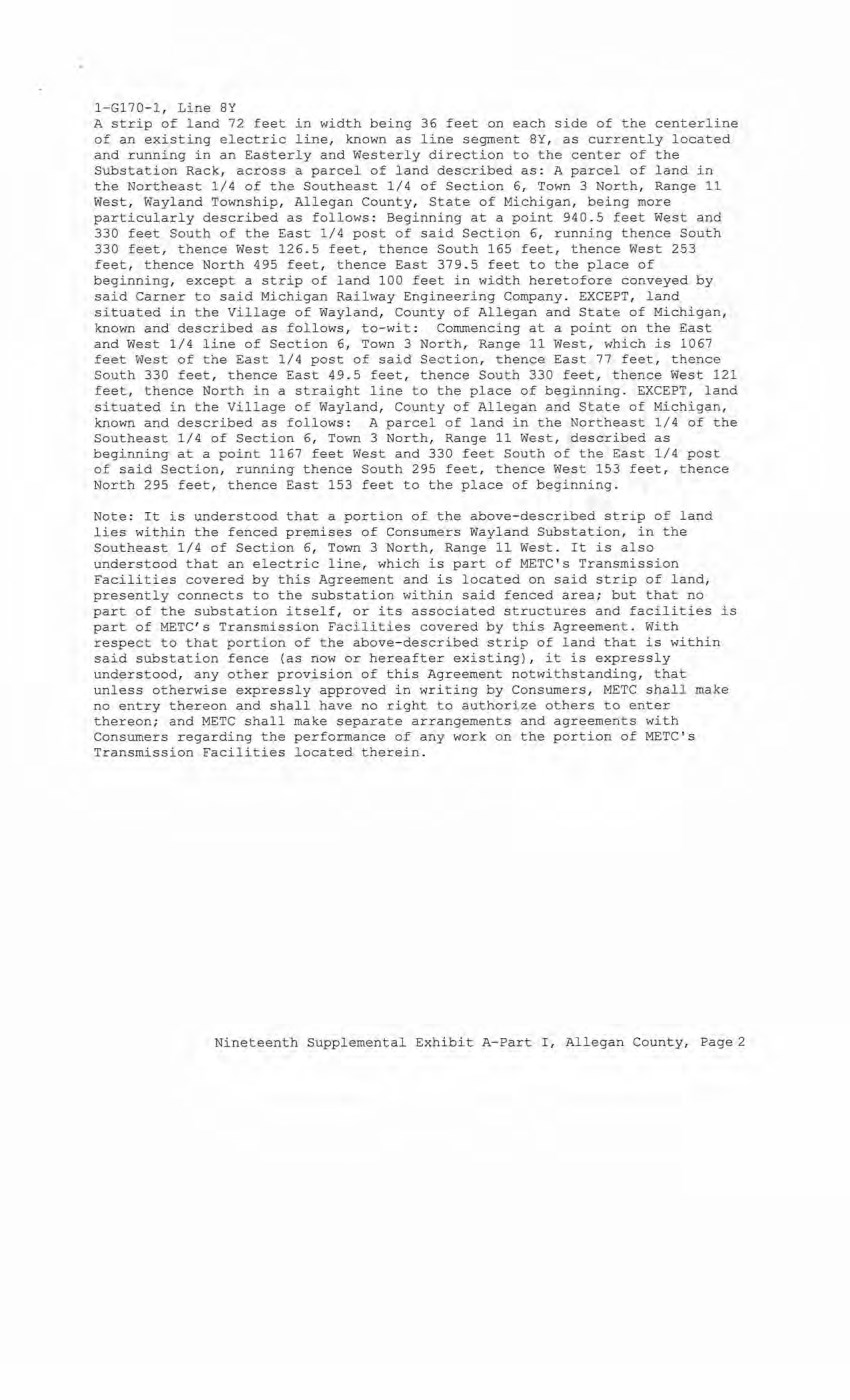
| 1-G170-1, Line 8Y A strip of land 72 feet in width being 36 feet on each side of the centerline of an existing electric line, known as line segment 8Y, as currently located and running in an Easterly and Westerly direction to the center of the Substation Rack, across a parcel of land described as: A parcel of land in the Northeast 1/4 of the Southeast 1/4 of Section 6, Town 3 North, Range 11 West, Wayland Township, Allegan County, State of Michigan, being more particularly described as follows: Beginning at a point 940.5 feet West and 330 feet South of the East 1/4 post of said Section 6, running thence South 330 feet, thence West 126.5 feet, thence South 165 feet, thence West 253 feet, thence North 495 feet, thence East 379.5 feet to the place of beginning, except a strip of land 100 feet in width heretofore conveyed by said Garner to said Michigan Railway Engineering Company. EXCEPT, land situated in the Village of Wayland, County of Allegan and State of Michigan, known and described as follows, to-wit: Commencing at a point on the East and West 1/4 line of Section 6, Town 3 North, Range 11 West, which is 1067 feet West of the East 1/4 post of said Section, thence East 77 feet, thence South 330 feet, thence East 49.5 feet, thence South 330 feet, thence West 121 feet, thence North in a straight line to the place of beginning. EXCEPT, land situated in the Village of Wayland, County of Allegan and State of Michigan, known and described as follows: A parcel of land in the Northeast 1/4 of the Southeast 1/4 of Section 6, Town 3 North, Range 11 West, described as beginning at a point 1167 feet West and 330 feet South of the East 1/4 post of said Section, running thence South 295 feet, thence West 153 feet, thence North 295 feet, thence East 153 feet to the place of beginning. Note: It is understood that a portion of the above-described strip of land lies within the fenced premises of Consumers Wayland Substation, in the Southeast 1/4 of Section 6, Town 3 North, Range 11 West. It is also understood that an electric line, which is part of METC's Transmission Facilities covered by this Agreement and is located on said strip of land, presently connects to the substation within said fenced area; but that no part of the substation itself, or its associated structures and facilities is part of METC's Transmission Facilities covered by this Agreement. With respect to that portion of the above-described strip of land that is within said substation fence (as now or hereafter existing), it is expressly understood, any other provision of this Agreement notwithstanding, that unless otherwise expressly approved in writing by Consumers, METC shall make no entry thereon and shall have no right to authorize others to enter thereon; and METC shall make separate arrangements and agreements with Consumers regarding the performance of any work on the portion of METC's Transmission Facilities located therein. Nineteenth Supplemental Exhibit A-Part I, Allegan County, Page 2 |
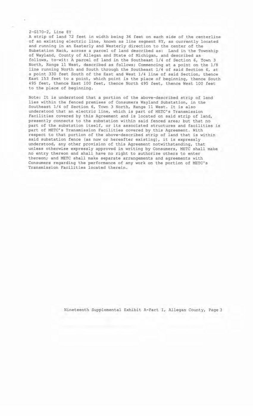
| 2-G170-2, Line 8Y A strip of land 72 feet in width being 36 feet on each side of the centerline of an existing electric line, known as line segment 8Y, as currently located and running in an Easterly and Westerly direction to the center of the Substation Rack, across a parcel of land described as: Land in the Township of Wayland, County of Allegan and State of Michigan, and described as follows, to-wit: A parcel of land in the Southeast 1/4 of Section 6, Town 3 North, Range 11 West, described as follows; Commencing at a point on the 1/8 line running North and South through the Southeast 1/4 of said Section 6, at a point 330 feet South of the East and West 1/4 line of said Section, thence East 153 feet to a point, which point is the place of beginning, thence South 495 feet, thence East 100 feet, thence North 495 feet, thence West 100 feet to the place of beginning. Note: It is understood that a portion of the above-described strip of land lies within the fenced premises of Consumers Wayland Substation, in the Southeast 1/4 of Section 6, Town 3 North, Range 11 West. It is also understood that an electric line, which is part of METC's Transmission Facilities covered by this Agreement and is located on said strip of land, presently connects to the substation within said fenced area; but that no part of the substation itself, or its associated structures and facilities is part of METC's Transmission Facilities covered by this Agreement. With respect to that portion of the above-described strip of land that is within said substation fence (as now or hereafter existing), it is expressly understood, any other provision of this Agreement notwithstanding, that unless otherwise expressly approved in writing by Consumers, METC shall make no entry thereon and shall have no right to authorize others to enter thereon; and METC shall make separate arrangements and agreements with Consumers regarding the performance of any work on the portion of METC's Transmission Facilities located therein. Nineteenth Supplemental Exhibit A-Part I, Allegan County, Page 3 |
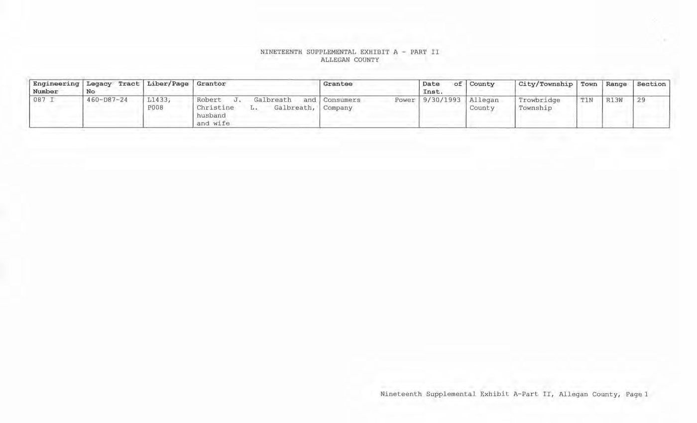
| NINETEENTH SUPPLEMENTAL EXHIBIT A - PART II ALLEGAN COUNTY Engineering Number Legacy Tract No Liber/Page Grantor Grantee Date Inst. of County City/Township Town Range Section 087 I 460-D87-24 L1433, P008 Robert J. Christine husband and wife Galbreath and L. Galbreath, Consumers Company Power 9/30/1993 Allegan County Trowbridge Township TIN R13W 29 Nineteenth Supplemental Exhibit A-Part II, Allegan County, Page 1 |
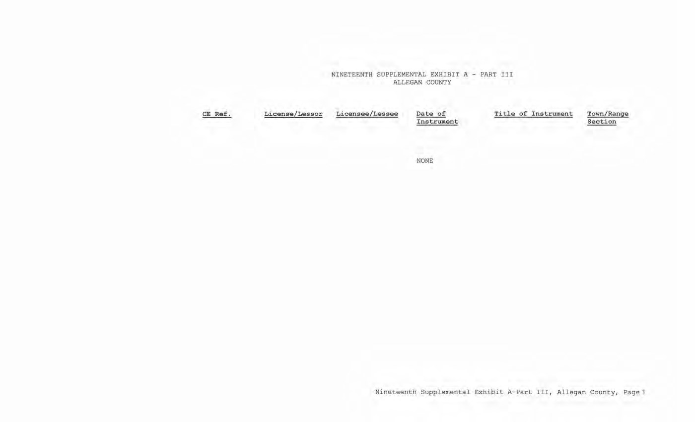
| NINETEENTH SUPPLEMENTAL EXHIBIT A - PART III ALLEGAN COUNTY CE Ref. License/Lessor Licensee/Lessee Date of Instrument Title of Instrument Town/Range Section NONE Nineteenth Supplemental Exhibit A-Part III, Allegan County, Page 1 |
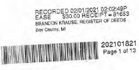
SUPPLEMENT NO. 19 TO AMENDED AND RESTATED EASEMENT AGREEMENT
THIS SUPPLEMENT NO. 19 TO AMENDED AND RESTATED EASEMENT AGREEMENT (“Supplement No. 19”) is made this 22 day of December, 2020, between CONSUMERS ENERGY COMPANY (formerly known as Consumers Power Company), a Michigan corporation, (successor by merger to Consumers Power Company, a Maine corporation), One Energy Plaza, Jackson, Michigan 49201 (“Consumers”) and MICHIGAN ELECTRIC TRANSMISSION COMPANY, LLC, a Michigan limited liability company (successor by merger to Michigan Electric Transmission Company, a Michigan corporation), 27175 Energy Way, Novi, Michigan 48377 (“METC”).
RECITALS:
| A. | Consumers and METC entered into a certain Easement Agreement dated April 1, 2001 whereunder Consumers granted an “Easement” (as therein defined) to METC in respect to certain “Premises” in the State of Michigan for the use set forth therein and on and subject to all of the terms and conditions set forth therein. |
| B. | Consumers and METC agreed on certain revisions to the terms and conditions of said Easement Agreement, and for ease of reference, restated said Easement Agreement in its entirety, to include all of said agreed-upon revisions as well as all unchanged provisions, in a certain Amended and Restated Easement Agreement dated as of April 29, 2002 (the “Agreement”). |
| C. | The “Premises” under the Agreement are therein defined as (a) the lands identified as “fee lands” in Part “I” of Exhibit A, attached to the Agreement, (b) the lands covered by the easements held by Consumers that are identified in Part “II” of Exhibit A, attached to the Agreement, and (c) the lands covered by the leases, permits and licenses held by Consumers that are identified in Part “III” of Exhibit A, attached to the Agreement; as said Parts I, II and III of Exhibit A were supplemented or modified in a certain Supplement No. 1 dated April 29, 2002, in a certain Supplement No. 2 dated April 29, 2002, in a certain Supplement No. 3 dated March 3, 2003, in a certain Supplement No. 4 dated October 2, 2006, in a certain Supplement No. 5 dated August 3, 2007, in a certain Supplement No. 6 dated June 18, 2008, in a certain Supplement No. 7 dated September 18, 2008, in a certain Supplement No. 8 dated December 4, 2008, in a certain Supplement No. 9 dated February 22, 2010, in a certain Supplement No. 10 dated March 25, 2010, in a certain Supplement No. 11 dated October 12, 2011, in a certain Supplement No. 12 dated July 20, 2012, in a certain Supplement No. 13 dated August 21, 2012, in a certain Supplement No. 14 dated September 23, 2013, in a certain Supplement No. 15 dated January 13, 2014, in a certain Supplement No. 16 dated January 31, 2017, in a certain Supplement No. 17 dated September 25, 2019, and in a certain Supplement No. 18 dated June 8, 2020, heretofore entered into by Consumers and METC. The parties now desire to further supplement and modify said Exhibit A to the Agreement as set forth herein below. |
2
| D. | References, in regard to historical matters, to “METC” in the foregoing recitals will be deemed to mean METC’s predecessor, Michigan Electric Transmission Company, a Michigan corporation, where relevant. |
NOW, THEREFORE, for good and valuable consideration, the receipt of which is acknowledged, Consumers and METC agree as follows:
| 1. | Exhibit A to the Agreement, as heretofore supplemented and/or modified, is hereby further supplemented and modified as set forth in “Nineteenth Supplemental Exhibit A”, attached hereto. |
It is expressly understood that any lands, easements, or leases/permits/licenses that are indicated in said attached Nineteenth Supplemental Exhibit A as being added are, on and subject to the terms and conditions of the Agreement (as supplemented and amended by this Supplement No. 19), hereby deemed added to Part I, Part II and Part III, respectively, of Exhibit A to the Agreement. However, it is further expressly understood that in addition to all rights granted to METC by the Agreement, METC shall have the following rights as to the lands identified as “Consumers Energy Equipment / Joint Asset Area Easement” on the accompanying NINETEENTH Supplemental Exhibit A sheets, inclusive of Parts I, II and III, which rights are also subject to the terms of the Parties’ Amended and Restated Transmission Interconnection Agreement (the “DTIA”): (a) the right to maintain any and all existing components of the Transmission System, as defined in the DTIA, and wiring or conduit connections for the same that currently exist over, on or under these lands; and (b) the right to connect its currently sited or future approved wiring or conduits for communications, station power, or control, operating at 600 volts or less, and any Jointly Owned Assets, as defined in the DTIA, over, on or under these lands.
It is also expressly understood that, with respect to any lands, easements, or leases/permits/licenses now covered by Part I, Part II or Part III of Exhibit A that are indicated in said attached Nineteenth Supplemental Exhibit A as being deleted, the Easement is hereby deemed RELEASED with respect thereto and the Agreement shall hereafter no longer apply thereto (provided, however, that all rights and obligations under the Agreement with respect to periods prior to the date of this Supplement No. 19 shall remain unaffected).
| 2. | It is expressly understood and agreed that in respect to the additional Premises represented by the land(s), easement(s), lease(s), permit(s) and/or license(s) that are added to Part I, Part II and Part III of Exhibit A to the Agreement pursuant to this Supplement No. 19 (the “Additional Premises”): |
| (a) | All references to “Commencement Date” that are found in Article 1 (“Grant of Easement”), Article 2 (“Term”), Article 5 (“Additions/Alterations”), Article 6 (“Consumers’ Reserved Rights to Use the Premises and Transmission Facilities”), Article 7 (“METC Approval of Compatible Uses”), Article 8 (“Certain Obligations of Consumers and Authorized Users; Etc.”) and Article 14 (“Environmental Matters”) of the Agreement shall be deemed to mean the date of this Supplement No. 19 and not the date that is identified in the Agreement as the “Commencement Date”. |
202101821
Page 2 of 13
3
| (b) | Except as expressly otherwise indicated in the immediately following sentence, all references to “Restated Agreement Date” that are found in Article 1 (“Grant of Easement”), Article 6 (“Consumers’ Reserved Rights to Use the Premises and Transmission Facilities”), and Article 12 (“Compliance With Applicable Laws”) of the Agreement shall also be deemed to mean the date of this Supplement No. 19 and not the date that is identified in the Agreement as the “Restated Agreement Date”. Notwithstanding the foregoing: |
| (i) | the preceding sentence does not apply to the purely historical statement in clause “(c)” of Section 1.2 of the Agreement that Trans-Elect, Inc. is “an affiliate of the entity which has become METC’s parent company as of the Restated Agreement Date”; and |
| (ii) | the parenthetical in the first sentence of the first paragraph of Section 7.1 of the Agreement reading “(see below regarding a certain period prior to the Restated Agreement Date)”, along with the fourth paragraph of said Section 7.1 reading “Consumers shall submit to METC within twenty (20) days of the Restated Agreement Date a list of all material Compatible Uses other than additions or modifications to Distribution Facilities that have been authorized between February 1, 2001 and the Restated Agreement Date for METC’s approval per the METC Compatible Use approval process described in this Section 7.1.”, both referred to a one-time historical matter and have no application to the Additional Premises or any other further effect or application whatsoever. |
| 3. | In addition to the original Transmission Facilities and Additions/Alterations thereto as referred to in Recital “A” of the Agreement, it is understood that such electric Transmission towers, pole structures, poles, crossarms, wires, cables, conduits, guys, anchors, transformers, insulators and/or other fixtures and equipment as may be owned by METC and located on the Additional Premises as of the date of this Supplement No. 19, and future Additions/Alternations made thereto on and subject to the terms and conditions of the Agreement, are included in the “Transmission Facilities” under the Agreement. |
Note: This Supplement No. 19 will not be recorded in all counties in which the Agreement itself, or Supplements Nos. 1 through 18, may have been recorded. This Supplement No. 19 (as were each of Supplements Nos. 1 through 18), will be recorded only in the county(ies) in which relevant Premises are located; being, in the case of this Supplement No. 19, only the following:
202101821
Page 3 of 13
4
Allegan County
Antrim County
Barry County
Bay County
Calhoun County
Charlevoix County
Clinton County
Crawford County
Emmet County
Genesee County
Gladwin County
Grand Traverse County
Gratiot County
Ingham County
Ionia County
Isabella County
Jackson County
Kalkaska County
Kent County
Leelanau County
Lenawee County
Manistee County
Midland County
Montcalm County
Muskegon County
Oceana County
Ogemaw County
Ottawa County
Roscommon County
Saginaw County
Shiawassee County
St. Joseph County
Washtenaw County
Wexford County
The fact that this Supplement No. 19 will be recorded only in the particular county(ies) identified above will in no way restrict, limit or otherwise affect the interpretation, application or enforcement of the Agreement; and the terms and conditions of the Agreement shall at all times be read, interpreted and applied in the manner provided for in Section 24.6 of the Agreement.
202101821
Page 4 of 13
5
IN WITNESS WHEREOF, Consumers and METC have executed this Supplement No. 19 as of the date first above written.
CONSUMERS ENERGY COMPANY, a Michigan corporation
| By | /s/ Mary Anne Marr | |
| | Mary Anne Marr | |
| | Director or Real Estate |
| | |
| STATE OF MICHIGAN | ) | |
| | | ) | ss. | |
| COUNTY OF | Jackson | ) | | |
| | | | | | | |
The foregoing instrument was acknowledged before this 22 day of December, 2020, by Mary Anne Marr, Director of Real Estate of CONSUMERS ENERGY COMPANY, a Michigan corporation, on behalf of the corporation.
| | /s/ Julie C Guinn |
| | Julie C Guinn |
| | |
| | Notary Public, Jackson County, Michigan |
| | Acting in Jackson County, Michigan |
| | My commission Expires: 12/29, 2020 |
202101821
Page 5 of 13
6
MICHIGAN ELECTRIC TRANSMISSION COMPANY, LLC, a Michigan limited liability company
By: ITC Holdings Corp., a Michigan corporation, its manager
| By: | /s/ Jean Kim D’ Anna | |
| | Jean Kim D’ Anna | |
| | Vice President and Deputy General Counsel – Legal Services |
| | |
| STATE OF MICHIGAN | ) | |
| | | ) | ss. | |
| COUNTY OF | Oakland | ) | | |
| | | | | | | |
The foregoing Instrument was acknowledged before this 16 day of December 2020, by Jean Kim D’ Anna, Vice President and Deputy General Counsel of ITC Holdings Corp., a Michigan corporation, as manager of MICHIGAN ELECTRIC TRANSMISSION COMPANY, LLC, a Michigan limited liability company, on behalf of the limited liability company.
| LAURA J. MCCRAY | | /s/ LAURA J. MCCRAY |
| NOTARY PUBLIC. STATE OF MI | |
| COUNTY OF OAKLAND | | Notary Public Oakland County, Michigan |
| MY COMMISSION EXPIRES Jul 30, 2021 | | Acting in Oakland County, Michigan |
| ACTING IN COUNTY OF Oakland | | My Commission Expires: 7/30/21, 2020 |
Exempt from transfer taxes per MCL §§ 207.505(f) and 207.526(f).
| Prepared by: Tracy L. VanWoert | | Return to: Julie Guinn |
| Consumers Energy Company | | Consumers Energy Company |
| EP–447 | | |
| One Energy Plaza | | |
| Jackson, Michigan 49201 | | |
202101821
Page 6 of 13
7
THE ATTACHED COPY OF THE NINETEENTH SUPPLEMENTAL EXHIBIT A THAT WAS PREPARED FOR RECORDATION IN BAY COUNTY, MICHIGAN, AND CONTAINS THE PORTIONS OF EACH OF PARTS I, II, AND III OF THE NINETEENTH SUPPLEMENT EXHIBIT A THAT RELATE TO PREMISES IN THAT COUNTY ONLY. SEE SECTION 24.6 OF THE AGREEMENT.
202101821
Page 7 of 13
NINETEENTH SUPPLEMENTAL EXHIBIT A
See sheet(s) labeled “NINETEENTH Supplemental Exhibit A–Part I”, attached hereto and made a part hereof. Said attached sheet(s) labeled NINETEENTH Supplemental Exhibit A–Part I consist of the following:
3 Pages for Allegan County
6 Pages for Antrim County
2 Pages for Barry County
2 Pages for Bay County
13 Pages for Calhoun County
2 Pages for Charlevoix County
6 Pages for Clinton County
4 Pages for Crawford County
7 Pages for Genesee County
1 Page for Gladwin County
6 Pages for Grand Traverse County
1 Page for Gratiot County
2 Pages for Ingham County
2 Pages for Ionia County
1 Page for Isabella County
2 Pages for Jackson County
1 Page for Kalkaska County
4 Pages for Kent County
1 Page for Leelanau County
3 Pages for Lenawee County
2 Pages for Manistee County
4 Pages for Midland County
1 Page for Montcalm County
17 Pages for Muskegon County
1 Pages for Oceana County
1 Page for Ogemaw County
4 Pages for Ottawa County
3 Pages for Roscommon County
2 Pages for Saginaw County
3 Pages for Shiawassee County
1 Page for St. Joseph County
3 Pages for Washtenaw County
2 Pages for Wexford County
202101821
Page 8 of 13
Ninneteenth Supplemental Exhibit A –
Introductory Page 1 of 2
See sheet(s) labeled “NINETEENTH Supplemental Exhibit A–Part II”, attached hereto and made a part hereof. Said attached sheet (s) labeled NINETEENTH Supplemental Exhibit A–Part II consist of the following:
1 Page for Allegan County
5 Pages for Antrim County
4 Pages for Barry County
1 Pages for Bay County
9 Pages for Calhoun County
4 Pages for Charlevoix County
9 Pages for Clinton County
2 Pages for Crawford County
6 Pages for Emmet County
8 Pages for Genesee County
3 Pages for Gladwin County
1 Page for Grand Traverse County
1 Page for Ingham County
6 Pages for Ionia County
5 Pages for Isabella County
1 Page for Kalkaska County
1 Page for Kent County
2 Pages for Leelanau County
3 Pages for Lenawee County
3 Pages for Manistee County
12 Pages for Midland County
1 Page for Montcalm County
5 Pages for Muskegon County
1 Page for Ogemaw County
4 Pages for Roscommon County
2 Pages for Shiawassee County
1 Page for St. Joseph County
2 Pages for Washtenaw County
| III. | Leases, Permits and Licenses: |
See sheet(s) labeled “NINETEENTH Supplemental Exhibit A-Part III”, attached hereto and made a part hereof. Said attached sheet(s) labeled Nineteenth Supplemental Exhibit A-Part III consist of the following:
NA
Nothing in this NINETEENTH Supplemental Exhibit A shall be deemed to affect, limit or waive any of the provisions of Sections 1.2 (“Title Limitations”) and 1.3 (“No Warranties”) of the Agreement.
202101821
Page 9 of 13
Nineteenth Supplemental Exhibit A –
Introductory Page 2 of 2
SUPPLEMENTAL 19 EXHIBIT A – PART I
BAY COUNTY
ADD THE FOLLOWING LAND DESCRIPTIONS:
1–E67–27, Line 5I
A strip of land 72 feet in width being 36 feet on each side of the centerline of an existing electric line, known as line segment 5I, as currently located and running in a Northerly and Southerly and Easterly and Westerly direction to the center of the Substation Rack, across a parcel of land described as: Township of Fraser, County of Bay, State of Michigan, and described as follows: A parcel of land in the Southwest 1/4 of the Northeast 1/4 of Section 2, Town 16 North, Range 4 East, described as follows: To find the place of beginning of this description commence at the East 1/4 post of said section; run thence West along the East and West 1/4 line of said section 2203.65 feet to the Westerly line of the Detroit and Mackinac Railway right of way; thence North 01°34’30” East along said Westerly line of said railway right of way 792.62 feet to the center line of the Au Sable State Road and the place of beginning of this description; thence continuing North 01°34’30” East along said Westerly line of the Detroit and Mackinac Railway right of way 518.13 feet to the North 1/8 line of said section; thence North 89°53’30” West along said North 1/8 line of said section 460.58 feet to the North and South 1/4 line of said section; thence South 00°30’20” West along said North and South 1/4 line of said section 660.01 feet; thence South 89°53’30” East, 331.52 feet to the center line of said Au Sable State Road; thence North 40°23’30” East along said center line of said Au Sable State Road 186.18 feet to place of beginning.
Note: It is understood that a portion of the above-described strip of land lies within the fenced premises of Consumers Almeda Substation, in the Northeast 1/4 of Section 2, Town 16 North, Range 4 East. It is also understood that an electric line, which is part of METC’s Transmission Facilities covered by this Agreement and is located on said strip of land, presently connects to the substation within said fenced area; but that no part of the substation itself, or its associated structures and facilities is part of METC’s Transmission Facilities covered by this Agreement. With respect to that portion of the above-described strip of land that is within said substation fence (as now or hereafter existing), it is expressly understood, any other provision of this Agreement notwithstanding, that unless otherwise expressly approved in writing by Consumers, METC shall make no entry thereon and shall have no right to authorize others to enter thereon; and METC shall make separate arrangements and agreements with Consumers regarding the performance of any work on the portion of METC’s Transmission Facilities located therein.
202101821
Page 10 of 13
Nineteenth Supplemental Exhibit A–Part I, Bay County, Page 1
2–E67–28, Line 5I
A strip of land 72 feet in width being 36 feet on each side of the centerline of an existing electric line, known as line segment 5I, as currently located and running in a Northerly and Southerly and Easterly and Westerly direction to the center of the Substation Rack, across a parcel of land described as: Township of Fraser, County of Bay, State of Michigan, and described as follows. A parcel of land in the Southeast 1/4 of the Northwest 1/4 of Section 2, Town 16 North, Range 4 East, described as follows: To find the place of beginning of this description commence at the East 1/4 post of said section; run thence West along the East and West 1/4 line of said section 2203.65 feet to the Westerly line of the Detroit & Mackinac Railway right of way; thence North 01°34’30” East along said Westerly line of said railway right of way 1310.75 feet to the North 1/8 line of said section; thence North 89°53’30” West along said North 1/8 line of said section 460.58 feet to the North and South 1/4 line of said section and the place of the beginning of this description; thence continuing North 89°53’30” West along said North 1/8 line of said section 199.42 feet; thence South 01°34’30” West, 660.22 feet; thence South 89°53’30” East, 211.74 feet to the North and South 1/4 line of said section; thence North 00°30’20” East along said North and South 1/4 line of said section 660.01 feet to the place of beginning.
Note: It is understood that a portion of the above-described strip of land lies within the fenced premises of Consumers Almeda Substation, in the Northwest 1/4 of Section 2, Town 16 North, Range 4 East. It is also understood that an electric line, which is part of METC’s Transmission Facilities covered by this Agreement and is located on said strip of land, presently connects to the substation within said fenced area; but that no part of the substation itself, or its associated structures and facilities is part of METC’s Transmission Facilities covered by this Agreement. With respect to that portion of the above-described strip of land that is within said substation fence (as now or hereafter existing), it is expressly understood, any other provision of this Agreement notwithstanding, that unless otherwise expressly approved in writing by Consumers, METC shall make no entry thereon and shall have no right to authorize others to enter thereon; and METC shall make separate arrangements and agreements with Consumers regarding the performance of any work on the portion of METC’s Transmission Facilities located therein.
202101821
Page 11 of 13
Nineteenth Supplemental Exhibit A–Part I, Bay County, Page 2
NINETEENTH SUPPLEMENTAL EXHIBIT A – PART III
BAY COUNTY
| CE Ref. | | License/Lessor | | Licensee/Lessee | | Date of Instrument | | Title of Instrument | | Town/Range Section |
| | | | | | | NONE | | | | |
202101821
Page 13 of 13
Nineteenth Supplemental Exhibit A–Part III, Bay County, Page 1
NINETEENTH SUPPLEMENTAL EXHIBIT A – PART II
BAY COUNTY
| Engineering Number | | Legacy Tract No | | Liber/Page | | | Grantor | | Grantee | | Date of Inst. | | County | | City/Township | | Town | | Range | | Section |
| 005 I | | 620-D5-29 | | | L549, P163 | | | Albin Gruszynski and Jennie Gruszynski, aka Jennie M. Gruszynski, husband and wife | | Consumers Power Company | | 1/19/1966 | | Bay County | | Fraser Township | | T16N | | R4E | | 2 |
202101821
Page 13 of 13
Nineteenth Supplemental Exhibit A-Part II, Bay County, Page 1
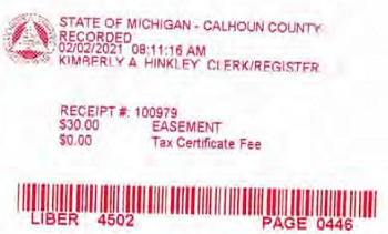
SUPPLEMENT NO. 19 TO AMENDED AND RESTATED EASEMENT AGREEMENT
THIS SUPPLEMENT NO. 19 TO AMENDED AND RESTATED EASEMENT AGREEMENT (“Supplement No. 19”) is made this 22 day of December, 2020, between CONSUMERS ENERGY COMPANY (formerly known as Consumers Power Company), a Michigan corporation, (successor by merger to Consumers Power Company, a Maine corporation), One Energy Plaza, Jackson, Michigan 49201 (“Consumers”) and MICHIGAN ELECTRIC TRANSMISSION COMPANY, LLC, a Michigan limited liability company (successor by merger to Michigan Electric Transmission Company, a Michigan corporation), 27175 Energy Way, Novi, Michigan 48377 (“METC”).
RECITALS:
| A. | Consumers and METC entered into a certain Easement Agreement dated April 1, 2001 whereunder Consumers granted an “Easement” (as therein defined) to METC in respect to certain “Premises” in the State of Michigan for the use set forth therein and on and subject to all of the terms and conditions set forth therein. |
| B. | Consumers and METC agreed on certain revisions to the terms and conditions of said Easement Agreement, and for ease of reference, restated said Easement Agreement in its entirety, to include all of said agreed-upon revisions as well as all unchanged provisions, in a certain Amended and Restated Easement Agreement dated as of April 29, 2002 (the “Agreement”). |
| C. | The “Premises” under the Agreement are therein defined as (a) the lands identified as “fee lands” in Part “I” of Exhibit A, attached to the Agreement, (b) the lands covered by the easements held by Consumers that are identified in Part “II” of Exhibit A, attached to the Agreement, and (c) the lands covered by the leases, permits and licenses held by Consumers that are identified in Part “III” of Exhibit A, attached to the Agreement; as said Parts I, II and III of Exhibit A were supplemented or modified in a certain Supplement No. 1 dated April 29, 2002, in a certain Supplement No. 2 dated April 29, 2002, in a certain Supplement No. 3 dated March 3, 2003, in a certain Supplement No. 4 dated October 2, 2006, in a certain Supplement No. 5 dated August 3, 2007, in a certain Supplement No. 6 dated June 18, 2008, in a certain Supplement No. 7 dated September 18, 2008, in a certain Supplement No. 8 dated December 4, 2008, in a certain Supplement No. 9 dated February 22, 2010, in a certain Supplement No. 10 dated March 25, 2010, in a certain Supplement No. 11 dated October 12, 2011, in a certain Supplement No. 12 dated July 20, 2012, in a certain Supplement No. 13 dated August 21, 2012, in a certain Supplement No. 14 dated September 23, 2013, in a certain Supplement No. 15 dated January 13, 2014, in a certain Supplement No. 16 dated January 31, 2017, in a certain Supplement No. 17 dated September 25, 2019, and in a certain Supplement No. 18 dated June 8, 2020, heretofore entered into by Consumers and METC. The parties now desire to further supplement and modify said Exhibit A to the Agreement as set forth herein below. |
2
| D. | References, in regard to historical matters, to “METC” in the foregoing recitals will be deemed to mean METC’s predecessor, Michigan Electric Transmission Company, a Michigan corporation, where relevant. |
NOW, THEREFORE, for good and valuable consideration, the receipt of which is acknowledged, Consumers and METC agree as follows:
| 1. | Exhibit A to the Agreement, as heretofore supplemented and/or modified, is hereby further supplemented and modified as set forth in “Nineteenth Supplemental Exhibit A”, attached hereto. |
It is expressly understood that any lands, easements, or leases/permits/licenses that are indicated in said attached Nineteenth Supplemental Exhibit A as being added are, on and subject to the terms and conditions of the Agreement (as supplemented and amended by this Supplement No. 19), hereby deemed added to Part I, Part II and Part III, respectively, of Exhibit A to the Agreement. However, it is further expressly understood that in addition to all rights granted to METC by the Agreement, METC shall have the following rights as to the lands identified as “Consumers Energy Equipment / Joint Asset Area Easement” on the accompanying NINETEENTH Supplemental Exhibit A sheets, inclusive of Parts I, II and III, which rights are also subject to the terms of the Parties’ Amended and Restated Transmission Interconnection Agreement (the “DTIA”): (a) the right to maintain any and all existing components of the Transmission System, as defined in the DTIA, and wiring or conduit connections for the same that currently exist over, on or under these lands; and (b)the right to connect its currently sited or future approved wiring or conduits for communications, station power, or control, operating at 600 volts or less, and any Jointly Owned Assets, as defined in the DTIA, over, on or under these lands.
It is also expressly understood that, with respect to any lands, easements, or leases/permits/licenses now covered by Part I, Part II or Part III of Exhibit A that are indicated in said attached Nineteenth Supplemental Exhibit A as being deleted, the Easement is hereby deemed RELEASED with respect thereto and the Agreement shall hereafter no longer apply thereto (provided, however, that all rights and obligations under the Agreement with respect to periods prior to the date of this Supplement No. 19 shall remain unaffected).
| 2. | It is expressly understood and agreed that in respect to the additional Premises represented by the land(s), easement(s), lease(s), permit(s) and/or license (s) that are added to Part I, Part II and Part III of Exhibit A to the Agreement pursuant to this Supplement No. 19 (the “Additional Premises”): |
| (a) | All references to “Commencement Date” that are found in Article 1 (“Grant of Easement”), Article 2 (“Term”), Article 5 (“Additions/Alterations”), Article 6 (“Consumers’ Reserved Rights to Use the Premises and Transmission Facilities”), Article 7 (“METC Approval of Compatible Uses”), Article 8 (“Certain Obligations of Consumers and Authorized Users; Etc.”) and Article 14 (“Environmental Matters”) of the Agreement shall be deemed to mean the date of this Supplement No. 19 and not the date that is identified in the Agreement as the “Commencement Date”. |
3
| (b) | Except as expressly otherwise indicated in the immediately following sentence, all references to “Restated Agreement Date” that are found in Article 1 (“Grant of Easement”), Article 6 (“Consumers’ Reserved Rights to Use the Premises and Transmission Facilities”), and Article 12 (“Compliance With Applicable Laws”) of the Agreement shall also be deemed to mean the date of this Supplement No. 19 and not the date that is identified in the Agreement as the “Restated Agreement Date”. Notwithstanding the foregoing: |
| (i) | the preceding sentence does not apply to the purely historical statement in clause “(c)” of Section 1.2 of the Agreement that Trans-Elect, Inc. is “an affiliate of the entity which has become METC’s parent company as of the Restated Agreement Date”; and |
| (ii) | the parenthetical in the first sentence of the first paragraph of Section 7.1 of the Agreement reading “(see below regarding a certain period prior to the Restated Agreement Date)”, along with the fourth paragraph of said Section 7.1 reading “Consumers shall submit to METC within twenty (20) days of the Restated Agreement Date a list of all material Compatible Uses other than additions or modifications to Distribution Facilities that have been authorized between February 1, 2001 and the Restated Agreement Date for METC’s approval per the METC Compatible Use approval process described in this Section 7.1.”, both referred to a one-time historical matter and have no application to the Additional Premises or any other further effect or application whatsoever. |
| 3. | In addition to the original Transmission Facilities and Additions/Alterations thereto as referred to in Recital “A” of the Agreement, it is understood that such electric Transmission towers, pole structures, poles, crossarms, wires, cables, conduits, guys, anchors, transformers, insulators and/or other fixtures and equipment as may be owned by METC and located on the Additional Premises as of the date of this Supplement No. 19, and future Additions/Alternations made thereto on and subject to the terms and conditions of the Agreement, are included in the “Transmission Facilities” under the Agreement. |
Note: This Supplement No. 19 will not be recorded in all counties in which the Agreement itself, or Supplements Nos. 1 through 18, may have been recorded. This Supplement No. 19 (as were each of Supplements Nos. 1 through 18), will be recorded only in the county(ies) in which relevant Premises are located; being, in the case of this Supplement No. 19, only the following:
4
Allegan County
Antrim County
Barry County
Bay County
Calhoun County
Charlevoix County
Clinton County
Crawford County
Emmet County
Genesee County
Gladwin County
Grand Traverse County
Gratiot County
Ingham County
Ionia County
Isabella County
Jackson County
Kalkaska County
Kent County
Leelanau County
Lenawee County
Manistee County
Midland County
Montcalm County
Muskegon County
Oceana County
Ogemaw County
Ottawa County
Roscommon County
Saginaw County
Shiawassee County
St. Joseph County
Washtenaw County
Wexford County
The fact that this Supplement No. 19 will be recorded only in the particular county(ies) identified above will in no way restrict, limit or otherwise affect the interpretation, application or enforcement of the Agreement; and the terms and conditions of the Agreement shall at all times be read, interpreted and applied in the manner provided for in Section 24.6 of the Agreement.
5
IN WITNESS WHEREOF, Consumers and METC have executed this Supplement No. 19 as of the date first above written.
CONSUMERS ENERGY COMPANY, a Michigan corporation
| By | /s/ Mary Anne Marr | |
| | Mary Anne Marr | |
| | Director or Real Estate |
| | |
| STATE OF MICHIGAN | ) | |
| | | ) | SS. | |
| COUNTY OF | Jackson | ) | | |
| | | | | | | |
The foregoing instrument was acknowledged before this 22 day of December 2020, by Mary Anne Marr, Director of Real Estate of CONSUMERS ENERGY COMPANY, a Michigan corporation, on behalf of the corporation.
 | /s/ Julie C. Guinn |
| | |
| | Notary Public, Jackson County, Michigan |
| | Acting in Jackson County, Michigan |
| | My commission Expires: 12/29, 2020 |
6
MICHIGAN ELECTRIC TRANSMISSION COMPANY, LLC, a Michigan limited liability company
By: ITC Holdings Corp., a Michigan corporation, its manager
| By: | /s/ Jean Kim D’ Anna | |
| | Jean Kim D’Anna | |
| | Vice President and Deputy General Counsel – Legal Services |
| | | | |
| STATE OF MICHIGAN | ) | |
| | | ) | SS. |
| COUNTY OF Oakland | ) | |
| | | | | |
The foregoing instrument was acknowledged before this 16 day of December 2020, by Jean Kim D’Anna, Vice President and Deputy General Counsel of ITC Holdings Corp., a Michigan corporation, as manager of MICHIGAN ELECTRIC TRANSMISSION COMPANY, LLC, a Michigan limited liability company, on behalf of the limited liability company.
| | |
| LAURA J. MCCRAY | /s/ Laura J. McCray |
| NOTARY PUBLIC. STATE OF MI | |
| COUNTY OF OAKLAND | Notary Public Oakland County, M |
| MY COMMISSION EXPIRES Jul 30, 2021 | Acting in Oakland County, Michigan |
| ACTING IN COUNTY OF OAKLAND | My Commission Expires: 7/30/21 , 2020 |
Exempt from transfer taxes per MCL §§ 207.505(f) and 207.526(f).
| Prepared by: Tracy L. VanWoert | | Return to: Julie Guinn |
| Consumers Energy Company | | Consumers Energy Company |
| EP7-447 | | |
| One Energy Plaza | | |
| Jackson, Michigan 49201 | | |
7
THE ATTACHED COPY OF THE NINETEENTH SUPPLEMENTAL EXHIBIT A THAT WAS PREPARED FOR RECORDATION IN CALHOUN COUNTY, MICHIGAN, AND CONTAINS THE PORTIONS OF EACH OF PARTS I, II, AND III OF THE NINETEENTH SUPPLEMENT EXHIBIT A THAT RELATE TO PREMISES IN THAT COUNTY ONLY. SEE SECTION 24.6 OF THE AGREEMENT.
NINETEENTH SUPPLEMENTAL EXHIBIT A
See sheet(s) labeled “NINETEENTH Supplemental Exhibit A-Part I”, attached hereto and made a part hereof. Said attached sheet(s) labeled NINETEENTH Supplemental Exhibit A-Part I consist of the following:
3 Pages for Allegan County
6 Pages for Antrim County
2 Pages for Barry County
2 Pages for Bay County
13 Pages for Calhoun County
2 Pages for Charlevoix County
6 Pages for Clinton County
4 Pages for Crawford County
7 Pages for Genesee County
1 Page for Gladwin County
6 Pages for Grand Traverse County
1 Page for Gratiot County
2 Pages for Ingham County
2 Pages for Ionia County
1 Page for Isabella County
2 Pages for Jackson County
1 Page for Kalkaska County
4 Pages for Kent County
1 Page for Leelanau County
3 Pages for Lenawee County
2 Pages for Manistee County
4 Pages for Midland County
1 Page for Montcalm County
17 Pages for Muskegon County
1 Pages for Oceana County
1 Page for Ogemaw County
4 Pages for Ottawa County
3 Pages for Roscommon County
2 Pages for Saginaw County
3 Pages for Shiawassee County
1 Page for St. Joseph County
3 Pages for Washtenaw County
2 Pages for Wexford County
LIBER 4502 PAGE 0453
Nineteenth Supplemental Exhibit A –
Introductory Page 1 of 2
See sheet(s) labeled “NINETEENTH Supplemental Exhibit A-Part II”, attached hereto and made a part hereof. Said attached sheet(s) labeled NINETEENTH Supplemental Exhibit A-Part II consist of the following:
1 Page for Allegan County
5 Pages for Antrim County
4 Pages for Barry County
1 Pages for Bay County
9 Pages for Calhoun County
4 Pages for Charlevoix County
9 Pages for Clinton County
2 Pages for Crawford County
6 Pages for Emmet County
8 Pages for Genesee County
3 Pages for Gladwin County
1 Page for Grand Traverse County
1 Page for Ingham County
6 Pages for Ionia County
5 Pages for Isabella County
1 Page for Kalkaska County
1 Page for Kent County
2 Pages for Leelanau County
3 Pages for Lenawee County
3 Pages for Manistee County
12 Pages for Midland County
1 Page for Montcalm County
5 Pages for Muskegon County
1 Page for Ogemaw County
4 Pages for Roscommon County
2 Pages for Shiawassee County
1 Page for St. Joseph County
2 Pages for Washtenaw County
| III | Leases, Permits and Licenses: |
See sheet(s) labeled “NINETEENTH Supplemental Exhibit A-Part III”, attached hereto and made a part hereof. Said attached sheet(s) labeled Nineteenth Supplemental Exhibit A-Part III consist of the following:
NA
Nothing in this NINETEENTH Supplemental Exhibit A shall be deemed to affect, limit or waive any of the provisions of Sections 1.2 (“Title Limitations”) and 1.3 (“No Warranties”) of the Agreement.
LIBER 4502 PAGE 0454
Nineteenth Supplemental Exhibit A –
Introductory Page 2 of 2
SUPPLEMENTAL 19 EXHIBIT A – PART I
CALHOUN COUNTY
ADD THE FOLLOWING LAND DESCRIPTIONS:
541–D61–13 and 541–D61–3, Line 61E
Land situated in the Townships of Pennfield and Emmet, County of Calhoun and State of Michigan described as a parcel of land in Section 32, Town 1 South, Range 7 West, described as beginning at a point on the Emmet-Pennfield Town line, 8.75 chains East of the South 1/4 post of Section 32, Town 1 South, Range 7 West, same being at intersection of said Town line and West line of land formerly owned by Charles W. Wood; thence North 1° West 5 Chains to land formerly owned by said Wood; thence West and parallel to said Town line 3 chains; thence North 24 feet, more or less, to land formerly owned by said Wood; thence West parallel with said Town line to the center of the Battle Creek Stream; thence down the center of said stream to said town line; thence East along said Town line to the point of beginning. ALSO a parcel of land in Section 5, Town 2 South, Range 7 West, described as beginning at the Northwest corner of land formerly owned by William Merritt; running thence Northerly up the Mill Pond 2 rods to the Town line; thence East along the Town line 39 rods, more or less, to the Mill Road, so called; thence South on Mill Road 2 rods to land formerly owned by H.H. Perry; thence West 39 rods to the place of beginning. Subject to the rights heretofore granted to the Commonwealth Power Company and Eastern Michigan Power Company; EXCEPT a parcel of land in the Southeast 1/4 of Section 32, Town 1 South, Range 7 West, being more particularly bounded and described as beginning on the South line of said Section 32, at the intersection thereof with the East line of Mill Street, said point of intersection being 445.5 feet East of the South 1/4 post of said Section 32; run thence North along the East line of Mill Street extended, 66 feet; thence East parallel with the South line of said section, 132 feet, more or less, to the West line of land owned by the Union Steam Pump Company; thence South 66 feet to the South line of Section 32; thence West 132 feet, more or less, to the place of beginning. Also the right to use in common with said first party and its agents, successors and assigns, for a private driveway, the strip of land 66 feet wide, adjoining the parcel above described, upon the West side thereof, being an extension of Mill Street so-called; EXCEPT a parcel of land in the Southeast 1/4 of Section 32, Town 1 South, Range 7 West, more particularly described as beginning on the South line of said section at the intersection thereof with the West line of Mill Street, said point of intersection being 379.5 feet East of the South 1/4 post of said Section 32; thence North along the West line of Mill Street, extended, 330 feet; thence Southwesterly in a straight line for a distance of 429 feet to the South line of said Section 32 at a point 290.5 feet West of the place of beginning; thence East on the South line of said Section 32 to the place of beginning. ALSO the right to use in common with Consumers Power Company and its successors and assigns, for a private driveway, the strip of land 66 feet wide adjoining with parcel above described and upon the East side thereof, being an extension of Mill Street, so called.
LIBER 4502 PAGE 0455
Nineteenth Supplemental Exhibit A-Part I, Calhoun County, Page 1
1–E103–20, Line 4E
A strip of land 72 feet in width being 36 feet on each side of the centerline of an existing electric line, known as line segment 4E, as currently located and running in a Northerly and Southerly direction to the center of the Substation Rack, across a parcel of land described as: A parcel of land in the East 1/2 of the Southwest 1/4 of Section 27, Town 2 South, Range 6 West, Marshall Township, Calhoun County, State of Michigan, described as follows: Beginning at the South 1/4 post of Section 27; thence North 87°53’40” West along the South line of said Section 888.08 feet to the center line of the North and South Highway; thence North 31°40’30” East along said center line 237.92 feet to the point of curve of a 10°20’ curve to the left; having a radius of 554.48 feet and a chord bearing North 16°20’12” East, 293.33 feet; thence along the arc of said curve a distance of 296.86 feet; thence North l°00’00” East along said center line 288.34 feet to the Southerly right of way of the Penn Central Railroad; thence North 68°16’40” East along said right of way 743.39 feet to the North and South 1/4 line of said Section; thence South 0°49’40” West along said 1/4 line 1080.14 feet to the place of beginning.
Note: It is understood that a portion of the above-described strip of land lies within the fenced premises of Consumers Hughes Substation, in the Southwest 1/4 of Section 27, Town 2 South, Range 6 West. It is also understood that an electric line, which is part of METC’s Transmission Facilities covered by this Agreement and is located on said strip of land, presently connects to the substation within said fenced area; but that no part of the substation itself, or its associated structures and facilities is part of METC’s Transmission Facilities covered by this Agreement. With respect to that portion of the above-described strip of land that is within said substation fence (as now or hereafter existing), it is expressly understood, any other provision of this Agreement notwithstanding, that unless otherwise expressly approved in writing by Consumers, METC shall make no entry thereon and shall have no right to authorize others to enter thereon; and METC shall make separate arrangements and agreements with Consumers regarding the performance of any work on the portion of METC’s Transmission Facilities located therein.
542–D61–4, Line 61E
Land situated in the City of Battle Creek, County of Calhoun and State of Michigan described as beginning at the North M post of Section 5, Town 2 South, Range 7 West, and running thence South on the 1/4 line 17 chains and 58 links to the center of the highway; thence South 76°50’ West in the center of the highway 7 chains and 82 links to the center of the Battle Creek Stream; thence Northerly along the stream and the mill-pond to the North line of Section 5; thence East 5 chains and 50 links to the beginning; EXCEPT a parcel of land located in the Northwest 1/4 of Section 5, Town 2 South, Range 7 West, being more particularly described as follows: beginning at the point of intersection of the Northerly line of Emmett Street East and the North and South 1/4 line of said Section 5; running thence South 79°43’47” West along the Northerly line of said Emmett Street East 49.5 feet; thence North 90°00’00” West 280 feet; thence South 81°36’02” West 190 feet more or less to the center thread of the Battle Creek River; thence Southerly 93 feet more or less along said center thread to the center line of said Emmett Street East; thence North 79°43’47” East along the center line of said Emmett Street East to the point of intersection of said center line with the North and South 1/4 line of said Section 5; thence Northerly along the said North and South 1/4 line to the point of beginning.
LIBER 4502 PAGE 0456
Nineteenth Supplemental Exhibit A–Part I, Calhoun County, Page 2
545–D61–6, Line 61E
Land situated in the City of Battle Creek, County of Calhoun and State of Michigan described as all that part of the Northwest 1/4 of Section 5, Town 2 South, Range 7 West, lying Easterly of the center line of Battle Creek Stream and lying Southerly of the center line of Emmet Street excepting and reserving therefrom a parcel of land described as beginning on the Southerly line of Emmet Street 49 1/2 feet Westerly from the North and South 1/4 line of Section 5; running thence South parallel with said 1/4 line 13 rods; thence Westerly parallel with the Southerly line of said Emmet Street to the center of Battle Creek Stream; thence Northerly up the center of the Battle Creek Stream to the center line of said Emmet Street; thence Easterly along the center line of said Emmet Street to a point Northerly of the place of beginning; thence Southerly to the place of beginning.
549–D61–10, Line 61E
Land situated in the City of Battle Creek, County of Calhoun and State of Michigan described as commencing at a point on the East and West 1/4 line of Section 5, Town 2 South, Range 7 West, situate 4 chains, 50 links East of the Northwest corner of the East 1/2 of the Southwest 1/4 of said Section 5; running thence South 3°15’ East parallel with the West line of the East 1/2 of the Southwest 1/4 of said Section 5, 2 chains, 50 links to the center of the Battle Creek Stream; thence up the center of said stream to the East and West 1/4 line; thence West 11 chains to the place of beginning; containing 15, more or less; with privilege of a road through Southeast 1/4 of the Northwest 1/4 of Section 5 on the West bank of Battle Creek Stream to and from the highway; EXCEPT a parcel of land lying between the Assessor’s Plat of Verona Manor, Kelley’s Addition, Maplewood Park (J.S. Draper’s Addition) and Barnes Addition to Battle Creek and a line commencing at the Northeast corner of Lot 76 of Assessor’s Plat of Verona Manor to Battle Creek, thence South 89°58’ East 20.17 feet, thence South 4°30’50” East 322.09 feet, thence on a curve with central angle 4°34’20” radius 3,798.64 feet, tangent 151.64 feet for 303.13 feet, thence South 0°30’30” West 447.82 feet, thence on a curve with central angle 40°00’00” radius 865.49 feet, tangent 315.01 feet for 604.23 feet, thence South 40°03’30” West 650 feet, plus or minus, to the center of the Battle Creek Stream, thence Northwesterly to the Southerly corner of Lot 14 of Barnes Addition to Battle Creek.
550–D61–11, Line 61E
Land situated in the Township Emmet, County of Calhoun and State of Michigan described as beginning at the center of Section 5, Town 2 South, Range 7 West; running thence West on the East and West 1/4 line of said section to the center of the Battle Creek Stream; thence in a Southeasterly direction along the center of said Battle Creek Stream, a distance of 400 feet; thence Northeasterly to the place of beginning.
551–D61–12 and 551–D61–1, Line 61E
Land situated in the City of Battle Creek, County of Calhoun and State of Michigan described as: Also a parcel of land described as 10 acres off the South part of the Northeast 1/4 of the Southwest 1/4 of Section 5, Town 2 South, Range 7 West; being the same lands as one of the parcels conveyed to Sarah A. Colvin in deed for the said County in Liber 154 of Deeds at Page 4; Also a parcel of land described as follows, to wit: so much of the Southeast 1/4 of the Southwest 1/4 of Section 5 of said Town 2 South, Range 7 West as lies North and West of the land of the Chicago and Grand Trunk Railway Company; EXCEPT from the above described lands all that parcel of land conveyed by Sarah A. Colvin to the Grand Trunk Westerly Railway Company by warranty deed dated May 10, 1910, and recorded in the Office of the Register of Deeds for said County May 12, 1910, in Liber 225 of Deeds at page 97; ALSO EXCEPT a parcel of land lying between the Assessor’s Plat of Verona Manor, Kelley’s Addition, Maplewood Park (J.S. Draper’s Addition) and Barnes Addition to Battle Creek and a line commencing at the Northeast corner of Lot 76 of Assessor’s Plat of Verona Manor to Battle Creek, thence South 89°58’ East 20.17 feet, thence South 4°30’50” East 322.09 feet. Thence on a curve with central angle 4°34’20” radius 3,798.64 feet, tangent 151.64 feet for 303.13 feet, the South 0°30’30” West 447.82 feet, thence on a curve with central angle 40°00’00” radius 865.49 feet, tangent 315.01 feet for 604.23 feet, thence South 40°03’30” West, 650 feet, plus or minus, to the center of the Battle Creek Stream, the Northwesterly to the Southerly corner of Lot 14 of Barnes Addition to Battle Creek. ALSO EXCEPT all that part of the East 1/2 of the West 1/2 of Section 5, Town 2 South, Range 7 West, described as bounded on the West by the Easterly line of Wagner Drive; bounded on the South and East by the thread of the Main-street channel of the Battle Creek River; and bounded on the North by the South line of Emmett Street East.
LIBER 4502 PAGE 0457
Nineteenth Supplemental Exhibit A–Part I, Calhoun County, Page 3
552–D61–13, Line 61E
Land situated in the City of Battle Creek, County of Calhoun and State of Michigan described as all that part of the West 1/2 of the Southwest 1/4 of Section 5, Town 2 South, Range 7 West, including island, lying Southerly of the center of Battle Creek Stream, excepting 9.91 acres off the West side thereof now or formerly owned by Roberts estate; EXCEPT a parcel of land in the Southwest 1/4 of Section 5, the Southeast 1/4 of Section 6 and the Northeast 1/4 of Section 7, all in Town 2 South, Range 7 West, more particularly described as follows: beginning at the section corner common to Sections 5, 6, 7, and 8, Town 2 South, Range 7 West; thence South 88°25’22” East along the South line of said Section 5, 918.40 feet; thence North 00°04’45” East, 150 feet; thence North 88°37’16” West, 1268.38 feet; thence South 00°04’45” West, 150 feet to the North line of said Section 7; thence North 89°08’30” West, along said North line, 442.46 feet; thence South 00°52’46” West, 615.74 feet to the North line of the plat of Roberts Addition to Battle Creek; thence South 88°09’01” East along the North line of said plat, 801.37 feet to the East line of said Section 7; thence North 00°04’45” East, 629.67 feet along said section line to the point of beginning.
Tract # 553–D61–14 and 553–D61–1
Land situated in the Township of Emmett, County of Calhoun and State of Michigan described as Beginning on the north and south section line on the east side of Section 6, Township 2 South, Range 7 West, at its intersection with the center of the Battle Creek stream; thence south approximately 16 chains, 87 links to the southeast corner of said Section 6; thence west 7 chains 75 links to east line of land of Olive A. Gilbert and others; thence north to center of said Battle Creek stream; thence up-stream and northeasterly along the center of said stream to beginning, containing 10.09 acres. ALSO beginning at the Southwest corner of Section 5, Town 2 South, Range 7 West; thence East 8 chains, 25 links; thence North to the center of the Battle Creek Stream; thence downstream and along the center line thereof to the West line of said Section 5; thence South along said Section line approximately 16 chains, 87 links to beginning; EXCEPT Land in the City of Battle Creek, County of Calhoun and State of Michigan described as follows: a parcel of land in the Southwest 1/4 of Section 5, the Southeast 1/4 of Section 6 and the Northeast 1/4 of Section 7, all in Town 2 South, Range 7 West, more particularly described as follows: Beginning at the section corner common to Section 5, 6, 7, & 8, Township 2 South, Range 7 West; thence South 88°25’22” East along the South line of said Section 5, 918.40 feet; thence North 00°04'45" East, 150 feet; thence North 88°37'16" West, 1268.38 feet; thence South 00°04'45" West, 150 feet to the North line of said Section 7; thence North 89°08'30" West, along said North line 442.46 feet; thence South 00°52'46" West, 615.74 feet to the North line of the plat of Roberts Addition to Battle Creek; thence South 88°09'01" East along the North line of said plat, 801.37 feet to the East line of said Section 7; thence North 00°04'45" East, 629.67 feet along said section line to the point of beginning. Containing 15.71 acres more or less.
LIBER 4502 PAGE 0458
Nineteenth Supplemental Exhibit A–Part I, Calhoun County, Page 4
554–D61–2, Line 61E
Land situated in the Township of Emmett, County of Calhoun and State of Michigan, described as part of the Southeast 1/4 of Section 6, Town 2 South, Range 7 West described as beginning on the South line of said Section 6 at a point 7 chains, 75 links West from the Southeast corner of said Section; running thence North 11 chains, 34 links to the center of the Battle Creek Stream; thence downstream in a Southwesterly direction and along the center of said stream to the intersection of such center line with the West line of the East 1/2 of the Southeast 1/4 of said Section 6; thence South on said West line of the East 1/2 of the Southeast 1/4 of said Section 6 to the South line of said Section 6; thence East to place of beginning being 7.32 acres. ALSO, beginning on the North line of Section 7, Town 2 South, Range 7 West at a point 48 rods West of the Northeast corner of said Section; running thence South 41 rods; thence West 5 rods; thence South 119 rods; thence West 27 rods; thence North to the North line of said Section 7; thence East on said section line to place of beginning, EXCEPT that part of said land heretofore platted and known as Gilbert’s First Addition and Gilbert’s Second Addition; EXCEPT land in the City of Battle Creek, County of Calhoun and State of Michigan described as a parcel of land in the Northeast 1/4 of Section 7, Town 2 South, Range 7 West, described as beginning at the Northeast corner of Lot 43 of Gilbert’s Second Addition to the City of Battle Creek, according to the recorded plat thereof; running thence North 120 feet; thence West to a point 120 feet distant North of the Northwest corner of said Lot 43; thence South 120 feet; thence East along the North line of said Lot 43 to the point of beginning; ALSO EXCEPT a parcel of land in the Northeast 1/4 of Section 7, Town 2 South, Range 7 West, more particularly described as follows: to find the point of beginning of this description, commence at the Northeast corner of said Section 7, thence North 89°08’30” West, 792.46 feet along the North line of said section; thence South 00°52’46” West, 615.74 feet to the Northwest Corner of Lot 109 of the plat of Robert’s Addition to the Battle Creek; thence North 89°10’10” West, 81.71 feet to the point of beginning; thence North 89°17’55” West, 247.25 feet; thence South 00°14’24” West, 150.37 feet to the Northeast corner of Lot 43 of the Plat of Gilbert’s Second Addition to Battle Creek; thence South 89°17’55” East, 245.92 feet along the North line of said plat of Gilbert’s Addition to the center line of Pine Street; thence North 00°44’52” East, 150.37 feet to the point of beginning.
LIBER 4502 PAGE 0459
Nineteenth Supplemental Exhibit A–Part I, Calhoun County, Page 5
555–D61–3, Line 61E
A parcel of land in the City of Battle Creek, County of Calhoun and State of Michigan described as a parcel of land beginning on the North line of Section 7, Town 2 South, Range 7 West, at a point 20 chains West of the Northeast corner of said Section 7, thence South 375 feet, thence West to the Easterly bank of the Battle Creek Stream, thence to the center of the stream, thence Northerly, Easterly and Southeasterly upstream along the center thereof to a point directly North of the place of beginning, thence South to the place of beginning. Being part of Sections 6 and 7, Town 2 South, Range 7 West. Also a triangular shaped parcel of land described as bounded on the North and East by the center of Battle Creek Stream, on the West by a line parallel with and 3 chains and 18 links East of the North and South 1/4 line of said Section 7, and on the Southeast by a line described as beginning on said line 3 chains and 18 links East of the 1/4 line at a point 400 feet South of the North line of said section, and running thence Northeast at an included angle of 45° with said West line to the center of said Battle Creek Stream; EXCEPT a parcel of land in the Northwest 1/4 of the Northeast 1/4 of Section 7, Town 2 South, Range 7 West beginning at a point on the North and South 1/4 line of said section distant South 03°38’10” East, 145.5 feet from the North 1/4 post thereof, and running thence Southeasterly 340 feet, more or less, to a point, which lies North 86°21’50” East, 209.88 feet from said North and South 1/4 line, and North 03°38’10” West, 1048.38 feet from the North line of Ivanhoe Street; thence North 41°21’50” East, 235 feet, more or less, to the center of the Battle Creek River; thence Northwesterly downstream along the center of said river to a point which lies North 86°21’50” East, 209.88 feet from said North and South 1/4 line of said section; thence North 03°38’10” West, 120 feet, more or less, to a point distant South 03°38’10” East, 45 feet from the North line of said section; thence Southwesterly 228 feet more or less to point of beginning.
557–D61–5 and 557–D61–4 and 557–D61–1*, Line 61E
A parcel of land in the City of Battle Creek, County of Calhoun and State of Michigan described as Lots 14, 15, 16, 17, 18, of Read’s Addition to the City of Battle Creek, according to the recorded plat thereof, and that parcel of land described as bounded on the North by the South line of Lots 6, 7, 8, 9, 10, and 11 of said addition, on the East by said Lots 14, 15, 16, 17, and 18, and on the South and West by the Battle Creek Stream, and in part bounded on the West by the East line of Lot 8 of said Read’s Addition. Being part of Section 6 and 7, Town 2 South, Range 7 West; EXCEPT Lot 14 of Read’s Addition to the City of Battle Creek, according to the recorded plat thereof; also a parcel of land described as commencing at the Northwest corner of Lot 14 of Read’s Addition to the City of Battle Creek, running thence Westerly along the Southerly line of Lots 11, 10 and 9 to the Southwesterly corner of Lot 9 of said Read’s Addition, run thence Southerly along the Easterly line of Lot 8 of said Addition a distance of 55 feet, run thence Easterly on a straight line to the Southwesterly corner of Lot 14 of said Addition, thence North along the West line of Lot 14 to the place of beginning. Being part of Section 6 and 7, Town 2 South, Range 7 West.
LIBER 4502 PAGE 0460
Nineteenth Supplemental Exhibit A–Part I, Calhoun County, Page 6
1–E138–1 and 1–E138–6, Line 61E
A strip of land 72 feet in width being 36 feet on each side of the centerline of an existing electric line, known as line segment 61E, as currently located and running in a Northerly and Southerly and Easterly and Westerly direction to the center of the Substation Rack, across a parcel of land described as: Land situated in the City of Battle Creek, County of Calhoun and State of Michigan described as beginning at the North 1/4 post of Section 7, Town 2 South, Range 7 West, from which the Southwest corner of a house foundation bears North 13°15’ West, 206-1/2 links; also a 27 inch elm, South 70-3/4° West, 59-1/4 links; also a 12 inch Willow, North 39-3/4° East, 141-3/4 links; also twin Black ash, South 13°30’ East, 86 links; running thence South 14 chains, 46 links, along the North and South 1/4 line of said Section to the Southeast corner of Lot 39 of “East Battle Creek”, according to the recorded plat of resurvey thereof; thence at an angle to the right of 89°54’, 9.49 chains to the center line of Elm Street; thence at an angle of 88°30’ to the right, along the center line of said street, 9.60 chains to angle in same on the South bank of the Battle Creek Stream; thence at an angle of 0°33’ to the left, along the center line of said Elm Street, 91 links to the center of said Battle Creek Stream; thence Northeasterly, along the center of said stream, 7 chains, 45 links, more or less, to the North line of said Section; thence East along said Section line, 3 chains, 90 links, to the place of beginning; Excepting and reserving the West 2 rods (the same being a part of Elm Street); being all that part of Lots 39 and 40 of the recorded plat of “Resurvey of East Battle Creek” as located by Harlan K. Whitney, Civil Engineer, lying East of Elm Street; ALSO all that certain piece or parcel of land situate in the City of Battle Creek, County of Calhoun and State of Michigan, and described as follows, to wit: beginning at the North 1/4 post of said Section 7; running thence South along the North and South 1/4 line of said section, 22 chains and 3 links, to the North line of Harper’s Addition to Battle Creek (being also the North line of Nichols Street); thence at right angles to said 1/4 lines Easterly along said North line of Nichols Street, 3 chains, 18 links; thence North parallel with said 1/4 line, 22 chains and 1 link, to a point on the North line of said section, from which a 12 inch willow bears North 8° West, 72-3/8 links; also a 6 inch soft maple, South 85°30’ East, 22-3/4 links distant (said point being also 15-1/2 links East at right angles from a North and South fence); thence West at an angle of 89°45’ to the left, along said section line, 3 chains, 18 links to the place of beginning, containing 7 acres of land; Also excepting and reserving from the above described two parcels of land to the owners of Lot 38 of the original plat of East Battle Creek and to the owners of the premises to the East of and immediately adjoining the land hereby conveyed and as appurtenant to said Lot 38 and said premised adjoining on the East the land hereby conveyed, the right to forever use under reasonable regulations for switching purposed only and in common with the owners of the land hereby conveyed one railway side track to be built, across the land hereby conveyed by the owners thereof or by the Michigan Central Railroad Company, or otherwise, where second party directs and parallel with the South line of said Lot 38; Intending hereby to convey the premises deeded March 17, 1899 by Byron E. Cole and Martha J. Cole to Nichols, Shepard & Company, as recorded in the Office of the Register of Deeds for Calhoun County, March 29, 1899 in Liber 163 of Deeds, on Page 397; excepting that portion thereof now included within the limits of Elm Street in said City of Battle Creek, and also excepting the right herein reserved for use of railroad siding across said premises; EXCEPT part of Lot 27 of Assessor’s Plat of Coleman’s Supplement to East Battle Creek as recorded in Liber 9 of Plats on Page 37 (formerly a part of Block 47 of “East Battle Creek” according to the recorded plat thereof) and a part of Block 39 of “East Battle Creek” according to the recorded plat thereof, described as commencing at the point of intersection of the centerline of Elm Street (661.98 feet more or less West of the North 1/4 corner of Section 7, Town 2 South, Range 7 West) and the North line of Section 7, Town 2 South, Range 7 West; thence South 02°49’52” East on the centerline of Elm Street 326.75 feet; thence South 02°27’32” East on the centerline of Elm Street 60.04 feet; thence North 87°32’28” East, 33 feet more or less to the East line of Elm Street and the place of beginning of this description; thence continue North 87°32’28” East 52 feet; thence North 02°44’48” West 265.55 feet; thence West to the East line of Elm Street; thence Southerly on the East line of Elm Street to the place of beginning; EXCEPT a parcel of land in the Northwest 1/4 of the Northeast 1/4 of Section 7, Town 2 South, Range 7 West, described as beginning at a point on the North and South 1/4 line of said section distant South 03°38’10” East, 145.5 feet from the North 1/4 post thereof, and run thence Southeasterly 340 feet, more or less, to a point which lies North 86°21’50” East 209.88 feet from said North and South 1/4 line, and North 03°38’10” West, 1048.38 feet from the North line of Ivanhoe Street; thence North 41°21’50” East, 235 feet, more or less, to the center of the Battle Creek River; thence Northwesterly downstream along the center of said river to a point which lies North 86°21’50” East, 209.88 feet from said North and South 1/4 line of said section; thence North 03°38’10” West, 120 feet, more or less, to a point distant South 03°38’10” East, 45 feet from the North line of said section; thence Southwesterly 228 feet more or less to the point of beginning.
LIBER 4502 PAGE 0461
Nineteenth Supplemental Exhibit A–Part I, Calhoun County, Page 7
Note: It is understood that a portion of the above–described strip of land lies within the fenced premises of Consumers Elm Street Substation, in the Northwest 1/4 of Section 7, Town 2 South, Range 7 West. It is also understood that an electric line, which is part of METC’s Transmission Facilities covered by this Agreement and is located on said strip of land, presently connects to the substation within said fenced area; but that no part of the substation itself, or its associated structures and facilities is part of METC’s Transmission Facilities covered by this Agreement. With respect to that portion of the above-described strip of land that is within said substation fence (as now or hereafter existing), it is expressly understood, any other provision of this Agreement notwithstanding, that unless otherwise expressly approved in writing by Consumers, METC shall make no entry thereon and shall have no right to authorize others to enter thereon; and METC shall make separate arrangements and agreements with Consumers regarding the performance of any work on the portion of METC’s Transmission Facilities located therein.
1–E224–7, Line 83D
A strip of land 72 feet in width being 36 feet on each side of the centerline of an existing electric line, known as line segment 83D, as currently located and running in Northerly and Southerly and an Easterly and Westerly direction to the center of the Substation Rack, across a parcel of land described as: Land in the Township of Emmett, County of Calhoun, and State of Michigan: The East 350 feet of the North 350 feet of the South 38 acres of the Southwest 1/4 of the Northwest 1/4 of Section 31, Town 2 South, Range 7 West; the North 170 feet of the South 38 acres of the Southwest 1/4 of the Northwest 1/4 of Section 31, Town 2 South, Range 7 West, EXCEPT the East 350 feet; the East 170 feet of the South 38 acres of the Southwest 1/4 of the Northwest 1/4 of Section 31, Town 2 South, Range 7 West, EXCEPT the North 350 feet; and the East 170 feet of the Northwest 1/4 of the Southwest 1/4 of Section 31, Town 2 South, Range 7 West, EXCEPT the South 717.06 feet.
LIBER 4502 PAGE 0462
Nineteenth Supplemental Exhibit A–Part I, Calhoun County, Page 8
Note: It is understood that a portion of the above-described strip of land lies within the fenced premises of Consumers Barnum Creek Substation, in the Northwest 1/4 of Section 31, Town 2 South, Range 7 West. It is also understood that an electric line, which is part of METC’s Transmission Facilities covered by this Agreement and is located on said strip of land, presently connects to the substation within said fenced area; but that no part of the substation itself, or its associated structures and facilities is part of METC’s Transmission Facilities covered by this Agreement. With respect to that portion of the above-described strip of land that is within said substation fence (as now or hereafter existing), it is expressly understood, any other provision of this Agreement notwithstanding, that unless otherwise expressly approved in writing by Consumers, METC shall make no entry thereon and shall have no right to authorize others to enter thereon; and METC shall make separate arrangements and agreements with Consumers regarding the performance of any work on the portion of METC’s Transmission Facilities located therein.
R00000041579, Line 83D
A parcel of land the Township of Emmett, County of Calhoun and State of Michigan, described as: A parcel of land in the Southeast 1/4 of Section 32, Town 2 South, Range 7 West, described as commencing at the South 1/4 corner of said Section 32; thence North 00°17’51” West along the North-South 1/4 line of said Section, 661.65 feet to the South line of the North 1/2 of the Southwest 1/4 of said Southeast 1/4 and the point of the beginning; thence continuing North 00°17’51” West along said North-South 1/4 line, 198.00 feet; thence North 89°55’41” East 663.47 feet to the East line of the West 1/2 of the Southwest 1/4 of said Southeast 1/4; thence South 00°16’09” East along said East line, 198.00 feet to said South line of the North 1/2 of the Southwest 1/4 of the Southeast 1/4; thence South 89°55’41” West along said South line, 663.38 feet to the point of the beginning.
1–G658–17, Line 83E
A strip of land 72 feet in width being 36 feet on each side of the centerline of an existing electric line, known as line segment 83E, as currently located and running in a Northerly and Southerly and Easterly and Westerly direction to the center of the Substation Rack, across a parcel of land described as: A parcel of land in the Southeast 1/4 of Section 26, Town 2 South, Range 8 West, Battle Creek Township, Calhoun County, State of Michigan, described as follows: Beginning at the Southwest corner of the recorded plat of Old Mill Gardens, running thence North 89°43’20” East along the South line of said plat a measured distance of 372.31 feet to a plat monument said distance per plat is 372.57, thence South 01°01’50” East, 175.02 feet, thence South 89°43’20” West, 372.31 feet to the East line of the recorded plat of Floradale, thence North 01v01’50” West along said East line of said plat 175.02 feet to the place of beginning.
Note: It is understood that a portion of the above-described strip of land lies within the fenced premises of Consumers Watkins Substation, in the Southeast 1/4 of Section 26, Town 2 South, Range 8 West. It is also understood that an electric line, which is part of METC’s Transmission Facilities covered by this Agreement and is located on said strip of land, presently connects to the substation within said fenced area; but that no part of the substation itself, or its associated structures and facilities is part of METC’s Transmission Facilities covered by this Agreement. With respect to that portion of the above-described strip of land that is within said substation fence (as now or hereafter existing), it is expressly understood, any other provision of this Agreement notwithstanding, that unless otherwise expressly approved in writing by Consumers, METC shall make no entry thereon and shall have no right to authorize others to enter thereon; and METC shall make separate arrangements and agreements with Consumers regarding the performance of any work on the portion of METC’s Transmission Facilities located therein.
LIBER 4502 PAGE 0463
Nineteenth Supplemental Exhibit A–Part I, Calhoun County, Page 9
1–RE223–24, Line 83E
A strip of land 72 feet in width being 36 feet on each side of the centerline of an existing electric line, known as line segment 83E, as currently located and running in a Northerly and Southerly and Easterly and Westerly direction to the center of the Substation Rack, across a parcel of land described as: Land in the City of Battle Creek, County of Calhoun and State of Michigan, described as follows: The West 660 feet of the North 590 feet of the West 1/2 of the Southeast 1/4 of Section 27, Town 2 South, Range 8 West, being more particularly described as: Commence at the East 1/4 corner of Section 27; thence South 89°55’40” West, along the East-West 1/4 line of Section 27, 1996.11 feet to the point of beginning of this description; thence continuing South 89°55’40” West, along the East-West 1/4 line, 660.00 feet to the center of Section 27; thence South 00°16’21” East, along the North-South 1/4 line of Section 27, 590.00 feet; thence North 89°55’40” East 660.00 feet; thence North 00°16’21” West 590.00 feet to the point of beginning. Bearings are based on the assumption that the East-West 1/4 line, from the East 1/4 corner to the center of Section 27, is South 89°55’40” West.
Note: It is understood that a portion of the above–described strip of land lies within the fenced premises of Consumers Sonoma Substation, in the Southeast 1/4 of Section 27, Town 2 South, Range 8 West. It is also understood that an electric line, which is part of METC’s Transmission Facilities covered by this Agreement and is located on said strip of land, presently connects to the substation within said fenced area; but that no part of the substation itself, or its associated structures and facilities is part of METC’s Transmission Facilities covered by this Agreement. With respect to that portion of the above–described strip of land that is within said substation fence (as now or hereafter existing), it is expressly understood, any other provision of this Agreement notwithstanding, that unless otherwise expressly approved in writing by Consumers, METC shall make no entry thereon and shall have no right to authorize others to enter thereon; and METC shall make separate arrangements and agreements with Consumers regarding the performance of any work on the portion of METC’s Transmission Facilities located therein.
LIBER 4502 PAGE 0464
Nineteenth Supplemental Exhibit A–Part I, Calhoun County, Page 10
2–E162–36, Line 74J
A strip of land 72 feet in widthbeing 36 feet on each side of the centerline of an existing electric line, known as line segment 74J, as currently located and running in a Northerly and Southerly direction to the center of the Substation Rack, across a parcel of land described as: Land in the City of Albion, County of Calhoun and State of Michigan, and described as follows to-wit: A parcel of land in the Northwest 1/4 of Section 3, Town 3 South, Range 4 West, and in the Southwest 1/4 of Section 34, Town 2 South, Range 4 West, described as follows: To find the place of beginning of this description, commence at the North 1/4 corner of said Section 3, run thence North 87°20’31” West along the section line common to said Sections 3 and 34, 681.00 feet to the place of beginning of this description; running thence South 00°57’32” East, 1052.64 feet; thence North 87°11’00” West, 129.96 feet; thence North 00°04’16” East parallel with and 792 feet distant West of the North and South 1/4 line of said Section 3, 1299.39 feet to an iron rod near the South bank of the Kalamazoo River; thence continuing North 00°04’16” East to the center thread of said river; thence Easterly along said center thread of said river to a point which said point is North 00°57’32” West of the place of beginning; thence South 00°57’32” East to an iron rod near the South bank of the Kalamazoo River; thence continuing South 00°57’32” East, 240.00 feet to the place of beginning, excepting therefrom the railroad right of way of The Penn Central Corporation which said right of way is described as follows: To find the place of beginning of the description of said railroad right of way, commence at the North 1/4 corner of said Section 3; run thence North 87°20’31” West along the section line common to said Sections 3 and 34, 681.00 feet; thence South 00°57’32” East, 610.18 feet to the Northwesterly line of said railroad right of way and the place of beginning of the description of said railroad right of way; thence continuing South 00°57’32” East, 120.28 feet to the Southeasterly line of said railroad right of way; thence along said Southeasterly right of way line on a 0’15’ curve to the left, said curve having a radius of 22885.33 feet and a chord bearing South 31°54’04” West, 235.14 feet along said chord; thence North 00°04’16” East parallel with and 792 feet distant West of the North and South 1/4 line of said Section 3, 125.71 feet to the Northwesterly line of said railroad right of way; thence along said Northwesterly right of way line on a 0’15’ curve to the right, said curve having a radius of 22951.33 feet and a chord bearing North 32°09’40” East, 229.38 feet along said chord to the place of beginning. Bearings are based on the North line of Section 3, Town 3 South, Range 4 West, between the North 1/4 corner of said section and the Northwest corner of said section assumed as North 87°20’31” West. EXCEPT, land in the City of Albion, County of Calhoun and State of Michigan, known and described as follows: Two adjacent parcels of land in the Southwest 1/4 of Section 34, Town 2 South, Range 4 West, described as follows: Parcel “A”: To find the place of beginning of this description, commence at the South 1/4 corner of said Section; thence North 87°20’31” West along the South line of the Southwest 1/4 of said Section, 545.67 feet to the place of beginning; thence continuing North 87°20’31” West along the South line of the Southwest 1/4 of said Section, 135.33 feet; thence North 0°57’32”West, 160 feet; thence South 87°24’23” East, 138.20 feet; thence South 0°04’16” West, 160 feet to the place of beginning. Parcel “B”: To find the place of beginning of this description, commence at the South 1/4 corner of said Section; thence North 87°20’31” West along the South line of said Section 792 feet to the place of beginning; thence South 87°20’31” East along the South line of said Section, 111 feet; thence North 0°57’32” West, 240 feet to an iron on the South bank of the Kalamazoo River; thence continuing North 0’57’32” West to the thread of the Kalamazoo River; thence downstream along the thread of said river to a point which is North 0°04’16” East from the place of beginning; thence South 0°04’16” West, 248.15 feet to the place of beginning. Bearings used in the above descriptions of said Parcels “A” and “B” are based on the South line of the Southwest 1/4 of Section 34, assumed as North 87°20’31” West.
Note: It is understood that a portion of the above-described strip of land lies within the fenced premises of Consumers Calhoun Substation, in the Northwest 1/4 of Section 3, Town 3 South, Range 4 West. It is also understood that an electric line, which is part of METC’s Transmission Facilities covered by this Agreement and is located on said strip of land, presently connects to the substation within said fenced area; but that no part of the substation itself, or its associated structures and facilities is part of METC’s Transmission Facilities covered by this Agreement. With respect to that portion of the above-described strip of land that is within said substation fence (as now or hereafter existing), it is expressly understood, any other provision of this Agreement notwithstanding, that unless otherwise expressly approved in writing by Consumers, METC shall make no entry thereon and shall have no right to authorize others to enter thereon; and METC shall make separate arrangements and agreements with Consumers regarding the performance of any work on the portion of METC’s Transmission Facilities located therein.
LIBER 4502 PAGE 0465
Nineteenth Supplemental Exhibit A–Part I, Calhoun County, Page 11
3–E162–38, Line 74J
A strip of land 72 feet in widthbeing 36 feet on each side of the centerline of an existing electric line, known as line segment 74J, as currently located and running in a Northerly and Southerly direction to the center of the Substation Rack, across a parcel of land described as: A parcel of land in the Northwest 1/4 of Section 3, Town 3 South, Range 4 West and in the Southwest 1/4 of Section 34, all being in the City of Albion, Calhoun County, Michigan, described as follows: To find the place of beginning of this description, commence at the North 1/4 corner of said Section 3, run thence North 87°20’31” West along the section line common to said Sections 3 and 34, 545.67 feet to the place of beginning of this description; thence South 00°04’16” West parallel with the North and South 1/4 line of said Section 3, 430.36 feet to the Northwesterly line of the railroad right of way of the Penn Central Corporation, thence along said railroad right of way line on a 3’ curve to the left, said curve having a radius of 1943.10 feet and chord bearing South 35°39’20” West, 213.48 feet; thence North 00°57’32” West, 770.18 feet; thence South 87°24’23” East, 138.20 feet; thence South 00°04’16” West parallel with the North and South 1/4 line of said Section 3, 160.00 feet to the place of beginning. Bearings are based on the North line of Section 3, Town 3 South, Range 4 West, between the North 1/4 corner of said section and the Northwest corner of said section assumed as North 87°20’31” West; EXCEPT, land in the City of Albion, County of Calhoun and State of Michigan, known and described as follows: Two adjacent parcels of land in the Southwest 1/4 of Section 34, Town 2 South, Range 4 West, described as follows: Parcel “A”: To find the place of beginning of this description, commence at the South 1/4 corner of said Section; thence North 87°20’31” West along the South line of the Southwest 1/4 of said Section, 545.67 feet to the place of beginning; thence continuing North 87°20’31” West along the South line of the Southwest 1/4 of said Section, 135.33 feet; thence North 0°57’32”West, 160 feet; thence South 87°24’23” East, 138.20 feet; thence South 0°04’16” West, 160 feet to the place of beginning. Parcel “B”: To find the place of beginning of this description, commence at the South 1/4 corner of said Section; thence North 87°20’31” West along the South line of said Section 792 feet to the place of beginning; thence South 87°20’31” East along the South line of said Section, 111 feet; thence North 0°57’32” West, 240 feet to an iron on the South bank of the Kalamazoo River; thence continuing North 0°57’32” West to the thread of the Kalamazoo River; thence downstream along the thread of said river to a point which is North 0°04’16” East from the place of beginning; thence South 0°04’16” West, 248.15 feet to the place of beginning. Bearings used in the above descriptions of said Parcels “A” and “B” are based on the South line of the Southwest 1/4 of Section 34, assumed as North 87°20’31” West.
LIBER 4502 PAGE 0466
Nineteenth Supplemental Exhibit A–Part I, Calhoun County, Page 12
Note: It is understood that a portion of the above-described strip of land lies within the fenced premises of Consumers Calhoun Substation, in the Northwest 1/4 of Section 3, Town 3 South, Range 4 West. It is also understood that an electric line, which is part of METC’s Transmission Facilities covered by this Agreement and is located on said strip of land, presently connects to the substation within said fenced area; but that no part of the substation itself, or its associated structures and facilities is part of METC’s Transmission Facilities covered by this Agreement. With respect to that portion of the above-described strip of land that is within said substation fence (as now or hereafter existing), it is expressly understood, any other provision of this Agreement notwithstanding, that unless otherwise expressly approved in writing by Consumers, METC shall make no entry thereon and shall have no right to authorize others to enter thereon; and METC shall make separate arrangements and agreements with Consumers regarding the performance of any work on the portion of METC’s Transmission Facilities located therein.
LIBER 4502 PAGE 0467
Nineteenth Supplemental Exhibit A–Part I, Calhoun County, Page 13
NINETEENTH SUPPLEMENTAL EXHIBIT A – PART II
CALHOUN COUNTY
| Engineering | Legacy Tract | Liber/Page | Grantor | Grantee | Date of | County | City/Township | Town | Range | Section |
| Number | No | | | | Inst. | | | | | |
| 074 J | 306.1–D74–68 | L1325, | Consolidated Rail | Consumers Power | 11/17/1982 | Calhoun | City of | T2S | R4W | 34 |
| | | P394-402 | Corporation | Company | | County | Albion | | | |
| 074 J | 306.1–DX74–62 | TBD | Consumers Power Company | City of Albion | 12/7/1990 | Calhoun | City of | T2S | R4W | 34 |
| | | | | | | County | Albion | | | |
| 074 J | 306–D74–64 | L1183, | City of Albion | Consumers Power | 4/2/1979 | Calhoun | City of | T2S | R4W | 34 |
| | | P135 | | Company | | County | Albion | | | |
| 074 J | 307–D74–65 | L1179, | Hayes-Albion Corporation | Consumers Power | 3/19/1979 | Calhoun | City of | T2S | R4W | 34 |
| | | P901 | | Company | | County | Albion | | | |
| 061E | 544–D61–5 | L232, P107 | Nancy Maria Wolf aka | Eastern Michigan | 3/27/1912 | Calhoun | City of | T2S | R7W | 5 |
| | | | Nancy Maria Wolfe | Power Company | | County | Battle Creek | | | |
| | | | | | | | | | | |
| Note: Said conveyance was subsequently conveyed among other rights and interest to Consumers Power Company by an instrument dated 11/25/1914 and recorded in L256, P147 |
| 061E | 558–D61–5 | L232, P120 | Henry Rupert and Adella | Eastern Michigan | 3/29/1912 | Calhoun | City of | T2S | R7W | 6 |
| | | | Rupert, husband and wife, | Power Company | | County | Battle Creek | | | |
| | | | Owen T. Morgan and Cora | | | | | | | |
| | | | B. Morgan, husband and | | | | | | | |
| | | | wife, Eli Link and Mary | | | | | | | |
| | | | Link, husband and wife, | | | | | | | |
| | | | and Anna E. Carson | | | | | | | |
| Note: Said conveyance was subsequently conveyed among other rights and interest to Consumers Power Company by an instrument dated 11/25/1914 and recorded in L256, P147 |
| 061E | 559–D61–1P | L232, P152 | Henry Ware and Carrie | Eastern Michigan | 4/15/1912 | Calhoun | City of | T2S | R7W | 6 |
| | | | Ware, husband and wife | Power Company | | County | Battle Creek | | | |
| | | | | | | | | | | |
| Note: Said conveyance was subsequently conveyed among other rights and interest to Consumers Power Company by an instrument dated 11/25/1914 and recorded in L256, P147 |
| 061E | 560–D61–1P | L232, P151 | Walter M. Newton and | Eastern Michigan | 5/6/1912 | Calhoun | City of | T2S | R7W | 6 |
| | | | Hettie A. Newton, husband | Power Company | | County | Battle Creek | | | |
| | | | and wife | | | | | | | |
LIBER 4502 PAGE 0468
Nineteenth Supplemental Exhibit A–Part II, Calhoun County, Page 1
| Note: Said conveyance was subsequently conveyed among other rights and interest to Consumers Power Company by an instrument dated 11/25/1914 and recorded in L256, P147 |
| 061E | 561–D61–6 | L217, P555 | Heirs of Edward Piper, | Eastern Michigan | 2/19/10 | Calhoun | City of | T2S | R7W | 6 |
| | | | Sr., deceased | Power Company | | County | Battle Creek | | | |
| | | | | | | | | | | |
| Note: Said conveyance was st17lbsequently conveyed among other rights and interest to Consumers Power Company by an instrument datec11/25/1914 and recorded in L256, P147 |
| 061E | 562–D61–7 | L232, P110 | Asaph Allen and Ida A. | Eastern Michigan | 3/13/1912 | Calhoun | City of | T2S | R7W | 6 |
| | | | Allen, husband and wife | Power Company | | County | Battle Creek | | | |
| | | | | | | | | | | |
| Note: Said conveyance was subsequently conveyed among other rights and interest to Consumers Power Company by an instrument dated 11/25/1914 and recorded in L256, P147 |
| 061E | 555.1–DX61–6 | L1352, | Consumers Power Company | City of Battle | 9/17/1985 | Calhoun | City of | T2S | R7W | 7 |
| | | P142 | | Creek | | County | Battle Creek | | | |
| Note: This instrument is a quitclaim deed running from Consumers to the indicated grantee, in which Consumers reserved one double circuit overhead electric transmission line running in a Northerly and Southerly direction across said land. The inclusion of said quitclaim deed herein is intended solely to refer to the reserved easement for said overhead electric transmission line, known as Line Segment 61E, running in a Northerly and Southerly direction across said land and not to any other easements for electric line, or any easements, rights or instrument for other purposes that may have been granted or reserved in said quitclaim deed. |
| 061E | 556–D61–4 | L1352, | Consumers Power Company | City of Battle | 9/17/1985 | Calhoun | City of | T2S | R7W | 7 |
| | | P142 | | Creek | | County | Battle Creek | | | |
| Note: This instrument is a quitclaim deed running from Consumers to the indicated grantee, in which Consumers reserved one double circuit overhead electric transmission line running in a Northerly and Southerly direction across said land. The inclusion of said quitclaim deed herein is intended solely to refer to the reserved easement for said overhead electric transmission line, known as Line Segment 61E, running in a Northerly and Southerly direction across said land and not to any other easements for electric line, or any easements, rights or instrument for other purposes that may have been granted or reserved in said quitclaim deed. |
| 083 D | R00000041565 | L2570, | E Patteson and Sally D | Consumers Energy | 12/30/2002 | Calhoun | Emmet | T2S | R7W | 31 |
| | | P282 | Tichenor | Company | | County | Township | | | |
| Note: Easement reservation for tree clearing in sale | | | | | | | |
| | | | | | | | |
| 083 D | R00000041566 | L2621, | Consumers Energy Company | Hugh E. White and | 1/30/2003 | Calhoun | Emmet | T2S | R7W | 31 |
| | | P350 | | Kathryn B. White, | | County | Township | | | |
| | | | | husband and wife | | | | | | |
| 083 D | R00000041576 | L2347, | Robert M. Blue, et al | Consumers Energy | 6/7/2001 | Calhoun | Emmet | T2S | R7W | 31 |
| | | P991 | | Company | | County | Township | | | |
LIBER 4502 PAGE 0469
Nineteenth Supplemental Exhibit A–Part II, Calhoun County, Page 2
| 083 D | R00000041577 | L2860, | Thelma E. Bishop, a woman | Consumers | Energy | 6/30/2004 | Calhoun | Emmet | T2S | R7W | 31 |
| | | P251 | | Company | | | County | Township | | | |
| 083 D | R00000041582 | L2445, P8 | Ross Chapin, a single man | Consumers | Energy | 3/7/2002 | Calhoun | Emmet | T2S | R7W | 32 |
| | | | | Company | | | County | Township | | | |
| 083 D | R00000041583 | L2444, | David C. Schultz and | Consumers | Energy | 3/1/2002 | Calhoun | Emmet | T2S | R7W | 32 |
| | | P580 | Joyce L. Schultz Living | Company | | | County | Township | | | |
| | | | Trust dated October 14, | | | | | | | | |
| | | | 1997 | | | | | | | | |
| 083 D | R00000041584 | L2444, | Robert Willavize and | Consumers | Energy | 3/1/2002 | Calhoun | Emmet | T2S | R7W | 32 |
| | | P578 | Delores Willavize, | Company | | | County | Township | | | |
| | | | Husband and wife | | | | | | | | |
| 083 D | R00000041585 | L2512, | Jeffrey A. Lawrence and | Consumers | Energy | 5/7/2002 | Calhoun | Emmet | T2S | R7W | 32 |
| | | P774 | Kathleen J. Lawrence, | Company | | | County | Township | | | |
| | | | husband and wife | | | | | | | | |
| | | | | | | | | | | | |
| 083 D | R00000041589 | L2545, | Kenneth M. Stautz, a | Consumers | Energy | 9/3/2002 | Calhoun | Emmet | T2S | R7W | 33 |
| | | P878 | single man and Douglas L. | Company | | | County | Township | | | |
| | | | Stautz, a married man | | | | | | | | |
| 083 D | R00000041590 | L2523, | Martha E. Aldrich, a | Consumers | Energy | 9/3/2002 | Calhoun | Emmet | T2S | R7W | 33 |
| | | P0897 | single woman | Company | | | County | Township | | | |
| 083 D | R00000041591 | L2523, P77 | Patricia M. Belcher, a | Consumers | Energy | 8/15/2002 | Calhoun | Emmet | T2S | R7W | 33 |
| | | | single woman | Company | | | County | Township | | | |
| 083 D | R00000041592 | L2523, P79 | John J. Smith and | Consumers | Energy | 8/15/2002 | Calhoun | Emmet | T2S | R7W | 33 |
| | | | Bernadette Smith, husband | Company | | | County | Township | | | |
| | | | and wife | | | | | | | | |
| 083 D | R00000041593 | L2522, | Russell A. Zaharion and | Consumers | Energy | 9/18/2002 | Calhoun | Emmet | T2S | R7W | 33 |
| | | P999 | Melva J. Zaharion, | Company | | | County | Township | | | |
| | | | husband and wife | | | | | | | | |
| 083 D | R00000041571 | L2667, | Hugh E. White and Kathryn | Consumers | Energy | 4/22/2003 | Calhoun | Emmet | T2S | R7W | 31 & 32 |
| | | P203 | B. White, husband and | Company | | | County | Township | | | |
| | | | wife, | | | | | | | | |
| 083 E | 192–D83–34 | L2899, | Sunstone Associates | Consumers | Energy | 9/21/2004 | Calhoun | City of | T2S | R8W | 25 |
| | | P609 | Corporation, a/k/a | Company | | | County | Battle Creek | | | |
| | | | Sunstone Associates | | | | | | | | |
| 083 E | 193–D83–17 | L844, P178 | St. Thomas Episcopal | Consumers | Power | 11/14/1963 | Calhoun | Battle Creek | T2S | R8W | 25 |
| | | | Church Trust | Company | | | County | Township | | | |
| 083 E | 194–D83–35 | L2794, | The Church of the | Consumers | Energy | 12/17/2003 | Calhoun | City of | T2S | R8W | 25 |
| | | P430 | Resurrection | Company | | | County | Battle Creek | | | |
LIBER 4502 PAGE 0470
Nineteenth Supplemental Exhibit A–Part II, Calhoun County, Page 3
| 083 E | 195–D83–36 | L2843, | Battle Creek Hari OHM, | Consumers | Energy | 2/10/2004 | Calhoun | City of | T2S | R8W | 25 |
| | | P281 | LLC | Company | | | County | Battle Creek | | | |
| | | | | | | | | | | | |
| Note: As modified or amended by ‘Agreement Regarding Easement’ between Consumers Energy Company Battle Creel Hari OHM LLC dated 5/9/2016 and recorded in L3172, P183; |
| 083 E | 196–D83–19 | L1032, | St. Thomas Episcopal | Consumers | Power | 5/2/1973 | Calhoun | Battle Creek | T2S | R8W | 25 |
| | | P811 | Church Trust | Company | | | County | Township | | | |
| 083 E | 197–D83–37 | L2899, | Vapari Enterprises, Inc. | Consumers | Energy | 9/18/2004 | Calhoun | City of | T2S | R8W | 25 |
| | | P611 | | Company | | | County | Battle Creek | | | |
| 083 E | 198–D83–25 | L2843, | Gary Fields Comedy Court, | Consumers | Energy | 3/18/2004 | Calhoun | City of | T2S | R8W | 26 |
| | | P277 | Inc. | Company | | | County | Battle Creek | | | |
| 083 E | 199–D83–26 | L3023, | RK Hospitality Group, | Consumers | Energy | 7/14/2005 | Calhoun | City of | T2S | R8W | 26 |
| | | P361 | Inc. | Company | | | County | Battle Creek | | | |
| 083 E | 200–D83–27 | L3085, | Battle Creek Hospitality, | Consumers | Energy | 10/3/2005 | Calhoun | City of | T2S | R8W | 26 |
| | | P906 | Inc. | Company | | | County | Battle Creek | | | |
| 083 E | 201–D83–28 | L3113, | Big Sky Development | Consumers | Energy | 1/19/2006 | Calhoun | City of | T2S | R8W | 26 |
| | | P997 | Battle Creek, LLC | Company | | | County | Battle Creek | | | |
| 083 E | 202–D83–1* | L1032, | Raymond W. Ludwa and | Consumers | Power | 11/30/1973 | Calhoun | Battle Creek | T2S | R8W | 26 |
| | | P679 | Florence J. Ludwa, | Company | | | County | Township | | | |
| | | | husband and wife | | | | | | | | |
| 083 E | 202–D83–1* | L2754, | Andrew R. Sheldon and | Consumers | Energy | 9/17/2003 | Calhoun | City of | T2S | R8W | 26 |
| | | P518 | Nancy A. Sheldon, husband | Company | | | County | Battle Creek | | | |
| | | | and wife | | | | | | | | |
| 083 E | 203–D83–9* | L1012, P44 | Charles E. Reed and Sally | Consumers | Power | 1/16/1973 | Calhoun | Battle Creek | T2S | R8W | 26 |
| | | | M. Reed, husband and wife | Company | | | County | Township | | | |
| 083 E | 203–D83–9* | L2779, | Charles E. Reed, a single | Consumers | Energy | 10/8/2003 | Calhoun | City of | T2S | R8W | 26 |
| | | P999 | man | Company | | | County | Battle Creek | | | |
| 083 E | 204–D83–8* | L1023, | Gerald Heaton and Bernice | Consumers | Power | 6/19/1973 | Calhoun | Battle Creek | T2S | R8W | 26 |
| | | P325 | J. Heaton, husband and wi fe | Company | | | County | Township | | | |
| 083 E | 204–D83–8* | L2780, P3 | Harold L. Smith and Lois | Consumers | Energy | 10/7/2003 | Calhoun | City of | T2S | R8W | 26 |
| | | | L. Smith Living Trust | Company | | | County | Battle Creek | | | |
| | | | Dated December 19, 2001 | | | | | | | | |
| 083 E | 205–D83–7* | L2780, P5 | Elwood A. Priess and | Consumers | Energy | 9/30/2003 | Calhoun | City of | T2S | R8W | 26 |
| | | | Beverly A. Priess, | Company | | | County | Battle Creek | | | |
| | | | husband and wife | | | | | | | | |
| 083 E | 205–D83–7* | L1012, P42 | John A. Burns and Shirley | Consumers | Power | 1/23/1973 | Calhoun | Battle Creek | T2S | R8W | 26 |
| | and 205–D83–8* | | J. Burns, husband and | Company | | | County | Township | | | |
| | | | wife | | | | | | | | |
LIBER 4502 PAGE 0471
Nineteenth Supplemental Exhibit A–Part II, Calhoun County, Page 4
| 083 E | 206–D83–40* | L1004, P78 | Richard L. Kilgore and | Consumers | Power | 9/25/1972 | Calhoun | Battle Creek | T2S | R8W | 26 |
| | | | Mary J. Kilgore, husband | Company | | | County | Township | | | |
| | | | and wife | | | | | | | | |
| 083 E | 206–D83–40* | L2780, Pll | Terry 0. Foreman, Jr., a | Consumers | Energy | 10/8/2003 | Calhoun | City of | T2S | R8W | 26 |
| | | | single man | Company | | | County | Battle Creek | | | |
| 083 E | 207–D83–39* | L1033, | Albert L. Driver and | Consumers | Power | 10/2/1972 | Calhoun | Battle Creek | T2S | R8W | 26 |
| | | P738 | Bette R. Driver, husband | Company | | | County | Township | | | |
| | | | and wife | | | | | | | | |
| 083 E | 207–D83–39* | L2780, P9 | John C. Brown and | Consumers | Energy | 10/7/2003 | Calhoun | City of | T2S | R8W | 26 |
| | | | Patricia A. Brown, | Company | | | County | Battle Creek | | | |
| | | | Husband and wife | | | | | | | | |
| 083 E | 208–D83–38* | L1004, P74 | Donald T. Jones and Diane | Consumers | Power | 9/26/1972 | Calhoun | Battle Creek | T2S | R8W | 26 |
| | | | K. Jones, husband and | Company | | | County | Township | | | |
| | | | wife | | | | | | | | |
| 083 E | 208–D83–38* | L2876, P45 | Darran G. Duncan and | Consumers | Energy | 7/23/2004 | Calhoun | City of | T2S | R8W | 26 |
| | | | Yvonne J. Duncan, husband | Company | | | County | Battle Creek | | | |
| | | | and wife | | | | | | | | |
| 083 E | 209–D83–37* | L1049, | Estate of of Verble L. | Consumers | Power | 8/1/1974 | Calhoun | Battle Creek | T2S | R8W | 26 |
| | | P427 | France, deceased | Company | | | County | Township | | | |
| 083 E | 209–D83–37P | L1008, | Verble L. France, a/k/a | Consumers | Power | 10/17/1972 | Calhoun | Battle Creek | T2S | R8W | 26 |
| | | P889 | Verbal France, a single | Company | | | County | Township | | | |
| | | | man | | | | | | | | |
| 083 E | 209–D83–37P | L2794, | Jonathon P. Major and | Consumers | Energy | 12/17/2003 | Calhoun | City of | T2S | R8W | 26 |
| | | P434 | Erin E. Major, husband | Company | | | County | Battle Creek | | | |
| | | | and wife | | | | | | | | |
| 083 E | 210–D83–6* | L1020, | Richard R. Ferris, a/k/a | Consumers | Power | 5/9/1973 | Calhoun | Battle Creek | T2S | R8W | 26 |
| | | P983 | Richard Rex Ferris and | Company | | | County | Township | | | |
| | | | Barbara J. Ferris, | | | | | | | | |
| | | | husband and wife | | | | | | | | |
| 083 E | 210–D83–6* | L2780, P7 | Barbara J. Butler Living | Consumers | Energy | 10/14/2003 | Calhoun | City of | T2S | R8W | 26 |
| | | | Trust dated November 10, | Company | | | County | Battle Creek | | | |
| | | | 2000 | | | | | | | | |
| 083 E | 211–D83–5* | L1170, | Sandra R. Doran, a/k/a | Consumers | Power | 1/10/1979 | Calhoun | Battle Creek | T2S | R8W | 26 |
| | | P671 | Sandra Rose Doran | Company | | | County | Township | | | |
| 083 E | 211–D83–5* | L2870, P13 | Sandra R. Reece, a | Consumers | Energy | 10/7/2003 | Calhoun | City of | T2S | R8W | 26 |
| | | | married woman | Company | | | County | Battle Creek | | | |
| 083 E | 212–D83–36* | L1004, P76 | John A. Burrows and Delma | Consumers | Power | 9/26/1972 | Calhoun | Battle Creek | T2S | R8W | 26 |
| | | | L. Burrows, husband and | Company | | | County | Township | | | |
| | | | wife | | | | | | | | |
LIBER 4502 PAGE 0472
Nineteenth Supplemental Exhibit A–Part II, Calhoun County, Page 5
| 083 E | 212–D83–36* | L2876, P41 | Lezlea A. Jones, a/k/a Leslea A. Jones, a single woman | Consumers Company | Energy | 7/22/2004 | Calhoun County | City of Battle Creek | T2S | R8W | 26 |
| 083 E | 213–D83–35* | L1020, P825 | Robert A. Flees and Tirzah M. Flees, husband and wife | Consumers Company | Power | 5/14/1973 | Calhoun County | Battle Creek Township | T2S | R8W | 26 |
| 083 E | 213–D83–35* | L2843, P275 | Gary L. Ashbay and Ellen C. Ashbay, husband and wife | Consumers Company | Energy | 1/2/2004 | Calhoun County | Battle Creek Township | T2S | R8W | 26 |
| 083 E | 214–D83–34* | L998, P372 | Robert E. Holmes and Alice L. Holmes, husband and wife | Consumers Company | Power | 6/5/1972 | Calhoun | Battle Creek Township | T2S | R8W | 26 |
| 083 E | 214–D83–34* | L2876, P43 | Pour-Over Trust of Chester Russell Wernecke and Alice Marie Wernecke dated September 6, 2000 | Consumers Company | Energy | 2/3/2004 | Calhoun County | City of Battle Creek | T2S | R8W | 26 |
| 083 E | 215–D83–33* | L993, P994 | Robert N. Long and Mary J. Long, a/k/a Mary Joyce Long, husband and wife | Consumers Company | Power | 5/15/1972 | Calhoun County | Battle Creek Township | T2S | R8W | 26 |
| 083 E | 215–D83–33* | L2794, P428 | David R. Thome, a single man | Consumers Company | Energy | 12/17/2003 | Calhoun County | Battle Creek Township | T2S | R8W | 26 |
| 083 E | 216–D83–32* | L992, P397 | William L. Bury and Nancy H. Bury, husband and wife | Consumers Company | Power | 4/26/1972 | Calhoun County | Battle Creek Township | T2S | R8W | 26 |
| 083 E | 216–D83–32* | L2843, P279 | Lauretta D. Bittner, a single woman | Consumers Company | Energy | 1/9/2004 | Calhoun County | Battle Creek Township | T2S | R8W | 26 |
| 083 E | 217–D83–30*
217–D83–31* | L1036, P798 | Gordon L. Hall and Florence E. Hall, husband and wife | Consumers Company | Power | 1/17/1974 | Calhoun County | Battle Creek Township | T2S | R8W | 26 |
| 083 E | 217–D83–30*
217–D 83–31* | L2779, P997 | Gordon L. hall and Florence E. Hall Living Trust dated July 22, 1994 Trust dated July 22, 1994 | Consumers Company | Energy | 10/7/2003 | Calhoun County | City of Battle Creek | T2S | R8W | 26 |
| 083 E | 218–D83–29* | L2794, P426 | Chip A. Bess and Cheryl L. Bess, f/k/a Cherly L.Garr,husband and wife | Consumers Company | Energy | 11/18/2003 | Calhoun County | City of Battle Creek | T2S | R8W | 26 |
Nineteenth Supplemental Exhibit A–Part II, Calhoun County, Page 6
| 083 E | 218–D83–29* | L1023, P323 | Hugh J. Ivany and MaryIvany, husband and wife | Consumers Company | Power | 6/18/1973 | Calhoun County | Battle Creek Township | T2S | R8W | 26 |
| 083 E | 219–D83–20 | L999, P348 | Vera L. Edwards | Consumers Company | Power | 6/23/1972 | Calhoun County | Battle Creek Township | T2S | R8W | 26 |
| 083 E | 219–D83–20 | L2876, P39 | John R. Edwards and Marilyn J. Edwards, husband and wife | Consumers Company | Energy | 6/18/2004 | Calhoun County | City of Battle Creek | T2S | R8W | 26 |
| 083 E | 220–D83–19 | L993, P992 | Sturgis C. Lyster and Lauretta Lyster, husband and wife | Consumers Company | Power | 4/20/1972 | Calhoun County | Battle Creek Township | T2S | R8W | 26 |
| 083 E | 220–D83–19 | L2754, P520 | Anna R. Narmore, a single woman | Consumers Company | Energy | 8/17/2003 | Calhoun County | City of Battle Creek | T2S | R8W | 26 |
| 083 E | 222–D83–19* | L2780, P1 | Jeffrey L. Harper Trust dated April 13, 1994 | Consumers Company | Energy | 10/8/2003 | Calhoun County | City of Battle Creek | T2S | R8W | 26 |
| 083 E | 223–D83–20* | L2781, P790 | David E. Hixon, et al | Consumers Company | Energy | 10/27/2003 | Calhoun County | City of Battle Creek | T2S | R8W | 26 |
| 083 E | 224–D83–21* | L2780, P15 | Harce G. Hammons and Mildred Hammons, husband | Consumers Company | Energy | 9/30/2003 | Calhoun County | City of Battle Creek | T2S | R8W | 26 |
| 083 E | 225–D83–22* | L2781, P792 | and wife Harry Perry, a single man | Consumers Company | Energy | 10/27/2003 | Calhoun County | City of Battle Creek | T2S | R8W | 26 |
| 083 E | 226–D83–23* | L2899, P61 | Andrew C. Tyler, Jr. and Renee G. Tyler, husband and wife | Consumers Company | Energy | 11/14/2004 | Calhoun County | City of Battle Creek | T2S | R8W | 26 |
| 083 E | 227–D83–24* | L2939, P438 | Michael S. Wenzel and Debra Wenzel, husband and wife | Consumers Company | Energy | 11/23/2004 | Calhoun County | City of Battle Creek | T2S | R8W | 26 |
| 083 E | 228–D83–25* | L2781,P794 | Steven K. Smith and Sharon A. Smith, husband and wife | Consumers Company | Energy | 10/27/2003 | Calhoun County | City of Battle Creek | T2S | R8W | 26 |
| 083 E | 229–D83–1* | L594, P9 | Harrison M. Peck and Thelma C. Peck, husband and wife | Consumers Company | Power | 7/1/1947 | Calhoun County | Battle Creek Township | T2S | R8W | 27 |
| 083 E | 229–D83–14* | L1032, P322 | Lloyd E. Peck and Patricia R. Peck, a/k/a Patricia Peck, husband and wife | Consumers Company | Power | 5/21/1973 | Calhoun County | Battle Creek Township | T2S | R8W | 27 |
Nineteenth Supplemental Exhibit A–Part II, Calhoun County, Page 7
| 083 E | 229–D83–14*,
229–D83–15* | L2968, P160 | Robert W. Johnson and Nicole A. Johnson husband and wife | Consumers Company | Energy | 3/18/2005 | Calhoun County | City of Battle Creek | T2S | R8W | 27 |
| 083 E | 229–D83–15* | L1165, P581 | Lloyd Peck, a/k/a LloydE. Peck and Patricia R.Peck, a/k/a Patricia Peck, husband and wife | Consumers Company | Power | 11/3/1978 | Calhoun County | Battle Creek Township | T2S | R8W | 27 |
| 083 E | 230–D83–20 | L1165, P580 | Edward Dennis and Doris E. Dennis, husband and wife | Consumers Company | Power | 10/13/1978 | Calhoun County | Battle Creek Township | T2S | R8W | 27 |
| 083 E | 230–D83–20 | L2781, P796 | James L. Hanke and Cathy J. Hanke, husband and wife | Consumers Company | Energy | 10/21/2003 | Calhoun County | City of Battle Creek | T2S | R8W | 27 |
| 083 E | 231–D83–21 | L1165, P579 | Elmer F. Marquardt and Doris P. Marquardt, husband and wife. | Consumers Company | Power | 11/2/1978 | Calhoun County | Battle Creek Township | T2S | R8W | 27 |
| 083 E | 231–D83–21 | L2794, P432 | Matthew R. Cook and Cara M. Cook | Consumers Company | Energy | 11/18/2003 | Calhoun County | City of Battle Creek | T2S | R8W | 27 |
| 083 E | 232–D83–22 | L1165, P578 | Roy C. Tribbett and Annettie C. Tribbett, husband and wife | Consumers Company | Power | 11/11/1978 | Calhoun County | Battle Creek Township | T2S | R8W | 27 |
| 083 E | 232–D83–22 | L2780, P19 | Roy C. Tribbett Living Trust dated August 6,1999 | Consumers Company | Energy | 10/14/2003 | Calhoun County | City of Battle Creek | T2S | R8W | 27 |
| 083 E | 233–D83–23 | L1165, P577 | Doris E. Wood | Consumers Company | Power | 10/12/1978 | Calhoun County | Battle Creek Township | T2S | R8W | 27 |
| 083 E | 175–D83–10 | L608, P269 | Myron Thompson and Florence H. Thompson,husband and wife | Consumers Company | Power | 11/24/1947 | Calhoun County | Battle Creek Township | T2S | R8W | 36 |
| 083 E | 176–D83–11 | L608, P261 | Leonard J. Dove and Ruth J. Dove, husband and wife | Consumers Company | Power | 8/7/1947 | Calhoun County | Battle Creek Township | T2S | R8W | 36 |
| 083 E | 177–D83–30 | L1399, P271 | Brookside Properties Limited Partnership | Consumers Company | Power | 6/26/1986 | Calhoun County | Battle Creek Township | T2S | R8W | 36 |
| 083 E | 184–D83–48 | L2939, P436 | CP Holdings, Inc. | Consumers Company | Energy | 9/22/2004 | Calhoun County | City of Battle Creek | T2S | R8W | 36 |
| 083 E | 185–D83–9 | L467, P343 | Frank R. Cowles and Delia A. Cowles, husband and wife | Consumers Company | Power | 6/13/1940 | Calhoun County | Battle Creek Township | T2S | R8W | 36 |
Nineteenth Supplemental Exhibit A–Part II, Calhoun County, Page 8
| 083 E | 186–D83–16 | L1106, P289 | Marshall D. Garvey and Fran C. Garvey, husband and wife | Consumers Company | Power | 7/20/1976 | Calhoun County | Battle Creek Township | T2S | R8W | 36 |
| 083 E | 187–D83–20 | L1138, P567 | Marshall D. Garvey and Fran C Garvey, husband and wife | Consumers Company | Power | 7/11/1977 | Calhoun County | Battle Creek Township | T2S | R8W | 36 |
| 083 E | 188–D83–25 | L1206, P398 | Dekornes Furniture | Consumers Company | Power | 1/9/1980 | Calhoun County | Battle Creek Township | T2S | R8W | 36 |
| 083 E | 190–D83–49 | L3117, P322 | City of Battle Creek | Consumers Company | Energy | 2/10/2006 | Calhoun County | City of Battle Creek | T2S | R8W | 36 |
| 083 E | 191–D83–50 | L3035, P42 | Sun Hospitality, Inc. | Consumers Company | Energy | 7/14/2005 | Calhoun County | City of Battle Creek | T2S | R8W | 36 |
Nineteenth Supplemental Exhibit A–Part II, Calhoun County, Page 9
NINETEENTH SUPPLEMENTAL EXHIBIT A – PART III
CALHOUN COUNTY
| CE Ref. | | License/Lessor | | Licensee/Lessee | | Date of
Instrument | | Title of Instrument | | Town/Range
Section |
| | | | | | | NONE | | | | |
Nineteenth Supplemental Exhibit A–Part III, Calhoun County, Page 1
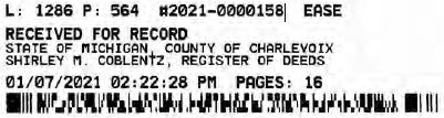
SUPPLEMENT NO. 19 TO AMENDED AND RESTATED EASEMENT AGREEMENT
THIS SUPPLEMENT NO. 19 TO ATTENDED AND RESTATED EASEMENT AGREEMENT (“Supplement No. 19”) is made this 22 day of December, 2020, between CONSUMERS ENERGY COMPANY (formerly known as Consumers Power Company), a Michigan corporation, (successor by merger to Consumers Power Company, a Maine corporation), One Energy Plaza, Jackson, Michigan 49201 (“Consumers”) and MICHIGAN ELECTRIC TRANSMISSION COMPANY, LLC, a Michigan limited liability company (successor by merger to Michigan Electric Transmission Company, a Michigan corporation), 27175 Energy Way, Novi, Michigan 48377 (“METC”).
RECITALS:
| A. | Consumers and METC entered into a certain Easement Agreement dated April 1, 2001 whereunder Consumers granted an “Easement” (as therein defined) to METC in respect to certain “Premises” in the State of Michigan for the use set forth therein and on and subject to all of the terms and conditions set forth therein. |
| B. | Consumers and METC agreed on certain revisions to the terms and conditions of said Easement Agreement, and for ease of reference, restated said Easement Agreement in its entirety, to include all of said agreed-upon revisions as well as all unchanged provisions, in a certain Amended and Restated Easement Agreement dated as of April 29, 2002 (the “Agreement”). |
| C. | The “Premises” under the Agreement are therein defined as (a) the lands identified as “fee lands” in Part “I” of Exhibit A, attached to the Agreement, (b) the lands covered by the easements held by Consumers that are identified in Part “II” of Exhibit A, attached to the Agreement, and (c) the lands covered by the leases, permits and licenses held by Consumers that are identified in Part “III” of Exhibit A, attached to the Agreement; as said Parts I, II and III of Exhibit A were supplemented or modified in a certain Supplement No. 1 dated April 29, 2002, in a certain Supplement No. 2 dated April 29, 2002, in a certain Supplement No. 3 dated March 3, 2003, in a certain Supplement No. 4 dated October 2, 2006, in a certain Supplement No. 5 dated August 3, 2007, in a certain Supplement No. 6 dated June 18, 2008, in a certain Supplement No. 7 dated September 18, 2008, in a certain Supplement No. 8 dated December 4, 2008, in a certain Supplement No. 9 dated February 22, 2010, in a certain Supplement No. 10 dated March 25, 2010, in a certain Supplement No. 11 dated October 2011, in a certain Supplement No. 12 dated July 20, 2012, in a certain Supplement No. 13 dated August 21, 2012, in a certain Supplement No. 14 dated September 23, 2013, in a certain Supplement No. 15 dated January 2014, in a certain Supplement No. 16 dated January 31, 2017, in a certain Supplement No. 17 dated September 25, 2019, and in a certain Supplement No. 18 dated June 8, 2020, heretofore entered into by Consumers and METC. The parties now desire to further supplement and modify said Exhibit A to the Agreement as set forth herein below. |
| D. | References, in regard to historical matters, to “METC” in the foregoing recitals will be deemed to mean METC’s predecessor, Michigan Electric Transmission Company, a Michigan corporation, where relevant. |
NOW, THEREFORE, for good and valuable consideration, the receipt of which is acknowledged, Consumers and METC agree as follows:
| 1. | Exhibit A to the Agreement, as heretofore supplemented and/or modified, is hereby further supplemented and modified as set forth in “Nineteenth Supplemental Exhibit A”, attached hereto. |
It is expressly understood that any lands, easements, or leases/permits/licenses that are indicated in said attached Nineteenth Supplemental Exhibit A as being added are, on and subject to the terms and conditions of the Agreement (as supplemented and amended by this Supplement No. 19), hereby deemed added to Part I, Part II and Part III, respectively, of Exhibit A to the Agreement. However, it is further expressly understood that in addition to all rights granted to METC by the Agreement, METC shall have the following rights as to the lands identified as “Consumers Energy Equipment / Joint Asset Area Easement” on the accompanying NINETEENTH Supplemental Exhibit A sheets, inclusive of Parts I, II and III, which rights are also subject to the terms of the Parties’ Amended and Restated Transmission Interconnection Agreement (the “DTIA”): (a) the right to maintain any and all existing components of the Transmission System, as defined in the DTIA, and wiring or conduit connections for the same that currently exist over, on or under these lands; and (b)the right to connect its currently sited or future approved wiring or conduits for communications, station power, or control, operating at 600 volts or less, and any Jointly Owned Assets, as defined in the DTIA, over, on or under these lands.
It is also expressly understood that, with respect to any lands, easements, or leases/permits/licenses now covered by Part I, Part II or Part III of Exhibit A that are indicated in said attached Nineteenth Supplemental Exhibit A as being deleted, the Easement is hereby deemed RELEASED with respect thereto and the Agreement shall hereafter no longer apply thereto (provided, however, that all rights and obligations under the Agreement with respect to periods prior to the date of this Supplement No. 19 shall remain unaffected).
| 2. | It is expressly understood and agreed that in respect to the additional Premises represented by the land(s), easement(s), lease(s), permit(s) and/or license(s) that are added to Part I, Part II and Part III of Exhibit A to the Agreement pursuant to this Supplement No. 19 (the “Additional Premises”): |
| (a) | All references to “Commencement Date” that are found in Article 1 (“Grant of Easement”), Article 2 (“Term”), Article 5 (“Additions/Alterations”), Article 6 (“Consumers’ Reserved Rights to Use the Premises and Transmission Facilities”), Article 7 (“METC Approval of Compatible Uses”), Article 8 (“Certain Obligations of Consumers and Authorized Users; Etc.”) and Article 14 (“Environmental Matters”) of the Agreement shall be deemed to mean the date of this Supplement No. 19 and not the date that is identified in the Agreement as the “Commencement Date”. |
| (b) | Except as expressly otherwise indicated in the immediately following sentence, all references to “Restated Agreement Date” that are found in Article 1 (“Grant of Easement”), Article 6 (“Consumers’ Reserved Rights to Use the Premises and Transmission Facilities”), and Article 12 (“Compliance With Applicable Laws”) of the Agreement shall also be deemed to mean the date of this Supplement No. 19 and not the date that is identified in the Agreement as the “Restated Agreement Date”. Notwithstanding the foregoing: |
| (i) | the preceding sentence does not apply to the purely historical statement in clause “(c)” of Section 1.2 of the Agreement that Trans-Elect, Inc. is “an affiliate of the entity which has become METC’s parent company as of the Restated Agreement Date”; and |
| (ii) | the parenthetical in the first sentence of the first paragraph of Section 7.1 of the Agreement reading “(see below regarding a certain period prior to the Restated Agreement Date)”, along with the fourth paragraph of said Section 7.1 reading “Consumers shall submit to METC within twenty (20) days of the Restated Agreement Date a list of all material Compatible Uses other than additions or modifications to Distribution Facilities that have been authorized between February 1, 2001 and the Restated Agreement Date for METC’s approval per the METC Compatible Use approval process described in this Section 7.1.”, both referred to a one-time historical matter and have no application to the Additional Premises or any other further effect or application whatsoever. |
| 3. | In addition to the original Transmission Facilities and Additions/Alterations thereto as referred to in Recital “A” of the Agreement, it is understood that such electric Transmission towers, pole structures, poles, crossarms, wires, cables, conduits, guys, anchors, transformers, insulators and/or other fixtures and eguipment as may be owned by METC and located on the Additional Premises as of the date of this Supplement No. 19, and future Additions/Alternations made thereto on and subject to the terms and conditions of the Agreement, are included in the “Transmission Facilities” under the Agreement. |
Note: This Supplement No. 19 will not be recorded in all counties in which the Agreement itself, or Supplements Nos. 1 through 18, may have been recorded. This Supplement No. 19 (as were each of Supplements Nos. 1 through 18), will be recorded only in the county(ies) in which relevant Premises are located; being, in the case of this Supplement No. 19, only the following:
Allegan County
Antrim County
Barry County
Bay County
Calhoun County
Charlevoix County
Clinton County
Crawford County
Emmet County
Genesee County
Gladwin County
Grand Traverse County
Gratiot County
Ingham County
Ionia County
Isabella County
Jackson County
Kalkaska County
Kent County
Leelanau County
Lenawee County
Manistee County
Midland County
Montcalm County
Muskegon County
Oceana County
Ogemaw County
Ottawa County
Roscommon County
Saginaw County
Shiawassee County
St. Joseph County
Washtenaw County
Wexford County
The fact that this Supplement No. 19 will be recorded only in the particular county(ies) identified above will in no way restrict, limit or otherwise affect the interpretation, application or enforcement of the Agreement; and the terms and conditions of the Agreement shall at all times be read, interpreted and applied in the manner provided for in Section 24.6 of the Agreement.
IN WITNESS WHEREOF, Consumers and METC have executed this Supplement No. 19 as of the date first above written.
CONSUMERS ENERGY COMPANY, a Michigan corporation
| By: | /s/ Mary Anne Marr | |
| | Mary Anne Marr | |
| | Director of Real Estate | |
| STATE OF MICHIGAN | ) | |
| | ) SS. |
| COUNTY OF Jackson | ) | |
The foregoing instrument was acknowledged before this 22 day of December, 2020, by Mary Anne Marr, Director of Real Estate of CONSUMERS ENERGY COMPANY, a Michigan corporation, on behalf of the corporation.
 | /s/Julie C. Guinn |
| | |
| | Notary Public, Jackson County, Michigan |
| | Acting in Jackson County, Michigan |
| | My Commission Expires: 12/29, 2020 |
MICHIGAN ELECTRIC TRANSMISSION COMPANY, LLC, a Michigan limited liability company
By: ITC Holdings Corp., a Michigan corporation, its manager
| By: | /s/ Jean Kim D’Anna | |
| | Jean Kim D’Anna | |
| | Vice President and Deputy General Counsel – Legal Services | |
| STATE OF MICHIGAN | ) | |
| | ) SS. |
| county of Oakland | ) | |
The foregoing instrument was acknowledged before this 16 day of December 2020, by Jean Kim D’Anna, Vice President and Deputy General Counsel of ITC Holdings Corp., a Michigan corporation, as manager of MICHIGAN ELECTRIC TRANSMISSION COMPANY, LLC, a Michigan limited liability company, on behalf of the limited liability company.
| LAURA J. MCCRAY | /s/ Laura J. Mccray |
| NOTARY PUBLIC, STATE OF MI | |
| COUNTY OF OAKLAND | Notary Public Oakland County, Michigan |
| MY COMMISSION EXPIRES Jul 30, 2021 | Acting in Oakland County, Michigan |
| ACTING IN COUNTY OF Oakland | My Commission Expires: 7/30/21, 2020 |
Exempt from transfer taxes per MCL §§ 207.505(f) and 207.526(f).
| Prepared by: Tracy L. VanWoert | Return to: Julie Guinn |
| Consumers Energy Company | Consumers Energy Company |
| EP7–447 | |
| One Energy Plaza | |
| Jackson, Michigan 49201 | |

THE ATTACHED COPY OF THE NINETEENTH SUPPLEMENTAL EXHIBIT A THAT WAS PREPARED FOR RECORDATION IN CHARLEVOIX COUNTY, MICHIGAN, AND CONTAINS THE PORTIONS OF EACH OF PARTS I, II, AND III OF THE NINETEENTH SUPPLEMENT EXHIBIT A THAT RELATE TO PREMISES IN THAT COUNTY ONLY. SEE SECTION 24.6 OF THE AGREEMENT.
NINETEENTH SUPPLEMENTAL EXHIBIT A
I. Fee Lands:
See sheet(s) labeled “NINETEENTH Supplemental Exhibit A-Part I”, attached hereto and made a part hereof. Said attached sheet(s) labeled NINETEENTH Supplemental Exhibit A-Part I consist of the following:
3 Pages for Allegan County
6 Pages for Antrim County
2 Pages for Barry County
2 Pages for Bay County
13 Pages for Calhoun County
2 Pages for Charlevoix County
6 Pages for Clinton County
4 Pages for Crawford County
7 Pages for Genesee County
1 Page for Gladwin County
6 Pages for Grand Traverse County
1 Page for Gratiot County
2 Pages for Ingham County
2 Pages for Ionia County
1 Page for Isabella County
2 Pages for Jackson County
1 Page for Kalkaska County
4 Pages for Kent County
1 Page for Leelanau County
3 Pages for Lenawee County
2 Pages for Manistee County
4 Pages for Midland County
1 Page for Montcalm County
17 Pages for Muskegon County
1 Pages for Oceana County
1 Page for Ogemaw County
4 Pages for Ottawa County
3 Pages for Roscommon County
2 Pages for Saginaw County
3 Pages for Shiawassee County
1 Page for St. Joseph County
3 Pages for Washtenaw County
2 Pages for Wexford County
Nineteenth Supplemental Exhibit A –
Introductory Page 1 of 2
II. Easements:
See sheet(s) labeled “NINETEENTH Supplemental Exhibit A-Part II”, attached hereto and made a part hereof. Said attached sheet(s) labeled NINETEENTH Supplemental Exhibit A-Part II consist of the following:
1 Page for Allegan County
1 Pages for Antrim County
1 Pages for Barry County
1 Pages for Bay County
9 Pages for Calhoun County
1 Pages for Charlevoix County
9 Pages for Clinton County
2 Pages for Crawford County
2 Pages for Emmet County
6 Pages for Genesee County
3 Pages for Gladwin County
1 Page for Grand Traverse County
1 Page for Ingham County
6 Pages for Ionia County
5 Pages for Isabella County
1 Page for Kalkaska County
1 Page for Kent County
2 Pages for Leelanau County
3 Pages for Lenawee County
3 Pages for Manistee County
12 Pages for Midland County
1 Page for Montcalm County
5 Pages for Muskegon County
1 Page for Ogemaw County
4 Pages for Roscommon County
2 Pages for Shiawassee County
1 Page for St. Joseph County
2 Pages for Washtenaw County
III Leases, Permits and Licenses:
See sheet(s) labeled “NINETEENTH Supplemental Exhibit A–Part III”, attached hereto and made a part hereof. Said attached sheet(s) labeled Nineteenth Supplemental Exhibit A–Part III consist of the following:
NA
Nothing in this NINETEENTH Supplemental Exhibit A shall be deemed to affect, limit or waive any of the provisions of Sections 1.2 (“Title Limitations”) and 1.3 (“No Warranties”) of the Agreement.
Nineteenth Supplemental Exhibit A -
Introductory Page 2 of 2
SUPPLEMENTAL 19 EXHIBIT A - PART I
CHARLEVOIX COUNTY
ADD THE FOLLOWING LAND DESCRIPTIONS:
1-E82-7, Line 114L
A strip of land 72 feet in width being 36 feet on each side of the centerline of an existing electric line, known as line segment 114L, as currently located and running in a Southerly direction to the center of the Substation Rack, across a parcel of land described as: A parcel of land in the Southwest 1/4 of Section 29, Town 32 North, Range 7 West, South Arm Township, Charlevoix County, and State of Michigan described as follows: Beginning at the Southwest corner of said section and running thence North along the West line of said section 788.25 feet to a point which is 528 feet distant South of the South 1/8 line of said section as measured along the said West line of said section; thence North 89°30’19” East, parallel with said South 1/8 line of said section 442.1 feet; thence South 788.15 feet to the South line of said section; thence South 89°29’30” West, along said South line of said section 442.1 feet to the place of beginning.
Note: It is understood that a portion of the above-described strip of land lies within the fenced premises of Consumers Miles Road Substation, in the Southwest 1/4 of Section 29, Town 32 North, Range 7 West. It is also understood that an electric line, which is part of METC’s Transmission Facilities covered by this Agreement and is located on said strip of land, presently connects to the substation within said fenced area; but that no part of the substation itself, or its associated structures and facilities is part of METC’s Transmission Facilities covered by this Agreement. With respect to that portion of the above-described strip of land that is within said substation fence (as now or hereafter existing), it is expressly understood, any other provision of this Agreement notwithstanding, that unless otherwise expressly approved in writing by Consumers, METC shall make no entry thereon and shall have no right to authorize others to enter thereon; and METC shall make separate arrangements and agreements with Consumers regarding the performance of any work on the portion of METC’s Transmission Facilities located therein.
1–G578–9, Line 114D
A strip of land 72 feet in width being 36 feet on each side of the centerline of an existing electric line, known as line segment 114D, as currently located and running in an Easterly and Westerly direction to the center of the Substation Rack, across a parcel of land described as: Land in the Township of Hayes, County of Charlevoix and State of Michigan, and described as follows: A parcel of land described as the North 192 feet of the West 132 feet of the Northwest 1/4 of the Southeast 1/4 of Section 9, Town 34 North, Range 7 West.
Note: It is understood that a portion of the above–described strip of land lies within the fenced premises of Consumers McNally Substation, in the Southeast 1/4 of Section 9, Town 34 North, Range 7 West. It is also understood that an electric line, which is part of METC’s Transmission Facilities covered by this Agreement and is located on said strip of land, presently connects to the substation within said fenced area; but that no part of the substation itself, or its associated structures and facilities is part of METC’s Transmission Facilities covered by this Agreement. With respect to that portion of the above-described strip of land that is within said substation fence (as now or hereafter existing), it is expressly understood, any other provision of this Agreement notwithstanding, that unless otherwise expressly approved in writing by Consumers, METC shall make no entry thereon and shall have no right to authorize others to enter thereon; and METC shall make separate arrangements and agreements with Consumers regarding the performance of any work on the portion of METC’s Transmission Facilities located therein.
Nineteenth Supplemental Exhibit A–Part I, Charlevoix County, Page 1
1–G810–10, Line 114D
A strip of land 72 feet in width being 36 feet on each side of the centerline of an existing electric line, known as line segment 114D, as currently located and running in an Easterly and Westerly direction to the center of the Substation Rack, across a parcel of land described as: A parcel of land in the Northwest 1/4 of the Southeast 1/4 of Section 9, Town 34 North, Range 7 West, Township of Hayes, County of Charlevoix and State of Michigan described as: Commencing at a 1” pipe at the center 1/4 corner of said Section; thence along the East and West 1/4 line of said Section, as monumented, South 89°33’18” East (recorded as South 89°33’50” East), 132.00 feet to a 1” pipe being the point of beginning of this description; thence continuing along said 1/4 line South 89°33’18” East (recorded as South 89°33’50” East), 150.00 feet to a 1/2” rod; thence South 00°23’08” West, 192.00 feet to a 1/2” rod; thence parallel with said East and West 1/4 line North 89°33’18” West, 150.00 feet to a 3/4” pipe; thence North 00°23’08” East (recorded as North 00°22’40” East), 192.00 feet to the point of beginning, containing 0.661 acres.
Note: It is understood that a portion of the above-described strip of land lies within the fenced premises of Consumers McNally Substation, in the Southeast 1/4 of Section 9, Town 34 North, Range 7 West. It is also understood that an electric line, which is part of METC’s Transmission Facilities covered by this Agreement and is located on said strip of land, presently connects to the substation within said fenced area; but that no part of the substation itself, or its associated structures and facilities is part of METC’s Transmission Facilities covered by this Agreement. With respect to that portion of the above–described strip of land that is within said substation fence (as now or hereafter existing), it is expressly understood, any other provision of this Agreement notwithstanding, that unless otherwise expressly approved in writing by Consumers, METC shall make no entry thereon and shall have no right to authorize others to enter thereon; and METC shall make separate arrangements and agreements with Consumers regarding the performance of any work on the portion of METC’s Transmission Facilities located therein.
Nineteenth Supplemental Exhibit A–Part I, Charlevoix County, Page 2
| 114 D | 347–D114–7 | L177, P399 | Raymond E. Griffen and Josephine A. Griffen, husband and wife | Consumers Power Company | 7/16/1959 | Charlevoix County | Hayes Township | T34N | R7W | 12 |
| 114 D | 348–D114–8 | L178,P196 | Raymond E. Griffen and Josephine A. Griffen, husband and wife | Consumers Power Company | 2/9/1960 | Charlevoix County | Hayes Township | T34N | R7W | 12 |
| 114 D | 349–D114–9 | L177,P397 | Oliver Garver, aka Oliver M. Garver and Pauline Garver,aka Pauline I. Garver, husband and wife | Consumers Power Company | 7/16/159 | CharlevoixCounty | Hayes Township | T34N | R7W | 12 |
| 114 D | 350–D114–1 | L177,P395 | Hiram Stewart and Margaret Stewart,aka Margaret R. Stewart, husband and wife | Consumers Power Company | 7/16/1959 | Charlevoix County | Hayes Township | T34N | R7W | 11 |
| 114 D | 351–D114–2 | L177,P392 | Jacob Speigl, aka Jake Speigl and Ann Margaret Speigl, aka Margaret Speigl, aka Anna Margaret, aka Anna M. Speigl, husband and wife, Lawrence J. Speigl, a single man, John Speigl, a single man | Consumers Power Company | 7/15/1959 | Charlevoix County | Hayes Township | T34N | R7W | 11 |
| 114 D | 352–D114–3 | L177,P390 | Ralph Burnett aka Ralph C. Burnett and Virginia Burnett, aka Virginia M. Burnett, husband and wife | Consumers Power Company | 7/15/1959 | Charlevoix County | Hayes Township | T34N | R7W | 11 |
Nineteenth Supplemental Exhibit A-Part I, Charlevoix County, Page 2
NINETEENTH SUPPLEMENTAL EXHIBIT A - PART II
CHARLEVOIX COUNTY
Engineering
Number | Legacy Tract
No | Liber/Page | Grantor | Grantee | Date of
Inst. | County | City/Township | Town | Range | Section |
| 114 D | 340–D114–12 | L178, P375 | Joseph Martinchek, aka Joseph Martincheck and Ann Martinchek, aka Ana Martinchek, aka Anna Martincheck, husband and wife | Consumers Power Company | 3/14/1960 | Charlevoix County | Hayes Township | T34N | R7W | 12 |
| 114 D | 342–D114–2 | L177, P409 | Victor Martincheck and Janice Martinchek, husband and wife | Consumers Power Company | 7/24/1959 | Charlevoix County | Hayes Township | T34N | R7W | 12 |
| 114 D | 343–D114–3 | L177, P407 | George N. Rice and Mabel Worth Rice, husband and wife | Consumers Power Company | 7/17/1959 | Charlevoix County | Hayes Township | T34N | R7W | 12 |
| 114 D | 344–D114–4 | L177, P405 | Wolfe Price, aka Wolfe Preiss, a single man | Consumers Power Company | 7/16/1959 | Charlevoix County | Hayes Township | T34N | R7W | 12 |
| 114 D | 345–D114–5 | L177, P403 | Stanley Wiklanski and Maud Wiklanski, husband and wife | Consumers Power Company | 7/16/1959 | Charlevoix County | Hayes Township | T34N | R7W | 12 |
| 114 D | 346–D114–6 | L177, P401 | Harrison Dorsey and Gladys Dorsey, formerly Gladys Glassford, husband and wife | Consumers Power Company | 7/16/1959 | Charlevoix County | Hayes Township | T34N | R7W | 12 |
Nineteenth Supplemental Exhibit A–Part II, Charlevoix County, Page 1
| 114 D | 353–D114–4 | L177, P388 | Leo Burnett, aka Leo G. Burnett and Juanita Burnett, husband and wife | Consumers Power Company | 7/15/1959 | Charlevoix County | Hayes Township | T34N | R7W | 11 |
| 114 D | 354–D114–1 | L177, P386 | Carlos J. Cole and Fern L. Cole, husband and wife | Consumers Power Company | 7/15/1959 | CharlevoixCounty | Hayes Township | T34N | R7W | 10 |
| 114 D | 355–0114–2 | L178, P197 | Estate of Norman Kunkle, mentally incompetent | Consumers Power Company | 2/5/1960 | CharlevoixCounty | Hayes Township | T34N | R7W | 10 |
| 114 D | 356–D114–3 | L177, P384 | George Schantz, a single man | Consumers Power Company | 7/15/1959 | CharlevoixCounty | Hayes Township | T34N | R7W | 10 |
| 114 D | 357–D114–4 | L178, P243 | Estate of Amandus Evers, mentally incompetent | Consumers Power Company | 2/22/1960 | CharlevoixCounty | Hayes Township | T34N | R7W | 10 |
| 114 D | 358–D114–5 | L177, P507 | Robert C. Crist and Ruth E. Crist, husband and wife | Consumers Power Company | 8/18/1959 | CharlevoixCounty | Hayes Township | T34N | R7W | 10 |
| 114 D | 359–D114–1 | L177, P382 | Elmer D. Hawley and Ester S. Hawley, husband and wife | Consumers Power Company | 7/14/1959 | CharlevoixCounty | Hayes Township | T34N | R7W | 9 |
| 114 D | 360–D114–2 | L178, P199 | Estate of John H. Budek, deceased | Consumers Power Company | 11/18/1959 | CharlevoixCounty | Hayes Township | T34N | R7W | 9 |
| 114 D | 361–D114–3 | L177, P380 | Loren E. Hamlin and Helen M. Hamlin, husband and wife | Consumers Power Company | 7/13/1959 | CharlevoixCounty | Hayes Township | T34N | R7W | 9 |
| 114 D | 362–D114–4 | L178, P302 | Builders Finance Company, a corporation | Consumers Power Company | 3/18/1960 | CharlevoixCounty | Hayes Township | T34N | R7W | 9 |
Nineteenth Supplemental Exhibit A–Part II, Charlevoix County, Page 3
| 114 J | 414–D114–1 | L204, P383 | Eugene E. Umlor and Reva V Umlor | Consumers Power Company | 10/20/1965 | Charlevoix County | Township ofSouth Arm | T32N | R7W | 32 |
| 114 J | 415–D114–2 | L204, P384 | Alonzo Murray and Bertha E. Murray, husband and wife; Rose Bussler; Mark P. Harwood and Lena E. Harwood, formerly known as Lena E. Holland | Consumers Power Company | 9/28/1965 | Charlevoix County | Township ofSouth Arm | T32N | R7W | 32 |
| 114 J | 416–D114–3 | L204, P386 | Emanuel J Cihak and Thelma Cihak, husband and wife | Consumers PowerCompany | 9/27/1965 | Charlevoix County | Township of South Arm | T32N | R7W | 32 |
| 114 J | 417–D114–4 | L204, P387 | Harold J Goebel and Ometa C Goebel, husband and wife | Consumers Power Company | 10/19/1965 | Charlevoix County | Township of South Arm | T32N | R7W | 32 |
| 114 J | 418–D114–5 | L204, P388 | Ward A Robinson and Lorraine C Robinson, husband and wife | Consumers Power Company | 10/4/1965 | Charlevoix County | Township of South Arm | T32N | R7W | 32 |
| 114 J | 419–D114–4 419–D114–6 | L204 , P389 | Ralph Walker aka Ralph L Walker and Sophia Walker, husband and wife | Consumers Power Company | 9/29/1965 | Charlevoix County | Township of South Arm | T32N | R7W | 29 32 |
| 114 J | 420–D114–5 | L204, P390 | Gerald E. Nice and Jerusha May Nice, husband and wife; and Gardelle R. Nice and Alta Nice, husband and wife | Consumers Power Company | 10/23/1965 | Charlevoix County | Township of South Arm | T32N | R7W | 29 |
| 114 L | 575–D114–6 | L213, P764 | Ralph L Walker and Sophia o Walker, husband and wife | Consumers Power Company | 3/12/1969 | Charlevoix County | Township of South Arm | T32N | R7W | 29 |
Nineteenth Supplemental Exhibit A–Part II, Charlevoix County, Page 4
NINETEENTH SUPPLEMENTAL EXHIBIT A – PART III
CHARLEVOIX COUNTY
| CE Ref. | | License/Lessor | | Licensee/Lessee | | Date of Instrument | | Title of Instrument | | Town/Range Section |
| | | | | | | NONE | | | | |
Nineteenth Supplemental Exhibit A–Part III, Charlevoix County, Page 1

SUPPLEMENT NO. 19 TO AMENDED AND RESTATED EASEMENT AGREEMENT
THIS SUPPLEMENT NO. 19 TO AMENDED AND RESTATED EASEMENT AGREEMENT (“Supplement No. 19”) is made this 22 day of December, 2020, between CONSUMERS ENERGY COMPANY (formerly known as Consumers Power Company), a Michigan corporation, (successor by merger to Consumers Power Company, a Maine corporation), One Energy Plaza, Jackson, Michigan 49201 (“Consumers”) and MICHIGAN ELECTRIC TRANSMISSION COMPANY, LLC, a Michigan limited liability company {successor by merger to Michigan Electric Transmission Company, a Michigan corporation), 27175 Energy Way, Novi, Michigan 48377 (“METC”).
RECITALS:
| A. | Consumers and METC entered into a certain Easement Agreement dated April 1, 2001 whereunder Consumers granted an “Easement” (as therein defined) to METC in respect to certain “Premises” in the State of Michigan for the use set forth therein and on and subject to all of the terms and conditions set forth therein. |
| B. | Consumers and METC agreed on certain revisions to the terms and conditions of said Easement Agreement, and for ease of reference, restated said Easement Agreement in its entirety, to include all of said agreed-upon revisions as well as all unchanged provisions, in a certain Amended and Restated Easement Agreement dated as of April 29, 2002 (the “Agreement”). |
| C. | The “Premises” under the Agreement are therein defined as (a) the lands identified as “fee lands” in Part “I” of Exhibit A, attached to the Agreement, (b) the lands covered by the easements held by Consumers that are identified in Part “II” of Exhibit A, attached to the Agreement, and (c) the lands covered by the leases, permits and licenses held by Consumers that are identified in Part “III” of Exhibit A, attached to the Agreement; as said Parts I, II and III of Exhibit A were supplemented or modified in a certain Supplement No. 1 dated April 29, 2002, in a certain Supplement No. 2 dated April 29, 2002, in a certain Supplement No. 3 dated March 3, 2003, in a certain Supplement No. 4 dated October 2, 2006, in a certain Supplement No. 5 dated August 3, 2007, in a certain Supplement No. 6 dated June 18, 2008, in a certain Supplement No. 7 dated September 18, 2008, in a certain Supplement No. 8 dated December 4, 2008, in a certain Supplement No. 9 dated February 22, 2010, in a certain Supplement No. 10 dated March 25, 2010, in a certain Supplement No. 11 dated October 2011, in a certain Supplement No. 12 dated July 20, 2012, in a certain Supplement No. 13 dated August 21, 2012, in a certain Supplement No. 14 dated September 23, 2013, in a certain Supplement No. 15 dated January 2014, in a certain Supplement No. 16 dated January 31, 2017, in a certain Supplement No. 17 dated September 25, 2019, and in a certain Supplement No. 18 dated June 8, 2020, heretofore entered into by Consumers and METC. The parties now desire to further supplement and modify said Exhibit A to the Agreement as set forth herein below. |
| D. | References, in regard to historical matters, to “METC” in the foregoing recitals will be deemed to mean METC’s predecessor, Michigan Electric Transmission Company, a Michigan corporation, where relevant. |
NOW, THEREFORE, for good and valuable consideration, the receipt of which is acknowledged, Consumers and METC agree as follows:
| 1. | Exhibit A to the Agreement, as heretofore supplemented and/or modified, is hereby further supplemented and modified as set forth in “Nineteenth Supplemental Exhibit A”, attached hereto. |
It is expressly understood that any lands, easements, or leases/permits/licenses that are indicated in said attached Nineteenth Supplemental Exhibit A as being added are, on and subject to the terms and conditions of the Agreement (as supplemented and amended by this Supplement No. 19), hereby deemed added to Part I, Part II and Part III, respectively, of Exhibit A to the Agreement. However, it is further expressly understood that in addition to all rights granted to METC by the Agreement, METC shall have the following rights as to the lands identified as “Consumers Energy Equipment / Joint Asset Area Easement” on the accompanying NINETEENTH Supplemental Exhibit A sheets, inclusive of Parts I, II and III, which rights are also subject to the terms of the Parties’ Amended and Restated Transmission Interconnection Agreement (the “DTIA”): (a) the right to maintain any and all existing components of the Transmission System, as defined in the DTIA, and wiring or conduit connections for the same that currently exist over, on or under these lands; and (b)the right to connect its currently sited or future approved wiring or conduits for communications, station power, or control, operating at 600 volts or less, and any Jointly Owned Assets, as defined in the DTIA, over, on or under these lands.
It is also expressly understood that, with respect to any lands, easements, or leases/permits/licenses now covered by Part I, Part II or Part III of Exhibit A that are indicated in said attached Nineteenth Supplemental Exhibit A as being deleted, the Easement is hereby deemed RELEASED with respect thereto and the Agreement shall hereafter no longer apply thereto (provided, however, that all rights and obligations under the Agreement with respect to periods prior to the date of this Supplement No. 19 shall remain unaffected).
| 2. | It is expressly understood and agreed that in respect to the additional Premises represented by the land(s) , easement(s), lease(s), permit(s) and/or license(s) that are added to Part I, Part II and Part III of Exhibit A to the Agreement pursuant to this Supplement No. 19 (the “Additional Premises”): |
| (a) | All references to “Commencement Date” that are found in Article 1 (“Grant of Easement”), Article 2 (“Term”), Article 5 (“Additions/Alterations”), Article 6 (“Consumers’ Reserved Rights to Use the Premises and Transmission Facilities”), Article 7 (“METC Approval of Compatible Uses”), Article 8 (“Certain Obligations of Consumers and Authorized Users; Etc.”) and Article 14 (“Environmental Matters”) of the Agreement shall be deemed to mean the date of this Supplement No. 19 and not the date that is identified in the Agreement as the “Commencement Date”. |
| (b) | Except as expressly otherwise indicated in the immediately following sentence, all references to “Restated Agreement Date” that are found in Article 1 (“Grant of Easement”), Article 6 (“Consumers’ Reserved Rights to Use the Premises and Transmission Facilities”), and Article 12 (“Compliance With Applicable Laws”) of the Agreement shall also be deemed to mean the date of this Supplement No. 19 and not the date that is identified in the Agreement as the “Restated Agreement Date”. Notwithstanding the foregoing: |
| (i) | the preceding sentence does not apply to the purely historical statement in clause “(c)” of Section 1.2 of the Agreement that Trans–Elect, Inc. is “an affiliate of the entity which has become METC’s parent company as of the Restated Agreement Date”; and |
| (ii) | the parenthetical in the first sentence of the first paragraph of Section 7.1 of the Agreement reading “(see below regarding a certain period prior to the Restated Agreement Date)”, along with the fourth paragraph of said Section 7.1 reading “Consumers shall submit to METC within twenty (20) days of the Restated Agreement Date a list of all material Compatible Uses other than additions or modifications to Distribution Facilities that have been authorized between February 1, 2001 and the Restated Agreement Date for METC’s approval per the METC Compatible Use approval process described in this Section 7.1.”, both referred to a one-time historical matter and have no application to the Additional Premises or any other further effect or application whatsoever. |
| 3. | In addition to the original Transmission Facilities and Additions/Alterations thereto as referred to in Recital “A” of the Agreement, it is understood that such electric Transmission towers, pole structures, poles, crossarms, wires, cables, conduits, guys, anchors, transformers, insulators and/or other fixtures and equipment as may be owned by METC and located on the Additional Premises as of the date of this Supplement No. 19, and future Additions/Alternations made thereto on and subject to the terms and conditions of the Agreement, are included in the “Transmission Facilities” under the Agreement. |
Note: This Supplement No. 19 will not be recorded in all counties in which the Agreement itself, or Supplements Nos. 1 through 18, may have been recorded. This Supplement No. 19 (as were each of Supplements Nos. 1 through 18), will be recorded only in the county(ies) in which relevant Premises are located; being, in the case of this Supplement No. 19, only the following:
Allegan County
Antrim County
Barry County
Bay County
Calhoun County
Charlevoix County
üClinton County
Crawford County
Emmet County
Genesee County
Gladwin County
Grand Traverse County
Gratiot County
Ingham County
Ionia County
Isabella County
Jackson County
Kalkaska County
Kent County
Leelanau County
Lenawee County
Manistee County
Midland County
Montcalm County
Muskegon County
Oceana County
Ogemaw County
Ottawa County
Roscommon County
Saginaw County
Shiawassee County
St. Joseph County
Washtenaw County
Wexford County
The fact that this Supplement No. 19 will be recorded only in the particular county(ies) identified above will in no way restrict, limit or otherwise affect the interpretation, application or enforcement of the Agreement; and the terms and conditions of the Agreement shall at all times be read, interpreted and applied in the manner provided for in Section 24.6 of the Agreement.
IN WITNESS WHEREOF, Consumers and METC have executed this Supplement No. 19 as of the date first above written.
CONSUMERS ENERGY COMPANY, a Michigan corporation
| By | /s/ Mary Anne Marr | |
| | Mary Anne Marr | |
| | Director of Real Estate | |
| STATE OF MICHIGAN | ) | |
| | ) SS. |
| COUNTY OF Jackson | ) | |
| | | |
The foregoing instrument was acknowledged before this 22 day of December 2020, by Mary Anne Marr, Director of Real Estate of CONSUMERS ENERGY COMPANY, a Michigan corporation, on behalf of the corporation.
 | /s/ Julie Guinn |
| | |
| | Notary Public, Jackson County, Michigan Acting in Jackson County, Michigan My Commission Expires: 12/29, 2020 |
MICHIGAN ELECTRIC TRANSMISSION COMPANY, LLC, a Michigan limited liability company
By: ITC Holdings Corp., a Michigan corporation, its manager
| By: | /s/ Jean Kim D’ Anna | |
| | Jean Kim D’ Anna | |
| | Vice President and Deputy General Counsel - Legal Services | |
| STATE OF MICHIGAN | ) | |
| | ) SS. |
| COUNTY OF Oakland | ) | |
| | | |
The foregoing instrument was acknowledged before this 16 day of December 2020, by Jean Kim D’ Anna, Vice President and Deputy General Counsel of ITC Holdings Corp., a Michigan corporation, as manager of MICHIGAN ELECTRIC TRANSMISSION COMPANY, LLC, a Michigan limited liability company, on behalf of the limited liability company.
| LAURA J. MCCRAY | /s/ Laura J. Mccray |
| NOTARY PUBLIC, STATE OF MI | |
| COUNTY OF OAKLAND | Notary Public Oakland County, Michigan |
| MY COMMISSION EXPIRES Jul 30, 2021 | Acting in Oakland County, Michigan |
| ACTING IN COUNTY OF Oakland | My Commission Expires: 7/30/21, 2020 |
Exempt from transfer taxes per MCL §§ 207.505(f) and 207.526(f).
| Prepared by: Tracy L. VanWoert | Return to: Julie Guinn |
| Consumers Energy Company | Consumers Energy Company |
| EP7-447 | |
| One Energy Plaza | |
| Jackson, Michigan 49201 | |
THE ATTACHED COPY OF THE NINETEENTH SUPPLEMENTAL EXHIBIT A THAT WAS PREPARED FOR RECORDATION IN CLINTON COUNTY, MICHIGAN, AND CONTAINS THE PORTIONS OF EACH OF PARTS I, II, AND III OF THE NINETEENTH SUPPLEMENT EXHIBIT A THAT RELATE TO PREMISES IN THAT COUNTY ONLY. SEE SECTION 24.6 OF THE AGREEMENT.
NINETEENTH SUPPLEMENTAL EXHIBIT A
I. Fee Lands:
See sheet(s) labeled “NINETEENTH Supplemental Exhibit A-Part I”, attached hereto and made a part hereof. Said attached sheet(s) labeled NINETEENTH Supplemental Exhibit A-Part I consist of the following:
3 Pages for Allegan County
6 Pages for Antrim County
2 Pages for Barry County
2 Pages for Bay County
13 Pages for Calhoun County
2 Pages for Charlevoix County
ü6 Pages for Clinton County
4 Pages for Crawford County
7 Pages for Genesee County
1 Page for Gladwin County
6 Pages for Grand Traverse County
1 Page for Gratiot County
2 Pages for Ingham County
2 Pages for Ionia County
1 Page for Isabella County
2 Pages for Jackson County
1 Page for Kalkaska County
4 Pages for Kent County
1 Page for Leelanau County
3 Pages for Lenawee County
2 Pages for Manistee County
4 Pages for Midland County
1 Page for Montcalm County
17 Pages for Muskegon County
1 Pages for Oceana County
1 Page for Ogemaw County
4 Pages for Ottawa County
3 Pages for Roscommon County
2 Pages for Saginaw County
3 Pages for Shiawassee County
1 Page for St. Joseph County
3 Pages for Washtenaw County
2 Pages for Wexford County
Nineteenth Supplemental Exhibit A -
Introductory Page 1 of 2
II. Easements:
See sheet(s) labeled “NINETEENTH Supplemental Exhibit A-Part II”, attached hereto and made a part hereof. Said attached sheet(s) labeled NINETEENTH Supplemental Exhibit A-Part II consist of the following:
1 Page for Allegan County
5 Pages for Antrim County
4 Pages for Barry County
1 Pages for Bay County
9 Pages for Calhoun County
4 Pages for Charlevoix County
ü9 Pages for Clinton County
2 Pages for Crawford County
6 Pages for Emmet County
8 Pages for Genesee County
3 Pages for Gladwin County
1 Page for Grand Traverse County
1 Page for Ingham County
6 Pages for Ionia County
5 Pages for Isabella County
1 Page for Kalkaska County
1 Page for Kent County
2 Pages for Leelanau County
3 Pages for Lenawee County
3 Pages for Manistee County
12 Pages for Midland County
1 Page for Montcalm County
5 Pages for Muskegon County
1 Page for Ogemaw County
4 Pages for Roscommon County
2 Pages for Shiawassee County
1 Page for St. Joseph County
2 Pages for Washtenaw County
III. Leases, Permits and Licenses:
See sheet(s) labeled “NINETEENTH Supplemental Exhibit A-Part III”, attached hereto and made a part hereof. Said attached sheet(s) labeled Nineteenth Supplemental Exhibit A-Part III consist of the following:
NA
Nothing in this NINETEENTH Supplemental Exhibit A shall be deemed to affect, limit or waive any of the provisions of Sections 1.2 (“Title Limitations”) and 1.3 (“No Warranties”) of the Agreement.
Nineteenth Supplemental Exhibit A -
Introductory Page 2 of 2
SUPPLEMENTAL 19 EXHIBIT A – PART I
CLINTON COUNTY
ADD THE FOLLOWING LAND DESCRIPTIONS:
1–E79–15, Line 77N
A strip of land 72 feet in width being 36 feet on each side of the centerline of an existing electric line, known as line segment 77N, as currently located and running in a Northerly and Southerly and Easterly and Westerly direction to the center of the Substation Rack, across a parcel of land described as: The Northeast 1/4 of the Northeast 1/4 of the Southeast 1/4 of Section 22, and the North 165 feet of the Northwest 1/4 of the Northeast 1/4 of the Southeast 1/4 of Section 22, Town 5 North, Range 3 West, Watertown Township, Clinton County, Michigan.
Note: It is understood that a portion of the above–described strip of land lies within the fenced premises of Consumers Looking Glass Substation Site, in the Southeast 1/4 of Section 22, Town 5 North, Range 3 West. It is also understood that an electric line, which is part of METC’s Transmission Facilities covered by this Agreement and is located on said strip of land, presently connects to the substation within said fenced area; but that no part of the substation itself, or its associated structures and facilities is part of METC’s Transmission Facilities covered by this Agreement. With respect to that portion of the above–described strip of land that is within said substation fence (as now or hereafter existing), it is expressly understood, any other provision of this Agreement notwithstanding, that unless otherwise expressly approved in writing by Consumers, METC shall make no entry thereon and shall have no right to authorize others to enter thereon; and METC shall make separate arrangements and agreements with Consumers regarding the performance of any work on the portion of METC’s Transmission Facilities located therein.
679–D77–18, Line 77N
A parcel of land situated in the Township of Watertown, County of Clinton and State of Michigan described as the North 165 feet of the West 1/2 of the West 1/2 of the Southeast 1/4 of Section 23, Town 5 North, Range 3 West. EXCEPT, the North 165 feet of the West 1/2 of the Southeast 1/4 of Section 23, Town 5 North, Range 3 West, which lies Southeasterly of the hereinafter described North limited access right of way of Highway I–69.
680–D77–19, Line 77N
Land situated in the Township of Watertown, County of Clinton and State of “ Michigan described as the North 165 feet of the Southwest 1/4 of Section 23, Town 5 North, Range 3 West, more specifically described as beginning at the West 1/4 post of said Section 23, running thence South 89°58’20” East along the East and West 1/4 line of said section a distance of 2645.46 feet to the North and South 1/4 line of said section; thence South 00°08’18” East along the North and South 1/4 line a distance of 165 feet; thence North 89°58’26” West a distance of 2645.67 feet to the West line of said section; thence North 00°03’50” West along the West line of said section 165 feet to the place of beginning.
Nineteenth Supplemental Exhibit A–Part I, Clinton County, Page 1
559–D28–20 Line 77N
Land situated in the Township of Bingham, County of Clinton and State of Michigan described as a parcel of land in the Southwest 1/4 of Section 10, Town 7 North, Range 2 West, described as follows: To find the place of beginning of said land, commence at the West 1/4 corner of said Section; thence East along the East and West 1/4 line of said Section 1306.5 feet to a point on the West, North and South 1/8 line of said Section; thence South 0°45’ East along the said West, North and South 1/8 line of said section, said line also being the West line and the West line extended, of land now owned by Consumers Power Company 1,373.31 feet to a point on the Southerly right of way line of the Grand Trunk Western Railroad which said point is the place of beginning of said land; thence continuing South 0°45’ East 66 feet; thence North 89°28’ East parallel with the said Grand Trunk Western Railroad 324 feet; thence North 0°45’ West 66 feet to a point on the Southerly line of the said Grand Trunk Western Railroad; thence South 89°28’ West along the Southerly line of the said Grand Trunk Western Railroad right of way 324 feet to the place of beginning
1–E33–1, Line 77N
A strip of land 72 feet in width being 36 feet on each side of the centerline of an existing electric line, known as line segment 77N, as currently located and running in a Northerly and Southerly direction to the center of the Substation Rack, across a parcel of land described as: A parcel of land in the Southwest 1/4 of Section 10, Town 7 North, Range 2 West, Bingham Township, Clinton County, Michigan, described as beginning at a point on the East and West 1/4 line of said section, 1306.5 feet East of the West 1/4 post of said section, which point is also the Northwest corner of the Northeast 1/4 of the Southwest 1/4 of Section 10, running thence East along said East and West 1/4 line 660 feet, thence South parallel to the West line of said section 660 feet, thence West parallel to said East and West 1/4 line 330 feet, thence South parallel to the West line of said section 610.4 feet to the North line of the Grand Trunk Western Railroad right of way, thence West along the North line of said Railroad right of way to a point which is 1306.75 feet East of the West line of said section, which point is located on the West 1/8 of said section, thence North along said 1/8 line to the place of beginning.
Note: It is understood that a portion of the above–described strip of land lies within the fenced premises of Consumers Bingham Substation, in the Southwest 1/4 of Section 10, Town 7 North, Range 2 West. It is also understood that an electric line, which is part of METC’s Transmission Facilities covered by this Agreement and is located on said strip of land, presently connects to the substation within said fenced area; but that no part of the substation itself, or its associated structures and facilities is part of METC’s Transmission Facilities covered by this Agreement. With respect to that portion of the above-described strip of land that is within said substation fence (as now or hereafter existing), it is expressly understood, any other provision of this Agreement notwithstanding, that unless otherwise expressly approved in writing by Consumers, METC shall make no entry thereon and shall have no right to authorize others to enter thereon; and METC shall make separate arrangements and agreements with Consumers regarding the performance of any work on the portion of METC’s Transmission Facilities located therein
Nineteenth Supplemental Exhibit A–Part I, Clinton County, Page 2
1–E33–1, Bingham Substation
(Note: The below entry replaces and supersedes the Bingham Substation entry included in Supplement 17, recorded in Clinton County on 10/7/2019 in instrument #5284551, Pages 10–14.)
A. Bingham Substation, 1–E33–1
(Reference: CE Equipment/Joint Asset Area)
A parcel of land in the Southwest 1/4 of Section 10, Town 7 North, Range 2 West, Bingham Township, Clinton County, Michigan, more particularly described as follows: To find the Point of Beginning, commence at the West 1/4 corner of said Section 10; thence North 90°00’00” East, along the East & West 1/4 line of said Section 10, 1401.00 feet; thence South 00°00’00” East, perpendicular to said East & West 1/4 line, 344.04 feet; thence North 90°00’00” East, parallel with said East & West 1/4 line, 25.40 feet to a point that is 5.00 feet West and exterior of an existing substation fence and the Point of Beginning of this description; thence 5.00 feet exterior of and parallel with said fence the following thirteen (13) courses: thence North 00°07’07” East, 136.76 feet; thence NorJennifer E. Neeb, husbandth 89°50’13” East, 80.01 feet; thence North 01°16’57” East, 15.74 feet; thence South 89°31’33” East, 24.75 feet; thence South 00°03’50” East, 15.46 feet; thence North 89°50’13” East, 205.35 feet; thence South 00°00’21” West, 167.59 feet; thence South 89°44’05” West, 118.74 feet; thence South 00°04’42” West, 155.55 feet; thence North 89°57’39” West, 125.84 feet; thence North 00°02’01” East, 153.23 feet; thence South 89°58’08” West, 66.10 feet; thence North 00°07’07” East, 32.76 feet to the Point of Beginning. EXCEPT for an area of land described as Bingham Substation METC Equipment Area which is more particularly described as follows: To find the Point of Beginning, commence at the West 1/4 corner of said Section 10; thence North 90°00’00” East, along the East & West 1/4 line of said Section 10, 1401.00 feet; thence South 00°00’00” East, perpendicular to said East & West 1/4 line, 344.04 feet; thence North 90°00’00” East, parallel with said East & West 1/4 line, 25.40 feet to a point that is 5.00 feet West and exterior of an existing substation fence and the Point of Beginning of this description; thence North 00°07’07” East, 5.00 feet exterior of and parallel with said fence, 131.76 feet to a point 5.00 feet West of the North line of said fence; thence North 89°50’13” East, along the North line of said fence and the extension thereof, 310.49 feet to a point 5.00 feet East of said fence line; thence South 00°00’21” West, 5.00 feet exterior of and parallel with said fence, 162.59 feet to a point 5.00 feet South of said fence line; thence South 89°44’05” West, 5.00 feet exterior of and parallel with said fence, 98.23 feet; thence North 00°01’12” West, 47.48 feet; thence South 89° 58’ 48” West, 42.51 feet; thence South 00°01’12” East, 17.00 feet; thence South 89°58’48” West, 170.00 feet to the Point of Beginning. EXCEPTING THEREFROM those parts of said parcel that may lie within the following described strip of land:
(i) Bingham Substation, 1–E33–1
(Reference: Transmission line 77K)
“Exception Strip No. 1”: A strip of land 72 feet in width being 36 feet on each side of the centerline of an existing electric transmission line located in the Southwest 1/4 of Section 10, T7N, R2W, the centerline of said strip being more particularly described as follows: To find the Point of Beginning, commence at the West 1/4 Corner of said Section; thence North 90°00’00” East, along the East-West 1/4 line of said Section, 1464.89 feet; thence South 00°31’17” East, 251.08 feet; thence North 89°47’37” East, 137.00 feet to the centerline of an existing electric transmission line at the substation rack and the Point of Beginning of this centerline description; thence along said centerline the following five courses: North 00°52’46” West, 63.62 feet; North 88°35’45” East, 166.84 feet; South 13°04’20” West, 403.98 feet; South 87°25’31” East, 232.70 feet; North 89°06’12” East, 64.79 feet to a point on the East boundary line of a parcel of land conveyed to Consumers Power Company by instrument dated August 13, 1954 and recorded on October 16, 1954 in Liber 277 at Page 343, Clinton County Records, and the Point of Ending of this centerline description. The sidelines of said 72 foot wide strip of land are to be extended or shortened to meet at angle points, said sidelines to begin at the substation rack and to terminate at the East line of the property surveyed per Consumers Energy Drawing No. S–E15841, Sheet 1, Revision D.
Nineteenth Supplemental Exhibit A–Part I, Clinton County, Page 3
NOTE: Unless Consumers expressly approves otherwise in writing, it is expressly understood that the only Transmission Facilities with which METC may occupy the land described above in this Item “A” are “Jointly Owned Assets” to the extent of METC’s undivided interest therein as may exist on said land from time to time pursuant to (and as defined in} the Amendment and Restatement of the April 1, 2001 Distribution– Transmission Interconnection Agreement between Consumers and METC dated April 29, 2002 {the “DTIA”}, as same may be amended from time to time. Unless Consumers expressly approves otherwise in writing, METC may not occupy said land described above in this Item “A” with any other Transmission facilities whatsoever.
METC may also use, for ingress to and egress from METC’s Transmission Facilities located on the land described in Item “C”, below, such areas of the land described above in this Item “A” as may from time to time be unoccupied and reasonably usable for purposes of such ingress and egress.
The foregoing are the only uses whatsoever that METC may make of the land described above in this Item “A”.
It is further expressly understood that Consumers may hereafter construct or install substation equipment, line connections and other electric Distribution facilities {in addition to any that may now already be existing)in, on, over and/or across the land described above in this Item “A”, and that same, when constructed or installed, will be considered a “Compatible Use” under the Agreement without any further action (including that no notice or approval under Article 7 of the Agreement shall be necessary).
B. Bingham Substation, 1–E33–1
(Reference: Ingress/Egress)
A strip of land 20 feet in width, being 10 feet on each side of the centerline of an existing driveway located in the Southwest 1/4 of Section 10, T7N, R2W, Bingham Township, Clinton County, Michigan, the centerline of said 20-foot wide strip of land being more particularly described as follows:
| (i) | “Access Strip”: To find the Point of Beginning, commence at the West 1/4 corner of said section; thence N 90°00’00” E, along the East–West 1/4 line of said section, 1361.28 feet to the centerline of an existing driveway and the Point of Beginning of the centerline description; thence along said centerline the following three courses: S 00°18’36” W, 330.53 feet; 133.56 feet along a curve to the left said curve having a radius of 85.00 feet, a central angle of 90°01’54” and a chord bearing S 44°42’21” E 120.24 feet; S 89°43’17” E, 48.34 feet to a point that is 5.00 feet West and exterior of an existing substation fence and the Point of Ending of this centerline description. The sidelines of said 20 foot wide strip of land are to be extended or shortened to meet at angle points, said sidelines to begin at the East-West 1/4 line and to terminate at a point 5.00 feet West of and exterior of said existing substation fence. |
Nineteenth Supplemental Exhibit A–Part I, Clinton County, Page 4
NOTE: METC may use, for ingress to and egress from METC’s Transmission Facilities located on the land described in Item “C”, below, the strip of land described above in this Item “B”.
Unless Consumers expressly approves otherwise in writing, it is expressly understood that the only Transmission Facilities with which METC may occupy the strip of land described above in this Item “B” are such substation access driveway and similar improvements constituting “Jointly Owned Assets”, to the extent of METC’s undivided interest therein, as may exist on said strips of land from time to time pursuant to {and as defined in) the DTIA, as same may be amended from time to time. Unless Consumers expressly approves otherwise in writing, METC may not occupy said strip of land described above in this Item “B” with any other Transmission Facilities whatsoever.
The foregoing are the only uses whatsoever that METC may make of the strip of land described above in this Item “B”.
It is further expressly understood that Consumers may hereafter construct or install an electric Distribution line or lines (in addition to any that may now already be existing) over and/or across the strip of land described above in this Item “B”, and that same, when constructed or installed, will be considered a “Compatible Use” under the Agreement without any further action (including that no notice or approval under Article 7 of the Agreement shall be necessary).
C. Bingham Substation, 1–E33–1
(Reference: METC Equipment Area)
A parcel of land situated in part of the Southwest 1/4 of Section 10, Town 7 North, Range 2 West, Bingham Township, Clinton County, Michigan, more particularly described as follows: To find the Point of Beginning, commence at the West 1/4 corner of said Section 10; thence North 90°00’00” East, along the East & West 1/4 line of said Section 10, 1401.00 feet; thence South 00’00’00” East, perpendicular to said East & West 1/4 line, 344.04 feet; thence North 90°00’00” East, parallel with said East & West 1/4 line, 25.40 feet to a point that is 5.00 feet West and exterior of an existing substation fence and the Point of Beginning of this description; thence North 00°07’07” East, 5.00 feet exterior of and parallel with said fence, 131.76 feet to a point 5.00 feet West of the North line of said fence; thence North 89°50’13” East, along the North line of said fence and the extension thereof, 310.49 feet to a point 5.00 feet East of said fence line; thence South 00°00’21” West, 5.00 feet exterior of and parallel with said fence, 162.59 feet to a point 5.00 feet South of said fence line; thence South 89°44’05” West, 5.00 feet exterior of and parallel with said fence, 98.23 feet; thence North 00°01’12” West, 47.48 feet; thence South 89° 58’ 48” West, 42.51 feet; thence South 00°01’12” East, 17.00 feet; thence South 89°58’48” West, 170.00 feet to the Point of Beginning. Said area contains 0.99 acre of land, more or less.
Nineteenth Supplemental Exhibit A–Part I, Clinton County, Page 5
EXCEPTING THEREFROM any part thereof that may lie within “Exception Strip No. 1” described in Item “A” above and those parts of said parcel that may lie within the following described strip of land:
| (i) | Bingham Substation, 1–E33–1 |
(Reference: Transmission line 77D)
“Exception Strip No. 2”: A strip of land 72 feet in width being 36 feet on each side of the centerline of an existing electric transmission line located in the Southwest 1/4 of Section 10, T7N, R2W, the centerline of said strip being more particularly described as follows: To find the Point of Beginning, commence at the West 1/4 Corner of said Section; thence North 90°00’00” East, along the East–West 1/4 line of said Section, 1464.89 feet; thence South 00°31’17” East, 251.08 feet to the centerline of an existing electric transmission line at the substation rack and the Point of Beginning of this centerline description; thence along said centerline the following three courses: North 01°21’12” West, 61.70 feet; North 88°18’22” West, 119.14 feet; North 00°45’00” West, 185.87 feet to a point on the East and West 1/4 line of said section, and the Point of Ending of this centerline description. The sidelines of said 72 foot wide strip of land are to be extended or shortened to meet at angle points, said sidelines to begin at the substation rack and to terminate at the North line of the property surveyed per Consumers Energy Drawing No. S–E15841, Sheet 1, Revision D.
D. It is understood that both “Exception Strip No. 1”, described in Item “A” above and “Exception Strip No. 2” described in Item “C” above as exceptions to the parcel description first set forth in said Item “A” and Item “C” (to the extent that they lie within said first described parcel), are themselves already “Premises” covered by the Agreement, said strips being described on Page 12 and Page 13 of the Clinton County portion of Exhibit A – Part I to the Agreement (being Page A00000521 and A00000252 in the overall page numbering of said Exhibit A-Part I to the Agreement). In respect to each of said two strips of land, there is, on the aforesaid page of Exhibit A–Part I to the Agreement, a note which, after first indicating that a portion of the applicable strip lies within Consumers fenced “Bingham Substation” premises, states that:
“With respect to that portion of the above–described strip of land that is within said substation fence (as now or hereafter existing), it is expressly understood, any other provision of this Agreement notwithstanding, that unless otherwise expressly approved in writing by Consumers, METC shall make no entry thereon and shall have no right to authorize others to enter thereon; and METC shall make separate arrangements and agreements with Consumers regarding the performance of any work on the portion of METCs Transmission Facilities located therein.”
Consumers hereby releases the restriction of the foregoing-quoted language in respect to the portion of each of said “Exception Strip No. 1” and “Exception Strip No. 2” that lies within the fenced premises of the “Bingham Substation” as now or hereafter existing.
Nineteenth Supplemental Exhibit A–Part I, Clinton County, Page 6
NINETEENTH SUPPLEMENTAL EXHIBIT A – PART II
CLINTON COUNTY
| Engineering | Legacy Tract | Liber/Page | Grantor | Grantee | Date of | County | City/Township | Town | Range | Section |
| Number | No | | | | | Inst. | | | | | |
| 077 N | 612–D77–38 | L323, | P940 | Donald L. Puetz and Elsie Rice Putz,
husband and wife | Consumers Power Company | 6/7/1967 | Clinton County | Township of Bingham | T7N | R2W | 10 |
| 077 N | 613–D77–13 | L323, | P941 | Leonard Puetz and Nancy Puetz,
husband and wife; Donald L. Puetz
and Elsie R. Puetz, husband and wife | Consumers Power Company | 6/6/1967 | Clinton County | Township of Bingham | T7N | R2W | 15 |
| 077 N | 614–D77–14 | L323, | P939 | Milo Pecktil and Evelyn Pecktil,
husband and wife | Consumer Power Company | 7/25/1967 | Clinton County | Township of Bingham | T7N | R2W | 15 |
| 077 N | 615–D77–15 | L326, | P498 | Elizabeth J Cheeney | Consumers Power Company | 2/5/1968 | Clinton County | Township of Bingham | T7N | R2W | 15 |
| 077 N | 616–D77–16 | L327, | P10 | Gary Alan VanOrsdol and Diana R.
VanOrsdol, aka Diana Rae VanOrsdol | Consumers Power Company | 6/6/1968 | Clinton County | Township of Bingham | T7N | R2W | 15 |
| 077 N | 617–D77–17 | L324, | P371 | Leo K Pouch and Edna D Pouch,
husband and wife | Consumers Power Company | 8/31/1967 | Clinton County | Township of Bingham | T7N | R2W | 15 |
| 077 N | 618–D77–18 | L324, | P372 | Ira E Jorae and Agatha Jorae,
husband and wife | Consumers Power Company | 8/30/1967 | Clinton County | Township of Bingham | T7N | R2W | 15 |
| 077 N | 619–D77–14 | L324, | P373 | Robert Chant aka Robert C. Chant and
Lena Chant aka Lena M. Chant,
husband and wife | Consumers Power Company | 8/28/1967 | Clinton County | Township of Bingham | T7N | R2W | 22 |
Nineteenth Supplemental Exhibit A–Part II, Clinton County, Page 1
| 077 N | 620–D77–15 | L323, | P938 | John Bappert and Phyliss Bappert,
husband and wife | Consumers Power Company | 6/1/1967 | Clinton County | Township of Bingham | T7N | R2W | 22 |
| 077 N | 621–D77–16 | L323, | P158 | Robert L Rademacher and Elizabeth
K Rademacher, husband and wife | Consumers Power Company | 5/2/1967 | Clinton County | Township of Bingham | T7N | R2W | 22 |
| 077 N | 622-D77-13 | L323, | P937 | Walter Sleeth aka Walter C. Sleeth and
Lorene I. Sleeth husband and wife | Consumers Power Company | 8/4/1967 | Clinton County | Township of Bingham | T7N | R2W | 27 |
| 077 N | 623–D77–14 | L323, | P159 | James E Crosby and Mary Frances Crosby,
husband and wife | Consumers Power Company | 5/23/1967 | Clinton County | Township of Bingham | T7N | R2W | 27 |
| 077 N | 624–D77–15 | L322, | P783 | Winchell Brown and Mildred Brown,
husband and wife | Consumers Power Company | 4/20/1967 | Clinton County | Township of Bingham | T7N | R2W | 27 |
| 077 N | 625–D77–16 | L323, | P932 | Ethel L Huot | Consumers Power Company | 8/2/1967 | Clinton County | Township of Bingham | T7N | R2W | 27 |
| 077 N | 626–D77–17 | L322, | P784 | Emil J Verlinde and Winifred C Verlinde,
husband and wife | Consumers Power Company | 4/19/1967 | Clinton County | Township of Bingham | T7N | R2W | 27 |
| 077 N | 627–D77–8 | L322, | P785 | William A Buggs and Hazel Buggs,
husband and wife | Consumers Power Company | 4/18/1967 | Clinton County | Township of Bingham | T7N | R2W | 34 |
| 077 N | 628–D77–9 | L322, | P786 | Albert T Chant and Gladys M Chant,
husband and wife | Consumers Power Company | 4/18/1967 | Clinton County | Township of Bingham | T7N | R2W | 34 |
| 077 N | 629–D77–10 | L323, | P933 | Erna H Sperry | Consumers Power Company | 7/28/1967 | Clinton County | Township of Bingham | T7N | R2W | 34 |
Nineteenth Supplemental Exhibit A–Part II, Clinton County, Page 2
| 077 N | 630–D77–21 | L323, | P934 | Erna H Sperry | Consumers Power Company | 7/28/1967 | Clinton County | Township of Bingham | T7N | R2W | 33 |
| 077 N | 631–D77–22 | L322, | P787 | Leo M Calder and Lucille M Calder,
husband and wife | Consumers Power Company | 4/6/1967 | Clinton County | Township of Bingham | T7N | R2W | 33 |
| 077 N | 638–D77–15 | L322, | P788 | Louis Brya and Margaret Brya,
husband and wife | Consumers Power Company | 4/19/1967 | Clinton County | Township of Olive | T6N | R2W | 4 |
| 077 N | 637–D77–14 | L324, | P374 | Erna H. Sperry; Ronald J. Houska and Carolyn A. Houska, husband and wife; Mildred S. Vermeersch | Consumers Power Company | 7/28/1967 | Clinton County | Township of Olive | T6N | R2W | 4 |
| 077 N | 636–D77–13 | L324, | P420 | Leo C. Belen and Betty J. Belen, husband and wife; Erna H. Sperry Mildred S. Vermeersch | Consumers Power Company | 5/10/1967 | Clinton County | Township of Olive | T6N | R2W | 4 |
| 077 N | 635–D77–12 | L324, | P376 | Erna H. Sperry, Mildred S.Vermeersch | Consumers Power Company | 7/28/1967 | Clinton County | Township of Olive | T6N | R2W | 4 |
| 077 N | 634–D77–11 | L324, | P423 | Jack W. Svendsen and Mirilyn C.Svendsen, husband and wife; Erna H.Sperry; Mildred S. Vermeersch | Consumers Power Company | 5/10/1967 | Clinton County | Township of Olive | T6N | R2W | 4 |
| 077 N | 632–DX77–9 | L375, | P54O | James T. Byra and Patricia K. Byra husband and wife | Consumers Power Company | 8/8/1978 | Clinton County | Township of Olive | T6N | R2W | 4 |
| 077 N | 633–D77–10 | L323, | P935 | Frank H. Ver Planck and Daisy Ver Planck aka Daisy D. Ver Planck husband and wife | Consumers Power Company | 7/12/1967 | Clinton County | Township of Olive | T6N | R2W | 4 |
| 077 N | 639–D77–8 | L323, | P936 | Ralph Hallead and Alice Hallead, husband and wife | Consumers Power Company | 6/20/1967 | Clinton County | Township of Olive | T6N | R2W | 9 |
Nineteenth Supplemental Exhibit A–Part II, Clinton County, Page 3
| 077 N | 640–D77–9 | L323, | P943 | Rita V. Rich; Raymond J. Taylor and Eileen C. Taylor, husband and wife Carl M. Hammond and Gertrude L. Hammond,
husband and wife | Consumers Power Company | 3/28/1967 | Clinton County | Township of Olive | T6N | R2W | 9 |
| 077 N | 641–D77–11 | L323, | P929 | Lucile Cutler | Consumers Power Company | 8/1/1967 | Clinton County | Township of Olive | T6N | R2W | 16 |
| 077 N | 642–D77–12 | L323, | P160 | Clyde G. Lapham and Netia M. Lapham,
husband and wife | Consumers Power Company | 4/7/1967 | Clinton County | Township of Olive | T6N | R2W | 16 |
| 077 N | 643–D77–13 | L322, | P797 | Maurice R. Thompson and Ann L. Thompson, husband and wife; L.J. Griswold and Myrtle Griswold, husband | Consumers Power Company | 3/8/1967 | Clinton County | Township of Olive | T6N | R2W | 16 |
| 077 N | 644–D77–14 | L322, | P790 | Earl T Barks and Mary H Barks,
husband and wife | Consumers Power Company | 3/21/1967 | Clinton County | Township of Olive | T6N | R2W | 16 |
| 077 N | 645–D77–13 | L322, | P791 | Myron S Howe, single | Consumers Power Company | 3/8/1967 | Clinton County | Township of Olive | T6N | R2W | 21 |
| 077 N | 646–D77–14 | L322, | P792 | Howard A. Heller and Lela W. Heller aka
Lela Heller, husband and wife | Consumers Power Company | 3/14/1967 | Clinton County | Township of Olive | T6N | R2W | 21 |
| 077 N | 647–D77–15 | L322, | P793 | Ray Lewis Cook fka Lewis Ray Cook, and
Carrie A. Cook, husband and wife | Consumers Power Company | 3/14/1967 | Clinton County | Township of Olive | T6N | R2W | 21 |
| 077 N | 648–D77–16 | L323, | P161 | Ray Lewis Cook fka Lewis Ray | Consumers Power Company | 3/14/1967 | Clinton County | Township of Olive | T6N | R2W | 21 |
Nineteenth Supplemental Exhibit A–Part II, Clinton County, Page 4
| 077 N | 649–D77–16 | L327, | P820 | John Klaver an Merle Lapham Klaver, husband and wife | Consumers power Company | 9/3/1968 | Clinton County | Township of Olive | T6N | R2W | 21 |
| | 649–D77–17 | | | | | | | | | | 20 |
| 077 N | 650–D77–17 | L323, | P930 | Earl Miller, a single man | Consumers Power Company | 7/17/1967 | Clinton County | Township of Olive | T6N | R2W | 20 |
| 077 N | 651–D77–18 | L323, | P931 | Raymond F Locher and Brownie M Locher, husband and wife | Consumers Power Company | 7/17/1967 | Clinton County | Township of Olive | T6N | R2W | 20 |
| 077 N | 652–D77–8 | L322, | P794 | Donald E Nichols and Dorothy E Nichols, husband and wife | Consumers Power Company | 2/28/1967 | Clinton County | Township of Olive | T6N | R2W | 19 |
| 077 N | 653–D77–9 | L322, | P795 | Lewis S. Phillips, a single man | Consumers Power Company | 3/6/1967 | Clinton County | Township of Olive | T6N | R2W | 19 |
| 077 N | 654–D77–10 | L323, | Pl62 | Monroe Bolles, a single man | Consumers Power Company | 2/14/1967 | Clinton County | Township of Olive | T6N | R2W | 19 |
| 077 N | 655–D77–9 | L322, | P796 | Robert Fedewa Sr. aka Robert E. | Consumers Power Company | 2/28/1967 | Clinton County | Township of Riley | T6N | R3W | 24 |
| | | | | Fedewa Sr., and Theresa Fedewa | | | | | | | |
| | | | | husband and wife; William A. Fedewa | | | | | | | |
| | | | | and M. Joan Fedewa; Stanley A. | | | | | | | |
| | | | | Fedewa and Bernice A. Fedewa, | | | | | | | |
| | | | | husband and wife | | | | | | | |
| 077 N | 656–D77–10 | L322, | P789 | Howard C Hoover and Edna B Hoover, husband and wife | Consumers Power Company | 2/10/1967 | Clinton County | Township of Riley | T6N | R3W | 24 |
| 077 N | 657–D77–11 | L323, | P163 | Mildred Witt | Consumers Power Company | 2/8/1967 | Clinton County | Township of Riley | T6N | R3W | 24 |
Nineteenth Supplemental Exhibit A–Part II, Clinton County, Page 5
| 077 N | 658–D77–12 | L322, | P799 | James M Sommer and Joanne K. Sommer, | Consumers | 2/7/1967 | Clinton | Township of | T6N | R3W | 24 |
| | | | | husband and wife; Albert R. Putt aka | Power | | County | Riley | | | |
| | | | | Albert B. Putt and Dolly Putt, | Company | | | | | | |
| | | | | husband and wife | | | | | | | |
| 077 N | 659–D77–7 | L322, | P801 | Toney Speerbrecker and Ruby P | Consumers | 2/3/1967 | Clinton | Township of | T6N | R3W | 23 |
| | | | | Speerbrecker | Power | | County | Riley | | | |
| | | | | | Company | | | | | | |
| 077 N | 660–D77–11 | L322, | P802 | Evelyn L Jarvis; David R. Jarvis and | Consumers | 2/10/1967 | Clinton | Township of | T6N | R3W | 26 |
| | | | | Barbara Jarvis, husband and wife; | Power | | County | Riley | | | |
| | | | | Adeline F. Herndon | Company | | | | | | |
| 077 N | 661–D77–12 | L322, | P8O4 | Thomas L. Bailey and Patey D. | Consumers | 2/9/1967 | Clinton | Township of | T6N | R3W | 26 |
| | | | | Bailey, husband and wife; Adeline F. | Power | | County | Riley | | | |
| | | | | Herndon | Company | | | | | | |
| 077 N | 662–D77–13 | L322, | P806 | Adeline F Herndon | Consumers | 2/10/1967 | Clinton | Township of | T6N | R3W | 26 |
| | | | | | Power | | County | Riley | | | |
| | | | | | Company | | | | | | |
| 077 N | 663–D77–14 | L322, | P807 | Chester B. Beagle and L. Jean | Consumers | 2/9/1967 | Clinton | Township of | T6N | R3W | 26 |
| | | | | Beagle, husband and wife; David L. | Power | | County | Riley | | | |
| | | | | Nulf and Jeanine E. Nulf, husband | Company | | | | | | |
| | | | | and wife; and Adeline F. Herndon | | | | | | | |
| 077 N | 664–D77–15 | L322, | P809 | Hugh J Coleman and Vivienne M | Consumers | 2/9/1967 | Clinton | Township of | T6N | R3W | 26 |
| | | | | Coleman, husband and wife; Adeline | Power | | County | Riley | | | |
| | | | | F. Herndon | Company | | | | | | |
| 077 N | 665–D77–16 | L322, | P811 | Hugh J Coleman and Vivienne M | Consumers | 2/9/1967 | Clinton | Township of | T6N | R3W | 26 |
| | | | | Coleman, husband and wife | Power | | County | Riley | | | |
| | | | | | Company | | | | | | |
| 077 N | 666–D77–17 | L322, | P812 | Adeline F Herndon | Consumers | 2/10/1967 | Clinton | Township of | T6N | R3W | 26 |
| | | | | | Power | | County | Riley | | | |
| | | | | | Company | | | | | | |
Nineteenth Supplemental Exhibit A–Part II, Clinton County, Page 6
| 077 N | 667–D77–18 | L323, | P164 | Henry L Zischke, single man | Consumers | 2/9/1967 | Clinton | Township of | T6N | R3W | 26 |
| | 667–D77–3 | | | | Power | | County | Riley | | | 35 |
| | | | | | Company | | | | | | |
| 077 N | 668–D77–4 | L323, | P165 | Henry L Zischke; Victor A. Zischke | Consumers | 2/10/1967 | Clinton | Township of | T6N | R3W | 35 |
| | | | | and June J. Zischke, husband and | Power | | County | Riley | | | |
| | | | | wife | Company | | | | | | |
| 077 N | 669–D77–7 | L322, | P813 | Russell A. Sibley and Ardis I. | Consumers | 2/2/1967 | Clinton | Township of | T5N | R3W | 2 |
| | | | | Sibley, husband and wife; Alger R. | Power | | County | Watertown | | | |
| | | | | Sibley and Lilah Sibley, husband and | Company | | | | | | |
| | | | | wife | | | | | | | |
| 077 N | 670–D77–8 | L322, | P814 | John C. Wardell aka John C. Wordell | Consumers | 1/31/1967 | Clinton | Township of | T5N | R3W | 2 |
| | | | | and Marian Wardell, husband and wife | Power | | County | Watertown | | | |
| | | | | | Company | | | | | | |
| 077 N | 671–D77–5 | L323, | P166 | Dorothy J Cusack and Louise A | Consumers | 1/25/1967 | Clinton | Township of | T5N | R3W | 11 |
| | | | | Ziegler | Power | | County | Watertown | | | |
| | | | | | Company | | | | | | |
| 077 N | 672–D77–6 | L322, | P815 | Glenn L. Wall and Edith I. Wall aka | Consumers | 1/24/1967 | Clinton | Township of | T5N | R3W | 11 |
| | | | | Edith L. Wall, husband and wife | Power | | County | Watertown | | | |
| | | | | | Company | | | | | | |
| 077 N | 673–D77–7 | L322, | P816 | Edward Felzke and Zelma Felzke, | Consumers | 1/31/1967 | Clinton | Township of | T5N | R3W | 11 |
| | | | | husband and wife | Power | | County | Watertown | | | |
| | | | | | Company | | | | | | |
| 077 N | 674-D77-8 | L322, | P817 | Jack D. Soltow and Gelnna R. Soltow, | Consumers | 1/25/1967 | Clinton | Township of | T5N | R3W | 11 |
| | | | | husband and wife | Power | | County | Watertown | | | |
| | | | | | Company | | | | | | |
Nineteenth Supplemental Exhibit A–Part II, Clinton County, Page 7
| 077 N | 675–D77–14 | L322, | P818 | Leon M. Trierweiler aka Leon M. | Consumers | 3/14/1967 | Clinton | Township of | T5N | R3W | 14 |
| | | | | Trierwieler and Viola A. Trierweiler | Power | | County | Watertown | | | |
| | | | | aka Viola Treierweiler, husband and | Company | | | | | | |
| | | | | wife | | | | | | | |
| 077 N | 676–D77–15 | L322, | P819 | Frank J. Keeny and Wanda J. Keeny, | Consumers | 1/25/1967 | Clinton | Township of | T5N | R3W | 14 |
| | | | | husband and wife | Power | | County | Watertown | | | |
| | | | | | Company | | | | | | |
| 077 N | 681–D77–20 | L326, | P700 | Walter C. Schroeder and Mattie C. | Consumers | 5/8/1968 | Clinton | Township of | T5N | R3W | 23 |
| | | | | Schroeder, husband and wife | Power | | County | Watertown | | | |
| | | | | | Company | | | | | | |
| 077 N | 682–D77–21 | L326, | P69 | Florence M Lonier | Consumers | 2/26/1968 | Clinton | Township of | T5N | R3W | 23 |
| | | | | | Power | | County | Watertown | | | |
| | | | | | Company | | | | | | |
| 077 N | 677–D77–15 | L323, | P167 | Ada E. Baker | Consumers | 1/26/1967 | Clinton | Township of | T5N | R3W | 23 |
| | | | | | Power | | County | Watertown | | | |
| | | | | | Company | | | | | | |
| 077 N | 677.3–D77–26 | L374, | P428 | Estate of Ada E. Baker, deceased, by | Consumers | 5/30/1979 | Clinton | Township of | T5N | R3W | 23 |
| | | | | Electa B. Galey, adminstratrix | Power | | County | Watertown | | | |
| | | | | | Company | | | | | | |
| 077 N | 677.1–D77–16 | L323, | P168 | Ada E. Baker | Consumers | 1/26/1967 | Clinton | Township of | T5N | R3W | 23 |
| | | | | | Power | | County | Watertown | | | |
| | | | | | Company | | | | | | |
Nineteenth Supplemental Exhibit A–Part II, Clinton County, Page 8
| 077 N | 677.2–D77–25 | L372, | P488 | Walter C. Schroeder and Mattie C. | Consumers | 4/25/1979 | Clinton | Township of | T5N | R3W | 23 |
| | | | | Schroeder husband and wife | Power | | County | Watertown | | | |
| | | | | | Company | | | | | | |
| 077 N | 843–D77–16 | L330, | P969 | Romuald Lonier aka Romuald G Lonier | Consumers | 3/18/1969 | Clinton | Township of | T5N | R3W | 22 |
| | | | | and Dorothea E Lonier aka Dorothea | Power | | County | Watertown | | | |
| | | | | E. Lonier, husband and wife | Company | | | | | | |
Nineteenth Supplemental Exhibit A–Part II, Clinton County, Page 9
NINETEENTH SUPPLEMENTAL EXHIBIT A - PART III
CLINTON COUNTY
| CE Ref. | License/Lessor | Licensee/Lessee | Date of | Title of Instrument | Town/Range |
| | | | Instrument | | Section |
| | | | | | |
| | | | NONE | | |
Nineteenth Supplemental Exhibit A–Part III, Clinton County, Page 1

SUPPLEMENT NO. 19 TO AMENDED AND RESTATED EASEMENT AGREEMENT
THIS SUPPLEMENT NO. 19 TO AMENDED AND RESTATED EASEMENT AGREEMENT (“Supplement No. 19”) is made this 22 day of December, 2020, between CONSUMERS ENERGY COMPANY (formerly known as Consumers Power Company), a Michigan corporation, (successor by merger to Consumers Power Company, a Maine corporation), One Energy Plaza, Jackson, Michigan 49201 (“Consumers”) and MICHIGAN ELECTRIC TRANSMISSION COMPANY, LLC, a Michigan limited liability company (successor by merger to Michigan Electric Transmission Company, a Michigan corporation), 27175 Energy Way, Novi, Michigan 48377 (“METC”).
RECITALS:
| A. | Consumers and METC entered into a certain Easement Agreement dated April 1, 2001 whereunder Consumers granted an “Easement” (as therein defined) to METC in respect to certain “Premises” in the State of Michigan for the use set forth therein and on and subject to all of the terms and conditions set forth therein. |
| B. | Consumers and METC agreed on certain revisions to the terms and conditions of said Easement Agreement, and for ease of reference, restated said Easement Agreement in its entirety, to include all of said agreed-upon revisions as well as all unchanged provisions, in a certain Amended and Restated Easement Agreement dated as of April 29, 2002 (the “Agreement”). |
| C. | The “Premises” under the Agreement are therein defined as (a) the lands identified as “fee lands” in Part “I” of Exhibit A, attached to the Agreement, (b) the lands covered by the easements held by Consumers that are identified in Part “II” of Exhibit A, attached to the Agreement, and (c) the lands covered by the leases, permits and licenses held by Consumers that are identified in Part “III” of Exhibit A, attached to the Agreement; as said Parts I, II and III of Exhibit A were supplemented or modified in a certain Supplement No. 1 dated April 29, 2002, in a certain Supplement No. 2 dated April 29, 2002, in a certain Supplement No. 3 dated March 3, 2003, in a certain Supplement No. 4 dated October 2, 2006, in a certain Supplement No. 5 dated August 3, 2007, in a certain Supplement No. 6 dated June 18, 2008, in a certain Supplement No. 7 dated September 18, 2008, in a certain Supplement No. 8 dated December 4, 2008, in a certain Supplement No. 9 dated February 22, 2010, in a certain Supplement No. 10 dated March 25, 2010, in a certain Supplement No. 11 dated October 2011, in a certain Supplement No. 12 dated July 20, 2012, in a certain Supplement No. 13 dated August 21, 2012, in a certain Supplement No. 14 dated September 23, 2013, in a certain Supplement No. 15 dated January 2014, in a certain Supplement No. 16 dated January 31, 2017, in a certain Supplement No. 17 dated September 25, 2019, and in a certain Supplement No. 18 dated June 8, 2020, heretofore entered into by Consumers and METC. The parties now desire to further supplement and modify said Exhibit A to the Agreement as set forth herein below. |
| D. | References, in regard to historical matters, to “METC” in the foregoing recitals will be deemed to mean METC’s predecessor, Michigan Electric Transmission Company, a Michigan corporation, where relevant. |
NOW, THEREFORE, for good and valuable consideration, the receipt of which is acknowledged, Consumers and METC agree as follows:
| 1. | Exhibit A to the Agreement, as heretofore supplemented and/or modified, is hereby further supplemented and modified as set forth in “Nineteenth Supplemental Exhibit A”, attached hereto. |
It is expressly understood that any lands, easements, or leases/permits/licenses that are indicated in said attached Nineteenth Supplemental Exhibit A as being added are, on and subject to the terms and conditions of the Agreement (as supplemented and amended by this Supplement No. 19), hereby deemed added to Part I, Part II and Part III, respectively, of Exhibit A to the Agreement. However, it is further expressly understood that in addition to all rights granted to METC by the Agreement, METC shall have the following rights as to the lands identified as “Consumers Energy Equipment / Joint Asset Area Easement” on the accompanying NINETEENTH Supplemental Exhibit A sheets, inclusive of Parts I, II and III, which rights are also subject to the terms of the Parties' Amended and Restated Transmission Interconnection Agreement (the “DTIA”): (a) the right to maintain any and all existing components of the Transmission System, as defined in the DTIA, and wiring or conduit connections for the same that currently exist over, on or under these lands; and (b)the right to connect its currently sited or future approved wiring or conduits for communications, station power, or control, operating at 600 volts or less, and any Jointly Owned Assets, as defined in the DTIA, over, on or under these lands.
It is also expressly understood that, with respect to any lands, easements, or leases/permits/licenses now covered by Part I, Part II or Part III of Exhibit A that are indicated in said attached Nineteenth Supplemental Exhibit A as being deleted, the Easement is hereby deemed RELEASED with respect thereto and the Agreement shall hereafter no longer apply thereto (provided, however, that all rights and obligations under the Agreement with respect to periods prior to the date of this Supplement No. 19 shall remain unaffected).
| 2. | It is expressly understood and agreed that in respect to the additional Premises represented by the land(s), easement(s), lease(s), permit(s) and/or license(s) that are added to Part I, Part II and Part III of Exhibit A to the Agreement pursuant to this Supplement No. 19 (the “Additional Premises”): |
| (a) | All references to “Commencement Date” that are found in Article 1 (“Grant of Easement”), Article 2 (“Term”), Article 5 (“Additions/Alterations”), Article 6 (“Consumers' Reserved Rights to Use the Premises and Transmission Facilities”), Article 7 (“METC Approval of Compatible Uses”), Article 8 (“Certain Obligations of Consumers and Authorized Users; Etc.”) and Article 14 (“Environmental Matters”) of the Agreement shall be deemed to mean the date of this Supplement No. 19 and not the date that is identified in the Agreement as the “Commencement Date”. |
| (b) | Except as expressly otherwise indicated in the immediately following sentence, all references to “Restated Agreement Date” that are found in Article 1 (“Grant of Easement”), Article 6 (“Consumers' Reserved Rights to Use the Premises and Transmission Facilities”), and Article 12 (“Compliance With Applicable Laws”) of the Agreement shall also be deemed to mean the date of this Supplement No. 19 and not the date that is identified in the Agreement as the “Restated Agreement Date”. Notwithstanding the foregoing: |
| (i) | the preceding sentence does not apply to the purely historical statement in clause “(c)” of Section 1.2 of the Agreement that Trans-Elect, Inc. is “an affiliate of the entity which has become METC’s parent company as of the Restated Agreement Date”; and |
| (ii) | the parenthetical in the first sentence of the first paragraph of Section 7.1 of the Agreement reading “(see below regarding a certain period prior to the Restated Agreement Date)”, along with the fourth paragraph of said Section 7.1 reading “Consumers shall submit to METC within twenty (20) days of the Restated Agreement Date a list of all material Compatible Uses other than additions or modifications to Distribution Facilities that have been authorized between February 1, 2001 and the Restated Agreement Date for METC’s approval per the METC Compatible Use approval process described in this Section 7.1.”, both referred to a one-time historical matter and have no application to the Additional Premises or any other further effect or application whatsoever. |
| 3. | In addition to the original Transmission Facilities and Additions/Alterations thereto as referred to in Recital “A” of the Agreement, it is understood that such electric Transmission towers, pole structures, poles, crossarms, wires, cables, conduits, guys, anchors, transformers, insulators and/or other fixtures and equipment as may be owned by METC and located on the Additional Premises as of the date of this Supplement No. 19, and future Additions/Alternations made thereto on and subject to the terms and conditions of the Agreement, are included in the “Transmission Facilities” under the Agreement. |
Note: This Supplement No. 19 will not be recorded in all counties in which the Agreement itself, or Supplements Nos. 1 through 13, may have been recorded. This Supplement No. 19 (as were each of Supplements Nos. 1 through 18), will be recorded only in the county(ies) in which relevant Premises are located; being, in the case of this Supplement No. 19, only the following:
Allegan County
Antrim County
Barry County
Bay County
Calhoun County
Charlevoix County
Clinton County
Crawford County
Emmet County
Genesee County
Gladwin County
Grand Traverse County
Gratiot County
Ingham County
Ionia County
Isabella County
Jackson County
Kalkaska County
Kent County
Leelanau County
Lenawee County
Manistee County
Midland County
Montcalm County
Muskegon County
Oceana County
Ogemaw County
Ottawa County
Roscommon County
Saginaw County
Shiawassee County
St. Joseph County
Washtenaw County
Wexford County
The fact that this Supplement No. 19 will be recorded only in the particular county(ies) identified above will in no way restrict, limit or otherwise affect the interpretation, application or enforcement of the Agreement; and the terms and conditions of the Agreement shall at all times be read, interpreted and applied in the manner provided for in Section 24.6 of the Agreement.
IN WITNESS WHEREOF, Consumers and METC have executed this Supplement No. 19 as of the date first above written.
CONSUMERS ENERGY COMPANY, a Michigan corporation
| By | /s/ Mary Anne Marr | |
| | Mary Anne Marr | |
| | Director of Real Estate | |
| STATE OF MICHIGAN | ) | | |
| | ) | SS. | |
| COUNTY OF Jackson | | ) | | |
The foregoing instrument was acknowledged before this 22 day of December, 2020, by Mary Anne Marr, Director of Real Estate of CONSUMERS ENERGY COMPANY, a Michigan corporation, on behalf of the corporation.
| | /s/ JULIE C. GUINN |
 | |
| | Notary Public Jackson County, Michigan |
| | Acting, in Jackson County, Michigan |
| | My Commission Expires: 12/29, 2020 |
MICHIGAN ELECTRIC TRANSMISSION COMPANY, LLC, a Michigan limited liability company
By: ITC Holdings Corp., a Michigan corporation, its manager
| By: | /s/ Jean Kim D’ Anna | |
| | Jean Kim D’ Anna | |
| | Vice President and Deputy General Counsel – Legal Services | |
| STATE OF MICHIGAN | ) | | |
| | ) | SS. | |
| COUNTY OF | Oakland | ) | | |
The foregoing instrument was acknowledged before this 16 day of December 2020, by Jean Kim D’ Anna, Vice President and Deputy General Counsel of ITC Holdings Corp., a Michigan corporation, as manager of MICHIGAN ELECTRIC TRANSMISSION COMPANY, LLC, a Michigan limited liability company, on behalf of the limited liability company.
| LAURA J. MCCRAY | /s/ Laura J. McCray |
| NOTARY PUBLIC, STATE OF MI | |
| COUNTY OF OAKLAND | Notary Public Oakland County, Michigan |
| MY COMMISSION EXPIRES Jul 30, 2021 | Acting in Oakland County, Michigan |
| ACTING IN COUNTY OF Oakland | My Commission Expires: _7/30/21_, 2020 |
Exempt from transfer taxes per MCL §§ 207.505(f) and 207.526(f).
| Prepared by: Tracy L. VanWoert | Return to: Julie Guinn |
| Consumers Energy Company | Consumers Energy Company |
| EP7–447 | |
| One Energy Plaza | |
| Jackson, Michigan 49201 | |
THE ATTACHED COPY OF THE NINETEENTH SUPPLEMENTAL EXHIBIT A THAT WAS PREPARED FOR RECORDATION IN CRAWFORD COUNTY, MICHIGAN, AND CONTAINS THE PORTIONS OF EACH OF PARTS I, II, AND III OF THE NINETEENTH SUPPLEMENT EXHIBIT A THAT RELATE TO PREMISES IN THAT COUNTY ONLY. SEE SECTION 24.6 OF THE AGREEMENT.
NINETEENTH SUPPLEMENTAL EXHIBIT A
See sheet(s) labeled “NINETEENTH Supplemental Exhibit A–Part I”, attached hereto and made a part hereof. Said attached sheet(s) labeled NINETEENTH Supplemental Exhibit A–Part I consist of the following:
3 Pages for Allegan County
6 Pages for Antrim County
2 Pages for Barry County
2 Pages for Bay County
13 Pages for Calhoun County
2 Pages for Charlevoix County
6 Pages for Clinton County
4 Pages for Crawford County
7 Pages for Genesee County
1 Page for Gladwin County
6 Pages for Grand Traverse County
1 Page for Gratiot County
2 Pages for Ingham County
2 Pages for Ionia County
1 Page for Isabella County
2 Pages for Jackson County
1 Page for Kalkaska County
4 Pages for Kent County
1 Page for Leelanau County
3 Pages for Lenawee County
2 Pages for Manistee County
4 Pages for Midland County
1 Page for Montcalm County
17 Pages for Muskegon County
1 Pages for Oceana County
1 Page for Ogemaw County
4 Pages for Ottawa County
3 Pages for Roscommon County
2 Pages for Saginaw County
3 Pages for Shiawassee County
1 Page for St. Joseph County
3 Pages for Washtenaw County
2 Pages for Wexford County
Nineteenth Supplemental Exhibit A –
Introductory Page 1 of 2
See sheet(s) labeled “NINETEENTH Supplemental Exhibit A–Part II”, attached hereto and made a part hereof. Said attached sheet(s) labeled NINETEENTH Supplemental Exhibit A–Part II consist of the following:
1 Page for Allegan County
1 Pages for Antrim County
1 Pages for Barry County
1 Pages for Bay County
9 Pages for Calhoun County
1 Pages for Charlevoix County
9 Pages for Clinton County
2 Pages for Crawford County
2 Pages for Emmet County
6 Pages for Genesee County
3 Pages for Gladwin County
1 Page for Grand Traverse County
1 Page for Ingham County
6 Pages for Ionia County
2 Pages for Isabella County
1 Page for Kalkaska County
1 Page for Kent County
2 Pages for Leelanau County
3 Pages for Lenawee County
1 Pages for Manistee County
12 Pages for Midland County
1 Page for Montcalm County
2 Pages for Muskegon County
1 Page for Ogemaw County
2 Pages for Roscommon County
2 Pages for Shiawassee County
1 Page for St. Joseph County
2 Pages for Washtenaw County
| III. | Leases, Permits and Licenses: |
See sheet(s) labeled “NINETEENTH Supplemental Exhibit A–Part III”, attached hereto and made a part hereof. Said attached sheet(s) labeled Nineteenth Supplemental Exhibit A–Part III consist of the following:
NA
Nothing in this NINETEENTH Supplemental Exhibit A shall be deemed to affect, limit or waive any of the provisions of Sections 1.2 (“Title Limitations”) and 1.3 (“No Warranties”) of the Agreement.
Nineteenth Supplemental Exhibit A –
Introductory Page 2 of 2
SUPPLEMENTAL 19 EXHIBIT A – PART I
CRAWFORD COUNTY
ADD THE FOLLOWING LAND DESCRIPTIONS:
| A. | 1–G786–7, Beaver Creek Substation |
(Reference: CE Equipment/Joint Asset Area)
A parcel of land located in the Northeast 1/4 of Section 5, Town 25 North, Range 3 West, Beaver Creek Township, Crawford County, Michigan, more particularly described as follows: To find the Point of Beginning, commence at the North 1/4 corner of said Section; thence North 89°58’39” East, along the North line of said Section, 584.72 feet to the centerline of an existing access drive; thence South 00°22’34” West, along said centerline, 322.10 feet; thence South 89°14’08” West, 115.41 feet to a point which is 5.00 feet East and exterior of an existing substation fence and the Point of Beginning of this description; thence 5.00 feet exterior and parallel with said fence the following nine (9) courses: South 00°03’38” East, 342.45 feet, North 89°58’16” West, 270.50 feet, North 00°01’44” West, 336.49 feet, South 89°36’54” West, 15.09 feet, North 00°38’19” East, 25.28 feet; North 89°53’36” East, 14.98; North 00°05’08” West 98.59 feet; South 89°56’14” East, 270.15 feet, South 00°03’38” East, 117.67 feet to the Point of Beginning. Except a parcel of land located in the Northeast 1/4 of Section 5, Town 25 North, Range 3 West, Beaver Creek Township, Crawford County, Michigan, more particularly described as follows: To find the Point of Beginning, commence at the North 1/4 corner of said Section; thence North 89°58’39” East, along the North line of said Section, 130.03 feet; thence South 01°15’40” West, 850.00 feet; thence North 89°58’39” East, 32.56 feet to the centerline of an existing electric transmission line; thence North 01°20’17” East , 83.72 feet; thence North 89°58’59” East, 146.19 feet; thence North 00°41,44” East,138.87 feet, to the Point of Beginning of this description; thence South 89°58’58” West, 28.37 feet, thence North 00°01’02” West, 178.02 feet; thence North 89°58’58” East, 146.00 feet; thence South 00°01’02” East, 178.02 feet; thence South 89°58’58” West, 117.63 feet to the Point of Beginning. Said area contains 2.27 acres of land, more or less.
NOTE: Unless Consumers expressly approves otherwise in writing, it is expressly understood that the only Transmission Facilities with which METC may occupy the land described above in this Item “A” are “Jointly Owned Assets” to the extent of METC’s undivided interest therein as may exist on said land from time to time pursuant to (and as defined in} the Amendment and Restatement of the April 1, 2001 Distribution Transmission Interconnection Agreement between Consumers and METC dated April 29, 2002 {the “DTIA”}, as same may be amended from time to time. Unless Consumers expressly approves otherwise in writing, METC may not occupy said land described above in this Item “A” with any other Transmission facilities whatsoever.
METC may also use, for ingress to and egress from METC’s Transmission Facilities located on the land described in Items “C” and “D”, below, such areas of the land described above in this Item “A” as may from time to time be unoccupied and reasonably usable for purposes of such ingress and egress.
The foregoing are the only uses whatsoever that METC may make of the land described above in this Item “A”. It is further expressly understood that Consumers may hereafter construct or install substation equipment, line connections and other electric
Nineteenth Supplemental Exhibit A–Part I, Crawford County, Page 1
Distribution facilities {in addition to any that may now already be existing) in, on, over and/or across the land described above in this Item “A”, and that same, when constructed or installed, will be considered a “Compatible Use” under the Agreement without any further action (including that no notice or approval under Article 7 of the Agreement shall be necessary).
| B. | 1–G786–7, Beaver Creek Substation |
(Reference: Ingress/Egress)
A strip of land 20 feet in width being 10 feet on each side of the centerline of an existing substation access drive located in the Northeast 1/4 of Section 5, Town 25 North, Range 3 West, Beaver Creek Township, Crawford County, Michigan, the centerline of said strip being more particularly described as follows:
| (i) | “Access Strip”: To find the Point of Beginning, commence at the North 1/4 corner of said Section; thence North 89°58’39” East, along the North line of said Section, 584.72 feet to a point on the centerline of a 20 foot wide access drive and the North line of the substation property per Consumers Energy Drawing No. SB-22516 and the Point of Beginning of this centerline description; thence along said access drive the following two (2) courses: South 00°22’34” West, 322.10 feet, South 89°14’08” West 115.41 feet, to a point which is 5.00 feet East and exterior of an existing substation fence and the Point of Ending of this centerline description. The sidelines of said 20 foot wide strip of land are to be extended and shortened to meet at angle points, said sidelines to begin at the North line of the property surveyed per aforesaid drawing and to terminate 5.00 feet East and exterior of an existing substation fence. Said strip of land contains 0.20 acres of land, more or less. |
NOTE: METC may use, for ingress to and egress from METC’s Transmission Facilities located on the land described in Items “C” and “D”, below, the strip of land described above in this Item “B”.
Unless Consumers expressly approves otherwise in writing, it is expressly understood that the only Transmission Facilities with which METC may occupy the strip of land described above in this Item “B” are such substation access driveway and similar improvements constituting “Jointly Owned Assets”, to the extent of METC’s undivided interest therein, as may exist on said strips of land from time to time pursuant to {and as defined in) the DTIA, as same may be amended from time to time. Unless Consumers expressly approves otherwise in writing, METC may not occupy said strip of land described above in this Item “B” with any other Transmission Facilities whatsoever.
The foregoing are the only uses whatsoever that METC may make of the strip of land described above in this Item “B”.
It is further expressly understood that Consumers may hereafter construct or install an electric Distribution line or lines (in addition to any that may now already be existing) over and/or across the strip of land described above in this Item “B”, and that same, when constructed or installed, will be considered a “Compatible Use” under the Agreement without any further action (including that no notice or approval under Article 7 of the Agreement shall be necessary).
Nineteenth Supplemental Exhibit A–Part I, Crawford County, Page 2
| C. | 1–G786–7, Beaver Creek Substation |
(Reference: METC Equipment Area)
A parcel of land located in the Northeast 1/4 of Section 5, T25N, R03W, Beaver Creek Township, Crawford County, Michigan, more particularly described as follows: To find the Point of Beginning, commence at the North 1/4 corner of said Section; thence North 89°58’39” East, along the North line of said Section, 130.03 feet; thence South 01°15’40” West, 850.00 feet; thence North 89°58’39” East, 32.56 feet to the centerline of an existing electric transmission line; thence North 01°20’17” East , 83.72 feet; thence North 89°58’59” East, 146.19 feet; thence North 00°41’44” East,180.92 feet, to the Point of Beginning of this description; thence South 89°58’58” West, 28.37 feet, thence North 00°01’02” West, 178.02 feet; thence North 89°58’58” East, 146.00 feet; thence South 00°01’02” East, 178.02 feet; thence South 89°58’58” West, 117.63 feet to the Point of Beginning. Said area contains 0.60 acres of land, more or less.
| D. | 1–G786–7, Beaver Creek Substation |
(Reference: Transmission Line 85R)
A strip of land 72 feet in width being 36 feet on each side of the centerline of an existing electric transmission line located in the Northeast 1/4 of Section 5, Town 25 North, Range 3 West, the centerline of said strip being more particularly described as follows: To find the Point of Beginning, commence at the North 1/4 corner of said Section; thence North 89°58’39” East, along the North line of said Section, 130.03 feet to the Northwest corner of property as surveyed in Consumers Energy Drawing No. SB-22516; thence South 01°15’40” West along the west line of said property, 850.00 feet, to the Southwest corner of said property, thence North 89°58’39” East along the South line of said property, 32.56 feet, to the centerline of an existing electric transmission line and the Point of Beginning of this centerline description; thence along said electric transmission line the following three (3) courses; North 01°20’17” East, 83.72 feet; North 89°58’59” East, 146.19; North 00°41’44” East 180.92 feet to the center of an existing substation rack and the Point of Ending of this centerline description. The sidelines of said 72 foot wide strip of land are to be extended or shortened to meet at angle points, said sidelines to begin at the West and South line of said property and to terminate at the center of the existing substation rack. Said strip of land contains 0.67 acres of land, more or less.
1–G786–7, Beaver Creek Substation
(Reference: Transmission Line 85W)
A strip of land 72 feet in width being 36 feet on each side of the centerline of an existing electric transmission line located in the Northeast 1/4 of Section 5, Town 25 North, Range 3 West, the centerline of said strip being more particularly described as follows: To find the Point of Beginning, commence at the North 1/4 corner of said Section; thence North 89°58’39” East, along the North line of said Section, 533.27 feet, to the centerline of an existing electric transmission line and the Point of Beginning of this centerline description; thence along said existing electric transmission line the following three (3) courses; South 00°57’44” West 726.03 feet; North 89°48’08” West 136.50 feet; North 00°25’34” West 140.24 feet to the center of an existing substation rack and the Point of Ending of this centerline description. The sidelines of said 72 foot wide strip of land are to be extended or shortened to meet at angle points, said sidelines to begin at the North Section line and to terminate at the center of said existing substation rack. Said strip of land contains 1.66 acres of land, more or less.
Nineteenth Supplemental Exhibit A–Part I, Crawford County, Page 3
A00000266161, Line 85R
A parcel of land in the West 1/2 of the West 1/2 of the Southwest 1/4 of the Southeast 1/4 of Section 8, Town 25 North, Range 3 West, Beaver Creek Township, Crawford County, Michigan, described as follows: Commence at the South 1/4 corner of said Section 8 and the place of beginning of this description: run then North l°08’08” East along the North and South 1/4 line of said section, 1310.58 feet to the South 1/8 line of said section; thence along said 1/8 line South 89°46’42” East, 330.53 feet; thence South 1°09’11” West, 1100.78 feet to the center line of Skyline Drive; thence along said center line North 88°35’24” West, 100 feet; thence South l°09’11” West, 211.99 feet to the South line of said section; thence along said South section line North 89°45’08” West, 230.13 feet to the place of beginning. (Bearings are based on the South line of Section 8, Town 25 North, Range 3 West, from the Southeast corner to the South 1/4 corner assumed as North 89°45’08” West); EXCEPT a parcel of land in the West 1/2 of the West 1/2 of the Southwest 1/4 of the Southeast 1/4 of Section 8, Town 25 North, Range 3 West, Beaver Creek Township, Crawford County, Michigan, described as follows: Commence at the South 1/4 corner of said Section 8 and run thence South 89°45’08” East, along the South line of said section, 103.81 feet to the point of beginning of this description; thence continuing South 89°45’08” East, along said South line of said section, 126.32 feet; thence North 01°09’11” East 211.99 feet to the center line of Skyline Drive; thence South 88°35’24” East, along said center line, 100.00 feet; thence North 01°09’11” East 445.78 feet; thence North 89°46’42” West 223.54 feet; thence South 01°23’49” West 655.70 feet to the point of beginning. (Note: Bearings are based on the South line of said Section 8, from the Southeast corner to the South 1/4 corner thereof, assumed as North 89°45’08” West.)
Nineteenth Supplemental Exhibit A–Part I, Crawford County, Page 4
NINETEENTH SUPPLEMENTAL EXHIBIT A – PART II
CRAWFORD COUNTY
| Engineering | Legacy Tract | Liber/Page | Grantor | Grantee | Date of | County | City/Township | Town | Range | Section |
| Number | No | | | | | Inst. | | | | | |
| 085 R | R00000034305 | L345, | P323 | Arthur and Elizabeth Rosenau, | Consumer | 6/9/1992 | Crawford | Beaver Creek | T25N | R3W | 21 |
| | | | | husband and wife | Energy | | County | Township | | | |
| 085 R | R00000034306 | L345, | P435 | Ben and Christine Bonner, | Consumers | 5/29/1992 | Crawford | Beaver Creek | T25N | R3W | 28 |
| | | | | husband and wife | Energy | | County | Township | | | |
| 085 R | R00000034336 | L346, | P474 | George W and Doris J Snider, | Consumers | 3/2/1992 | Crawford | Beaver Creek | T25N | R3W | 33 |
| | | | | husband and wife | Energy | | County | Township | | | |
| 085 R | R00000034337 | L342, | P36 | Evelyn Garland, et al | Consumers | 3/4/1992 | Crawford | Beaver Creek | T25N | R3W | 33 |
| | | | | | Energy | | County | Township | | | |
| 085 R | R00000034338 | L342, | P217 | Clifford E. Fritz, Jr. and | Consumers | 4/29/1992 | Crawford | Beaver Creek | T25N | R3W | 33 |
| | | | | Florence M. Fritz, husband and | Energy | | County | Township | | | |
| | | | | wife | | | | | | | |
| 085 R | R00000034303 | L346, | P199 | Joseph and Sylvia Funni, etal | Consumers | 7/6/1992 | Crawford | Beaver Creek | T25N | R3W | 20 |
| | | | | | Energy | | County | Township | | | |
| 085 R | R00000034339 | L344, | P122 | Wayne Engen, et al | Consumers | 4/24/1992 | Crawford | Beaver Creek | T25N | R3W | 33 |
| | | | | | Energy | | County | Township | | | |
| 085 R | R00000034340 | L342, | P215 | Bruce and Mary Jones, husband | Consumers | 4/9/1992 | Crawford | Beaver Creek | T25N | R3W | 33 |
| | | | | and wife | Energy | | County | Township | | | |
| 085 R | R00000034341 | L345, | P319 | Michael Kochis, et al | Consumers | 5/5/1992 | Crawford | Beaver Creek | T25N | R3W | 33 |
| | | | | | Energy | | County | Township | | | |
| 085 R | R00000034290 | L346, | P62 | Skyline Ski Club, Inc | Consumers | 7/21/1992 | Crawford | Beaver Creek | T25N | R3W | 8 |
| | | | | | Energy | | County | Township | | | |
| 085 R | R00000034291 | L345, | P601 | Gerald and Vivian Balmes, | Consumers | 4/17/1992 | Crawford | Beaver Creek | T25N | R3W | 8 |
| | | | | husband and wife | Energy | | County | Township | | | |
| 085 R | R00000034292 | L345, | P321 | Gerald and Vivian Balmes, | Consumers | 4/17/1992 | Crawford | Beaver Creek | T25N | R3W | 8 |
| | | | | husband and wife | Energy | | County | Township | | | |
| 085 R | R00000034293 | L391, | P428 | State of Michigan by the | Consumers | 6/9/1994 | Crawford | Beaver Creek | T25N | R3W | 8, 17, |
| | | | | Department of Natural | Power | | County | Township | | | 16, 21 |
| | | | | Resources | Company | | | | | | |
| 085 R | R00000034284 | L345, | P317 | Weyerhaeuser NR Company | Consumers | 6/3/1992 | Crawford | Beaver Creek | T25N | R3W | 5 |
| | | | | | Energy | | County | Township | | | |
Nineteenth Supplemental Exhibit A–Part II, Crawford County, Page 1
NINETEENTH SUPPLEMENTAL EXHIBIT A – PART III
CRAWFORD COUNTY
| | | | | | Date of | | | | Town/Range |
| CE Ref. | | License/Lessor | | Licensee/Lessee | | Instrument | | Title of Instrument | | Section |
| | | | | | | | | | | |
| | | | | | | NONE | | | | |
Nineteenth Supplemental Exhibit A–Part III, Crawford County, Page1
| Received for Record 06/04/2021 09:43 AM 5186790 L: 1233 P: 825 EAM Total Pages: 17 Received for Record 06/04/2021 10:21 :00 AM Rec Fee: $30.00 Karen Cosens, Emmet County Register of Deeds SUPPLEMENT NO. 19 TO AMENDED AND RESTATED EASEMENT AGREEMENT THIS SUPPLEMENT NO. 19 TO ~'-'.!ENDED AND RESTATED EAS_EMENT AGREEMENT ("Supplement No. 19") is made this ~ day of l)e,ltVh.,0---e,✓ , 2020, between CONSUMERS ENERGY COMPANY (formerly known as Consumers Power Company), a Michigan corporation, (successor by merger to Consumers Power Company, a Maine corporation), One Energy Plaza, Jackson, Michigan 49201 ("Consumers") and MICHIGAN ELECTRIC TRANSMISSION COMPANY, LLC, a Michigan limited liability company ( successor by merger to Michigan Electric Transmission Company, a Michigan corporation), 27175 Energy Way, Novi, Michigan 48377 ("METC"). RECITALS: A. Consumers and METC entered into a certain Easement Agreement dated April 1, 2001 whereunder Consumers granted an "Easement" (as therein defined) to METC in respect to certain "Premises" in the State of Michigan for the use set forth therein and on and subject to all of the terms and conditions set forth therein. B. Consumers and METC agreed on certain revisions to the terms and conditions of said Easement Agreement, and for ease of reference, restated said Easement Agreement in its entirety, to include all of said agreed-upon revisions as well as all unchanged provisions, in a certain Amended and Restated Easement Agreement dated as of April 29, 2002 (the "Agreement"). C. The "Premises" under the Agreement are therein defined as (a) the lands identified as "fee lands" in Part "I" of Exhibit A, attached to the Agreement, (b) the lands covered by the easements held by Consumers that are identified in Part "II" of Exhibit A, attached to the Agreement, and ( c) the lands covered by the leases, permits and licenses held by Consumers that are identified in Part "III" of Exhibit A, attached to the Agreement; as said Parts I, II and III of Exhibit A were supplemented or modified in a certain Supplement No. 1 dated April 29, 2002, in a certain Supplement No. 2 dated April 29, 2002, in a certain Supplement No. 3 dated March 3, 2003, in a certain Supplement No. 4 dated October 2, 2006, in a certain Supplement No. 5 dated August 3, 2007, in a certain Supplement No. 6 dated June 18, 2008, in a certain Supplement No. 7 dated September 18, 2008, in a certain Supplement No. 8 dated December 4, 2008, in a certain Supplement No. 9 dated February 22, 2010, in a certain Supplement No. 10 dated March 25, 2010, in a certain Supplement No. 11 dated October 12, 2011, in a certain Supplement No. 12 dated July 20, 2012, in a certain Supplement No. 13 dated August 21, 2012, in a certain Supplement No. 14 dated September 23, 2013, in a certain Supplement No. 15 dated January 13, 2014, in a certain Supplement No. 16 dated January 31, 2017, in a certain Supplement No. 17 dated September 25, 2019, and in a certain Supplement No. 18 dated June 8, 2020, heretofore entered into by Consumers and METC. The parties now desire to further supplement and modify said Exhibit A to the Agreement as set forth herein below. |
| 5186790 L: 1233 P: 825 Karen Cosens, Emmet Register of Deeds EAM 06/04/2021 10:21 AM Page 2 of 17 2 D. References, in regard to historical matters, to "METC" in the foregoing recitals will be deemed to mean METC' s predecessor, Michigan Electric Transmission Company, a Michigan corporation, where relevant. NOW, THEREFORE, for good and valuable consideration, the receipt of which is acknowledged, Consumers and METC agree as follows: 1. Exhibit A to the Agreement, as heretofore supplemented and/or modified, is hereby further supplemented and modified as set forth in "Nineteenth Supplemental Exhibit A", attached hereto. 2. It is expressly understood that any lands, easements, or leases/permits/licenses that are indicated in said attached Nineteenth Supplemental Exhibit A as being added are, on and subject to the terms and conditions of the Agreement (as supplemented and amended by this Supplement No. 19), hereby deemed added to Part I, Part II and Part III, respectively, of Exhibit A to the Agreement. However, it is further expressly understood that in addition to all rights granted to METC by the Agreement, METC shall have the following rights as to the lands identified as "Consumers Energy Equipment/ Joint Asset Area Easement" on the accompanying NINETEENTH Supplemental Exhibit A sheets, inclusive of Parts I, II and III, which rights are also subject to the terms of the Parties' Amended and Restated Transmission Interconnection Agreement (the "□ TIA"): (a) the right to maintain any and all existing components of the Transmission System, as defined in the □ TIA, and wiring or conduit connections for the same that currently exist over, on or under these lands; and (b)the right to connect its currently sited or future approved wiring or conduits for communications, station power, or control, operating at 600 volts or less, and any Jointly Owned Assets, as defined in the □ TIA, over, on or under these lands. It is also expressly understood that, with respect to any lands, easements, or leases/permits/licenses now covered by Part I, Part II or Part III of Exhibit A that are indicated in said attached Nineteenth Supplemental Exhibit A as being deleted, the Easement is hereby deemed RELEASED with respect thereto and the Agreement shall hereafter no longer apply thereto (provided, however, that all rights and obligations under the Agreement with respect to periods prior to the date of this Supplement No. 19 shall remain unaffected) It is expressly understood and agreed Premises represented by the land ( s) , and/or license(s) that are added to Exhibit A to the Agreement pursuant "Additional Premises"): that in respect to the additional easement (s), lease (s), permit (s) Part I, Part II and Part III of to this Supplement No. 19 (the (a) All references to "Commencement Date" that are found in Article 1 ("Grant of Easement"), Article 2 ("Term"), Article 5 ("Additions/Alterations"), Article 6 ("Consumers' Reserved Rights to Use the Premises and Transmission Facilities"), Article 7 ("METC Approval of Compatible Uses"), Article 8 ("Certain Obligations of Consumers and Authorized Users; Etc.") and Article 14 ("Environmental Matters") of the Agreement shall be deemed to mean the date of this Supplement No. 19 and not the date that is identified in the Agreement as the "Commencement Date". |
| 5186790 L: 1233 P: 825 Karen Cosens, Emmet Register of Deeds EAM 06/04/2021 10:21 AM Page 3 of 17 3 (b) Except as expressly otherwise indicated in the immediately following sentence, all references to "Restated Agreement Date" that are found in Article 1 ("Grant of Easement"), Article 6 ("Consumers' Reserved Rights to Use the Premises and Transmission Facilities"), and Article 12 ("Compliance With Applicable Laws") of the Agreement shall also be deemed to mean the date of this Supplement No. 19 and not the date that is identified in the Agreement as the "Restated Agreement Date". Notwithstanding the foregoing: (i) the preceding sentence does not apply to the purely historical statement in clause "(c)" of Section 1.2 of the Agreement that Trans-Elect, Inc. is "an affiliate of the entity which has become METC's parent company as of the Restated Agreement Date"; and (ii) the parenthetical in the first sentence of the first paragraph of Section 7.1 of the Agreement reading "(see below regarding a certain period prior to the Restated Agreement Date)", along with the fourth paragraph of said Section 7.1 reading "Consumers shall submit to METC within twenty ( 20) days of the Restated Agreement Date a list of all material Compatible Uses other than additions or modifications to Distribution Facilities that have been authorized between February 1, 2001 and the Restated Agreement Date for METC's approval per the METC Compatible Use approval process described in this Section 7.1.", both referred to a one-time historical matter and have no application to the Additional Premises or any other further effect or application whatsoever. 3. In addition to the original Transmission Facilities and Additions/Alterations thereto as referred to in Recital "A" of the Agreement, it is understood that such electric Transmission towers, pole structures, poles, crossarms, wires, cables, conduits, guys, anchors, transformers, insulators and/or other fixtures and equipment as may be owned by METC and located on the Additional Premises as of the date of this Supplement No. 19, and future Additions/Alternations made thereto on and subject to the terms and conditions of the Agreement, are included in the "Transmission Facilities" under the Agreement. Note: This Supplement No. 19 will not be recorded in all counties in which the Agreement itself, or Supplements Nos. 1 through 18, may have been recorded. This Supplement No. 19 (as were each of Supplements Nos. 1 through 18), will be recorded only in the county(ies) in which relevant Premises are located; being, in the case of this Supplement No. 19, only the following: |

| 5186790 L: 1233 P: 825 Karen Cosens, Emmet Register of Deeds EAM 06/04/2021 10:21 AM Page 4 of 17 Allegan County Antrim County Barry County Bay County Calhoun County Charlevoix County Clinton County Crawford County Emmet County Genesee County Gladwin County Grand Traverse County Gratiot County Ingham County Ionia County Isabella County Jackson County Kalkaska County Kent County Leelanau County Lenawee County Manistee County Midland County Montcalm County Muskegon County Oceana County Ogemaw County Ottawa County Roscommon County Saginaw County Shiawassee County St. Joseph County Washtenaw County Wexford County 4 The fact that this Supplement No. 19 will be recorded only in the particular county(ies) identified above will in no way restrict, limit or otherwise affect the interpretation, application or enforcement of the Agreement; and the terms and conditions of the Agreement shall at all times be read, interpreted and applied in the manner provided for in Section 24.6 of the Agreement. |
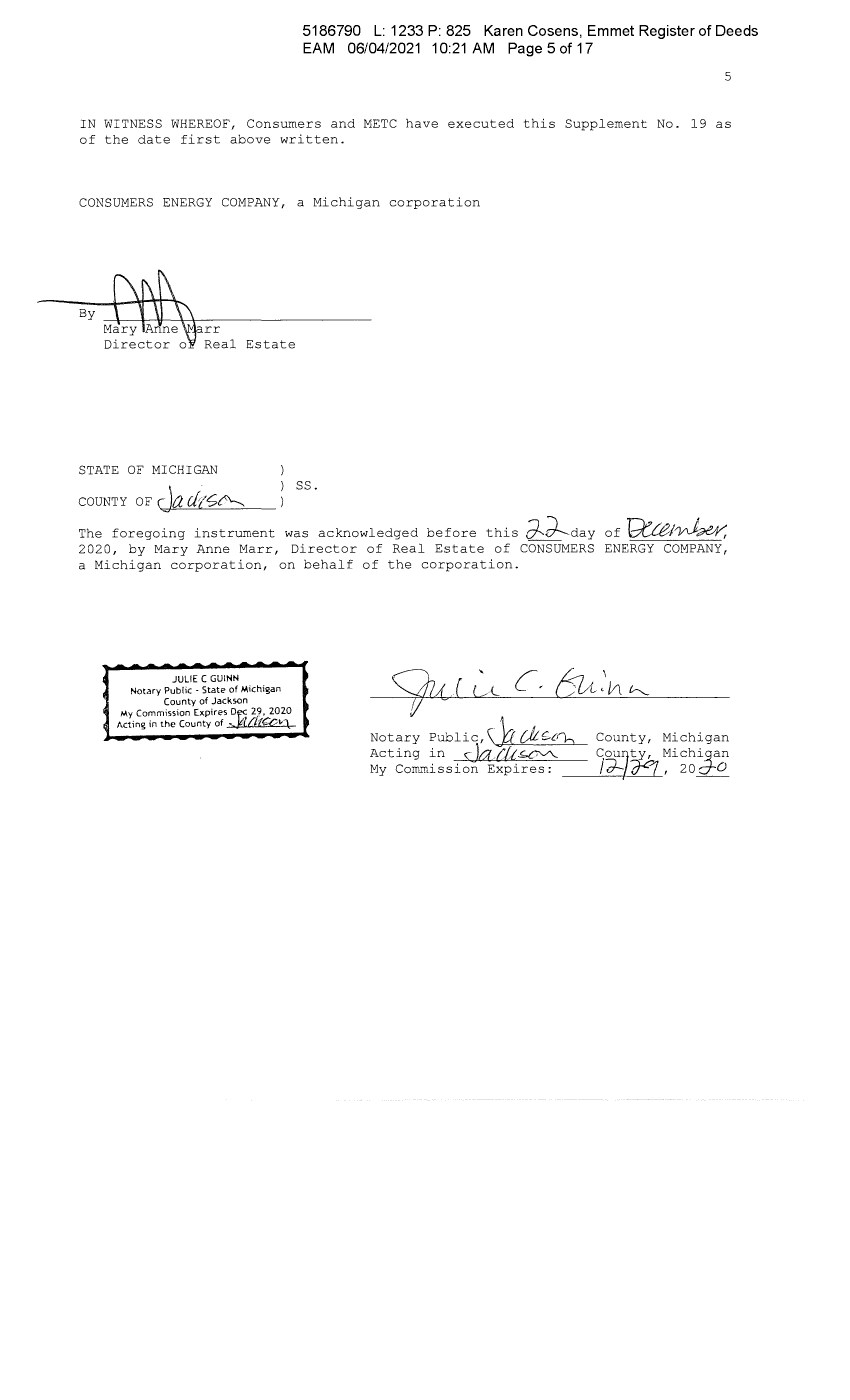
| 5186790 L: 1233 P: 825 Karen Cosens, Emmet Register of Deeds EAM 06/04/2021 10:21 AM Page 5 of 17 5 IN WITNESS WHEREOF, Consumers and METC have executed this Supplement No. 19 as of the date first above written. CONSUMERS ENERGY COMPANY, a Michigan corporation ByM~rr Directo;: Real Estate STATE OF MICHIGAN couNTY oF r )a drc;c'---._ ~ ss. The foregoing instrument was acknowledged before this d--d-day of ~/~r, 2020, by Mary Anne Marr, Director of Real Estate of CONSUMERS ENERGY COMPANY, a Michigan corporation, on behalf of the corporation. JULIE C GUINN Notary Public • State of Michigan County of Jackson My Commission Expires Dk£ 29, 2020 Acting in the County of -,. t/{(i:Ov1_ Notary Public,\ 0 {).L,;._c,7--i Acting in S:: Jam~ My Commission Expires: County, Michigan C,ou/ty, Michi_Qan /d-- rJ, 2ost:Q_ |
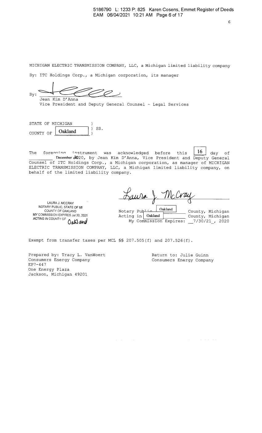
| 5186790 L: 1233 P: 825 Karen Cosens, Emmet Register of Deeds EAM 06/04/2021 10:21 AM Page 6 of 17 6 MICHIGAN ELECTRIC TRANSMISSION COMPANY, LLC, a Michigan limited liability company By: ITC Holdings Corp., a Michigan corporation, its manager By,=~__p____, Jean Kim D'Anna Vice President and Deputy General Counsel - Legal Services STATE OF MICHIGAN COUNTY OF -=O=akl=an=d=="- ss. The forenni nn i n<,trument was acknowledged before this I 16 I day of Decemher olO20, by Jean Kim D' Anna, Vice President and Deputy General Counsel of ITC Holdings Corp., a Michigan corporation, as manager of MICHIGAN ELECTRIC TRANSMISSION COMPANY, LLC, a Michigan limited liability company, on behalf of the limited liability company. LAURA J. MCCRAY NOTARY PUBLIC, STATE OF Ml COUNTY OF OAKLAND MY COMMISSION EXPIRES Jul 30, 2021 ACTING IN COUNTY OF 0~ <JHvJ Notary PulJ;c / Oakland I County, Michigan Acting inL __ o_ak._Ian_d_,_1--,---- County, Michigan My Commission Expires: _7/30/21, 2020 Exempt from transfer taxes per MCL §§ 207.505(f) and 207.526(f). Prepared by: Tracy L. Vanwoert Consumers Energy Company EP7-447 One Energy Plaza Jackson, Michigan 49201 Return to: Julie Guinn Consumers Energy Company |

| 5186790 L: 1233 P: 825 Karen Cosens, Emmet Register of Deeds EAM 06/04/2021 10:21 AM Page 7 of 17 THE ATTACHED COPY OF THE NINETEENTH SUPPLEMENTAL EXHIBIT A THAT WAS PREPARED FOR RECORDATION IN EMMET COUNTY, MICHIGAN, AND CONTAINS THE PORTIONS OF EACH OF PARTS I, II, AND III OF THE NINETEENTH SUPPLEMENT EXHIBIT A THAT RELATE TO PREMISES IN THAT COUNTY ONLY. SEE SECTION 24.6 OF THE AGREEMENT. 7 |
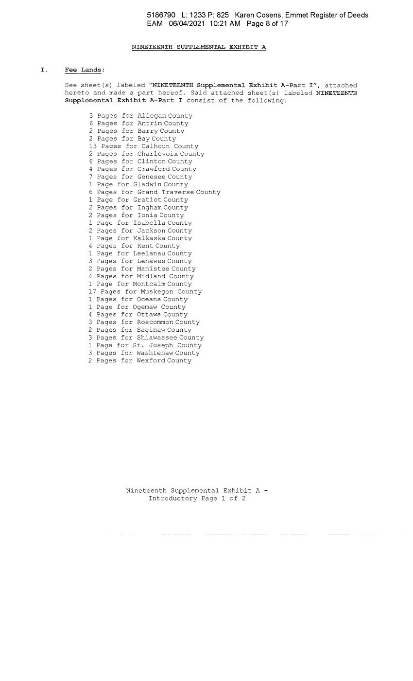
| I . Fee Lands : 5186790 L: 1233 P: 825 Karen Cosens, Emmet Register of Deeds EAM 06/04/2021 10:21 AM Page 8 of 17 NINETEENTH SUPPLEMENTAL EXHIBIT A See sheet(s) labeled "NINETEENTH Supplemental Exhibit A-Part I", attached hereto and made a part hereof. Said attached sheet(s) labeled NINETEENTH Supplemental Exhibit A-Part I consist of the following: 3 Pages for Allegan County 6 Pages for Antrim County 2 Pages for Barry County 2 Pages for Bay County 13 Pages for Calhoun County 2 Pages for Charlevoix County 6 Pages for Clinton County 4 Pages for Crawford County 7 Pages for Genesee County 1 Page for Gladwin County 6 Pages for Grand Traverse County 1 Page for Gratiot County 2 Pages for Ingham County 2 Pages for Ionia County 1 Page for Isabella County 2 Pages for Jackson County 1 Page for Kalkaska County 4 Pages for Kent County 1 Page for Leelanau County 3 Pages for Lenawee County 2 Pages for Manistee County 4 Pages for Midland County 1 Page for Montcalm County 17 Pages for Muskegon County 1 Pages for Oceana County 1 Page for Ogemaw County 4 Pages for Ottawa County 3 Pages for Roscommon County 2 Pages for Saginaw County 3 Pages for Shiawassee County 1 Page for St. Joseph County 3 Pages for Washtenaw County 2 Pages for Wexford County Nineteenth Supplemental Exhibit A - Introductory Page 1 of 2 |
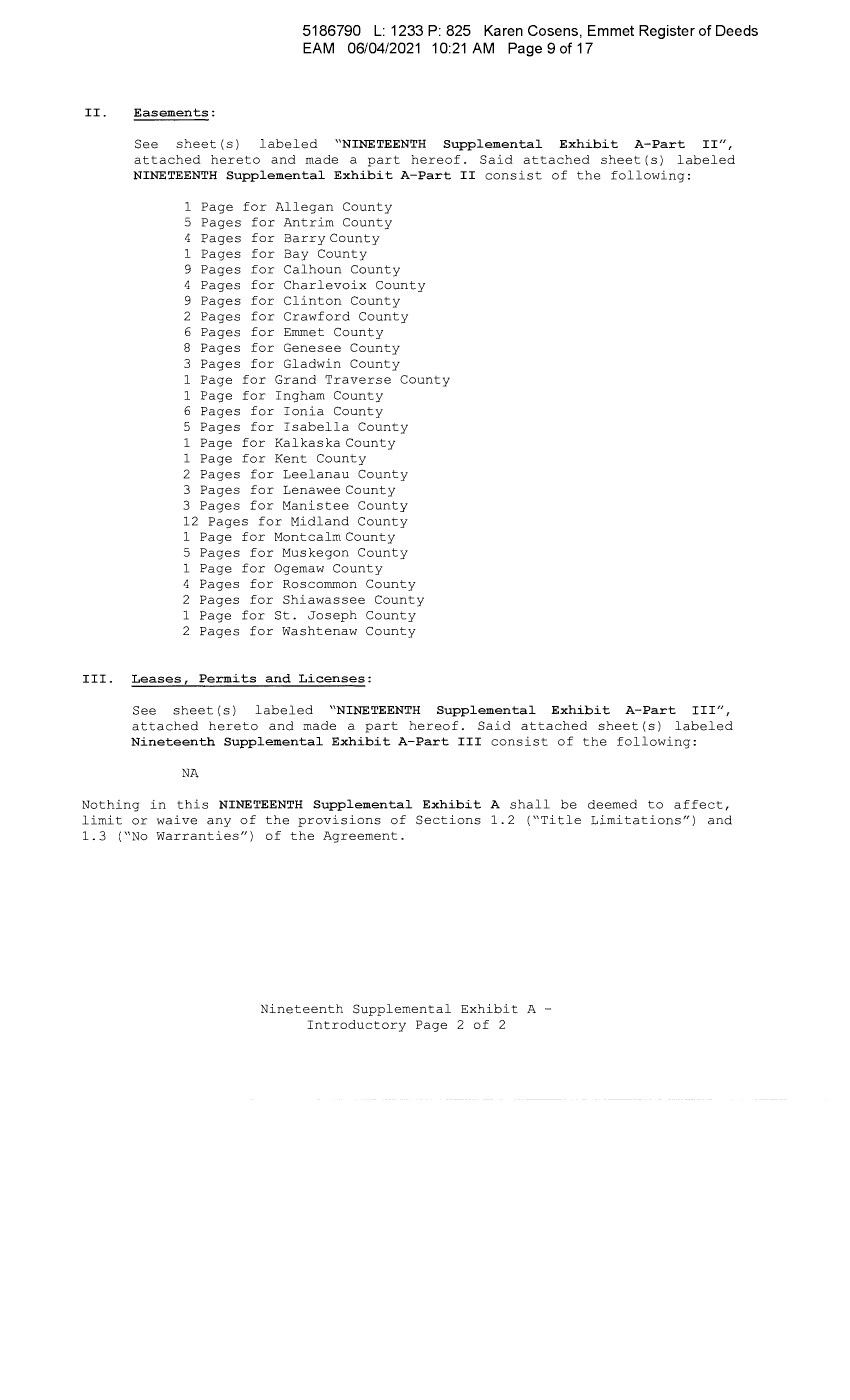
| II. Easements: 5186790 L: 1233 P: 825 Karen Cosens, Emmet Register of Deeds EAM 06/04/2021 10:21 AM Page 9 of 17 See sheet(s) labeled "NINETEENTH Supplemental Exhibit A-Part II", attached hereto and made a part hereof. Said attached sheet(s) labeled NINETEENTH Supplemental Exhibit A-Part II consist of the following: 1 Page for Allegan County 5 Pages for Antrim County 4 Pages for Barry County 1 Pages for Bay County 9 Pages for Calhoun County 4 Pages for Charlevoix County 9 Pages for Clinton County 2 Pages for Crawford County 6 Pages for Emmet County 8 Pages for Genesee County 3 Pages for Gladwin County 1 Page for Grand Traverse County 1 Page for Ingham County 6 Pages for Ionia County 5 Pages for Isabella County 1 Page for Kalkaska County 1 Page for Kent County 2 Pages for Leelanau County 3 Pages for Lenawee County 3 Pages for Manistee County 12 Pages for Midland County 1 Page for Montcalm County 5 Pages for Muskegon County 1 Page for Ogemaw County 4 Pages for Roscommon County 2 Pages for Shiawassee County 1 Page for St. Joseph County 2 Pages for Washtenaw County III. Leases, Permits and Licenses: See sheet(s) labeled "NINETEENTH Supplemental Exhibit A-Part III", attached hereto and made a part hereof. Said attached sheet(s) labeled Nineteenth Supplemental Exhibit A-Part III consist of the following: NA Nothing in this NINETEENTH Supplemental Exhibit A shall be deemed to affect, limit or waive any of the provisions of Sections 1.2 ("Title Limitations") and 1.3 ("No Warranties") of the Agreement. Nineteenth Supplemental Exhibit A - Introductory Page 2 of 2 |
| 5186790 L: 1233 P: 825 Karen Cosens, Emmet Register of Deeds EAM 06/04/2021 10:21 AM Page 10 of 17 SUPPLEMENTAL 19 EXHIBIT A - PART I EMMET COUNTY ADD THE FOLLOWING LAND DESCRIPTIONS: None Nineteenth Supplemental Exhibit A-Part I, Emmet County, Page 1 |
 | (/) "'O Q) Q) 0 ..... 0 ..... Q) +-' (/) 0) Q) 0::: +-' Q) E E w (/) C Q) (/) 0 0 C Q) ..... ctl ~ LO N co a.. (") (") N ...... ..:J 0 (J) r- (0 co ...... LO I'- ~ ... ... : ~ t "' "" < ~ '- ... ~ ~ C "' "" < LI Engineering Legacy Tract Liber/Page Number No 114 D 320-D114-10 L183, P115 114 D 323-D114-11 Ll093, P824 NINETEENTH SUPPLEMENTAL EXHIBIT A - PART II EMMET COUNTY Granter Grantee Date of Inst. Charles J. Consumers Power Company 9/8/1961 Hitchings, Jr. and Beatrice E. Hitchings, husband and wife Consumers Power The Little Traverse Bay 7/27/2007 Company Bands of Odawa Indians County City/Township Town Range Section Emmet Bear Creek T34N R5W 7 County Township Emmet Bear Creek T34N R5W 7 County Township Note: This instrument is a quitclaim deed running from Consumers to the indicated grantee, in which Consumers reserved an overhead electric transmission line running in an Easterly and Westerly direction across said land. The inclusion of said quitclaim deed herein is intended solely to refer to the reserved easement for said overhead electric transmission line, known as Line Segment 114D, running in an Easterly and Westerly direction across said land and not to any other easements for electric line, or any easements, rights or instrument for other purposes that may have been granted or reserved in said quitclaim deed. 114 D 324-D114-12 L1010, Consumers Energy Petoskey Investment Group, 7/18/2003 Emmet Bear Creek T34N R5W 7 P653 Company LLC County Township Note: This instrument is a quitclaim deed running from Consumers to the indicated grantee, in which Consumers reserved an overhead electric transmission line running in an Easterly and Westerly direction across said land. The inclusion of said quitclaim deed herein is intended solely to refer to the reserved easement for said overhead electric transmission line, known as Line Segment 114D, running in an Easterly and Westerly direction across said land and not to any other easements for electric line, or any easements, rights or instrument for other purposes that may have been granted or reserved in said quitclaim deed. 114 D 311-D114-5 L183, P127 Donald Hyde and Consumers Power Company 4/12/1961 Emmet Bear Creek T34N R5W 8 Evelyn A. Hyde, aka County Township Evelyn Hyde, husband and wife 114 D 312-D114-6, L183, P123 The City of Petoskey Consumers Power Company 6/20/1961 Emmet Bear Creek T34N R5W 8, 17 312-D114-1 County Township Nineteenth Supplemental Exhibit A-Part II, Emmet County, Page 1 |

| (/) "'O Q) Q) 0 ..... 0 ..... Q) +-' (/) 0) Q) 0::: +-' Q) E E w (/) C Q) (/) 0 0 C Q) ..... ctl ~ LO N co a.. (") (") N ...... ..:J 0 (J) r- (0 co ...... LO I' "'" ~o C'~ "'" :n ( - "' < ru cli "'" ~µ " ~~ Cb " "' < LJU 114 D 114 D 114 D 114 D 114 D 114 D 114 D 114 D 313-Dl14-7, L183, P126 313-Dl14-2 314-Dl14-8, L183, P125 314-Dl14-3 308-Dl14-5 L183, P131 309-Dl14-6 L183, P129 310-Dl14-7 L183, Pl28 315-Dl14-4 L183, P122 316-Dl14-5 L183, Pl21 317-Dl14-1 L183, Pl20 Ben J. Bochniak, aka Ben Bochniak and Helen L. Bochniak, aka Helen Bochniak, husband and wife Frank I. Hoover, aka Frank Hoover and Martha M. Hoover, husband and wife Ben Sobleskey and Nioba Sobleskey, husband and wife, Sophia Foster, Frances Fettig, leo Sobleski and Mary Jane Sobleski, husband and wife Bruno Kruzell, aka Bruno Kruzel and Emma Kruzell, aka Emma Kruzel, husband and wife, Clarence L. Doyle and Marjorie M. Doyle, husband and wife Marinus Veurink, aka Marinio Veurink and Muriel Veurink, husband and wife James L. Guy, a single man Andrew F. Daniel and Irene Daniel, husband and wife Obed S. Otto and Donna J. Otto, husband and wife Consumers Power Company 5/5/1961 Emmet Bear Creek T34N R5W 8, 17 County Township Consumers Power Company 5/3/1961 Emmet Bear Creek T34N R5W 8, 17 County Township Consumers Power Company 4/4/1961 Emmet Bear Creek T34N R5W 9 County Township Consumers Power Company 4/11/1961 Emmet Bear Creek T34N R5W 9 County Township Consumers Power Company 4/12/1961 Emmet Bear Creek T34N R5W 9 County Township Consumers Power Company 5/8/1961 Emmet Bear Creek T34N R5W 17 County Township Consumers Power Company 5/8/1961 Emmet Bear Creek T34N R5W 17 County Township Consumers Power Company 9/9/1961 Emmet Bear Creek T34N R5W 18 County Township Nineteenth Supplemental Exhibit A-Part II, Emmet County, Page 2 |
 | (/) "'O Q) Q) 0 ..... 0 ..... Q) +-' (/) 0) Q) 0::: +-' Q) E E w (/) C Q) (/) 0 0 C Q) ..... ctl ~ LO N co a.. (") (") N ...... ..:J 0 (J) r- (0 co ...... LO I """ ( C" """ i~ ..c: <I 0 c· """ 0 ~ -,; ~ C ~ <I u 114 D 318-D114-2 L183, P118 Wilbert Wilhelm and Consumers Power Company 9/8/1961 Emmet Bear Creek T34N R5W 18 Leora Wilhelm, County Township husband and wife 114 D 319-D114-3 L183, P116 Carl R. Alpers and Consumers Power Company 9/8/1961 Emmet Bear Creek T34N R5W 18 Georgia Alpers, aka County Township Georgia K. Alpers, husband and wife Except as partially released by 'Partial Release of Easement' between Consumers Energy Company and Radio City Village LLC, dated 5/16/2008 and recorded in Liber 1103, Page 84 114 D 321-D114-4 L183, P193 Joseph D Frost and Consumers Power Company 5/11/1961 Emmet Bear Creek T34N R5W 18 Agnes Frost, husband County Township and wife Except as partially released by 'Partial Release of Easement' between Consumers Energy Company and Linda s. Beier, fka Linda s. Keiswetter, dated 5/16/2008 and recorded in Liber 1103, Page 85 114 D 322-D114-5 L183, P114 John Ruzinsky and Consumers Power Company 5/10/1961 Emmet Bear Creek T34N R5W 18 Stella Ruzinsky, County Township husband and wife 114 D 340-D114-1 Ll 71, P299 Joseph Martinchek, Consumers Power Company 3/14/1960 Emmet Resort T34N R6W 7 aka Joseph County Township Martincheck and Ann Martinchek, aka Ana Martinchek, aka Anna Martincheck, husband and wife 114 D 341-D114-2 L169, P348 Orlie Brecheisen Consumers Power Company 7/7/1959 Emmet Resort T34N R6W 7 County Township 114 D 337-D114-1 L169, P352 Edwin Schwartz fisher Consumers Power Company 7/24/1959 Emmet Resort T34N R6W 8 and Catherine County Township Schwartz fisher, husband and wife Nineteenth Supplemental Exhibit A-Part II, Emmet County, Page 3 |
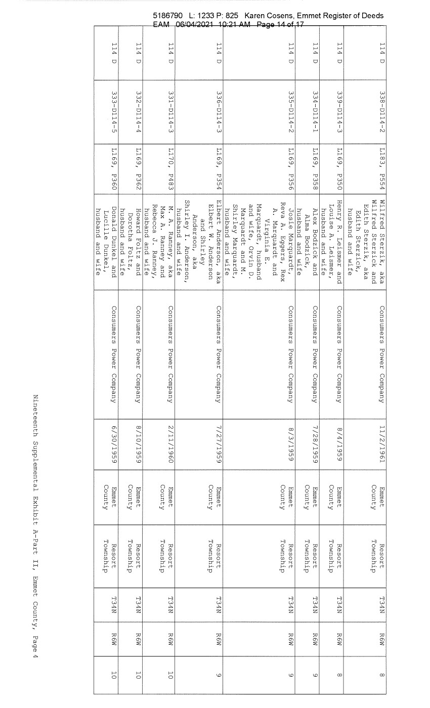 | (/) "'O Q) Q) 0 ..... 0 ..... Q) +-' (/) 0) Q) 0::: +-' Q) E E w (/) C Q) (/) 0 0 C Q) ..... ctl ~ LO N co a.. (") (") N ...... ..:J 0 (J) r- (0 co ...... LO 114 114 114 I'- '<" ~ 114 " '<" : ~ t "' "" < ~ ,a· '<" 114 ~ " ~ C ~ 114 <I u 114 114 D 338-0114-2 L183, P554 D 339-0114-3 L169, P350 D 334-0114-1 L169, P358 D 335-0114-2 L169, P356 D 336-0114-3 L169, P354 D 331-0114-3 L170, P483 D 332-0114-4 L169, P362 D 333-0114-5 L169, P360 Wilfred Sterzik, aka Wilfred Sterzick and Edith Sterzik, aka Edith Sterzick, husband and wife Henry R. Leismer and Louise A. Leismer, husband and wife Alex Bodzick and Alma Bodzick, husband and wife Josie Marquardt, Reva A. Eggers, Rex A. Marquardt and Virginia E. Marquardt, husband and wife, Orvin D. Marquardt and M. Shirley Marquardt, husband and wife Elbert Anderson, aka Elbert W. Anderson and Shirley Anderson, aka Shirley I. Anderson, husband and wife M. A. Ranney, aka Max A. Ranney and Rebecca J. Ranney, husband and wife Howard Foltz and Dorotha Foltz, husband and wife Donald Dunkel and Lucille Dunkel, husband and wife Consumers Power Company 11/2/1961 Emmet Resort T34N R6W 8 County Township Consumers Power Company 8/4/1959 Emmet Resort T34N R6W 8 County Township Consumers Power Company 7/28/1959 Emmet Resort T34N R6W 9 County Township Consumers Power Company 8/3/1959 Emmet Resort T34N R6W 9 County Township Consumers Power Company 7/27/1959 Emmet Resort T34N R6W 9 County Township Consumers Power Company 2/11/1960 Emmet Resort T34N R6W 10 County Township Consumers Power Company 8/10/1959 Emmet Resort T34N R6W 10 County Township Consumers Power Company 6/30/1959 Emmet Resort T34N R6W 10 County Township Nineteenth Supplemental Exhibit A-Part II, Emmet County, Page 4 |
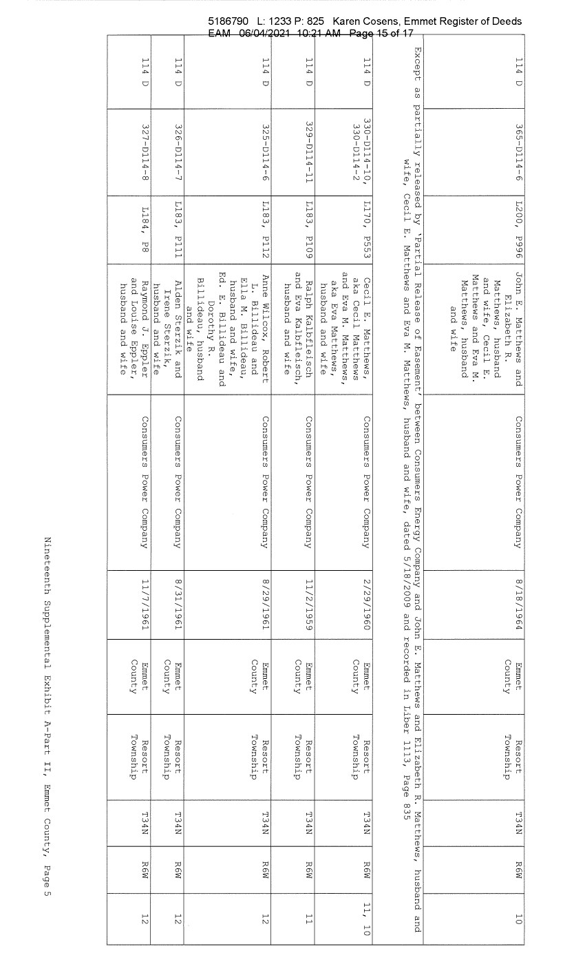
| (/) "'O Q) Q) 0 ..... 0 ..... Q) +-' (/) 0) Q) 0::: +-' Q) E E w (/) C Q) (/) 0 0 C Q) ..... ctl ~ LO N co a.. (") (") N ...... ..:J 0 (J) r- (0 co ...... LO I'- '<" ~~ l! '<" ; ~ t "' "" < '<" ' c. '<" ~ ~ -,; ~ C "' "" < u 114 D 365-D114-6 L200, P996 John E. Matthews and Consumers Power Company 8/18/1964 Emmet Resort T34N R6W 10 Elizabeth R. County Township Matthews, husband and wife, Cecil E. Matthews and Eva M. Matthews, husband and wife Except as partially released by 'Partial Release of Easement' between Consumers Energy Company and John E. Matthews and Elizabeth R. Matthews, husband and wife, Cecil E. Matthews and Eva M. Matthews, husband and wife, dated 5/18/2009 and recorded in Liber 1113, Page 835 114 D 330-D114-10, L170, P553 Cecil E. Matthews, Consumers Power Company 2/29/1960 Emmet Resort T34N R6W 11, 10 330-D114-2 aka Cecil Matthews County Township and Eva M. Matthews, aka Eva Matthews, husband and wife 114 D 329-D114-11 L183, P109 Ralph Kalbfleisch Consumers Power Company 11/2/1959 Emmet Resort T34N R6W 11 and Eva Kalbfleisch, County Township husband and wife 114 D 325-D114-6 L183, Pll2 Anne Wilcox, Robert Consumers Power Company 8/29/1961 Emmet Resort T34N R6W 12 L. Billideau and County Township Ella M. Billideau, husband and wife, Ed. E. Billideau and Dorothy R. Billideau, husband and wife 114 D 326-D114-7 L183, Plll Alden Sterzik and Consumers Power Company 8/31/1961 Emmet Resort T34N R6W 12 Irene Sterzik, County Township husband and wife 114 D 327-D114-8 Ll84, PS Raymond J. Eppler Consumers Power Company 11/7/1961 Emmet Resort T34N R6W 12 and Louise Eppler, County Township husband and wife Nineteenth Supplemental Exhibit A-Part II, Emmet County, Page 5 |
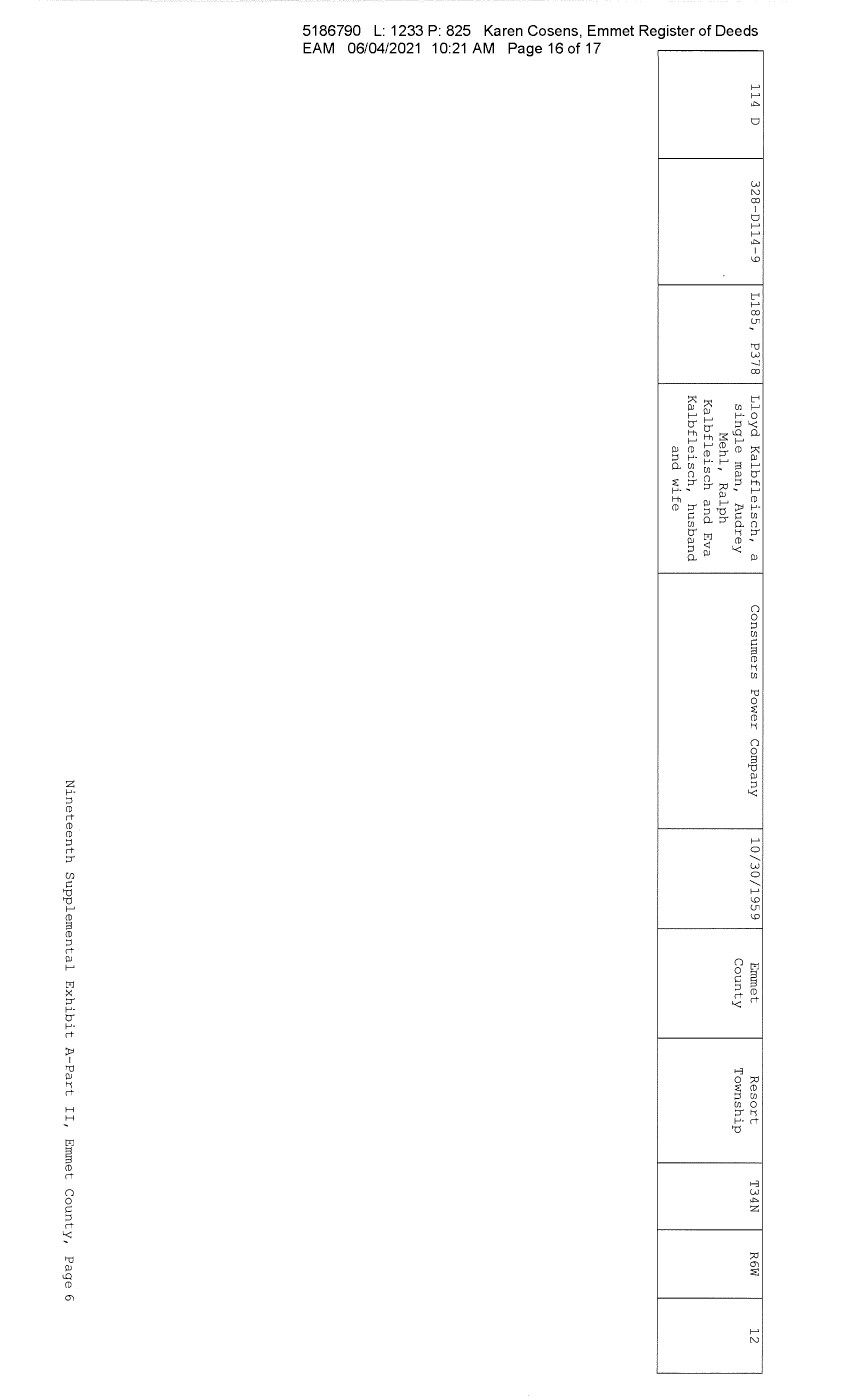
| (/) "'O Q) Q) 0 ..... 0 ..... Q) +-' (/) 0) Q) 0::: Q) E E r-- w,..... (/)-0 ~ CD (/) ...... 0 Q) 0 Cl C !il Q) a.. ..... ~~ <( LO .. N N co .. .. 0 a.. ...... ("') ...... ("') N NO ..-N -- "" -.;J" _J 0 om (J) 0 r- (0 ~ ~ <( LO W 114 D 328-0114-9 Ll85, P378 Lloyd Kalbfleisch, a single man, Audrey Mehl, Ralph Kalbfleisch and Eva Kalbfleisch, husband and wife Consumers Power Company 10/30/1959 Emmet Resort T34N R6W 12 County Township Nineteenth Supplemental Exhibit A-Part II, Emmet County, Page 6 |

| (/) "'O Q) Q) 0 ..... 0 ..... Q) +-' (/) 0) Q) 0::: Q) E E r-- w,..... (/)-0 ~ r-- (/) ...... 0 Q) 0 Cl C !il Q) a.. ..... ~~ <( LO .. N N co .. .. 0 a.. ...... ("') ...... ("') N NO ..-N -- "" -.;J" ....Jo om (J) 0 r- (0 ~ ~ <( LO W CE Ref. :L_j..cense/Less_or NINETEENTH SUPPLEMENTAL EXHIBIT A - PART III EMMET COUNTY Licensee/Lessee Date of Instrument NONE Title of Instrument Town/Range Section Nineteenth Supplemental Exhibit A-Part III, Emmet County, Pagel |
| 202102230012607 Pages: 25 Recorded: 02/23/2021 09:26 AM Fees: $30.00 Rpct: 21-10890 John J. Gleason, Resister of Deeds Genesee County, Ml MAIL p; .' I: 4 7 SUPPLEMENT NO. 19 TO AMENDED AND RESTATED EASEMENT AGREEMENT THIS SUPPLEMENT NO. 19 TO )W_ENDED AND RE~TED EA9E~ENJ AGREEMENT ("Supplement No. 19") is made this ~ day of .Jdt_{.£,h(L,l?-{J'r , 2020, between CONSUMERS ENERGY COMPANY (formerly known as Consumers Power Company), a Michigan corporation, (successor by merger to Consumers Power Company, a Maine corporation), One Energy Plaza, Jackson, Michigan 49201 ("Consumers") and MICHIGAN ELECTRIC TRANSMISSION COMPANY, LLC, a Michigan limited liability company ( successor by merger to Michigan Electric Transmission Company, a Michigan corporation), 27175 Energy Way, Novi, Michigan 48377 ("METC"). RECITALS: A. Consumers and METC entered into a certain Easement Agreement dated April 1, 2001 whereunder Consumers granted an "Easement" (as therein defined) to METC in respect to certain "Premises" in the State of Michigan for the use set forth therein and on and subject to all of the terms and conditions set forth therein. 8. Consumers and METC agreed on certain revisions to the terms and conditions of said Easement Agreement, and for ease of reference, restated said Easement Agreement in its entirety, to include all of said agreed-upon revisions as well as all unchanged provisions, in a certain Amended and Restated Easement Agreement dated as of April 29, 2002 (the "Agreement"). C. The "Premises" under the Agreement are therein defined as (a) the lands identified as "fee lands" in Part "I" of Exhibit A, attached to the Agreement, (b) the lands covered by the easements held by Consumers that are identified in Part "II" of Exhibit A, attached to the Agreement, and ( c) the lands covered by the leases, permits and licenses held by Consumers that are identified in Part "III" of Exhibit A, attached to the Agreement; as said Parts I, II and III of Exhibit A were supplemented or modified in a certain Supplement No. 1 dated April 29, 2002, in a certain Supplement No. 2 dated April 29, 2002, in a certain Supplement No. 3 dated March 3, 2003, in a certain Supplement No. 4 dated October 2, 2006, in a certain Supplement No. 5 dated August 3, 2007, in a certain Supplement No. 6 dated June 18, 2008, in a certain Supplement No. 7 dated September 18, 2008, in a certain Supplement No. 8 dated December 4, 2008, in a certain Supplement No. 9 dated February 22, 2010, in a certain Supplement No. 10 dated March 25, 2010, in a certain Supplement No. 11 dated October 12, 2011, in a certain Supplement No. 12 dated July 20, 2012, in a certain Supplement No. 13 dated August 21, 2012, in a certain Supplement No. 14 dated September 23, 2013, in a certain Supplement No. 15 dated January 13, 2014, in a certain Supplement No. 16 dated January 31, 2017, in a certain Supplement No. 17 dated September 25, 2019, and in a certain Supplement No. 18 dated June 8, 2020, heretofore entered into by Consumers and METC. The parties now desire to further supplement and modify said ii,\'O Exhibit A to the Agreement as set forth herein below. ef,~ |

| 202102230012607 Page 2 of 25 2 D. References, in regard to historical matters, to "METC" in the foregoing recitals will be deemed to mean METC' s predecessor, Michigan Electric Transmission Company, a Michigan corporation, where relevant. NOW, THEREFORE, for good and valuable consideration, the receipt of which is acknowledged, Consumers and METC agree as follows: 1. Exhibit A to the Agreement, as heretofore supplemented and/or modified, is hereby further supplemented and modified as set forth in "Nineteenth Supplemental Exhibit A", attached hereto. 2. It is expressly understood that any lands, easements, or leases/permits/licenses that are indicated in said attached Nineteenth Supplemental Exhibit A as being added are, on and subject to the terms and conditions of the Agreement (as supplemented and amended by this Supplement No. 19), hereby deemed added to Part I, Part II and Part III, respectively, of Exhibit A to the Agreement. However, it is further expressly understood that in addition to all rights granted to METC by the Agreement, METC shall have the following rights as to the lands identified as "Consumers Energy Equipment/ Joint Asset Area Easement" on the accompanying NINETEENTH Supplemental Exhibit A sheets, inclusive of Parts I, II and III, which rights are also subject to the terms of the Parties' Amended and Restated Transmission Interconnection Agreement (the "DTIA"): (a) the right to maintain any and all existing components of the Transmission System, as defined in the DTIA, and wiring or conduit connections for the same that currently exist over, on or under these lands; and (b)the right to connect its currently sited or future approved wiring or conduits for communications, station power, or control, operating at 600 volts or less, and any Jointly Owned Assets, as defined in the DTIA, over, on or under these lands. It is also expressly understood that, with respect to any lands, easements, or leases/permits/licenses now covered by Part I, Part II or Part III of Exhibit A that are indicated in said attached Nineteenth Supplemental Exhibit A as being deleted, the Easement is hereby deemed RELEASED with respect thereto and the Agreement shall hereafter no longer apply thereto (provided, however, that all rights and obligations under the Agreement with respect to periods prior to the date of this Supplement No. 19 shall remain unaffected). It is expressly understood and agreed Premises represented by the land ( s) , and/or license (s) that are added to Exhibit A to the Agreement pursuant "Additional Premises"): that in respect to the additional easement(s), lease(s), permit(s) Part I, Part II and Part III of to this Supplement No. 19 (the (a) All references to "Commencement Date" that are found in Article 1 ("Grant of Easement"), Article 2 ("Term"), Article 5 ("Additions/Alterations"), Article 6 ("Consumers' Reserved Rights to Use the Premises and Transmission Facilities"), Article 7 ("METC Approval of Compatible Uses"), Article 8 ("Certain Obligations of Consumers and Authorized Users; Etc.") and Article 14 ("Environmental Matters") of the Agreement shall be deemed to mean the date of this Supplement No. 19 and not the date that is identified in the Agreement as the "Commencement Date". |
| 202102230012607 Page 3 of 25 3 (b} Except as expressly otherwise indicated in the immediately following sentence, all references to "Restated Agreement Date" that are found in Article 1 ("Grant of Easement"}, Article 6 ("Consumers' Reserved Rights to Use the Premises and Transmission Facilities"}, and Article 12 ("Compliance With Applicable Laws"} of the Agreement shall also be deemed to mean the date of this Supplement No. 19 and not the date that is identified in the Agreement as the "Restated Agreement Date". Notwithstanding the foregoing: (i} the preceding sentence does not apply to the purely historical statement in clause "(c}" of Section 1. 2 of the Agreement that Trans-Elect, Inc. is "an affiliate of the entity which has become METC's parent company as of the Restated Agreement Date"; and (ii} the parenthetical in the first sentence of the first paragraph of Section 7.1 of the Agreement reading "(see below regarding a certain period prior to the Restated Agreement Date}", along with the fourth paragraph of said Section 7.1 reading "Consumers shall submit to METC within twenty (20) days of the Restated Agreement Date a list of all material Compatible Uses other than additions or modifications to Distribution Facilities that have been authorized between February 1, 2001 and the Restated Agreement Date for METC's approval per the METC Compatible Use approval process described in this Section 7.1.", both referred to a one-time historical matter and have no application to the Additional Premises or any other further effect or application whatsoever. 3. In addition to the original Transmission Facilities and Additions/Alterations thereto as referred to in Recital "A" of the Agreement, it is understood that such electric Transmission towers, pole structures, poles, crossarms, wires, cables, conduits, guys, anchors, transformers, insulators and/or other fixtures and equipment as may be owned by METC and located on the Additional Premises as of the date of this Supplement No. 19, and future Additions/Alternations made thereto on and subject to the terms and conditions of the Agreement, are included in the "Transmission Facilities" under the Agreement. Note: This Supplement No. 19 will not be recorded in all counties in which the Agreement itself, or Supplements Nos. 1 through 18, may have been recorded. This Supplement No. 19 (as were each of Supplements Nos. 1 through 18), will be recorded only in the county(ies} in which relevant Premises are located; being, in the case of this Supplement No. 19, only the following: |

| Allegan County Antrim County Barry County Bay County Calhoun County Charlevoix County Clinton County Crawford County Emmet County Genesee County Gladwin County Grand Traverse County Gratiot County Ingham County Ionia County Isabella County Jackson County Kalkaska County Kent County Leelanau County Lenawee County Manistee County Midland County Montcalm County Muskegon County Oceana County Ogemaw County Ottawa County Roscommon County Saginaw County Shiawassee County St. Joseph County Washtenaw County Wexford County 202102230012607 Page 4 of 25 4 The fact that this Supplement No. 19 will be recorded only in the particular county(ies} identified above will in no way restrict, limit or otherwise affect the interpretation, application or enforcement of the Agreement; and the terms and conditions of the Agreement shall at all times be read, interpreted and applied in the manner provided for in Section 24.6 of the Agreement. |
| 202102230012607 Page 5 of 25 5 IN WITNESS WHEREOF, Consumers and METC have executed this Supplement No. 19 as of the date first above written. CONSUMERS ENERGY COMPANY, a Michigan corporation By·~ Director o= Real Estate I Mary Anne arr STATE OF MICHIGAN couNTY oF cJatltU'Yi ss. The foregoing ins;rument was acknowledged before this d-9-day of ~d~ 2020, by Mary Anne Marr, Director of Real Estate of CONSUMERS ENERY COMPANY, a Michigan corporation, on behalf of the corporation. JULIE C GUINN Notary Public • State of Michi11an County of Jackson My Commission Expires DWj~9. 2020 Actin11 in the County of , 1'60"V) Notary Public, d'l.ckE..6\--i County, Acting in c.JqatG6b, County, My Commission Expires: /""J-- /;J-.'1 I Michigan Michigan t 20~ |
| 202102230012607 Page 6 of 25 6 MICHIGAN ELECTRIC TRANSMISSION COMPANY, LLC, a Michigan limited liability company By: ITC Holdings Corp., a Michigan corporation, its manager By,-=l~ /Jeanim D'Anna Vice President and Deputy General Counsel - Legal Services STATE OF MICHIGAN COUNTY OF -=' =======!.. ss. The forenni nn i n-3trument was acknowledged before this .W day of T>ecemhera020, by ~ean Kim D'Anna, Vice President and Deputy General Counsel of ITC Holdings Corp., a Michigan corporation, as manager of MICHIGAN ELECTRIC TRANSMISSION COMPANY, LLC, a Michigan limited liability company, on behalf of the limited liability company. LAURA J. MCCRAY NOTARY PUBLIC, STATE OF Ml COUNTY OF OAKLAND MY COMMISSION EXPIRES Jul 30, 2021 ACTING IN COUNTY OF o~lciMJI Notary Pul1 · 0 J Oakland I County, Michigan Acting inL--~~--rl:::----:--- County, Michigan My Commission Expires: _7/30/21_, 2020 I ✓ Exempt from transfer taxes per MCL §§ 207.SOS(f) and 207.526(f). I Prepared by: Tracy L. Vanwoert Consumers Energy Company EP?-447 One Energy Plaza Jackson, Michigan 49201 Return to: Julie Guinn Consumers Energy Company |

| 202102230012607 Page 7 of 25 THE ATTACHED COPY OF THE NINETEENTH SUPPLEMENTAL EXHIBIT A THAT WAS PREPARED FOR RECORDATION IN GENESEE COUNTY, MICHIGAN, AND CONTAINS THE PORTIONS OF EACH OF PARTS I, II, AND III OF THE NINETEENTH SUPPLEMENT EXHIBIT A THAT RELATE TO PREMISES IN THAT COUNTY ONLY. SEE SECTION 24.6 OF THE AGREEMENT. 7 |
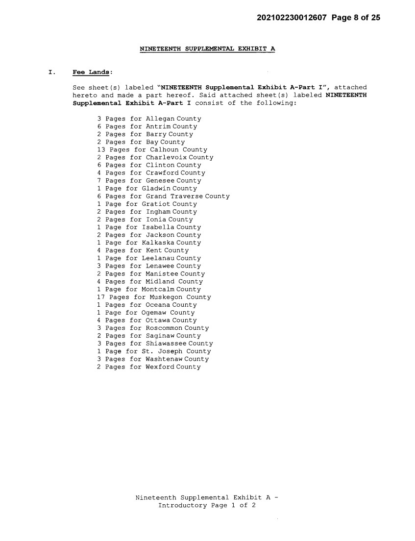
| 202102230012607 Page 8 of 25 NINETEENTH SUPPLEMENTAL EXHIBIT A I . Fee Lands: See sheet(s) labeled "NINETEENTH Supplemental Exhibit A-Part I", attached hereto and made a part hereof. Said attached sheet(s) labeled NINETEENTH Supplemental Exhibit A-Part I consist of the following: 3 Pages for Allegan County 6 Pages for Antrim County 2 Pages for Barry County 2 Pages for Bay County 13 Pages for Calhoun County 2 Pages for Charlevoix County 6 Pages for Clinton County 4 Pages for Crawford County 7 Pages for Genesee County 1 Page for Gladwin County 6 Pages for Grand Traverse County 1 Page for Gratiot County 2 Pages for Ingham County 2 Pages for Ionia County 1 Page for Isabella County 2 Pages for Jackson County 1 Page for Kalkaska County 4 Pages for Kent County 1 Page for Leelanau County 3 Pages for Lenawee County 2 Pages for Manistee County 4 Pages for Midland County 1 Page for Montcalm County 17 Pages for Muskegon County 1 Pages for Oceana County 1 Page for Ogemaw County 4 Pages for Ottawa County 3 Pages for Roscommon County 2 Pages for Saginaw County 3 Pages for Shiawassee County 1 Page for St. Joseph County 3 Pages for Washtenaw County 2 Pages for Wexford County Nineteenth Supplemental Exhibit A - Introductory Page 1 of 2 |

| 202102230012607 Page 9 of 25 II. Easements: See sheet(s) labeled "NINETEENTH Supplemental Exhibit A-Part II", attached hereto and made a part hereof. Said attached sheet(s) labeled NINETEENTH Supplemental Exhibit A-Part II consist of the following: l Page for Allegan County 5 Pages for Antrim County 4 Pages for Barry County 1 Pages for Bay County 9 Pages for Calhoun County 4 Pages for Charlevoix County 9 Pages for Clinton County 2 Pages for Crawford County 6 Pages for Emmet County 8 Pages for Genesee County 3 Pages for Gladwin County 1 Page for Grand Traverse County 1 Page for Ingham County 6 Pages for Ionia County 5 Pages for Isabella County 1 Page for Kalkaska County 1 Page for Kent County 2 Pages for Leelanau County 3 Pages for Lenawee County 3 Pages for Manistee County 12 Pages for Midland County 1 Page for Montcalm County 5 Pages for Muskegon County 1 Page for Ogemaw County 4 Pages for Roscommon County 2 Pages for Shiawassee County 1 Page for St. Joseph County 2 Pages for Washtenaw County III. Leases, Permits and Licenses: See sheet(s) labeled "NINETEENTH Supplemental Exhibit A-Part III", attached hereto and made a part hereof. Said attached sheet(s) labeled Nineteenth Supplemental Exhibit A-Part III consist of the following: NA Nothing in this NINETEENTH Supplemental Exhibit A shall be deemed to affect, limit or waive any of the provisions of Sections 1.2 ("Title Limitations") and 1.3 ("No Warranties") of the Agreement. Nineteenth Supplemental Exhibit A - Introductory Page 2 of 2 |
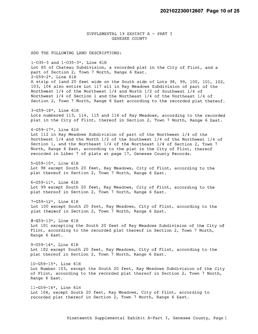
| 202102230012607 Page10of25 SUPPLEMENTAL 19 EXHIBIT A - PART I GENESEE COUNTY ADD THE FOLLOWING LAND DESCRIPTIONS: 1-035-3 and 1-035-3*, Line 61H Lot 85 of Chateau Subdivision, a recorded plat in the City of Flint, and a part of Section 2, Town 7 North, Range 6 East. 2-G59-2*, Line 61H A strip of land 20 feet wide on the South side of Lots 98, 99, 100, 101, 102, 103, 104 also entire Lot 117 all in Ray Meadows Subdivision of part of the Northwest 1/4 of the Northwest 1/4 and North 1/2 of Southwest 1/4 of Northwest 1/4 of Section 1 and the Northeast 1/4 of the Northeast 1/4 of Section 2, Town 7 North, Range 6 East according to the recorded plat thereof. 3-G59-18*, Line 61H Lots numbered 113, 114, 115 and 116 of Ray Meadows, according to the recorded plat in the City of Flint, thereof in Section 2, Town 7 North, Range 6 East. 4-G59-17*, Line 61H Lot 112 in Ray Meadows Subdivision of part of the Northwest 1/4 of the Northwest 1/4 and the North 1/2 of the Southwest 1/4 of the Northwest 1/4 of Section 1, and the Northeast 1/4 of the Northeast 1/4 of Section 2, Town 7 North, Range 6 East, according to the plat in the City of Flint, thereof recorded in Liber 7 of plats at page 17, Genesee County Records. 5-G59-10*, Line 61H Lot 98 except South 20 feet, Ray Meadows, City of Flint, according to the plat thereof in Section 2, Town 7 North, Range 6 East. 6-G59-11*, Line 61H Lot 99 except South 20 feet, Ray Meadows, City of Flint, according to the plat thereof in Section 2, Town 7 North, Range 6 East. 7-G59-12*, Line 61H Lot 100 except South 20 feet, Ray Meadows, City of Flint, according to the plat thereof in Section 2, Town 7 North, Range 6 East. 8-G59-13*, Line 61H Lot 101 excepting the South 20 feet of Ray Meadows Subdivision of the City of Flint, according to the recorded plat thereof in Section 2, Town 7 North, Range 6 East. 9-G59-14*, Line 61H Lot 102 except South 20 feet, Ray Meadows, City of Flint, according to the plat thereof in Section 2, Town 7 North, Range 6 East. 10-G59-15*, Line 61H Lot Number 103, except the South 20 feet, Ray Meadows Subdivision of the City of Flint, according to the recorded plat thereof in Section 2, Town 7 North, Range 6 East. ll-G59-16*, Line 61H Lot 104, except South 20 feet, Ray Meadows, City of Flint, according to recorded plat thereof in Section 2, Town 7 North, Range 6 East. Nineteenth Supplemental Exhibit A-Part I, Genesee County, Page 1 |
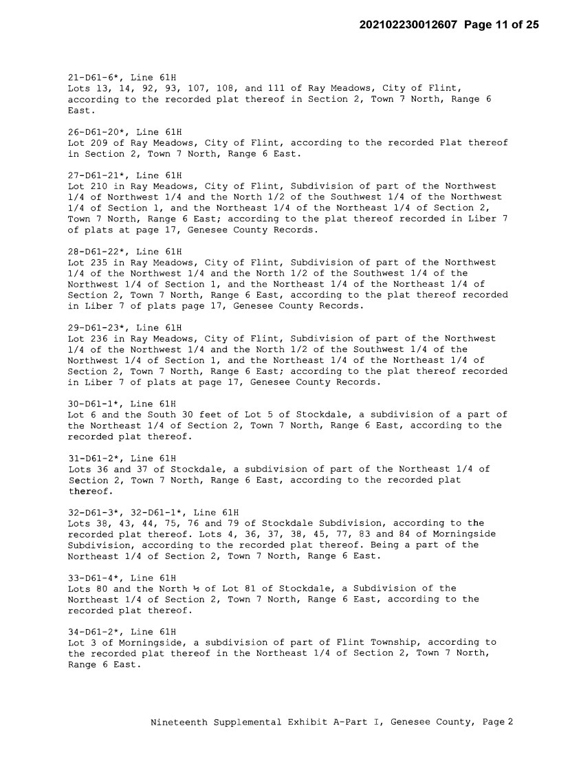
| 202102230012607 Page11 of25 21-D61-6*, Line 61H Lots 13, 14, 92, 93, 107, 108, and 111 of Ray Meadows, City of Flint, according to the recorded plat thereof in Section 2, Town 7 North, Range 6 East. 26-D61-20*, Line 61H Lot 209 of Ray Meadows, City of Flint, according to the recorded Plat thereof in Section 2, Town 7 North, Range 6 East. 27-D61-21*, Line 61H Lot 210 in Ray Meadows, City of Flint, Subdivision of part of the Northwest 1/4 of Northwest 1/4 and the North 1/2 of the Southwest 1/4 of the Northwest 1/4 of Section 1, and the Northeast 1/4 of the Northeast 1/4 of Section 2, Town 7 North, Range 6 East; according to the plat thereof recorded in Liber 7 of plats at page 17, Genesee County Records. 28-D61-22*, Line 61H Lot 235 in Ray Meadows, City of Flint, Subdivision of part of the Northwest 1/4 of the Northwest 1/4 and the North 1/2 of the Southwest 1/4 of the Northwest 1/4 of Section 1, and the Northeast 1/4 of the Northeast 1/4 of Section 2, Town 7 North, Range 6 East, according to the plat thereof recorded in Liber 7 of plats page 17, Genesee County Records. 29-D61-23*, Line 61H Lot 236 in Ray Meadows, City of Flint, Subdivision of part of the Northwest 1/4 of the Northwest 1/4 and the North 1/2 of the Southwest 1/4 of the Northwest 1/4 of Section 1, and the Northeast 1/4 of the Northeast 1/4 of Section 2, Town 7 North, Range 6 East; according to the plat thereof recorded in Liber 7 of plats at page 17, Genesee County Records. 30-D61-1*, Line 61H Lot 6 and the South 30 feet of Lot 5 of Stockdale, a subdivision of a part of the Northeast 1/4 of Section 2, Town 7 North, Range 6 East, according to the recorded plat thereof. 31-D61-2*, Line 61H Lots 36 and 37 of Stockdale, a subdivision of part of the Northeast 1/4 of Section 2, Town 7 North, Range 6 East, according to the recorded plat thereof. 32-D61-3*, 32-D61-1*, Line 61H Lots 38, 43, 44, 75, 76 and 79 of Stockdale Subdivision, according to the recorded plat thereof. Lots 4, 36, 37, 38, 45, 77, 83 and 84 of Morningside Subdivision, according to the recorded plat thereof. Being a part of the Northeast 1/4 of Section 2, Town 7 North, Range 6 East. 33-D61-4*, Line 61H Lots 80 and the North½ of Lot 81 of Stockdale, a Subdivision of the Northeast 1/4 of Section 2, Town 7 North, Range 6 East, according to the recorded plat thereof. 34-D61-2*, Line 61H Lot 3 of Morningside, a subdivision of part of Flint Township, according to the recorded plat thereof in the Northeast 1/4 of Section 2, Town 7 North, Range 6 East. Nineteenth Supplemental Exhibit A-Part I, Genesee County, Page2 |
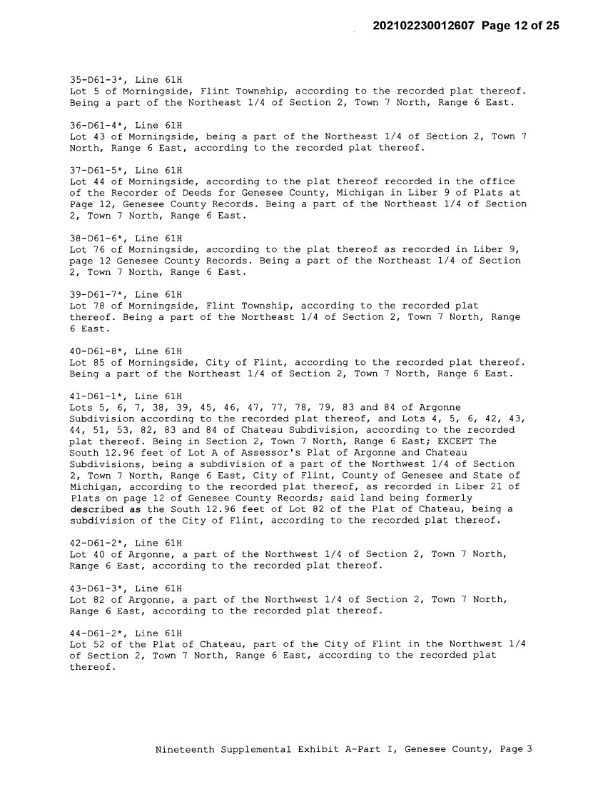
| 202102230012607 Page 12 of 25 35-D61-3*, Line 61H Lot 5 of Morningside, Flint Township, according to the recorded plat thereof. Being a part of the Northeast 1/4 of Section 2, Town 7 North, Range 6 East. 36-D61-4*, Line 61H Lot 43 of Morningside, being a part of the Northeast 1/4 of Section 2, Town 7 North, Range 6 East, according to the recorded plat thereof. 37-D61-5*, Line 61H Lot 44 of Morningside, according to the plat thereof recorded in the office of the Recorder of Deeds for Genesee County, Michigan in Liber 9 of Plats at Page 12, Genesee County Records. Being a part of the Northeast 1/4 of Section 2, Town 7 North, Range 6 East. 38-D61-6*, Line 61H Lot 76 of Morningside, according to the plat thereof as recorded in Liber 9, page 12 Genesee County Records. Being a part of the Northeast 1/4 of Section 2, Town 7 North, Range 6 East. 39-D61-7*, Line 61H Lot 78 of Morningside, Flint Township, according to the recorded plat thereof. Being a part of the Northeast 1/4 of Section 2, Town 7 North, Range 6 East. 40-D61-8*, Line 61H Lot 85 of Morningside, City of Flint, according to the recorded plat thereof. Being a part of the Northeast 1/4 of Section 2, Town 7 North, Range 6 East. 41-D61-1*, Line 61H Lots 5, 6, 7, 38, 39, 45, 46, 47, 77, 78, 79, 83 and 84 of Argonne Subdivision according to the recorded plat thereof, and Lots 4, 5, 6, 42, 43, 44, 51, 53, 82, 83 and 84 of Chateau Subdivision, according to the recorded plat thereof. Being in Section 2, Town 7 North, Range 6 East; EXCEPT The South 12.96 feet of Lot A of Assessor's Plat of Argonne and Chateau Subdivisions, being a subdivision of a part of the Northwest 1/4 of Section 2, Town 7 North, Range 6 East, City of Flint, County of Genesee and State of Michigan, according to the recorded plat thereof, as recorded in Liber 21 of Plats on page 12 of Genesee County Records; said land being formerly described as the South 12.96 feet of Lot 82 of the Plat of Chateau, being a subdivision of the City of Flint, according to the recorded plat thereof. 42-D61-2*, Line 61H Lot 40 of Argonne, a part of the Northwest 1/4 of Section 2, Town 7 North, Range 6 East, according to the recorded plat thereof. 43-D61-3*, Line 61H Lot 82 of Argonne, a part of the Northwest 1/4 of Section 2, Town 7 North, Range 6 East, according to the recorded plat thereof. 44-D61-2*, Line 61H Lot 52 of the Plat of Chateau, part of the City of Flint in the Northwest 1/4 of Section 2, Town 7 North, Range 6 East, according to the recorded plat thereof. Nineteenth Supplemental Exhibit A-Part I, Genesee County, Page 3 |
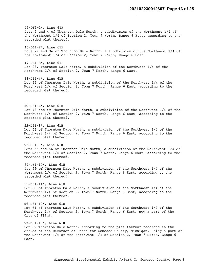
| 202102230012607 Page13of25 45-D61-l*, Line 61H Lots 3 and 4 of Thornton Dale North, a subdivision of the Northwest 1/4 of the Northwest 1/4 of Section 2, Town 7 North, Range 6 East, according to the recorded plat thereof. 46-D61-2*, Line 61H Lots 27 and 34 of Thornton Dale North, a subdivision of the Northwest 1/4 of the Northwest 1/4 of Section 2, Town 7 North, Range 6 East. 47-D61-3*, Line 61H Lot 28, Thornton Dale North, a subdivision of the Northwest 1/4 of the Northwest 1/4 of Section 2, Town 7 North, Range 6 East. 48-D61-4*, Line 61H Lot 33 of Thornton Dale North, a subdivision of the Northwest 1/4 of the Northwest 1/4 of Section 2, Town 7 North, Range 6 East, according to the recorded plat thereof. 50-D61-6*, Line 61H Lot 48 and 49 Thornton Dale North, a subdivision of the Northwest 1/4 of the Northwest 1/4 of Section 2, Town 7 North, Range 6 East, according to the recorded plat thereof. 52-D61-8*, Line 61H Lot 54 of Thornton Dale North, a subdivision of the Northwest 1/4 of the Northwest 1/4 of Section 2, Town 7 North, Range 6 East, according to the recorded plat thereof. 53-D61-9*, Line 61H Lots 55 and 56 of Thornton Dale North, a subdivision of the Northwest 1/4 of the Northwest 1/4 of Section 2, Town 7 North, Range 6 East, according to the recorded plat thereof. 54-D61-10*, Line 61H Lot 59 of Thornton Dale North, a subdivision of the Northwest 1/4 of the Northwest 1/4 of Section 2, Town 7 North, Range 6 East, according to the recorded plat thereof. 55-D61-ll*, Line 61H Lot 60 of Thornton Dale North, a subdivision of the Northwest 1/4 of the Northwest 1/4 of Section 2, Town 7 North, Range 6 East, according to the recorded plat thereof. 56-D61-12*, Line 61H Lot 61 of Thornton Dale North, a subdivision of the Northwest 1/4 of the Northwest 1/4 of Section 2, Town 7 North, Range 6 East, now a part of the City of Flint. 57-D61-13*, Line 61H Lot 62 Thornton Dale North, according to the plat thereof recorded in the office of the Recorder of Deeds for Genesee County, Michigan. Being a part of the Northwest 1/4 of the Northwest 1/4 of Section 2, Town 7 North, Range 6 East. Nineteenth Supplemental Exhibit A-Part I, Genesee County, Page 4 |
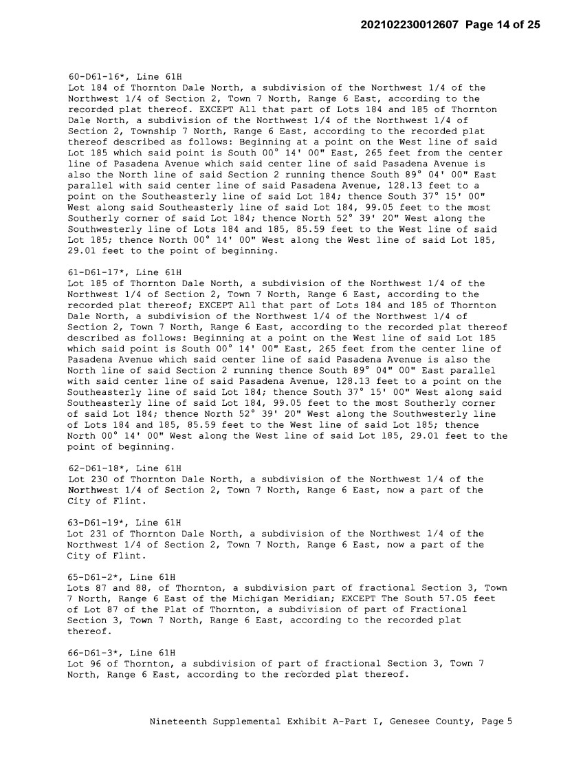
| 202102230012607 Page14of25 60-D61-16*, Line 61H Lot 184 of Thornton Dale North, a subdivision of the Northwest 1/4 of the Northwest 1/4 of Section 2, Town 7 North, Range 6 East, according to the recorded plat thereof. EXCEPT All that part of Lots 184 and 185 of Thornton Dale North, a subdivision of the Northwest 1/4 of the Northwest 1/4 of Section 2, Township 7 North, Range 6 East, according to the recorded plat thereof described as follows: Beginning at a point on the West line of said Lot 185 which said point is South 00° 14' 00" East, 265 feet from the center line of Pasadena Avenue which said center line of said Pasadena Avenue is also the North line of said Section 2 running thence South 89° 04' 00" East parallel with said center line of said Pasadena Avenue, 128.13 feet to a point on the Southeasterly line of said Lot 184; thence South 37° 15' 00" West along said Southeasterly line of said Lot 184, 99.05 feet to the most Southerly corner of said Lot 184; thence North 52° 39' 20" West along the Southwesterly line of Lots 184 and 185, 85.59 feet to the West line of said Lot 185; thence North 00° 14' 00" West along the West line of said Lot 185, 29.01 feet to the point of beginning. 61-D61-17*, Line 61H Lot 185 of Thornton Dale North, a subdivision of the Northwest 1/4 of the Northwest 1/4 of Section 2, Town 7 North, Range 6 East, according to the recorded plat thereof; EXCEPT All that part of Lots 184 and 185 of Thornton Dale North, a subdivision of the Northwest 1/4 of the Northwest 1/4 of Section 2, Town 7 North, Range 6 East, according to the recorded plat thereof described as follows: Beginning at a point on the West line of said Lot 185 which said point is South 00° 14' 00" East, 265 feet from the center line of Pasadena Avenue which said center line of said Pasadena Avenue is also the North line of said Section 2 running thence South 89° 04" 00" East parallel with said center line of said Pasadena Avenue, 128.13 feet to a point on the Southeasterly line of said Lot 184; thence South 37° 15' 00" West along said Southeasterly line of said Lot 184, 99.05 feet to the most Southerly corner of said Lot 184; thence North 52° 39' 20" West along the Southwesterly line of Lots 184 and 185, 85.59 feet to the West line of said Lot 185; thence North 00° 14' 00" West along the West line of said Lot 185, 29.01 feet to the point of beginning. 62-D61-18*, Line 61H Lot 230 of Thornton Dale North, a subdivision of the Northwest 1/4 of the Northwest 1/4 of Section 2, Town 7 North, Range 6 East, now a part of the City of Flint. 63-D61-19*, Line 61H Lot 231 of Thornton Dale North, a subdivision of the Northwest 1/4 of the Northwest 1/4 of Section 2, Town 7 North, Range 6 East, now a part of the City of Flint. 65-D61-2*, Line 61H Lots 87 and 88, of Thornton, a subdivision part of fractional Section 3, Town 7 North, Range 6 East of the Michigan Meridian; EXCEPT The South 57.05 feet of Lot 87 of the Plat of Thornton, a subdivision of part of Fractional Section 3, Town 7 North, Range 6 East, according to the recorded plat thereof. 66-D61-3*, Line 61H Lot 96 of Thornton, a subdivision of part of fractional Section 3, Town 7 North, Range 6 East, according to the recorded plat thereof. Nineteenth Supplemental Exhibit A-Part I, Genesee County, Page 5 |
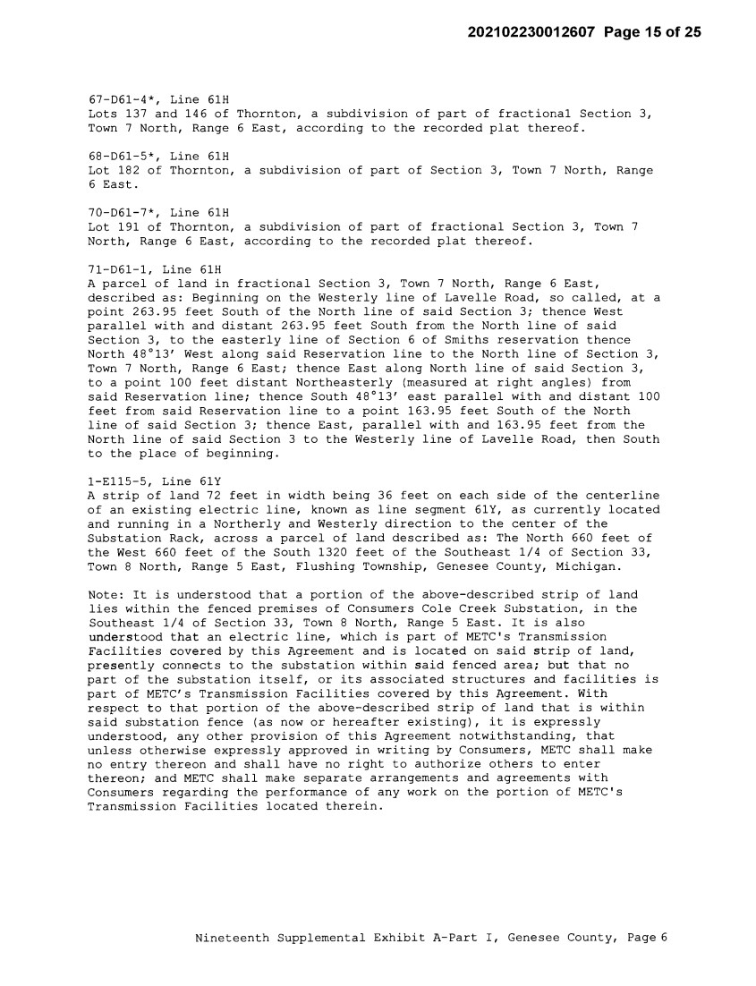
| 202102230012607 Page15of25 67-061-4*, Line 61H Lots 137 and 146 of Thornton, a subdivision of part of fractional Section 3, Town 7 North, Range 6 East, according to the recorded plat thereof. 68-061-5*, Line 61H Lot 182 of Thornton, a subdivision of part of Section 3, Town 7 North, Range 6 East. 70-061-7*, Line 61H Lot 191 of Thornton, a subdivision of part of fractional Section 3, Town 7 North, Range 6 East, according to the recorded plat thereof. 71-061-1, Line 61H A parcel of land in fractional Section 3, Town 7 North, Range 6 East, described as: Beginning on the Westerly line of Lavelle Road, so called, at a point 263.95 feet South of the North line of said Section 3; thence West parallel with and distant 263.95 feet South from the North line of said Section 3, to the easterly line of Section 6 of Smiths reservation thence North 48°13' West along said Reservation line to the North line of Section 3, Town 7 North, Range 6 East; thence East along North line of said Section 3, to a point 100 feet distant Northeasterly (measured at right angles) from said Reservation line; thence South 48°13' east parallel with and distant 100 feet from said Reservation line to a point 163.95 feet South of the North line of said Section 3; thence East, parallel with and 163.95 feet from the North line of said Section 3 to the Westerly line of Lavelle Road, then South to the place of beginning. 1-E115-5, Line 61Y A strip of land 72 feet in width being 36 feet on each side of the centerline of an existing electric line, known as line segment 61Y, as currently located and running in a Northerly and Westerly direction to the center of the Substation Rack, across a parcel of land described as: The North 660 feet of the West 660 feet of the South 1320 feet of the Southeast 1/4 of Section 33, Town 8 North, Range 5 East, Flushing Township, Genesee County, Michigan. Note: It is understood that a portion of the above-described strip of land lies within the fenced premises of Consumers Cole Creek Substation, in the Southeast 1/4 of Section 33, Town 8 North, Range 5 East. It is also understood that an electric line, which is part of METC's Transmission Facilities covered by this Agreement and is located on said strip of land, presently connects to the substation within said fenced area; but that no part of the substation itself, or its associated structures and facilities is part of METC's Transmission Facilities covered by this Agreement. With respect to that portion of the above-described strip of land that is within said substation fence (as now or hereafter existing), it is expressly understood, any other provision of this Agreement notwithstanding, that unless otherwise expressly approved in writing by Consumers, METC shall make no entry thereon and shall have no right to authorize others to enter thereon; and METC shall make separate arrangements and agreements with Consumers regarding the performance of any work on the portion of METC's Transmission Facilities located therein. Nineteenth Supplemental Exhibit A-Part I, Genesee County, Page 6 |
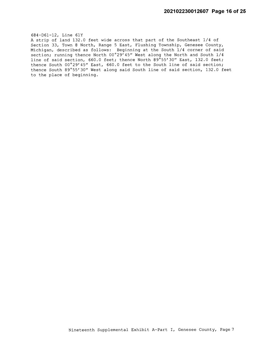
| 202102230012607 Page16of25 684-D61-12, Line 61Y A strip of land 132.0 feet wide across that part of the Southeast 1/4 of Section 33, Town 8 North, Range 5 East, Flushing Township, Genesee County, Michigan, described as follows: Beginning at the South 1/4 corner of said section; running thence North 00°29'45" West along the North and South 1/4 line of said section, 660.0 feet; thence North 89°55'30" East, 132.0 feet; thence South 00°29'45" East, 660.0 feet to the South line of said section; thence South 89°55'30" West along said South line of said section, 132.0 feet to the place of beginning. Nineteenth Supplemental Exhibit A-Part I, Genesee County, Page 7 |
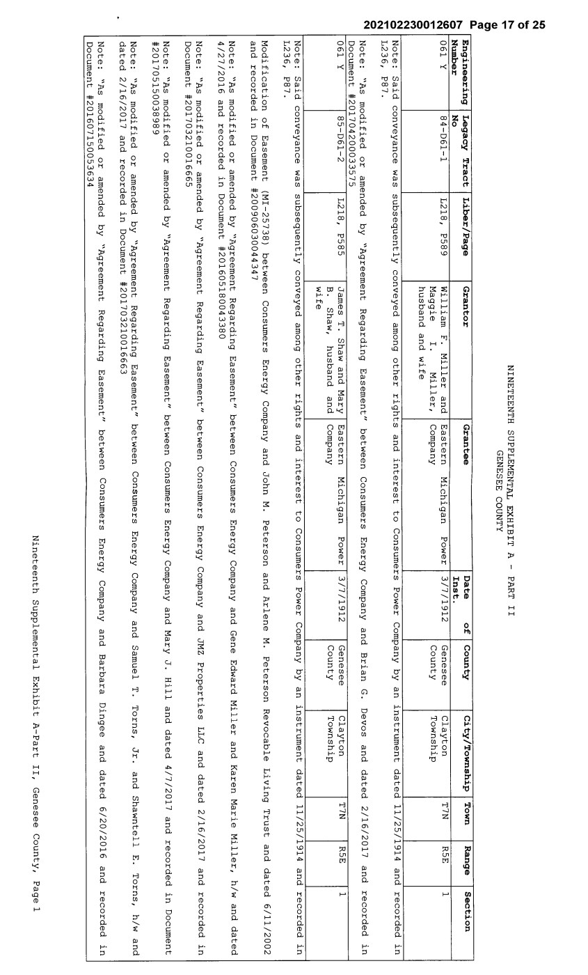
| Lt) N .... 0 ....... """" (1) O') ca NINETEENTH SUPPLEMENTAL EXHIBIT A - PART II GENESEE COUNTY D.. ,-------,--------:--.--::-:-------=----:-.-::---:-:------.-=-------.--=---,-------------.---=-----:--------------.-=:--:------=-.--::-:-------:----r---::--:--~=------=-=---.-:::------.--=------=----:---:-----. ....., Engineering Legacy Tract I Liber/Page Granter I Grantee I Date of I County I City/Township I Town I Range I Section o Number No Inst. ~ 061 Y 84-D61-1 L218, P589 William F. Miller and I Eastern Michigan Power 13/7/1912 I Genesee I Clayton I T7N I R5E I 1 """" 0 0 C"') N Maggie I. Miller, Company husband and wife County Township S 1-N_o_t_e_: _S_a_i_· d---'c'--o-n_v_e_y_a_n_c_e_w_a_s___._s_u_b_s_e_q_u_e_n_t_l_y __ c_o_._n_v_e_y_e_d_a_m_o_n_g_o_t_h_e_r_r_i_g_h__._t_s_a_n_d __ i_n_t_e_r_e_s_t_t_o_C_o_n_s_u_m_e_r,__s_P_o_w_e_r __ C_o_m....1.p_a_n_y_b_y_a_n---:i-'-n-s_t_r_um_e_n_t __ d_a_t_e_d_.__.,...l.,,.l---,/c::2--:5:-/-,-1.....,,.9..,..1""""'4_a_n_d-:-'-_r_e_c_o_r_d-:-e-d--,-----:i-n---, N L236, P87. 0 N Note: "As modified or amended by "Agreement Regarding Easement" between Consumers Energy Company and Brian G. Document #201704200033575 061 Y I 85-D61-2 L218, P585 James T. Shaw and Mary B. Shaw, husband and wife Eastern Company Michigan Power 3/7/1912 Genesee County Devos and dated 2/16/2017 and recorded Clayton Township T7N R5E 1 in Note: Said conveyance was subsequently conveyed among other rights and interest to Consumers Power Company by an instrument dated 11/25/1914 and recorded in L236, P87. Modification of Easement (MI-25738) between Consumers Energy Company and John M. Peterson and Arlene M. Peterson Revocable Living Trust and dated 6/11/2002 and recorded in Document #200906030044347 Note: "As modified or amended by "Agreement Regarding Easement" between Consumers Energy Company and Gene Edward Miller and Karen Marie Miller, h/w and dated 4/27/2016 and recorded in Document #201605180043380 Note: "As modified or amended by "Agreement Regarding Easement" between Consumers Energy Company and JMZ Properties LLC and dated 2/16/2017 and recorded in Document #201703210016665 Note: "As modified or amended by "Agreement Regarding Easement" between Consumers Energy Company and Mary J. Hill and dated 4/7/2017 and recorded in Document #201705150038989 Note: "As modified or amended by "Agreement Regarding Easement" between Consumers Energy Company and Samuel T. Tarns, Jr. and Shawntell E. Tarns, h/w and dated 2/16/2017 and recorded in Document #201703210016663 Note: "As modified or amended by "Agreement Regarding Easement" between Consumers Energy Company and Barbara Dingee and dated 6/20/2016 and recorded in Document #201607150053634 Nineteenth Supplemental Exhibit A-Part II, Genesee County, Page 1 |
 | Lt) N .... 0 co """" (1) O') ca D.. ....... 0 CD N """" 0 0 C"') N N 0 """" N 0 N 061 y 86-061-1 L218, P573 Charles R. Hosie Eastern Michigan Power 1/26/1912 Genesee Clayton T7N R5E 2 Company County Township Note: Said conveyance was subsequently conveyed among other rights and interest to Consumers Power Company by an instrument dated 11/25/1914 and recorded in L236, P87. Note: "As modified or amended by "Agreement Regarding Easement" between Consumers Energy Company and Gary S. Bruder and Lynn M. Bruder, h/w and dated 2/1/2017 and recorded in Document #201702170009284 061H 25-061-19* L1316, P42 Pilgrims Holiness Consumers Power Company 5/14/1957 Genesee City of Flint T7N R6E 2 Church, a religious County Society, by it duly authorized trustees 061H 49-061-5* L682, P509 Hubert Construction Consumers Power Company 4/12/1938 Genesee City of Flint T7N R6E 2 Company, a County Copartnership composed of Geo T. Monroe, a widower and Hubery L. Waterbury 061H 51-061-7* L683, P622 John Talsma and Consumers Power Company 4/1/1938 Genesee City of Flint T7N R6E 2 Blanche Talsma, County husband and wife 061H 58-061-14* L682, P497 Hubert L. Waterbury Consumers Power Company 4/12/1938 Genesee City of Flint T7N R6E 2 and Mary D. Waterbury, County husband and wife 061H 59-061-15* L683, P624 William Eggley and Consumers Power Company 4/20/1938 Genesee City of Flint T7N R6E 2 Geaurdeline Eggley, County husband and wife 061H 61.1-061-26* L1839, P287 Flint City Council City of Flint 11/6/1972 Genesee Flint T7N R6E 2 County Township 061H 64-DX61-1* L2577, P961 Consumers Power John M. Bourbeau 4/17/1995 Genesee City of Flint T7N R6E 3 Company County Note: This instrument is a quitclaim deed running from Consumers to the indicated grantee, in which Consumers reserved an overhead electric transmission line running in an Easterly and Westerly direction across said land. The inclusion of said quitclaim deed herein is intended solely to refer to the reserved easement for said overhead electric transmission line, known as Line Segment 61H, running in an Easterly and Westerly direction across said land and not to any other easements for electric line, or any easements, rights or instrument for other purposes that may have been granted or reserved in said quitclaim deed. 061H 69-DX61-6* L1213, P116 Consumers Power William Lukashuk and 8/27/1954 Genesee Flint T7N R6E 3 Company Frances, husband and County Township wife Nineteenth Supplemental Exhibit A-Part II, Genesee County, Page 2 |
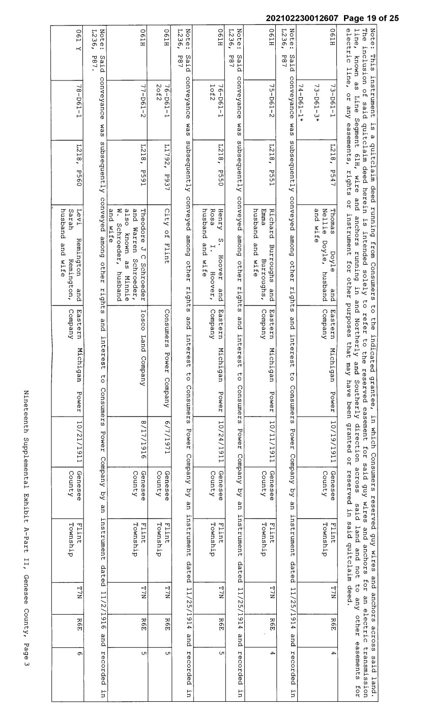
| Lt) N .... 0 a, """" (1) O') ca D.. ....... 0 CD N """" 0 0 C"') N N 0 """" N 0 N Note: This instrument is a quitclaim deed running from Consumers to the indicated grantee, in which Consumers reserved guy wires and anchors across said land. The inclusion of said quitclaim deed herein is intended solely to refer to the reserved easement for said guy wires and anchors for an electric transmission line, known as Line Segment 61H, wire and anchors running in and Northerly and Southerly direction across said land and not to any other easements for electric line, or any easements, rights or instrument for other purposes that may have been granted or reserved in said quitclaim deed. 061H 73-D61-1 L218, P547 Thomas Doyle and Eastern Michigan Power 10/19/1911 Genesee Flint T7N R6E 4 Nellie Doyle, husband Company County Township 73-D61-3* and wife 74-D61-l* Note: Said conveyance was subsequently conveyed among other rights and interest to Consumers Power Company by an instrument dated 11/25/1914 and recorded in L236, P87 061H 75-D61-2 L218, P551 Richard Burroughs and Eastern Michigan Power 10/11/1911 Genesee Flint T7N R6E 4 Emma Burroughs, Company County Township husband and wife Note: Said conveyance was subsequently conveyed among other rights and interest to Consumers Power Company by an instrument dated 11/25/1914 and recorded in L236, P87 061H 76-D61-1 L218, P550 Henry s. Hoover and Eastern Michigan Power 10/24/1911 Genesee Flint T7N R6E 5 lof2 Rosa I. Hoover, Company County Township husband and wife Note: Said conveyance was subsequently conveyed among other rights and interest to Consumers Power Company by an instrument dated 11/25/1914 and recorded in L236, P87 061H 76-D61-1 L1792, P937 City of Flint Consumers Power Company 6/7/1971 Genesee Flint T7N R6E 5 2of2 County Township 061H 77-D61-2 L218, P591 Theodore JC Schroeder Iosco Land Company 8/17/1916 Genesee Flint T7N R6E 5 and Warren Schroeder, County Township also known as Minnie w. Schroeder, husband and wife Note: Said conveyance was subsequently conveyed among other rights and interest to Consumers Power Company by an instrument dated 11/2/1916 and recorded in L236, P87. 061 Y 78-D61-1 L218, P560 Levi Remington and Eastern Michigan Power 10/21/1911 Genesee Flint T7N R6E 6 Sarah Remington, Company County Township husband and wife - Nineteenth Supplemental Exhibit A-Part II, Genesee County, Page3 |
 | Lt) N .... 0 0 N Note: L236, Said conveyance was P87 subsequently conveyed among other rights and interest to Consumers Power Company by an instrument dated 11/25/1914 and recorded in I 061 Y (1) O') ca D.. 79-D61-2 L218, P571 Ira D. Luce and Helen Eastern Michigan Power 10/14/1911 Genesee Flint T7N R6E 6 ....... 0 CD N """" 0 0 C"') N N 0 """" N 0 N Luce, husband and wife Company County Township Note: Said conveyance was subsequently conveyed among other rights and interest to Consumers Power Company by an instrument dated 11/25/1914 and recorded in L236, P87 061 Y 80-D61-3 L218, P579 Corydon M. Thayer, a Eastern Michigan Power 2/17/1912 Genesee Flint T7N R6E 6 single man and Addie Company County Township E. Thayer Note: Said conveyance was subsequently conveyed among other rights and interest to Consumers Power Company by an instrument dated 11/25/1914 and recorded in L236, P87. Note: "As modified or amended by "Agreement Regarding Easement" between Consumers Energy Company and Michael R. Basista and dated 8/16/2017 and recorded in Document #201709260061850 Note: "As modified or amended by "Agreement Regarding Easement" between Consumers Energy Company and The Richard L. Graham Revocable Trust Agreement and dated 2/17/2017 and recorded in Document #201703210016661 Note: "As modified or amended by "Agreement Regarding Easement" between Consumers Energy Company and Nickel/Hurand Elms, L.L.C. and dated 07/21/2016 and recorded in Document #201608120058766 Note: "As modified or amended by "Agreement Regarding Easement" between Consumers Energy Company and John Meeks and Colleen D. Meeks, h/w and dated 07/07/2017 and recorded in Document #201708020052775 Note: "As modified or amended by "Agreement Regarding Easement" between Consumers Energy Company and Jason L. Hindman and Angela L. Hindman/ h/w AND Jerry R. Hindm0n and Donna M. Hindmn, h/w and dated 5/23/2016 and recorded in Document #201606270050024 061H 72-D61-2* L218, P548 Edward A. Murphy, a Eastern Michigan Power 10/24/1911 Genesee Flint T7N R6E Smiths single man Company County Township Reservation Note: Said conveyance was subsequently conveyed among other rights and interest to Consumers Power Company by an instrument dated 11/25/1914 and recorded in L236, P87 061 Y 93-D61-l L218, P574 Duke Brown and Ethel Eastern Michigan Power 2/14/2012 Genesee Flushing T8N R5E 33 Brown, husband and Company County Township wife Nineteenth Supplemental Exhibit A-Part II, Genesee County, Page 4 |
 | Lt) N .... 0 """" N (1) O') ca D.. ....... 0 CD N """" 0 0 C"') N N 0 """" N 0 N Note: Said conveyance was subsequently conveyed among other rights and interest to Consumers Power Company by an instrument dated 11/25/1914 and recorded in L236, P87. Note: "As modified or amended by "Agreement Regarding Easement" between Consumers Energy Company and Chester Glenn Walker and Jan I. Walker, h/w dated 2/20/2017 and recorded in Document #201703100013833 Note: "As modified or amended by "Agreement Regarding Easement" between Consumers Energy Company and Diana M. Lotz dated 1/25/2017 and recorded in Document #201702170009285 Note: "As modified or amended by "Agreement Regarding Easement" between Consumers Energy Company and Christopher R. Weissert and Kimberly K. Weissert, h/w dated 1/31/2017 and recorded in Document #201702170009286 Note: "As modified or amended by "Agreement Regarding Easement" between Consumers Energy Company and B.A. Okraku and Doris L. Okraku, h/w dated 1/26/2017 and recorded in Document #201702170009287 Note: "As modified or amended by "Agreement Regarding Easement" between Consumers Energy Company and Christian S. Walker dated 3/1/2017 and recorded in Document #201703220016787 061 Y I 94-D61-2 I 2018082800842 Edith Marjorie Consumers Energy Company 8/7/2018 Genesee Flushing I T8N I R5E I 33 19 Stevenson County Township 061 Y I 94-D61-2 I L218, P577 Stephen W. Marshall, a Eastern Michigan Power 2/10/1912 Genesee Flushing I T8N I R5E I 33 single man and Maggie Company County Township Marshall Note: Said conveyance was subsequently conveyed among other rights and interest to Consumers Power Company by an instrument dated 11/25/1914 and recorded in L236, P87 Note: "As modified or amended by "Agreement Regarding Easement" between Consumers Energy Company and Andrew D. Suski and Karen V. Suski, h/w and dated 3/15/2017 and recorded in Document #201704070030831 Note: "As modified or amended by "Agreement Regarding Easement" between Consumers Energy Company and Linda Marie Skinner and dated 3/15/2017 and recorded in Document #201704050030306 Note: "As modified or amended by "Agreement Regarding Easement" between Consumers Energy Company and Edith Marjorie Stevenson and dated 3/15/2017 and recorded in Document #201704050030307 061 Y I 89-D61-1 I L218, P566 Stephen C. Ottaway and Ella L. Ottaway, husband and wife Eastern Company Michigan Power 12/27/1911 Genesee County Flushing Township T8N R5E 34 Nineteenth Supplemental Exhibit A-Part II, Genesee County, Page 5 |

| Lt) N .... 0 N N (1) O') ca D.. ....... 0 CD N """" 0 0 C"') N N 0 """" N 0 N Note: Said conveyance was subsequently conveyed among other rights and interest to Consumers Power Company by an instrument dated 11/25/1914 and recorded in L236, P87. Note: "As modified or amended by "Agreement Regarding Easement" between Consumers Energy Company and Tiffany E. Reaume and dated 6/12/2016 and recorded in Document #201608040057433 Note: "As modified or amended by "Agreement Regarding Easement" between Consumers Energy Company and Kenneth R. Warren and Joyce M. Warren, h/w and dated 4/22/2016 and recorded in Document #201605230044035 061 Y 90-D61-2 L218, P568 Samuel Jones and Mary Eastern Michigan Power 12/13/1911 Genesee Flushing T8N R5E 34 A Jones, husband and Company County Township wife Note: Said conveyance was subsequently conveyed among other rights and interest to Consumers Power Company by an instrument dated 11/25/1914 and recorded in L236, P87. Note: "As modified or amended by "Agreement Regarding Easement" between Consumers Energy Company and John L. Baesl, Sr. and Patricia A. Baesl, h/w and dated 4/26/2016 and recorded in Document #201605230044034 Note: "As modified or amended by "Agreement Regarding Easement" between Consumers Energy Company and Jayson A. Draper and Tina E. Draper, h/w and dated 6/28/2017 and recorded in Document #201707280052072 061 Y 91-D61-3 L218, P580 School District #4, Eastern Michigan Power 2/26/1912 Genesee Flushing T8N R5E 34 Twp of Clayton & Company County Township Flushing Said conveyance was subsequently conveyed among other rights and interest to Consumers Power Company by an instrument dated 11/25/1914 and recorded in L236, P87. 061 y 92-D61-4 L218, P575 James E. Davis and Eastern Michigan Power 2/15/1912 Genesee Flushing T8N R5E 34 Minnie Davis, husband Company County Township and wife, Alice L. Bolt, formerly Alice L. French Note: Said conveyance was subsequently conveyed among other rights and interest to Consumers Power Company by an instrument dated 11/25/1914 and recorded in L236, P87. Note: "As modified or amended by "Agreement Regarding Easement" between Consumers Energy Company and Karen A. Schantz and dated 5/12/2016 and recorded in Document #201606140047556 Nineteenth Supplemental Exhibit A-Part II, Genesee County, Page 6 |

| Lt) N .... 0 C"') N (1) O') ca D.. ....... 0 CD N """" 0 0 C"') N N 0 """" N 0 N Note: "As modified or amended by "Agreement Regarding Easement" between Consumers Energy Company and George G. Vergos and Krista M. Vergos, h/w and dated 5/12/2016 and recorded in Document #201606140047557 Note: "As modified or amended by "Agreement Regarding Easement" between Consumers Energy Company and Troy J. Droomer and dated 4/29/2016 and recorded in Document #201605180043378 Note: "As modified or amended by "Agreement Regarding Easement" between Consumers Energy Company and Kevin J. Sprygada and dated 5/4/2016 and recorded in Document #201606270050025 Note: "As modified or amended by "Agreement Regarding Easement" between Consumers Energy Company and Christine M. Klimaszewski and dated 8/24/2017 and recorded in Document #201709260061851 Note: "As modified or amended by "Agreement Regarding Easement" between Consumers Energy Company and Lonnie Bragg and dated 7/27/2017 and recorded in Document #201709140059929 061 Y 87-D61-1 L218, P590 James V. Cuthbertson I Eastern Michigan Catherine Cuthbertson Company Power I 3/1/1912 3/21/1912 Genesee County Flushing Township T8N R5E 35 Note: Said conveyance was subsequently conveyed among other rights and interest to Consumers Power Company by an instrument dated 11/25/1914 and recorded in L236, P87. Note: "As modified or amended by "Agreement Regarding Easement" between Consumers Energy Company and J. Dennis Swartz and Ann Alee J. Swartz, h/w and dated 2/1/2017 and recorded in Document #201702170009283 Note: "As modified or amended by "Agreement Regarding Easement" between Consumers Energy Company and Sara J. Olney and dated 5/2/2016 and recorded in Document #201605180043379 061 Y 88-D61-2 L218, P583 Ralph E. Hoard and Mary E. Hoard, husband and wife and Henry A. Kingman, a single man Eastern Company Michigan Power 2/2/1912 Genesee County Flushing Township T8N R5E 35 Note: Said conveyance was subsequently conveyed among other rights and interest to Consumers Power Company by an instrument dated 11/25/1914 and recorded in L236, P87. Note: "As modified or amended by "Agreement Regarding Easement" between Consumers Energy Company and Gary Dieck and Kathryn R. Dieck, h/w and dated 2/9/2017 and recorded in Document #201703030012822 Note: "As modified or amended by "Agreement Regarding Easement" between Consumers Energy Company and Barry L. Jensen and Theresa J. Jensen, h/w and dated 2/16/2017 and recorded in Document #201703210016666 Nineteenth Supplemental Exhibit A-Part II, Genesee County, Page 7 |
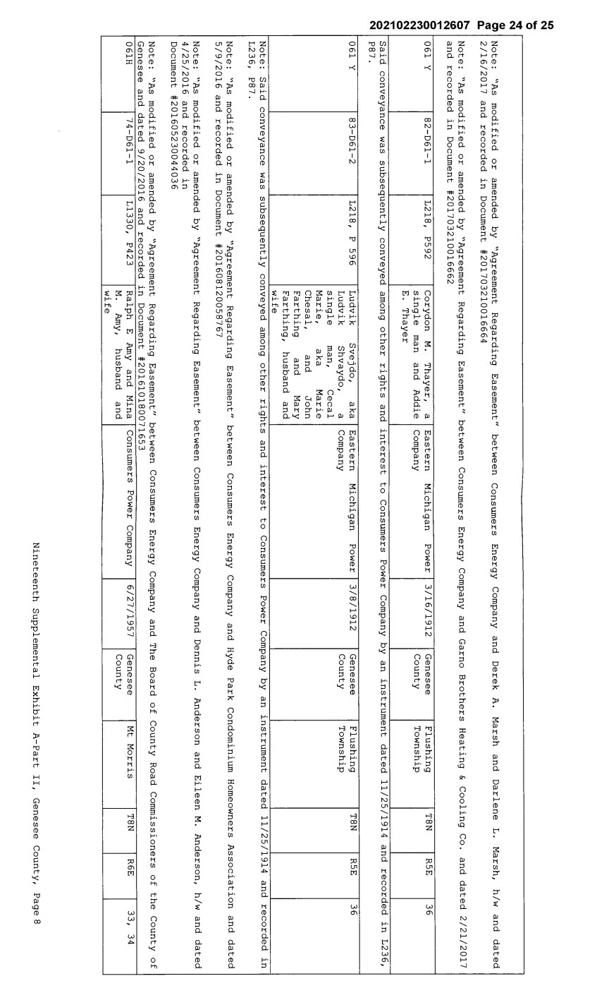
| Lt) N .... 0 "11:1' N (1) 0'1 I Note: "As modified or amended by "Agreement Regarding Easement" between Consumers Energy Company and Derek A. Marsh and Darlene L. Marsh, h/w and dated ~ 2/16/2017 and recorded in Document #201703210016664 ....... 0 CD N """" 0 0 C"') N N 0 """" Note: "As modified or amended by "Agreement Regarding Easement" between Consumers Energy Company and Garno Brothers Heating & Cooling Co. and dated 2/21/2017 and recorded in Document #201703210016662 061 Y 82-D61-l L218, P592 Corydon M. single man E. Thayer Thayer, a and Addie Eastern Company Michigan Power 3/16/1912 Genesee County Flushing Township T8N R5E 36 ~ I Said conveyance was subsequently conveyed among other rights and interest to Consumers Power Company by an instrument dated 11/25/1914 and recorded in L236, N P87. 061 Y 83-D61-2 L218, P 596 Ludvik Ludvik single Marie, Chesal, Svejdo, aka Shvaydo, a Eastern Company Michigan Power 3/8/1912 Genesee County Flushing Township T8N R5E 36 man, Cecal aka Marie and John Farthing and Mary Farthing, husband and wife Note: Said conveyance was subsequently L236, P87. conveyed among other rights and interest to Consumers Power Company by an instrument dated 11/25/1914 and recorded in Note: "As modified or amended by "Agreement Regarding Easement" between Consumers Energy Company and Hyde Park Condominium Homeowners Association and dated 5/9/2016 and recorded in Document #201608120058767 Note: "As modified or amended by "Agreement Regarding Easement" between Consumers Energy Company and Dennis L. Anderson and Eileen M. Anderson, h/w and dated 4/25/2016 and recorded in Document #201605230044036 Note: "As modified or amended by "Agreement Regarding Easement" between Consumers Energy Genesee and dated 9/20/2016 and recorded in Document #201610180071653 061H I 74-D61-l I Ll330, P423 I Ralph E Amy and Mina I Consumers Power Company M. Amy, husband and wife Company and The Board of County Road Commissioners of the County of 6/27/1957 Genesee County Mt Morris T8N R6E 33, 34 Nineteenth Supplemental Exhibit A-Part II, Genesee County, Page 8 |
| Lt) N .... 0 Lt) N (1) O') ca D.. ....... 0 CD N """" 0 CE Ref. 0 License/Lesso_]:' C"') N N 0 """" N 0 N NINETEENTH SUPPLEMENTAL EXHIBIT A - PART III GENESEE COUNTY LicenseeLLessee Date of Instrument NONE Title of Instrument Town/Range Section Nineteenth Supplemental Exhibit A-Part III, Genesee County, Page 1 |
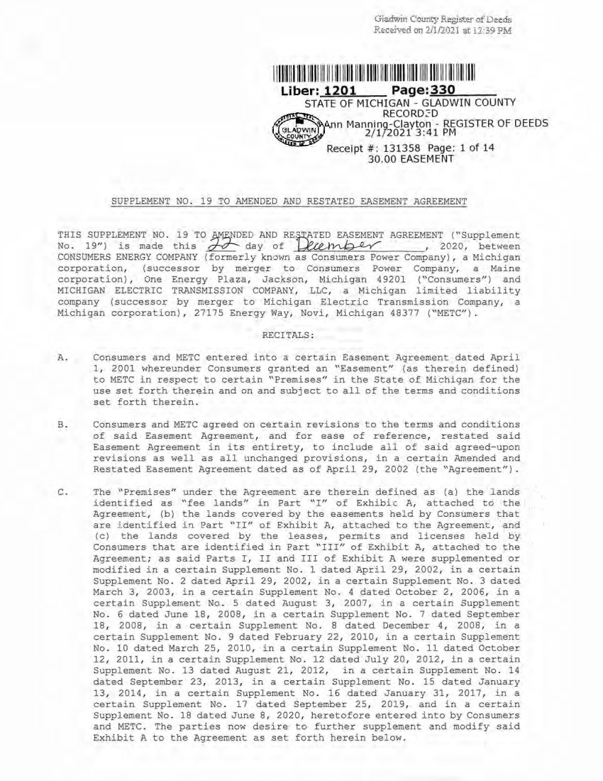
| Giadwin C our1 cy Regj:;ter of eed~ R.~ .c ·,,10..cl. on 2/1/2021 at.11:3~ PM I I IIIII II I III I IIII Ill II I I ll lllll lllll lllll llll llllll lllll ll lll llll I I I I ll llll llll Uber: 1201 Page:=3=3=0 __ _ STATE OF MICHIGAN - GLADWIN COUNTY RECORD :.:: D nn Manning-Clayton - REGI STER OF DE EDS 2/ 1/ 2021 3:41 PM Receipt #: 131358 Page : 1 of 14 30.00 EASEMENT SUPPLEMENT NO. 19 TO AMENDED AND RESTATED EASEMENT AGREEMENT THIS SUPPLEMENT NO. 19 TO )¥1.E,NDED AND REWTED EASEMENT AGREEMENT ("Supplement No . 19") is made this ~ day of ~)~ , 2020 , between CONSUMERS ENERGY COMPANY (formerly known as Consumers Power Company), a Michigan corporation, (successor by merger to Consumers Power Company, a Maine corporation), One Energy Plaza, Jackson, Michigan 4 9201 (''Consumers") and MICHIGAN ELECTRIC TRANSMISSION COMPANY, LLC , a Michigan limited liability company ( successor by merger to Michigan Electric Transmission Company, a Michigan corporation) , 27175 Energy Way, Novi , Michigan 48377 ("METC") . RECITALS: A. Consumers and METC entered into a certain Easement Agreement dated April 1, 2001 whereunder Consumers granted an "Easement" (as therein defined) to METC in respect to certain "Premises" in the State of Michigan for the use set forth therein and on and subject to all of the terms and conditions set forth therein . B. Consumers and METC agreed on certain revisions to the terms and conditions of said Easement Agreement, and for ease of reference, restated said Easement Agreement in its entirety, to include all of said agreed-upon revisions as well as all unchanged provisions, in a certain Amended and Restated Easement Agreement dated as of April 29, 2002 (the "Agreement") . C. The "Premises" under the Agreement are therein defined as (a) the lands identified as ''fee lands" in Part "I" of Exhibic A, attached to the Agreement, (b) the lands covered by the easements held by Consumers that are i dentified in Part " II" of Exhibit A, attached to the Agreement , and (c) the lands covered by the leases , permits and licenses held by Consumers that are identified in Part "III" of Exhibit A, attached to the Agreement; as said Parts I , II a nd III of Exhibit A were supplemented or modified in a certain Supplement No. 1 dated April 29, 2002, in a certain Supplement No . 2 dated April 29, 2002 , in a certain Supplement No . 3 dated March 3 , 2003, in a certain Supplement No. 4 dated October 2 , 2006 , in a certain Supplement No. 5 dated August 3 , 2007, in a certain Supplement No. 6 dated June 18 , 2008 , in a certain Supplement No. 7 dated September 18 , 2008., in a certain Supplement No . 8 dated December 4, 2008 , in a certain Supplement No . 9 dated February 22 1 2010, in a certain Supplement No . 10 dated March 25, 2010, in a certain Supplement No . 11 dated October 12, 2011 , in a certain Supplement No. 12 dated July 20 , 2012, in a certain Supplement No . 13 dated August 21, 2012, in a certain Supplement No . 14 dated September 23, 2013, in a certain Supplement No. 15 dated January 13, 2014 , in a certain Supplement No . 16 dated January 31, 2017 , in a certain Supplement No . 17 dated September 25, 2019 1 and in a certain Supplement No. 18 dated June 8, 2020, heretofore entered into by Consumers and METC. The parties now desire to further supplement and modify said Exhibit A to the Agreement as set forth herein below. |
| 2 D. References, in regard to historical matters, to ''METC" in the foregoing recitals will be deemed to mean METC' s predecessor, Michigan Electric Transmission Company, a Michigan corporation, where relevant. NOW, THEREFORE, for good and valuable consideration, the receipt of which is acknowledged, Consumers and METC agree as follows: 1 . Exhibit A to the Agreement, as heretofore supplemented and/or modi fied, is hereby further supplemented and modified as set forth in " Nineteenth Supplemental Exhibit A", attached hereto. It is expressly understood that any lands, easements, or leases/permits/licenses that are indicated in said attached Nineteenth Supplemental Exhibit A as being added are, on and subject to the terms and conditions of the Agreement ( as supplemented and amended by this Supplement No. 19) , hereby deemed added to Part I , Part II and Part III, respectively, of Exhibit A to the Agreement . However, it is further expressly understood that in addition to all rights granted to METC by the Agreement, METC shall have the following rights as to the lands identified as "Consumers Energy Equipment/ Joint Asset Area Easement" on the accompanying NINETEENTH Suppl emental Exhibit A sheets, inclusive of Parts I, II and III, which rights are also subject to the terms of the Parties' Amended and Restated Transmission Interconnection Agreement (the ''DTIA"): (a) the right to maintai n any and all existing components of the Transmission System, as defined in the DTIA, and wiring or conduit connections for the same that currently exist over I on or under these lands; and (b)the right to connect its currently sited or future approved wiring or conduits for communications, station power, or control, operating at 600 volts or less, and any Jointly Owned Assets, as defined in the DTIA, over, on or under these lands . It is also expressly understood that, with respect to any lands, easements, or leases/permits/licenses now covered by Part I , Part II or Part III of Exhibit A that are indicated in said attached Nineteenth Supplemental Exhibit A as being deleted, the Easement is hereby deemed RELEASED with respect thereto and the Agreement shall hereafter no longer apply thereto (provided, however, that all rights and obligations under the Agreement with respect to periods prior to the date of this Supplement No. 19 shall remain unaffected). 2 . It is expressly understood and agreed that in respect to the additional Premises represented by the land(s), easement(s) , lease(s), permit(s) and/or license{s) that are added to Part I, Part II and Part III of Exhibit A to the Agreement pursuant to this Supplement No . 19 (the "Additional Premises") : (a) All references to ''Commencement Date" that are found in Article 1 {" Grant of Easement") , Article 2 ("Term"), Article 5 ("Additions/Alterations"), Article 6 ("Consumers' Reserved Rights to Use the Premises and Transmission Facilities''), Article 7 ("METC Approval of Compatible Uses"), Article 8 ("Certain Obligations of Consumers and Authorized Users; Etc.") and Article 14 ("Environmental Matters") of the Agreement shall be deemed to mean the date of this Supplement No . 19 and not t he date that is identified in the Agreement as the "Commencement Date". |

| 3. 3 (b) Except as expressly otherwise indicated in the immediately following sentence, all references to "Restated Agreement Date" that are found in Article 1 ("Grant of Easement"), Article 6 ( "Consumers' Reserved Rights to Ose the Premises and Transmission Facilities"), and Article 12 ("Compliance With Applicable Laws") of the Agreement shall also be deemed to mean the date of this Supplement No. 19 and not the date that is identified in the Agreement as the "Restated Agreement Date 11 • Notwithstanding the foregoing : (i) the preceding sentence does not apply to the purely historical statement in clause "(c) 11 of Section 1. 2 of the Agreement that Trans-Elect, Inc . is "an affiliate of the entity which has become METC's parent company as of the Restated Agreement Date"'; and (ii) the parenthetical in the first sentence of the first paragraph of Section 7 . 1 of the Agreement reading "(see below regarding a certain period prior to the Restated Agreement Date)", along with the fourth paragraph of said Section 7.1 reading ''Consumers sball submit to METC within twenty ( 20) days of the Restated Agreement Date a list of all material Compatible Uses other than additions or modifications to Distribution Facilities that have been authorized between February 1 , 2001 and the Restated Agreement Date for METC's approval per the METC Compatible Use approval process described in this Section 7 . 1.", both referred to a one- time historical matter and have no application to the Additional Premises or any other further effect or application whatsoever . In addition to Additions/Alterations the original Transmission Facilities and thereto as referred to in Recital " A" of the Agreement, it is understood that such electric Transmission towers, pole structures, poles, crossarms, wires, cables, conduits, guys, anchors, transformers, insulators and/or other fixtures and equipment as may be owned by METC and located on the Additional Premises as of the date of this Supplement No. 19, and future Additions/Alternations made thereto on and subject to the terms and conditions of the Agreement, are included in the "Transmission Facilities" under the Agreement. Note: This Supplement No. 19 will not be recorded in all counties in whi ch the Agreement itself, or Supplements Nos . 1 through 18, may have been recorded. This Supplement No . 19 (as were each of Supplements Nos. 1 through 18), will be recorded only in the county(ies) in which relevant Premises are located; being, in the case of this Supplement No. 19, only the following : |

| Allegan County Antrim County Barry County Bay County Calhoun County Charl evoix County Clinton County Crawford Coun ty Emmet County Genesee County Gladwin County Grand Traverse County Gratiot Count y Ingham County Ionia County Isabella Count y Jackson County Kal kaska County Kent County Leelanau County Lenawee County Manistee County Midl and County Montcal m County Muskegon County Oceana County Ogemaw County Ottawa County Roscommon County Saginaw County Shiawassee County St. Joseph County Washtenaw County Wexford County 4 The fact that this Supplement No. 19 will be recorded onl y in the particular county(ies) identified above will in no way restrict, limi t or otherwise affect t h e interpretati on, appli cation or enforcement of the Agreement; and the terms and conditions of the Agreement s hall at all times be read, interpreted and appl ied in the manner provided for in Secti on 24 . 6 of the Agreement . |
| -- 5 IN WTT'NESS WHEREOF, Consumers and METC have executed thi s Supplement No. 19 as of the date first above written. CONSUMERS ENERGY COMPANY , a Michigan corporation By --'1----\---- · ~ ~C\ ,L-..--- 2 _ Mar)'An !:Yrr Director of Real Escate STATE OF MICHIGAN CO0NTY Of c)a,teL00v\._ ss. The foregoing instrument was acknowledged before this ;}'J.--day of D@J~e,Y, 2020, by Mary Anne Marr, Director of Real Estate of CONSUMERS ENERGY COMPANY, a Michigan corporation, on behalf of the corporati on. JULIE C GUINN Notary Public - State of Michigan Coun!)' of Jack.son M . Y , Comm1s~ion Expires (?ec ;I.,~ _2020 Act,ng •n the County of.,.,c),_ii,=ti ~ il =~~.,__ Not~ry ~ublif, C,JQ let'~ County, Michigan Acting in <,.L(l,(}'lG CJv, Co\lnty, Michi gan My Commi ssion Expires: _ _,__(~]-..-+-/~:~----' - - ; 2o_fjQ l |
| 6 MICIUGAN ELECTRIC TRANSMISSION COMPANY, LLC, a Michigan limited liability company By: ITC Holdings Corp., a Michigan corporation, its manager By : Jean:imD• Anna Vice President and Deputy General Counsel - Legal Services STATE OF MICHIGAN COUNTY OF J Oakland ss. The forerrni nrr instrument was acknowledged before this I 16 I day of Oecemher ao20, by Jean Kim D' Anna, Vice President and Deputy General Counsel of ITC Holdings Corp. , a Michigan corporation, as manager of MICHIGAN ELECTRIC TRANSMISSION COMPANY, LLC, a Michigan limited liability company, on behalf of the limited liability company. LAURA J, MCCRAY NOTARY PUBLIC. STATE OF Ml COUNTY OF OAKLAND MY COMMISSION EXPIRES Jul 30, 2021 ACTING IN COUNTY OF O ~l~ Notary Pu!/" 0 j Oakbmd I County, Michigan Acting in I L _ _, o ,_akl_ ·_ an,-d_~l =---:--- County, Michigan My Commission Expires: _ 7/30/21_, 2020 Exempt from transfer taxes per MCL §§ 207 . SOS(f) and 207 .526(f). Prepared by: Tracy L. Vanwoert Consumers Energy Company EP7- 447 One Energy Plaza Jackson, Michigan 49201 Return to: Julie Guinn Consumers Energy Company J - |

| THE ATTACHED COPY OF THE NINETEENTH SUPPLEMENTAL EXHIBIT A THAT WAS PREPARED FOR RECORDATION IN GLADWIN COUNTY, MICHIGAN, A~D CONTAINS THE PORTIONS OF EACH OF PARTS I, II, AND III OF THE NINETEENTH SUPPLEM£NT EXHIBIT A THAT RELATE TO PREMISES IN THAT COUNTY ONLY. SEE SECTION 24 . 6 OF THE AGREEMENT. 7 |
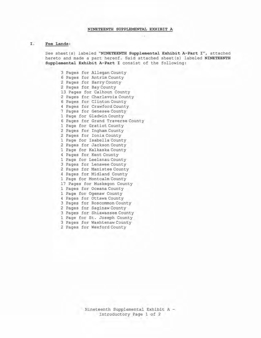
| NINETEENTH SUPPLEMENTAL EXHIBIT A I . Fee Lands: See sheet (s) l abeled "NINETEENTH Supplemental Exhibit A-Part 'I" , att::ached hereto and made a part hereof. Said attached sheet(s) labeled NINETEENTH Supplemental Exhibit A-Part I consist of the following : 3 Pages for Allegan County 6 Pages .for Antrim County 2 Pages fo:r Barry County 2 Pages for Bay County 13 Pages for Cal houn County 2 Pages for Charlevoix County 6 Pages for Cl inton County 4 Pages for CrawfordCounty 7 Pages for Genesee County 1 Page for Gladwin County 6 Pages for Grand Tra ver se County 1 Pa ge for Gratiot County 2 Pages for Ingham County 2 Pages for Ionia County 1 Page for Isabella County 2 Pages for Jackson County 1 Page for Kalkaska County 4 Pages for Kent County 1 Page for Leelanau County 3 Pages for Lenawee County 2 Pages for Manistee County 4 Pages for Midland County 1 Page for Montcalm County 17 Pages for Muskegon County 1 Pages for Oceana County 1 Page for Ogemaw County 4 Pages for Ottawa County 3 Pages for Roscommon County 2 Pages for Saginaw County 3 Pages for Shiawassee County 1 Page for St. Joseph County 3 Pages for Washtenaw County 2 Pages for Wexford County Nineteenth Supplemental Exhibit A - Introductory Pa ge 1 of 2 |
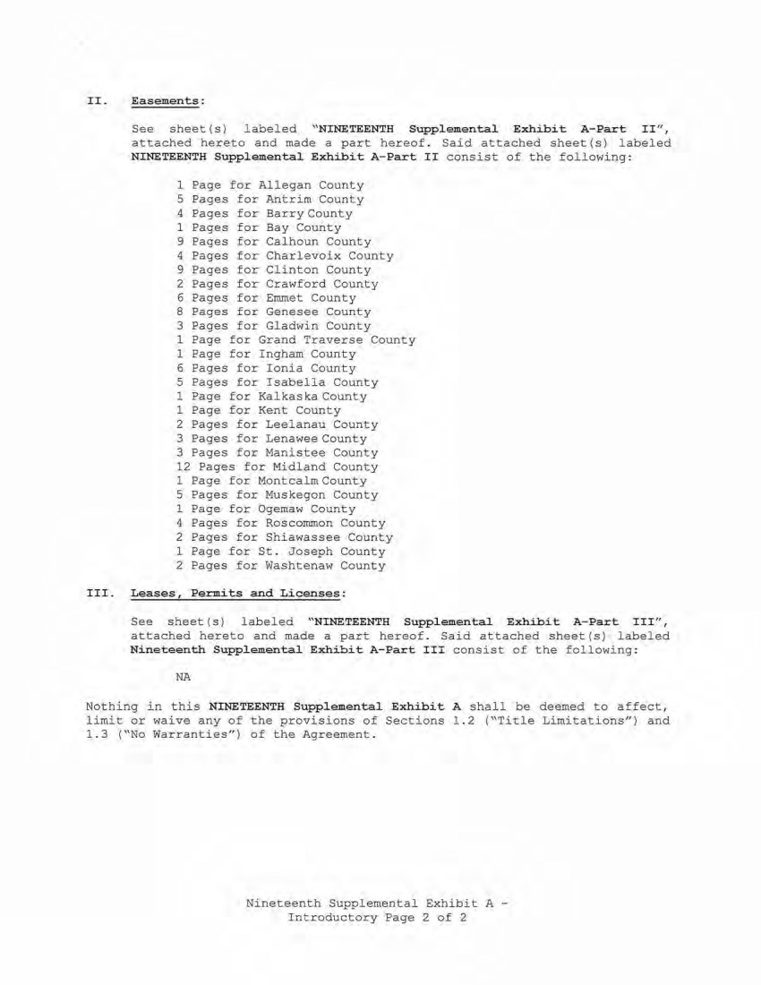
| II. Easements: III. See sheet ( s) l abeled " NINETEENTH Supplemental Exhibit A-Part Ir ' , attached hereto and made a part hereof. Said attached sheet(s) labeled NINETEENTH Supplemental E,dlibit A-Part II consist of the following: 1 Page for All egan County 5 Pages for Antrim County 4 Pages for Barry Count y 1 Pages for Bay County 9 Pages for CalhoJ.ln County 4 Pages for Charlevoix County 9 Pages for Clinton County 2 Pages for Crawford County 6 Pages for Emmet County 8 Pages for Genesee County 3 Pages for Gladwin County 1 Page for Grand Traverse County 1 Page for Ingham County 6 Pages for I onia County 5 Pages for Isabella County 1 Page for Kalkaska County 1 Page for Kent County 2 Pages for Leelanau County 3 Pages for Lenawee County 3 Pages for Manistee County 12 Pages for Midland County 1 Page for Montcalm County 5 Pages for Muskegon County 1 Page for Ogemaw County 4 Pages for Roscommon County 2 Pages for Shiawassee County 1 Page £or St. Joseph County 2 Pages for Washtenaw County Leases, Permits and Licenses: See sheet (s) labeled "NINETEENTH Suppl emental Exhibi.t A- Part III" , attached hereto and made a part hereof. Said attached sheet(s) l abeled Nineteenth Supplemental Exhibit A-Part III consist of the following : NA Nothi ng in this NINETEENTH Supplemental Exhibit A shall be deemed to affect, limit or waive any of the provisions of Sections 1.2 ("Title Limitations") and 1.3 ("No Warranties") of the Agreement. Nineteenth Supplemental Exhibit A - Introductory Page 2 of 2 |
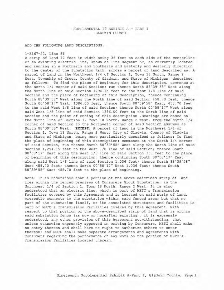
| SUPPLEMENTAL 19 EXHIBIT A - PART I GLADWIN COUNTY ADD THE FOLLOWING LAND DESCRIPTIONS : 1-£167- 22, Line ST A strip of land 72 feet in width being 36 feet on each side of the centerline of an existing electric line, known as line segment ST, as currently located and running in a Northerly and Southerly and Easterly and Westerly direction to the center of the Substation Rack, across a parcel of land described as: A parcel of land in the Northwest 1/4 of Section 1, Town 18 North, Range 2 West, Township of Grout, County of Gladwin, and State of Michigan, described as follows : To find the place of beginning for this description, commence at the North 1/4 corner of said Section; run thence North 88°39'58 11 West along the North line of said Section 1294.15 feet to the West 1/8 line of said section and the place of beginning of this description, thence continuing North 88°39'58" West along the North line of said Section 458.70 feet; thence South 00°58'17 11 East, 1386. 00 feet; thence South 88°39'58" East, 458 . 70 feet to the said West 1/8 line of said Section; thence North 00°58'17 11 West along said West 1/8 line of said Section 1386. 00 feet to the North line of said Section and the point of ending of this description . Bearings are based on the North line of Section 1 , Town 18 North, Range 2 West, from the North 1/4 corner of said Section to the Northwest corner of said Section assumed as North 88°39' 58" West. EXCEPT: A parcel of land in the Northwest 1/4 of Section 1 , Town 18 North, Range 2 West, City of Gladwin, County of Gl adwin and State of Michigan, being more particularly described as follows : To find the place of beginning of this description; commence at the North 1/4 corner of said Section, run thence North 88°39'58" West along the North line of said Section 1 , 294 . 15 feet to the West 1/8 line of said Section; thence South 00°58'17" East along the West 1/8 line of said Section 350 feet to the place of beginning of this description; thence continuing South 00°58'17" East along said West 1/8 line of said Section 1,036 feet; thence North 88°39'58" West 458.70 feet; thence North 00°58 ' 17" West 1,036 feet; thence South 88°39'58- East 458.70 feet to the place of beginning. Note : It is understood that a portion of the above-described strip of land lies within the fenced premises of Consumers Grout Substation, in the Northwest 1/4 of Section 1, Town 18 North, Range 2 West. It is also understood that an electric line, which .is part of METC ' s Transmission Facilities covered by this Agreement and is located on said strip of land, presently connects to the substation within said fenced area; but that no part of the substation itself, or its associated s.tructures and facilities is part of METC's Transmission Facilities covered by this Agreement. With respect to that portion of the above- described strip of land that is within said substation fence (as now or hereafter existing), it is expressly understood, any other provision of this Agreement notwithstanding, that unless otherwise expressly approved in writing by Consumers, M.ETC shall make no entry thereon and shall have no right to authorize others to enter thereon; and METC shall make separate arrangements and agreements with Consumers regarding the performance of any work on the portion of METC's Transmission Facilities located therein . Nineteenth Supplemental Exhibit A- Part I, Gladwin County, Pagel |

| Liber/Page Ll74, P600 L282, P508 L282, P506 L277, P562 Ll 74, P277 L280, P362 L280 , P235 L280, P231 NINETEENTH SUPPLEMENTAL EXHIBIT A - PART II GLADWIN COUNTY Grantor Grantee Date of Inst. Gordon M . Smith and Rhea Smith, Consumers 5/18/1956 husband and wife; Neil Sanderson Power and Beth M. Sanderson, husband and Company wife; Charles D. Muma and Irene E. Muma, husband and wife Charles D. Muma and Irene E. Muma Consumers 11/19/1979 aka Irene F. Muma , husband a nd Power wife; Christopher L. Muma and Linda Company s . Muma, h usband and wife Charles D. Muma and Irene E. Muma Consumers 11/19/1979 aka Irene F. Muma , husband and Power wife; Christopher L. Muma and Linda Company s . Muma, husband and wife Richard D. Rankin aka Richard Consumers 3/8/1979 Rankin and Pamel a A. Rankin aka Power Pamela Rankin, husband and wife Company J. Leo Ayre and Ruth E. Ayre, Consumers 5/18/1956 husband and wife and George E. Power Ayre, a single man Company Calvin w . Kern and Jeannette Kern, Consumers 7/31/1979 husband and wife Power Company Stanley C. Alexander and Erva J. Consumers 6/26/1979 Alexander, husband and wife Power Company Hayden E. Neely and Gail L. Neely, Consumers 6/28/1979 husband and wife Power Company County City/Township Town Range Section Gladwin Sage Township T19N R2W 36 County Gladwin Sage Township Tl9N R2W 36 County Gladwin Sage Township Tl9N R2W 36 County Gladwin Sage Township Tl9N R2W 36 County Gladwin Sage Township T19N R2W 36 County Gladwin Sage Township Tl.9N R2W 36 County Gladwin Sage Township T19N R2W 35 County Gladwin Sage Township Tl9N R2W 35 County Nineteenth Suppl emental Exhibit A- Part II, Gladwin County, Page 1 |
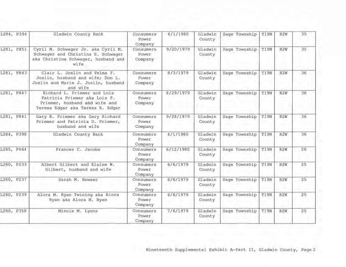
| L284, P394 Gladwin County Bank Consumers 4/1/1980 Gladwin Sage Township Tl9N R2W 35 Power County Company L281, P851 Cyril M. Schwager Jr. aka Cyril M. Consumers 9/20/1979 Gladwin Sage Township T19N R2W 35 Schwager and Christina E. Schwager Power County aka Christina Schwager, husband and Company wife L281, P843 Clair L . Joslin and Velma F . Consumers 8/3/1979 Gladwin Sage Township Tl9N R2W 36 Joslin, husband and wife; Don L. Power County Joslin and Marie J. Joslin, husband Company and wife L281, P847 Richard L. Priemer and Lois Consumers 8/29/1979 Gladwin Sage Township Tl9N R2W 36 Patricia Priemer aka Lois P. Power County Priemer, husband and wife and Company Teresa Edgar aka Teresa R. Edgar L281, P841 Gary R . Priemer aka Gary Richard Consumers 9/28/1979 Gladwin Sage Township Tl9N R2W 36 Priemer and Patricia D. Priemer, Power County husband and wife Company L284, P398 Gladwin County Bank Consumers 4/1/1980 Gladwin Sage Township Tl9N R2W 36 Power Coun ty Company L285, P464 Frances C . Jacobs Consumers 6/12/1980 Gladwin Sage 'l'ownship Tl9N R2W 26 Power County Company L280, P233 Albert Gilbert and Elaine w. Consumers 6/6/1979 Gladwin Sage Township Tl9N R2W 25 Gilbert, husband and wife Power County Company L280, P237 Sarah M. Bovvser Consumers 6/6/1979 Gladwin Sage Township Tl9N R2W 25 Power County Company L280, P239 Alora M. Ryan Twining aka Alora Consumers 6/6/1979 Gladwin Sage 'rownship Tl9N R2W 25 Ryan aka Alora M. Ryan Power County Company L280, P358 Minnie M. Lyons Consumers 7/6/1979, Gladwin Sage Township Tl9N R2W 25 Power County Company Nineteenth Supplemental Exhibit A-Part II, Gladwin Coun ty, Page2 |
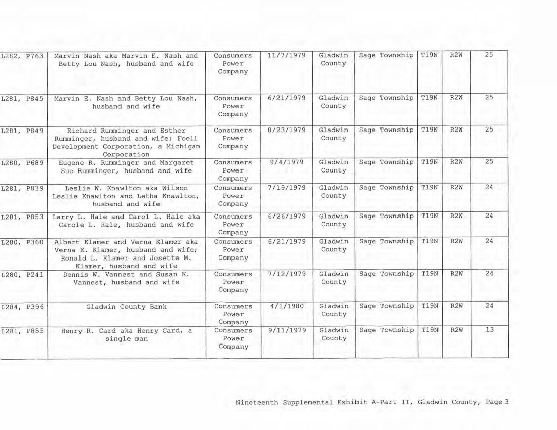
| L282, P763 Marvin Nash aka Marvin E. Nash and Consumers 11/7/1979 Gladwin Sage Township T19N RZW 25 Betty Lou Nash, husband and wife Power County Company L281, P845 Marvin E. Nash and Betty Lou Nash, Consumers 6/21/1979 Gladwin Sage Township T19N R2W 25 husband and wife Power County Company L281, P849 Richard Rumminger and Esther Consumers 8/23/1979 Gladwin Sage Township T19N R2W 25 Rumminger, husband and wife; Foell Power County Development Corporation, a Michigan Company Corporation L280, P689 Eugene R. Rurnminger and Margaret Consumers 9/4/1979 Gladwin Sage Township Tl9N R2W 25 Sue Rurnminger, husband and wife Power County Company L281, P839 Leslie w. Knawlton aka Wilson Consumers 7/19/1979 Gladwin Sage Township T19N R2W 24 Leslie Knawlton and Letha Knawlton, Power County husband and wife Company L281, P853 Larry L. Hale and Carol L. Hale aka Consumers 6/26/1979 Gladwin Sage Township Tl9N RZW 24 Carole L. Hale, husband and wife Power County Company L280, P360 Al bert Klamer and Verna Klamer aka Consumers 6/21/1979 Gladwin Sage Township T19N R2W 24 Verna E. I<:lamer, husband and wife; Power County Ronald L. Klamer and Josette M. Company Klamer, husband and wife L280, P241 Dennis W. Vannest and Susan K. Consumers 7/12/1979 Gladwin Sage 'l'ownship T19N R2W 24 Vannest, husband and wife Power County Company L284 , P396 Gladwin County Bank Consumers 4/1/1980 Gladwin Sage Township T19N R2W 24 Power County Company L281 , P855 Henry R. Card aka Henry Card, a Consumers 9/11/1979 Gladwin Sage Township T19N R2W 13 single man Power County Company Nineteenth Supplemental Exhibit A-Part II, Gladwin County, Page 3 |
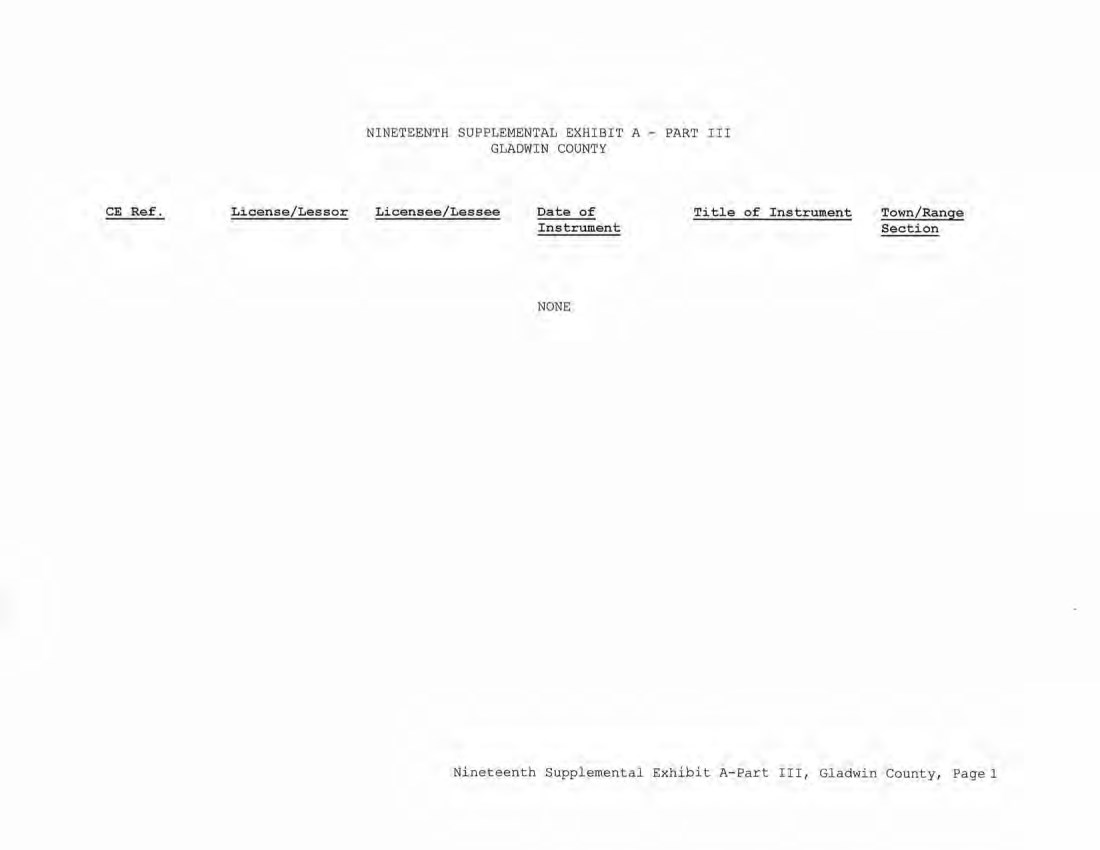
| CE Ref. License/Lessor NINETEENTH SUPPLEMENTAL EXHIBIT A - PART III GLADWIN COUNTY Licensee/Lessee Date of Instrument NONE Title of Instrument Town/Range Section Nineteenth Supplemental Exhibit A-Part III, Gladwin County, Page 1 |
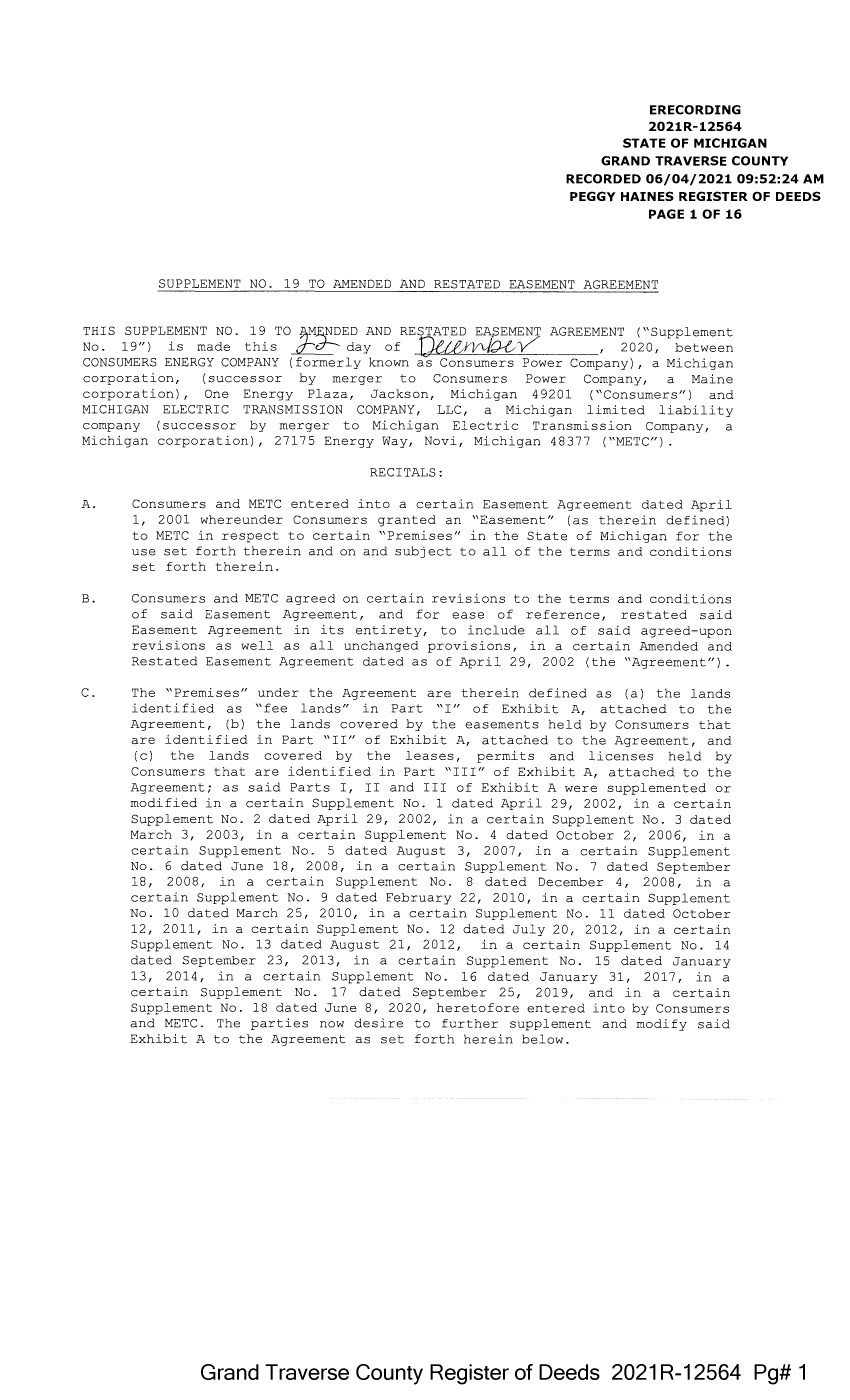
| ERECORDING 2021R-12564 STATE OF MICHIGAN GRAND TRAVERSE COUNTY RECORDED 06/04/2021 09:52:24 AM PEGGY HAINES REGISTER OF DEEDS PAGE 1 OF 16 SUPPLEMENT NO. 19 TO AMENDED AND RESTATED EASEMENT AGREEMENT THIS SUPPLEMENT NO. 19 TO 1-:"£.NDED AND RESTATED EA~EMENT AGREEMENT ("Supplement No. 19") is made this d--- day of JJ,et&f'l/\Jx ✓ , 2020, between CONSUMERS ENERGY COMPANY (formerly known as Consumers Power Company), a Michigan corporation, (successor by merger to Consumers Power Company, a Maine corporation), One Energy Plaza, Jackson, Michigan 49201 ("Consumers") and MICHIGAN ELECTRIC TRANSMISSION COMPANY, LLC, a Michigan limited liability company ( successor by merger to Michigan Electric Transmission Company, a Michigan corporation), 27175 Energy Way, Novi, Michigan 48377 ("METC"). RECITALS: A. Consumers and METC entered into a certain Easement Agreement dated April 1, 2001 whereunder Consumers granted an "Easement" (as therein defined) to METC in respect to certain "Premises" in the State of Michigan for the use set forth therein and on and subject to all of the terms and conditions set forth therein. B. Consumers and METC agreed on certain revisions to the terms and conditions of said Easement Agreement, and for ease of reference, restated said Easement Agreement in its entirety, to include all of said agreed-upon revisions as well as all unchanged provisions, in a certain Amended and Restated Easement Agreement dated as of April 29, 2002 (the "Agreement"). C. The "Premises" under the Agreement are therein defined as (a) the lands identified as "fee lands" in Part "I" of Exhibit A, attached to the Agreement, (b) the lands covered by the easements held by Consumers that are identified in Part "II" of Exhibit A, attached to the Agreement, and (c) the lands covered by the leases, permits and licenses held by Consumers that are identified in Part "III" of Exhibit A, attached to the Agreement; as said Parts I, II and III of Exhibit A were supplemented or modified in a certain Supplement No. 1 dated April 29, 2002, in a certain Supplement No. 2 dated April 29, 2002, in a certain Supplement No. 3 dated March 3, 2003, in a certain Supplement No. 4 dated October 2, 2006, in a certain Supplement No. 5 dated August 3, 2007, in a certain Supplement No. 6 dated June 18, 2008, in a certain Supplement No. 7 dated September 18, 2008, in a certain Supplement No. 8 dated December 4, 2008, in a certain Supplement No. 9 dated February 22, 2010, in a certain Supplement No. 10 dated March 25, 2010, in a certain Supplement No. 11 dated October 12, 2011, in a certain Supplement No. 12 dated July 20, 2012, in a certain Supplement No. 13 dated August 21, 2012, in a certain Supplement No. 14 dated September 23, 2013, in a certain Supplement No. 15 dated January 13, 2014, in a certain Supplement No. 16 dated January 31, 2017, in a certain Supplement No. 17 dated September 25, 2019, and in a certain Supplement No. 18 dated June 8, 2020, heretofore entered into by Consumers and METC. The parties now desire to further supplement and modify said Exhibit A to the Agreement as set forth herein below. Grand Traverse County Register of Deeds 2021 R-12564 Pg# 1 |
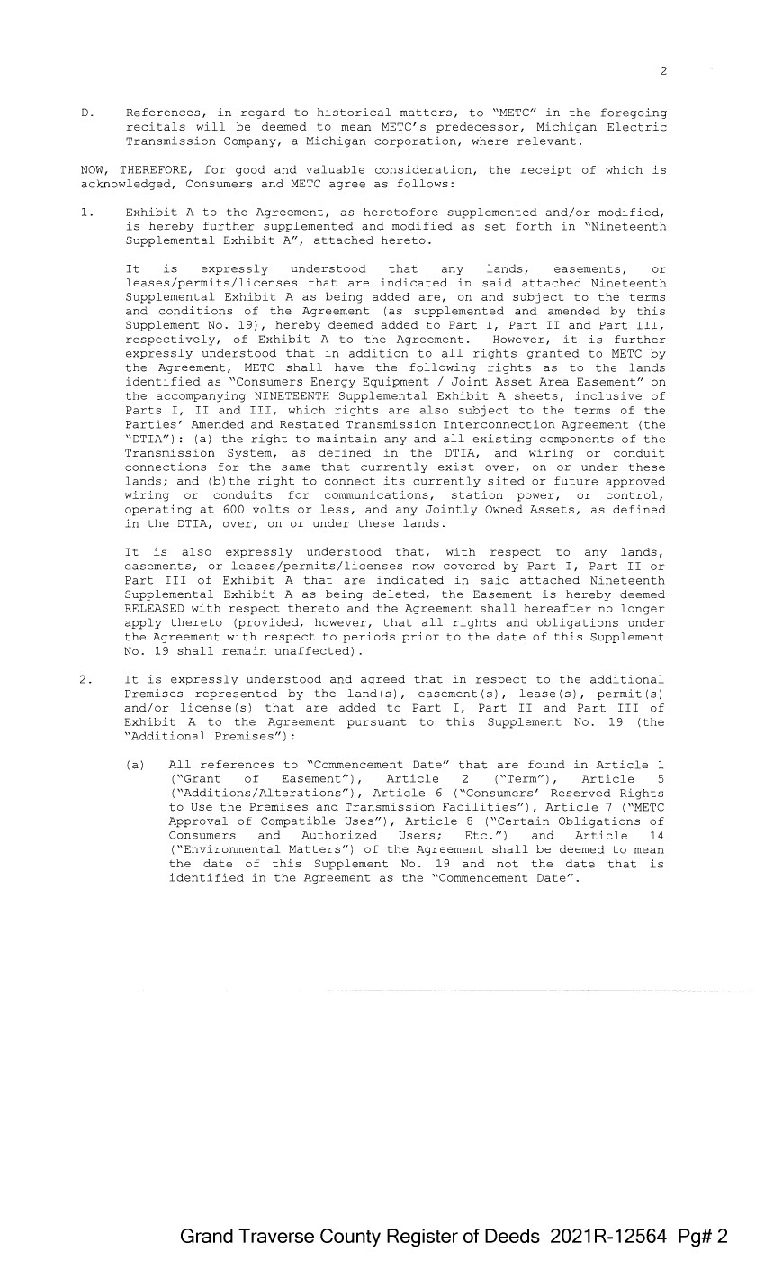
| 2 D. References, in regard to historical matters, to "METC" in the foregoing recitals will be deemed to mean METC' s predecessor, Michigan Electric Transmission Company, a Michigan corporation, where relevant. NOW, THEREFORE, for good and valuable consideration, the receipt of which is acknowledged, Consumers and METC agree as follows: 1. Exhibit A to the Agreement, as heretofore supplemented and/or modified, is hereby further supplemented and modified as set forth in "Nineteenth Supplemental Exhibit A", attached hereto. 2. It is expressly understood that any lands, easements, or leases/permits/licenses that are indicated in said attached Nineteenth Supplemental Exhibit A as being added are, on and subject to the terms and conditions of the Agreement (as supplemented and amended by this Supplement No. 19), hereby deemed added to Part I, Part II and Part III, respectively, of Exhibit A to the Agreement. However, it is further expressly understood that in addition to all rights granted to METC by the Agreement, METC shall have the following rights as to the lands identified as "Consumers Energy Equipment/ Joint Asset Area Easement" on the accompanying NINETEENTH Supplemental Exhibit A sheets, inclusive of Parts I, II and III, which rights are also subject to the terms of the Parties' Amended and Restated Transmission Interconnection Agreement (the "□ TIA"): (a) the right to maintain any and all existing components of the Transmission System, as defined in the □ TIA, and wiring or conduit connections for the same that currently exist over, on or under these lands; and (b)the right to connect its currently sited or future approved wiring or conduits for communications, station power, or control, operating at 600 volts or less, and any Jointly Owned Assets, as defined in the □ TIA, over, on or under these lands. It is also expressly understood that, with respect to any lands, easements, or leases/permits/licenses now covered by Part I, Part II or Part III of Exhibit A that are indicated in said attached Nineteenth Supplemental Exhibit A as being deleted, the Easement is hereby deemed RELEASED with respect thereto and the Agreement shall hereafter no longer apply thereto (provided, however, that all rights and obligations under the Agreement with respect to periods prior to the date of this Supplement No. 19 shall remain unaffected) It is expressly understood and agreed Premises represented by the land ( s) , and/or license(s) that are added to Exhibit A to the Agreement pursuant "Additional Premises"): that in respect to the additional easement (s), lease (s), permit (s) Part I, Part II and Part III of to this Supplement No. 19 (the (a) All references to "Commencement Date" that are found in Article 1 ( "Grant of Easement") , Article 2 ("Term") , Article 5 ("Additions/Alterations"), Article 6 ("Consumers' Reserved Rights to Use the Premises and Transmission Facilities"), Article 7 ("METC Approval of Compatible Uses"), Article 8 ("Certain Obligations of Consumers and Authorized Users; Etc.") and Article 14 ("Environmental Matters") of the Agreement shall be deemed to mean the date of this Supplement No. 19 and not the date that is identified in the Agreement as the "Commencement Date". Grand Traverse County Register of Deeds 2021 R-12564 Pg# 2 |
| 3 (b) Except as expressly otherwise indicated in the immediately following sentence, all references to "Restated Agreement Date" that are found in Article l ("Grant of Easement"), Article 6 ("Consumers' Reserved Rights to Use the Premises and Transmission Facilities"), and Article 12 ("Compliance With Applicable Laws") of the Agreement shall also be deemed to mean the date of this Supplement No. 19 and not the date that is identified in the Agreement as the "Restated Agreement Date". Notwithstanding the foregoing: ( i) the preceding sentence does not apply to the purely historical statement in clause "(c)" of Section 1. 2 of the Agreement that Trans-Elect, Inc. is "an affiliate of the entity which has become METC's parent company as of the Restated Agreement Date"; and (ii) the parenthetical in the first sentence of the first paragraph of Section 7.1 of the Agreement reading "(see below regarding a certain period prior to the Restated Agreement Date)", along with the fourth paragraph of said Section 7.1 reading "Consumers shall submit to METC within twenty (20) days of the Restated Agreement Date a list of all material Compatible Uses other than additions or modifications to Distribution Facilities that have been authorized between February 1, 2001 and the Restated Agreement Date for METC's approval per the METC Compatible Use approval process described in this Section 7.1.", both referred to a one-time historical matter and have no application to the Additional Premises or any other further effect or application whatsoever. 3. In addition to the original Transmission Facilities and Additions/Alterations thereto as referred to in Recital "A" of the Agreement, it is understood that such electric Transmission towers, pole structures, poles, cross arms, wires, cables, conduits, guys, anchors, transformers, insulators and/or other fixtures and equipment as may be owned by METC and located on the Additional Premises as of the date of this Supplement No. 19, and future Additions/Alternations made thereto on and subject to the terms and conditions of the Agreement, are included in the "Transmission Facilities" under the Agreement. Note: This Supplement No. 19 will not be recorded in all counties in which the Agreement itself, or Supplements Nos. 1 through 18, may have been recorded. This Supplement No. 19 (as were each of Supplements Nos. 1 through 18), will be recorded only in the county(ies) in which relevant Premises are located; being, in the case of this Supplement No. 19, only the following: Grand Traverse County Register of Deeds 2021 R-12564 Pg# 3 |
| Allegan County Antrim County Barry County Bay County Calhoun County Charlevoix County Clinton County Crawford County Emmet County Genesee County Gladwin County Grand Traverse County Gratiot County Ingham County Ionia County Isabella County Jackson County Kalkaska County Kent County Leelanau County Lenawee County Manistee County Midland County Montcalm County Muskegon County Oceana County Ogemaw County Ottawa County Roscommon County Saginaw County Shiawassee County St. Joseph County Washtenaw County Wexford County 4 The fact that this Supplement No. 19 will be recorded only in the particular county(ies) identified above will in no way restrict, limit or otherwise affect the interpretation, application or enforcement of the Agreement; and the terms and conditions of the Agreement shall at all times be read, interpreted and applied in the manner provided for in Section 24.6 of the Agreement. Grand Traverse County Register of Deeds 2021 R-12564 Pg# 4 |
| 6 MICHIGAN ELECTRIC TRANSMISSION COMPANY, LLC, a Michigan limited liability company By: ITC Holdings Corp., a Michigan corporation, its manager By,~· Jean Kim D'Anna Vice President and Deputy General Counsel - Legal Services STATE OF MICHIGAN couNTY OF -==O=akl=an=d===- ss. The forenni nn i n5trument was acknowledged before this I 16 I day of Decemher '2.020, by Jean Kim D' Anna, Vice President and Deputy General Counsel of ITC Holdings Corp., a Michigan corporation, as manager of MICHIGAN ELECTRIC TRANSMISSION COMPANY, LLC, a Michigan limited liability company, on behalf of the limited liability company. LAURA J. MCCRAY NOTARY PUBLIC, STATE OF Ml COUNTY OF OAKLAND MY COMMISSION EXPIRES Jul 30, 2021 j ACTING IN COUNTY OF Ool<.\a,WA Notary Acting My P[' ; c I 0••1 ~, I in Oakland I Commission Expires: County, Michigan County, Michigan _7/30/21, 2020 Exempt from transfer taxes per MCL §§ 207.505(f) and 207.526(f). Prepared by: Tracy L. Vanwoert Consumers Energy Company EP7-447 One Energy Plaza Jackson, Michigan 49201 Return to: Julie Guinn Consumers Energy Company Grand Traverse County Register of Deeds 2021 R-12564 Pg# 5 |
| THE ATTACHED COPY OF THE NINETEENTH SUPPLEMENTAL EXHIBIT A THAT WAS PREPARED FOR RECORDATION IN GRAND TRAVERSE COUNTY, MICHIGAN, AND CONTAINS THE PORTIONS OF EACH OF PARTS I, II, AND III OF THE NINETEENTH SUPPLEMENT EXHIBIT A THAT RELATE TO PREMISES IN THAT COUNTY ONLY. SEE SECTION 24.6 OF THE AGREEMENT. 7 Grand Traverse County Register of Deeds 2021 R-12564 Pg# 6 |
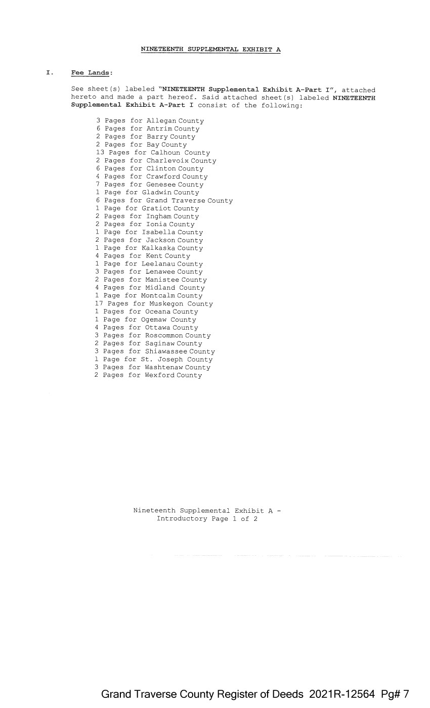
| NINETEENTH SUPPLEMENTAL EXHIBIT A I . Fee Lands : See sheet(s) labeled "NINETEENTH Supplemental Exhibit A-Part I", attached hereto and made a part hereof. Said attached sheet(s) labeled NINETEENTH Supplemental Exhibit A-Part I consist of the following: 3 Pages for Allegan County 6 Pages for Antrim County 2 Pages for Barry County 2 Pages for Bay County 13 Pages for Calhoun County 2 Pages for Charlevoix County 6 Pages for Clinton County 4 Pages for Crawford County 7 Pages for Genesee County 1 Page for Gladwin County 6 Pages for Grand Traverse County 1 Page for Gratiot County 2 Pages for Ingham County 2 Pages for Ionia County 1 Page for Isabella County 2 Pages for Jackson County 1 Page for Kalkaska County 4 Pages for Kent County 1 Page for Leelanau County 3 Pages for Lenawee County 2 Pages for Manistee County 4 Pages for Midland County 1 Page for Montcalm County 17 Pages for Muskegon County 1 Pages for Oceana County 1 Page for Ogemaw County 4 Pages for Ottawa County 3 Pages for Roscommon County 2 Pages for Saginaw County 3 Pages for Shiawassee County l Page for St. Joseph County 3 Pages for Washtenaw County 2 Pages for Wexford County Nineteenth Supplemental Exhibit A - Introductory Page 1 of 2 Grand Traverse County Register of Deeds 2021 R-12564 Pg# 7 |
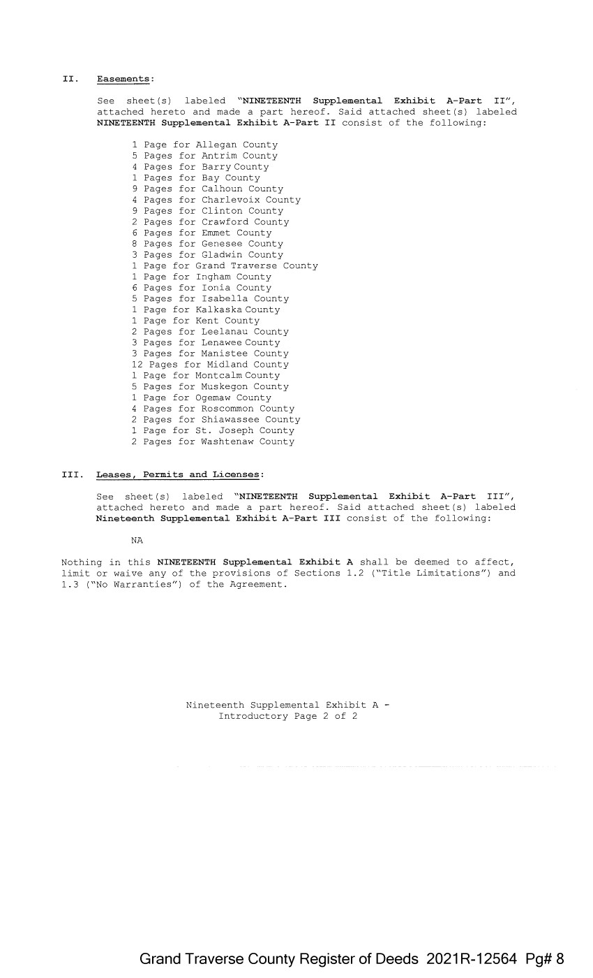
| II. Easements: See sheet(s) labeled "NINETEENTH Supplemental Exhibit A-Part II", attached hereto and made a part hereof. Said attached sheet(s) labeled NINETEENTH Supplemental Exhibit A-Part II consist of the following: l Page for Allegan County 5 Pages for Antrim County 4 Pages for Barry County l Pages for Bay County 9 Pages for Calhoun County 4 Pages for Charlevoix County 9 Pages for Clinton County 2 Pages for Crawford County 6 Pages for Emmet County 8 Pages for Genesee County 3 Pages for Gladwin County 1 Page for Grand Traverse County 1 Page for Ingham County 6 Pages for Ionia County 5 Pages for Isabella County 1 Page for Kalkaska County 1 Page for Kent County 2 Pages for Leelanau County 3 Pages for Lenawee County 3 Pages for Manistee County 12 Pages for Midland County 1 Page for Montcalm County 5 Pages for Muskegon County 1 Page for Ogemaw County 4 Pages for Roscommon County 2 Pages for Shiawassee County 1 Page for St. Joseph County 2 Pages for Washtenaw County III. Leases, Permits and Licenses: See sheet(s) labeled "NINETEENTH Supplemental Exhibit A-Part III", attached hereto and made a part hereof. Said attached sheet(s) labeled Nineteenth Supplemental Exhibit A-Part III consist of the following: NA Nothing in this NINETEENTH Supplemental Exhibit A shall be deemed to affect, limit or waive any of the provisions of Sections 1.2 ("Title Limitations") and 1.3 ("No Warranties") of the Agreement. Nineteenth Supplemental Exhibit A - Introductory Page 2 of 2 Grand Traverse County Register of Deeds 2021 R-12564 Pg# 8 |
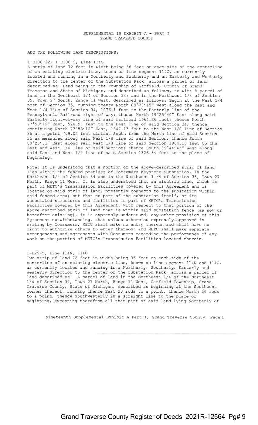
| SUPPLEMENTAL 19 EXHIBIT A - PART I GRAND TRAVERSE COUNTY ADD THE FOLLOWING LAND DESCRIPTIONS: 1-E108-22, 1-E108-9, Line 1140 A strip of land 72 feet in width being 36 feet on each side of the centerline of an existing electric line, known as line segment 1140, as currently located and running in a Northerly and Southerly and an Easterly and Westerly direction to the center of the Substation Rack, across a parcel of land described as: Land being in the Township of Garfield, County of Grand Traverse and State of Michigan, and described as follows, to-wit: A parcel of land in the Northeast 1/4 of Section 34; and in the Northwest 1/4 of Section 35, Town 27 North, Range 11 West, described as follows: Begin at the West 1/4 post of Section 35; running thence North 89°38'15" West along the East and West 1/4 line of Section 34, 1076.1 feet to the Easterly line of the Pennsylvania Railroad right of way; thence North 19°25'40" East along said Easterly right-of-way line of said railroad 1664.26 feet; thence North 77°53'12" East, 528.91 feet to the East line of said Section 34; thence continuing North 77°53'12" East, 1347.13 feet to the West 1/8 line of Section 35 at a point 709.02 feet distant South from the North line of said Section 35 as measured along said West 1/8 line of said Section; thence South 00°25'51" East along said West 1/8 line of said Section 1964.16 feet to the East and West 1/4 line of said Section; thence South 89°44'45" West along said East and West 1/4 line of said Section 1326.54 feet to the place of beginning. Note: It is understood that a portion of the above-described strip of land lies within the fenced premises of Consumers Keystone Substation, in the Northeast 1/4 of Section 34 and in the Northwest 1 /4 of Section 35, Town 27 North, Range 11 West. It is also understood that an electric line, which is part of METC's Transmission Facilities covered by this Agreement and is located on said strip of land, presently connects to the substation within said fenced area; but that no part of the substation itself, or its associated structures and facilities is part of METC's Transmission Facilities covered by this Agreement. With respect to that portion of the above-described strip of land that is within said substation fence (as now or hereafter existing), it is expressly understood, any other provision of this Agreement notwithstanding, that unless otherwise expressly approved in writing by Consumers, METC shall make no entry thereon and shall have no right to authorize others to enter thereon; and METC shall make separate arrangements and agreements with Consumers regarding the performance of any work on the portion of METC's Transmission Facilities located therein. 1-E29-5, Line 114N, 1140 Two strip of land 72 feet in width being 36 feet on each side of the centerline of an existing electric line, known as line segment 114N and 1140, as currently located and running in a Northerly, Southerly, Easterly and Westerly direction to the center of the Substation Rack, across a parcel of land described as: A parcel of land in the Northeast 1/4 of the Northeast 1/4 of Section 34, Town 27 North, Range 11 West, Garfield Township, Grand Traverse County, State of Michigan, described as beginning at the Southwest corner thereof, running thence East 20 rods to a point, thence North 56 rods to a point, thence Southwesterly in a straight line to the place of beginning, excepting therefrom all that part of said land lying Northerly of Nineteenth Supplemental Exhibit A-Part I, Grand Traverse County, Page 1 Grand Traverse County Register of Deeds 2021 R-12564 Pg# 9 |
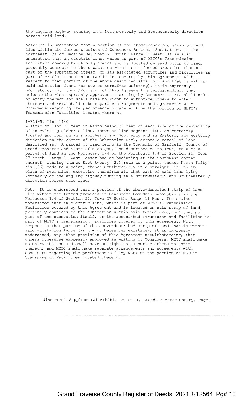
| the angling highway running in a Northwesterly and Southeasterly direction across said land. Note: It is understood that a portion of the above-described strip of land lies within the fenced premises of Consumers Boardman Substation, in the Northeast 1/4 of Section 34, Town 27 North, Range 11 West. It is also understood that an electric line, which is part of METC's Transmission Facilities covered by this Agreement and is located on said strip of land, presently connects to the substation within said fenced area; but that no part of the substation itself, or its associated structures and facilities is part of METC's Transmission Facilities covered by this Agreement. With respect to that portion of the above-described strip of land that is within said substation fence (as now or hereafter existing), it is expressly understood, any other provision of this Agreement notwithstanding, that unless otherwise expressly approved in writing by Consumers, METC shall make no entry thereon and shall have no right to authorize others to enter thereon; and METC shall make separate arrangements and agreements with Consumers regarding the performance of any work on the portion of METC's Transmission Facilities located therein. l-E29-5, Line 1140 A strip of land 72 feet in width being 36 feet on each side of the centerline of an existing electric line, known as line segment 1140, as currently located and running in a Northerly and Southerly and an Easterly and Westerly direction to the center of the Substation Rack, across a parcel of land described as: A parcel of land being in the Township of Garfield, County of Grand Traverse and State of Michigan, and described as follows, to-wit: A parcel of land in the Northeast 1/4 of the Northeast 1/4 of Section 34, Town 27 North, Range 11 West, described as beginning at the Southwest corner thereof, running thence East twenty (20) rods to a point, thence North fifty six (56) rods to a point, thence Southwesterly in a straight line to the place of beginning, excepting therefrom all that part of said land lying Northerly of the angling highway running in a Northwesterly and Southeasterly direction across said land. Note: It is understood that a portion of the above-described strip of land lies within the fenced premises of Consumers Boardman Substation, in the Northeast 1/4 of Section 34, Town 27 North, Range 11 West. It is also understood that an electric line, which is part of METC's Transmission Facilities covered by this Agreement and is located on said strip of land, presently connects to the substation within said fenced area; but that no part of the substation itself, or its associated structures and facilities is part of METC's Transmission Facilities covered by this Agreement. With respect to that portion of the above-described strip of land that is within said substation fence (as now or hereafter existing), it is expressly understood, any other provision of this Agreement notwithstanding, that unless otherwise expressly approved in writing by Consumers, METC shall make no entry thereon and shall have no right to authorize others to enter thereon; and METC shall make separate arrangements and agreements with Consumers regarding the performance of any work on the portion of METC's Transmission Facilities located therein. Nineteenth Supplemental Exhibit A-Part I, Grand Traverse County, Page 2 Grand Traverse County Register of Deeds 2021 R-12564 Pg# 10 |
| 2-E29-6, Line 114N A strip of land 72 feet in width being 36 feet on each side of the centerline of an existing electric line, known as line segment 114N, as currently located and running in a Northerly, Southerly, Easterly and Westerly direction to the center of the Substation Rack, across a parcel of land described as: A parcel of land in the Northeast 1/4 of Section 34, Town 27 North, Range 11 West, Garfield Township, Grand Traverse County, State of Michigan, described as beginning at the point of intersection of the angling highway running in a Northwesterly and Southeasterly direction across said 1/4 Section and of the angling highway running Northeasterly and Southwesterly across said 1/4 Section, running thence Southwesterly along the center line of said Northeasterly and Southwesterly highway, 420 feet, running thence Westerly to a point on the East, North and South 1/8 line, 120 feet South of the North 1/8 line of said Section, running thence North on said East 1/8 line, 120 feet to the South line of the Northeast 1/4 of the Northeast 1/4 of said Section 34, thence East along said South line 20 rods, thence North to the center line of the angling highway running in a Northwesterly and Southeasterly direction across said 1/4 Section, thence Southeasterly along the center line of said highway to the place of beginning. Note: It is understood that a portion of the above-described strip of land lies within the fenced premises of Consumers Boardman Substation, in the Northeast 1/4 of Section 34, Town 27 North, Range 11 West. It is also understood that an electric line, which is part of METC's Transmission Facilities covered by this Agreement and is located on said strip of land, presently connects to the substation within said fenced area; but that no part of the substation itself, or its associated structures and facilities is part of METC's Transmission Facilities covered by this Agreement. With respect to that portion of the above-described strip of land that is within said substation fence (as now or hereafter existing), it is expressly understood, any other provision of this Agreement notwithstanding, that unless otherwise expressly approved in writing by Consumers, METC shall make no entry thereon and shall have no right to authorize others to enter thereon; and METC shall make separate arrangements and agreements with Consumers regarding the performance of any work on the portion of METC's Transmission Facilities located therein. 2-E29-6, Line 1140 A strip of land 72 feet in width being 36 feet on each side of the centerline of an existing electric line, known as line segment 1140, as currently located and running in a Northerly and Southerly and an Easterly and Westerly direction to the center of the Substation Rack, across a parcel of land described as: Land being in the Township of Garfield, County of Grand Traverse and State of Michigan, and described as follows, to-wit: A parcel of land in the Northeast 1/4 of Section 34, Town 27 North, Range 11 West, described as beginning at the point of intersection of the angling highway running in a Northwesterly and Southeasterly direction across said 1/4 Section and of the angling highway running Northeasterly and Southwesterly across said 1/4 Section, running thence Southwesterly along the center line of said Northeasterly and Southwesterly highway, four hundred twenty (420) feet, running thence Westerly to a point on the East, North and South 1/8 line, one hundred twenty (120) feet South of the North 1/8 line of said Section, running thence North on said East 1/8 line, one hundred twenty (120) feet to the South line of the Northeast 1/4 of the Northeast 1/4 of said Section 34, thence East along said South line twenty (20) rods, thence North to the center line of the angling highway running in a Northwesterly and Nineteenth Supplemental Exhibit A-Part I, Grand Traverse County, Page 3 Grand Traverse County Register of Deeds 2021 R-12564 Pg# 11 |
| Southeasterly direction across said 1/4 Section, thence Southeasterly along the center line of said highway to the place of beginning. Note: It is understood that a portion of the above-described strip of land lies within the fenced premises of Consumers Boardman Substation, in the Northeast 1/4 of Section 34, Town 27 North, Range 11 West. It is also understood that an electric line, which is part of METC's Transmission Facilities covered by this Agreement and is located on said strip of land, presently connects to the substation within said fenced area; but that no part of the substation itself, or its associated structures and facilities is part of METC's Transmission Facilities covered by this Agreement. With respect to that portion of the above-described strip of land that is within said substation fence (as now or hereafter existing), it is expressly understood, any other provision of this Agreement notwithstanding, that unless otherwise expressly approved in writing by Consumers, METC shall make no entry thereon and shall have no right to authorize others to enter thereon; and METC shall make separate arrangements and agreements with Consumers regarding the performance of any work on the portion of METC's Transmission Facilities located therein. 1-E108-22, 1-E108-9, Line 114N A strip of land 72 feet in width being 36 feet on each side of the centerline of an existing electric line, known as line segment 114N, as currently located and running in a Northerly, Southerly, Easterly and Westerly direction to the center of the Substation Rack, across a parcel of land described as: A parcel of land in the Northeast 1/4 of Section 34; and in the Northwest 1/4 of Section 35, Town 27 North, Range 11 West, Garfield Township, Grand Traverse County, State of Michigan, described as follows: Begin at the West 1/4 post of Section 35; running thence North 89°38'15" West along the East and West 1/4 line of Section 34, 1076.1 feet to the Easterly line of the Pennsylvania Railroad right of way; thence North 19°25'40" East along said Easterly right-of-way line of said railroad 1664.26 feet; thence North 77°53'12" East, 528.91 feet to the East line of said Section 34; thence continuing North 77°53'12 East, 1347.13 feet to the West 1/8 line of Section 35 at a point 709.02 feet distant South from the North line of said Section 35 as measured along said West 1/8 line of said Section; thence South 00°25'51" East along said West 1/8 line of said Section 1964.16 feet to the East and West 1/4 line of said Section; thence South 89°44'45" West along said East and West 1/4 line of said Section 1326.54 feet to the place of beginning. Note: It is understood that a portion of the above-described strip of land lies within the fenced premises of Consumers Keystone Substation, in the Northeast 1/4 of Section 34, and the Northwest 1/4 of Section 35, Town 27 North, Range 11 West. It is also understood that an electric line, which is part of METC's Transmission Facilities covered by this Agreement and is located on said strip of land, presently connects to the substation within said fenced area; but that no part of the substation itself, or its associated structures and facilities is part of METC's Transmission Facilities covered by this Agreement. With respect to that portion of the above-described strip of land that is within said substation fence (as now or hereafter existing), it is expressly understood, any other provision of this Agreement notwithstanding, that unless otherwise expressly approved in writing by Consumers, METC shall make no entry thereon and shall have no right to authorize others to enter thereon; and METC shall make separate arrangements and agreements with Consumers regarding the performance of any work on the portion of METC's Transmission Facilities located therein. Nineteenth Supplemental Exhibit A-Part I, Grand Traverse County, Page 4 Grand Traverse County Register of Deeds 2021 R-12564 Pg# 12 |
| 1-G249-1, Line 114Y A strip of land 72 feet in width being 36 feet on each side of the centerline of an existing electric line, known as line segment 114Y, as currently located and running in a Northerly and Easterly direction to the center of the Substation Rack, across a parcel of land described as: Beginning at the Southeast corner of the Southwest 1/4 of Section 31, Town 28 North, Range 9 West, thence North on the North and South 1/4 line of said Section 31, 592.00 feet, thence West 33.0 feet for the point of beginning of this description, thence West 66.0 feet, thence North 66.0 feet, thence East 66.0 feet, thence South 66.0 feet to the point of ending of this description. Being part of the East 1/2 of the East 1/2 of the Southwest 1/4 of Section 31, Town 28 North, Range 9 West, Acme Township, Grand Traverse County, and State of Michigan. Note: It is understood that a portion of the above-described strip of land lies within the fenced premises of Consumers Clearwater Substation, in the Southwest 1/4 of Section 31, Town 28 North, Range 9 West. It is also understood that an electric line, which is part of METC's Transmission Facilities covered by this Agreement and is located on said strip of land, presently connects to the substation within said fenced area; but that no part of the substation itself, or its associated structures and facilities is part of METC's Transmission Facilities covered by this Agreement. With respect to that portion of the above-described strip of land that is within said substation fence (as now or hereafter existing), it is expressly understood, any other provision of this Agreement notwithstanding, that unless otherwise expressly approved in writing by Consumers, METC shall make no entry thereon and shall have no right to authorize others to enter thereon; and METC shall make separate arrangements and agreements with Consumers regarding the performance of any work on the portion of METC's Transmission Facilities located therein. 2-G249-9, Line 114Y A strip of land 72 feet in width being 36 feet on each side of the centerline of an existing electric line, known as line segment 114Y, as currently located and running in a Northerly and Easterly direction to the center of the Substation Rack, across a parcel of land described as: A parcel of land in the Southwest 1/4 of Section 31, Town 28 North, Range 9 West, Acme Township, Grand Traverse County, Michigan, described as follows: To find the place of beginning of this description commence at the South 1/4 post of said section, run thence North along the North and South 1/4 line of said section 592 feet to place of beginning of this description, thence continuing North along the said North and South 1/4 line of said section 166 feet, thence West 133 feet, thence South 166 feet, thence East 133 feet to the place of beginning. Note: It is understood that a portion of the above-described strip of land lies within the fenced premises of Consumers Bates Road Substation, in the Southwest 1/4 of Section 31, Town 28 North, Range 9 West. It is also understood that an electric line, which is part of METC's Transmission Facilities covered by this Agreement and is located on said strip of land, presently connects to the substation within said fenced area; but that no part of the substation itself, or its associated structures and facilities is part of METC's Transmission Facilities covered by this Agreement. With respect to that portion of the above-described strip of land that is within said substation fence (as now or hereafter existing), it is expressly understood, any other provision of this Agreement notwithstanding, that unless otherwise expressly approved in writing by Consumers, METC shall make Nineteenth Supplemental Exhibit A-Part I, Grand Traverse County, Page 5 Grand Traverse County Register of Deeds 2021 R-12564 Pg# 13 |
| no entry thereon and shall have no right to authorize others to enter thereon; and METC shall make separate arrangements and agreements with Consumers regarding the performance of any work on the portion of METC's Transmission Facilities located therein. l-RE248-13, Line 114Y A parcel of land in the Southwest 1/4 of Section 31, Town 28 North, Range 9 West, Acme Township, Grand Traverse County, Michigan, described as follows: Commencing at the South 1/4 corner of Section 31, Town 28 North, Range 9 West, and running thence North 00°10'31" West 122.32 feet, along the North South 1/4 line of said Section 31, to the Point of Beginning; thence South 67°06'08" West 97.28 feet, along the Northerly line of a clear vision tract (as described in Liber 264, Page 186), to the Northerly right-of-way of State Highway M-72; thence North 89°31'34" West 570.17 feet, along said Northerly right-of-way line of State Highway M-72; thence North 00°11'20" West 1560.89 feet, along the West line of the East 1/2 of the East 1/2 of the Southwest 1/4 of said Section 31; thence South 89°07'35" East 660.35 feet to the said North-South 1/4 line of Section 31; thence South 00°10'31" East 882.00 feet, along the said North-South 1/4 line, thence South 89°49'29" West 133.00 feet; thence South 00°10'31" East 166.00 feet; thence North 89°49'29" East 133.00 feet, to the said North-South 1/4 line; thence South 00°10'31" East 469.68 feet, along the said North-South 1/4 line, to the Point of Beginning. Nineteenth Supplemental Exhibit A-Part I, Grand Traverse County, Page 6 Grand Traverse County Register of Deeds 2021 R-12564 Pg# 14 |

| Engineering Legacy Tract Liber/Page Number No 114 y R00000035585 2009R- 10708 114 y R00000035583 2008R- 10088 114 y R00000035581 2008R- 03152 114 y R00000035584 2008R- 11468 114 y 9. 2-Dl19-4 L262, Pl07 114 y R00000035580 2008R- 01889 114 y R00000035582 2008R- 07705 114 y MI00000002283 2009R- 23491 114 y R00000035587 2009R- 12311 114 y R00000035608 2009R- 07837 NINETEENTH SUPPLEMENTAL EXHIBIT A - PART II GRAND TRAVERSE COUNTY Granter Grantee Date of Inst. Thomas A. Shield and Consumers Power Company 4/23/2009 Candace D. Shield, husband and wife Clifford M. Lindsey Consumers Power Company 5/7/2008 and Claire J. Lindsey, husband and wife North Pacific Group Consumers Power Company 1/10/2008 Inc, an Oregon corporation Immanuel LLC, a Consumers Power Company 5/22/2008 Michigan limited liability company Richard E. Montague, Consumers Power Company 7/22/1965 aka Richard Montague and Gloria J. Montague, aka Gloria Montague, husband and wife Judith L. Hoxsie, Consumers Power Company 1/15/2008 Revocable Inter Vivos Trust Orchard Hill Farms, Consumers Power Company 1/15/2008 a Michigan co- partnership H. Y. C Inc., a Consumers Power Company 11/3/2009 Michigan corporation State of Michigan by Consumers Power Company 5/20/2009 the Department of Natural Resources Maxin B. Frost Consumers Power Company 3/18/2009 Revocable Living Trust dated September 1, 1998 County City/Township Town Range Grand Acme Township T27N R9W Traverse County Grand Acme Township T27N R9W Traverse County Grand Acme Township T27N R9W Traverse County Grand Acme Township T27N R9W Traverse County Grand Acme Township T27N R9W Traverse County Grand Acme Township T27N R9W Traverse County Grand Acme Township T27N R9W Traverse County Grand Acme Township T27N R9W Traverse County Grand Acme Township T27N R9W Traverse County Grand Acme Township T27N R9W Traverse County Nineteenth Supplemental Exhibit A-Part II, Grand Traverse County, Page 1 LO T""" ::i::i:: 0) 0.. ~ CD !.O Section('~ T"" i 6 c: T"" ~~ 6 C'~ 18 6 ~I) C) i5 6 n ·-- 6 I l)J t~ •i:,-, i: :o (I') 6 (.) () p 6 SI> t6 6 r 1~ rh 7 & 18 Cl 18 |

| CE Ref. Licens_e/Lesso;- NINETEENTH SUPPLEMENTAL EXHIBIT A - PART III GRAND TRAVERSE COUNTY :I:._icensee/Lessee Date of Instrument NONE Title of Instrument Town/Range Section Nineteenth Supplemental Exhibit A-Part III, Grand Traverse County, Page 1 CD T""" ::i::i:: 0) 0.. ~ CD LO N T""" I 0::: T""" N 0 N CJ) "'O (I) (I) 0 '+- a I- ()) +-' CJ) 0) (I) 0::: >- +-' C :J 0 u (I) CJ) I- ()) > co I- I- "'O C co I- C) |
 | STATE OF MICHIGAN – GRATIOT COUNTY | |  |
| RECEIVED | | OR Liber 01072 Page 01410 - 01421 |
| 01/07/2021 11:56:17 AM | | Filed for Record in GRATIOT COUNTY |
| MARY MERCHANT - REGISTER OF DEEDS | | JANUARY 07, 2021 01:41:37 PM |
| | | MARY MERCHANT, REGISTER OF DEEDS
AGREEMENT |
| | | $30.00 Rec # 53585 |
SUPPLEMENT NO. 19 TO AMENDED AND RESTATED EASEMENT AGREEMENT
THIS SUPPLEMENT NO. 19 TO AMENDED AND RESTATED EASEMENT AGREEMENT (“Supplement No. 19”) is made this 22 day of December, 2020, between CONSUMERS ENERGY COMPANY (formerly known as Consumers Power Company), a Michigan corporation, (successor by merger to Consumers Power Company, a Maine corporation), One Energy Plaza, Jackson, Michigan 49201 (“Consumers”) and MICHIGAN ELECTRIC TRANSMISSION COMPANY, LLC, a Michigan limited liability company (successor by merger to Michigan Electric Transmission Company, a Michigan corporation), 27175 Energy Way, Novi, Michigan 48377 (“METC”).
RECITALS:
| A. | Consumers and METC entered into a certain Easement Agreement dated April 1, 2001 whereunder Consumers granted an “Easement” (as therein defined) to METC in respect to certain “Premises” in the State of Michigan for the use set forth therein and on and subject to all of the terms and conditions set forth therein. |
| B. | Consumers and METC agreed on certain revisions to the terms and conditions of said Easement Agreement, and for ease of reference, restated said Easement Agreement in its entirety, to include all of said agreed-upon revisions as well as all unchanged provisions, in a certain Amended and Restated Easement Agreement dated as of April 29, 2002 (the “Agreement”) . |
| C. | The “Premises” under the Agreement are therein defined as (a) the lands identified as “fee lands” in Part “I” of Exhibit A, attached to the Agreement, (b) the lands covered by the easements held by Consumers that are identified in Part “II” of Exhibit A, attached to the Agreement, and (c) the lands covered by the leases, permits and licenses held by Consumers that are identified in Part “III” of Exhibit A, attached to the Agreement; as said Parts I, II and III of Exhibit A were supplemented or modified in a certain Supplement No. 1 dated April 29, 2002, in a certain Supplement No. 2 dated April 29, 2002, in a certain Supplement No. 3 dated March 3, 2003, in a certain Supplement No. 4 dated October 2, 2000, in a certain Supplement No. 5 dated August 3, 2007, in a certain Supplement No. 6 dated June 18, 2008, in a certain Supplement No. 7 dated September 18, 2008, in a certain Supplement No. 8 dated December 4, 2008, in a certain Supplement No. 9 dated February 22, 2010, in a certain Supplement No. 10 dated March 25, 2010, in a certain Supplement No. 11 dated October (a) 2011, in a certain Supplement No. 12 dated July 20, 2012, in a certain Supplement No. 13 dated August 21, 2012, in a certain Supplement No. 14 dated September 23, 2013, in a certain Supplement No. 15 dated January (b) 2014, in a certain Supplement No. 16 dated January 31, 2017, in a certain Supplement No. 17 dated September 25, 2019, and in a certain Supplement No. 18 dated June 8, 2020, heretofore entered into by Consumers and METC. The parties now desire to further supplement and modify said Exhibit A to the Agreement as set forth herein below. |
| D. | References, in regard to historical matters, to “METC” in the foregoing recitals will be deemed to mean METC’s predecessor, Michigan Electric Transmission Company, a Michigan corporation, where relevant. |
NOW, THEREFORE, for good and valuable consideration, the receipt of which is acknowledged. Consumers and METC agree as follows:
| 1. | Exhibit A to the Agreement, as heretofore supplemented and/or modified, is hereby further supplemented and modified as set forth in “Nineteenth Supplemental Exhibit A”, attached hereto. |
It is expressly understood that any lands, easements, or leases/permits/licenses that are indicated in said attached Nineteenth Supplemental Exhibit A as being added are, on and subject to the terms and conditions of the Agreement (as supplemented and amended by this Supplement No. 19), hereby deemed added to Part I, Part II and Part III, respectively, of Exhibit A to the Agreement. However, it is further expressly understood that in addition to all rights granted to METC by the Agreement, METC shall have the following rights as to the lands identified as “Consumers Energy Equipment / Joint Asset Area Easement” on the accompanying NINETEENTH Supplemental Exhibit A sheets, inclusive of Parts I, II and III, which rights are also subject to the terms of the Parties’ Amended and Restated Transmission Interconnection Agreement (the “DTIA”): (a) the right to maintain any and all existing components of the Transmission System, as defined in the DTIA, and wiring or conduit connections for the same that currently exist over, on or under these lands; and (b)the right to connect its currently sited or future approved wiring or conduits for communications, station power, or control, operating at 600 volts or less, and any Jointly Owned Assets, as defined in the DTIA, over, on or under these lands.
It is also expressly understood that, with respect to any lands, easements, or leases/permits/licenses now covered by Part I, Part II or Part III of Exhibit A that are indicated in said attached Nineteenth Supplemental Exhibit A as being deleted, the Easement is hereby deemed RELEASED with respect thereto and the Agreement shall hereafter no longer apply thereto (provided, however, that all rights and obligations under the Agreement with respect to periods prior to the date of this Supplement No. 19 shall remain unaffected).
| 2. | It is expressly understood and agreed that in respect to the additional Premises represented by the land(s), easement(s), lease(s), permit(s) and/or license(s) that are added to Part I, Part II and Part III of Exhibit A to the Agreement pursuant to this Supplement No. 19 (the “Additional Premises”): |
| (a) | All references to “Commencement Date” that are found in Article 1 (“Grant of Easement”), Article 2 (“Term”), Article 5 (“Additions/Alterations”), Article 6 (“Consumers’ Reserved Rights to Use the Premises and Transmission Facilities”), Article 7 (“METC Approval of Compatible Uses”), Article 8 (“Certain Obligations of Consumers and Authorized Users; Etc.”) and Article 14 (“Environmental Matters”) of the Agreement shall be deemed to mean the date of this Supplement No. 19 and not the date that is identified in the Agreement as the “Commencement Date”. |
| (b) | Except as expressly otherwise indicated in the immediately following sentence, all references to “Restated Agreement Date” that are found in Article 1 (“Grant of Easement”), Article 6 (“Consumers’ Reserved Rights to Use the Premises and Transmission Facilities”), and Article 12 (“Compliance With Applicable Laws”) of the Agreement shall also be deemed to mean the date of this Supplement No. 19 and not the date that is identified in the Agreement as the “Restated Agreement Date”. Notwithstanding the foregoing: |
| (i) | the preceding sentence does not apply to the purely historical statement in clause “(c)” of Section 1.2 of the Agreement that Trans-Elect, Inc. is “an affiliate of the entity which has become METC’s parent company as of the Restated Agreement Date”; and |
| (ii) | the parenthetical in the first sentence of the first paragraph of Section 7.1 of the Agreement reading “(see below regarding a certain period prior to the Restated Agreement Date)”, along with the fourth paragraph of said Section 7.1 reading “Consumers shall submit to METC within twenty (20) days of the Restated Agreement Date a list of all material Compatible Uses other than additions or modifications to Distribution Facilities that have been authorized between February 1, 2001 and the Restated Agreement Date for METC’s approval per the METC Compatible Use approval process described in this Section 7.1.”, both referred to a one-time historical matter and have no application to the Additional Premises or any other further effect or application whatsoever. |
| 3. | In addition to the original Transmission Facilities and Additions/Alterations thereto as referred to in Recital “A” of the Agreement, it is understood that such electric Transmission towers, pole structures, poles, crossarms, wires, cables, conduits, guys, anchors, transformers, insulators and/or other fixtures and equipment as may be owned by METC and located on the Additional Premises as of the date of this Supplement No. 19, and future Additions/Alternations made thereto on and subject to the terms and conditions of the Agreement, are included in the “Transmission Facilities” under the Agreement. |
Note: This Supplement No. 19 will not be recorded in all counties in which the Agreement itself, or Supplements Nos. 1 through 18, may have been recorded. This Supplement No. 19 (as were each of Supplements Nos. 1 through 18), will be recorded only in the county(ies) in which relevant Premises are located; being, in the case of this Supplement No. 19, only the following:
Allegan County
Antrim County
Barry County
Bay County
Calhoun County
Charlevoix County
Clinton County
Crawford County
Emmet County
Genesee County
Gladwin County
Grand Traverse County
Gratiot County
Ingham County
Ionia County
Isabella County
Jackson County
Kalkaska County
Kent County
Leelanau County
Lenawee County
Manistee County
Midland County
Montcalm County
Muskegon County
Oceana County
Ogemaw County
Ottawa County
Roscommon County
Saginaw County
Shiawassee County
St. Joseph County
Washtenaw County
Wexford County
The fact that this Supplement No. 19 will be recorded only in the particular county(ies) identified above will in no way restrict, limit or otherwise affect the interpretation, application or enforcement of the Agreement; and the terms and conditions of the Agreement shall at all times be read, interpreted and applied in the manner provided for in Section 24.6 of the Agreement.
IN WITNESS WHEREOF, Consumers and METC have executed this Supplement No. 19 as of the date first above written.
CONSUMERS ENERGY COMPANY, a Michigan corporation
| By | /s/ Mary Anne Marr | |
| | Mary Anne Marr | |
| | Director or Real Estate |
| STATE OF MICHIGAN | ) | |
| | ) | ss. | |
| COUNTRY OF | Jackson | ) | | |
The foregoing instrument was acknowledged before this 22 day of December, 2020, by Mary Anne Marr, Director of Real Estate of CONSUMERS ENERGY COMPANY, a Michigan corporation, on behalf of the corporation.
| JULIE C GUINN | /s/ Julie C Guinn |
| Notary Public - State of Michigan | |
| County of Jackson | Notary Public, Jackson County, Michigan |
| My Commission Expires Dec 29, 2020 | Acting in Jackson County, Michigan |
| Acting in the County of Jackson | My commission Expires: 12/29, 2020 |
| | |
| | |
| LAURA J. MCCRAY | |
| NOTARY PUBLIC. STATE OF Ml | /s/ Laura J. Mccray |
| COUNTY OF OAKLAND | |
| MY COMMISSION EXPIRES Jul 30, 2021 | |
| ACTING IN COUNTY OF Oakland | Notary Public Oakland County, Michigan |
| | Acting in Oakland County, Michigan |
| | My Commission Expires: 7/30/21 , 2020 |
Exempt from transfer taxes per MCL §§ 207.505(f) and 207.526(f).
| Prepared by: Tracy L. VanWoert | | Return to: Julie Guinn |
| Consumers Energy Company | | Consumers Energy Company |
| EP7–447 | | |
| One Energy Plaza | | |
| Jackson, Michigan 49201 | | |
MICHIGAN ELECTRIC TRANSMISSION COMPANY, LLC, a Michigan limited liability company
| By: | ITC Holdings Corp., a Michigan corporation, its manager | |
| By: | /s/ Jean Kim D’ Anna | |
| | Jean Kim D’ Anna | |
| | Vice President and Deputy General Counsel – Legal Services |
| STATE OF MICHIGAN | ) | |
| | ) | SS. |
| COUNTY OF Oakland | ) | |
The foreogoing instrument was acknowledged before this 16 day of December 2020, by Jean Kim D’Anna, Vice President and Deputy General Counsel of ITC Holdings Corp., a Michigan corporation, as manager of MICHIGAN ELECTRIC TRANSMISSION COMPANY, LLC, a Michigan limited liability company, on behalf of the limited liability company.
| LAURA J. MCCRAY | |
| NOTARY PUBLIC. STATE OF Ml | /s/ Laura J. Mccray |
| COUNTY OF OAKLAND | |
| MY COMMISSION EXPIRES Jul 30, 2021 | Notary Public Oakland County, Michigan |
| ACTING IN COUNTY OF Oakland | Acting in Oakland County, Michigan |
| | My Commission Expires: 7/30/21 , 2020 |
Exempt from transfer taxes per MCL §§ 207.505(f) and 207.526(f).
| Prepared by: Tracy L. VanWoert | | Return to: Julie Guinn |
| Consumers Energy Company | | Consumers Energy Company |
| EP7–447 | | |
| One Energy Plaza | | |
| Jackson, Michigan 49201 | | |
THE ATTACHED COPY OF THE NINETEENTH SUPPLEMENTAL EXHIBIT A THAT WAS PREPARED FOR RECORDATION IN GRATIOT COUNTY, MICHIGAN, AND CONTAINS THE PORTIONS OF EACH OF PARTS I, II, AND III OF THE NINETEENTH SUPPLEMENT EXHIBIT A THAT RELATE TO PREMISES IN THAT COUNTY ONLY. SEE SECTION 24.6 OF THE AGREEMENT.
NINETEENTH SUPPLEMENTAL EXHIBIT A
See sheet(s) labeled “NINETEENTH Supplemental Exhibit A–Part I”, attached hereto and made a part hereof. Said attached sheet(s) labeled NINETEENTH Supplemental Exhibit A–Part I consist of the following:
3 Pages for Allegan County
6 Pages for Antrim County
2 Pages for Barry County
2 Pages for Bay County
13 Pages for Calhoun County
2 Pages for Charlevoix County
6 Pages for Clinton County
4 Pages for Crawford County
7 Pages for Genesee County
1 Page for Gladwin County
6 Pages for Grand Traverse County
1 Page for Gratiot County
2 Pages for Ingham County
2 Pages for Ionia County
1 Page for Isabella County
2 Pages for Jackson County
1 Page for Kalkaska County
4 Pages for Kent County
1 Page for Leelanau County
3 Pages for Lenawee County
2 Pages for Manistee County
4 Pages for Midland County
1 Page for Montcalm County
17 Pages for Muskegon County
1 Pages for Oceana County
1 Page for Ogemaw County
4 Pages for Ottawa County
3 Pages for Roscommon County
2 Pages for Saginaw County
3 Pages for Shiawassee County
1 Page for St. Joseph County
3 Pages for Washtenaw County
2 Pages for Wexford County
Nineteenth Supplemental Exhibit A –
Introductory Page 1 of 2
See sheet(s) labeled “NINETEENTH Supplemental Exhibit A-Part II”, attached hereto and made a part hereof. Said attached sheet(s) labeled NINETEENTH Supplemental Exhibit A-Part II consist of the following:
1 Page for Allegan County
5 Pages for Antrim County
4 Pages for Barry County
1 Pages for Bay County
9 Pages for Calhoun County
4 Pages for Charlevoix County
9 Pages for Clinton County
2 Pages for Crawford County
6 Pages for Emmet County
8 Pages for Genesee County
3 Pages for Gladwin County
1 Page for Grand Traverse County
1 Page for Ingham County
6 Pages for Ionia County
5 Pages for Isabella County
1 Page for Kalkaska County
1 Page for Kent County
2 Pages for Leelanau County
3 Pages for Lenawee County
3 Pages for Manistee County
12 Pages for Midland County
1 Page for Montcalm County
5 Pages for Muskegon County
1 Page for Ogemaw County
4 Pages for Roscommon County
2 Pages for Shiawassee County
1 Page for St. Joseph County
2 Pages for Washtenaw County
| III. | Leases, Permits and Licenses: |
See sheet(s) labeled “NINETEENTH Supplemental Exhibit A–Part III”, attached hereto and made a part hereof. Said attached sheet(s) labeled Nineteenth Supplemental Exhibit A–Part III consist of the following:
NA
Nothing in this NINETEENTH Supplemental Exhibit A shall be deemed to affect, limit or waive any of the provisions of Sections 1.2 (“Title Limitations”) and 1.3 (“No Warranties”) of the Agreement
Nineteenth Supplemental Exhibit A –
Introductory Page 2 of 2
SUPPLEMENTAL 19 EXHIBIT A – PART I
GRATIOT COUNTY
ADD THE FOLLOWING LAND DESCRIPTIONS:
1-E52-8, Line 6FK
A strip of land 72 feet in width being 36 feet on each side of the centerline of an existing electric line, known as line segment 6FK, as currently located and running in a Northwesterly and Southeasterly direction to the center of the Substation Rack, across a parcel of land described as: Commencing on the West line of Section 23, Town 12 North, Range 3 West, Pine River Township, Gratiot County, and State of Michigan, at a point one hundred thirty-two (132) feet South of the East and West 1/4 line of said Section; running thence South along the West line of said Section, six hundred sixty feet (660) feet to a point; thence East parallel to the said East and West 1/4 line, six hundred sixty (660) feet to a point; thence North parallel to the West line of said section six hundred sixty (660) feet to a point; thence West six hundred sixty (660) feet to the place of beginning.
Note: It is understood that a portion of the above-described strip of land lies within the fenced premises of Consumers Alma Substation, in the Southwest 1/4 of Section 23, Town 12 North, Range 3 West. It is also understood that an electric line, which is part of METC’s Transmission Facilities covered by this Agreement and is located on said strip of land, presently connects to the substation within said fenced area; but that no part of the substation itself, or its associated structures and facilities is part of METC’s Transmission Facilities covered by this Agreement. With respect to that portion of the above-described strip of land that is within said substation fence (as now or hereafter existing), it is expressly understood, any other provision of this Agreement notwithstanding, that unless otherwise expressly approved in writing by Consumers, METC shall make no entry thereon and shall have no right to authorize others to enter thereon; and METC shall make separate arrangements and agreements with Consumers regarding the performance of any work on the portion of METC’s Transmission Facilities located therein.
Nineteenth Supplemental Exhibit A–Part I, Gratiot county, Page 1
NINETEENTH SUPPLEMENTAL EXHIBIT A – PART II
GRATIOT COUNTY
| File Ref. | Grantor | Grantee | Date of Inst. | Liber/Page | Town/Range/Section |
| | | | | Doc Series | Plat |
| | | | | | |
| | | | | NONE | |
Nineteenth Supplemental Exhibit A-Part I, Gratiot county, Page 1
NINETEENTH SUPPLEMENTAL EXHIBIT A – PART III
GRATIOT COUNTY
| CE Ref. | License/Lessor | Licensee/Lessee | Date of | Title of Instrument | Town/Range |
| | | | Instrument | | Section |
| | | | | | |
| | | | NONE | | |
Nineteenth Supplemental Exhibit A–Part III, Gratiot County, Page 1

SUPPLEMENT NO. 19 TO AMENDED AND RESTATED EASEMENT AGREEMENT
THIS SUPPLEMENT NO. 19 TO AMENDED AND RESTATED EASEMENT AGREEMENT (“Supplement No. 19”) is made this 22 day of December 2020, between CONSUMERS ENERGY COMPANY (formerly known as Consumers Power Company), a Michigan corporation, (successor by merger to Consumers Power Company, a Maine corporation), One Energy Plaza, Jackson, Michigan 49201 (“Consumers”) and MICHIGAN ELECTRIC TRANSMISSION COMPANY, LLC, a Michigan limited liability company (successor by merger to Michigan Electric Transmission Company, a Michigan corporation), 27175 Energy Way, Novi, Michigan 48377 (“METC”).
RECITALS:
| A. | Consumers and METC entered into a certain Easement Agreement dated April 1, 2001 whereunder Consumers granted an “Easement” (as therein defined) to METC in respect to certain “Premises” in the State of Michigan for the use set forth therein and on and subject to all of the terms and conditions set forth therein. |
| B. | Consumers and METC agreed on certain revisions to the terms and conditions of said Easement Agreement, and for ease of reference, restated said Easement Agreement in its entirety, to include all of said agreed-upon revisions as well as all unchanged provisions, in a certain Amended and Restated Easement Agreement dated as of April 29, 2002 (the “Agreement”) . |
| C. | The “Premises” under the Agreement are therein defined as (a) the Lands identified as “fee lands” in Part “I” of Exhibit A, attached to the Agreement, (b) the lands covered by the easements held by Consumers that are identified in Part “II” of Exhibit A, attached to the Agreement, and (c) the lands covered by the leases, permits and licenses held by Consumers that are identified in Part “III” of Exhibit A, attached to the Agreement; as said Parts I, II and III of Exhibit A were supplemented or modified in a certain Supplement No. 1 dated April 29, 2002, in a certain Supplement No. 2 dated April 29, 2002, in a certain Supplement No. 3 dated March 3, 2003, in a certain Supplement No. 4 dated October 2, 2006, in a certain Supplement No. 5 dated August 3, 2007, in a certain Supplement No. 6 dated June 18, 2008, in a certain Supplement No. 7 dated September 18, 2008, in a certain Supplement No. 8 dated December 4, 2008, in a certain Supplement No. 9 dated February 22, 2010, in a certain Supplement No. 10 dated March 25, 2010, in a certain Supplement No. 11 dated October 12, 2011, in a certain Supplement No. 12 dated July 20, 2012, in a certain Supplement No. 13 dated August 21, 2012, in a certain Supplement No. 14 dated September 23, 2013, in a certain Supplement No. 15 dated January 12, 2014, in a certain Supplement No. 16 dated January 31, 2017, in a certain Supplement No. 17 dated September 25, 2019, and in a certain Supplement No. 18 dated June 8, 2020, heretofore entered into by Consumers and METC. The parties now desire to further supplement and modify said Exhibit A to the Agreement as set forth herein below. |
| D. | References, in regard to historical matters, to “METC” in the foregoing recitals will be deemed to mean METC’s predecessor, Michigan Electric Transmission Company, a Michigan corporation, where relevant. |
NOW, THEREFORE, for good and valuable consideration, the receipt of which is acknowledged, Consumers and METC agree as follows:
| 1. | Exhibit A to the Agreement, as heretofore supplemented and/or modified, is hereby further supplemented and modified as set forth in “Nineteenth Supplemental Exhibit A”, attached hereto. |
It is expressly understood that any lands, easements, or leases/permits/licenses that are indicated in said attached Nineteenth Supplemental Exhibit A as being added are, on and subject to the terms and conditions of the Agreement (as supplemented and amended by this Supplement No. 19), hereby deemed added to Part I, Part II and Part III, respectively, of Exhibit A to the Agreement. However, it is further expressly understood that in addition to all rights granted to METC by the Agreement, METC shall have the following rights as to the lands identified as “Consumers Energy Equipment / Joint Asset Area Easement” on the accompanying NINETEENTH Supplemental Exhibit A sheets, inclusive of Parts I, II and III, which rights are also subject to the terms of the Parties’ Amended and Restated Transmission Interconnection Agreement (the “DTIA”): (a) the right to maintain any and all existing components of the Transmission System, as defined in the DTIA, and wiring or conduit connections for the same that currently exist over, on or under these lands; and (b)the right to connect its currently sited or future approved wiring or conduits for communications, station power, or control, operating at 600 volts or less, and any Jointly Owned Assets, as defined in the DTIA, over, on or under these lands.
It is also expressly understood that, with respect to any lands, easements, or leases/permits/licenses now covered by Part I, Part II or Part III of Exhibit A that are indicated in said attached Nineteenth Supplemental Exhibit A as being deleted, the Easement is hereby deemed RELEASED with respect thereto and the Agreement shall hereafter no longer apply thereto (provided, however, that all rights and obligations under the Agreement with respect to periods prior to the date of this Supplement No. 19 shall remain unaffected).
| 2. | It is expressly understood and agreed that in respect to the additional Premises represented by the land(s), easement(s), lease(s), permit(s) and/or license(s) that are added to Part I, Part II and Part III of Exhibit A to the Agreement pursuant to this Supplement No. 19 (the “Additional Premises”): |
| (a) | All references to “Commencement Date” that are found in Article 1 (“Grant of Easement”), Article 2 (“Term”), Article 5 (“Additions/Alterations”), Article 6 (“Consumers’ Reserved Rights to Use the Premises and Transmission Facilities”), Article 7 (“METC Approval of Compatible Uses”), Article 8 (“Certain Obligations of Consumers and Authorized Users; Etc.”) and Article 14 (“Environmental Matters”) of the Agreement shall be deemed to mean the date of this Supplement No. 19 and not the date that is identified in the Agreement as the “Commencement Date”. |
| (b) | Except as expressly otherwise indicated in the immediately following sentence, all references to “Restated Agreement Date” that are found in Article 1 (“Grant of Easement”), Article 6 (“Consumers’ Reserved Rights to Use the Premises and Transmission Facilities”), and Article 12 (“Compliance With Applicable Laws”) of the Agreement shall also be deemed to mean the date of this Supplement No. 19 and not the date that is identified in the Agreement as the “Restated Agreement Date”. Notwithstanding the foregoing: |
| (i) | the preceding sentence does not apply to the purely historical statement in clause “(c)” of Section 1.2 of the Agreement that Trans–Elect, Inc. is “an affiliate of the entity which has become METC’s parent company as of the Restated Agreement Date”; and |
| (ii) | the parenthetical in the first sentence of the first paragraph of Section 7.1 of the Agreement reading “(see below regarding a certain period prior to the Restated Agreement Date)”, along with the fourth paragraph of said Section 7.1 reading “Consumers shall submit to METC within twenty (20) days of the Restated Agreement Date a list of all material Compatible Uses other than additions or modifications to Distribution Facilities that have been authorized between February 1, 2001 and the Restated Agreement Date for METC’s approval per the METC Compatible Use approval process described in this Section 7.1.”, both referred to a one-time historical matter and have no application to the Additional Premises or any other further effect or application whatsoever. |
| 3. | In addition to the original Transmission Facilities and Additions/Alterations thereto as referred to in Recital “A” of the Agreement, it is understood that such electric Transmission towers, pole structures, poles, crossarms, wires, cables, conduits, guys, anchors, transformers, insulators and/or other fixtures and equipment as may be owned by METC and located on the Additional Premises as of the date of this Supplement No. 19, and future Additions/Alternations made thereto on and subject to the terms and conditions of the Agreement, are included in the “Transmission Facilities” under the Agreement. |
Note: This Supplement No. 19 will not be recorded in all counties in which the Agreement itself, or Supplements Nos. 1 through 18, may have been recorded. This Supplement No. 19 (as were each of Supplements Nos. 1 through 18), will be recorded only in the county(ies) in which relevant Premises are located; being, in the case of this Supplement No. 19, only the following:
Allegan County
Antrim County
Barry County
Bay County
Calhoun County
Charlevoix County
Clinton County
Crawford County
Emmet County
Genesee County
Gladwin County
Grand Traverse County
Gratiot County
Ingham County
Ionia County
Isabella County
Jackson County
Kalkaska County
Kent County
Leelanau County
Lenawee County
Manistee County
Midland County
Montcalm County
Muskegon County
Oceana County
Ogemaw County
Ottawa County
Roscommon County
Saginaw County
Shiawassee County
St. Joseph County
Washtenaw County
Wexford County
The fact that this Supplement No. 19 will be recorded only in the particular county(ies) identified above will in no way restrict, limit or otherwise affect the interpretation, application or enforcement of the Agreement; and the terms and conditions of the Agreement shall at all times be read, interpreted and applied in the manner provided for in Section 24.6 of the Agreement.
IN WITNESS WHEREOF, Consumers and METC have executed this Supplement No. 19 as of the date first above written.
CONSUMERS ENERGY COMPANY, a Michigan corporation
| By | /s/ Mary Anne Marr | |
| | Mary Anne Marr | |
| | Director of Real Estate | |
| STATE OF MICHIGAN | ) | |
| | ) | SS. |
| COUNTY OF Jackson | ) | |
The foregoing instrument was acknowledged before this 22 day of December, 2020, by Jean Kim D’ Anna, Vice President and Deputy General Counsel of ITC Holdings Corp., a Michigan corporation, as manager of MICHIGAN ELECTRIC TRANSMISSION COMPANY, LLC, a Michigan limited liability company, on behalf of the limited liability company.
 | /s/ Julie Guinn |
| |
| Notary Public, Jackson County, Michigan |
| Acting in Jackson County, Michigan |
| My Commission Expires: 12/29, 2020 |
MICHIGAN ELECTRIC TRANSMISSION COMPANY, LLC, a Michigan limited liability company
By: ITC Holdings Corp., a Michigan corporation, its manager
| By: | /s/ Jean Kim D’ Anna | |
| | Jean Kim D’ Anna | |
| | Vice President and Deputy General Counsel – Legal Services | |
| STATE OF MICHIGAN | ) | |
| | ) | SS. |
| COUNTY OF Oakland | ) | |
The foregoing instrument was acknowledged before this 16 day of December 2020, by Jean Kim D’ Anna, Vice President and Deputy General Counsel of ITC Holdings Corp., a Michigan corporation, as manager of MICHIGAN ELECTRIC TRANSMISSION COMPANY, LLC, a Michigan limited liability company, on behalf of the limited liability company.
| LAURA J. MCCRAY | /s/ Laura J. McCray |
| NOTARY PUBLIC, STATE OF MI | |
| COUNTY OF OAKLAND | Notary Public Oakland County, Michigan |
| MY COMMISSION EXPIRES Jul 30, 2021 | Acting in Oakland County, Michigan |
| ACTING IN COUNTY OF Oakland | My Commission Expires: _7/30/21_, 2020 |
Exempt from transfer taxes per MCL §§ 207.505(f) and 207.526(f).
| Prepared by: Tracy L. VanWoert | Return to: Julie Guinn |
| Consumers Energy Company | Consumers Energy Company |
| EP7–447 | |
| One Energy Plaza | |
| Jackson, Michigan 49201 | |
THE ATTACHED COPY OF THE NINETEENTH SUPPLEMENTAL EXHIBIT A THAT WAS PREPARED FOR RECORDATION IN INGHAM COUNTY, MICHIGAN, AND CONTAINS THE PORTIONS OF EACH OF PARTS I, II, AND III OF THE NINETEENTH SUPPLEMENT EXHIBIT A THAT RELATE TO PREMISES IN THAT COUNTY ONLY. SEE SECTION 24.6 OF THE AGREEMENT.
NINETEENTH SUPPLEMENTAL EXHIBIT A
See sheet(s) labeled “NINETEENTH Supplemental Exhibit A–Part I”, attached hereto and made a part hereof. Said attached sheet(s) labeled NINETEENTH Supplemental Exhibit A–Part I consist of the following:
3 Pages for Allegan County
6 Pages for Antrim County
2 Pages for Barry County
2 Pages for Bay County
13 Pages for Calhoun County
2 Pages for Charlevoix County
6 Pages for Clinton County
4 Pages for Crawford County
7 Pages for Genesee County
1 Page for Gladwin County
6 Pages for Grand Traverse County
1 Page for Gratiot County
2 Pages for Ingham County
2 Pages for Ionia County
1 Page for Isabella County
2 Pages for Jackson County
1 Page for Kalkaska County
4 Pages for Kent County
1 Page for Leelanau County
3 Pages for Lenawee County
2 Pages for Manistee County
4 Pages for Midland County
1 Page for Montcalm County
17 Pages for Muskegon County
1 Pages for Oceana County
1 Page for Ogemaw County
4 Pages for Ottawa County
3 Pages for Roscommon County
2 Pages for Saginaw County
3 Pages for Shiawassee County
1 Page for St. Joseph County
3 Pages for Washtenaw County
2 Pages for Wexford County
Nineteenth Supplement Exhibit A –
Introductory Page 1 of 2
See sheet(s) labeled “NINETEENTH Supplemental Exhibit A-Part II”, attached hereto and made a part hereof. Said attached sheet(s) labeled NINETEENTH Supplemental Exhibit A-Part II consist of the following:
1 Page for Allegan County
5 Pages for Antrim County
4 Pages for Barry County
1 Pages for Bay County
9 Pages for Calhoun County
4 Pages for Charlevoix County
9 Pages for Clinton County
2 Pages for Crawford County
6 Pages for Emmet County
8 Pages for Genesee County
3 Pages for Gladwin County
1 Page for Grand Traverse County
1 Page for Ingham County
6 Pages for Ionia County
5 Pages for Isabella County
1 Page for Kalkaska County
1 Page for Kent County
2 Pages for Leelanau County
3 Pages for Lenawee County
3 Pages for Manistee County
12 Pages for Midland County
1 Page for Montcalm County
5 Pages for Muskegon County
1 Page for Ogemaw County
4 Pages for Roscommon County
2 Pages for Shiawassee County
1 Page for St. Joseph County
2 Pages for Washtenaw County
| III. | Leases, Permits and Licenses: |
See sheet(s) labeled “NINETEENTH Supplemental Exhibit A-Part III”, attached hereto and made a part hereof. Said attached sheet(s) labeled Nineteenth Supplemental Exhibit A-Part III consist of the following:
NA
Nothing in this NINETEENTH Supplemental Exhibit A shall be deemed to affect, limit or waive any of the provisions of Sections 1.2 (“Title Limitations”) and 1.3 (“No Warranties”) of the Agreement.
Nineteenth Supplemental Exhibit A –
Introductory Page 2 of 2
SUPPLEMENTAL 19 EXHIBIT A – PART I
INGHAM COUNTY
ADD THE FOLLOWING LAND DESCRIPTIONS:
1–E222–17, Line 4L
A strip of land 72 feet in width being 36 feet on each side of the centerline of an existing electric line, known as line segment 4L, as currently located and running in a Northerly and Southerly and Easterly and Westerly direction to the center of the Substation Rack, across a parcel of land described as: A parcel of land in the Northeast fractional 1/4 of Section 5, Town 1 North, Range 1 West, Township of Leslie, County of Ingham and State of Michigan, described as follows: Commencing at the Northeast corner of said Section as monumented; thence North 00°01’18” West, along the East line of said Section, 0.47 feet to the North line of said Section; thence North 89°47’56” West, along the North line of said Section, 673.90 feet; thence South 00°02’23” East, 1740.14 feet to an existing iron monument; thence continuing South 00°02’23” East, 37.06 feet to the point of beginning of this description; thence continuing South 00°02’23” East, 163.04 feet to an existing iron monument; thence North 89°59’45” East, 453.77 feet to the Westerly right-of- way line of Highway U.S-127; thence South 00°01’16” West, along said right-of-way line, 200.00 feet; thence South 89°59’45” West, 653.55 feet; thence North 00°02’23” West, 362.88 feet; thence North 89°56’53” East, 200.00 feet to the point of beginning.
Note: It is understood that a portion of the above–described strip of land lies within the fenced premises of Consumers Churchill Substation, in the Northeast 1/4 of Section 5, Town 1 North, Range 1 West. It is also understood that an electric line, which is part of METC’s Transmission Facilities covered by this Agreement and is located on said strip of land, presently connects to the substation within said fenced area; but that no part of the substation itself, or its associated structures and facilities is part of METC’s Transmission Facilities covered by this Agreement. With respect to that portion of the above–described strip of land that is within said substation fence (as now or hereafter existing), it is expressly understood, any other provision of this Agreement notwithstanding, that unless otherwise expressly approved in writing by Consumers, METC shall make no entry thereon and shall have no right to authorize others to enter thereon; and METC shall make separate arrangements and agreements with Consumers regarding the performance of any work on the portion of METC’s Transmission Facilities located therein.
Nineteenth Supplemental Exhibit A–Part I, Ingham County, Page 1
2–E222–18, Line 4L
A strip of land 72 feet in width being 36 feet on each side of the centerline of an existing electric line, known as line segment 4L, as currently located and running in a Northerly and Southerly and Easterly and Westerly direction to the center of the Substation Rack, across a parcel of land described as: A parcel of land in the Northeast fractional 1/4 of Section 5, Town 1 North, Range 1 West, Township of Leslie, County of Ingham and State of Michigan described as follows: Commencing at the Northeast corner of said Section as monumented; thence North 00°01’18” West, along the East line of said Section, 0.47 feet to the North line of said Section; thence North 89°47’56” West, along the North line of said Section, 673.90 feet; thence South 00°02’23 East, 1740.14 feet to an existing iron monument; thence continuing South 00°02’23” East, 37.06 feet to the point of beginning of this description; thence North 89°58’59” East, 453.98 feet; thence 12.35 feet along a curve to the left along the Westerly right-of-way line of Highway U.S.-127, said curve having a central angle of 00°01’50”, a radius of 23,073.33 feet and a chord distance of 12.35 feet bearing South 00°02’ll” West; thence South 00°01’16” West, continuing along said right-of-way line, 187.86 feet; thence South 89°59’45” West 453.77 feet to an existing iron monument; thence North 00°02’23” West 200.11 feet to the point of beginning.
Note: It is understood that a portion of the above–described strip of land lies within the fenced premises of Consumers Churchill Substation, in the Northeast 1/4 of Section 5, Town 1 North, Range 1 West. It is also understood that an electric line, which is part of METC’s Transmission Facilities covered by this Agreement and is located on said strip of land, presently connects to the substation within said fenced area; but that no part of the substation itself, or its associated structures and facilities is part of METC’s Transmission Facilities covered by this Agreement. With respect to that portion of the above–described strip of land that is within said substation fence (as now or hereafter existing), it is expressly understood, any other provision of this Agreement notwithstanding, that unless otherwise expressly approved in writing by Consumers, METC shall make no entry thereon and shall have no right to authorize others to enter thereon; and METC shall make separate arrangements and agreements with Consumers regarding the performance of any work on the portion of METC’s Transmission Facilities located therein.
Nineteenth Supplemental Exhibit A–Part I, Ingham County, Page 2
NINETEENTH SUPPLEMENTAL EXHIBIT A – PART II
INGHAM COUNTY
| Engineering | Legacy | Liber/Page | Grantor | Grantee | Date of | County | City/Township | Town | Range | Section |
| Number | Tract No | | | | Inst. | | | | | |
| 004 L | 442–D4–20 | L3057,
P148 | Bud Rice, a single man | Consumers Energy Company | 6/20/2003 | Ingham County | Leslie Township | TIN | R1W | 6 |
| | | | | | | | | | | |
| 004 L | 443–D4–19, | L3095, | Hawkins Farms, a | Consumers Energy Company | 11/19/2003 | Ingham | Leslie | TIN | R1W | 6, 5 |
| | 443–D4–21 | P1149 | Michigan Co– | | | County | Township | | | |
| | | | Partnership | | | | | | | |
Nineteenth Supplemental Exhibit A-Part II, Ingham County, Page 1
NINETEENTH SUPPLEMENTAL EXHIBIT A – PART III
INGHAM COUNTY
| CE Ref. | License/Lessor | Licensee/Lessee | Date of Instrument | Title of Instrument | Town/Range Section |
| | | | | | |
| | | | NONE | | |
Nineteenth Supplemental Exhibit A-Part III, Ingham County, Page 1

SUPPLEMENT NO. 19 TO AMENDED AND RESTATED EASEMENT AGREEMENT
THIS SUPPLEMENT NO. 19 TO AMENDED AND RESTATED EASEMENT AGREEMENT (“Supplement No. 19”) is made this 22 day of December, 2020, between CONSUMERS ENERGY COMPANY (formerly known as Consumers Power Company), a Michigan corporation, (successor by merger to Consumers Power Company, a Maine corporation), One Energy Plaza, Jackson, Michigan 49201 (“Consumers”) and MICHIGAN ELECTRIC TRANSMISSION COMPANY, LLC, a Michigan limited liability company (successor by merger to Michigan Electric Transmission Company, a Michigan corporation), 27175 Energy Way, Novi, Michigan 48377 (“METC”).
RECITALS:
| A. | Consumers and METC entered into a certain Easement Agreement dated April 1, 2001 whereunder Consumers granted an “Easement” (as therein defined) to METC in respect to certain “Premises” in the State of Michigan for the use set forth therein and on and subject to all of the terms and conditions set forth therein. |
| B. | Consumers and METC agreed on certain revisions to the terms and conditions of said Easement Agreement, and for ease of reference, restated said Easement Agreement in its entirety, to include all of said agreed-upon revisions as well as all unchanged provisions, in a certain Amended and Restated Easement Agreement dated as of April 29, 2002 (the “Agreement”). |
| C. | The “Premises” under the Agreement are therein defined as (a) the lands identified as “fee lands” in Part “I” of Exhibit A, attached to the Agreement, (b) the lands covered by the easements held by Consumers that are identified in Part “II” of Exhibit A, attached to the Agreement, and (c) the lands covered by the leases, permits and licenses held by Consumers that are identified in Part “III” of Exhibit A, attached to the Agreement; as said Parts I, II and III of Exhibit A were supplemented or modified in a certain Supplement No. 1 dated April 29, 2002, in a certain Supplement No. 2 dated April 29, 2002, in a certain Supplement No. 3 dated March 3, 2003, in a certain Supplement No. 4 dated October 2, 2006, in a certain Supplement No. 5 dated August 3, 2007, in a certain Supplement No. 6 dated June 18, 2008, in a certain Supplement No. 7 dated September 18, 2008, in a certain Supplement No. 8 dated December 4, 2008, in a certain Supplement No. 9 dated February 22, 2010, in a certain Supplement No. 10 dated March 25, 2010, in a certain Supplement No. 11 dated October 2011, in a certain Supplement No. 12 dated July 20, 2012, in a certain Supplement No. 13 dated August 21, 2012, in a certain Supplement No. 14 dated September 23, 2013, in a certain Supplement No. 15 dated January 2014, in a certain Supplement No. 16 dated January 31, 2017, in a certain Supplement No. 17 dated September 25, 2019, and in a certain Supplement No. 18 dated June 8, 2020, heretofore entered into by Consumers and METC. The parties now desire to further supplement and modify said Exhibit A to the Agreement as set forth herein below. |
Consumers Energy
One Energy Plaza
Jackson, MI 49201-9938
| D. | References, in regard to historical matters, to “METC” in the foregoing recitals will be deemed to mean METC’s predecessor, Michigan Electric Transmission Company, a Michigan corporation, where relevant. |
NOW, THEREFORE, for good and valuable consideration, the receipt of which is acknowledged. Consumers and METC agree as follows:
| 1. | Exhibit A to the Agreement, as heretofore supplemented and/or modified, is hereby further supplemented and modified as set forth in “Nineteenth Supplemental Exhibit A”, attached hereto. |
It is expressly understood that any lands, easements, or leases/permits/licenses that are indicated in said attached Nineteenth Supplemental Exhibit A as being added are, on and subject to the terms and conditions of the Agreement (as supplemented and amended by this Supplement No. 19), hereby deemed added to Part I, Part II and Part III, respectively, of Exhibit A to the Agreement. However, it is further expressly understood that in addition to all rights granted to METC by the Agreement, METC shall have the following rights as to the lands identified as “Consumers Energy Equipment / Joint Asset Area Easement” on the accompanying NINETEENTH Supplemental Exhibit A sheets, inclusive of Parts I, II and III, which rights are also subject to the terms of the Parties’ Amended and Restated Transmission Interconnection Agreement (the “DTIA”): (a) the right to maintain any and all existing components of the Transmission System, as defined in the DTIA, and wiring or conduit connections for the same that currently exist over, on or under these lands; and (b)the right to connect its currently sited or future approved wiring or conduits for communications, station power, or control, operating at 600 volts or less, and any Jointly Owned Assets, as defined in the DTIA, over, on or under these lands.
It is also expressly understood that, with respect to any lands, easements, or leases/permits/licenses now covered by Part I, Part II or Part III of Exhibit A that are indicated in said attached Nineteenth Supplemental Exhibit A as being deleted, the Easement is hereby deemed RELEASED with respect thereto and the Agreement shall hereafter no longer apply thereto (provided, however, that all rights and obligations under the Agreement with respect to periods prior to the date of this Supplement No. 19 shall remain unaffected).
| 2. | It is expressly understood and agreed that in respect to the additional Premises represented by the land(s), easement(s), lease(s), permit(s) and/or license(s) that are added to Part I, Part II and Part III of Exhibit A to the Agreement pursuant to this Supplement No. 19 (the “Additional Premises”): |
| (a) | All references to “Commencement Date” that are found in Article 1 (“Grant of Easement”), Article 2 (“Term”), Article 5 (“Additions/Alterations”), Article 6 (“Consumers’ Reserved Rights to Use the Premises and Transmission Facilities”), Article 7 (“METC Approval of Compatible Uses”), Article 8 (“Certain Obligations of Consumers and Authorized Users; Etc.”) and Article 14 (“Environmental Matters”) of the Agreement shall be deemed to mean the date of this Supplement No. 19 and not the date that is identified in the Agreement as the “Commencement Date”. |
| (b) | Except as expressly otherwise indicated in the immediately following sentence, all references to “Restated Agreement Date” that are found in Article 1 (“Grant of Easement”), Article 6 (“Consumers’ Reserved Rights to Use the Premises and Transmission Facilities”), and Article 12 (“Compliance With Applicable Laws”) of the Agreement shall also be deemed to mean the date of this Supplement No. 19 and not the date that is identified in the Agreement as the “Restated Agreement Date”. Notwithstanding the foregoing: |
| (i) | the preceding sentence does not apply to the purely historical statement in clause “(c)” of Section 1.2 of the Agreement that Trans-Elect, Inc. is “an affiliate of the entity which has become METC’s parent company as of the Restated Agreement Date”; and |
| (ii) | the parenthetical in the first sentence of the first paragraph of Section 7.1 of the Agreement reading “(see below regarding a certain period prior to the Restated Agreement Date)”, along with the fourth paragraph of said Section 7.1 reading “Consumers shall submit to METC within twenty (20) days of the Restated Agreement Date a list of all material Compatible Uses other than additions or modifications to Distribution Facilities that have been authorized between February 1, 2001 and the Restated Agreement Date for METC’s approval per the METC Compatible Use approval process described in this Section 7.1.”, both referred to a one-time historical matter and have no application to the Additional Premises or any other further effect or application whatsoever. |
| 3. | In addition to the original Transmission Facilities and Additions/Alterations thereto as referred to in Recital “A” of the Agreement, it is understood that such electric Transmission towers, pole structures, poles, crossarms, wires, cables, conduits, guys, anchors, transformers, insulators and/or other fixtures and equipment as may be owned by METC and located on the Additional Premises as of the date of this Supplement No. 19, and future Additions/Alternations made thereto on and subject to the terms and conditions of the Agreement, are included in the “Transmission Facilities” under the Agreement. |
Note: This Supplement No. 19 will not be recorded in all counties in which the Agreement itself, or Supplements Nos. 1 through 18, may have been recorded. This Supplement No. 19 (as were each of Supplements Nos. 1 through 18), will be recorded only in the county(ies) in which relevant Premises are located; being, in the case of this Supplement No. 19, only the following:
Allegan County
Antrim County
Barry County
Bay County
Calhoun County
Charlevoix County
Clinton County
Crawford County
Emmet County
Genesee County
Gladwin County
Grand Traverse County
Gratiot County
Ingham County
Ionia County
Isabella County
Jackson County
Kalkaska County
Kent County
Leelanau County
Lenawee County
Manistee County
Midland County
Montcalm County
Muskegon County
Oceana County
Ogemaw County
Ottawa County
Roscommon County
Saginaw County
Shiawassee County
St. Joseph County
Washtenaw County
Wexford County
The fact that this Supplement No. 19 will be recorded only in the particular county(ies) identified above will in no way restrict, limit or otherwise affect the interpretation, application or enforcement of the Agreement; and the terms and conditions of the Agreement shall at all times be read, interpreted and applied in the manner provided for in Section 24.6 of the Agreement.
IN WITNESS WHEREOF, Consumers and METC have executed this Supplement No. 19 as of the date first above written.
CONSUMERS ENERGY COMPANY, a Michigan corporation
| By | /s/ Mary Anne Marr | |
| | Mary Anne Marr | |
| | Director of Real Estate | |
| STATE OF MICHIGAN | ) | | |
| | ) | SS. | |
| county of | Jackson | ) | | |
The foregoing instrument was acknowledged before this 22 day of December, 2020, by Mary Anne Marr, Director of Real Estate of CONSUMERS ENERGY COMPANY, a Michigan corporation, on behalf of the corporation.
 |
/s/Julie C Guinn |
Notary Public, Jackson County, Michigan
Acting in Jackson County, Michigan
My Commission Expires: 12/29, 2020 |
MICHIGAN ELECTRIC TRANSMISSION COMPANY, LLC, a Michigan limited liability company
By: ITC Holdings Corp., a Michigan corporation, its manager
| By: | /s/ Jean Kim D’ Anna | |
| | Jean Kim D’ Anna | |
| | Vice President and Deputy General Counsel - Legal Services | |
| STATE OF MICHIGAN | ) | | |
| | ) | SS. | |
| county of | Oakland | ) | | |
The foregoing instrument was acknowledged before 16 this day of December 2020, by Jean Kim D’ Anna, Vice President and Deputy General Counsel of ITC Holdings Corp., a Michigan corporation, as manager of MICHIGAN ELECTRIC TRANSMISSION COMPANY, LLC, a Michigan limited liability company, on behalf of the limited liability company.
| LAURA J. MCCRAY | /s/ Laura J. Mccray |
| NOTARY PUBLIC, STATE OF MI | |
| COUNTY OF OAKLAND | Notary Public Oakland County, Michigan |
| MY COMMISSION EXPIRES Jul 30, 2021 | Acting in Oakland County, Michigan |
| ACTING IN COUNTY OF Oakland | My Commission Expires: __7/30/21, 2020 |
Exempt from transfer taxes per MCL §§ 207.505(f) and 207.526(f).
| Prepared by: Tracy L. VanWoert | Return to: Julie Guinn |
| Consumers Energy Company | Consumers Energy Company |
| EP7-447 | |
| One Energy Plaza | |
| Jackson, Michigan 49201 | |
THE ATTACHED COPY OF THE NINETEENTH SUPPLEMENTAL EXHIBIT A THAT WAS PREPARED FOR RECORDATION IN IONIA COUNTY, MICHIGAN, AND CONTAINS THE PORTIONS OF EACH OF PARTS I, II, AND III OF THE NINETEENTH SUPPLEMENT EXHIBIT A THAT RELATE TO PREMISES IN THAT COUNTY ONLY. SEE SECTION 24.6 OF THE AGREEMENT.
NINETEENTH SUPPLEMENTAL EXHIBIT A
See sheet(s) labeled “NINETEENTH Supplemental Exhibit A–Part I”, attached hereto and made a part hereof. Said attached sheet(s) labeled NINETEENTH Supplemental Exhibit A–Part I consist of the following:
3 Pages for Allegan County
6 Pages for Antrim County
2 Pages for Barry County
2 Pages for Bay County
13 Pages for Calhoun County
2 Pages for Charlevoix County
6 Pages for Clinton County
4 Pages for Crawford County
7 Pages for Genesee County
1 Page for Gladwin County
6 Pages for Grand Traverse County
1 Page for Gratiot County
2 Pages for Ingham County
2 Pages for Ionia County
1 Page for Isabella County
2 Pages for Jackson County
1 Page for Kalkaska County
4 Pages for Kent County
1 Page for Leelanau County
3 Pages for Lenawee County
2 Pages for Manistee County
4 Pages for Midland County
1 Page for Montcalm County
17 Pages for Muskegon County
1 Pages for Oceana County
1 Page for Ogemaw County
4 Pages for Ottawa County
3 Pages for Roscommon County
2 Pages for Saginaw County
3 Pages for Shiawassee County
1 Page for St. Joseph County
3 Pages for Washtenaw County
2 Pages for Wexford County
Nineteenth Supplemental Exhibit A -
Introductory Page 1 of 2
See sheet(s) labeled “NINETEENTH Supplemental Exhibit A–Part II”, attached hereto and made a part hereof. Said attached sheet(s) labeled NINETEENTH Supplemental Exhibit A–Part II consist of the following:
1 Page for Allegan County
5 Pages for Antrim County
4 Pages for Barry County
1 Pages for Bay County
9 Pages for Calhoun County
4 Pages for Charlevoix County
9 Pages for Clinton County
2 Pages for Crawford County
6 Pages for Emmet County
8 Pages for Genesee County
3 Pages for Gladwin County
1 Page for Grand Traverse County
1 Page for Ingham County
6 Pages for Ionia County
5 Pages for Isabella County
1 Page for Kalkaska County
1 Page for Kent County
2 Pages for Leelanau County
3 Pages for Lenawee County
3 Pages for Manistee County
12 Pages for Midland County
1 Page for Montcalm County
5 Pages for Muskegon County
1 Page for Ogemaw County
4 Pages for Roscommon County
2 Pages for Shiawassee County
1 Page for St. Joseph County
2 Pages for Washtenaw County
| III. | Leases, Permits and Licenses: |
See sheet(s) labeled “NINETEENTH Supplemental Exhibit A–Part III”, attached hereto and made a part hereof. Said attached sheet(s) labeled Nineteenth Supplemental Exhibit A–Part III consist of the following:
NA
Nothing in this NINETEENTH Supplemental Exhibit A shall be deemed to affect, limit or waive any of the provisions of Sections 1.2 (“Title Limitations”) and 1.3 (“No Warranties”) of the Agreement.
Nineteenth Supplemental Exhibit A –
Introductory Page 2 of 2
SUPPLEMENTAL 19 EXHIBIT A - PART I
IONIA COUNTY
ADD THE FOLLOWING LAND DESCRIPTIONS:
1–E128–9, Line 77AC
A strip of land 72 feet in width being 36 feet on each side of the centerline of an existing electric line, known as line segment 77AC, as currently located and running in an Easterly and Westerly direction to the center of the Substation Rack, across a parcel of land described as: A parcel of land in the Northeast 1/4 of Section 10, Town 6 North, Range 5 West, Township of Portland, County of Ionia and State of Michigan, described as follows: To find the place of beginning of this description commence at the North 1/4 post of said Section, run thence East along the North line of said Section, 1321.04 feet to the East 1/8 line of said Section and the place of beginning of this description; running thence South 00°00’50” East along said East 1/8 line of said Section, 1314.14 feet to the North 1/8 line of said Section as occupied; thence South 89°55’56” East along said North 1/8 line as occupied, 660.00 feet; thence North 00°00’50” West, 660.00 feet; thence West 484.00 feet; thence North 00°00’50” West, 655.12 feet to the North line of said Section; thence West along said North line of said Section, 176.00 feet to the place of beginning.
Note: It is understood that a portion of the above-described strip of land lies within the fenced premises of Consumers David Substation, in the Northeast 1/4 of Section 10, Town 6 North, Range 5 West. It is also understood that an electric line, which is part of METC’s Transmission Facilities covered by this Agreement and is located on said strip of land, presently connects to the substation within said fenced area; but that no part of the substation itself, or its associated structures and facilities is part of METC’s Transmission Facilities covered by this Agreement. With respect to that portion of the above-described strip of land that is within said substation fence (as now or hereafter existing), it is expressly understood, any other provision of this Agreement notwithstanding, that unless otherwise expressly approved in writing by Consumers, METC shall make no entry thereon and shall have no right to authorize others to enter thereon; and METC shall make separate arrangements and agreements with Consumers regarding the performance of any work on the portion of METC’s Transmission Facilities located therein.
894–D77–26, Line 77AC
Land in the Township of Lyons, County of Ionia and State of Michigan described as follows: Commencing at the Southeast corner of Section 34, Town 7 North, Range 5 West; thence North 0° 11’ 06” East, 319.43 feet to the point of beginning of this description; thence West, 681.83 feet; thence North 0°11’06” East, 223.69 feet; thence South 89°05’10” West, 636.70 feet; thence North 0°09’59” East, 2117.53 feet to the East and West 1/4 line of Section 34; thence along the East and West line North 89°55’42” East, 1318.99 feet to the East 1/4 post; thence South 0°11’06�� West, 2332.89 feet to the point of beginning. EXCEPT a parcel of land in the East 1/2 of the Southeast 1/4 of Section 34, Town 7 North, Range 5 West, described as follows: To find the place of beginning, commence at the Southeast corner of Section 34; thence North 01°11’06” East 719.43 feet to the place of the beginning of this exception description; thence West 1318.47 feet to the East 1/8 line of said Section; thence North 00°09’59” East, along said East 1/8 line, 1930.76 feet to the East and West 1/4 line of said Section; thence North 89°55’42” East, along said East and West 1/4 line, 1318.89 feet to the East line of said Section; thence South 00°11’06” West, along said East line, 1932.89 feet to the place of beginning of this exception.
Nineteenth Supplemental Exhibit A-Part I, Ionia County, Page 1
NINETEENTH SUPPLEMENTAL EXHIBIT A – PART II
IONIA COUNTY
| Engineering | | Legacy Tract | | Liber/Page | | Grantor | | Grantee | | Date of Inst. | | County | | City/Township | | Town | | Range | | Section |
| Number | | No | | | | | | | | | | | | | | | | | | | | |
| 068 K | | R00000006854 | | L598, | | P4874 | | Donald K Stahl, Trustee | | Consumers | | 8/11/2006 | | Ionia | | Campbell | | 5N | | 8W | | 16 |
| | | | | | | | | | | Energy Company | | | | County | | Township | | | | | | |
| 068 K | | R00000006855 | | L593, | | P4718 | | Donald K Stahl and Marilyn | | Consumers | | 9/28/2005 | | Ionia | | Campbell | | 5N | | 8W | | 16 |
| | | | | | | | | J Stahl, husband and wife | | Energy Company | | | | County | | Township | | | | | | |
| 068 K | | R00000006856 | | L587, | | P4387 | | Donald K Stahl and Marilyn | | Consumers | | 2/23/2005 | | Ionia | | Campbell | | 5N | | 8W | | 16 |
| | | | | | | | | J Stahl, husband and wife | | Energy Company | | | | County | | Township | | | | | | |
| 068 K | | R00000006857 | | L598, | | P4876 | | Scott L Klahn, a single | | Consumers | | 8/11/2005 | | Ionia | | Campbell | | 5N | | 8W | | 16 |
| | | | | | | | | man and David L Klahn, a | | Energy Company | | | | County | | Township | | | | | | |
| | | | | | | | | Married man, joint | | | | | | | | | | | | | | |
| | | | | | | | | tenants | | | | | | | | | | | | | | |
| 068 K | | R00000006883 | | L589, | | P9711 | | Herbert D Geiger and | | Consumers | | 6//14/2005 | | Ionia | | Campbell | | 5N | | 8W | | 16 |
| | | | | | | | | Katherine E Geiger, Trust | | Energy Company | | | | County | | Township | | | | | | |
| | | | | | | | | dated 02-10-2000 | | | | | | | | | | | | | | |
| 068 K | | R00000006865 | | L598, | | P4623 | | David L Klahn, Gordon A. | | Consumers | | 8/21/2006 | | Ionia | | Campbell | | 5N | | 8W | | 17 |
| | | | | and | | L595, | | Klahn and Douglas A. | | Energy Company | | 2/11/2006 | | County | | Township | | | | | | |
| | | | | P2944 | | | | Klahn, as Co-Trustees of | | | | | | | | | | | | | | |
| | | | | | | | | the Frederick B. and | | | | | | | | | | | | | | |
| | | | | | | | | Darlene A. Klahn | | | | | | | | | | | | | | |
| | | | | | | | | Irrevocable Trust U/A/D | | | | | | | | | | | | | | |
| | | | | | | | | and Frederick B. and | | | | | | | | | | | | | | |
| | | | | | | | | Darlene A. Klahn | | | | | | | | | | | | | | |
| | | | | | | | | Irrevocable Trust | | | | | | | | | | | | | | |
| 068 K | | R00000006869 | | L595, | | P2942 | | Diane Wieland aka Diane C | | Consumers | | 12/16/2005 | | Ionia | | Campbell | | 5N | | 8W | | 18 |
| | | | | | | | | Wieland aka Diane C Stahl, | | Energy Company | | | | County | | Township | | | | | | |
| | | | | | | | | Trustee | | | | | | | | | | | | | | |
| 068 K | | R00000006870 | | L595, | | P2946 | | Tobias E Schrock and Velma | | Consumers | | 3/1/2006 | | Ionia | | Campbell | | 5N | | 8W | | 18 |
| | | | | | | | | L Schrock, Trustees | | Energy Company | | | | County | | Township | | | | | | |
| 068 K | | R00000006871 | | L595, | | P2940 | | Swiss Lane Farms, LLC | | Consumers Energy Company | | 12/19/2005 | | Ionia County | | Campbell Township | | 5N | | 8W | | 18 |
| 068 K | | R00000006879 | | L590, | | P3203 | | Michael F. Neeb and Jennifer E. Neeb, husband and wife | | Consumers Energy Company | | 6/21/2005 | | Ionia County | | Campbell Township | | 5N | | 8W | | 21 |
Nineteenth Supplemental Exhibit A–Part II, Ionia County, Page 1
| 068 K | | R00000006880 | | L598, | | P4870 | | Glenna M. Eldred | | Consumers | | 8/11/2006 | | Ionia | | Campbell | | 5N | | 8W | | 21 |
| | | | | | | | | | | Energy Company | | | | County | | Township | | | | | | |
| 068 K | | R00000006881 | | L589, | | P9713 | | George E Eldred and Glenna | | Consumers | | 6/13/2005 | | Ionia | | Campbell | | 5N | | 8W | | 21 |
| | | | | | | | | M Eldred, husband and wife | | Energy Company | | | | County | | Township | | | | | | |
| 068 K | | R00000006882 | | L587, | | P4389 | | George E Eldred and Glenna | | Consumers | | 2/22/2005 | | Ionia | | Campbell | | 5N | | 8W | | 21 |
| | | | | | | | | M Eldred, husband and wife | | Energy Company | | | | County | | Township | | | | | | |
| 068 K | | R00000006884 | | L589, | | P9709 | | Herbert D Geiger and | | Consumers | | 6/14/2005 | | Ionia | | Campbell | | 5N | | 8W | | 21 |
| | | | | | | | | Katherine E Geiger, Trust | | Energy Company | | | | County | | Township | | | | | | |
| | | | | | | | | dated 02-10-2000 | | | | | | | | | | | | | | |
| 068 K | | R00000006885 | | L589, | | P9707 | | Herbert D Geiger and | | Consumers | | 6/14/2005 | | Ionia | | Campbell | | 5N | | 8W | | 21 |
| | | | | | | | | Katherine E Geiger, Trust | | Energy Company | | | | County | | Township | | | | | | |
| | | | | | | | | dated 02-10-2000 | | | | | | | | | | | | | | |
| 077 AC | | 896–D77–3 | | L512, | | P798 | | John L Simon, a single man | | Consumers | | 5/6/1992 | | Ionia | | Portland | | T6N | | R5W | | 2 |
| | | | | | | | | | | Power Company | | | | County | | Township | | | | | | |
| 077 AC | | 900–D77–4 | | L435, | | P239 | | Leon J Keilen and Agnes M | | Consumers | | 8/29/1977 | | Ionia | | Portland | | T6N | | R5W | | 2 |
| | | | | | | | | Keilen, husband and wife | | Power Company | | | | County | | Township | | | | | | |
| 077 AC | | 897–D77–15 | | L520, | | P550 | | Dale E Hyland and Doah M | | Consumers | | 10/18/1993 | | Ionia | | Portland | | T6N | | R5W | | 3 |
| | | | | | | | | Hyland, husband and wife | | Power Company | | | | County | | Township | | | | | | |
| 077 AC | | 898–D77–16 | | L435, | | P233 | | Norman M Weber and Edna R | | Consumers | | 8/25/1977 | | Ionia | | Portland | | T6N | | R5W | | 3 |
| | | | | | | | | Weber, husband and wife | | Power Company | | | | County | | Township | | | | | | |
| 077 AC | | 899–D77–17 | | L435, | | P235 | | Julius J Martin and Julia | | Consumers | | 8/26/1977 | | Ionia | | Portland | | T6N | | R5W | | 3 |
| | | | | | | | | C Martin, husband and wife | | Power Company | | | | County | | Township | | | | | | |
| 077 AC | | 901–D77–18 | | L512, | | P796 | | Allen E Nurenberg and Mary | | Consumers | | 5/1/1992 | | Ionia | | Portland | | T6N | | R5W | | 3 |
| | | | | | | | | P Nurenberg, husband and | | Power Company | | | | County | | Township | | | | | | |
| | | | | | | | | wife | | | | | | | | | | | | | | |
| 077 AC | | 903–D77–12 | | L435, | | P241 | | Lawrence C Keilen, et al | | Consumers | | 8/29/1977 | | Ionia | | Portland | | T6N | | R5W | | 10 |
| | | | | | | | | | | Power Company | | | | County | | Township | | | | | | |
| 077 AC | | 902–D77–6 | | L435, | | P243 | | Leon J Keilen, et al | | Consumers | | 8/29/1977 | | Ionia | | Portland | | T6N | | R5W | | 11 |
| | | | | | | | | | | Power Company | | | | County | | Township | | | | | | |
| 077 AC | | 858–D77–9 | | L441, | | P82 | | Alexander J Martin, et al | | Consumers | | 11/27/1978 | | Ionia | | Lyons | | T7N | | R5W | | 11 |
| | | | | | | | | | | Power Company | | | | County | | Township | | | | | | |
| 077 AC | | 859–D77–25 | | L519, | | P4 4 8 | | Bruce B Kramer and Lucille | | Consumers | | 7/12/1993 | | Ionia | | Lyons | | T7N | | R5W | | 14 |
| | | | | | | | | M Kramer, husband and wife | | Power Company | | | | County | | Township | | | | | | |
| 077 AC | | 862–D77–26 | | L528, | | P1109 | | Robert G Schmitz and Donna | | Consumers | | 3/15/1994 | | Ionia | | Lyons | | T7N | | R5W | | 14 |
| | | | | | | | | J Schmitz, husband and | | Power Company | | | | County | | Township | | | | | | |
| | | | | | | | | wife | | | | | | | | | | | | | | |
Nineteenth Supplemental Exhibit A–Part II, Ionia County, Page 2
| 077 AC | | 862–D77–26 | | L435, | | P710 | | Harry J Bridge and Ada S | | Consumers | | 7/7/1977 | | Ionia | | Lyons | | T7N | | R5W | | 14 |
| | | | | | | | | Bridge, husband and wife | | Power Company | | | | County | | Township | | | | | | |
| 077 AC | | 863–D77–27 | | L435, | | P708 | | Raymond P Kramer and | | Consumers | | 8/26/1977 | | Ionia | | Lyons | | T7N | | R5W | | 14 |
| | | | | | | | | Theresa M Kramer. husband | | Power Company | | | | County | | Township | | | | | | |
| | | | | | | | | and wife | | | | | | | | | | | | | | |
| 077 AC | | 860–D77–7 | | L512, | | P843 | | Ionia County Road | | Consumers | | 4/23/1992 | | Ionia | | Lyons | | T7N | | R5W | | 15 |
| | | | | | | | | Commission | | Power Company | | | | County | | Township | | | | | | |
| 077 AC | | 861–D77–8 | | L435, | | P237 | | John L Carter and Judy A | | Consumers | | 8/30/1977 | | Ionia | | Lyons | | T7N | | R5W | | 15 |
| | | | | | | | | Carter, husband and wife | | Power Company | | | | County | | Township | | | | | | |
| 077 AC | | 865.1–D77–9 | | L594, | | P3399 | | Andrew M Smith, a single | | Consumers | | 7/26/2005 | | Ionia | | Lyons | | T7N | | R5W | | 22 |
| | | | | | | | | man | | Energy Company | | | | County | | Township | | | | | | |
| 077 AC | | 865–D77–9 | | L514, | | P552 | | Hilary Schafer and Arlene | | Consumers | | 8/6/1992 | | Ionia | | Lyons | | T7N | | R5W | | 23 |
| | | | | | | | | Schafer, husband and wife | | Power Company | | | | County | | Township | | | | | | |
| 077 AC | | 866–D77–10 | | L513, | | P99 | | Clarence T Smith, single | | Consumers | | 5/1/1992 | | Ionia | | Lyons | | T7N | | R5W | | 23 |
| | | | | | | | | man | | Power Company | | | | County | | Township | | | | | | |
| 077 AC | | 867–D77–11 | | L434, | | P333 | | Eugene W Cook and Donna L | | Consumers | | 8/3/1977 | | Ionia | | Lyons | | T7N | | R5W | | 23 |
| | | | | | | | | cook, husband and wife | | Power Company | | | | County | | Township | | | | | | |
| 077 AC | | 868–D77–12 | | L434, | | P331 | | Ethel A Gee, et al | | Consumers | | 7/18/1977 | | Ionia | | Lyons | | T7N | | R5W | | 23 |
| | | | | | | | | | | Power Company | | | | County | | Township | | | | | | |
| 077 AC | | 869–D77–13 | | L514, | | P548 | | Donald F Stump and | | Consumers | | 7/24/1992 | | Ionia | | Lyons | | T7N | | R5W | | 23 |
| | | | | | | | | Patricia Stump, husband | | Power Company | | | | County | | Township | | | | | | |
| | | | | | | | | and wife | | | | | | | | | | | | | | |
| 077 AC | | 870–D77–7 | | L434, | | P140 | | Roman L Hafner and Marian | | Consumers | | 7/18/1977 | | Ionia | | Lyons | | T7N | | R5W | | 26 |
| | | | | | | | | C Hafner, husband and wife | | Power Company | | | | County | | Township | | | | | | |
| 077 AC | | 871–D77–8 | | L514, | | P550 | | Donald F Stump and | | Consumers | | 7/24/1992 | | Ionia | | Lyons | | T7N | | R5W | | 26 |
| | | | | | | | | Patricia Stump, husband | | Power Company | | | | County | | Township | | | | | | |
| | | | | | | | | and wife | | | | | | | | | | | | | | |
| 077 AC | | 874–D77–9 | | L512, | | P842 | | Stanley P Simon and | | Consumers | | 4/23/1992 | | Ionia | | Lyons | | T7N | | R5W | | 26 |
| | | | | | | | | Barbara Simon, husband | | Power Company | | | | County | | Township | | | | | | |
| | | | | | | | | and wife | | | | | | | | | | | | | | |
| 077 AC | | 875–D77–10 | | L512, | | P845 | | LeRoy F Nurenberg and | | Consumers | | 5/20/1992 | | Ionia | | Lyons | | T7N | | R5W | | 26 |
| | | | | | | | | Carol S Nurenberg, | | Power Company | | | | County | | Township | | | | | | |
| | | | | | | | | husband and wife | | | | | | | | | | | | | | |
| 077 AC | | 876–D77–11 | | L514, | | P312 | | Oak Hill Gun Club | | Consumers | | 6/3/1992 | | Ionia | | Lyons | | T7N | | R5W | | 26 |
| | | | | | | | | | | Power Company | | | | County | | Township | | | | | | |
Nineteenth Supplemental Exhibit A–Part II, Ionia County, Page 3
| 077 AC | | 872–D77–11 | | L514, | | P546 | | Norman L Cook and Blanche | | Consumers | | 7/16/1992 | | Ionia | | Lyons | | T7N | | R5W | | 27 |
| | | | | | | | | Cook, husband and wife | | Power Company | | | | County | | Township | | | | | | |
| 077 AC | | 873–D77–12 | | L436, | | P483 | | Raymond L Huhn and Anna R | | Consumers | | 2/2/1978 | | Ionia | | Lyons | | T7N | | R5W | | 27 |
| | | | | | | | | Huhn, husband and wife | | Power Company | | | | County | | Township | | | | | | |
| 077 AC | | 877–D77–27 | | L436, | | P485 | | Joseph A Simon, and Mary | | Consumers | | 1/19/1978 | | Ionia | | Lyons | | T7N | | R5W | | 34 |
| | | | | | | | | C. Simon, Alvin L. Simon | | Power Company | | | | County | | Township | | | | | | |
| | | | | | | | | and Loretta Simon, Hilary | | | | | | | | | | | | | | |
| | | | | | | | | Simon and Thelma Simon, | | | | | | | | | | | | | | |
| | | | | | | | | Casper Simon | | | | | | | | | | | | | | |
| 077 AC | | 877–D77–27 | | L567, | | P77 | | Gary S Gross, and Carolle | | Consumers | | 10/17/2002 | | Ionia | | Lyons | | T7N | | R5W | | 34 |
| | | | | | | | | A. Gross, husband and | | Energy Company | | | | County | | Township | | | | | | |
| | | | | | | | | wife, Richard L Nurenberg | | | | | | | | | | | | | | |
| | | | | | | | | and Judith A. Nurenberg, | | | | | | | | | | | | | | |
| | | | | | | | | husband and wife, Thomas | | | | | | | | | | | | | | |
| | | | | | | | | A and Ann M Nurenberg, | | | | | | | | | | | | | | |
| | | | | | | | | husband and wife, Steven | | | | | | | | | | | | | | |
| | | | | | | | | L. Heiden and Sue Ellen | | | | | | | | | | | | | | |
| | | | | | | | | Heiden, husband and wife. | | | | | | | | | | | | | | |
| 077 AC | | 891–D77–28 | | L564, | | P8863 | | Roy L Huhn and Elaine M Huhn, husband and wife. | | Consumers Energy Company | | 8/1/2002 | | Ionia County | | Lyons Township | | T7N | | R5W | | 34 |
| 077 AC | | 892–D77–26 (30) | | L528, | | P2971 | | Dale E Hyland and Donah M Hyland, husband and wife | | Consumers Power Company | | 3/10/1994 | | Ionia County | | Lyons Township | | T7N | | R5W | | 34 |
Note: This instrument is a quitclaim deed running from Consumers to the indicated grantee, in which Consumers reserved one double circuit overhead electric transmission line running in a Northerly and Southerly direction across said land. The inclusion of said quitclaim deed herein is intended solely to refer to the reserved easement for said overhead electric transmission line, known as Line Segment 77AC, running in a Northerly and Southerly direction across said land and not to any other easements for electric line, or any easements, rights or instrument for other purposes that may have been granted or reserved in said quitclaim deed.
| 077 AC | | 894–D77–29 | | L520, | | P815 | | Dennis J Hyland and Robin | | Consumers | | 10/22/1993 | | Ionia | | Lyons | | T7N | | R5W | | 34 |
| | | | | | | | | E Hyland, husband and wife | | Power Company | | | | County | | Township | | | | | | |
| 077 AC | | 878–D77–12 | | L514, | | P122 | | Township of Lyons | | Consumers | | 5/21/1992 | | Ionia | | Lyons | | T7N | | R5W | | 35 |
| | | | | | | | | | | Power Company | | | | County | | Township | | | | | | |
| 077 AC | | 879–D77–13 | | L516, | | P8 | | Mark J Thelen, a single | | Consumers | | 9/2/1992 | | Ionia | | Lyons | | T7N | | R5W | | 35 |
| | | | | | | | | man Steven M Schmitz, a single man, Daniel J Pline, a single man | | Power Company | | | | County | | Township | | | | | | |
| | | | | | | | | | | | | | | | | | | | | | | |
Nineteenth Supplemental Exhibit A–Part II, Ionia County, Page 4
| 077 AC | | 880–D77–14 | | L563, | | P6785 | | Edward A Feldpausch an | | Consumers | | 7/20/2002 | | Ionia | | Lyons | | T7N | | R5W | | 35 |
| | | | | | | | | Julie R Feldpausch, | | Energy Company | | | | County | | Township | | | | | | |
| | | | | | | | | husband and wife | | | | | | | | | | | | | | |
| 077 AC | | 881–D77–15 | | L565, | | P1151 | | Dennis A Miller and Sally | | Consumers | | 9/13/2002 | | Ionia | | Lyons | | T7N | | R5W | | 35 |
| | | | | | | | | J Miller, husband and wife | | Energy Company | | | | County | | Township | | | | | | |
| 077 AC | | 882–D77–16 | | L565, | | P1145 | | Douglas A Keilen and Lori | | Consumers | | 9/12/2002 | | Ionia | | Lyons | | T7N | | R5W | | 35 |
| | | | | | | | | Keilen, husband and wife | | Energy Company | | | | County | | Township | | | | | | |
| 077 AC | | 883–D77–17 | | L563, | | P6787 | | Troy D. Speckin and Sara | | Consumers | | 7/20/2002 | | Ionia | | Lyons | | T7N | | R5W | | 35 |
| | | | | | | | | Speckin, husband and wife | | Energy Company | | | | County | | Township | | | | | | |
| 077 AC | | 884–D77–18 | | L565, | | P1147 | | Douglas A Keilen and Lori | | Consumers | | 9/12/2002 | | Ionia | | Lyons | | T7N | | R5W | | 35 |
| | | | | | | | | Keilen, husband and wife | | Energy Company | | | | County | | Township | | | | | | |
| 077 AC | | 885–D77–19 | | L563, | | P6783 | | Jimmy E Howard and Cathy | | Consumers | | 7/20/2002 | | Ionia | | Lyons | | T7N | | R5W | | 35 |
| | | | | | | | | A Howard, husband and wife | | Energy Company | | | | County | | Township | | | | | | |
| 077 AC | | 886–D77–20 | | L565, | | P1149 | | David J Martin, a single | | Consumers | | 9/13/2002 | | Ionia | | Lyons | | T7N | | R5W | | 35 |
| | | | | | | | | man | | Energy Company | | | | County | | Township | | | | | | |
| 077 AC | | 887–D77–21 | | L564, | | P8861 | | Chris W Thoma and Martha | | Consumers | | 8/3/2002 | | Ionia | | Lyons | | T7N | | R5W | | 35 |
| | | | | | | | | L Thoma, husband and wife | | Energy Company | | | | County | | Township | | | | | | |
| 077 AC | | 888–D77–22 | | L567, | | P79 | | Patrick D Pline and Susan | | Consumers | | 10/24/2002 | | Ionia | | Lyons | | T7N | | R5W | | 35 |
| | | | | | | | | L Pline, husband and wife | | Energy Company | | | | County | | Township | | | | | | |
| 077 AC | | 889–D77–23 | | L564, | | P8859 | | Chris W Thoma and Martha | | Consumers | | 8/3/2002 | | Ionia | | Lyons | | T7N | | R5W | | 35 |
| | | | | | | | | L Thoma, husband and wife | | Energy Company | | | | County | | Township | | | | | | |
| 077 AC | | 890–D77–24 | | L564, | | P8865 | | Stump Farms | | Consumers | | 8/17/2002 | | Ionia | | Lyons | | T7N | | R5W | | 35 |
| | | | | | | | | | | Energy Company | | | | County | | Township | | | | | | |
| 077 AC | | 895–D77–25 | | L512, | | P840 | | Stump Farms, et al | | Consumers | | 5/20/1992 | | Ionia | | Lyons | | T7N | | R5W | | 35 |
| | | | | | | | | | | Power Company | | | | County | | Township | | | | | | |
| 077 AC | | 856–D77–11 | | L589, | | P4354 | | Glen Earl Sterner | | Consumers | | 5/23/2005 | | Ionia | | Lyons | | T7N | | R5W | | 11 |
| | | 856–D77–7 | | | | | | Revocable Trust dated | | Energy Company | | | | County | | Township | | | | | | 10 |
| | | | | | | | | September 11, 2003 | | | | | | | | | | | | | | |
| | | | | | | | | and Lea Catherine Sterner | | | | | | | | | | | | | | |
| | | | | | | | | Revocable Trust dated | | | | | | | | | | | | | | |
| | | | | | | | | September 11, 2003 | | | | | | | | | | | | | | |
| 077 AC | | 857–D77–12 | | L589, | | P4356 | | Glen Earl Sterner Jr and | | Consumers | | 5/23/2005 | | Ionia | | Lyons | | T7N | | R5W | | 10 |
| | | | | | | | | Diane Kay Sterne, husband | | Energy Company | | | | County | | Township | | | | | | 11 |
| | | 857–D77–8 | | | | | | and wife | | | | | | | | | | | | | | |
Nineteenth Supplemental Exhibit A–Part II, Ionia County, Page 5
| 077 AC | | 864–D77–6 | | L435, | | P245 | | Raymond P Kramer and | | Consumers | | 8/26/1977 | | Ionia | | Lyons | | T7N | | R5W | | 14 |
| | | 864–D77–28 | | | | | | Theresa M Kramer, husband | | Power Company | | | | County | | Township | | | | | | 15 |
| | | | | | | | | and wife | | | | | | | | | | | | | | |
Nineteenth Supplemental Exhibit A–Part II, Ionia County, Page 2
NINETEENTH SUPPLEMENTAL EXHIBIT A – PART III
IONIA COUNTY
| CE Ref. | License/Lessor | Licensee/Lessee | Date of | Title of Instrument | Town/Range |
| | | | Instrument | | Section |
| | | | | | |
| | | | NONE | | |
Nineteenth Supplemental Exhibit A–Part III, Ionia County, Page 1

SUPPLEMENT NO. 19 TO AMENDED AND RESTATED EASEMENT AGREEMENT
THIS SUPPLEMENT NO. 19 TO AMENDED AND RESTATED EASEMENT AGREEMENT (“Supplement No. 19”) is made this 22 day of December, 2020, between CONSUMERS ENERGY COMPANY (formerly known as Consumers Power Company), a Michigan corporation, (successor by merger to Consumers Power Company, a Maine corporation), One Energy Plaza, Jackson, Michigan 49201 (“Consumers”) and MICHIGAN ELECTRIC TRANSMISSION COMPANY, LLC, a Michigan limited liability company (successor by merger to Michigan Electric Transmission Company, a Michigan corporation), 27175 Energy Way, Novi, Michigan 48377 (“METC”).
RECITALS:
| A. | Consumers and METC entered into a certain Easement Agreement dated April 1, 2001 whereunder Consumers granted an “Easement” (as therein defined) to METC in respect to certain “Premises” in the State of Michigan for the use set forth therein and on and subject to all of the terms and conditions set forth therein. |
| B. | Consumers and METC agreed on certain revisions to the terms and conditions of said Easement Agreement, and for ease of reference, restated said Easement Agreement in its entirety, to include all of said agreed-upon revisions as well as all unchanged provisions, in a certain Amended and Restated Easement Agreement dated as of April 29, 2002 (the “Agreement”). |
| C. | The “Premises” under the Agreement are therein defined as (a) the lands identified as “fee lands” in Part “I” of Exhibit A, attached to the Agreement, (b) the lands covered by the easements held by Consumers that are identified in Part “II” of Exhibit A, attached to the Agreement, and (c) the lands covered by the leases, permits and licenses held by Consumers that are identified in Part “III” of Exhibit A, attached to the Agreement; as said Parts I, II and III of Exhibit A were supplemented or modified in a certain Supplement No. 1 dated April 29, 2002, in a certain Supplement No. 2 dated April 29, 2002, in a certain Supplement No. 3 dated March 3, 2003, in a certain Supplement No. 4 dated October 2, 2006, in a certain Supplement No. 5 dated August 3, 2007, in a certain Supplement No. 6 dated June 18, 2008, in a certain Supplement No. 7 dated September 18, 2008, in a certain Supplement No. 8 dated December 4, 2008, in a certain Supplement No. 9 dated February 22, 2010, in a certain Supplement No. 10 dated March 25, 2010, in a certain Supplement No. 11 dated October 2011, in a certain Supplement No. 12 dated July 20, 2012, in a certain Supplement No. 13 dated August 21, 2012, in a certain Supplement No. 14 dated September 23, 2013, in a certain Supplement No. 15 dated January 2014, in a certain Supplement No. 16 dated January 31, 2017, in a certain Supplement No. 17 dated September 25, 2019, and in a certain Supplement No. 18 dated June 8, 2020, heretofore entered into by Consumers and METC. The parties now desire to further supplement and modify said Exhibit A to the Agreement as set forth herein below. |
| D. | References, in regard to historical matters, to “METC” in the foregoing recitals will be deemed to mean METC’s predecessor, Michigan Electric Transmission Company, a Michigan corporation, where relevant. |
NOW, THEREFORE, for good and valuable consideration, the receipt of which is acknowledged, Consumers and METC agree as follows:
| 1. | Exhibit A to the Agreement, as heretofore supplemented and/or modified, is hereby further supplemented and modified as set forth in “Nineteenth Supplemental Exhibit A”, attached hereto. |
It is expressly understood that any lands, easements, or leases/permits/licenses that are indicated in said attached Nineteenth Supplemental Exhibit A as being added are, on and subject to the terms and conditions of the Agreement (as supplemented and amended by this Supplement No. 19), hereby deemed added to Part I, Part II and Part III, respectively, of Exhibit A to the Agreement. However, it is further expressly understood that in addition to all rights granted to METC by the Agreement, METC shall have the following rights as to the lands identified as “Consumers Energy Equipment / Joint Asset Area Easement” on the accompanying NINETEENTH Supplemental Exhibit A sheets, inclusive of Parts I, II and III, which rights are also subject to the terms of the Parties’ Amended and Restated Transmission Interconnection Agreement (the “DTIA”): (a) the right to maintain any and all existing components of the Transmission System, as defined in the DTIA, and wiring or conduit connections for the same that currently exist over, on or under these lands; and (b)the right to connect its currently sited or future approved wiring or conduits for communications, station power, or control, operating at 600 volts or less, and any Jointly Owned Assets, as defined in the DTIA, over, on or under these lands.
It is also expressly understood that, with respect to any lands, easements, or leases/permits/licenses now covered by Part I, Part II or Part III of Exhibit A that are indicated in said attached Nineteenth Supplemental Exhibit A as being deleted, the Easement is hereby deemed RELEASED with respect thereto and the Agreement shall hereafter no longer apply thereto (provided, however, that all rights and obligations under the Agreement with respect to periods prior to the date of this Supplement No. 19 shall remain unaffected).
| 2. | It is expressly understood and agreed that in respect to the additional Premises represented by the land(s), easement(s), lease(s), permit(s) and/or license(s) that are added to Part I, Part II and Part III of Exhibit A to the Agreement pursuant to this Supplement No. 19 (the “Additional Premises”): |
| (a) | All references to “Commencement Date” that are found in Article 1 (“Grant of Easement”), Article 2 (“Term”), Article 5 (“Additions/Alterations”), Article 6 (“Consumers’ Reserved Rights to Use the Premises and Transmission Facilities”), Article 7 (“METC Approval of Compatible Uses”), Article 8 (“Certain Obligations of Consumers and Authorized Users; Etc.”) and Article 14 (“Environmental Matters”) of the Agreement shall be deemed to mean the date of this Supplement No. 19 and not the date that is identified in the Agreement as the “Commencement Date”. |
| (b) | Except as expressly otherwise indicated in the immediately following sentence, all references to “Restated Agreement Date” that are found in Article 1 (“Grant of Easement”), Article 6 (“Consumers’ Reserved Rights to Use the Premises and Transmission Facilities”), and Article 12 (“Compliance With Applicable Laws”) of the Agreement shall also be deemed to mean the date of this Supplement No. 19 and not the date that is identified in the Agreement as the “Restated Agreement Date”. Notwithstanding the foregoing: |
| (i) | the preceding sentence does not apply to the purely historical statement in clause “(c)” of Section 1.2 of the Agreement that Trans-Elect, Inc. is “an affiliate of the entity which has become METC’s parent company as of the Restated Agreement Date”; and |
| (ii) | the parenthetical in the first sentence of the first paragraph of Section 7.1 of the Agreement reading “(see below regarding a certain period prior to the Restated Agreement Date)”, along with the fourth paragraph of said Section 7.1 reading “Consumers shall submit to METC within twenty (20) days of the Restated Agreement Date a list of all material Compatible Uses other than additions or modifications to Distribution Facilities that have been authorized between February 1, 2001 and the Restated Agreement Date for METC’s approval per the METC Compatible Use approval process described in this Section 7.1.”, both referred to a one-time historical matter and have no application to the Additional Premises or any other further effect or application whatsoever. |
| 3. | In addition to the original Transmission Facilities and Additions/Alterations thereto as referred to in Recital “A” of the Agreement, it is understood that such electric Transmission towers, pole structures, poles, crossarms, wires, cables, conduits, guys, anchors, transformers, insulators and/or other fixtures and equipment as may be owned by METC and located on the Additional Premises as of the date of this Supplement No. 19, and future Additions/Alternations made thereto on and subject to the terms and conditions of the Agreement, are included in the “Transmission Facilities” under the Agreement. |
Note: This Supplement No. 19 will not be recorded in all counties in which the Agreement itself, or Supplements Nos. 1 through 18, may have been recorded. This Supplement No. 19 (as were each of Supplements Nos. 1 through 18), will be recorded only in the county(ies) in which relevant Premises are located; being, in the case of this Supplement No. 19, only the following:
Allegan County
Antrim County
Barry County
Bay County
Calhoun County
Charlevoix County
Clinton County
Crawford County
Emmet County
Genesee County
Gladwin County
Grand Traverse County
Gratiot County
Ingham County
Ionia County
Isabella County
Jackson County
Kalkaska County
Kent County
Leelanau County
Lenawee County
Manistee County
Midland County
Montcalm County
Muskegon County
Oceana County
Ogemaw County
Ottawa County
Roscommon County
Saginaw County
Shiawassee County
St. Joseph County
Washtenaw County
Wexford County
The fact that this Supplement No. 19 will be recorded only in the particular county(ies) identified above will in no way restrict, limit or otherwise affect the interpretation, application or enforcement of the Agreement; and the terms and conditions of the Agreement shall at all times be read, interpreted and applied in the manner provided for in Section 24.6 of the Agreement.
IN WITNESS WHEREOF, Consumers and METC have executed this Supplement No. 19 as of the date first above written.
CONSUMERS ENERGY COMPANY, a Michigan corporation
| By: | /s/ Mary Anne Marr | |
| | Mary Anne Marr | |
| | Director of Real Estate | |
| STATE OF MICHIGAN | ) | |
| | ) | SS. |
| county of Jackson | ) | |
The foregoing instrument was acknowledged before this 22 day of December, 2020, by Mary Anne Marr, Director of Real Estate of CONSUMERS ENERGY COMPANY, a Michigan corporation, on behalf of the corporation.
 | /s/Julie C. Guinn |
| | Notary Public, Jackson County, Michigan |
| | Acting in Jackson County, Michigan |
| | My Commission Expires: 12/29, 2020 |
MICHIGAN ELECTRIC TRANSMISSION COMPANY, LLC, a Michigan limited liability company
By: ITC Holdings Corp., a Michigan corporation, its manager
| By: | /s/ Jean Kim D’ Anna | |
| | Jean Kim D’ Anna | |
| | Vice President and Deputy General Counsel – Legal Services | |
| STATE OF MICHIGAN | ) | |
| | ) | SS. |
| county of Oakland | ) | |
The foregoing instrument was acknowledged before this 16 day of December 2020, by Jean Kim D’ Anna, Vice President and Deputy General Counsel of ITC Holdings Corp., a Michigan corporation, as manager of MICHIGAN ELECTRIC TRANSMISSION COMPANY, LLC, a Michigan limited liability company, on behalf of the limited liability company.
| LAURA J. MCCRAY | /s/ Laura J. McCray |
| NOTARY PUBLIC, STATE OF MI | |
| COUNTY OF OAKLAND | Notary Public Oakland County, Michigan |
| MY COMMISSION EXPIRES Jul 30, 2021 | Acting in Oakland County, Michigan |
| ACTING IN COUNTY OF Oakland | My Commission Expires: 7/30/21 , 2020 |
Exempt from transfer taxes per MCL §§ 207.505(f) and 207.526(f).
| Prepared by: Tracy L. VanWoert | Return to: Julie Guinn |
| Consumers Energy Company | Consumers Energy Company |
| EP7–447 | |
| One Energy Plaza | |
| Jackson, Michigan 49201 | |
THE ATTACHED COPY OF THE NINETEENTH SUPPLEMENTAL EXHIBIT A THAT WAS PREPARED FOR RECORDATION IN ISABELLA COUNTY, MICHIGAN, AND CONTAINS THE PORTIONS OF EACH OF PARTS I, II, AND III OF THE NINETEENTH SUPPLEMENT EXHIBIT A THAT RELATE TO PREMISES IN THAT COUNTY ONLY. SEE SECTION 24.6 OF THE AGREEMENT.
NINETEENTH SUPPLEMENTAL EXHIBIT A
I. Fee Lands:
See sheet(s) labeled “NINETEENTH Supplemental Exhibit A–Part I”, attached hereto and made a part hereof. Said attached sheet(s) labeled NINETEENTH Supplemental Exhibit A–Part I consist of the following:
3 Pages for Allegan County
6 Pages for Antrim County
2 Pages for Barry County
2 Pages for Bay County
13 Pages for Calhoun County
2 Pages for Charlevoix County
6 Pages for Clinton County
4 Pages for Crawford County
7 Pages for Genesee County
1 Page for Gladwin County
6 Pages for Grand Traverse County
1 Page for Gratiot County
2 Pages for Ingham County
2 Pages for Ionia County
1 Page for Isabella County
2 Pages for Jackson County
1 Page for Kalkaska County
4 Pages for Kent County
1 Page for Leelanau County
3 Pages for Lenawee County
2 Pages for Manistee County
4 Pages for Midland County
1 Page for Montcalm County
17 Pages for Muskegon County
1 Pages for Oceana County
1 Page for Ogemaw County
4 Pages for Ottawa County
3 Pages for Roscommon County
2 Pages for Saginaw County
3 Pages for Shiawassee County
1 Page for St. Joseph County
3 Pages for Washtenaw County
2 Pages for Wexford County
Nineteenth Supplemental Exhibit A –
Introductory Page 1 of 2
II. Easements:
See sheet(s) labeled “NINETEENTH Supplemental Exhibit A–Part II”, attached hereto and made a part hereof. Said attached sheet(s) labeled NINETEENTH Supplemental Exhibit A–Part II consist of the following:
1 Page for Allegan County
1 Pages for Antrim County
1 Pages for Barry County
1 Pages for Bay County
9 Pages for Calhoun County
1 Pages for Charlevoix County
9 Pages for Clinton County
2 Pages for Crawford County
2 Pages for Emmet County
6 Pages for Genesee County
3 Pages for Gladwin County
1 Page for Grand Traverse County
1 Page for Ingham County
6 Pages for Ionia County
2 Pages for Isabella County
1 Page for Kalkaska County
1 Page for Kent County
2 Pages for Leelanau County
3 Pages for Lenawee County
1 Pages for Manistee County
12 Pages for Midland County
1 Page for Montcalm County
2 Pages for Muskegon County
1 Page for Ogemaw County
2 Pages for Roscommon County
2 Pages for Shiawassee County
1 Page for St. Joseph County
2 Pages for Washtenaw County
III. Leases, Permits and Licenses:
See sheet(s) labeled “NINETEENTH Supplemental Exhibit A–Part III”, attached hereto and made a part hereof. Said attached sheet(s) labeled Nineteenth Supplemental Exhibit A–Part III consist of the following:
NA
Nothing in this NINETEENTH Supplemental Exhibit A shall be deemed to affect, limit or waive any of the provisions of Sections 1.2 (“Title Limitations”) and 1.3 (“No Warranties”) of the Agreement.
Nineteenth Supplemental Exhibit A –
Introductory Page 2 of 2
SUPPLEMENTAL 19 EXHIBIT A – PART I
ISABELLA COUNTY
ADD THE FOLLOWING LAND DESCRIPTIONS:
1–E231–22, Line 6AH
A strip of land 72 feet in width being 36 feet on each side of the centerline of an existing electric line, known as line segment BAH, as currently located and running in a Northerly and Southerly and Easterly and Westerly direction to the center of the Substation Rack, across a parcel of land described as: A parcel of land in the North 1/2 of the Northwest 1/4 of Section 2, Town 16 North, Range 4 West, City of Clare, Isabella County, Michigan described as follows: Commencing at the North 1/4 corner of said section; thence South 00°35’37 East, along the North and South 1/4 line of said section (also being the Westerly boundary of Clare Industrial Park No. 2 as recorded in Liber 10 of Plats, Page 611), 1311.03 feet; thence South 89°35’33” West, along the North 1/8 line of said section, 1337.25 feet to the point of beginning of this description; thence continuing South 89°35’33” West, along said North 1/8 line, 442.11 feet; thence North 00°25’44” West 671.02 feet; thence North 89°27’50” East 522.36 feet to the centerline of Pilot Drive; thence South 00°24’27” East, along the centerline of Pilot Drive, 120.00 feet; thence continuing along the centerline of Pilot Drive on the arc of a 421.18 – foot radius curve to the right 99.53 feet, said curve having a central angle of 13°32’25” and a long chord bearing South 06°21’45” West 99.30 feet; thence South 13°07’58” West, continuing along the centerline of Pilot Drive, 241.69 feet; thence continuing along the centerline of Pilot Drive on the arc of a 421.18 - foot radius curve to the left 99.53 feet, said curve having a central angle of 13°32’25” and a long chord bearing South 06°21’45” West 99.30 feet; thence South 00°24’27” East, continuing along the centerline of Pilot Drive, 120.00 feet to the point of beginning.
Note: It is understood that a portion of the above–described strip of land lies within the fenced premises of Consumers Vernon Substation, in the Northwest 1/4 of Section 2, Town 16 North, Range 4 West. It is also understood that an electric line, which is part of METCs Transmission Facilities covered by this Agreement and is located on said strip of land, presently connects to the substation within said fenced area; but that no part of the substation itself, or its associated structures and facilities is part of METC’s Transmission Facilities covered by this Agreement. With respect to that portion of the above–described strip of land that is within said substation fence (as now or hereafter existing), it is expressly understood, any other provision of this Agreement notwithstanding, that unless otherwise expressly approved in writing by Consumers, METC shall make no entry thereon and shall have no right to authorize others to enter thereon; and METC shall make separate arrangements and agreements with Consumers regarding the performance of any work on the portion of METC’s Transmission Facilities located therein.
Nineteenth Supplemental Exhibit A–Part I, Isabella County, Page 1
NINETEENTH SUPPLEMENTAL EXHIBIT A – PART II
ISABELLA COUNTY
| Engineering | Legacy | Liber/P | Grantor | Grantee | Date of | County | City/Township | Town | Range | Section |
| Number | Tract No | age | | | Inst. | | | | | |
| 006 Y | 744–D6–9 | L466, | Alford Gates Jr., a single | Consumers | 7/16/1980 | Isabella | Wise Township | T16N | R3W | 1 |
| | | P114 | man and Hattie Lee Bradford, | Power Company | | County | | | | |
| | | | a single woman, Carlton | | | | | | | |
| | | | Thisse and Delores J. | | | | | | | |
| | | | Thisse, husband and wife | | | | | | | |
| 006 Y | 745–D6–10 | L466, | Willie B. Winston and | Consumers | 7/15/1980 | Isabella | Wise Township | T16N | R3W | 1 |
| | | P108 | Beufort Winston, husband and | Power Company | | County | | | | |
| | | | wife, Joseph Evans and Almae | | | | | | | |
| | | | Evans, his wife | | | | | | | |
| 006 Y | 746–D6–11 | L466, | Patrick R. O’Laughlin, a | Consumers | 7/18/1980 | Isabella | Wise Township | T16N | R3W | 1 |
| | | P112 | single man | Power Company | | County | | | | |
| 006 Y | 747–D6–12 | L466, | Marion W. Smith and Dorothy | Consumers | 7/17/1980 | Isabella | Wise Township | T16N | R3W | 1 |
| | | P110 | M. Smith, husband and wife | Power Company | | County | | | | |
| 006 Y | 748–D6–3 | L505, | Marjorie Morris, aka | Consumers | 3/12/1981 | Isabella | Wise Township | T16N | R3W | 2 |
| | | P409 | Marjorie E. Morris and | Power Company | | County | | | | |
| | | | Bernard J. Morris, husband | | | | | | | |
| | | | and wife, and Charlotte L. | | | | | | | |
| | | | Plamondon, aka Charlotte | | | | | | | |
| | | | Plamondon | | | | | | | |
| 006 Y | 749–D6–4 | L470, | C. Christopher Wolfe and | Consumers | 10/21/1980 | Isabella | Wise Township | T16N | R3W | 2 |
| | | P568 | Linda K. Wolfe, husband and | Power Company | | County | | | | |
| | | | wife, David C. Keller and | | | | | | | |
| | | | Christine J. Keller, husband | | | | | | | |
| | | | and wife, and Philip A. | | | | | | | |
| | | | Albert and Nancy Albert and | | | | | | | |
| | | | Nancy Albert, husband and wife | | | | | | | |
| 006 Y | 750–D6–5 | L470, | C. Christopher Wolfe and | Consumers | 8/21/1980 | Isabella | Wise Township | T16N | R3W | 2 |
| | | P564 | Linda K. Wolfe, David C. | Power Company | | County | | | | |
| | | | Keller and Christine Keller, | | | | | | | |
| | | | husband and wife, Philip A. | | | | | | | |
| | | | Albert and Nancy Albert, | | | | | | | |
| | | | husband and wife | | | | | | | |
Nineteenth Supplemental Exhibit A–Part II, Isabella County, Page 1
| 006 Y | 751–D6–6 | L470, | C. Christopher Wolfe and | Consumers | 10/16/1980 | Isabella | Wise Township | T16N | R3W | 2 |
| | | P566 | Linda K. Wolfe, aka Linda K. | Power Company | | County | | | | |
| | | | Kidder, husband and wife | | | | | | | |
| 006 Y | 752–D6–7 | L495, | H. John Pfeiffer, a single | Consumers | 1/14/1982 | Isabella | Wise Township | T16N | R3W | 2 |
| | | P7 9 | man | Power Company | | County | | | | |
| 006 Y | 753–D6–19 | L471, | Victor A. Tarnowski and | Consumers | 11/25/1980 | Isabella | Wise Township | T16N | R3W | 3 |
| | | P139 | Verna A. Tarnowski, husband | Power Company | | County | | | | |
| | | | and wife, and Philip | | | | | | | |
| | | | Tarnowwki, aka Philip J. | | | | | | | |
| | | | Tarnowski, a single man | | | | | | | |
| 006 Y | 754–D6–20 | L470, | Grace Barber, Douglas J. | Consumers | 9/23/1980 | Isabella | Wise Township | T16N | R3W | 3 |
| | | P33 | Connor and Sharon M. Connor, | Power Company | | County | | | | |
| | | | husband and wife | | | | | | | |
| 006 Y | 755–D6–21 | L470, | Grace Barber, Junior Hamby, | Consumers | 10/15/1980 | Isabella | Wise Township | T16N | R3W | 3 |
| | | P31 | aka J.D. Hamby and Betty | Power Company | | County | | | | |
| | | | Hamby, husband and wife | | | | | | | |
| 006 Y | 756–D6–22 | L468, | Samuel E. Kushmaul and | Consumers | 9/23/1980 | Isabella | Wise Township | T16N | R3W | 3 |
| | | P561 | Alvaretta I. Kushmaul, aka | Power Company | | County | | | | |
| | | | Alvaretta Kushmaul, husband | | | | | | | |
| | | | and wife | | | | | | | |
| 006 Y | 762–D6–3 | L4 68, | Norval Arnold, aka Norval G. | Consumers | 10/8/1980 | Isabella | Wise Township | T16N | R3W | 5 |
| | | P577 | Arnold, and Virginia Arnold, | Power Company | | County | | | | |
| | | | aka Virginia B. Arnold, | | | | | | | |
| | | | husband and wife | | | | | | | |
| 006 Y | 766–D6–6 | L473, | Ralph A. Wiggins, aka Ralph | Consumers | 12/2/1980 | Isabella | Wise Township | T16N | R3W | 6 |
| | | P225 | A. Wiggins, Sr, a married | Power Company | | County | | | | |
| | | | man | | | | | | | |
| 006 Y | 771–D6–7 | L500, | Ferdinand Seibt and Jo M. | Consumers | 4/29/1982 | Isabella | Wise Township | T16N | R3W | 6 |
| | | P589 | Seibt, husband and wife | Power Company | | County | | | | |
| 006 Y | 773–D6–8 | L500, | Ferdinand Seibt and Jo M. | Consumers | 4/29/1982 | Isabella | Wise Township | T16N | R3W | 6 |
| | | P590 | Seibt, husband and wife | Power Company | | County | | | | |
| 006 Y | 767–D6–24 | L476, | Floyd F. Bontrager and Alma | Consumers | 2/25/1981 | Isabella | Wise Township | T16N | R3W | 7 |
| | | P299 | G. Bontrager, husband and | Power Company | | County | | | | |
| | | | wife | | | | | | | |
Nineteenth Supplemental Exhibit A–Part II, Isabella County, Page 2
| 006 Y | 768–D6–25 | L492, | James O’ Fisher & Geraldine | Consumers | 10/28/1981 | Isabella | Wise Township | T16N | R3W | 7 |
| | | P414 | Fisher, husband and wife, | Power Company | | County | | | | |
| | | | Arthur J. Fisher and Bette | | | | | | | |
| | | | L. Fisher, husband and wife, | | | | | | | |
| | | | Ralph J. Fisher, Jr and Mary | | | | | | | |
| | | | Ann Fisher, husband and wife | | | | | | | |
| 006 Y | 769–D6–26 | L481, | Township of Wise | Consumers | 5/20/1981 | Isabella | Wise Township | T16N | R3W | 7 |
| | | P477 | | Power Company | | County | | | | |
| 006 Y | 770–D6–27 | L484, | County of Isabella | Consumers | 6/25/1981 | Isabella | Wise Township | T16N | R3W | 7 |
| | | P231 | | Power Company | | County | | | | |
| 006 Y | 772–D6–28 | L476, | George L. Dickerson and | Consumers | 3/3/1981 | Isabella | Wise Township | T16N | R3W | 7 |
| | | P642 | Joann E. Dickerson a/k/a | Power Company | | County | | | | |
| | | | Joann Dickerson, husband and | | | | | | | |
| | | | wife | | | | | | | |
| 006 Y | 761–D6–13 | L5O4, | Daniel A. McDonald, aka | Consumers | 8/6/1982 | Isabella | Wise Township | T16N | R3W | 8 |
| | | P588 | Daniel McDonald and | Power Company | | County | | | | |
| | | | Genevieve M. McDonald, aka | | | | | | | |
| | | | Genevieve McDonald, husband | | | | | | | |
| | | | and wife | | | | | | | |
| 006 Y | 763–D6–14 | L478, | Charles F. Bolle and Oleta | Consumers | 2/17/1981 | Isabella | Wise Township | T16N | R3W | 8 |
| | | P544 | W. Bolle, aka Oleta Bolle, | Power Company | | County | | | | |
| | | | husband and wife | | | | | | | |
| 006 Y | 764–D6–15 | L502, | Frances A. Bolle, aka | Consumers | 6/30/1982 | Isabella | Wise Township | T16N | R3W | 8 |
| | | P590 | Frances Bolle | Power Company | | County | | | | |
| 006 Y | 765–D6–16 | L478, | Alton B. Arnold and Dorothy | Consumers | 3/26/1981 | Isabella | Wise Township | T16N | R3W | 8 |
| | | P542 | M. Arnold, aka Dorothy | Power Company | | County | | | | |
| | | | Arnold, husband and wife | | | | | | | |
| 006 Y | 758–D6–20 | L498, | Kathleen Bolle, Doris | Consumers | 1/27/1982 | Isabella | Wise Township | T16N | R3W | 9 |
| | | P331 | Hebner, Morris Singer and | Power Company | | County | | | | |
| | | | Ann Singer, husband and | | | | | | | |
| | | | wife, Leonard Lane and Ellen | | | | | | | |
| | | | Lane, husband and wife | | | | | | | |
| 006 Y | 759–D6–21 | L498, | Kathleen Bolle, Doris | Consumers | 1/27/1982 | Isabella | Wise Township | T16N | R3W | 9 |
| | | P328 | Hebner, Morris Singer and | Power Company | | County | | | | |
| | | | Ann Singer, husband and | | | | | | | |
| | | | wife, Leonard Lane and Ellen | | | | | | | |
| | | | Lane, husband and wife | | | | | | | |
| 006 Y | 760–D6–22 | L468, | Frank R. Murphy and Lillian | Consumers | 10/8/1980 | Isabella | Wise Township | T16N | R3W | 9 |
| | | P575 | M. Murphy, aka Lillian | Power Company | | County | | | | |
| | | | Murphy, husband and wife | | | | | | | |
Nineteenth Supplemental Exhibit A–Part II, Isabella County, Page 3
| 006 Y | 757–D6–3 | L478, | Bruce W. Clare and Marlene | Consumers | 2/3/1981 | Isabella | Wise Township | T16N | R3W | 10 |
| | | P555 | M. Clare, husband and wife | Power Company | | County | | | | |
| 006 Y | 775–D6–8 | L500, | Ferdinand Seibt and Jo M. | Consumers | 4/29/1982 | Isabella | Vernon | T16N | R4W | 1 |
| | | P591 | Seibt, husband and wife | Power Company | | County | Township | | | |
| 006 Y | 776–D6–9 | L470, | Ezra H. Miller and Emmaline | Consumers | 9/19/1980 | Isabella | Vernon | T16N | R4W | 1 |
| | | P570 | V. Miller, husband and wife | Power Company | | County | Township | | | |
| 006 Y | 777–D6–10 | L469, | J. Wilson Bader, aka John | Consumers | 10/8/1980 | Isabella | Vernon | T16N | R4W | 1 |
| | | P596 | Wilson Bader and Dorothy M. | Power Company | | County | Township | | | |
| | | | Bader, aka Dorothy Marie | | | | | | | |
| | | | Bader, husband and wife | | | | | | | |
| 006 Y | 778–D6–11 | L470, | Frederick J. Sexton and | Consumers | 10/28/1980 | Isabella | Vernon | T16N | R4W | 1 |
| | | P572 | Marjorie Sexton, aka | Power Company | | County | Township | | | |
| | | | Marjorie A. Sexton, husband | | | | | | | |
| | | | and wife | | | | | | | |
| 006 Y | 779–D6–10 | L469, | Barbara J. Torres | Consumers | 10/15/1980 | Isabella | Vernon | T16N | R4W | 2 |
| | | P545 | | Power Company | | County | Township | | | |
| 006 Y | 780–D6–11 | L467, | Thomas B. Scott and Roselle | Consumers | 8/20/1980 | Isabella | Vernon | T16N | R4W | 2 |
| | | P572 | R. Scott, husband and wife | Power Company | | County | Township | | | |
| 006 Y | 781–D6–12 | L4 67, | Lawrence A. Simmer and Betty | Consumers | 9/11/1980 | Isabella | Vernon | T16N | R4W | 2 |
| | | P570 | Jane Simmer, aka Betty J. | Power Company | | County | Township | | | |
| | | | Simmer, husband and wife | | | | | | | |
| 006 Y | 782–D6–13 | L4 68, | Fred J. Ackerman, aka Fred | Consumers | 9/11/1980 | Isabella | Vernon | T16N | R4W | 2 |
| | | P563 | Ackerman and Alice M. | Power Company | | County | Township | | | |
| | | | Ackerman, aka Alice | | | | | | | |
| | | | Ackerman, husband and wife, | | | | | | | |
| | | | Joseph D. Johnston and | | | | | | | |
| | | | Barbara J. Johnston, husband | | | | | | | |
| | | | and wife | | | | | | | |
| 006 Y | 783–D6–2P | L4 60, | City of Clare | Consumers | 1/15/1980 | Isabella | Vernon | T16N | R4W | 2 |
| | | P121 | | Power Company | | County | Township | | | |
| 006 Y | 784–D6–14 | L459, | Clare County Development | Consumers | 11/13/1979 | Isabella | Vernon | T16N | R4W | 2 |
| | | P210 | Corporation | Power Company | | County | Township | | | |
| 006 Y | 785–D6–15 | L457, | Earl and Jean Smedley, | Consumers | 8/16/1979 | Isabella | Vernon | T16N | R4W | 2 |
| | | P620 | husband and wife | Powers Company | | County | Township | | | |
Nineteenth Supplemental Exhibit A–Part II, Isabella County, Page 4
| 006 Y | T–26 | L1270, | Martinrea Industries, Inc. | Consumers | 10/27/2004 | Isabella | City of Clare | T16N | R4W | 2 |
| | | P275 | | Energy | | County | | | | |
| 006 Y | T–27 | L1267, | Julianne Sykora, Trustee | Consumers | 9/7/2004 | Isabella | Vernon | T16N | R4W | 2 |
| | | P728 | | Energy | | County | Township | | | |
| 006 Y | T–28 | L1270, | Letherer Truss Inc | Consumers | 7/12/2004 | Isabella | Vernon | T16N | R4W | 2 |
| | | P607 | | Energy | | County | Township | | | |
| | | | | | | | And City of | | | |
| | | | | | | | Clare | | | |
| 006 Y | T–29 | L1270, | Martinrea Industries, Inc. | Consumers | 10/27/2004 | Isabella | City of Clare | T16N | R4W | 2 |
| | | P273 | | Energy | | County | | | | |
| 006 Y | 774–D6–7 | L485, | Edith Haggart | Consumers | 7/21/1981 | Isabella | Vernon | T16N | R4W | 12 |
| | | P662 | | Power Company | | County | Township | | | |
Nineteenth Supplemental Exhibit A–Part II, Isabella County, Page 5
NINETEENTH SUPPLEMENTAL EXHIBIT A – PART III
ISABELLA COUNTY
| CE Ref. | License/Lessor | Licensee/Lessee | Date of | Title of Instrument | Town/Range |
| | | | Instrument | | Section |
| | | | | | |
| | | | NONE | | |
Nineteenth Supplemental Exhibit A–Part III, Isabella County, Page 1

SUPPLEMENT NO. 19 TO AMENDED AND RESTATED EASEMENT AGREEMENT
THIS SUPPLEMENT NO. 19 TO AMENDED AND RESTATED EASEMENT AGREEMENT (“Supplement No. 19”) is made this 22 day of December, 2020, between CONSUMERS ENERGY COMPANY (formerly known as Consumers Power Company), a Michigan corporation, (successor by merger to Consumers Power Company, a Maine corporation), One Energy Plaza, Jackson, Michigan 49201 (“Consumers”) and MICHIGAN ELECTRIC TRANSMISSION COMPANY, LLC, a Michigan limited liability company (successor by merger to Michigan Electric Transmission Company, a Michigan corporation), 27175 Energy Way, Novi, Michigan 48377 (“METC”).
RECITALS:
| A. | Consumers and METC entered into a certain Easement Agreement dated April 1, 2001 whereunder Consumers granted an “Easement” (as therein defined) to METC in respect to certain “Premises” in the State of Michigan for the use set forth therein and on and subject to all of the terms and conditions set forth therein. |
| B. | Consumers and METC agreed on certain revisions to the terms and conditions of said Easement Agreement, and for ease of reference, restated said Easement Agreement in its entirety, to include all of said agreed-upon revisions as well as all unchanged provisions, in a certain Amended and Restated Easement Agreement dated as of April 29, 2002 (the “Agreement”). |
| C. | The “Premises” under the Agreement are therein defined as (a) the lands identified as “fee lands” in Part “I” of Exhibit A, attached to the Agreement, (b) the lands covered by the easements held by Consumers that are identified in Part “II” of Exhibit A, attached to the Agreement, and (c) the lands covered by the leases, permits and licenses held by Consumers that are identified in Part “III” of Exhibit A, attached to the Agreement; as said Parts I, II and III of Exhibit A were supplemented or modified in a certain Supplement No. 1 dated April 29, 2002, in a certain Supplement No. 2 dated April 29, 2002, in a certain Supplement No. 3 dated March 3, 2003, in a certain Supplement No. 4 dated October 2, 2006, in a certain Supplement No. 5 dated August 3, 2007, in a certain Supplement No. 6 dated June 18, 2008, in a certain Supplement No. 7 dated September 18, 2008, in a certain Supplement No. 8 dated December 4, 2008, in a certain Supplement No. 9 dated February 22, 2010, in a certain Supplement No. 10 dated March 25, 2010, in a certain Supplement No. 11 dated October 2011, in a certain Supplement No. 12 dated July 20, 2012, in a certain Supplement No. 13 dated August 21, 2012, in a certain Supplement No. 14 dated September 23, 2013, in a certain Supplement No. 15 dated January 2014, in a certain Supplement No. 16 dated January 31, 2017, in a certain Supplement No. 17 dated September 25, 2019, and in a certain Supplement No. 18 dated June 8, 2020, heretofore entered into by Consumers and METC. The parties now desire to further supplement and modify said Exhibit A to the Agreement as set forth herein below. |
| D. | References, in regard to historical matters, to “METC” in the foregoing recitals will be deemed to mean METC’s predecessor, Michigan Electric Transmission Company, a Michigan corporation, where relevant. |
NOW, THEREFORE, for good and valuable consideration, the receipt of which is acknowledged, Consumers and METC agree as follows:
| 1. | Exhibit A to the Agreement, as heretofore supplemented and/or modified, is hereby further supplemented and modified as set forth in “Nineteenth Supplemental Exhibit A”, attached hereto. |
It is expressly understood that any lands, easements, or leases/permits/licenses that are indicated in said attached Nineteenth Supplemental Exhibit A as being added are, on and subject to the terms and conditions of the Agreement (as supplemented and amended by this Supplement No. 19), hereby deemed added to Part I, Part II and Part III, respectively, of Exhibit A to the Agreement. However, it is further expressly understood that in addition to all rights granted to METC by the Agreement, METC shall have the following rights as to the lands identified as “Consumers Energy Equipment / Joint Asset Area Easement” on the accompanying NINETEENTH Supplemental Exhibit A sheets, inclusive of Parts I, II and III, which rights are also subject to the terms of the Parties’ Amended and Restated Transmission Interconnection Agreement (the “DTIA”): (a) the right to maintain any and all existing components of the Transmission System, as defined in the DTIA, and wiring or conduit connections for the same that currently exist over, on or under these lands; and (b)the right to connect its currently sited or future approved wiring or conduits for communications, station power, or control, operating at 600 volts or less, and any Jointly Owned Assets, as defined in the DTIA, over, on or under these lands.
It is also expressly understood that, with respect to any lands, easements, or leases/permits/licenses now covered by Part I, Part II or Part III of Exhibit A that are indicated in said attached Nineteenth Supplemental Exhibit A as being deleted, the Easement is hereby deemed RELEASED with respect thereto and the Agreement shall hereafter no longer apply thereto (provided, however, that all rights and obligations under the Agreement with respect to periods prior to the date of this Supplement No. 19 shall remain unaffected).
| 2. | It is expressly understood and agreed that in respect to the additional Premises represented by the land(s), easement(s), lease(s), permit(s) and/or license(s) that are added to Part I, Part II and Part III of Exhibit A to the Agreement pursuant to this Supplement No. 19 (the “Additional Premises”): |
| (a) | All references to “Commencement Date” that are found in Article 1 (“Grant of Easement”), Article 2 (“Term”), Article 5 (“Additions/Alterations”) , Article 6 (“Consumers’ Reserved Rights to Use the Premises and Transmission Facilities”), Article 7 (“METC Approval of Compatible Uses”), Article 8 (“Certain Obligations of Consumers and Authorized Users; Etc.”) and Article 14 (“Environmental Matters”) of the Agreement shall be deemed to mean the date of this Supplement No. 19 and not the date that is identified in the Agreement as the “Commencement Date”. |
| (b) | Except as expressly otherwise indicated in the immediately following sentence, all references to “Restated Agreement Date” that are found in Article 1 (“Grant of Easement”), Article 6 (“Consumers’ Reserved Rights to Use the Premises and Transmission Facilities”), and Article 12 (“Compliance With Applicable Laws”) of the Agreement shall also be deemed to mean the date of this Supplement No. 19 and not the date that is identified in the Agreement as the “Restated Agreement Date”. Notwithstanding the foregoing: |
| (i) | the preceding sentence does not apply to the purely historical statement in clause “(c)” of Section 1.2 of the Agreement that Trans-Elect, Inc. is “an affiliate of the entity which has become METC’s parent company as of the Restated Agreement Date”; and |
| (ii) | the parenthetical in the first sentence of the first paragraph of Section 7.1 of the Agreement reading “(see below regarding a certain period prior to the Restated Agreement Date)”, along with the fourth paragraph of said Section 7.1 reading “Consumers shall submit to METC within twenty (20) days of the Restated Agreement Date a list of all material Compatible Uses other than additions or modifications to Distribution Facilities that have been authorized between February 1, 2001 and the Restated Agreement Date for METC’s approval per the METC Compatible Use approval process described in this Section 7.1.”, both referred to a one-time historical matter and have no application to the Additional Premises or any other further effect or application whatsoever. |
| 3. | In addition to the original Transmission Facilities and Additions/Alterations thereto as referred to in Recital “A” of the Agreement, it is understood that such electric Transmission towers, pole structures, poles, crossarms, wires, cables, conduits, guys, anchors, transformers, insulators and/or other fixtures and equipment as may be owned by METC and located on the Additional Premises as of the date of this Supplement No. 19, and future Additions/Alternations made thereto on and subject to the terms and conditions of the Agreement, are included in the “Transmission Facilities” under the Agreement. |
Note: This Supplement No. 19 will not be recorded in all counties in which the Agreement itself, or Supplements Nos. 1 through 18, may have been recorded. This Supplement No. 19 (as were each of Supplements Nos. 1 through 18), will be recorded only in the county(ies) in which relevant Premises are located; being, in the case of this Supplement No. 19, only the following:
Allegan County
Antrim County
Barry County
Bay County
Calhoun County
Charlevoix County
Clinton County
Crawford County
Emmet County
Genesee County
Gladwin County
Grand Traverse County
Gratiot County
Ingham County
Ionia County
Isabella County
Jackson County
Kalkaska County
Kent County
Leelanau County
Lenawee County
Manistee County
Midland County
Montcalm County
Muskegon County
Oceana County
Ogemaw County
Ottawa County
Roscommon County
Saginaw County
Shiawassee County
St. Joseph County
Washtenaw County
Wexford County
The fact that this Supplement No. 19 will be recorded only in the particular county(ies) identified above will in no way restrict, limit or otherwise affect the interpretation, application or enforcement of the Agreement; and the terms and conditions of the Agreement shall at all times be read, interpreted and applied in the manner provided for in Section 24.6 of the Agreement.
IN WITNESS WHEREOF, Consumers and METC have executed this Supplement No. 19 as of the date first above written.
CONSUMERS ENERGY COMPANY, a Michigan corporation
| By: | /s/ Mary Anne Marr | |
| | Mary Anne Marr | |
| | Director of Real Estate | |
| STATE OF MICHIGAN | ) | |
| | ) | SS. |
COUNTY OF Jackson | ) | |
The foregoing instrument was acknowledged before this 22 day of December, 2020, by Mary Anne Marr, Director of Real Estate of CONSUMERS ENERGY COMPANY, a Michigan corporation, on behalf of the corporation.
 | /s/Julie C Guinn |
| |
Notary Public, Jackson County, Michigan
Acting in County, Michigan
My Commission Expires: 12/29, 2020 |
MICHIGAN ELECTRIC TRANSMISSION COMPANY, LLC, a Michigan limited liability company
By: ITC Holdings Corp., a Michigan corporation, its manager
| By: | /s/ Jean Kim D’ Anna | |
| | Jean Kim D’ Anna | |
| | Vice President and Deputy General Counsel – Legal Services | |
| STATE OF MICHIGAN | ) | |
| | ) | SS. |
| county of Oakland | ) | |
The foregoing instrument was acknowledged before this 16 day of December 2020, by Jean Kim D’ Anna, Vice President and Deputy General Counsel of ITC Holdings Corp., a Michigan corporation, as manager of MICHIGAN ELECTRIC TRANSMISSION COMPANY, LLC, a Michigan limited liability company, on behalf of the limited liability company.
| LAURA J. MCCRAY | /s/ Laura J. Mccray |
| NOTARY PUBLIC, STATE OF MI | |
| COUNTY OF OAKLAND | Notary Public Oakland County, Michigan |
| MY COMMISSION EXPIRES Jul 30, 2021 | Acting in Oakland County, Michigan My Commission Expires: 7/30/21, 2020 |
| ACTING IN COUNTY OF Oakland | |
Exempt from transfer taxes per MCL §§ 207.505(f) and 207.526(f).
| Prepared by: Tracy L. VanWoert | Return to: Julie Guinn |
| Consumers Energy Company | Consumers Energy Company |
| EP7–447 | |
| One Energy Plaza | |
| Jackson, Michigan 49201 | |
THE ATTACHED COPY OF THE NINETEENTH SUPPLEMENTAL EXHIBIT A THAT WAS PREPARED FOR RECORDATION IN JACKSON COUNTY, MICHIGAN, AND CONTAINS THE PORTIONS OF EACH OF PARTS I, II, AND III OF THE NINETEENTH SUPPLEMENT EXHIBIT A THAT RELATE TO PREMISES IN THAT COUNTY ONLY. SEE SECTION 24.6 OF THE AGREEMENT.
NINETEENTH SUPPLEMENTAL EXHIBIT A
See sheet(s) labeled “NINETEENTH Supplemental Exhibit A–Part I”, attached hereto and made a part hereof. Said attached sheet(s) labeled NINETEENTH Supplemental Exhibit A–Part I consist of the following:
3 Pages for Allegan County
6 Pages for Antrim. County
2 Pages for Barry County
2 Pages for Bay County
13 Pages for Calhoun County
2 Pages for Charlevoix County
6 Pages for Clinton County
4 Pages for Crawford County
7 Pages for Genesee County
1 Page for Gladwin County
6 Pages for Grand Traverse County
1 Page for Gratiot County
2 Pages for Ingham County
2 Pages for Ionia County
1 Page for Isabella County
2 Pages for Jackson County
1 Page for Kalkaska County
4 Pages for Kent County
1 Page for Leelanau County
3 Pages for Lenawee County
2 Pages for Manistee County
4 Pages for Midland County
1 Page for Montcalm County
17 Pages for Muskegon County
1 Pages for Oceana County
1 Page for Ogemaw County
4 Pages for Ottawa County
3 Pages for Roscommon County
2 Pages for Saginaw County
3 Pages for Shiawassee County
1 Page for St. Joseph County
3 Pages for Washtenaw County
2 Pages for Wexford County
Nineteenth Supplemental Exhibit A –
Introductory Page 1 of 2
See sheet(s) labeled “NINETEENTH Supplemental Exhibit A–Part II”, attached hereto and made a part hereof. Said attached sheet(s) labeled NINETEENTH Supplemental Exhibit A–Part II consist of the following:
1 Page for Allegan County
1 Pages for Antrim County
1 Pages for Barry County
1 Pages for Bay County
9 Pages for Calhoun County
1 Pages for Charlevoix County
9 Pages for Clinton County
2 Pages for Crawford County
2 Pages for Emmet County
6 Pages for Genesee County
3 Pages for Gladwin County
1 Page for Grand Traverse County
1 Page for Ingham County
6 Pages for Ionia County
2 Pages for Isabella County
1 Page for Kalkaska County
1 Page for Kent County
2 Pages for Leelanau County
3 Pages for Lenawee County
1 Pages for Manistee County
12 Pages for Midland County
1 Page for Montcalm County
2 Pages for Muskegon County
1 Page for Ogemaw County
2 Pages for Roscommon County
2 Pages for Shiawassee County
1 Page for St. Joseph County
2 Pages for Washtenaw County
| III | Leases, Permits and Licenses: |
See sheet(s) labeled “NINETEENTH Supplemental Exhibit A–Part III”, attached hereto and made a part hereof. Said attached sheet(s) labeled Nineteenth Supplemental Exhibit A–Part III consist of the following:
NA
Nothing in this NINETEENTH Supplemental Exhibit A shall be deemed to affect, limit or waive any of the provisions of Sections 1.2 (“Title Limitations”) and 1.3 (“No Warranties”) of the Agreement.
Nineteenth Supplemental Exhibit A –
Introductory Page 2 of 2
SUPPLEMENTAL 19 EXHIBIT A – PART I
JACKSON COUNTY
ADD THE FOLLOWING LAND DESCRIPTIONS:
1–E35–11, Line 17P
A strip of land 72 feet in width being 36 feet on each side of the centerline of an existing electric line, known as line segment 17P, as currently located and running in a Northerly and Southerly direction to the center of the Substation Rack, across a parcel of land described as: Land in the Township of Leoni, County of Jackson, and State of Michigan, and described as follows: A parcel of land in the Northwest fractional 1/4 of Section 6, Town 3 South, Range 1 East, described as beginning at a point on the East and West 1/4 line of said Section 132 feet West of the center of said Section, running thence West along the East and West 1/4 line of said Section 418 feet, thence North 0°19’ West 480.75 feet, thence East 418 feet, to a point North 0°19’ West 480.75 feet from the place of beginning, thence South 0°19 East 480.75 feet to the place of beginning.
Note: It is understood that a portion of the above-described strip of lies within the fenced premises of Consumers Page Avenue Substation, in the Northwest 1/4 of Section 6, Town 3 South, Range 1 East. It is also understood that an electric line, which is part of METC’s Transmission Facilities covered by this Agreement and is located on said strip of land, presently connects to the substation within said fenced area; but that no part of the substation itself, or its associated structures and facilities is part of METC’s Transmission Facilities covered by this Agreement. With respect to that portion of the above-described strip of land that is within said substation fence (as now or hereafter existing), it is expressly understood, any other provision of this Agreement notwithstanding, that unless otherwise expressly approved in writing by Consumers, METC shall make no entry thereon and shall have no right to authorize others to enter thereon; and METC shall make separate arrangements and agreements with Consumers regarding the performance of any work on the portion of METC’s Transmission Facilities located therein.
3-E35-13, Line 17P
A strip of land 72 feet in width being 36 feet on each side of the centerline of an existing electric line, known as line segment 17P, as currently located and running in a Northerly and Southerly direction to the center of the Substation Rack, across a parcel of land described as: Land in the Township of Leoni, County of Jackson and State of Michigan, and described as follows, to-wit: A strip of land 8 rods wide off the East side of a parcel of land containing 25 acres off the South side of the Northwest fractional 1/4 of Section 6, Town 3 South, Range 1 East.
Note: It is understood that a portion of the above–described strip of lies within the fenced premises of Consumers Page Avenue Substation, in the Northwest 1/4 of Section 6, Town 3 South, Range 1 East. It is also understood that an electric line, which is part of METC’s Transmission Facilities covered by this Agreement and is located on said strip of land, presently connects to the substation within said fenced area; but that no part of the substation itself, or its associated structures and facilities is part of METC’s Transmission Facilities covered by this Agreement. With respect to that portion of the above-described strip of land that is within said substation fence (as now or hereafter existing), it is expressly understood, any other provision of this Agreement notwithstanding, that unless otherwise expressly approved in writing by Consumers, METC shall make no entry thereon and shall have no right to authorize others to enter thereon; and METC shall make separate arrangements and agreements with Consumers regarding the performance of any work on the portion of METC’s Transmission Facilities located therein.
Nineteenth Supplemental Exhibit A–Part I, Jackson County, Page 1
1–E3–6, Line 17I
A strip of land 72 feet in width being 36 feet on each side of the centerline of an existing electric line, known as line segment 17I, as currently located and running in a Northeasterly and Southwesterly direction to the center of the Substation Rack, across a parcel of land described as: A parcel of land two hundred (200) feet wide off the East side of the Southeast 1/4 of the Southwest 1/4 of Section 32, Town 4 South, Range 1 East, Columbia Township, Jackson County, Michigan.
Note: It is understood that a portion of the above–described strip of land lies within the fenced premises of Consumers Cement City Substation, in the Southwest 1/4 of Section 32, Town 4 South, Range 1 East. It is also understood that an electric line, which is part of METC’s Transmission Facilities covered by this Agreement and is located on said strip of land, presently connects to the substation within said fenced area; but that no part of the substation itself, or its associated structures and facilities is part of METC’s Transmission Facilities covered by this Agreement. With respect to that portion of the above–described strip of land that is within said substation fence (as now or hereafter existing), it is expressly understood, any other provision of this Agreement notwithstanding, that unless otherwise expressly approved in writing by Consumers, METC shall make no entry thereon and shall have no right to authorize others to enter thereon; and METC shall make separate arrangements and agreements with Consumers regarding the performance of any work on the portion of METC’s Transmission Facilities located therein.
Nineteenth Supplemental Exhibit A–Part I, Jackson County, Page 2
NINETEENTH SUPPLEMENTAL EXHIBIT A – PART II
JACKSON COUNTY
| File Ref. | Grantor | Grantee | Date of Inst. | Liber/Page | Town/Range/Section |
| | | | | Doc Series | Plat |
| | | | | | |
| | | | | NONE | |
Nineteenth Supplemental Exhibit A–Part II, Jackson County, Page 1
NINETEENTH SUPPLEMENTAL EXHIBIT A - PART III
JACKSON COUNTY
| CE Ref. | License/Lessor | Licensee/Lessee | Date of | Title of Instrument | Town/Range |
| | | | Instrument | | Section |
| | | | | | |
| | | | NONE | | |
Nineteenth Supplemental Exhibit A–Part III, Jackson County, Page 1
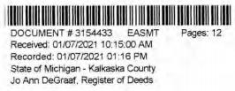
SUPPLEMENT NO. 19 TO AMENDED AND RESTATED EASEMENT AGREEMENT
THIS SUPPLEMENT NO. 19 TO AMENDED AND RESTATED EASEMENT AGREEMENT (“Supplement No. 19”) is made this 22 day of December 2020, between CONSUMERS ENERGY COMPANY (formerly known as Consumers Power Company), a Michigan corporation, (successor by merger to Consumers Power Company, a Maine corporation), One Energy Plaza, Jackson, Michigan 49201 (“Consumers”) and MICHIGAN ELECTRIC TRANSMISSION COMPANY, LLC, a Michigan limited liability company (successor by merger to Michigan Electric Transmission Company, a Michigan corporation), 27175 Energy Way, Novi, Michigan 48377 (“METC”).
RECITALS:
| A. | Consumers and METC entered into a certain Easement Agreement dated April 1, 2001 whereunder Consumers granted an “Easement” (as therein defined) to METC in respect to certain “Premises” in the State of Michigan for the use set forth therein and on and subject to all of the terms and conditions set forth therein. |
| B. | Consumers and METC agreed on certain revisions to the terms and conditions of said Easement Agreement, and for ease of reference, restated said Easement Agreement in its entirety, to include all of said agreed-upon revisions as well as all unchanged provisions, in a certain Amended and Restated Easement Agreement dated as of April 29, 2002 (the “Agreement”). |
| C. | The “Premises” under the Agreement are therein defined as (a) the lands identified as “fee lands” in Part “I” of Exhibit A, attached to the Agreement, (b) the lands covered by the easements held by Consumers that are identified in Part “II” of Exhibit A, attached to the Agreement, and (c) the lands covered by the leases, permits and licenses held by Consumers that are identified in Part ‘”III” of Exhibit A, attached to the Agreement; as said Parts I, II and III of Exhibit A were supplemented or modified in a certain Supplement No. 1 dated April 29, 2002, in a certain Supplement No. 2 dated April 29, 2002, in a certain Supplement No. 3 dated March 3, 2003, in a certain Supplement No. 4 dated October 2, 2006, in a certain Supplement No. 5 dated August 3, 2007, in a certain Supplement No. 6 dated June 18, 2008, in a certain Supplement No. 7 dated September 18, 2008, in a certain Supplement No. 8 dated December 4, 2008, in a certain Supplement No. 9 dated February 22, 2010, in a certain Supplement No. 10 dated March 25, 2010, in a certain Supplement No. 11 dated October 2011, in a certain Supplement No. 12 dated July 20, 2012, in a certain Supplement No. 13 dated August 21, 2012, in a certain Supplement No. 14 dated September 23, 2013, in a certain Supplement No. 15 dated January 2014, in a certain Supplement No. 16 dated January 31, 2017, in a certain Supplement No. 17 dated September 25, 2019, and in a certain Supplement No. 18 dated June 8, 2020, heretofore entered into by Consumers and METC. The parties now desire to further supplement and modify said Exhibit A to the Agreement as set forth herein below. |
| D. | References, in regard to historical matters, to “METC” in the foregoing recitals will be deemed to mean METC’s predecessor, Michigan Electric Transmission Company, a Michigan corporation, where relevant. |
NOW, THEREFORE, for good and valuable consideration, the receipt of which is acknowledged, Consumers and METC agree as follows:
| 1. | Exhibit A to the Agreement, as heretofore supplemented and/or modified, is hereby further supplemented and modified as set forth in “Nineteenth Supplemental Exhibit A”, attached hereto. |
It is expressly understood that any lands, easements, or leases/permits/licenses that are indicated in said attached Nineteenth Supplemental Exhibit A as being added are, on and subject to the terms and conditions of the Agreement (as supplemented and amended by this Supplement No. 19), hereby deemed added to Part I, Part II and Part III, respectively, of Exhibit A to the Agreement. However, it is further expressly understood that in addition to all rights granted to METC by the Agreement, METC shall have the following rights as to the lands identified as “Consumers Energy Equipment / Joint Asset Area Easement” on the accompanying NINETEENTH Supplemental Exhibit A sheets, inclusive of Parts I, II and III, which rights are also subject to the terms of the Parties’ Amended and Restated Transmission Interconnection Agreement (the “DTIA”): (a) the right to maintain any and all existing components of the Transmission System, as defined in the DTIA, and wiring or conduit connections for the same that currently exist over, on or under these lands; and (b)the right to connect its currently sited or future approved wiring or conduits for communications, station power, or control, operating at 600 volts or less, and any Jointly Owned Assets, as defined in the DTIA, over, on or under these lands.
It is also expressly understood that, with respect to any lands, easements, or leases/permits/licenses now covered by Part I, Part II or Part III of Exhibit A that are indicated in said attached Nineteenth Supplemental Exhibit A as being deleted, the Easement is hereby deemed RELEASED with respect thereto and the Agreement shall hereafter no longer apply thereto (provided, however, that all rights and obligations under the Agreement with respect to periods prior to the date of this Supplement No. 19 shall remain unaffected).
| 2. | It is expressly understood and agreed that in respect to the additional Premises represented by the land(s), easement(s), lease(s), permit(s) and/or license(s) that are added to Part I, Part II and Part III of Exhibit A to the Agreement pursuant to this Supplement No. 19 (the “Additional Premises”): |
| (a) | All references to “Commencement Date” that are found in Article 1 (“Grant of Easement”), Article 2 (“Term”), Article 5 (“Additions/Alterations”), Article 6 (“Consumers’ Reserved Rights to Use the Premises and Transmission Facilities”), Article 7 (“METC Approval of Compatible Uses”), Article 8 (“Certain Obligations of Consumers and Authorized Users; Etc.”) and Article 14 (“Environmental Matters”) of the Agreement shall be deemed to mean the date of this Supplement No. 19 and not the date that is identified in the Agreement as the “Commencement Date”. |
| (b) | Except as expressly otherwise indicated in the immediately following sentence, all references to “Restated Agreement Date” that are found in Article 1 (“Grant of Easement”) , Article 6 (“Consumers’ Reserved Rights to Use the Premises and Transmission Facilities”), and Article 12 (“Compliance With Applicable Laws”) of the Agreement shall also be deemed to mean the date of this Supplement No. 19 and not the date that is identified in the Agreement as the “Restated Agreement Date”. Notwithstanding the foregoing: |
| (i) | the preceding sentence does not apply to the purely historical statement in clause “(c)” of Section 1.2 of the Agreement that Trans–Elect, Inc. is “an affiliate of the entity which has become METC’s parent company as of the Restated Agreement Date”; and |
| (ii) | the parenthetical in the first sentence of the first paragraph of Section 7.1 of the Agreement reading “(see below regarding a certain period prior to the Restated Agreement Date)”, along with the fourth paragraph of said Section 7.1 reading “Consumers shall submit to METC within twenty (20) days of the Restated Agreement Date a list of all material Compatible Uses other than additions or modifications to Distribution Facilities that have been authorized between February 1, 2001 and the Restated Agreement Date for METC’s approval per the METC Compatible Use approval process described in this Section 7.1.”, both referred to a one-time historical matter and have no application to the Additional Premises or any other further effect or application whatsoever. |
| 3. | In addition to the original Transmission Facilities and Additions/Alterations thereto as referred to in Recital “A” of the Agreement, it is understood that such electric Transmission towers, pole structures, poles, crossarms, wires, cables, conduits, guys, anchors, transformers, insulators and/or other fixtures and equipment as may be owned by METC and located on the Additional Premises as of the date of this Supplement No. 19, and future Additions/Alternations made thereto on and subject to the terms and conditions of the Agreement, are included in the “Transmission Facilities” under the Agreement. |
Note: This Supplement No. 19 will not be recorded in all counties in which the Agreement itself, or Supplements Nos. 1 through 18, may have been recorded. This Supplement No. 19 (as were each of Supplements Nos. 1 through 18), will be recorded only in the county(ies) in which relevant Premises are located; being, in the case of this Supplement No. 19, only the following:
Allegan County
Antrim County
Barry County
Bay County
Calhoun County
Charlevoix County
Clinton County
Crawford County
Emmet County
Genesee County
Gladwin County
Grand Traverse County
Gratiot County
Ingham County
Ionia County
Isabella County
Jackson County
Kalkaska County
Kent County
Leelanau County
Lenawee County
Manistee County
Midland County
Montcalm County
Muskegon County
Oceana County
Ogemaw County
Ottawa County
Roscommon County
Saginaw County
Shiawassee County
St. Joseph County
Washtenaw County
Wexford County
The fact that this Supplement No. 19 will be recorded only in the particular county(ies) identified above will in no way restrict, limit or otherwise affect the interpretation, application or enforcement of the Agreement; and the terms and conditions of the Agreement shall at all times be read, interpreted and applied in the manner provided for in Section 24.6 of the Agreement.
IN WITNESS WHEREOF, Consumers and METC have executed this Supplement No. 19 as of the date first above written.
CONSUMERS ENERGY COMPANY, a Michigan corporation
| By | /s/ Mary Anne Marr | |
| | Mary Anne Marr | |
| | Director or Real Estate | |
The foregoing instrument was acknowledged before this 22 day of December, 2020, by Mary Anne Marr, Director of Real Estate of CONSUMERS ENERGY COMPANY, a Michigan corporation, on behalf of the corporation.
 | /s/ Julie C. Guinn |
| | |
| | Notary Public, Jackson County, Michigan |
| | Acting in Jackson County, Michigan |
| | My commission Expires: 12/29, 2020 |
MICHIGAN ELECTRIC TRANSMISSION COMPANY, LLC, a Michigan limited liability company
| By: | ITC Holdings Corp., a Michigan corporation, its manager | |
| By: | /s/ Jean Kim D’ Anna | |
| | Jean Kim D’ Anna | |
| | Vice President and Deputy General Counsel – Legal Services | |
| STATE OF MICHIGAN | ) | |
| | ) | SS. |
| COUNTY OF | Oakland | ) | |
The foregoing instrument was acknowledged before this 16 day of December 2020, by Jean Kim D’ Anna, Vice President and Deputy General Counsel of ITC Holdings Corp., a Michigan corporation, as manager of MICHIGAN ELECTRIC TRANSMISSION COMPANY, LLC, a Michigan limited liability company, on behalf of the limited liability company.
| LAURA J. MCCRAY | |
| NOTARY PUBLIC, STATE OF MI | /s/ Laura J. McCray |
| COUNTY OF OAKLAND | |
| MY COMMISSION EXPIRES Jul 30, 2021 | |
| ACTING IN COUNTY OF Oakland | Notary Public Oakland County, Michigan |
| | Acting in Oakland County, Michigan |
| | My Commission Expires: __7/30/21 , 2020 |
Exempt from transfer taxes per MCL §§ 207.505(f) and 207.526(f).
| Prepared by: Tracy L. VanWoert | | Return to: Julie Guinn |
| Consumers Energy Company | | Consumers Energy Company |
| EP7–447 | | |
| One Energy Plaza | | |
| Jackson, Michigan 49201 | | |
THE ATTACHED COPY OF THE NINETEENTH SUPPLEMENTAL EXHIBIT A THAT WAS PREPARED FOR RECORDATION IN KALKASKA COUNTY, MICHIGAN, AND CONTAINS THE PORTIONS OF EACH OF PARTS I, II, AND III OF THE NINETEENTH SUPPLEMENT EXHIBIT A THAT RELATE TO PREMISES IN THAT COUNTY ONLY. SEE SECTION 24.6 OF THE AGREEMENT.
NINETEENTH SUPPLEMENTAL EXHIBIT A
See sheet(s) labeled “NINETEENTH Supplemental Exhibit A-Part I”, attached hereto and made a part hereof. Said attached sheet(s) labeled NINETEENTH Supplemental Exhibit A-Part I consist of the following:
3 Pages for Allegan County
6 Pages for Antrim County
2 Pages for Barry County
2 Pages for Bay County
13 Pages for Calhoun County
2 Pages for Charlevoix County
6 Pages for Clinton County
4 Pages for Crawford County
7 Pages for Genesee County
1 Page for Gladwin County
6 Pages for Grand Traverse County
1 Page for Gratiot County
2 Pages for Ingham County
2 Pages for Ionia County
1 Page for Isabella County
2 Pages for Jackson County
1 Page for Kalkaska County
4 Pages for Kent County
1 Page for Leelanau County
3 Pages for Lenawee County
2 Pages for Manistee County
4 Pages for Midland County
1 Page for Montcalm County
17 Pages for Muskegon County
1 Pages for Oceana County
1 Page for Ogemaw County
4 Pages for Ottawa County
3 Pages for Roscommon County
2 Pages for Saginaw County
3 Pages for Shiawassee County
1 Page for St. Joseph County
3 Pages for Washtenaw County
2 Pages for Wexford County
Nineteenth Supplemental Exhibit A –
Introductory Page 1 of 2
See sheet(s) labeled “NINETEENTH Supplemental Exhibit A–Part II”, attached hereto and made a part hereof. Said attached sheet(s) labeled NINETEENTH Supplemental Exhibit A–Part II consist of the following:
1 Page for Allegan County
5 Pages for Antrim County
4 Pages for Barry County
1 Pages for Bay County
9 Pages for Calhoun County
4 Pages for Charlevoix County
9 Pages for Clinton County
2 Pages for Crawford County
6 Pages for Emmet County
8 Pages for Genesee County
3 Pages for Gladwin County
1 Page for Grand Traverse County
1 Page for Ingham County
6 Pages for Ionia County
5 Pages for Isabella County
1 Page for Kalkaska County
1 Page for Kent County
2 Pages for Leelanau County
3 Pages for Lenawee County
3 Pages for Manistee County
12 Pages for Midland County
1 Page for Montcalm County
5 Pages for Muskegon County
1 Page for Ogemaw County
4 Pages for Roscommon County
2 Pages for Shiawassee County
1 Page for St. Joseph County
2 Pages for Washtenaw County
| III. | Leases, Permits and Licenses: |
See sheet(s) labeled “NINETEENTH Supplemental Exhibit A–Part III”, attached hereto and made a part hereof. Said attached sheet(s) labeled Nineteenth Supplemental Exhibit A–Part III consist of the following:
NA
Nothing in this NINETEENTH Supplemental Exhibit A shall be deemed to affect, limit or waive any of the provisions of Sections 1.2 (“Title Limitations”) and 1.3 (“No Warranties”) of the Agreement.
Nineteenth Supplemental Exhibit A –
Introductory Page 2 of 2
SUPPLEMENTAL 19 EXHIBIT A – PART I
KALKASKA COUNTY
ADD THE FOLLOWING LAND DESCRIPTIONS:
1–E129–8, Line 114R
A strip of land 72 feet in width being 36 feet on each side of the centerline of an existing electric line, known as line segment HR, as currently located and running in an Easterly and Westerly direction to the center of the Substation Rack, across a parcel of land described as: The East 660.0 feet to the North 440.0 feet of the Northeast 1/4 of Section 12, Town 28 North, Range 8 West, Clearwater Township, Kalkaska County.
Note: It is understood that a portion of the above–described strip of land lies within the fenced premises of Consumers Clearwater Substation, in the Northeast 1/4 of Section 12, Town 28 North, Range 8 West. It is also understood that an electric line, which is part of METC’s Transmission Facilities covered by this Agreement and is located on said strip of land, presently connects to the substation within said fenced area; but that no part of the substation itself, or its associated structures and facilities is part of METC's Transmission Facilities covered by this Agreement. With respect to that portion of the above–described strip of land that is within said substation fence (as now or hereafter existing), it is expressly understood, any other provision of this Agreement notwithstanding, that unless otherwise expressly approved in writing by Consumers, METC shall make no entry thereon and shall have no right to authorize others to enter thereon; and METC shall make separate arrangements and agreements with Consumers regarding the performance of any work on the portion of METC's Transmission Facilities located therein.
Nineteenth Supplemental Exhibit A–Part I, Kalkaska County, Page 1
NINETEENTH SUPPLEMENTAL EXHIBIT A - PART II
KALKASKA COUNTY
| Legacy Tract | Liber/Page | Grantor | Grantee | Date of | County | City/Township | Town | Range | Section |
| No | | | | | Inst. | | | | | |
| 643–D114–9 | L124, | P87 | Spruce & Pine, Inc | Consumers Power
Company | 12/7/1971 | Kalkaska
County | Clearwater
Township | T28N | R8W | 12 |
| 644–D114–10 | L123, | P646 | Joseph J. Penjak and
Mary J. Penjak,
husband and wife | Consumers Power
Company | 1/24/1972 | Kalkaska
County | Clearwater
Township | T28N | R8W | 12 |
Nineteenth Supplemental Exhibit A–Part II, Kalkaska County, Page 1
NINETEENTH SUPPLEMENTAL EXHIBIT A - PART III
KALKASKA COUNTY
| CE Ref. | License/Lessor | Licensee/Lessee | Date of | Title of Instrument | Town/Range |
| | | | Instrument | | Section |
| | | | | | |
| | | | NONE | | |
Nineteenth Supplemental Exhibit A–Part III, Kalkaska County, Page 1
| FEB D 2 2021 - -- ---- -- - 202102100016751 Total Pages: 15 02/10/2021 02:44 PM Fees: $30.00 Lisa Posthumus Lyons, County Clerk/Register ~uijhu~f rtilll11 11w1i 1111111111 11111111111111 111111111111111111111111111111111 SUPPLEMENT NO. 19 TO AMENDED AND RESTATED EASEMENT AGREEMENT THIS SUPPLEMENT NO. 19 TO ~J;_NDED AND RESF\~ED EASEMENT AGREEMENT ("Supplement No. 19") is made this ~ day of Wlf1~fl0,(' , 2020, between ~CONSUMERS ENERGY COMPANY (formerly known as Consumers Power Company), a Michigan corporation, (successor by merger to Consumers Power Company, a Maine corporation), One Energy Plaza, Jackson, Michigan 49201 ("Consumers") and MICHIGAN ELECTRIC TRANSMISSION COMPANY, LLC, a Michigan limited liability company (successor by merger to Michigan Electric Transmission Company, a Michigan corporation), 27175 Energy Way, Novi, Michigan 48377 ("METC"). RECITALS: A. Consumers and METC entered into a certain Easement Agreement dated April 1, 2001 whereunder Consumers granted an "Easement" (as therein defined) to METC in respect to certain "Premises" in the State of Michigan for the use set forth therein and on and subject to all of the terms and conditions set forth therein. B. Consumers and METC agreed on certain revisions to the terms and conditions of said Easement Agreement, and for ease of reference, restated said Easement Agreement in its entirety, to include all of said agreed-upon revisions as well as all unchanged provisions, in a certain Amended and Restated Easement Agreement dated as of April 29, 2002 (the "Agreement"). C. The "Premises" under the Agreement are therein defined as (a) the lands identified as "fee lands" in Part "I" of Exhibit A, attached to the Agreement, (b) the lands covered by the easements held by Consumers that are identified in Part "II" of Exhibit A, attached to.the Agreement, and ( c) the lands covered by the leases, permits and licenses held by Consumers that are identified in Part "III" of Exhibit A, attached to the Agreement; as said Parts I, II and III of Exhibit A were supplemented or modified in a certain Supplement No. 1 dated April 29, 2002, in a certain Supplement No. 2 dated April 29, 2002, in a certain Supplement No. 3 dated March 3, 2003, in a certain Supplement No. 4 dated October 2, 2006, in a certain Supplement No. 5 dated August 3, 2007, in a certain Supplement No. 6 dated June 18, 2008, in a certain Supplement No. 7 dated September 18, 2008, in a certain Supplement No. 8 dated December 4, 2008, in a certain Supplement No. 9 dated February 22, 2010, in a certain Supplement No. 10 dated March 25, 2010, in a certain Supplement No. 11 dated October 12, 2011, in a certain Supplement No. 12 dated July 20, 2012, in a certain Supplement No. 13 dated August 21, 2012, in a certain Supplement No. 14 dated September 23, 2013, in a certain Supplement No. 15 dated January 13, 2014, in a certain Supplement No. 16 dated January 31, 2017, in a certain Supplement No. 17 dated September 25, 2019, and in a certain Supplement No. 18 dated June 8, 2020, heretofore entered into by Consumers and· METC. The parties now desire to further supplement and modify said Exhibit A to the Agreement as set forth herein below. |
| 202102100016751 Page 2 of 15 2 D. References, in regard to historical matters, to "METC" in the foregoing recitals will be deemed to mean METC' s predecessor, Michigan Electric Transmission Company, a Michigan corporation, where relevant. NOW, THEREFORE, for good and valuable consideration, the receipt of which is acknowledged, Consumers and METC agree as follows: 1. Exhibit A to the Agreement, as heretofore supplemented and/or modified, is hereby further supplemented and modified as set forth in "Nineteenth Supplemental Exhibit A", attached hereto. 2. It is expressly understood that any lands, easements, or leases/permits/licenses that are indicated in said attached Nineteenth Supplemental Exhibit A as being added are, on and subject to the terms and conditions of the Agreement (as supplemented and amended by this Supplement No. 19), hereby deemed added to Part I, Part II and Part III, respectively, of Exhibit A to the Agreement. However, it is further expressly understood that in addition to all rights granted to METC by the Agreement, METC shall have the following rights as to the lands identified as "Consumers Energy Equipment/ Joint Asset Area Easement" on the accompanying NINETEENTH Supplemental Exhibit A sheets, inclusive of Parts I, II and III, which rights are also subject to the terms of the Parties' Amended and Restated Transmission Interconnection Agreement (the "DTIA"): (a) the right to maintain any and all existing components of the Transmission System, as defined in the DTIA, and wiring or conduit connections for the same that currently exist over, on or under these lands; and (b)the right to connect its currently sited or future approved wiring or conduits for communications, station power, or control, operating at 600 volts or less, and any Jointly Owned Assets, as defined in the DTIA, over, on or under these lands. It is also expressly understood that, with respect to any lands, easements, or leases/permits/licenses now covered by Part I, Part II or Part III of Exhibit A that are indicated in said attached Nineteenth Supplemental Exhibit A as being deleted, the Easement is hereby deemed RELEASED with respect thereto and the Agreement shall hereafter no longer apply thereto (provided, however, that all rights and obligations under the Agreement with respect to periods prior to the date of this Supplement No. 19 shall remain unaffected). It is expressly understood and agreed Premises represented by the land ( s) , and/ or license ( s) that are added to Exhibit A to the Agreement pursuant "Additional Premises"): that in respect to the additional easement (s), lease (s), permit (s) Part I, Part II and Part III of to this Supplement No. 19 ( the (a) All references to "Commencement Date" that are found in Article 1 ("Grant of Easement"), Article 2 ("Term"), Article 5 ("Additions/Alterations"), Article 6 ("Consumers' Reserved Rights to Use the Piemises and Transmission Facilities"), Article 7 ("METC Approval of Compatible Uses"), Article 8 ("Certain Obligations of Consumers and Authorized Users; Etc.") and Article 14 ("Environmental Matters") of the Agreement shall be deemed to mean the date of this Supplement No. 19 and not the date that is identified in the Agreement as the "Commencement Date". |
| 202102100016751 Page 3 of 15 3 (b) Except as expressly otherwise indicated in the immediately following sentence, all references to "Restated Agreement Date" that are found in Article 1 ("Grant of Easement"), Article 6 ("Consumers' Reserved Rights to Use the Premises and Transmission Facilities"), and Article 12 ("Compliance With Applicable Laws") of the Agreement shall also be deemed to mean the date of this Supplement No. 19 and not the date that is identified in the Agreement as the "Restated Agreement Date". Notwithstanding the foregoing: (i) the preceding sentence does not apply to the purely historical statement in clause "(c)" of Section 1. 2 of the Agreement that Trans-Elect, Inc. is "an affiliate of the entity which has become METC's parent company as of the Restated Agreement Date"; and (ii) the parenthetical in the first sentence of the first paragraph of Section 7.1 of the Agreement reading "(see below regarding a certain period prior to the Restated Agreement Date)", along with the fourth paragraph of said Section 7.1 reading "Consumers shall submit to METC within twenty ( 20) days of the Restated Agreement Date a list of all material Compatible Uses other than additions or modifications to Distribution Facilities that have been authorized between February 1, 2001 and the Restated Agreement Date for METC's approval per the METC Compatible Use approval process described in this Section 7.1.", both referred to a one-time historical matter and have no application to the Additional Premises or any other further effect or application whatsoever. 3. In addition to the original Transmission Facilities and Additions/Alterations thereto as referred to in Recital "A" of the Agreement, it is understood that such electric Transmission towers, pole structures, poles, crossarms, wires, cables, conduits, guys, anchors, transformers, insulators and/or other fixtures and equipment as may be owned by METC and located on the Additional Premises as of the date of this Supplement No. 19, and future Additions/Alternations made thereto on and subject to the terms and conditions of the Agreement, are included in the "Transmission Facilities" under the Agreement. Note: This Supplement No. 19 will not be recorded in all counties in which the Agreement itself, or Supplements Nos. 1 through 18, may have been recorded. This Supplement No. 19 (as were each of Supplements Nos. 1 through 18), will be recorded only in the county(ies) in which relevant Premises are located; being, in the case of this Supplement No. 19, only the following: |

| Allegan County Antrim County Barry County Bay County Calhoun County Charlevoix County Clinton County Crawford County Emmet County Genesee County Gladwin County Grand Traverse County Gratiot County Ingham County Ionia County Isabella County Jackson County Kalkaska County Kent County Leelanau County Lenawee County Manistee County Midland County Montcalm County Muskegon County Oceana County Ogemaw County Ottawa County Roscommon County Saginaw County Shiawassee County St. Joseph County Washtenaw County Wexford County 202102100016751 Page 4 of 15 4 The fact that this Supplement No. 19 will be recorded only in the particular county(ies) identified above will in no way restrict, limit or otherwise affect the interpretation, application or enforcement of the Agreement; and the terms and conditions of the Agreement shall at all times be read, interpreted and applied in the manner provided for in Section 24.6 of the Agreement. |
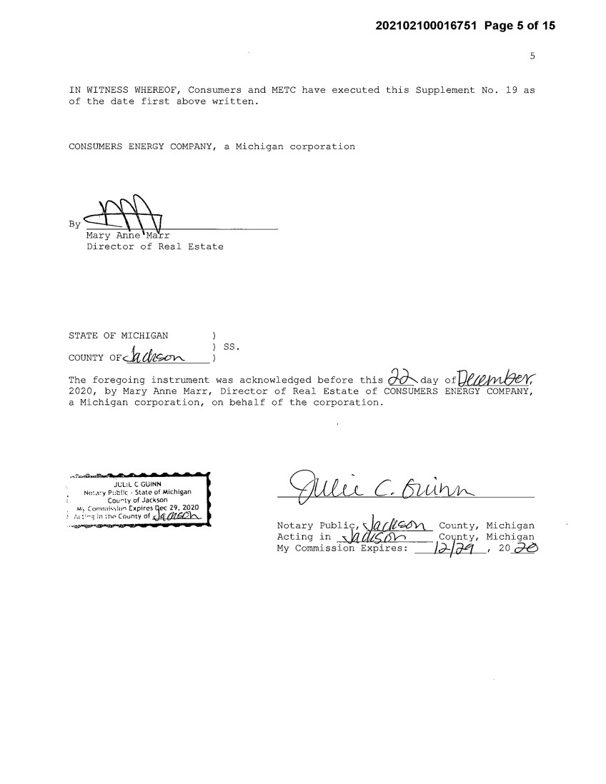
| 202102100016751 Page 5 of 15 5 IN WITNESS WHEREOF, Consumers and METC have executed this Supplement No. 19 as of the date first above written. CONSUMERS ENERGY COMPANY, a Michigan corporation By~r Director of Real Estate STATE OF MICHIGAN COUNTY OFc..k&~ ss. The foregoing instrument was acknowledged before this ~day off}e~ 2020, by Mary Anne Marr, Director of Real Estate of CONSUMERS ENERGY COMPANY, a Michigan corporation, on behalf of the corporation. JL;L:L C GUINN No:,icy P::hi:c - State of Michigan Cou~ty of Jackson M·, Comrnis,:o" Expires qec 29, 2020 :., :'"'i :n ;!1;• County of .J'b{IJGZ)b ... ~ .. - <j}ulu C 6uAVw-_ Not~ry ~ublic, ~~G6'v\. County, Michigan Acting in :s,.¼{ {1)~ County, Michigan My Commission Expires: _ _,_/~J---+-/-aVf___,__, 20~ I |
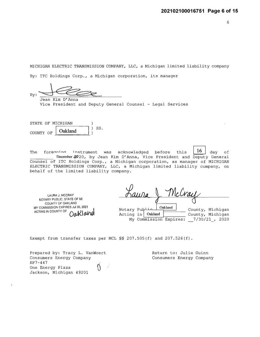
| 202102100016751 Page 6 of 15 6 MICHIGAN ELECTRIC TRANSMISSION COMPANY, LLC, a Michigan limited liability company By: ITC Holdings Corp., a Michigan corporation, its manager By: Jean Kim D'Anna Vice President and Deputy General Counsel - Legal Services STATE OF MICHIGAN COUNTY OF I Oakland ss. The forerrni nrr i n.c;trument was acknowledged before this I 16 I day of Decemher ao20, by Jean Kim D' Anna, Vice President and Deputy General Counsel of ITC Holdings Corp., a Michigan corporation, as manager of MICHIGAN ELECTRIC TRANSMISSION COMPANY, LLC, a Michigan limited liability company, on behalf of the limited liability company. LAURA J. MCCRAY NOTARY PUBLIC, STATE OF Ml COUNTY OF OAKLAND MY COMMISSION EXPIRES Jul 30, 2021. J ACTING IN COUNTY OF Oo.-l< l ~ Notary Acting My Pu,H c I Oakl~d I in Oakland I Commission Expires: County, Michigan County, Michigan 7/30/21, 2020 Exempt from transfer taxes per MCL §§ 207.505(f) and 207.526(f). Prepared by: Tracy L. Vanwoert Consumers Energy Company EP7-447 One Energy Plaza Jackson, Michigan 49201 Return to: Julie Guinn Consumers Energy Company |

| 202102100016751 Page 7 of 15 THE ATTACHED COPY OF THE NINETEENTH SUPPLEMENTAL EXHIBIT A THAT WAS PREPARED FOR RECORDATION IN KENT COUNTY, MICHIGAN, AND CONTAINS THE PORTIONS OF EACH OF PARTS I, II, AND III OF THE NINETEENTH SUPPLEMENT EXHIBIT A THAT RELATE TO PREMISES IN THAT COUNTY ONLY. SEE SECTION 24.6 OF THE AGREEMENT. 7 |
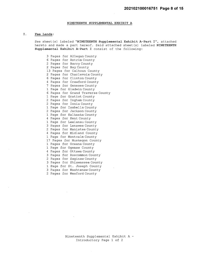
| 202102100016751 Page 8 of 15 NINETEENTH SUPPLEMENTAL EXHIBIT A I. Fee Lands : See sheet(s) labeled "NINETEENTH Supplemental Exhibit A-Part I", attached hereto and made a part hereof. Said attached sheet(s) labeled NINETEENTH Supplemental Exhibit A-Part I consist of the following: 3 Pages for Allegan County 6 Pages for Antrim County 2 Pages for Barry County 2 Pages for Bay County 13 Pages for Calhoun County 2 Pages for Charlevoix County 6 Pages for Clinton County 4 Pages for Crawford County 7 Pages for Genesee County 1 Page for Gladwin County 6 Pages for Grand Traverse County 1 Page for Gratiot County 2 Pages for Ingham County 2 Pages for Ionia County 1 Page for Isabella County 2 Pages for Jackson County 1 Page for Kalkaska County 4 Pages for Kent County 1 Page for Leelanau County 3 Pages for Lenawee County 2 Pages for Manistee County 4 Pages for Midland County 1 Page for Montcalm County 17 Pages for Muskegon County 1 Pages for Oceana County 1 Page for Ogemaw County 4 Pages for Ottawa County 3 Pages for Roscommon County 2 Pages for Saginaw County 3 Pages for Shiawassee County 1 Page for St. Joseph County 3 Pages for Washtenaw County 2 Pages for Wexford County Nineteenth Supplemental Exhibit A - Introductory Page 1 of 2 |
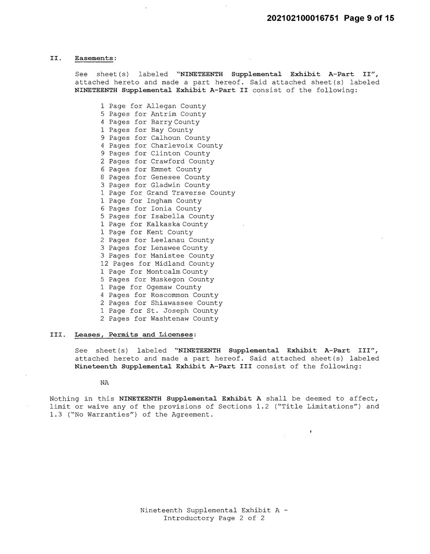
| 202102100016751 Page 9 of 15 II. Easements: See sheet(s) labeled "NINETEENTH Supplemental Exhibit A-Part II", attached hereto and made a part hereof. Said attached sheet(s) labeled NINETEENTH Supplemental Exhibit A-Part II consist of the following: 1 Page for Allegan County 5 Pages for Antrim County 4 Pages for Barry County 1 Pages for Bay County 9 Pages for Calhoun County 4 Pages for Charlevoix County 9 Pages for Clinton County 2 Pages for Crawford County 6 Pages for Emmet County 8 Pages for Genesee County 3 Pages for Gladwin County 1 Page for Grand Traverse County 1 Page for Ingham County 6 Pages for Ionia County 5 Pages for Isabella County 1 Page for Kalkaska County 1 Page for Kent County 2 Pages for Leelanau County 3 Pages for Lenawee County 3 Pages for Manistee County 12 Pages for Midland County 1 Page for Montcalm County 5 Pages for Muskegon County 1 Page for Ogemaw County 4 Pages for Roscommon County 2 Pages for Shiawassee County 1 Page for St. Joseph County 2 Pages for Washtenaw County III. Leases, Permits and Licenses: See sheet(s) labeled "NINETEENTH Supplemental Exhibit A-Part III", attached hereto and made a part hereof. Said attached sheet(s) labeled Nineteenth Supplemental Exhibit A-Part III consist of the following: NA Nothing in this NINETEENTH Supplemental Exhibit A shall be deemed to affect, limit or waive any of the provisions of Sections 1.2 ("Title Limitations") and 1.3 ("No Warranties") of the Agreement. Nineteenth Supplemental Exhibit A - Introductory Page 2 of 2 |
| 202102100016751 Page 1 0 of 15 SUPPLEMENTAL 19 EXHIBIT A - PART I KENT COUNTY ADD THE FOLLOWING LAND DESCRIPTIONS: 1-E176-21, Line 68K A strip of land 72 feet in width being 36 feet on each side of the centerline of an existing electric line, known as line segment 68K, as currently located and running in a Northerly and Southerly direction to the center of the Substation Rack, across a parcel of land described as: A parcel of land in the West 1/2 of the Southeast 1/4 of Section 13, Town 5 North, Range 11 West, Township of Gaines, County of Kent and State of Michigan, lying Southwesterly of the former Penn Central railroad, and being more particularly described as follows: To find the place of beginning of this description, commence at the South 1/4 corner of said Section 13; thence North 0°11'30" West along the North and South 1/4 line of said Section, 1,671.91 feet to the place of beginning of this description; thence continuing North 0°11'30" West along the North and South 1/4 line of said Section, 971.77 feet to the East and West 1/4 line of said Section; thence South 89°04'48" East along the East and West 1/4 line of said Section, 668.38 feet to a point on the Southwesterly right of way line of the former Penn Central Railroad, said point being hereinafter referred to as "Point A"; thence South 41°55'27" East along the Southwesterly right of way line of said former railroad, 975.09 feet to the East 1/8 line of said Section; thence South 0°09'52" East along the East 1/8 line of said Section, 268.81 feet; thence North 88°33'12" West, 1,317.81 feet to the place of beginning. ALSO, a parcel of land in the West 1/2 of the Southeast 1/4 of said Section 13, Town 5 North, Range 11 West, lying Northeasterly of the former Penn Central Railroad, and being more particularly described as follows: To find the place of beginning of this description, commence at the aforementioned "Point"; thence South 89°04'48" East along the East and West 1/4 line of said Section, 136.38 feet to the Northeasterly right of way line of the former Penn Central Railroad and the place of beginning of this description; thence continuing South 89°04'48" East along the East and W~st 1/4 line of said Section, 513.15 feet to the East 1/8 line of said Section; thence South 0°09'52" East along said East 1/8 line, 564.93 feet to the Northeasterly right of way line of said former railroad; thence North 41°55'27" West along the Northeasterly right of way line of said former railroad, 770.35 feet to the place of beginning. Bearings are based on the South line of the Southwest 1 / 4 of Section 13 being assumed as North 89°09'40" West. Note: It is understood that a portion of the above-described strip of land lies within the fenced premises of Consumers Gaines Substation, in the Southeast 1/4 of Section 13, Town 5 North, Range 11 West. It is also understood that an electric line, which is part of METC's Transmission Facilities covered by this Agreement and is located on said strip of land, presently connects to the substation within said fenced area; but that no part of the substation itself, or its associated structures and facilities is part of METC's Transmission Facilities covered by this Agreement. With respect to that portion of the above-described strip of land that is within said substation fence (as now or hereafter existing), it is expressly understood, any other provision of this Agreement notwithstanding, that unless otherwise expressly approved in writing by Consumers, METC shall make no entry thereon and shall have no right to authorize others to enter thereon; and METC shall make separate arrangements and agreements with Nineteenth Supplemental Exhibit A-Part I, Kent County, Page 1 |
| 202102100016751 Page11 of15 Consumers regarding the performance of any work on the portion of METC's Transmission Facilities located therein. 3-E176-25, Line 68K A strip of land 72 feet in width being 36 feet on each side of the centerline of an existing electric line, known as line segment 68K, as currently located and running in a Northerly and Southerly direction to the center of the Substation Rack, across a parcel of land described as: A parcel of land in the West 1/2 of the Northeast 1/4 of Section 13, Town 5 North, Range 11 West, Township of Gaines, County of Kent, and State of Michigan, described as commencing at the North 1/4 corner of said Section 13; thence South 00°11'13" East 1930.18 feet along the North-South 1/4 line to the Southwesterly line of the former Penn Central Railroad and the point of beginning of this description; thence continuing South 00°11'13" East 736.12 feet along said North-South 1/4 line to the center of said Section 13; thence South 89°04'48" East 668.38 feet along the East-West 1/4 line to the Southwesterly line of the former Penn Central Railroad; thence North 41°55'27" West 1003.79 feet along said Southwesterly line to the point of beginning. Note: It is understood that a portion of the above-described strip of land lies within the fenced premises of Consumers Gaines Substation, in the Northeast 1/4 of Section 13, Town 5 North, Range 11 West. It is also understood that an electric line, which is part of METC's Transmission Facilities covered by this Agreement and is located on said strip of land, presently connects to the substation within said fenced area; but that no part of the substation itself, or its associated structures and facilities is part of METC's Transmission Facilities covered by this Agreement. With respect to that portion of the above-described strip of land that is within said substation fence (as now or hereafter existing), it is expressly understood, any other provision of this Agreement notwithstanding, that unless otherwise expressly approved in writing by Consumers, METC shall make no entry thereon and shall have no right to authorize others to enter thereon; and METC shall make separate arrangements and agreements with Consumers regarding the performance of any work on the portion of METC's Transmission Facilities located therein. Nineteenth Supplemental Exhibit A-Part I, Kent County, Page2 |
| 202102100016751 Page12of15 1-El57-19, Line 2P A strip of land 72 feet in width being 36 feet on each side of the centerline of an existing electric line, known as line segment 2P, as currently located and running in a Northerly and Southerly and Easterly and Westerly direction to the center of the Substation Rack, across a parcel of land described as: Land in the Township of Cannon, Kent County, Michigan, and described as follows, to wit: All that part of the North 200 feet of the South 400 feet of the Northwest 1/4 of Section 6, Town 8 North, Range 10 West, lying Easterly of the Easterly line of the right of way of old US-131, excepting therefrom the East 1250 feet; described as follows: To find the place of beginning of this description, commence at the West 1/4 corner of said Section; run thence North 88°29'38" East along the East and West 1/4 line of said Section 1604.19 feet to the West line of the East 1250 feet of the Northwest 1/4 of said Section; thence North along said West line of the East 1250 feet of the Northwest 1/4 of said Section 200.00 feet to the place of beginning of this description; thence continuing North along said West line of the East 1250 feet of the Northwest 1/4 of said Section 200.00 feet to the North line of the South 400 feet of the Northwest 1/4 of said Section; thence South 88°29'38" West along said North line of the South 400 feet of the Northwest 1/4 of said Section 1285.49 feet to the Easterly right of way line of said old US-131 as fenced; thence Southerly along said Easterly right of way line on a curve to the left, said curve having a radius of 5579.65 feet and a chord bearing South 03°27'50" West, a distance of 200.69 feet along said chord to the North line of the South 200 feet of the Northwest 1/4 of said Section; thence North 88°29'38" East along said North line of the South 200 feet of the Northwest 1/4 of said Section 1297.62 feet to the place of beginning. Note: It is understood that a portion of the above-described strip of land lies within the fenced premises of Consumers Cannon Substation, in the Northwest 1/4 of Section 6, Town 8 North, Range 10 West. It is also understood that an electric line, which is part of METC's Transmission Facilities covered by this Agreement and is located on said strip of land, presently connects to the substation within said fenced area; but that no part of the substation itself, or its associated structures and facilities is part of METC's Transmission Facilities covered by this Agreement. With respect to that portion of the above-described strip of land that is within said substation fence (as now or hereafter existing), it is expressly understood, any other provision of this Agreement notwithstanding, that unless otherwise expressly approved in writing by Consumers, METC shall make no entry thereon and shall have no right to authorize others to enter thereon; and METC shall make separate arrangements and agreements with Consumers regarding the performance of any work on the portion of METC's Transmission Facilities located therein. Nineteenth Supplemental Exhibit A-Part I, Kent County, Page 3 |
| 202102100016751 Page13of15 1-E102-25, Line 2K A strip of land 72 feet in width being 36 feet on each side of the centerline of an existing electric line, known as line segment 2K, as currently located and running in an Easterly and Westerly direction to the center of the Substation Rack, across a parcel of land described as: A parcel of land in the Northeast 1/4 of the Northwest 1/4 of Section 7, Town 9 North, Range 11 West, Township of Algoma, County of Kent and State of Michigan, described as follows: To find the place of beginning of this description commence at the North 1/4 corner of said Section; run thence South 00°04'20" East along the North and South 1/4 line of said Section, 480.45 feet to the place of beginning of this description; thence continuing South 00°04'20" East along said North and South 1/4 line of said Section, 858.00 feet to the North 1/8 line of said Section; thence South 89°09'10" West along said North 1/8 line of said Section, 560.05 feet; thence North 00°04'20" West, 858.00 feet; thence North 89°09'10" East, 560.05 feet to the place of beginning. Note: It is understood that a portion of the above-described strip of land lies within the fenced premises of Consumers Algoma Substation, in the Northwest 1/4 of Section 7, Town 9 North, Range 11 West. It is also understood that an electric line, which is part of METC's Transmission Facilities covered by this Agreement and is located on said strip of land, presently connects to the substation within said fenced area; but that no part of the substation itself, or its associated structures and facilities is part of METC's Transmission Facilities covered by this Agreement. With respect to that portion of the above-described strip of land that is within said substation fence (as now or hereafter existing), it is expressly understood, any other provision of this Agreement notwithstanding, that unless otherwise expressly approved in writing by Consumers, METC shall make no entry thereon and shall have no right to authorize others to enter thereon; and METC shall make separate arrangements and agreements with Consumers regarding the performance of any work on the portion of METC's Transmission Facilities located therein. Nineteenth Supplemental Exhibit A-Part I, Kent County, Page 4 |
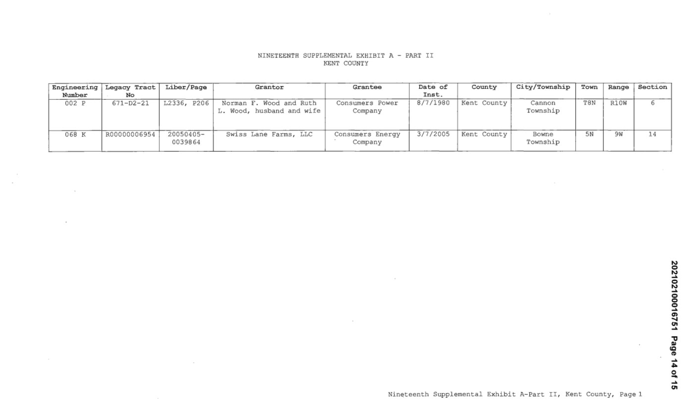
| Engineering Legacy Tract Liber/Page Nwnber No 002 p 671-D2-21 L2336, P206 068 K R00000006954 20050405- 00398 64 NINETEENTH SUPPLEMENTAL EXHIBIT A - PART II KENT COUNTY Granter Grantee Date of Inst. Norman F. Wood and Ruth Consumers Power 8/7/1980 L. Wood, husband and wife Company Swiss Lane Farms, LLC Consumers Energy 3/7/2005 Company County City/Township Town Range Section Kent County Cannon T8N Rl0W 6 Township Kent County Bowne SN 9W 14 Township Nineteenth Supplemental Exhibit A-Part II, Kent County, Page 1 N 0 N ..Jo. 0 N ..Jo. 0 0 0 ..Jo. a, ..... (11 ..Jo. "'tJ ~ cc ff) ..Jo. ..,::. 0 """ .Jo. (11 |
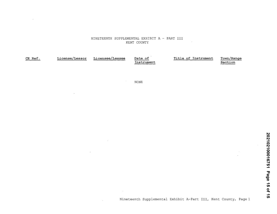
| CE Ref. LicenseLLessor NINETEENTH SUPPLEMENTAL EXHIBIT A - PART III KENT COUNTY Licensee/Lessee Date of Instrument NONE Title of Instrument Town/Range Section Nineteenth Supplemental Exhibit A-Part III, Kent County, Page 1 N 0 N ..Jo. 0 N ..Jo. 0 0 0 ..Jo. a, ..... (11 ..Jo. "'tJ ~ cc ff) ..Jo. (11 0 """ .Jo. (11 |
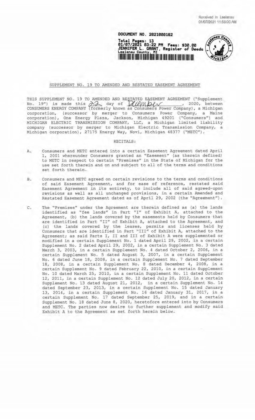
| Re.ce1 ved in Leelanau 01 JD7!2021 '11 .56:00 ,tl.J./i DOCUftENT NO. 2021000162 Tolal Pages: 13 01/07/2021 03:22 Pft Fees: $30.00 JENNIFER L. GRANT, Regisler of Deeds ~""' ~uo~11111i1~111i1t 1111f 1i11 1111111111111 111111 11111 1 1 111 1111 1111 SUPPLEMENT NO . 19 TO AMENDED AND RESTATED EASEMENT AGREEMENT THIS SUPPLEMENT N'O . 19 TO AMENDED AND RE=_ED E~MENT AGREEMENT ("Supplement No. 19") is made this ~ day of WJ3 JIJJI . Pd;,if , 2020, between CONSUMERS ENERGY COMPANY (formerly known as Consumers Power Company), a Michigan corporation, (successor by merger to Consumers Power Company, a Maine corporation) , One Energy Plaza, Jackson, Michigan 49201 ("Consumers" ) and MICHIGAN ELECTRIC TRANSMISSION COMPANY, LLC, a Michigan limited liability company ( successor by merger to Michigan Electric Transmission Company, a Michigan corporation) , 27175 Energy Way, Novi, Michigan 48377 ("METC") . RECITALS: A. Consumers and M ETC entered into a certain Easement Agreement dated April 1, 2001 whereunder Consumers granted an " Easement" (as therein defined) to METC in respect to certain "Premises" in the State of Michigan for the use set forth therein and on and subject to all of the terms and conditions set forth therein. B. Consumers and METC agreed on certain revisions to the terms and conditions of said Easement Agreement, and for ease of reference, restated said Easement Agreement in its entirety, to include all of said agreed-upon revisions as well as all unchanged provisions, in a certain Amended and Restated Easement Agreement dated as of April 29, 2002 (the ''Agreement") . C. The ''Premises" under the Agreement are therein defined as (a) the lands identified as "fee lands" in Part " I" of Exhibit A, attached to the Agreement, (b) t he lands covered by the easements held by Consumers that are identified in Part "II" of Exhibit A, attached to the Agreement, and (c) the lands covered by the leases, pe:r:mits and licenses held by Consumers that are identi f ied i n Part "III" of Exhibit A, attached to the Agreement; as said Parts I , II and III of Exhibit A were supplemented or modified in a cert ain Supplement No . 1 dated April 29, 2002, in a certain Supplement No. 2 dated April 29, 2002, in a certain Supplement No. 3 dated March 3, 2003, in a certain Supplement No. 4 dated October 2, 2006, in a certain Supplement No. S dated August 3, 2007 , in a certain Supplement No. 6 dated June 18, 2008, in a certain Suppl ement No. 7 dated September 18, 2008, in a certain Supplement No . 8 dated December 4 , 2008, in a certai n Supplement No. 9 dated February 22, 2010, in a certain Supplement No . 10 dated March 25, 2010, in a certain Supplement No . 11 dated October 12, 2011, in a certain Supplement No. 12 dated July 20, 2012, in a certain Supplement No . 13 dated August 21, 2012, in a certain Supplement No. 14 dated September 23, 2013, in a certain Supplement No. 15 dated January 13, 2014, in a certain Supplement No. 16 dated January 31, 2017, in a certain Supplement No. 17 dated September 25, 2019, and in a certain Supplement No. 18 dated June 8, 2020, heretofore entered into by Consumers and METC. The parties now desire to further supplement and modi fy said Exhibit A to the Agreement as set forth herein below. |
| 2 D. References, in regard to historical matters, to "METC" in the foregoing recitals will be deemed to mean METC' s predecessor, Michigan Electric Transmission Company, a Michigan corporation,. where relevant. NOW, THEREFORE, for good and valuable consideration, the receipt of which is acknowledged, Consumers and METC agree as follows : 1 . Exhibit A to the Agreement, as heretofore supplemented and/or modified, is hereby further supplemented and modified as set forth in "Nineteenth Supplemental Exhibit A" , attached hereto. It is expressly understood that any lands, easements, or leases/permits/licenses that are indicated in said attached Nineteenth Supplemental Exhibit A as being added are, on and subject to the terms and conditions of the Agreement (as supplemented and amended by this Supplement No . 19), hereby deemed added to Part I , Part II and Part III, respectively, of Exhibit A to the Agreement. However, it is further expressly understood that in addition to all rights granted to METC by the Agreement, METC shall have the fol l owing rights as to the lands identified as "Consumers Energy Equipment/ Joint Asset Area Easement" on the accompanying NINETEENTH Supplemental Exhibit A sheets, inclusive of Parts I, II and III, which rights are also subject to the terms of the Parties' Amended and Restated Transmission Interconnection Agreement (the "DTIA") : (a) the right to maintain any and all existing components of the Transmission System, as defined in the DTIA, and wiring or conduit connections for the same that currently exist over, on or under these lands; and (b)the right to connect its currently sited or future approved wiring or conduits for communications, station power, or control, operating at 600 volts or less, and any Jointly Owned Assets, as defined in the DT IA, over, on or under these lands. It is also expressly understood that, with respect to any lands, easements, or leases/permits/licenses now covered by Part I, Part II or Part I I I of Exhibit A that are indicated in sai d attached Nineteenth Supplemental Exhibit A as being del eted, the Easement is hereby deemed RELEASED with respect thereto and the Agreement shall hereafter no longer apply thereto (provided, however, that all rights and obligations under the Agreement with respect to periods prior to the date of this Supplement No . 19 shall remain unaffected) . 2 . It is expressly understood and agreed that in respect to t he addi t i onal Premises represented by the land(s) , easement(s) , lease(s) , permit(s) and/or license (s) that are added to Part I , Part II and Part III of Exhibit A to the Agreement pursuant to this Supplement No. 1 9 (the "Additional Premises") : {a) All references to "Commencement Date" that are found in Article 1 ( "Grant of Easement"), Article 2 (''Term"), Article 5 ("Additions/Alterations" ) , Article 6 ("Consumers' Reserved Rights to Use the Premises and Transmission Facilities"), Article 7 ("ME!l'C Approval of Compatib le Oses" ) , Article 8 ("Certain Obligations of Consumers and Authorized Users; Etc.") and Article 14 ("Environmental Matters") of the Agreement shall be deemed to mean the date of this Supplel!lent No . 19 and not the date that is identified in the Agreement as the "Commencement DateII. |

| 3 (b) Except as expressly otherwise indicated in the immediately following sentence, all references to "Restated Agreement Date" that are found in Article 1 ( "Grant of Easement"), Article 6 ("Consumers' Reserved Rights to Use the Premises and Transmission Facilities"), and Article 12 ("Compliance With Applicabl e Laws" ) of the Agreement shall also be deemed to mean the date of this Supplement No. 19 and not the date that is identified in the Agreement as the "Restated Agreement Date''_ Notwithstanding the foregoing: (i) the preceding sentence does not apply to the purely historical statement in clause "(c)" of Section L 2 of the Agreement that Trans-Elect, Inc. is "an affiliate of the entity which has become METC's parent company as of the Restated Agreement Date"; and (ii) the parenthetical in the first sentence of the first paragraph of Section 7 . 1 of the Agreement reading "(see below regarding a certain period prior to the Restated Agreement Date)", along with the fourth paragraph of said Section 7 . 1 reading "Consumers shall submit to METC within twenty (20) days of the Restated Agreement Date a list of a l l material Compatible Uses other than additions or modifications to Distribution Facilities that have been authorized between February 1, 2001 and the Restated Agreement Date for METC's approval per the METC Compatible Use approval process described in this Section 7 . 1 . N, both referred to a one-time historical matter and have no application to the Additional Premises or any other further effect or application whatsoever. 3 . In addition to the original Transmission Facilities and Addi t i ons/Alterations thereto as referred to in Recital "A" of the Agreement, it is understood that such electric Transmission towers, pole structures, poles, crossarms, wires, cables, conduits, guys, anchors, transformers, insulators and/or other fixtures and equipment as may be owned by METC and located on the Additional Premi ses as of the date of this Supplement No. 19, and future Additions/Alternations made thereto on and subject to the terms and conditions of the Agreement, are included in the "Transmission Facilities" under the Agreement . Note : This Supplement No. 19 will not be recorded in all counties in which t he Agreement itself, or Supplements Nos. 1 through 18, may have been recorded. This Supplement No . 19 (as were each of Supplements Nos. 1 through 18), will be recorded only in the county(ies) in which relevant Premises are located; being, in the case of this Supplement No. 19, only the following: |

| Allegan County Antrim County Barry County Bay County Calhoun County Charlevoix County Cl inton County Crawford County Emmet County Genesee County Gladwin County Grand Traverse County Gratiot County Ingham County Ionia County Isabella County Jackson County Kalkaska County Kent County Leelanau County Lenawee County Manistee County Midland County Montcalm County M uskegon County Oceana County Ogemaw County Ottawa County Roscommon County Saginaw County Shiawassee County St. Joseph County Washtenaw County Wex ford County 4 The fact that this Supplement No. 19 will be recorded only in the particular county(ies) identified above will in no way restrict, limit or otherwise affect the interpretation, application or enforcement of the Agreement; and the terms and conditions of the Agreement shall at a ll times be read, interpreted and applied in the manner provided for in Section 24 . 6 of the Agreement. |
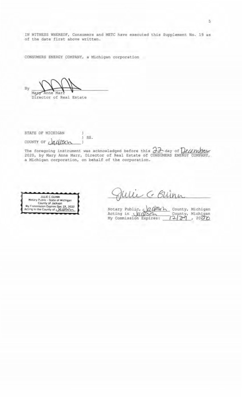
| 5 IN WITNESS WHEREOF , Consumers and METC have executed this Supplement No. 19 as of the da te first above written . CONSUMERS ENERGY COMPANY , a Michigan corporation ByM~ r Director of Real Estate STATE OF MICHIGAN COIJNT Y OF Jill~ ss. The foregoing instrument was acknowledged before this ~ day of ~{}'~ 2020, by Mary Anne Marr, Director of Real Esta e of CONSUMERS ENEGY COMPANY , a Michigan corporation, on behalf of the corporation. JULIE C GUINN Notary P'--blk • State of Michigan County of Jackson My. Co'."mission Expires jec. z;r 2020 11c: 1r,g in the County of c 'f. c;a""' Notary Publi.c,~f. (;/_~~ County, Acting in ~ ku: tCh, Cor nty' My Cornrnissior( Expires : /-;)__7i4 Michigan Michigan , 202Tb |
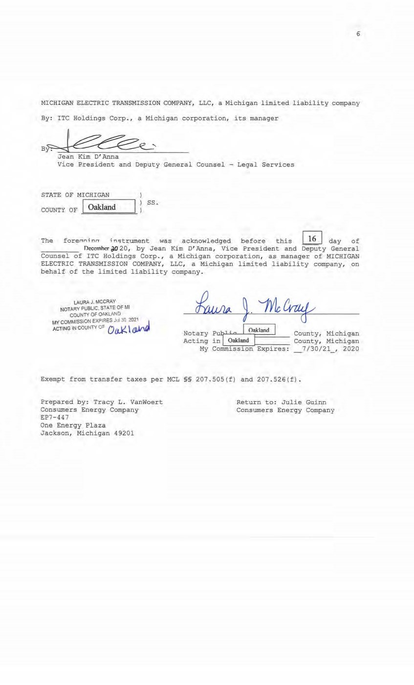
| 6 MICHIGAN ELECTRIC TRANSMISSION COMPANY, LLC1 a Michigan limited liability company By: ITC Holdings Corp., a Michigan corporation, its manager Jean Kim D'Anna Vice President and Deputy General Counsel - Legal Services STATE OF MICHIGAN COUNTY OF ..!=O =akl=an=d===--- ss. The forerrn; nrr ; n5trument was acknowledged before this I 1 6 I day of December ;J.O 20, by Jean Kim D' Anna, Vice President and Deputy General Counsel of ITC Holdings Corp., a Michigan corporation, as manager of MICHIGAN ELECTRIC TRANSMISSION COMPANY, LLC, a Michigan limited liability company, on behalf of the limited liability company. LAURA J. MCCRAY NOTARY PUBLIC, STATE OF Ml COUNTY OF OAKLAND MY COMMISSION EXPl~t:S Jul 30 2021_ j ACTING IN COUNTY O.- 0 [t,K \ (J)/VI, Notary Acting My p~r; Q I O,khrnd I in Oakland I Commission Expires: County, Michigan County, Michigan _7/30/21_ , 2020 Exempt from transfer taxes per MCL §§ 207.S0S(f) and 207 . 526(f). Prepared by: Tracy L . Vanwoert Consumers Energy Company EP7- 447 One Energy Plaza Jackson, Michigan 49201 Return to: Julie Guinn Consumers Energy Company |

| THE ATTACHED COPY OF THE NINETEENTH SUPPLEMENTAL EXHIBIT A THAT WAS PREPARED FOR RECORDATION IN LEELANAU COUNTY, MICHIGAN, AND CONTA1NS THE PORTIONS OF EACH OF PARTS I, II, AND III OF THE NINETEENTH SUP~LEMENT EXHIBIT A THAT RELATE TO PREMISES IN THAT COUNTY ONLY. SEE SECTION 24.6 OF THE AGREEMENT . 7 |
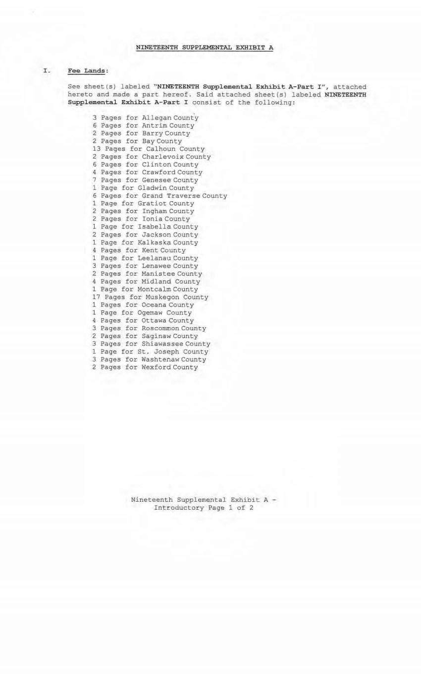
| NINETEENTH SUPPLEMENTAL EXHIBIT A I . Fee Lands : See sheet(s) labeled "NINETEENTH Supplemental Exhibit A- Part I " , attached hereto and made a part hereof. Said attached sheet(s) labeled NINETEENTH Supplemental Exhibit A-Part I consist of the following: 3 Pages for Allegan County 6 Pages for Antrim County 2 Pages for Barry County 2 Pages for Bay County 13 Pages for Calhoun County 2 Pages for Charlevoix County 6 Pages for Clinton County 4 Pages for Crawford County 7 Pages for Genesee County 1 Page for Gladwin County 6 Pages for Grand Traverse County 1 Page for Gratiot County 2 Pages for Ingham County 2 Pages for Ioni a County 1 Page for Isabella County 2 Pages for Jackson County 1 Page for Kalkaska County 4 Pages for Kent County 1 Page for Leelanau County 3 Pages for Lenawee County 2 Pages for Manistee County 4 Pages for Midland County 1 Page for Montcalm County 17 Pages for Muskegon County 1 Pages for Oceana County 1 Page for Ogemaw County 4 Pages for Ottawa County 3 Pages for Roscommon County 2 Pages for Saginaw County 3 Pages for Shiawassee County 1 Page for St. Joseph County 3 Pages for WashtenawCounty 2 Pages for Wexford County Ni neteenth Supplemental Exhibit A - Introductory Page 1 of 2 |

| II. Easements: See sheet ( s} labeled "''NINETEENTH Supplemental Exhibit A-Part II", attached hereto and made a part hereof . Said attached sheet(s) labeled NINETEENTH Supplemental Exhibit A- Part II consist of the following: 1 Page for Allegan County 5 Pages for Ant rim County 4 Pages for Barry County 1 Pages for Bay County 9 Pages for Calhoun County 4 Pages for Charlevoix County 9 Pages for Clinton County 2 Pages for Crawford County 6 Pages for Emmet County 8 Pages £or Genesee County 3 Pages for Gladwin County 1 Page for Grand Tr averse County 1 Page for Ingham County 6 Pages for Ionia County 5 Pages for Isabella County 1 Page for Kal kaska County 1 Page for Kent County 2 Pages for Leelanau County 3 Pages for Lenawee County 3 Pages for Manistee County 12 Pages for Midl and County 1 Page for Montcalm County 5 Pages for M uskegon County 1 Page for Ogemaw County 4 Pages for Roscommon County 2 Pages for Shi awassee County 1 Page for St. Joseph County 2 Pages for Washtenaw County III. Leases, Permits and Licenses: See sheet ( s) labeled "NINETEENTH Supplemental Exhibit A- Part III" , attache d hereto and made a part hereof. Said attached sheet(s) labeled Nineteenth Supplem. eotal Exhibit A-Part III consist of the followi ng: NA Nothing in this NINETEENTH Supplemental Exhibit A shall be deemed to affect, l imit or waive any of t he provisions of Sections 1 . 2 ("Title Limi tations") and 1 . 3 ("No Warranties") of the Agreement . Nineteenth Supplemental Exhibit A - Introductory Page 2 of 2 |
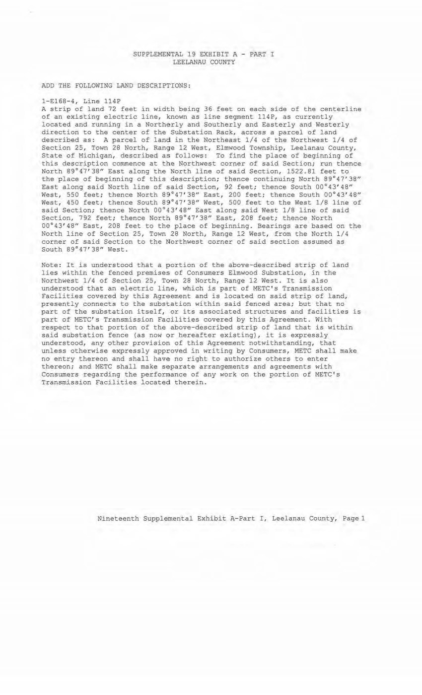
| SUPPLEMENTAL 19 EXHIBIT A - PART I LEELANAU COUNTY ADD THE FOLLOWING LAND DESCRIPTIONS : 1-£168- 4, Line 114P A strip of land 72 feet in width being 36 feet on each side of the centerline of an existing electric line, known as line segment 114P, as currently located and running i n a Northerly and Southerly and Easterly and Westerly direction to the center of the Substation Rack, across a parcel of land described as: A parcel of land in the Northeast 1/4 of the Northwest 1 /4 of Section 25, Town 28 North, Range 12 West, Elmwood Township, Leelanau County, State of Michigan, described a s follows : To f ind the place of beginning of this description commence at the Northwest cor ner of said Section; run thence North 89°47'38" East along the North line of said Section, 1522. 81 feet to the place of beginning of this description; thence continuing North 89°47'38" East along said North line 0£ said Section, 92 feet ; thence South 00°43' 48" West, 550 feet ; thence North 89°47 ' 38n East, 200 feet; thence South 00°43'48n West, 450 feet; thence Sou th 89°47 ' 38" West, 500 feet to t he West l/8 l i ne of said Section; t hence North 00°43'48" East a l ong sai d West 1/8 line of said Section, 792 feet ; thence North 89°47' 38n East, 208 feet; thence North 00°43' 48" East, 208 feet to the place of beginning. Bearings are- based on the North line of Section 25, Town 28 North, Range 12 West, from the North 1/4 cor ner of s aid Section to the Northwest corner of said section assumed as South 89°47'38 n West. Note : It is understood that a portion of t h e above-described strip of land lies withi n t h e fenced p remises of Consumers Elmwood Subs tation, in the Northwest 1 /4 of Section 25, Town 28 North, Range 12 West . It is also understood that an electric line, which is part of METC ' s Transmission Facilities covered by this Agreement and is located on said strip of land, presen tly connects to the substation within said fenced area; but that no part of the substation itself, or its associated structures and facilities is part of METC ' s Transmission Facilities covered by this Agreement . With respect to that portion of the above-describ ed strip of land that is within said substation fence (as now or hereafter existing), it is expressly understood, any other provision of this Agreement notwithstanding, t h at unless otherwise expr essly approved in writing by Consumer s, METC shall make no entry thereon and shall have no right to authorize others to enter thereon; and METC shall make separate arrangements and agreements with Consumers regarding the performance of any work on the portion of METC ' s Transmission Facilities located therein. Nineteenth Supplemental Exhibit A- Part I , Leelanau County, Pagel |
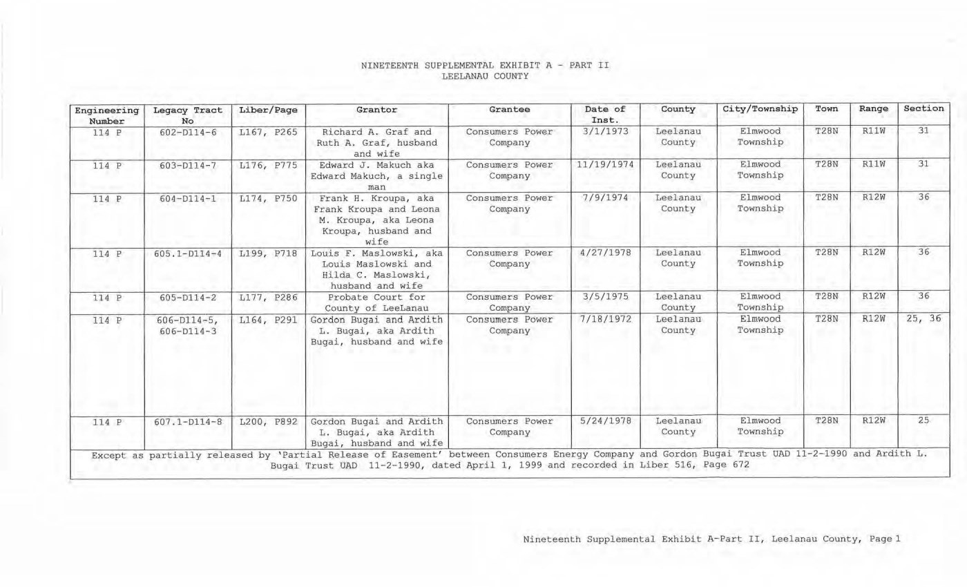
| NINETEENTH SUPPLEMENTAL EXHIBIT A - PART II LEELANAU COUNTY Engineering Legacy Tract Liber/Page Grantor Grantee Date of Number No Inst. 114 p 602-0114-6 L167, P265 Richard A. Gr af and Consumers Power 3/1/1973 Ruth A. Graf, husband Company and wife 114 p 603-D114-7 Ll 76, P775 Edw ard J . Makuch aka Consumers Power 11/19/1974 Edward Makuch, a single Company man 114 p 604-D114-1 L174 , P750 Frank H. Kroupa, aka Consumers Power 7/9/1974 Frank Kroupa and Leona Company M. Kroupa, aka Leona Kroupa, husband and wife 114 p 605. 1- D 114-4 L199, P718 Louis F. Maslowski, aka ConsUJ11ers Power 4/27/1978 Louis Maslowski and Company Hilda C. Maslowski, husband and wife 114 p 605-0114- 2 L177, P286 Probate Court f or Consumers Power 3/5/1975 County of LeeLanau Company 114 p 606-0114-5, L164, P291 Gordon Bugai and Ardith Consumers Power 7/18/1972 606-D114-3 L. Bugai, aka Ardith Company Bugai, husband and wife 114 p 607.1-D114-8 L200, P892 Gordon Bugai and Ardith Consumers Power 5/24/1978 L. Bugai, aka Ardith Company Bugai, husband and wife Except as partiall y released by ' Partial Release of Easement' between Consumers Energy Company Sugai Trust UAD 11-2-1990, dated April 1 , 1999 and recorded in County City/Township Town Range Section Leelanau El mwood T28N RllW 31 County Township Leelanau El mwood T28N RllW 31 County Township Leelanau Elmwood T28N R12W 36 County Township Leelanau Elmwood T28N R12W 36 County Township Leel anau Elmwood T28N R12W 36 County Township Leelanau El mwood T28N R12W 25, 36 County Township Le€lanau Elmwood T28N Rl2W 25 County Township and Gordon Bugai '!'rust UAD 11-2-1990 and Ardith L . Liber 516, Page 672 Nineteenth Supplemental Exhibit A-Part II, Leelanau County, Page 1 |
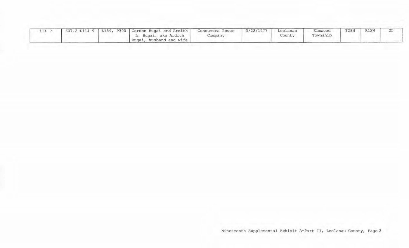
| 114 p 607 . 2-D114-9 Ll 89, P390 Gordon Bugai and Ardith Consumers Power 3/22/ 1977 Leelanau Elmwood T28N R12W 25 L. Sugai, aka Ardith Company County Township Bugai, husband and wife Nineteenth Supplemental Exhibit A- Part II, Leelanau County, Page2 |
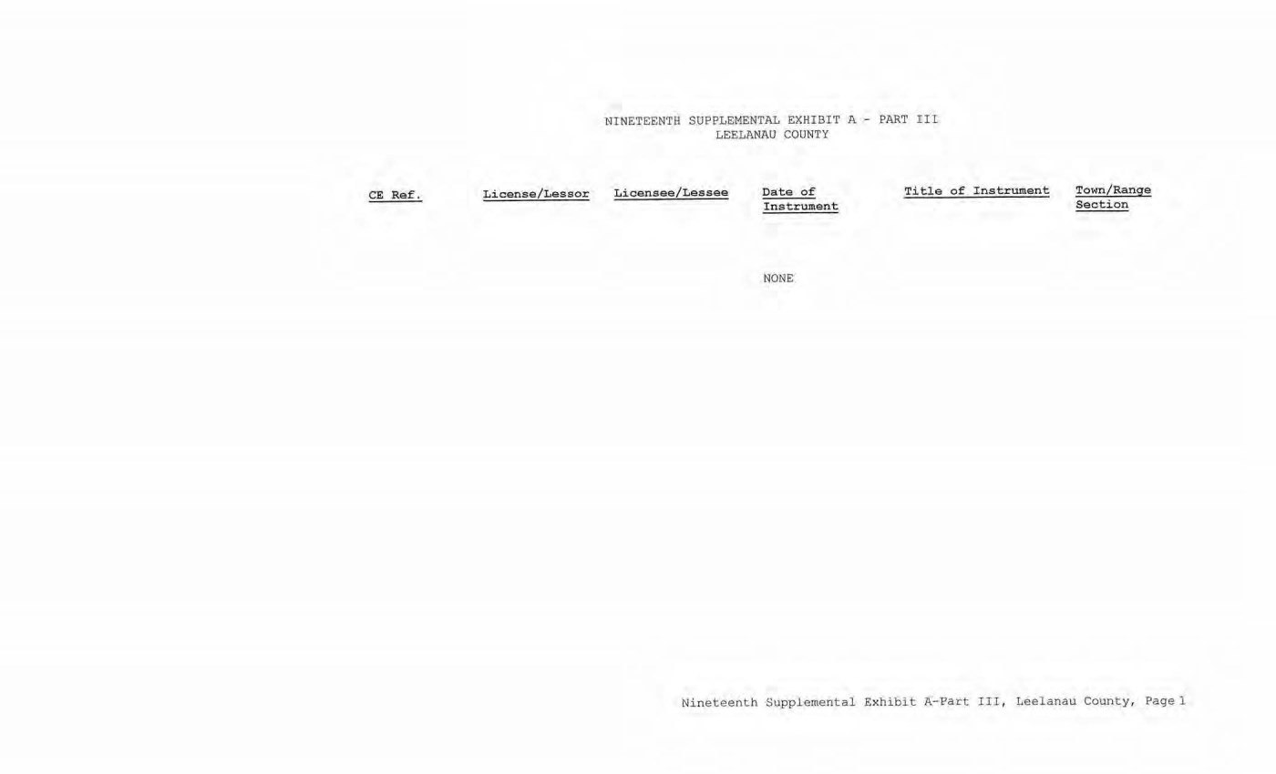
| CE Ref. License/Lessor NINETEENTH SUPPLEMENTAL EXHIBIT A - PART III LEELANAU COUNTY Licensee/Lessee Date of Instrument NONE Ti tle of Instrument Town/Range Section Nineteenth Supplemental Exhibit A-Part III , Leelanau Councy, Pagel |
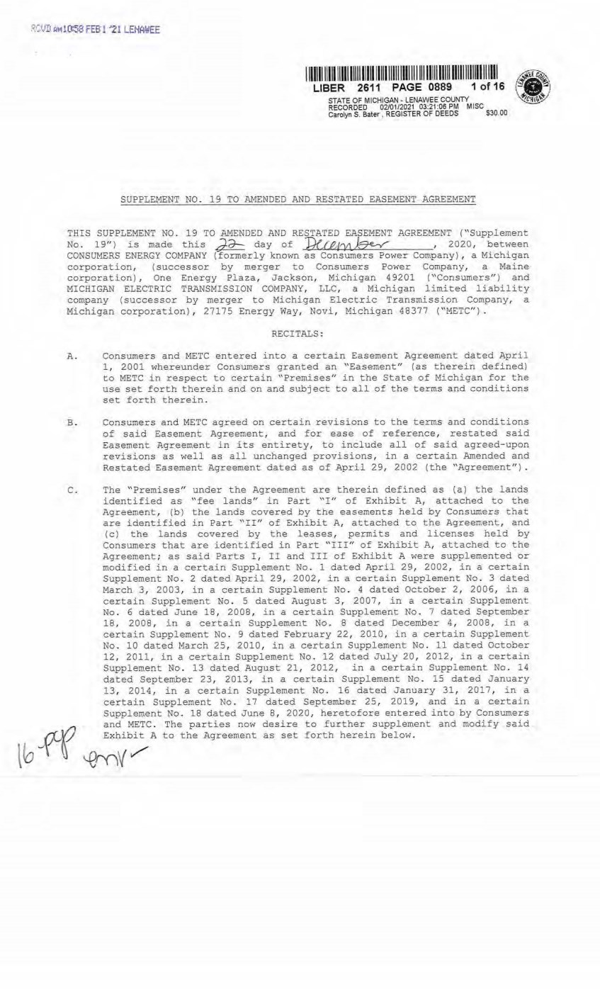
| 1 111111 lllll lllll lllll 1 1 111 1 1111 1 11111111111111 1111 1111 11 ll1111111 1 1111 1111 LIBER 2611 PAGE 0889 1 of 16 STATE OF MICHIGAN - LENAWEE COUNTY RECORDED 02/01/2021 03:21:06 PM MISC Carolyn S. Bater, REGISTER OF DEEDS $30.00 SUPPLEMENT NO . 19 TO AMENDED AND RESTATED EASEMENT AGREEMENT THIS SUPPLEMENT NO . 19 TO .AMENDED AND RESTATED EASEMENT AGREEMENT ("Supplement No. 19" ) is made this J-;J-. day of Prc.e,t,1okz-e.£ , 2020, be-cween CONSUMERS ENERGY COMPANY (formerly known as Consumers Power Company) , a Michigan corporation, (successor by merger to Consumers Power Company, a Maine corporation), One Energy Plaza, Jackson, Michigan 49201 ("Consumers") and MICHIGAN ELECTRIC TRANSMISSION COMPANY, LLC , a Michigan limited liabilicy company ( successor by merger to Michigan Elect.ric Tr"rnsmission Company, a Michigan corporation) , 27175 Energy Way, Novi, Michigan 48377 ("fv'.i.ETC"). RECITALS: A. Consumers and METC entered into a certain Easement Agreement dated April 1, 2001 whereunder Consumers granted an ''Easement" ( as therein defined) to METC in respect to certain "Premises" in the State of Michigan for the use set forth therein and on and subject to all of the terms and conditions set £orth therein. B. Consumers and METC agreed on certain revisions to the terms and conditions of said Easement Agreement, and for ease of reference, restated said Easement Agreement in its entirety, to include all of said agreed-upon revisions as well as all unchanged provisions, in a certain Amended and Restated Easement Agreement dated as of April 29, 2002 (the "Agreement"). C. The "Premises" under the Agreement are therein defined as (a) the lands identified as "fee lands'' in Part ''I,r of Exhibit A, attached to the Agreement, (b) the lands covered by the easements held by Consumers that are identified in Part "II" of Exhibit A, attached to the Agreement, and ( c) the lands covered by t he leases, permits and licenses held by Consumers that are identified in Part "III" of Exhibit A, attached to the Agreement; as said Parts I , II and III of Exhibit A were supplemented or modified in a certain Supplement No . 1 dated April 29, 2002, in a certain Supplement No. 2 dated April 29, 2002, in a certain Supplement No. 3 dated March 3 , 2003, in a certain Supplement No . 4 dated October 2, 2006, in a certain Supplement No. 5 dated August 3, 2007, in a certain Supplement No. 6 dated June 18, 2008, in a certain Supplement No. 7 dated September 18, 2008 , in a certain Supplement No. 8 dated December 4, 2008, in a certain Supplement No. 9 dated February 22, 2010, in a certain Supplement No. 10 dated March 25, 2010, in a certain Supplement No . 11 dated October 12, 2011, in a certain Supplement No. 12 dated July 20, 2012 , in a certain Supplement No. 13 dated August 21, 2012, in a certain Supplement No . 14 dated September 23, 2013, in a certain Supplement No. 15 dated January 13, 2014, in a certain Supplement No . 16 dated January 31, 2017, in a certain Supplement No . 17 dated September 25, 2019, and in a certain Supplement No. 18 dated June 8 , 2020, heretofore entered into by Consumers VJ and METC . The parties now desire to further supplement and modify said l ~ ~ ~ ~vb:;. A to the Agreement as set forth herein below. |
| I 1 11111 1 1 111 1 1 1111111111 111 illlll 111111111111 11111111 11111 1111 1111111 1111III LIBER 2611 PAGE 0889 2 of 16 2 D. References, in regard to historical matters, to "METC" in the foregoing recitals will be deemed to mean METC' s predecessor, Michigan Electric Transmission Company, a Michigan corporation, where relevant. NOW, THEREFORE, for good and valuable consideration, the receipt of which is acknowledged, Consumers and METC agree as follows : 1. Exhibit A to the Agreement, as heretofore supplemented and/or modified, is hereby further supplemented and modified as set forth in "Nineteenth Supplemental Exhibit A", attached hereto. lt is expressly understood that any lands, easements, or leases/permits/licenses that are indicated in said attached Nineteenth Supplemental Exhibit A as being added are, on and subject to the terms and conditions of the Agreement (as supplemented and amended by this Supplement No. 19), hereby deemed added to Part I, Part II and Part III, respectively, of Exhibit A to the Agreement. However, it is further expressly understood that in addition to all rights granted to METC by the Agreement, METC shall have the following rights as to the lands identified as "Consumers Energy Equipment/ Joint Asset Area Easement" on the accompanying NINETEENTH Supplemental Exhibit A sheets, inclusive of Parts I , II and III, which rights are also subject to the terms of the Parties' Amended and Restated Transmission Interconnection Agreement (the "DTIA") : (a) the right to maintain any and all existing components of the Transmission System, as defined in the DTIA, and wiring or conduit connections for the same that currently exist over, on or under these lands; and (b)the right to connect its currently sited or future approved wiring or conduits for communications, station power, or control, operating at 600 volts or less, and any Jointly Owned Assets, as defined in the DTIA, over, on or under these lands. It is also expressly understood that, with respect to any lands, easements, or leases/permits/licenses now covered by Part I , Part II or Part III of Exhibit A that are indicated in said attached Nineteenth Supplemental Exhibit A as being deleted, the Easement is hereby deemed RELEASED with respect thereto and the Agreement shall hereafter no longer apply thereto (provided, however, that all rights and obligations under the Agreement with respect to periods prior to the date of this Supplement No. 19 shall remain unaffected). 2 . I t is expressly understood and agreed that in respect to the additional Premises represented by the land(s), easernent(s), lease(s ) , permit(s) and/or license(s) that are added to Part I , Part II and Part III of Exhibit A to the Agreement pursuant to this Supplement No. 19 (the "Additional Premises") : (a) All references to "Commencement Date" that are found in Article 1 ( "Grant of Easement") , Article 2 ("Term") , Article 5 ("Additions/Alterations"), Article 6 ("Consumers' Reserved Rights to 0se the Premises and Transmission Facilities"), Article 7 ("METC Approval of Compatible Uses"), Article 8 ("Certain Obligations of Consumers and Authorized Users; Etc. ") and Article 14 ("Environmental Matters") of the Agreement shall be deemed to mean the date 0£ this Supplement No . 19 and not the date that is identified in the Agreement as the "Commencement Date''. |
| 3. 3 (b) Except as expressly otherwise indicated in the immediately foll owing sentence, all references to "Restated Agreement Date" that are found in Article l ("Grant of Easement"), Article 6 ("Consumers' Reserved Rights to Use the Premises and Transmission Facilities"), and Article 12 ("Compliance With Applicable Laws") of the Agreement shall also be deemed to mean the date of this Supplement No . 19 and not the date that is identified in the Agreement as the ''Restated Agreement Date". Notwithstanding the foregoing: (i) the preceding sentence does not apply to the purely historical statement in clause " (c)" of Section 1. 2 of the Agreement that Trans-Elect, Inc. is "an af£iliate of the entity which has become METC' s parent company as of the Restated Agreement Date"; and (ii} the parenthetical in the first sentence of the first paragraph of Section 7 . 1 of the Agreement reading "(see below regarding a certain period prior to the Restated Agreement Date) ", along with the fourth paragraph of said Section 7.1 reading "Consumers shall submit to METC within twenty (20) days of the Restated Agreement Date a list of all material Compatible Uses other than additions or modifications to Distribution Facilities that have been authorized between February l, 2001 and the Restated Agreement Date for METC's approval per the METC Compatible Ose approval process described in this Section 7.1 . ", both referred to a one- time historical matter and have no application to the Additional Premises or any other further effect or application whatsoever. In addition to Additions/Alterations the original Transmission Facilities thereto as referred to in Recital "A" 0£ and the Agreement, it is understood that such e lectric Transmi ssion towers, pole structures, poles, crossarms, wires, cables, conduits, guys, anchors, transformers, insulators and/or other fixtures and equipment as may be owned by METC and located on the Additional Premises as of the date of this Supplement No. 19, and future Additions/Alternations made thereto on and subject to the terms and conditions of the Agreement, are included in the "Transmission Facilities" under the Agreement . Note: This Supplement No . 19 wil l not be recorded in all counties in which the Agreement itself, or Suppl ements Nos. l through 18, may have been recorded. This Supplement No. 19 (as were each of Suppl ements Nos. 1 through 18), will be recorded only in the county ( ies) in which rel evant Premises are located; being, in the case of this Supplement No. 19, only the following: I llllll lllll lllll lllll lllll lllll lllll \11111 1111111 111111111111111 1111111111 LIBER 2611 PAGE 0889 3 of 16 |

| All egan County Antrim County Barry County Bay County Calhoun County Charlevoix County Clinton County Crawford Cou,nty Emmet County Genesee Cou,nty Gladwin County Grand Traverse County Gratiot County Ingham County Ionia County Isabella County Jackson County Kalka.ska County Kent County Leelanau County Lenawee County Manistee County Midland County Montcalm County Muskegon County Oceana County Ogemaw County Ottawa County Roscommon County Saginaw County Shiawassee County St. Joseph County Washtenaw County Wexford County 4 The fact that this Supplement No. 19 will be recorded only in the particular county(ies) identified above wil l in no way restrict, limit or otherwise affect the interpret ation, application or enforcement of the Agreement; and the terms and conditions of the Agreement shall at all times be read, interpreted and applied in the manner provided for in Section 24.6 of the Agreement. I 111111111111 11111111111 111) 1111111111111111111111 11111111111 11111111111111 LIBER 2611 PAGE 0889 4 of 16 |

| 5 IN WITNESS WHEREOF, Consumers and METC have executed this Supplement No. 19 as of the date first above written. CONSUMERS ENERGY COMPANY, a Michigan corporation By -+--L-i---+-+--------- - Ma y An arr Director of Real Estate STATE OF MICHIGAN COUNTY OF c.ia.. {l!ff;(J'Y] ss. The foregoing instrument was acknowledged before this.d'd---day of ·QeceJnbffl7 2020, by Mary Anne Marr, Director of Real Estate of CONSUMERS ENERGY COMPANY, a Michigan corporation, on behalf of the corporation. JULI( C GUINN Notary Public - State of Michigan County of Jack.son My Comrnhsinn Expires Dec 29 2020 Acting in lhe County ck }q.tl,${'V) Notary Public, ...J4,tfLf.t'\.-'\ County, Acting i n -hctti=Ah County, My Commission Expires: IJ--.-/n:!7 Michigan Michigan I 20_QQ I 1 11111 111111 111111 11111111 1 111 11111111111 1 1 111 1111 111111111111111 1 1 1 111 111 LIBER 2611 PAGE 0889 5 of 16 |
| 6 MICHIGAN ELECTRIC TRANSMISSION COMPANY, LLC , a Michigan limited liability company By: ITC Holdings Corp. , a Michigan corporation, its .manager ..,Je~ Jean Kim D' Anna Vice President and Deputy General Counsel - Legal Services STATE OF MICHIGAN COUNTY OF Oakland ss. The forenni nn i n<;;trument was acknowledged befor e this ~ day of Decemher a.020, by Jean Kim D' Anna, Vice President and Deputy General Counsel of ITC Holdings Corp., a Michigan corporation, as manager of MICHIGAN ELECTRIC TRANSMISSION COMPANY, LLC, a Michigan limited liability company, on behalf of the limited liability company. LAURA J. MCCRAY NOTARY PUBLIC, STATE OF Ml COUNTY OF OJ\KLAND MY COMMISSION EXPIRES Jul 30, 2021 ACTING IN COUNTY OF D a,t::.l w Notary Puljl; c I Oakl~d I County, Michigan Acting inl Oakland I County, Michigan My Cornm.iL-·~s-s-1~·0-n_.J-=E-x-p~i-r_e_s_: _7/30/21_ , 2020 Exempt from transfer taxes per MCL §§ 207 . 505(f) and 207 . 526(f) . Prepared by: Tracy L. Vanwoert Consumers Energy Company EP7- 447 One Energy Plaza Jackson, Michigan 49201 Return to: Julie Guinn Consumers Energy Company I 1 1111111111 1 11111111111111 1 1111 lllll llll II I Ill 111 1111111111111111111111III LIBER 2611 PAGE 0889 6 of 16 |

| THE ATTACHED COPY OF THE NINETEENTH SUPPLEMENTAL EXHIBIT A THAT WAS PREPARED FOR RECORDATION IN LENAWEE COO'NTY, MICHIGAN , AND CONTAINS THE PORTIONS OF EACH OF PARTS I, II, AND III OF THE NINETEENTH SUPPLEMENT EXHI BIT A THAT RELATE TO PREMISES IN THAT COONTY ONLY . SEE SECTION 24 . 6 OF TEE AGREEMENT. 1111111 ll lll lllll lllll lllll ll/1111111111111111111111111111111 1 1 111111111111 LIBER 2611 PAGE 0889 7 of 16 7 |
| NINETEENTH SUPPLEMENTAL EXHIBIT A I . Fee Lands : See sheet (s) labeled "NINETEENTH Supplemental Exhib.it A- Part I " , attached hereto and made a part hereof. Said attached sheet(s) labeled NINETEENTH Supplemental Exhibit A-Part I consist of the following: 3 Pages for Allegan County 6 Pages for Antrim County 2 Pages for Barry County 2 Pages for Bay County 13 Pages for Calhoun County 2 Pages for Charlevoix County 6 Pages for Clinton Coum:y 4 Pages for Crawford County 7 Pages for Genesee County 1 Page for Gladwin County 6 Pages for Grand Traverse County 1 Page for Gratiot County 2 Pages for Ingham County 2 Pages for Ionia County 1 Page for Isabella County 2 Pages for Jackson County 1 Page for Kalkaska County 4 Pages for Kent County 1 Page for Leelanau County 3 Pages for Lenawee County 2 Pages for Manistee County 4 Pages for Midland County 1 Page for Montcalm County 17 Pages for Muskegon County 1 Pages for Oceana County 1 Page for Ogemaw County 4 Pages for Ottawa County 3 Pages for Roscommon County 2 Pages for Saginaw County 3 Pages for Shiawassee County 1 Page for St. Joseph County 3 Pages for Washtenaw County 2 Pages for Wexford County I 11111111 1 1 11 1111 lllll 11111 1 1111111111111111 111111 11111 1 1 111111111111111 111 LIBER 2611 PAGE 0889 8 of 16 Nineteenth Supplemental Exhibit A - Introductory Page 1 of 2 |
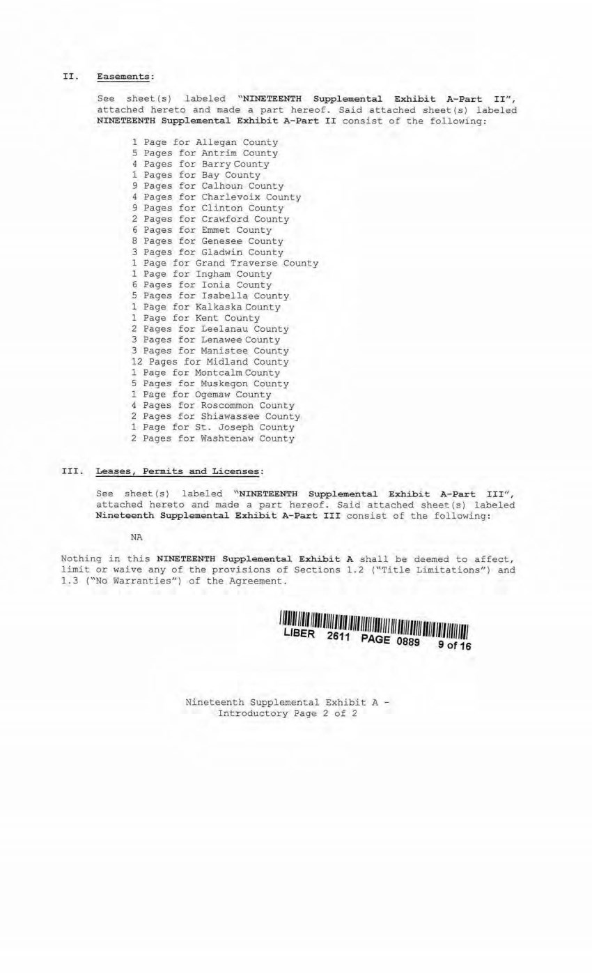
| II. Easements : See sheet(s) labeled "NINETEENTH Supplemental Exhibit A-Part II", attached hereto and made a part hereof. Said attached sheet(s) labeled NINETEENTH Suppl emental Exhibit A- Part II consist of the following: l Page for Allegan County 5 Pages for Antrim County 4 Pages for Barry County 1 Pages for Bay County 9 Pages for Calhoun County 4 Pages for Charlevoix County 9 Pages for Clinton County 2 Pages for Crawford County 6 Pages for Emmet County 8 Pages for Genesee County 3 Pages for Gladwin County l Page for Grand Traverse County 1 Page for Ingham County 6 Pages for Ionia County 5 Pages for Isabella County 1 Page for Kalkaska County 1 Page for Kent County 2 Pages for Leelanau County 3 Pages for Lenawee County 3 Pages for Manistee County 12 Pages for Midland County 1 Page for Montcalm County 5 Pages for Muskegon County 1 Page for Ogemaw County 4 Pages for Roscommon County 2 Pages for Shiawassee County 1 Page for St . Joseph County 2 Pages for Washtenaw County III. Lease s , Permit s and Licenses: See sheet (s) labeled "NINETEENTH Suppl emental Exhibi t A-Part I II", attached hereto and made a part hereof. Said attached sheet(s) labeled Ni ne teenth Supplement al Exhibit A-Part III consist of the following: NA Nothing in this NINETEENTH Supplemental Exhibi t A shall be deemed to affect, limit or waive any of the provisions of Sections 1.2 ("Title Limitations") and 1 . 3 ("No Warranties") of the Agreement . Nineteenth Supplemental Exhibit A - Introductory Page 2 of 2 |
| I llllll lllll lllll lllll 1 1 111 1 1111 1 11111111111111 111 111111111111 lllllllll llll UBER 2611 PAGE 0889 10 of 16 SUPPLEMENTAL 19 EXHIBIT A - PART I LENAWEE COUNTY ADD THE FOLLOWING LAND DESCRIPTIONS : l-E219-11, Line 84B A strip of land 72 feet i n width being 36 feet on each s i de of the centerline of an e xisting electric line, known as line segment 84B, as currently located and running in an Easterly and Westerly across a parcel of land described as : A parcel of land i n the Northeast 1/4 of Section 1 , Town 6 South, Range 4 East, Raisin Township, Lenawee County, Michigan, more particularly described as : Commencing at the East 1/4 corner of said Section 1 , thence North along the East Line of said section, 800 . 00 feet to the Point of Beginning of this description; thence continuing North alon g said East Line, 350 . 00 feet; thence West 250 . 00 feet; thence South 350.00 feet ; thence East 250.00 feet to the Point of Beginning. 2-E71-8, Line 84B A strip of land 72 feet in width being 36 feet on each side of the centerline of an existing electric line, known as line segment 848, as currently located and running in an Easterly and Westerly direction to the center of the Substation Rack, across a parcel of land described as : Land in the Township of Raisin, County of Lenawee and State of Michigan, and described as follows, to-wit: A parcel of land in the North 1/2 of Section 3, Town 6 South, Range 4 East, described as follows: To find the place of beginning of this description commence at the Northwest corner of said Section; run thence South 02°30' 50" West along the West line of said Section 1223.3 feet to the North line of the South 1/2 of the Northwest 1/4 of sai d Sect ion; thence South 88°58 ' 12'' East along said North line of the South 1/2 of the Northwest 1/4 of said Section 361. 06 feet to the East line of the New York Central Rai lroad right of way and the place of beginning of this description; thence continuing South 88°58' 12" East along said North line of the South 1/2 of the Northwest 1/4 of said Section 2232. 86 feet to the center line of Mill Highway; thence on a curve to the right, said curve having a radius of 660 feet, a chord bearing South 16°21' 29" West, a chord distance of 82.16 feet, to the point of t angent; thence South 19°55' 30" West along t he center line of said highway 108 . 84 feet; thence South 88°45' 53" East, 100.83 feet to the high water mark of Raisin Mills Millpond; thence South 16°48' 10" West along said high water mark 94 . 8 feet; thence South 03°37'20" East along said high water mark 64 feet; thence South 30°17'20'' East, a l ong said high water mark 52.67 feet; thence North 88°45 ' 53" West, 101. 81 feet to the center line of Mill Highway; thence on a curve to the left, said curve having a radius of 249 . 5 feet, a chord bearing of South 26°30'38/I East, a chord distance of 20 . 8 feet to the point of tangent; then ce South 28°54 ' 00" East along the center line of said highway 71 . 13 feet to a point of curve; thence on a curve to the right, said curve having a radius of 65 . 51 feet; a chord bearing of South 22° 08' 05" West, a chord distance of 101 . 87 feet to the center l ine of Comfort Road; thence South 73°10' 10" West along said center line of said Comfort Road 56 . 74 feet; thence South 88°01' 20n West a l ong said center line of said Comfort Road 790.92 feet ; thence South 88°40' 50" West along said center line of said Comfort Road 1185 . 59 feet; thence South 81°20'l4" West along said center line of said Comfort Road 155. 48 feet to the East l i ne of the New York Central Railroad right of way; thence North 00°18' 50" East along said East line of said railroad right of way 691 . 19 feet to the place of beginning; EXCEPT : The right of way of The Adrian and Detroit Railroad Company as surveyed across said land; ALSO EXCEPT: A parcel of land in the South 1/2 of Nineteenth Supplemental Exhibit A-Part I, Lenawee County, Page 1 |
| I 11111111 111 1 1111 lllll lllll lllll 111111111111111 1111 1 lllll 111111111111111111 LIBER 2611 PAGE 0889 11 of 16 the Northwest 1/4 of Section 3, Town 6 South, Range 4 East, described as follows : To find the place of beginning of this description commence at the Northwest corner of said section; run thence South 02°30'50" West along the West line of said section, 1223.30 feet to the North l ine of the South 1/2 of the Northwest 1/ 4 of said sect ion; · thence South 88 ° 58 ' 12" East along said North l ine of South 1/2 of the Northwest 1/4 of said section, 361. 06 feet to East line of the railroad right of way of the Penn Central Transportation Company and the place of beginning of this description; running thence South 00°18'50" West along said East line of railroad right of way of the Penn Central Transportation Company 691 . 19 feet to the center line of Comfort Road; thence North 81°20' 14" East along the center line of said Comfort Road 155. 48 feet; thence North 88°40' 50" East along said center line of said Comfort Road 820 feet; thence North 00°18'50" East to a point on the North line of the South 1/2 of the Northwest 1/4 of said section; thence North 88°58' 12" West along said North line of the South 1/2 of the Northwest 1/4 of said section to the place of beginning. Note: It is understood that a portion of the above-described strip of land l ies within the fenced premises of Consumers Raisin Substation, in the Northwest 1/4 of Section 3 , Town 6 South, Range 4 East. It is a lso understood that an electric line, which is part of METC ' s Transmission Facilities covered by this Agreement and is located on said strip of land, presently connects to the substation within said fenced area; but that no part of the substation itself, or its associated structures a nd facilities is part of METC ' s Transmission Facilities covered by this Agreement . With respect to that portion of the above- described strip of land that is within said substation fence (as now or hereafter existing) , it is expressly understood, any other provision of this Agreement notwithstanding, t hat unless otherwise expressly approved in writing by Consumers, METC shall make no entry thereon and shall have no right to authorize others to enter thereon; and METC shall make separate arrangements and agreements with Consumers regarding the performance of any work on the portion of METC ' s Transmission Facilities located therein . 1-El0?-10, Line 17H A strip of land 72 feet in width being 36 feet on each side of the centerline of an existing electric line, known as line segment 17H, as currently located and running in an Easterly and Westerly direction to t he center of the Substation Rack, across a parcel of land described as : A parcel of land in the Northwest 1/4 of Section 22, Town 7 South, Range 1 East, Hudson Townshi p, Lenawee County, and State of M ichigan, described as follows: To find the place of beginning of this description commence at the Northwest corner of said section; run thence South 89°52' 00" East along the North l ine of said section, 1175 . 50 feet to the place of beginning of this description; t hence continuing South 89°52'00" East along said North line of said section, 660 . 00 feet; thence South 00°08 ' 00" West, 660.00 feet; thence North 89°52 ' 00" West, 660 . 00 feet; t hence North 00°08' 00" East, 660 . 00 feet to the place of beginning. Note: It is understood that a portion of the above-described strip of land lies within the fenced premises of Consumers Dowling Substation, in the Northwest 1/4 of Section 22, Town 7 South, Range 1 East . It is also understood that an electric line, whi ch is part of METC ' s Transmission Facilities covered by this Agreement and is located on said strip of land, presently connects to the substation wi thin said fenced area; bu t that no part of the substation itself, or its associated structures and f acilities is part of METC ' s Transmission Facilities covered by this Agreement. With Nineteenth Supplemental Exhibit A-Part I , Lenawee County; Page2 |
| respect to that portion of the above- described strip of land that is within said substation fence (as now or hereafter existing) , it is expressly understood, any other provision of this Agreement notwithstanding, that unless otherwise expressly approved in writing by Consumers, METC shall make no entry thereon and shall have no right to authorize others to enter thereon; and METC shall make separate arrangements and agreements with Consumers regarding the performance of any work on the portion of METC ' s Transmission Facilities located therein. I 11111111 1 1 11 1111lll1111111 1 1111111111111111 1 11 11111 lllll lllll llll lll ll l lll LIBER 2611 PAGE 0889 12 of 16 Nineteenth Supplemental Exhibit A-Part I , Lenawee County, Page3 |
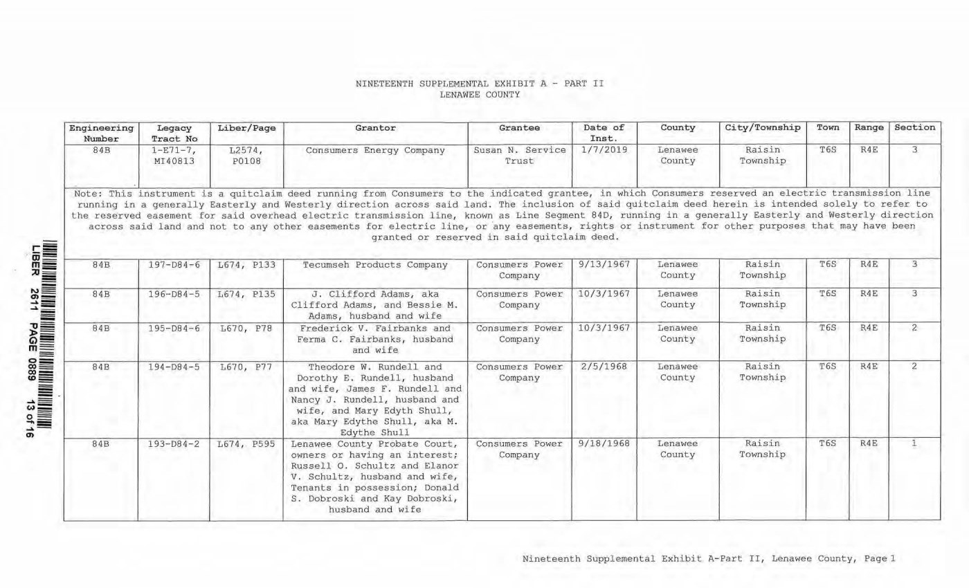
| Enginee-ring Legacy Number Tract No 84B l - E71-7, MI40813 Note: This instrument is Liber/Page NINETEENTH SUPPLEMENTAL EX HIBIT A - PART II LENAWEE COU-NTY Granter Grantee Date of Inst. County L257 4, Consumers Energy Company Susan N. Service 1/7/2019 Lenawee P0108 Trust County a quitclaim deed running from Consumers to the indi cated grantee, in which Consumers City/Townshi p Town Range Section Raisin T6S R4E 3 Township reserved an electric transmission line running i n a general ly Easterly and Westerly directi on across said land. The inclusion of said quitcl a i m deed herein is intended solely to refe.r: to the r eserved easement for sai d overhead el ectric transmission line, known as Line Segment 84D, r unning in a generally Easterly and Westerl y direction across said land and not to any other easements for electric line, or 'any easements, rights or instrument for other purposes that may have been gr anted or reserved in said quitclaim deed. 848 197-D84-6 L674, P133 Tecumseh Products Company Consumers Power 9/13/1967 Lenawee Raisin T6S R4E 3 Com pany County Township 84B 196-084-5 L674 , Pl35 J . Clifford Adams, aka Consumers Power 10/3/1967 Lenawee Raisin T6S R4E 3 Cli fford Adams , and Bessie M . Company County Township Ad?ll\S, husband and wife 84B 195-084-6 L670, P78 Frederick V. Fairbanks and Consumers Power 10/3/1967 Lenawee Raisin T6S R4E 2 Ferma C. Fairbanks, husband Company County Township and wife 84B 194-D84-5 L670, P77 Theodore w . Rundell and Consumers Power 2/ 5 /1968 Lenawee Raisin T6S R4E 2 Dor othy E. Rundell, husband Company County Township and wife, J ames f . Rundell and Nancy J . Rundell, husband and wife, and Mary Edyth Shull, aka Mary Edythe Shull, aka M. Edyt he Shu ll 84B 193-D84-2 L6 74, P595 Lenawee County Probate Court, Consumers Power 9/ 18/1968 Lenawee Raisin T6S R4E 1 owners or having an interest; Company County Township Russell 0 . Schultz and Elanor V. Schult z, husband and wife, Tenants in possession; Donald s. Dobroski and Kay Oobroski , husband and wife Nineteenth Suppl emental Exhibit A- Part II, Lenawee County, Page 1 |
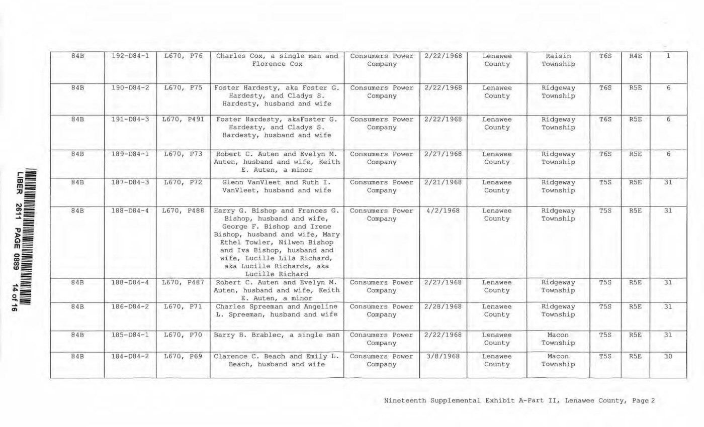
| 84B 192-084-1 L670, P76 Charles Cox, a single man and Consumers Power 2/22/1968 Lenawee Raisin T6S R4E 1 Florence Cox Company County Township 84B 190-D84-2 L670, P75 Foster Hardesty, aka Foster G. Consumers Power 2/22/1968 Lenawee Ridgeway T6S RSE 6 Hardesty, and Cladys S . Company County Township Hardesty, husband and wife 84B 191-084-3 1670, P491 Foster Hardesty, akaFoster G. Consumers Power 2/22/1968 Lenawee Ridgeway T6S RSE 6 Hardesty, and Cladys S . Company County Township Hardesty, husband and wife 84B 189-D84-l L670, P73 Robert C. Auten and Evelyn M. Consumers Power 2/27/1968 Lenawee Ridgeway 1'6S RSE 6 Auten, husband and wife, Keith Company County Township E. Auten, a minor 84B 187-084-3 1670, P72 Glenn Vanvleet and Ruth I . Consumers Power 2/21/1968 Lenawee Ridgeway TSS RSE 31 Vanvleet, husband and wife Company County Township 84B 188-D84- 4 1670, P488 Harry G. Bishop and Frances G. Consumers Power 4/2/1968 Lenawee Ridgeway TSS RSE 31 Bishop, husband and wife, Company County Township George F. Bishop and Irene Bishop, husband and wife, Mary Ethel Towler, Nilwen Bishop and Iva Bishop, husband and wife, Lucille Lila Richard, aka Lucille Richards, aka Lucille Richard 848 188-084-4 L670, P487 Robert C. Auten and Evelyn M. Consumers Power 2/27/1968 Lenawee Ridgeway TSS RSE 31 Auten, husband and wife, Keith Company County Township E. Auten, a minor 848 186-084-2 1670, P71 Charles Spreeman and Angeline Consumers Power 2/28/1968 Lenawee Ridgeway T5S RSE 31 L. Spreeman, husband and wife Company County Township 848 185-084-1 L670, P70 Barry B. Brablec, a single man Consumers Power 2/22/1968 Lenawee Macon TSS R5E 31 Company County Tow nship 848 184-084-2 L670, P69 Clarence C. Beach and Emily L. Consumers Power 3/8/1968 Lenawee Macon TSS RSE 30 Beach, husband and wife Company County Township Nineteenth Supplemental Exhibit A-Part II, Lenawee County, Page2 |
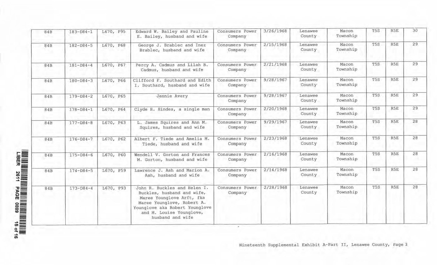
| - 84B 183-D84-1 L670, P95 Edward W. Bailey and Pauline Consumers Power 3/26/1968 Lenawee Macon T5S R5E 30 E. Bailey, husband and w ife Company County Township 84B 182-D84-5 L670, P68 George J . Brablec and Inez Consumers Power 2/15/1968 Lenawee Macon TSS RSE 29 Brablec, husband and wife Company County Township 84B 181-D84-4 L670, P67 Percy A. Cadmus and Lilah B. Consumers Power 2/21/1968 Lenawee Macon TSS R5E 29 Cadmus, husband and wife Company County Township 84B 180-D84-3 L670, P66 Clifford F. Southard and Edith Consumers Power 9/28/1967 Lenawee Macon T5S R5E 29 I. Southard, husband and wife Company County Township 84B 179-084-2 L670, P65 Jennie Avery Consumers Power 9/28/1967 Lenawee Macon TSS RSE 29 Company County Tow nship 84B 178-D84-l L670, P64 Clyde H. Hindes, a single man Consumers Power 2/20/1968 Lenawee Macon T5S RSE 29 Company County Township 84B 177-D84- 8 L670, P63 L . James Squires and Ann M. Consumers Power 9/29/1967 Lenawee Macon T5S RSE 28 Squires, husband and wife Company County Township 84B 176-D84- 7 L670, P62 Albert F. Tiede and Amelia M. Consumers Power 2/23/1968 Lenawee Macon TSS R5E 28 Ti ede, husband and wife Company County Township 84B 175-D84 -6 L670, P60 Wendell V. Gorton and Frances Consumers Power 2/16/1968 Lenawee Macon T5S RSE 28 M. Gorton, husband and wife Company County Township 8 4B 174-D84-5 1670, P59 Lawrence J. Ash and Marion A. Consumers Power 2/14/1968 Lenawee M acon T5S RSE 28 Ash, husband and wife Company County Township 84B 173-084-4 L670, P93 John R. Buckles and Helen I. Consumers Power 2/28/1968 Lenawee Macon TSS RSE 28 Buckles, husband and wife, Company County Township Maree Youngl ove Arft, fka Maree Younglove, Robert A. Younglove a ka Robert Younglove and M. Louise Younglove, husband and wife Nineteenth Supplemental Exhibit A-Part II, Lenawee County, Page 3 |
| CE Ref. License/Lessor NINETEENTH SUPPLEMENTAL EXHIBIT A - PART Ill LENA WEE COUNTY Licensee/Lessee Date of Instrument NONE Title of Instrument Town/Range Section Nineteenth Supplemental Exhibit A-Part III, Lenawee County, Page 1 |
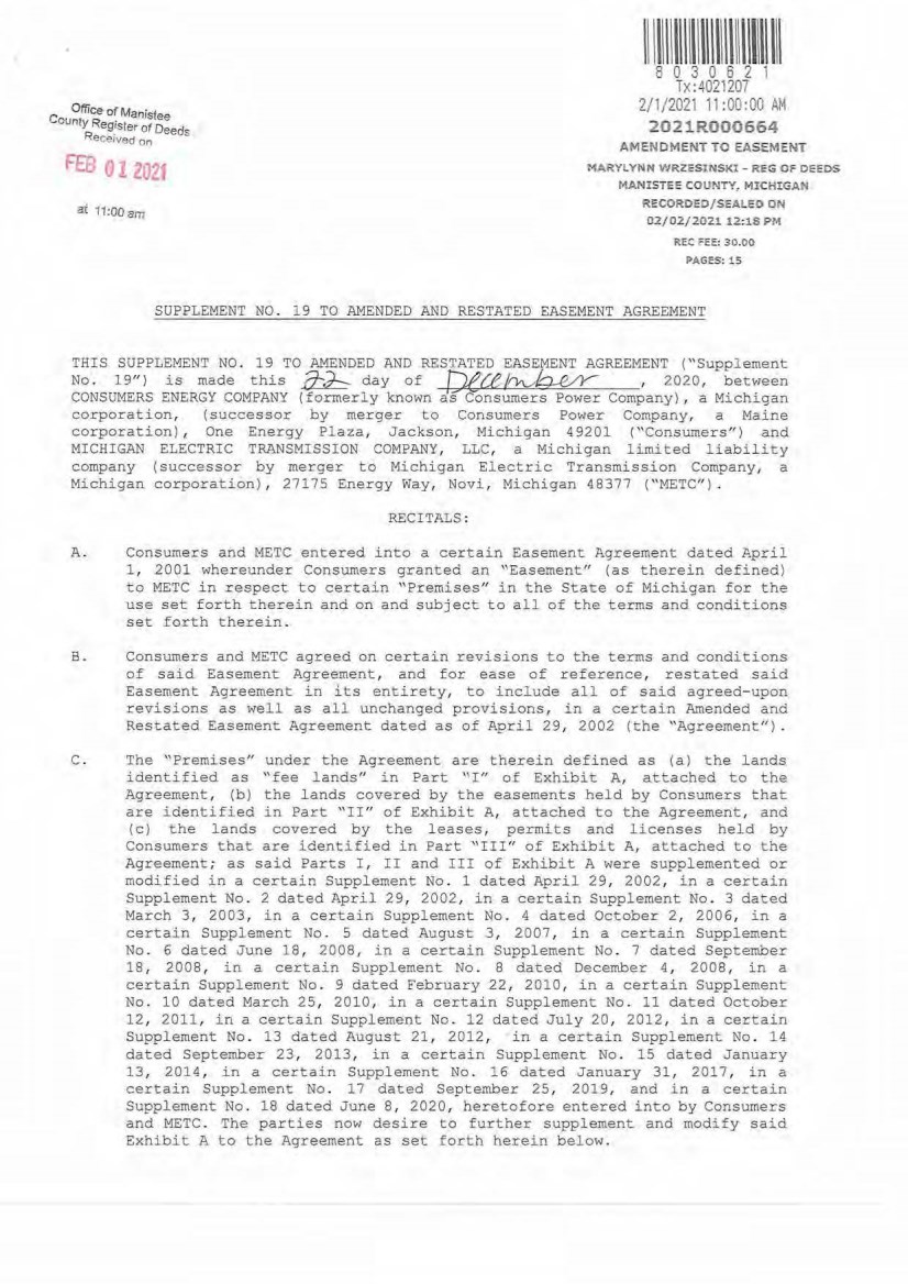
| C Office of Manistee ounty Reg!ster of Deeds Rece,ved on FEB V - ttJ2t ac 11:oo am I I llll\lllll\1111111\1111111111 8 0 3 0 6 2 1 Tx:4021207 2/1/2021 11:00:00 AM 2021R000664 AMfNDMENT TO EASEMENT MA.RYLYNN WRZESUiSK,: - REG OF DEEDS MANlSTE~ COUNTY, MlCHIGAN RECOROED/ScALEO ON 02/02/2021 12:18 PM REC ;::EE: 30.00 PAGES:15 SUPPLEMENT NO. 19 TO AMENDED AND RESTATED EASEMENT AGREEMENT THIS SUPPLEMENT NO. 19 TO AMENDED AND RESTATED EASEMENT AGREEMENT ("Supplement No. 19") is made this ~ day of f)ece~ , 2020, between CONSUMERS ENERGY COMPANY (formerly known dsConsumers Power Company) , a Michigan corporation, (successor by merger to Consumers Power Company, a Maine corporation) , One Energy Plaza, Jackson, Michigan 49201 ("Consumers") and MICHIGAN ELECTRI C TRANSMISSION COMPANY, LLC, a Michigan limited liability company ( successor by merger to Michigan Electric Transmission Company, a Michigan corporation), 27175 Energy Way, Novi, Michigan 48377 ("METC") . RECITALS : A. Consumers and METC entered into a certain Easement Agreement dated April 1 , 2001 whereunder Consumers granted an "Easement" (as therein defined) to METC in respect to certain "Premises'' in the State of Michigan for the use set forth therein and on and subject to all of the terms and conditions set forth therein. B. Consumers and METC agreed on certain revisions to the terms and conditions of said Easement Agreement, and for ease of reference, restated said Easement Agreement in its entirety, to include all of said agreed- upon revisions as well as all unchanged provisions, in a certain Amended and Restated Easement Agreement dated as of April 29, 2002 (the "Agreement"). C. The "Premises" under the Agreement are therein defined as (a) the lands identified as "fee lands'' in Part "I" of Exhibit A, attached to the Agreement, (b) the lands covered by the easements held by Consume.rs that are identified in Part "II" of Exhibit A, attached to the Agreement, and (c) the lands covered by the leases, permits and licenses held by Consumers that are identified i n Part "III" of Exhibit A, attached to the Agreement; as said Parts I, II and III of Exhibit A were supplemented or modified in a certain Supplement No. 1 dated April 29, 2002, in a certain Supplement No. 2 dated April 29, 2002 , in a certain Supplement No . 3 dated March 3 , 2003, in a certain Supplement No. 4 dated October 2 , 2006, in a certain Supplement No. 5 dated August 3, 2007, in a certain Supplement No. 6 dated June 18, 2008, in a certain Supplement No . 7 dated September 18, 2008, in a certain Supplement No . 8 dated December 4, 2008 , in a certain Supplement No . 9 dated February 22, 2010, in a certain Supplement No. 10 dated March 25, 2010, in a certain Supplement No. 11 dated October 12, 2011 , in a certain Supplement No. 12 dated July 20, 2012, in a certain Supplement No. 13 dated August 21, 2012, in a certain Supplement No . 14 dated September 23, 2013, in a certain Supplement No. 15 dated January 13, 2014 , in a certain Supplement No . 16 dated January 31, 2017, in a certain Supplement No . 17 dated September 25, 2019, and in a certain Supplement No. 18 dated June 8 , 2020, heretofore entered into by Consumers and METC . The parties now desire to further supplement and modify said Exhibit A to the Agreement as set forth herein below. |
| 2 D. References, in regard to historical matters, to "METC" in the foregoing recitals will be deemed to mean METC' s predecessor, Michigan Electric TranSTrri sslon Company, a Michigan corporation, where relevant. NOW, THEREFORE , for good and valuable consideration, the receipt of whi ch is acknowledged, Consumers and METC agree as follows: 1 . Exhibit A to the Agreement, as heretofore supplemented and/or modified, is he reby f urther suppl emented a nd modi fied as set forth in "Nineteenth Supplemental Exhibit A", attached hereto. 2. It is expressly understood that any lands, easements, or leases/permits/licenses that are indicated in said attached Nineteenth Supplemental Exhibit A as being added are, on and subject to t he terms and conditions of the Agreement (as supplemented and amended by thi s Supplement No . 19) , hereby deemed added to Part I , Part II and Part III, respectively, of Exhibit A to the Agreement . However, it is further expressly understood that in addition to all rights granted to METC by the Agreement, METC shal l have the following rights as to the l ands identified as "Consumers Energy Equi pment/ Joint Asset Area Easement" on the accompanying NINETEENTH Supplemental Exhibit A sheets, inclusi ve of Parts I, II and III, which rights are a l so subject to the terms of the Parti es' Amended and Restated Transmission Interc onnection Agreement (the "DTIA") : (a) the right to maintain any and all existing components of the Transmission System, as defined in the □TIA , and wiring or conduit connections for the same that currently exist over, on or under these lands; and (b) t he right to connect its currently sited or future approved wiring o r conduits for communications, station power, or control, operating at 600 volts or less, and any Joi ntly Owned Assets, as defined in the DT IA, o~er, on or under these lands. It is also e.xpressly understood that, with respect to any l ands, easements, or leases/permit s/licenses now covered by Part I , Part II or Part II I of Exhi bit A that are indicated in said attached Nineteenth Supplemental Exhibit A as being deleted, the Easement is hereby deemed RELEASED with respect thereto and the Agreement shall hereafter no longer apply thereto (provided, however, that all rights and obligations undar the Agreement wit h respect to periods prior to the date of this Supplement No. 19 shall remain unaffected). It is expressly understood and agreed Premi ses represented by the land ( s) , and/or license (s) that are added to Exhibit A to the Agreement pursuant "Addi tional Premises") : that in respect to the additional easement(s) , lease (s), permit (s) Part I , Part II and Part I II of to this Supplement No . 19 (the (a) All references to "Commencement Date'' t hat are found in Articl e l ( "Grant of Easement'' ) , Article 2 (" Term" ) , Articl e 5 ("Addi tions /Alterations" ) , Articl e 6 ("Consumers ' Reserved Rights to Ose the Premises and Transmission Faci lities"), Article 7 (" METC Approval of Compatible Uses"), Article 8 ("Certain Obligations of Consumers and Authorized Users ; Etc. ") and Article 14 ("Environmental Matters" ) of the Agreement shall be deemed to mean the date of this Supplement No . 19 and not the date that is identified in the Agreement as the "Commencement Date". |
| 3 (b) 8xcept as e xpressly otherwise indicated in the immediately following sentence, all references to "Restated Agreement Date" that are found i n Article l ("Grant of Easement") , Article 6 ("Con sumers' Reserved Rights to 0se the Premises and Transmission Facilities"), and Article 12 ("Compliance With Applicable Laws") of the Agreement shall also be deemed to mean the date of this Supplement No. 19 and not the date that is identified in the P..greement as the "Restated Agreement Date". Notwithstanding the foregoing: ( i) the preceding sentence does not apply to the purely historical statement in clause " ( c)" of Section l . 2 of the Agreement that Trans-Elect, Inc. is "an affiliate of the entity which has become METC's parent company as of the Restated Agreement Date"" ; and (ii) the parenthetical in the first sentence of the first paragraph of Section 7 . 1 of the Agreement reading "(see below regarding a certain period prior to the Restated Agreement Date)", along with the fourth paragraph of said Section 7 . 1 reading "Consumers shall submit to METC within twenty (20) days of the Restated Agreement Date a l ist of all material Compatible Uses other than additions or modifications to Distribution Facilities that have been authorized between February 1 , 2001 and the Restated Agreement Date f or METC's approval per the METC Compatible 0se approval process described in this Section 7.1.", both referred to a one- time historical matter and have no application to the Additional Premises or any other further effect or application whatsoever. 3. In addition to the original Transmission Facilities and Additions/Alterations thereto as referred to in Recital "A" of the Agreement, it is understood that such e lectric Transmission towers, pole structures, poles, crossarrns, wires, cables, conduits, guys, anchors, transformers, insulators and/or other fixtures and equipment as may be owned by METC and located on the Additional Premises as of t he date of this Supplement No . 19, and future Additions/Alternations made t hereto on and subject to the terms and conditions of the Agreement, are included in the "Transmission Facilities" under the Agreement. Note : This Supplement No . 19 will not be recorded in all counties in which the Agreement itself, or Supplements Nos . 1 through 18, may have been recorded. This Supplement No . 19 (as were each of Supplements Nos. 1 through 18) , will be recorded only in the county(ies) in which _relevant Premises are located; being, in the case of this Supplement No . 19, only the following: |

| Allegan County Antrim County Barry County Bay County Calhoun County Charlevoix County Clinton County Crawford County Emmet County Genesee County Gladwin County Grand Traverse County Gratiot County Ingham County Ionia County Isabella County Jackson County Kalkaska County Kent County Leelanau County Lenawee County Manistee County Midland County Montcalm County Muskegon County Oceana County Ogemaw County Ottawa County Roscommon County Saginaw County Shiawassee County St. Joseph County Washtenaw County W exford County 4 The fact that this Supplement No. 19 wi11 be recorded only in the particular county(ies) identified above will in no way restrict, limit or otherwise affect the interpretation, application or enforcement of the Agreement; and the terms and conditions of the Agreement shall at a l l times be read, interpreted and applied in the manner provided for in Section 24.6 of the Agreement . |
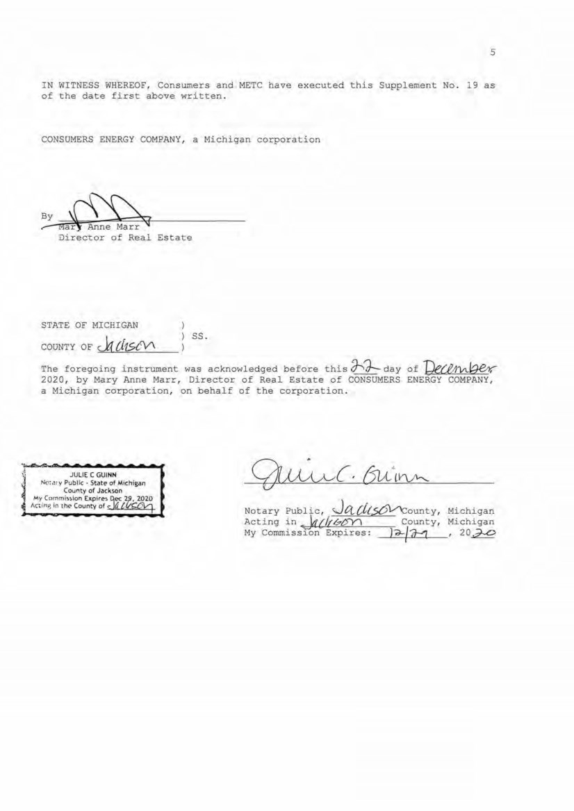
| 5 IN WITNES S W HEREOF , Consumers and METC have executed this Supplement No . 9 a s of the date first above written . CONSUMERS ENERGY COMPANY , a Michigan corporation ~Ma c~ Director of Real Es tate STATE OF MICHIGAN COUNTY OF c.lr [j15,ty\ ss. The foregoing instrument was acknowledged before this 3-<J-- day of I)ece,11At9e,r,-- 2020 , by Mary Anne Marr, Director of Real Estate of CONSUMERS ENERGY COMPANY, a Michigan corporation, on behalf of the corporation. J JULIE C GUINN ~ j No:<?: y Public • State of Michigan County of Jack.son My Commi,,lon Expire, ec 2 f,C. if:'l fn lhc- County of ,_ <...,_.aw"""'-c...+ Notary Public, JCt.,.[i.(,5{5V'<:,ounty, Acting in_ W'{ff/;.t>Y') County, My Conunissro~ Expires : )-;)..../ff:'7. I Michigan Michigan , 20..z::Q |
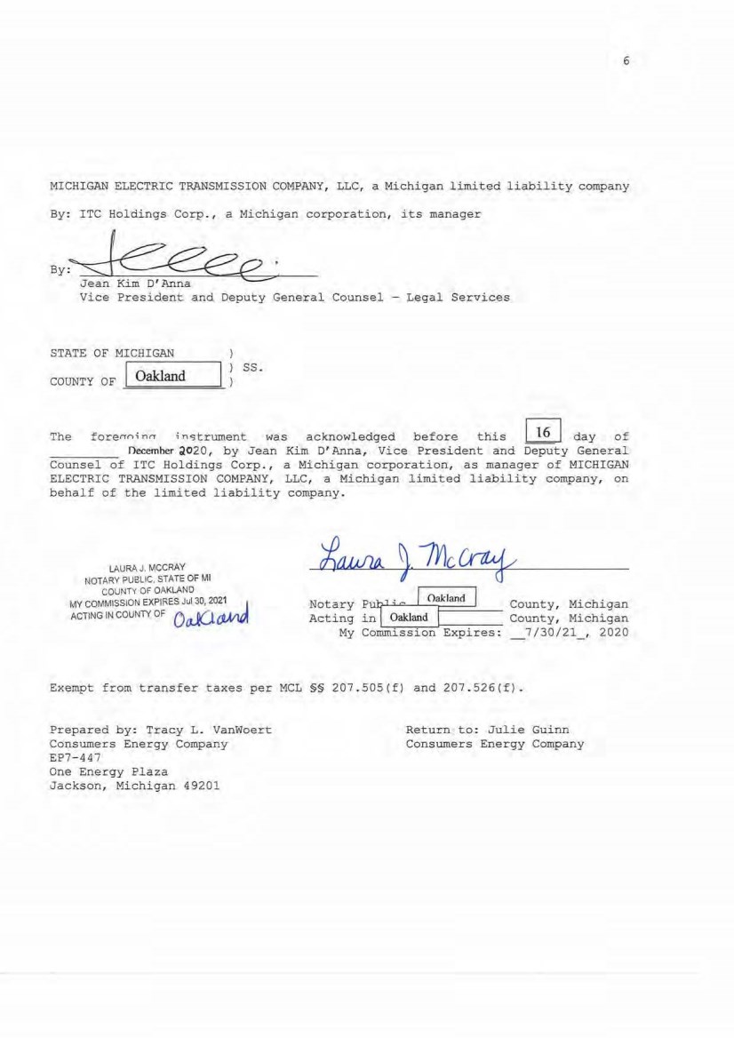
| 6 M I CHIGAN ELECTRIC TRANSMISSION COMPANY, LLC, a Michigan limited liability company By: ITC Holdings Corp., a Michigan corporation, its manager By~-='2- ' JeanKimO'Anna Vice President and Deputy General Counsel - Legal Services STATE OF MICHIGAN COUNTY OF Oakland ss. The forerrni nrr i nc;trument was acknowl edged befor e this I 16 I day of Oecemher d020, by Jean Kim D' Anna, Vice President and Deputy General Counsel of ITC Holdings Corp. , a Michigan corporation, as manager of MICHIGAN ELECTRIC TRANSMISSION COMPANY, LLC , a Michigan limited liability company, on behalf of the limited liability company. LAURAJ. MCCRAY NOTARY PUBLIC, STATE OF Ml COUNTY OF OAKLAND MY COMMISSION EXPIRES Jul 30, 2021 . 1 ACTING IN COUNTY OF Oal(,l ~ Notary Pu[1 ; 0 I Oaklanrl I County, Michigan Acting in _ Oakland I County, Michigan My Cornm L_ i~ · s _s _i ~ ·o _n_...=E_x_p~i_r_e_s_ : _7/30/21_, 2020 Exempt from transfer taxes per MCL §§ 207 .505(f ) and 207 . 526(f). Prepared by: Tracy L. Vanwoert Consumers Energy Company EP7- 447 One Energy Pl aza Jackson, Michigan 49201 Return to: Julie Guinn Consumers Energy Company |

| THE ATTACHED COPY OF THE NINETEENTH SUPPLEMENTAL EXHIBIT A THAT WAS PREPARED FOR RECORDATION IN MANISTEE COUNTY, MICHIGAN , AND CONTAINS THE PORTIONS OF EACH OF PARTS I , II, AND III OF THE NINETEENTH SUPPLEMENT EXHIBIT A THAT RELATE TO PREMISES IN THAT COUNTY ONLY. SEE SECTION 24 . 6 OF THE AGREEMENT. 7 |
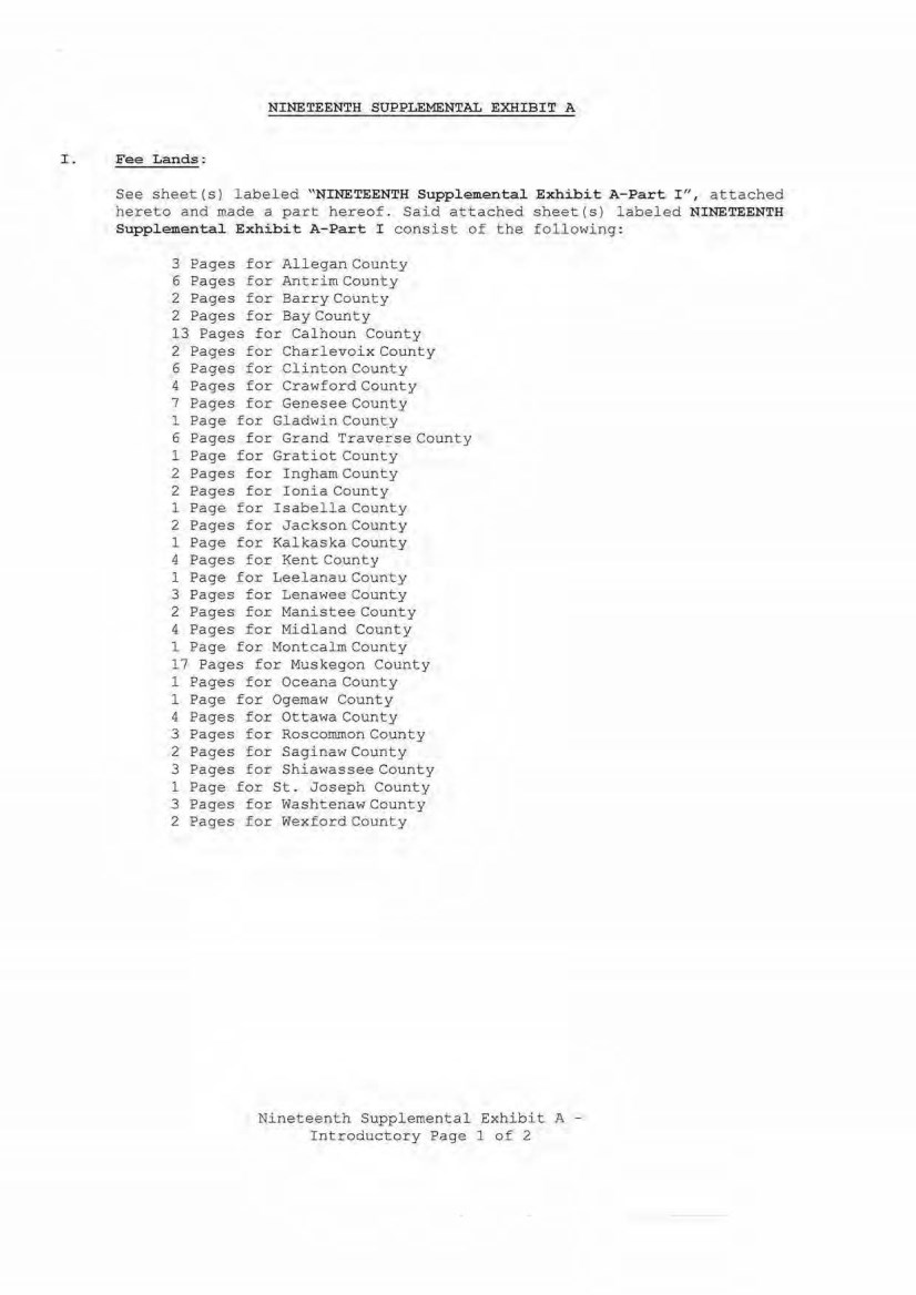
| NINETEENTH SUPPLEMENTAL EXHIBIT A I. Fee Lands: See sheet (s) labeled "NINETEENTH Supplemental Exhibi t A-Part I " , attached hereto and made a part hereof. Said attached sheet(s) labeled NINETEENTH Supplemental Exhibit A-Part I consist of the following: 3 Pages for Allegan County 6 E'ages for Antrim County 2 Pages for Barry County 2 Pages for Bay County 13 Pages for Ca lhoun County 2 Pages for Charlevoi x County 6 Pages for Clinton County 4 Pages for Cr awford County 7 Pages for Genesee County 1 Page for Gladwin County 6 Pages for Grand Traverse County 1 Page for Gratiot County 2 Pages for Ingham County 2 Pages for Ionia County 1 Page for Isabella County 2 Pages for Jackson County 1 Page for Kalkaska County 4 Pages for Kent County 1 Page for Leelanau County 3 Pages for Lenawee County 2 Pages for Manistee County 4 Pages for Midl and County 1 Page for Montcalm County 17 Pages for Muskegon County 1 Pages for Oceana County 1 Page for Ogemaw County 4 Pa ges f or Ottawa County 3 Pages for Roscommon County 2 Pa ge s for Saginaw County 3 Pages for Shiawasse e County 1 Page for St . Joseph County 3 Pages for Washtena w County 2 Pages for Wex ford County Nineteenth Supplemental Exhibit A - Introductory Pagel 0£ 2 |
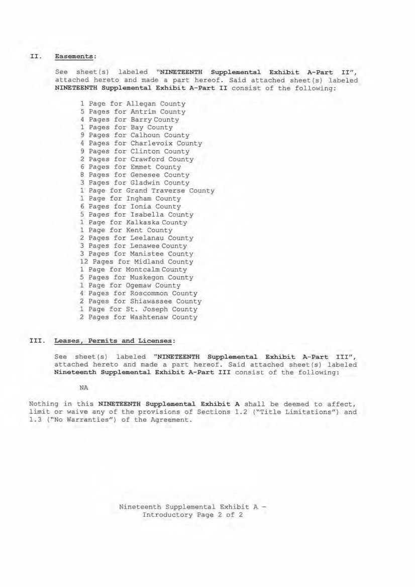
| II. Easements: See sheet(s) labeled "NINETEENTH Supplemental Exhibit A-Part II", attached hereto and made a part hereof . Said attached s h eet(s) labeled NINETEENTH Supplemental Exhibit A-Part II consist of the following: 1 Page for Allegan County 5 Pages for Antrim County 4 Pages for Barry County 1 Pages for Bay County 9 Pages for Calhoun County 4 Pages for Charlevoix County 9 Pages for Clinton County 2 Pages for Crawford County 6 Pages for Emmet County 8 Pages for Genesee County 3 Pages for Gladwin County 1 Page for Grand Traverse County 1 Eage for Ingham County 6 Pages for Ionia County 5 Pages for Isabella County 1 Page for Kalkaska County 1 Page for Kent County 2 Pages for Leelanau County 3 Pages for Lenawee County 3 Pages for Manistee County 12 Pages for Midl and County 1 Page for Montcalm County 5 Pages for Muskegon County 1 Page for Ogemaw County 4 Pages for Roscommon County 2 Pages for Shiawassee County 1 Page £or St. Joseph County 2 Pages for Washtenaw County III. Leases, Permits and Licenses: See sheet (s) labeled ''NINETEENTH Supplemental Exhibit A-Part III", attached hereto and made a part hereof. Said attached sheet(s) labeled Nineteenth Supplemental Exhibit A-Part III consist of the following : NA Nothing in this NINETEENTH Supplemental Exhibit A shall be deemed to affect, limit or waive any of the provisions of Sections 1 . 2 ("Title Limitations") and 1 . 3 (" No Warranties") of the Agreement. Nineteenth Supplemental Exhibit A - Introductory Page 2 of 2 |
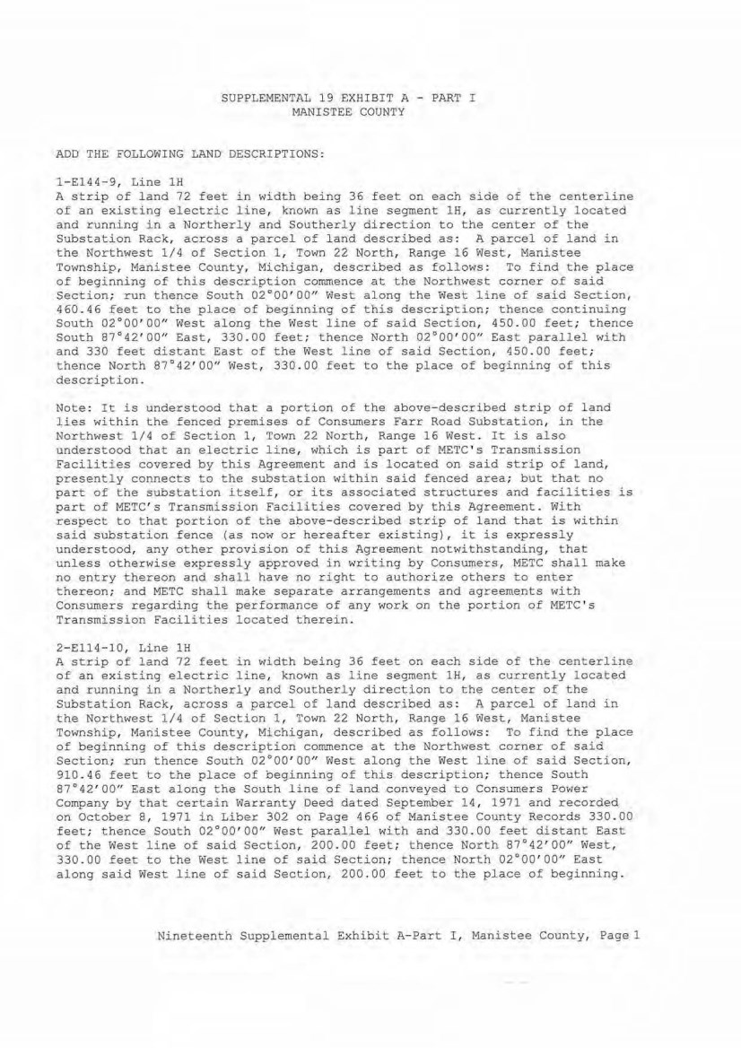
| SUPPLEMENTAL 19 EXHIBIT A - PART I MANISTEE COUNTY ADD THE FOLLOWING LAND DESCRIPTIONS: l-El44- 9, Line lH A strip of land 72 feet in width being 36 feet on each side of the centerl ine of an existing electric line, known as line segment lH, as currently located and running in a Northerly and Sout herly direction to the center of the Substation Rack, across a parcel of l and described as: A parcel of land in the Northwest 1/4 of Section 1 , Town 22 North, Range 16 West, Manistee Township, Manistee County, Michigan, described as follows : To find the place of b e ginning of this description commence at the Northwest corner of said Section; run thence South 02°00' 00" West along the West line of said Secti on, 460 . 46 feet to the p l ace of beginning of t h is description; thence continuing Sou th 02°00'00" West along the West line of said Sect ion, 450 . 00 feet; thence South 87°42' 00" East, 330. 00 fe€t; thence North 02°00' 00'' East parall el with and 330 feet distant East of the West l ine of said Section, 450.00 feet; thence North 87°42' 00" West, 330 .00 feet to the place of beginning of this description. Note: It is understood that a portion of the above-described strip of l and lies within the fenced premises of Consumers Farr Road Substation, in the Nort hwest 1 /4 of Section 1, Town 22 North, Range 16 West . It is also understood that an electric line, which is part of METC ' s Transmission Facilities covered by this Agreement and is located on said strip of land, presently connects to the substation within said fenced area; but that no part of the substation itself, or its associated structures and facili ties is part of METC ' s Transmission Facil ities covered by this Agreement. With respect to that portion of the a~ove- described strip of land that is within said substation fence (as now or hereafter existing), it is expressly understood, any other provision of this Agreement notwithstanding, that unl ess otherwise expressly approved in writing by Consumers, METC shall make no entry thereon and shall have no right to authorize others to enter thereon; and METC shall make separate arrangements and agr eements with Consumers regarding the performance of any work on the portion of METC ' s Transmission Facilities located therein. 2- Ell4-10, Line lH A strip of land 72 feet in width being 36 feet on each side of the cent erline of an existing electric line, known as line segment lH, as currently l ocated and running in a Northerly and Southerly directi on to the center of the Substation Rack, across a parcel of land described as:. A parcel of land i n the Northwest 1/4 of Section 1, Town 22 North, Rang. e 16 West, Manistee Townshi p , Manistee County, Michigan, described as follows : To find the place of beginning of this description commence at the Northwest corner of sai d Section; run thence South 02°00'00" West. along the West line of said Section, 910.46 feet to the place of beginning of this description; thence South 87°42' 00" East along the South l i ne of land conveyed to Consumers Power Company by that certain Warranty Deed dated September 14, 1971 and recorded on October 8 , 1971 in Liber 302 on Page 466 of Manistee County Records 330. 00 feet; thence South 02°00'00" West parallel with and 330.00 feet distant East of the West line of said Section, 200 . 00 feet; thence North 87°42'00" West, 330.00 feet to the West line of said Section; thence Nort h 02°00'00" East along said West line of said Section, 200. 00 feet to the pl ace of beginning. Nineteenth Supplemental Exhibit A-Part I, Manistee County, Pagel |
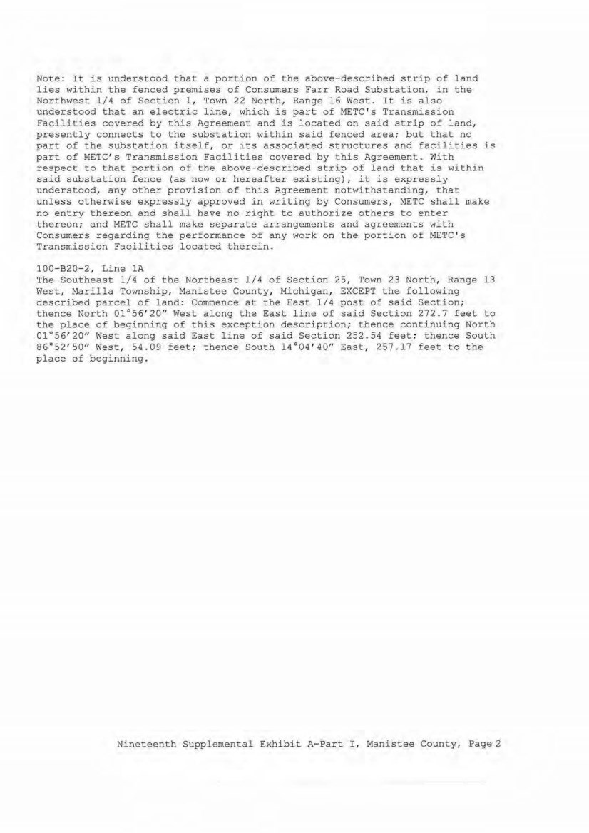
| Note: It is understood that a portion of the above-described strip of land lies within the fenced premises of Consumers Farr Road Substation, in t he Northwest 1/4 of Section 1, Town 22 North, Range 16 West . I t is also understood that an electric line, which is part of METC's Transmission Facilities covered by this Agreement and is located on said strip of land, presently connects to the substation within said fenced area; but that no part of the substation itself, or its associated structures and facilities is part of METC's Transmission Facilities covered by this Agreement. W i th respect to that portion of the above~described strip of land that is within said substation fence (as now or hereafter existing), it is expressly understood, any other provision of t his Agreement notwithstanding, that unless otherwise expressly approved in writing by Consumers, METC shall make no ent ry thereon and shall have no right to authorize others to enter thereon; and METC shall make separate arrangements and agreements with Consumers regarding the performance of any work on the portion of METC's Transmission Facilities located therein. 100- B20- 21 Line lA The Southeast 1/4 of the Northeast 1/4 of Section 25, Town 23 North, Range 13 West, Marilla Township, Manistee County, Michigan, EXCEPT the following described parcel of land: Commence at the East 1/4 post of said Section; thence North 01°56'20u West along the East line of said Section 272 . 7 feet to the place of beginning of this exception description; t hence continuing North 01°56'20" West along said East l i ne of said Section 252.54 feet; thence South 86°52'50" West, 54.09 feet; thence South 14°04'40" East, 257 .17 feet to the place of beginning. Nineteenth Supplemental Exhibit A- Part I, Manistee County, Page2 |
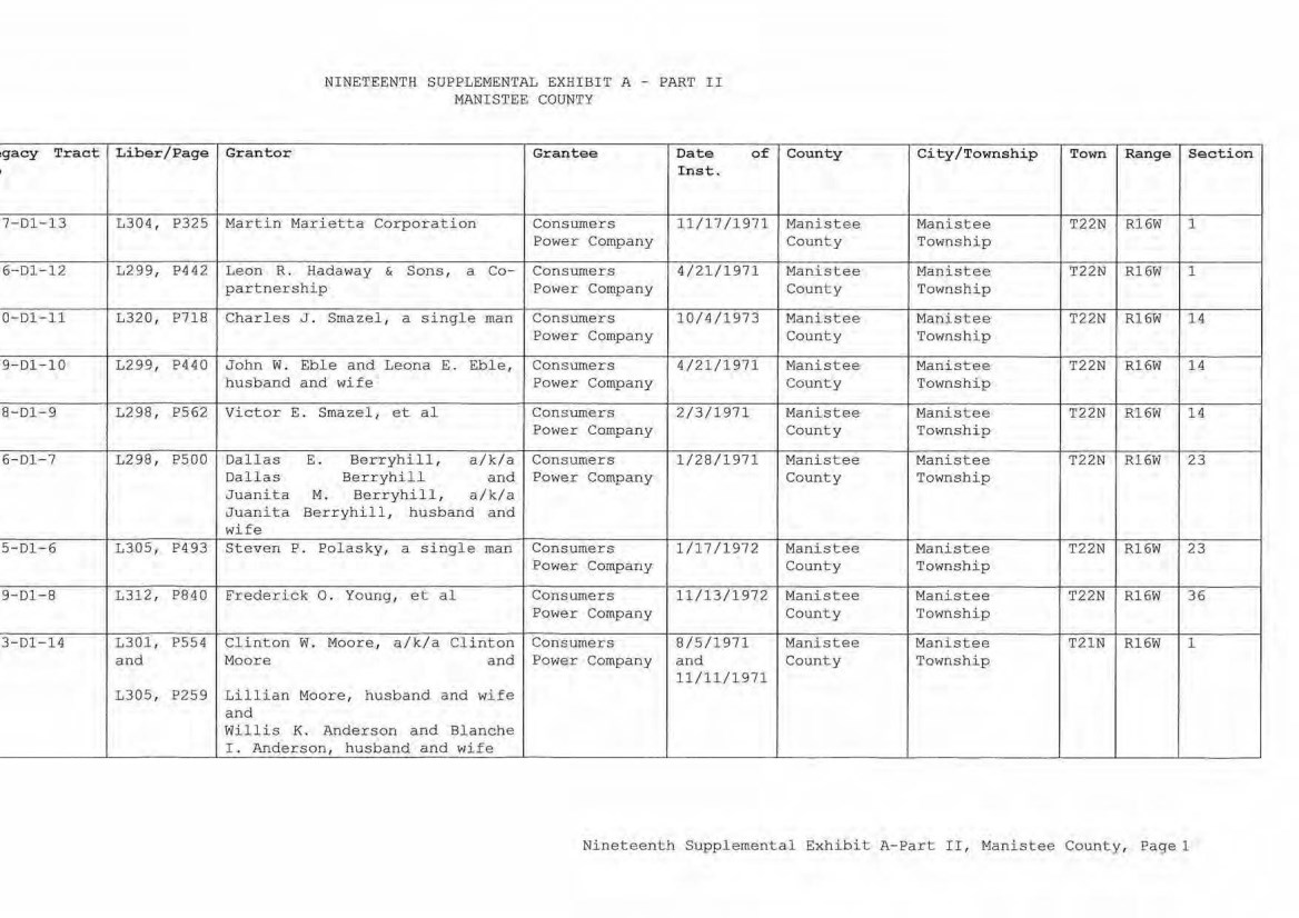
| ,gacy Tr act Liber/Pa ge I 7-D1-13 1304, P325 6-D1 - 1 2 L299, P442 0- Dl- 11 1 320, P718 9-D1-10 1299, P4 40 8-D1-9 1298 , P562 6-Dl-7 L298, PS00 5-D1- 6 L3.05, P493 9-D1- 8 1 312, P840 3-D1-14 L301, P554 and L305, P259 NINETEENTH SUPPLEM ENTAL EXHIBI T A - PART I I MANI STEE COUNTY Gr ant or Grante e Date of Inst. M artin Marietta Corporati on Consumers ll/17 /1971 Power Company Leon R. Hada1~ay & Sons, a Co- Consumer s 4/21/ 1971 part nership Power Company Charles J . Smazel, a single man Conslllllers 10/4/1973 Power Company John W . Ebl e and Leona E. Eble, Consumers 4/21/ 1971 h u sband and wife Powe r Company Victor E. Smazel, et a l Consumers 2/3/1971 Power Company Dal las E. Berryhill, a/k /a Consumer s 1 /28/1971 Dallas Berryhill and Power Company J ua nit a M. Berryhill , a / k/a Juanita Berr yhi l l, husband and wife Steven P . Polasky , a singl e man Consumers 1/17/ 1972 Power Comp any Frederi ck 0 . Young, et al Consumers 11/13/1972 Power Company Clinton w. M oore, a/k /a Clinton Consumers 8/5/ 1971 Moore and Power Compan y a nd 11/ ll/1 971 Lillian Moore, husband and wife and Willis K. Anderson and Blanche L Anderson, husband a nd wife County City/Towns hip Town Range Sec tion Manistee Manistee T22N R16W 1 County Township Manistee Mani stee T22N R16W 1 County Township M anistee M anistee T22N R16W 14 County Township M anistee M anist ee T22N Rl 6W 14 County Township Manistee Manistee T22N R16W 14 County Tow nship Mani stee Mani stee T22N Rl6W 23 County Township Manistee Manistee T22N R16W 23 Count y Township M anistee M ani stee T22N Rl6W 36 County Township Manistee M ani stee T21N R16W 1 County Township Ni nete enth Supplemental Exhibit A-Part II, M ani stee Coun ty, Page 1 |
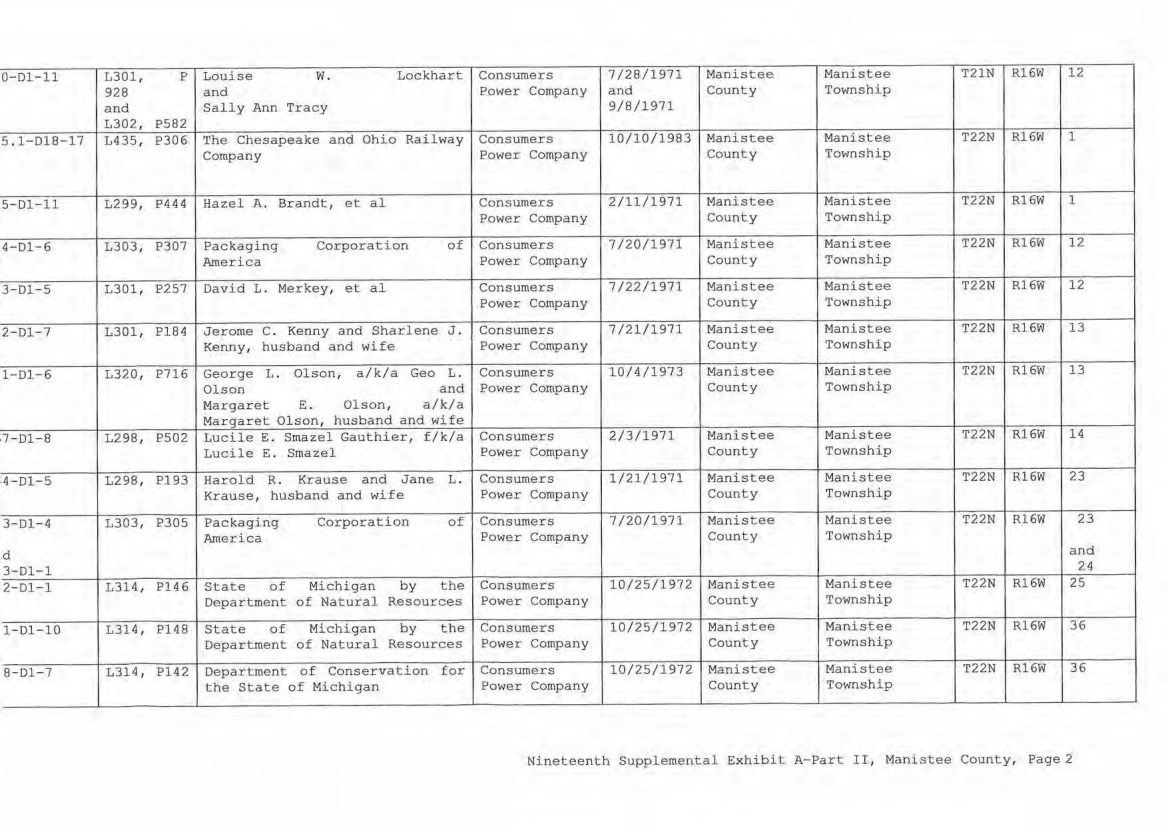
| 0-D1-11 L301, p Louise w. Lockhart Consumers 7/28/1971 Manistee Manistee T21N Rl6W 12 928 and Power Company and County Township and Sally Ann Tracy 9/8/1971 L302, P582 5.1-D18-17 L435, P306 1'he Chesapeake and Ohio Railway Consumers 10/l0/1983 Manistee Manistee T22N Rl6W 1 Company Power Company County Township 5-Dl-11 L299, P444 Hazel A. Brandt, et al Consumer s 2/11/1971 Manistee Man i stee T22N Rl6W 1 Power Company County Townshi p 4-D1-6 L303, P307 Packaging Corporation of Consumers 7/20/1971 Manistee Manistee T22N Rl6W 12 America Power Company County Township 3-D1-5 L3011 P257 David L. Merkey, et al Consumers 7/22/1971 Manistee Manistee T22N R16W 12 Power Company County Township 2-Dl -7 L301, P184 Jerome C. Kenny and Sharlene J. Consumers 7/21/1971 Manistee Manistee T22N R16W 13 Kenny, husband and wife Power Company County Township 1-D1-6 L320, P716 George L. Ol son, a/k/a Geo L. Consumers 1 0/4/1973 Manistee Manistee T22N Rl6W 13 Olson and Power Company County Township Margaret E. Olson, a/k/a Margaret Olson, husband and wife ,7- D1- 8 L298 , P502 Lucile E. Smazel Gauthier, f/k/a Consumers 2/3/1971 Manistee Manistee T22N R16W 14 Lucile E. Smazel Power Company County Township ,4- D1- 5 L298, Pl93 Harold R. Krause and Jane L. Consumers 1/21/1971 Manistee Manistee T22N R16W 23 Krause, husband and wife Power Company County Township 3-01-4 L303, P305 Packaging Corporation of Consumers 7/20/1971 Manistee Manistee T22N Rl6W 23 America Power Company County Township ,d and 3-D1-1 24 2-Dl-1 L314, Pl46 State of Michigan by the Consumers 10/25/1972 Manistee Manistee T22N Rl6W 25 Department of Natural Resources Power Company County Township l-D1-10 L314 , Pl48 State of Michigan by the Consumers 10/25/1972 Manistee Manistee T22N Rl6W 36 , Department of Natural Resources Power Company County Township 8-01-7 L314, Pl42 Department of Conservation for Consumers 10/25/1972 Manistee Manistee T22N R16W 36 the Stat e of Michigan Power Company County Township Ninet eenth Supplement al Exhibit A-Part II, Manistee County, Page2 |
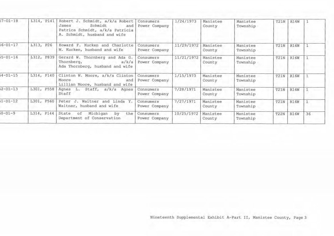
| j7-Dl-18 L314, Pl41 Robert J. Schmidt, a/k/a Robert Consumers 1/24/1973 Manistee Manistee T21N Rl6W 1 James Schmidt and Power Company County Township Patrica Schmidt, a/k/a Patricia A. Schmidt, husband and wife i6-Dl-17 L313, P26 Howard F . Kucken and Charlotte Consumers 11/29/1972 Manistee Manistee T21N R16W 1 M. Kuc ken, husband and wife Power Company County Township iS-Dl- 16 L312, P839 Gerard w. Thornberg and Ada G. Consumers 11/21/1972 Manistee Manistee T21N R16W 1 Thornberg, a/k/a Power Company County Township Ada Thornberg, husband and wife i4-Dl-15 L314, Pl40 Clinton w. Moore, a/k/a Clinton Consumers 1/15/1973 Manistee Manistee T21N Rl6W 1 Moore and Power Company County Township Lillian Moore, husband and wife i2-Dl-13 L301, P558 Agnes L . Staff, a/k/a Agnes Consumers 7/28/1971 Manistee Manistee T21N R16W 1 Staff Power Company County Township il-D1-12 L301, P560 Peter J. Waitner and Linda Y. Consumers 7/27/1971 Manistee Manistee T21N Rl6W l Waitner, husband and wife Power Company CoW1ty Township i0-01-9 L314 , Pl44 State of Michigan by the Consumers 10/25/1972 Manistee Manistee T22N Rl6W 36 Department of Conservation Power Company County Township Nineteenth Supplemental Exhibit A-Part II, Manistee County, Page 3 |
| CE Re£. License/Lessor NINETEENTH SUPPLEMENTAL EXHIBIT A - PART III MANISTEE COUNTY Licensee/Lessee Date of Instrument NONE Title of Instrument Town/Range Section Nineteenth Supplemental Exhibit A-Part III, Manistee County, Page 1 |
| PAGE 00328 1 of 26 STATE OF MICHIGAN - MIDLAND COUNTY RECEIVED 01/07/2021 10:47:25 AM RECORDED 01/07/2021 10:48:43 AM Receipt #188616 JULIE K. ATKINSON, REGISTER OF DEEDS LIBER 01641 SUPPLEMENT NO. 19 TO AMENDED AND RESTATED EASEMENT AGREEMENT THIS SUPPLEMENT NO. 19 TO AMENDED AND RESTATED EASEMENT AGREEMENT ("Supplement No. 19") is made this day of , 2020, between CONSUMERS ENERGY COMPANY (formerly known as Consumers Power Company), a Michigan corporation, (successor by merger to Consumers Power Company, a Maine corporation), One Energy Plaza, Jackson, Michigan 49201 ("Consumers") and MICHIGAN ELECTRIC TRANSMISSION COMPANY, LLC, a Michigan limited liability company (successor by merger to Michigan Electric Transmission Company, a Michigan corporation), 27175 Energy Way, Novi, Michigan 48377 ("METC"). RECITALS: A. Consumers and METC entered into a certain Easement Agreement dated April 1, 2001 whereunder Consumers granted an "Easement" (as therein defined) to METC in respect to certain "Premises" in the State of Michigan for the use set forth therein and on and subject to all of the terms and conditions set forth therein. B. Consumers and METC agreed on certain revisions to the terms and conditions of said Easement Agreement, and for ease of reference, restated said Easement Agreement in its entirety, to include all of said agreed-upon revisions as well as all unchanged provisions, in a certain Amended and Restated Easement Agreement dated as of April 29, 2002 (the "Agreement"). C. The "Premises" under the Agreement are therein defined as (a) the lands identified as "fee lands" in Part "I" of Exhibit A, attached to the Agreement, (b) the lands covered by the easements held by Consumers that are identified in Part "II" of Exhibit A, attached to the Agreement, and (c) the lands covered by the leases, permits and licenses held by Consumers that are identified in Part "III" of Exhibit A, attached to the Agreement; as said Parts I, II and III of Exhibit A were supplemented or modified in a certain Supplement No. 1 dated April 29, 2002, in a certain Supplement No. 2 dated April 29, 2002, in a certain Supplement No. 3 dated March 3, 2003, in a certain Supplement No. 4 dated October 2, 2006, in a certain Supplement No. 5 dated August 3, 2007, in a certain Supplement No. 6 dated June 18, 2008, in a certain Supplement No. 7 dated September 18, 2008, in a certain Supplement No. 8 dated December 4, 2008, in a certain Supplement No. 9 dated February 22, 2010, in a certain Supplement No. 10 dated March 25, 2010, in a certain Supplement No. 11 dated October 12, 2011, in a certain Supplement No. 12 dated July 20, 2012, in a certain Supplement No. 13 dated August 21, 2012, in a certain Supplement No. 14 dated September 23, 2013, in a certain Supplement No. 15 dated January 13, 2014, in a certain Supplement No. 16 dated January 31, 2017, in a certain Supplement No. 17 dated September 25, 2019, and in a certain Supplement No. 18 dated June 8, 2020, heretofore entered into by Consumers and METC. The parties now desire to further supplement and modify said Exhibit A to the Agreement as set forth herein below. 1111111 1111111111 1 1111 II III lllll 1 1111 1 111 11 1 111 111 1111111 11111 1 1 11111 111III LIBER 01641 PAGE 00328 1 of 26 • STATE OF MICHIGAN - MIDLAND COUNlY RECEIVED 01/07/2021 10 :47:25 AM RECORDED 01/07/2021 10:48:43 AM Reoedpt #188616 JULIE K. ATKINSON, REGISTER OF DEEDS , SUPPLEMENT NO . 19 TO AMENDED AND RESTATED EASEMENT AGREEMENT THIS SUPPLEMENT NO . 19 TO AMENDED AND RESF\1,;ED EASEMENT AGREEMENT ( " Supplement No. 19") is made this »- day of /_..d:{,_c.t-J~,y , 2020, between CONSUMERS ENERGY COMPANY (formerl y known as Consumers Power Company) , a Michigan corporation, (successor by merger to Consumers Power Company, a Maine corporation) , One Energy Plaza, Jackson, Michigan 4 9201 ("Consumers") and MICHIGAN ELECTRIC TRANSMISSION COMPANY , LLC, a M i chigan limited liability company (successor by mer ger to Michigan Electric Transmission Company, a Michigan corporation) , 27175 Energy Way, Novi, Michigan 48377 (" METC" ) . RECITALS : A. Consumers and. METC entered into a certain Easement Agreement dated April 1 , 2001 whereunder Consumers granted an ''Easement" (as therein defined) to METC in respect to certain " Premises'' in the State of Michigan for the use set forth therein and on and subject to all of the terms and conditions set f orth therein. B. Consurners and METC agr eed on certain revisions to t h e terms and conditions of said Easement Agreement, and for ease of reference, restated said Easement Agreement in its entirety, to include all of said agreed- upon revisions as well as all unchanged provisions, in a certain Amended and Restated Easement Agreement dated as of April 29, 2002 (the "Agreement"). C . The "Premises" under the Agreement are therein defined as (a) the lands identified as " fee lands" in Part " I " of Exbibit A, attached t o the Agreement, (b) the l ands covered by the easements held by Consumers that are identi f i ed in Part "II" of Exhibit A, attached to t he Agreement, and (c) the lands covered by the leases, permits and licenses hel d by Consumers that are identified in Part "III" of Exhibit A, attached to the Agreement; as said Parts I , II and III of Exhibit A were supplemented or modified in a certain Supplement No . l dated April 29, 2002, in a cer tain Supplement No . 2 dated April 29, 2002, in a certain Supplement No . 3 dated March 3, 2003, in a certain Supplement No . 4 dated October 2 , 2006, in a certain Supplement No. 5 dated August 3 , 2007 , in a certain Supplement No . 6 dated June 18, 2008, in a certain Supplement No . 7 dated September 18, 2008 , in a certain Supplement No . 8 dated December 4, 2008, in a certain Supplement No . 9 dated February 22, 2010, in a certain Supplement No . 10 dated March 25, 2010 , in a certain Supplement No . 11 dated October 12, 2011, in a certain Supplement No . 12 dated July 20, 2012, in a certain Supplement No . 13 dated August 21 , 2012, in a certain Supplement No . 14 dated September 23, 2013 , in a certain Supplement No. 15 dated January 13 , 2014 , in a certain Supplement No . 1 6 dated January 31, 2017 , in a certain Supplement No . 17 dated September 25, 2019, and in a certain Supplement No . 18 dated June 8 , 2020, heretofore entered into by Consumers and METC . The parties now desire to further supplement and modify said Exhibit A to the Agreement as set forth herein below. |
| LIBER 01641 PAGE 00328 2 of 26 2 D. References, in regard to historical matters, to "METC" in the foregoing recitals will be deemed to mean METC's predecessor, Michigan Electric Transmission Company, a Michigan corporation, where relevant. NOW, THEREFORE, for good and valuable consideration, the receipt of which is acknowledged, Consumers and METC agree as follows: 1. Exhibit A to the Agreement, as heretofore supplemented and/or modified, is hereby further supplemented and modified as set forth in "Nineteenth Supplemental Exhibit A", attached hereto. It is expressly understood that any lands, easements, or leases/permits/licenses that are indicated in said attached Nineteenth Supplemental Exhibit A as being added are, on and subject to the terms and conditions of the Agreement (as supplemented and amended by this Supplement No. 19), hereby deemed added to Part I, Part II and Part III, respectively, of Exhibit A to the Agreement. However, it is further expressly understood that in addition to all rights granted to METC by the Agreement, METC shall have the following rights as to the lands identified as "Consumers Energy Equipment / Joint Asset Area Easement" on the accompanying NINETEENTH Supplemental Exhibit A sheets, inclusive of Parts I, II and III, which rights are also subject to the terms of the Parties' Amended and Restated Transmission Interconnection Agreement (the "DTIA"): (a) the right to maintain any and all existing components of the Transmission System, as defined in the DTIA, and wiring or conduit connections for the same that currently exist over, on or under these lands; and (b)the right to connect its currently sited or future approved wiring or conduits for communications, station power, or control, operating at 600 volts or less, and any Jointly Owned Assets, as defined in the DTIA, over, on or under these lands. It is also expressly understood that, with respect to any lands, easements, or leases/permits/licenses now covered by Part I, Part II or Part III of Exhibit A that are indicated in said attached Nineteenth Supplemental Exhibit A as being deleted, the Easement is hereby deemed RELEASED with respect thereto and the Agreement shall hereafter no longer apply thereto (provided, however, that all rights and obligations under the Agreement with respect to periods prior to the date of this Supplement No. 19 shall remain unaffected). 2. It is expressly understood and agreed that in respect to the additional Premises represented by the land(s), easement(s), lease(s), permit(s) and/or license (s) that are added to Part I, Part II and Part III of Exhibit A to the Agreement pursuant to this Supplement No. 19 (the "Additional Premises"): (a) All references to "Commencement Date" that are found in Article 1 ("Grant of Easement"), Article 2 ("Term"), Article 5 ("Additions/Alterations") , Article 6 ("Consumers' Reserved Rights to Use the Premises and Transmission Facilities"), Article 7 ("METC Approval of Compatible Uses"), Article 8 ("Certain Obligations of Consumers and Authorized Users; Etc.") and Article 14 ("Environmental Matters") of the Agreement shall be deemed to mean the date of this Supplement No. 19 and not the date that is identified in the Agreement as the "Commencement Date". 111111111111111111111111111111111111111111111111111111111 ll111 1111111111111 UBER 01641 PAGE 00328 2 of 26 2 D. References, in regard to historical matters, to "METC" in the foregoing recitals will be deemed to mean METC' s predecessor, Michigan Electric Transmission Company, a Michigan corporation, where relevant. NOW, THEREFORE , for good and valuable consideration, the receipt of which is acknowledged, Consumers and M8TC agree as follows. : l . Exhibit A to the Agr eement, as her etofore supplemented and/or modified, is hereby further supplemented and modified as set forth in "Nineteenth Supplemental Exhibit A" , attached hereto. I t is expressly understood that any lands, easements, or leases/permits/licenses that are indicated in said attached Nineteenth Supplemental Exhibit A as being added are, on and subject to the terms and conditions of the Agreement (as supplemented and amended by this Supplement No . 19) , hereby deemed added to Part I , Part II and Part III, re spec ti vely, of Exhibit A to the Agreement. However, it is further expressly understood that 1n addition to all rights granted to METC by the Agreement, METC shall have the following rights as to the lands identified as " Consumers Energy Equipment/ Joint Asset Area Easement" on the accom panying· NINETEENTR Supplemental Exhibit A sheets, inclusive of Parts T, II and III, which rights are also subject to the terms of the Parties' Amended and Restated Transmission Interconnection Agreement (the "DTIA") : (a) the right to maintain any and all existing components of the Transmission System, as defined in the DTIA, and wiring or conduit connections for the same that currently exist over, on or under t hese landsi and (b)the right to connect its currently sited or future approved wiring or conduits for communications, station power, or control, operating at 600 vol ts or less, and any Jointly Owned Assets, as defined in the DTIA, over, on or under these lands. It is also expressly understood that , with respect to any lands, easements, or leases/permits/li censes now covered by Part I , Part II or Part III of Exhibit A that are indi cated in said attached Nineteenth Supplemental Exhi b i t A as being deleted, the Easement is hereby deemed RELEASED with respect thereto and the Agreement shall hereafter no longer apply thereto (provided, however, that all rights and obligation s under the Agreement with respect to periods pri or to the date of this Supplement No. 19 shall remain unaffected). 2 . I t is expressly understood and agreed that in respect to the additional Premises represented by the land ( s) , easement ( s) , lease ( s) , permi t ( s) and/or license (s) that are added to Part I , Part II and Part III of Exhibit A to the Agreement pursuant to this Supplement No . 19 (the "Additional Premises" ) : (a) All references to "Commencement Date" t hat are found in Article 1 ("Gran t of Easement" ) , Article 2 ("Term" ) , Article 5 ("Addi t i on s/Alterationsfl) , Article 6 ("Consumers' Reserved Rights co Use the Premises and Transmission Facilities" ) , Article 7 ("METC Approval of Compatible Uses") , Article 8 ("Certain Obligations of Consumers and Authorized Users; Etc.") and Article 14 ( ''Environmental Matters" ) of the Agreement shall be deemed to mean the date of this Supplement No . 19 and not the date that is ident ified in the Agreement as the "Commencement Date" . |
| LIBER 01641 PAGE 00328 3 of 26 3 (b) Except as expressly otherwise indicated in the immediately following sentence, all references to "Restated Agreement Date" that are found in Article 1 ("Grant of Easement"), Article 6 ("Consumers' Reserved Rights to Use the Premises and Transmission Facilities"), and Article 12 ("Compliance With Applicable Laws") of the Agreement shall also be deemed to mean the date of this Supplement No. 19 and not the date that is identified in the Agreement as the "Restated Agreement Date". Notwithstanding the foregoing: (i) the preceding sentence does not apply to the purely historical statement in clause "(c)" of Section 1.2 of the Agreement that Trans-Elect, Inc. is "an affiliate of the entity which has become METC's parent company as of the Restated Agreement Date"; and (ii) the parenthetical in the first sentence of the first paragraph of Section 7.1 of the Agreement reading "(see below regarding a certain period prior to the Restated Agreement Date)", along with the fourth paragraph of said Section 7.1 reading "Consumers shall submit to METC within twenty (20) days of the Restated Agreement Date a list of all material Compatible Uses other than additions or modifications to Distribution Facilities that have been authorized between February 1, 2001 and the Restated Agreement Date for METC's approval per the METC Compatible Use approval process described in this Section 7.1.", both referred to a one-time historical matter and have no application to the Additional Premises or any other further effect or application whatsoever. 3. In addition to the original Transmission Facilities and Additions/Alterations thereto as referred to in Recital "A" of the Agreement, it is understood that such electric Transmission towers, pole structures, poles, crossarms, wires, cables, conduits, guys, anchors, transformers, insulators and/or other fixtures and equipment as may be owned by METC and located on the Additional Premises as of the date of this Supplement No. 19, and future Additions/Alternations made thereto on and subject to the terms and conditions of the Agreement, are included in the "Transmission Facilities" under the Agreement. Note: This Supplement No. 19 will not be recorded in all counties in which the Agreement itself, or Supplements Nos. 1 through 18, may have been recorded. This Supplement No. 19 (as were each of Supplements Nos. 1 through 18), will be recorded only in the county(ies) in which relevant Premises are located; being, in the case of this Supplement No. 19, only the following: I 111111 lllll 1 1111 1111111111 lllll 1111111111111111111111111 ll1 11 1111111111111 UBER 01641 PAGE 00328 3 of 26 3 (b) Except as expressly otherwise indi cated in the i mmediately following sentence, all references to ''Restated Agreement Date" that are found in Article l ( "Grant of Easement" ) , Article 6 ("Consumers' Reserved Right s to Use the Premises and Transmissi on Facilities" ) , and Article 12 ("Compliance With Applicable Laws" ) of the Agreement shall also be deemed to mean the date of this Supplement No . 19 and not the date that is identified in t he Agreement as the "Restated Agreement Date'' . Notwithstanding the foregoing : (i) the preceding sentence does not apply to the purely historical statement in cl.ause " (c) " of Section 1. 2 of the Agreement that Trans-Elect, Inc. is " an affiliate of the entity which has become METC ' s parent company as of the Restated Agreement Date"; and (ii) the parenthet ical in the first sentence of the first paragraph o f Section 7 , 1 of the Agreement reading "(see below regarding a certain period prior to the Restated Agreement Date) ", along with the fourth paragraph of said Section 7.1 reading "Consumers shall submit to METC within twenty (20) days of the Restated Agreement Date a list of all material Compatibl e Uses other than addi tions or modifications to Distribution Facilities that have been authorized between February 1 , 2001 and the Restated Agreement Date for METC ' s approval per the METC Compatible Use approval process described in this Section 7 . 1 . " , both referred to a one-time historical matter and have no application to the Additional Premises or any other further effect or applicati on whatsoever. 3 . In addition to the original Transmission Facilities and Additions/Alterations thereto as referred to in Recital "A" of the Agreement, it is understood that such electric Transmissi on towers, pole structures, poles, crossarms, wires, cables, conduits, guys, anchors, transformers, insul ators and/or other fixtur es and equipment as may be owned by METC and located on the Additional Premises as of the date of this Supplement No . 19, and future Additions/Alternati ons made thereto on and subject to the terms and conditions of the Agreement, are included in the "Transmission Facilities" under the Agreement . Note : This Supplement No . 19 will not be recorded in all counties in which the Agreement itself, or Supplements Nos . 1 through 18, may have been recorded . This Supplement No . 19 (as were each of Supplements Nos . 1 through 18) , will be recorded only in the county(i es) in which relevant Premises are located; being, in the case of this Supplement No . 19, only the following : |
| LIBER 01641 PAGE 00328 4 of 26 4 Allegan County Antrim County Barry County Bay County Calhoun County Charlevoix County Clinton County Crawford County Emmet County Genesee County Gladwin County Grand Traverse County Gratiot County Ingham County Ionia County Isabella County Jackson County Kalkaska County Kent County Leelanau County Lenawee County Manistee County Midland County Montcalm County Muskegon County Oceana County Ogemaw County Ottawa County Roscommon County Saginaw County Shiawassee County St. Joseph County Washtenaw County Wexford County The fact that this Supplement No. 19 will be recorded only in the particular county(ies) identified above will in no way restrict, limit or otherwise affect the interpretation, application or enforcement of the Agreement; and the terms and conditions of the Agreement shall at all times be read, interpreted and applied in the manner provided for in Section 24.6 of the Agreement. Allegan County Antrim County Barry County Bay County Calhoun County Charlevoix County Clinton County Crawford County Emmet County Genesee County Gladwin County Grand Traverse County Gratiot County Ing h am County Ionia County Isabella County Jackson County Kal k aska County Kent County Leelanau County Lenawee County Manistee County Midland County Montcalm County Muskegon County Oceana County Ogemaw County Ottawa County Roscommon County Saginaw County Shiawassee County St . Joseph County Washtenaw County Wexford County 11 11 111 11 111111 1 1 11 11 1 1 1 111 1111 1 11111 1 1111 11111 111 11 11 111 11 111 1 1 1 1 1 111111 1 1 UBER 01641 PAGE 00328 4 o f 26 4 The fact that this Supplement No . 19 will be recorded only in the particular county(ies) identified above will in no way restrict , limit or otherwise affect the interpretation , application or enforcement of the Agreement ; and the terms and conditions of the Agreement shall at all times be read, interpreted and applied in the manner provided for in Section 24 . 6 of the Agreement . |
| LIBER 01641 PAGE 00328 5 of 26 5 IN WITNESS WHEREOF, Consumers and METC have executed this Supplement No. 19 as of the date first above written. CONSUMERS ENERGY COMPANY, a Michigan corporation — Mary Anne Ma\r Director of Real Estate STATE OF MICHIGAN COUNTY OF s. )# ) ) ss. ) The foregoing instrument was acknowledged before this 2020, by Mary Anne Marr, Director of Real Estate of CONSUMERS a Michigan corporation, on behalf of the corporation. p U — day Of P? ONSUMERS ENERGY COMPANY, .... . .. . .. ill. f JLLIE C GUINN Not.ry Public State of Michigan County of Jackson My Cu'n^bss’nn Expires Dec 29, 2020 Acting ir the County of ^ mJM. ^{py\ v. -V ,a 7. u-c.^5 j f i La ,>~C■ ____ Notary Public, County, Michigan Acting in c J/[ f( c ^ 7^ _____ County, Michigan My Commission Expires: j r 20 1111111 111111111111111 1111111111 1111 11111111111 111111111111111 1 111111111111 UBER 01641 PAGE 00328 5 of 26 5 IN WITNESS WHEREOF, Consumers and METC have executed this Supplement No . 19 as of the date first above written. CONSUMERS ENERGY COMPANY, a Michi gan corporation ~ Director of Real Estate STATE OF MICHI GAN COUNTY OF s,_ )tl dt26)0 ss. The foregoing instrument was acknowledged before this ~ay of ~(.e,£,111,, ksc, 2020, by Mary Anne Marr, Director of Real Estate of CONSUMERS ENEGY COMPANY, a Michigan corporation, on behalf of the corporation. Jt,UE C GUINN l'i,,:,,·, P:.blic- 5:,HC' of Michigan County ol JdCkson "I- r-,>"l"l's•.'o~ expire, Qec 29, 2020 ,, '. '"~ -" :~1,, C:m,~:y of J/i.[ft"q;Qo ~ ' t'i"J .... ,~ -;i~~-..... ------ ... Not~ry :ublic, ~d1c..._~Fn_ County, Acting in sJL'tu_S_ co y nty, My Commission Expires : l d-/_~{ Michigan Michigan , 202c) |
| LIBER 01641 PAGE 00328 6 of 26 6 MICHIGAN ELECTRIC TRANSMISSION COMPANY, LLC, a Michigan limited liability company By: ITC Holdings Corp., a Michigan corporation, its manager Jean Kim D'Anna Vice President and Deputy General Counsel - Legal Services STATE OF MICHIGAN ) COUNTY OF Oakland ) ss. The fore^lnrr instrument was acknowledged before this 16 day of _____________ December ^020, by Jean Kim D'Anna, Vice President and Deputy General Counsel of ITC Holdings Corp., a Michigan corporation, as manager of MICHIGAN ELECTRIC TRANSMISSION COMPANY, LLC, a Michigan limited liability company, on behalf of the limited liability company. LAURA J. MCCRAY NOTARY PUBLIC, STATE OF Ml COUNTY OF OAKLAND MY COMMISSION EXPIRES Jul 30, 2021 ACTING IN COUNTY OF Notary Pul^1^ Acting in My Commission Expires: County, Michigan County, Michigan 7/30/21 , 2020 Exempt from transfer taxes per MCL §§ 207.505(f) and 207.526(f). Prepared by: Tracy L. VanWoert Return to: Julie Guinn Consumers Energy Company Consumers Energy Company EP7-447 One Energy Plaza Jackson, Michigan 49201 111111111111111111111111111111111111111111111111111111111111111111111111111 UBER 01641 PAGE 00328 6 of 26 6 MICHIGAN ELECTRIC TRANSMISSION COMPANY , LLC, a Michigan limited liability company By : ITC Holdings Corp. , a Michigan corporation, its manager By Jean Kim D' Anna Vice President and Deputy General Counsel - Legal Services STATE OF MICHIGAN COONTY OF .:= Q =akl = an = d ===- ss. The forenninn instrument was acknowledged before this I 16 I day of Oecemher )020, by Jean Kim D' Anna, Vice President and Deputy General Counsel of ITC Hol dings Corp., a Michigan corporation, as manager of MICHIGAN ELECTRIC TRANSMISSION COMPANY, LLC, a Michigan limited liability company, on behalf of the limited liability company. LAURA J. MCCRAY NOTARY PUBLIC. STATE OF Ml COUN:'I OF OAKLAND MY COMMISSION EXPIRES Jul 30, 202t ACTING IN COUNTY OF O<J.t:,lwv;/ Notary Acting My Puln c I Oal<l, ,rl I in Oakland I Commission Expires: County, Michigan County, Michigan _7/30/21_, 2020 Exempt from transfer taxes per MCL §§ 207.505(£) and 207 . 526(£) . Prepared by: Tracy L . Vanwoert Consumers Energy Company EP7-447 One Energy Plaza Jackson, Michigan 49201 Return to: Julie Guinn Consumers Energy Company |

| LIBER 01641 PAGE 00328 7 of 26 7 THE ATTACHED COPY OF THE NINETEENTH SUPPLEMENTAL EXHIBIT A THAT WAS PREPARED FOR RECORDATION IN MIDLAND COUNTY, MICHIGAN, AND CONTAINS THE PORTIONS OF EACH OF PARTS I, II, AND III OF THE NINETEENTH SUPPLEMENT EXHIBIT A THAT RELATE TO PREMISES IN THAT COUNTY ONLY. SEE SECTION 24.6 OF THE AGREEMENT. 11 11111 111111111111111 11111 lllll 1111 1111111 1111 11111 11111 111111111 1 11111111 LIBER 01641 PAGE 00328 7 of 26 7 THE ATTACHED COPY OF THE NINETEENTH SOPPLEMENTAL EXHIBIT A THAT WAS PREPARED FOR RECORD ATION IN MIDLAND COUNTY, MICHIGAN , AND CONTAINS THE PORTIONS OF EACH OF PARTS I , II, AND III OF THE NINETEENTH SUPPLEMENT EXHIBIT A TH AT RELATE TO PREMISES IN THAT COUNTY ONLY . SEE SECTION 24. 6 OF THE AGREEMENT . |
| LIBER 01641 PAGE 00328 8 of 26 NINETEENTH SUPPLEMENTAL EXHIBIT A Fee Lands: See sheet(s) labeled "NINETEENTH Supplemental Exhibit A-Part I", attached hereto and made a part hereof. Said attached sheet(s) labeled NINETEENTH Supplemental Exhibit A-Part I consist of the following: 3 Pages for Allegan County 6 Pages for Antrim County 2 Pages for Barry County 2 Pages for Bay County 13 Pages for Calhoun County 2 Pages for Charlevoix County 6 Pages for Clinton County 4 Pages for Crawford County 7 Pages for Genesee County 1 Page for Gladwin County 6 Pages for Grand Traverse County 1 Page for Gratiot County 2 Pages for Ingham County 2 Pages for Ionia County 1 Page for Isabella County 2 Pages for Jackson County 1 Page for Kalkaska County 4 Pages for Kent County 1 Page for Leelanau County 3 Pages for Lenawee County 2 Pages for Manistee County 4 Pages for Midland County 1 Page for Montcalm County 17 Pages for Muskegon County 1 Pages for Oceana County 1 Page for Ogemaw County 4 Pages for Ottawa County 3 Pages for Roscommon County 2 Pages for Saginaw County 3 Pages for Shiawassee County 1 Page for St. Joseph County 3 Pages for Washtenaw County 2 Pages for Wexford County Nineteenth Supplemental Exhibit A - Introductory Page 1 of 2 I 1111 11 111111111 1 11 111 1 1 111 111111 1111 11 1 1111111 111 11 11 11 111 1 1 1 111 1 11 1111 11 1 U B E R 0 1 6 4 1 P AGE 0 0 328 8 of 26 NINETEENTH SUPPLEMENTAL EXHIBIT A I . Fee Lands : See sheet (s) labeled " NINETEENTH Supplemental Exhibit A - Part I ", attached hereto and made a part hereof . Said attached sheet(s) labeled NINETEENTH Supplemental Exhibit A - Part I consist of the following : 3 Pages for Allegan County 6 Pages £or Antrim County 2 Pages for Barry County 2 Pages for Bay County 13 Pages for Calhoun County 2 Pages for CharlevoixCounty 6 Pages for Clinton County 4 Pages for Crawford County 7 Pages for Genesee County 1 Page for Gladwin County 6 Pages for Grand TraverseCounty 1 Page for Gratiot County 2 Pages for Ingham County 2 Pages for Ionia County 1 Page for Isabella County 2 Pages for Jackson County 1 Page for Kalkaska County 4 Pages for Kent County 1 Page for Leelanau County 3 Pages for Lenawee County 2 Pages for Manistee County 4 Pages for Midland County 1 Page for Montcalm Councy 17 Pages £or Muskegon County 1 Pages for Oceana County 1 Page for Ogemaw County 4 Pages for Ottawa County 3 Pages for Roscommon County 2 Pages for Saginaw County 3 Pages for Shiawassee County 1 Page for St . Joseph County 3 Pages for Washtenaw County 2 Pages for Wexford County Nineteenth Supplemental Exhibit A - Introductory Page 1 of 2 |
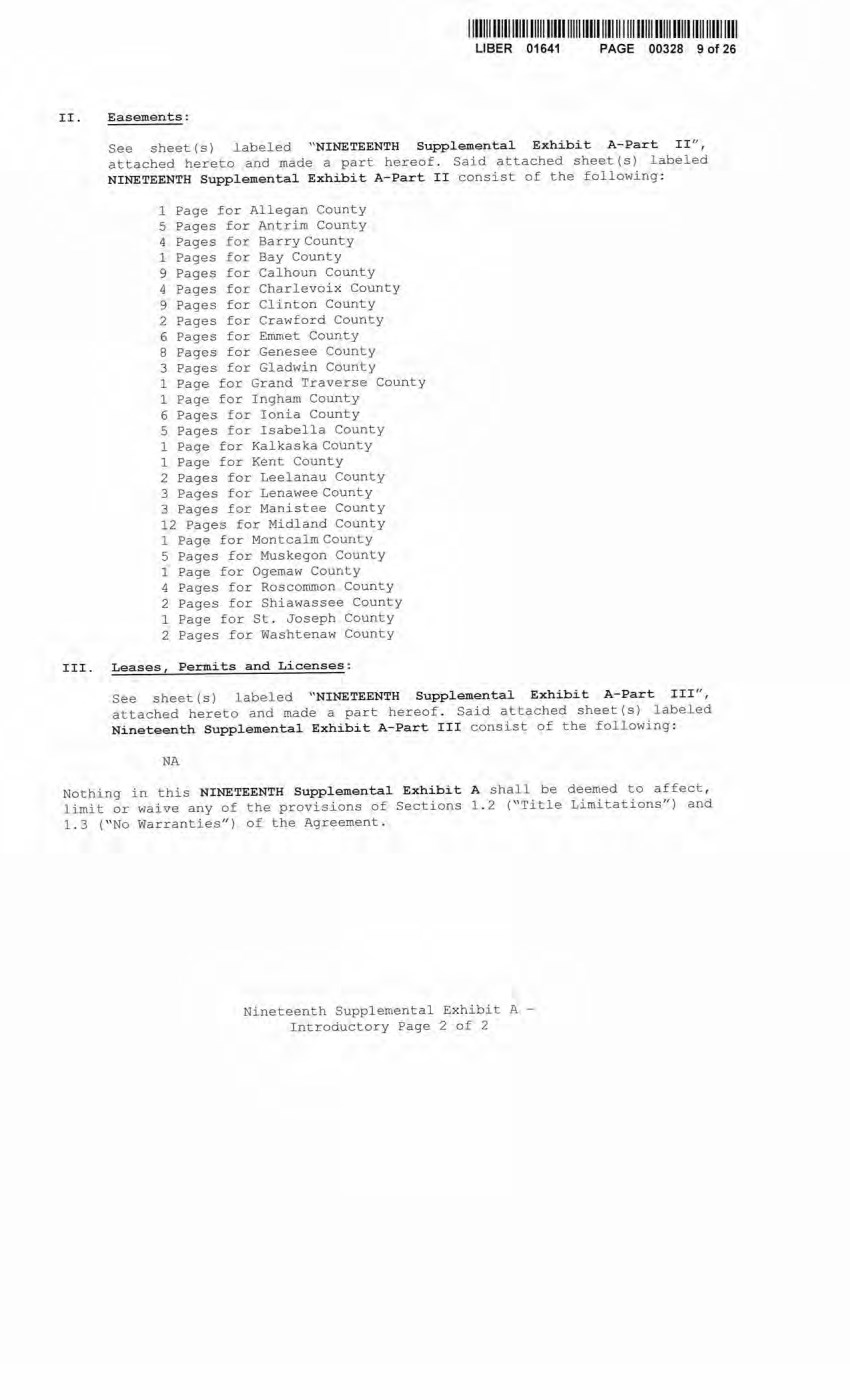
| LIBER 01641 PAGE 00328 9 of 26 II. Easements: See sheet(s) labeled "NINETEENTH Supplemental Exhibit A-Part II", attached hereto and made a part hereof. Said attached sheet(s) labeled NINETEENTH Supplemental Exhibit A-Part II consist of the following: 1 Page for Allegan County 5 Pages for Antrim County 4 Pages for Barry County 1 Pages for Bay County 9 Pages for Calhoun County 4 Pages for Charlevoix County 9 Pages for Clinton County 2 Pages for Crawford County 6 Pages for Emmet County 8 Pages for Genesee County 3 Pages for Gladwin County 1 Page for Grand Traverse County 1 Page for Ingham County 6 Pages for Ionia County 5 Pages for Isabella County 1 Page for Kalkaska County 1 Page for Kent County 2 Pages for Leelanau County 3 Pages for Lenawee County 3 Pages for Manistee County 12 Pages for Midland County 1 Page for Montcalm County 5 Pages for Muskegon County 1 Page for Ogemaw County 4 Pages for Roscommon County 2 Pages for Shiawassee County 1 Page for St. Joseph County 2 Pages for Washtenaw County III. Leases, Permits and Licenses: See sheet(s) labeled "NINETEENTH Supplemental Exhibit A-Part III", attached hereto and made a part hereof. Said attached sheet(s) labeled Nineteenth Supplemental Exhibit A-Part III consist of the following: NA Nothing in this NINETEENTH Supplemental Exhibit A shall be deemed to affect, limit or waive any of the provisions of Sections 1.2 ("Title Limitations") and 1.3 ("No Warranties") of the Agreement. Nineteenth Supplemental Exhibit A - Introductory Page 2 of 2 11 111 11 11 11111111 1 1 1 11 1 1 111 1111 1 111 1 1 1 1111 11111 11 111 11 111 11 1 11111 1 1 1 11 11 11 1 UBER 01641 PAGE 00328 9 o f 26 II. Easem e nts: See sheet(s) labeled '' NINETEENTH Supplemental Exhibit A-Part II ", attached hereto and made a part hereof . Said attached sheet(s) labeled NINETEENTH Supp l emental Exhib i t A - Part II consist of the following : 1 Page for Allegan County 5 Pages for Antrim County 4 Pages for Barry County 1 Pages £or Bay County 9 Pages for Calhoun County 4 Pages for Charlevoix County 9 Pages for Clinton County 2 Pages for Crawford County 6 Pages for Emmet County 8 Pages for Genesee County 3 Pages for Gladwin County 1 Page for Grand Traverse County 1 Page for Ingham County 6 Pages for Ionia Co un ty 5 Pages for Isabella County 1 Page for Kalkaska County 1 Page for Kent County 2 Pages for Le elana u County 3 Pages for Lenawee County 3 Pages for Manistee County 12 Pages for Midland County 1 Page for Montcalm County 5 Pages for Muskegon County 1 Page for Ogemaw County 4 Pages for Roscommon County 2 Pages for Shiawassee County 1 P age for St . Josep h County 2 Pages for Washtenaw County III. L e ases, Pertnits and Licenses : See sheet (s) labeled " NINETEENTH Supplemental Exhib i t A-Pa r t III ", attached hereto and made a part hereof . Said attached sheet(s) labeled Nineteenth Supplemental Exhibit A-Part III consist of tbe following : NA Nothing in this NINETEENTH Supplemental Exhib i t A shall be deemed to a f fect , limit or waive any of the provis i ons of Sections 1 . 2 (uTitle Limitations " ) and 1 . 3 ( " No Wa rranties u) of t h e Agr eem ent . Nineteenth Supplemental Exhibi~ A - Introductory Page 2 of 2 |
| LIBER 01641 PAGE 00328 10 of 26 SUPPLEMENTAL 19 EXHIBIT A - PART I MIDLAND COUNTY ADD THE FOLLOWING LAND DESCRIPTIONS: 158-D6-4 , Line 6B A strip of land fifty (50) feet wide off the East side of the North fractional 1/2 of the Northwest fractional 1/4 of Section 4, Town 14 North, Range 1 East, Homer Township, Midland County, Michigan. MI00000029107, Line 6B The East 50.00 feet of the Southeast 1/4 of the Northwest 1/4 of Section 4, Town 14 North, Range 1 East, Homer Township, Midland County, Michigan, being more particularly described as: Beginning at a point on the North-South 1/4 line of said Section 4 which is South 00°04'32" East, along said North-South 1/4 line, 1237.26 feet from the North 1/4 corner of said Section 4; thence continuing South 00°04'32" East, 1309.86 feet to the interior 1/4 corner of said Section 4; thence South 89°16'39" West, along the East-West 1/4 line of said Section 4, 50.00 feet; thence North 00°04'32" West, parallel with said North-South 1/4 line, 1309.53 feet to a point on the North line of the South 1/2 of the Northwest 1/4 of said Section 4; thence North 88°53'50" East, along said North line of the South 1/2 of the Northwest 1/4, 50.01 feet to the point of beginning. Containing 1.50 acres of land. 183- D6-2, Line 6FL The Northeast 1/4 of Southwest fractional 1/4, Section 4, containing 40 acres more or less, Town 15 North, Range 1 East, Lincoln Township, Midland County, Michigan; EXCEPT the East the 150 feet Northeast 1/4 of the Southwest 1/4 of Section 4, Town 15 North, Range 1 East, also excluding all mineral rights 184- D6-3, Line 6FL The West 100 feet of the Southwest 1/4 of the Northeast 1/4 of Section 4, Town 15 North, Range 1 East in, Lincoln Township, Midland County, Michigan. 179-D6-2, Line 6FL The West 100 feet of the Northwest 1/4 of the Northeast 1/4, in Section 9, Town 15 North, Range 1 East, Lincoln Township, Midland County, Michigan 181-D6-4, Line 6FL The Southwest 1/4 of Northeast 1/4, Section 9, containing 40 acres more or less, Town 15 North, Range 1 East, Lincoln Township, Midland County, Michigan. Excepting the following described land Consumers Power Company conveyed via Quit-Claim Deed dated December 18, 1968, as follows: The Southwest 1/4 of the Northeast 1/4 except the West 100 feet thereof, and the Northwest 1/4 of the Southeast 1/4 except the West 100 feet thereof, and the Northeast 1/4 of the Southwest 1/4 except the East 125 feet thereof, all in Section 9, Town 15 North, Range 1 East, Lincoln Township, Midland County, Michigan. 173-D6-1, Line 6FL The Southeast 1/4 of the Southwest 1/4, Section 16, containing 40 acres more or less, Town 15 North, Range 1 East, Lincoln Township, Midland County, Michigan; EXCEPT the East 125 feet The East 1/2 and the Southwest 1/4 of Section 16, Town 15 North, Range 1 East. Nineteenth Supplemental Exhibit A-Part I, Midland County, Page 1 111111 1111111111111111 lllll lllll 11111111111111111111 11111111111111 111 II I III UBER 01641 SUPPLEMENTAL 19 EXHIBIT A - PART I MIDLAND COUNTY ADD THE FOLLOWING LAND DESCRIPTIONS : 158- 06-4 , Line 6B PAGE 00328 10 of 26 A strip of land fifty (50) feet wide off the East side of the North fractional 1/2 of the Northwest fractional 1/4 of Section 4, Town 14 North, Rangel East , Homer Township, Midland County, Michigan. MI00000029107, Line 6B The East 50 . 00 feet of the Southeast 1/4 of the Northwest 1/4 of Section 4 , Town 14 North, Range 1 East, Homer Township, Midland County, Michigan, being more particularly described as : Beginning at a point on the North-South 1/4 line of said Section 4 which is South 00°04 ' 32" East, along said North-South 1/4 line, 1237 . 26 feet from the North 1/4 corner of said Section 4. ; thence continuing South 00°04 ' 32" East, 1309. 86 feet to the i nterior 1/4 corner of said Section 4; t hence South 89°16' 39n West, along the East-West 1/4 line of said Section 4, 50 . 00 feet; thence North 00°04 ' 32" West, parallel with said North-South 1/4 line, 1309 . 53 feet to a point on the North line of the South 1/2 of the Northwest 1/4 of said Section 4; thence North 88°53' 50" East , along said North line of the South 1/2 of the Northwest 1/4, 50 . 01 feet to the point of beginning. Containing 1 . 50 acres of land. 183-06-2, Line 6FL The Northeast 1/4 of Southwest fractional 1/4, Section 4, containing 40 acres more or less, Town 15 North, Range 1 East, Lincoln Township, Midland County, Michigan; EXCEPT the East the 150 feet Northeast 1/4 of the Southwest 1/4 of Section 4, Town 15 North, Range 1 East , also excluding all mineral rights 184-06-3, Line 6FL The West 100 feet of the Southwest 1 /4 of the Northeast 1/4 of Section 4 , Town 15 North, Range 1 East in, Lincoin Township, Midland County, Michigan . 179- 06-2, Line 6FL The West 100 feet of the Northwest 1/4 of the Northeast 1/4, in Section 9, Town 15 North, Range 1 East, Lincoln Township, Midland County, Michigan 181-06-4, Line 6FL The Southwest 1/4 of Northeasc 1/~, Section 9 , containing 40 acres more or less, Town 15 North, Range 1 East, Lincoln Township, Midland County, Michigan. Excepting the following described land Consumers Power Company conveyed via Quit-Claim Deed dated December 18, 1968, as follows : The Southwest 1/4 of the Northeast 1/4 except the West 100 feet thereof, and the Northwest 1/4 of che Southeast l/4 except the West 100 feet thereof, and the Northeast 1/4 of the Southwest 1/4 except the East 125 feet thereof, all in Section 9 , Town 15 North, Range 1 East~ Lincoln Township, Midland County, Michigan . 173- D6 - 1 , Line 6FL The Southeast 1/4 of the Southwest 1/4, Section 16, containing 40 acres more or less , Town 15 North, Rangel East, Lincoln Township, Midland County, Michigan; EXCEPT the East 125 feet The East 1/2 and the Southwest 1/4 of Section 16, Town 15 North, Range 1 East. Nineteenth Supplemental Exhibit A- Part I , Midland County, Pagel |
| LIBER 01641 PAGE 00328 11 of 26 174-D6-2, Line 6FL The Northeast 1/4 of the Southwest 1/4, Section 16, containing 40 acres more or less, Town 15 North, Range 1 East, Lincoln Township, Midland County, Michigan; EXCEPT the East 1/2 of the Southwest 1/4 of Section 16, Town 15 North, Range 1 East, except the East 125 feet thereof. 17 5-D6-3, Line 6FL The Southeast 1/4 of Section 16, containing 160 acres more or less, Town 15 North, Range 1 East, Lincoln Township, Midland County, Michigan; EXCEPT the Southeast 1/4 of Section 16, Town 15 North, Range 1 East, excepting therefrom from the Westerly 125 feet thereof. 168- D6-2, Line 6FL The Southwest 1/4 of Southeast 1/4, Section 21, containing forty (40) acres more or less, Town 15 North, Range 1 East, Lincoln Township, Midland County, Michigan; EXCEPT the South 1/2 of the Southwest fractional 1/4, EXCEPT the East 78 feet thereof, and the Southwest 1/4 of the Southeast 1/4; EXCEPT the West 54 feet thereof, all in Section 21, Town 15 North, Range 1 East, Lincoln Township, Midland County, Michigan. 169- D6-3, Line 6FL The East 78 feet of the South 1/2 of the Southwest fractional 1/4 of Section 21, ALSO the East 100 feet of the South 1/2 of the Northwest fractional 1/4, of Section 21, all in Town 15 North, Range 1 East, Lincoln Township, Midland Michigan. 1-G662-16, Line 6FL A strip of land 72 feet in width being 36 feet on each side of the centerline of an existing electric line, known as line segment 6FL, as currently located and running in a Northerly and Southerly direction to the center of the Substation Rack, across a parcel of land described as: The West 66 feet of the South 350 feet of the Southwest 1/4 of the Northeast 1/4 of Section 28, Town 15 North, Range 1 East, Lincoln Township, Midland County, Michigan. Note: It is understood that a portion of the above-described strip of land lies within the fenced premises of Consumers Price Road Substation, in the Northeast 1/4 of Section 28, Town 15 North, Range 1 East. It is also understood that an electric line, which is part of METC's Transmission Facilities covered by this Agreement and is located on said strip of land, presently connects to the substation within said fenced area; but that no part of the substation itself, or its associated structures and facilities is part of METC's Transmission Facilities covered by this Agreement. With respect to that portion of the above-described strip of land that is within said substation fence (as now or hereafter existing), it is expressly understood, any other provision of this Agreement notwithstanding, that unless otherwise expressly approved in writing by Consumers, METC shall make no entry thereon and shall have no right to authorize others to enter thereon; and METC shall make separate arrangements and agreements with Consumers regarding the performance of any work on the portion of METC’s Transmission Facilities located therein. Nineteenth Supplemental Exhibit A-Part I, Midland County, Page 2 1111111 11111 11111 11111 lllll 1111111111 1111111111 1111111111 1 111111111 11 111111 UBER 01641 PAGE 00328 11 of 26 l74-D6-2, Line 6FL The Northeast 1/4 of the Southwest 1/4, Section 16, containing 40 acres more or less, Town 15 North, Range 1 East, Lincoln Township, Midland County, Michigan; EXCEPT the East 1/2 of the Southwest 1/4 of Section 16, Town 15 North, Range 1 East, except the Bast 125 feet thereof . 175-D6-3, Line 6FL The Southeast 1/4 of Section 16, containing 160 acres more or less, Town 15 North, Range 1 East, Lincoln Township, Midland County, Michigan; EXCEPT the Southeast 1/4 of Section 16, Town 15 North, Range 1 East, excepting therefrom from the Westerly 125 feet thereof. 168-D6-2, Line 6FL The Southwest 1/4 of Southeast 1/4, Section 21, containing forty (40) acres more or less, Town 15 Nor th, Range 1 East, Lincoln Township, Midland County, Michigan; EXCEPT the South 1/2 of the Southwest fractional 1/4, EXCEPT the East 78 f eet thereof, and the Southwest 1 /4 of the Southeast 1/4; EXCEPT the West 54 feet thereof, all in Section 21, Town 15 Nor th, Rang·e 1 East, Lincoln Township, Midland County, Michigan. 169-D6-3, Line 6FL The East 78 feet of the Sout h 1/2 of the Southwest fractional 1/4 of Section 21, ALSO the East 100 feet of the South 1/2 of the Northwest fracti onal 1 /4 , of Section 21, all in Town 15 North, Range 1 East, Lincoln Township, Midland Michigan. l-G662-16, Line 6FL A strip of land 72 feet in width being 36 £eet on each side of the centerline of an existing electric line, known as line segment 6FL, as currently located and running in a Northerly and Southerly direction to the center of the Substation Rack, across a parcel of land described as : The West 66 feet of the South 350 feet of the Southwest 1/4 of the Northeast 1/4 of Section 28 1 Town 15 North, Range 1 East, Lincoln Township, Midland County, Michigan. Note: I t is understood that a portion of the above-described strip of l and lies within the fenced premises of Consumers Price Road Substation, in the Northeast 1/4 of Section 28 , Town 15 North, Range 1 East. It is also understood that an electric line, which is part of METC ' s Transmission Facilities covered by this Agreement and is located on said strip 0£ land, presently connects to the substation within said fenced area ; but that no part of the substation itself, or its associated structures and facilities is part of METC ' s Transmi ssion Facilities covered by this Agreement . With respect to that portion of the above- described strip of land that is withi n said substation fence (as now or hereafter existing) , it is expressly understood, any other provision of this Agreement notwithstanding, that unless otherwise expressly approved in writing by Consumers , METC shall make no entry thereon and shall have no right to authorize others to enter thereon; and METC shall make separate arrangements and agreements with Consumers regarding the performance of any work on the portion of METC ' s Transmission Facilities located therein. Nineteenth Supplemental Exhibit A-Part I, Midland County, Page2 |
| LIBER 01641 PAGE 00328 12 of 26 2- G662-17, Line 6FL A strip of land 72 feet in width being 36 feet on each side of the centerline of an existing electric line, known as line segment 6FL, as currently located and running in a Northerly and Southerly direction to the center of the Substation Rack, across a parcel of land described as: The North 110 feet of the West 66 feet of the South 460 feet of the Southwest 1/4 of the Northeast 1/4 of Section 28, Town 15 North, Range 1 East, Lincoln Township, Midland County, Michigan. Note: It is understood that a portion of the above-described strip of land lies within the fenced premises of Consumers Price Road Substation, in the Northeast 1/4 of Section 28, Town 15 North, Range 1 East. It is also understood that an electric line, which is part of METC’s Transmission Facilities covered by this Agreement and is located on said strip of land, presently connects to the substation within said fenced area; but that no part of the substation itself, or its associated structures and facilities is part of METC's Transmission Facilities covered by this Agreement. With respect to that portion of the above-described strip of land that is within said substation fence (as now or hereafter existing), it is expressly understood, any other provision of this Agreement notwithstanding, that unless otherwise expressly approved in writing by Consumers, METC shall make no entry thereon and shall have no right to authorize others to enter thereon; and METC shall make separate arrangements and agreements with Consumers regarding the performance of any work on the portion of METC’s Transmission Facilities located therein. 3- G662-18, Line 6FL A strip of land 72 feet in width being 36 feet on each side of the centerline of an existing electric line, known as line segment 6FL, as currently located and running in a Northerly and Southerly direction to the center of the Substation Rack, across a parcel of land described as: The East 264 feet of the South 462 feet of the Southeast 1/4 of the Northwest 1/4 of Section 28, Town 15 North, Range 1 East, Lincoln Township, Midland County, Michigan. Note: It is understood that a portion of the above-described strip of land lies within the fenced premises of Consumers Price Road Substation, in the Northwest 1/4 of Section 28, Town 15 North, Range 1 East. It is also understood that an electric line, which is part of METC’s Transmission Facilities covered by this Agreement and is located on said strip of land, presently connects to the substation within said fenced area; but that no part of the substation itself, or its associated structures and facilities is part of METC's Transmission Facilities covered by this Agreement. With respect to that portion of the above-described strip of land that is within said substation fence (as now or hereafter existing), it is expressly understood, any other provision of this Agreement notwithstanding, that unless otherwise expressly approved in writing by Consumers, METC shall make no entry thereon and shall have no right to authorize others to enter thereon; and METC shall make separate arrangements and agreements with Consumers regarding the performance of any work on the portion of METC’s Transmission Facilities located therein. 160-D6-1, Line 6B A strip of land one hundred (100) feet wide off the West side of that part of the Southeast 1/4 of Section 33, Town 15 North, Range 1 East, lying Southerly of the Tittabawassee River, Lincoln Township, Midland County, Michigan. Said strip of land will be used in the first instance for electric transmission lines and telephone lines; but may be put to such further uses Nineteenth Supplemental Exhibit A-Part I, Midland County, Page 3 1111111 111 111111111111 11111 lllll 11111 1 11111 1111 11111 lllll 11111 111111111 1 111 UBER 01641 PAGE 00328 12 of 26 2-G662-17 , Line 6FL A strip of land 72 feet in widch being 36 feet on each side of the centerline of an existing electric line, known as line segment 6FL, as currently located and running in a Northerly and Southerly direction to the center of the Substation Rack, across a parcel of land described as : The North 1 10 feet of the West 66 feet or the South 460 feet of the Southwest 1/4 of the Northeast 1/4 of Section 28, Town 15 North, Range 1 East, Lincoln Township, Midland County, Michigan . Note: It is understood that a portion of the above-described strip of land lies within the fenced premises of Consumers Price Road Substation, in the Northeast 1/4 of Section 28, Town 15 North, Rangel East . It is also understood that an electric line, which is part of METC ' s Transmission Facilities covered by this Agreement and is located on said strip of land, presently connects to the substation within said fenced area; but that no part of the substation itself, or its associated structures aTid facilities is part of METC ' s Transmission Facilities covered by this Agreement . With respect to that portion of the above-described strip of land that is within said substation fence (as now or hereafter e xisting) , it is expressly understood, any other provision of this Agreement notwithstanding, that unless otherwise expressly approved in writing by Consumers, METC shall make no entry thereon and shall have no right to authorize others to enter thereon; and METC shall make separate arrangements and agreements with Conswners regarding the performance of any work on the portion of METC's Transmission Facilities located therein. 3- G662- 18, Line 6FL A strip of land 72 feet in width being 36 feet on each side of the centerline of an existing electric line, known as line segment 6FL, as currently located and running in a Northerly and Southerly direction to the center of the Substation Rack, across a parcel of land described as : The East 264 feet of the South 462 feet of the Southeast 1/4 of the Northwest 1/4 of Section 28, Town 15 North, Range 1 East, Lincoln Township, Midland County, Michigan . Note: It is understood that a portion of the above-described strip of land lies within the fenced premises of Consumers Price Road Substation, in the Northwest 1/4 of Section 28, Town 15 North, Range 1 East. It is also understood that an electric line, which is part of METC ' s Transmission Facilities covered by this Agreement and is located on said strip of land, presently connects to the substation within said fenced area; but that no part of the substation itself, or its associated structures and facilities is part of METC ' s Transmission facilities covered by this Agreement . With respect to that portion of the above- described strip of land that is within said substation fence (a.s now or hereafter existing) , it is expressly understood, any other provision of this Agreement notwithstanding, that unless otherwise expressly approved in writing by Consumers, METC shall make no entry thereon and shall have no right to authorize others to enter thereon; and METC shall make separate arrangements and agreements with Consumers regarding the performance of any work on the portion of METC ' s Transmission Facilities located therein . 160-D6-1, Line 6B A strip of land one hundred (100) feet wide off the West side of that part of the Southeast 1/4 of Section 33, Town 15 North, Range 1 East, lying Southerly of the Tittabawassee River, Lincoln Township, Midland County, Michigan. Said strip of land will be used in the first instance for electric transmission lines and telephone lines; but may be put to such further uses Nineteenth Supplemental Exhibit A-Part I , Midland County, Page 3 |
| LIBER 01641 PAGE 00328 13 of 26 as the party of the second part, its successors or assigns, at any time may see fit. Parties of the first part may continue to use the land for general farming to any extent not inconsistent with use by the party of the second part, its successors or assigns, and may erect and maintain fences across said strip providing suitable gates for passage along the strip. Such use of the land to be at the risk of the first parties and to continue only until the party of the second part, its successors or assigns, desires to take exclusive possession. 161-D6-2, Line 6B Government Lot 7 of Section 33, containing 54.50 acres, more or less, Town 15 North, Range 1 East, Lincoln Township, Midland County, Michigan. 190-D6-5, Line 6FL A parcel of land commencing at the Northeast corner of the Southeast 1/4 of the Northwest fractional 1/4 of Section 33, Town 16 North, Range 1 East, running West 2 rods, thence South 80 rods, thence East 2 rods, thence North 80 rods to place of beginning containing 1 acre of land, all in Town 16 North, Range 1 East, Hope Township, Midland County, Michigan. 1-E5-1, Line 6FL A strip of land 72 feet in width being 36 feet on each side of the centerline of an existing electric line, known as line segment 6FL, as currently located and running in a Northwesterly and Southeasterly direction to the center of the Substation Rack, across a parcel of land described as: A parcel of land in the West 1/2 of the West 1/2 of the Northeast fractional 1/4 of Section 1, Town 16 North, Range 1 West, Edenville Township, Midland County, Michigan, being more particularly described as follows: Beginning on the East line of said West 1/2 of the Northwest 1/4 of the Northeast fractional 1/4 at a point 660 feet East and 396 feet South of the North 1/4 corner of said Section 1, running thence South 600 feet, thence West to the North and South 1/4 line of said Section 1, thence North on said 1/4 line to the Southerly line of land now owned by the Wolverine Power Company, thence Northeasterly along the Southerly line of the Wolverine Power Company's land to the place of beginning. And also a strip of land 2 rods wide lying West of and along and adjoining the East line of the West 1/2 of the West 1/2 of the Northeast fractional 1/4 of Section 1, Town 16 North, Range 1 West, and extending from the North line of the highway on the East and West 1/4 line of said Section 1, North a distance of 1648 feet, more or less to the Southerly line of the parcel of land first described herein. Note: It is understood that a portion of the above-described strip of land lies within the fenced premises of Consumers Levely Substation, in the Northeast 1/4 of Section 1, Town 16 North, Range 1 West. It is also understood that an electric line, which is part of METC’s Transmission Facilities covered by this Agreement and is located on said strip of land, presently connects to the substation within said fenced area; but that no part of the substation itself, or its associated structures and facilities is part of METC's Transmission Facilities covered by this Agreement. With respect to that portion of the above-described strip of land that is within said substation fence (as now or hereafter existing), it is expressly understood, any other provision of this Agreement notwithstanding, that unless otherwise expressly approved in writing by Consumers, METC shall make no entry thereon and shall have no right to authorize others to enter thereon; and METC shall make separate arrangements and agreements with Consumers regarding the performance of any work on the portion of METC’s Transmission Facilities located therein. Nineteenth Supplemental Exhibit A-Part I, Midland County, Page 4 1111111 111 1 1 1 1 1 111111111111 1111 11111 11 1 11 1 11 111 11111 1111111111 1111 1 1111 1 111 UBER 01641 PAGE 00328 13 of 26 as the party of the second part, its successors or assigns, at any time may see fit . Parties of the first part may continue to use the land for general farming to any extent not inconsistent with use by the party of the second, part, its successors or assigns, and may erect and maintain fences across said strip providing suitable gates for passage along the strip. Such use of the land to be at the risk of the first parties and to continue only until the party of the second part, its successors or assigns, desires to take exclusive possession. 161-06-2, Line 68 Government Lot 7 of Section 33, containing 54 . 50 acres, more or less, Town 15 North, Range 1 East, Lincoln Township, Midland County, Michigan. 190-06-5, Line 6FL A parcel of l and commencing at the Northeast corner of the Southeast 1/4 of the Northwest fractional 1/4 of Section 33, Town 16 North, Range 1 East, running West 2 rods, thence South 80 rods, thence East 2 rods, thence North 80 rods to place of beginning containing 1 acre of l and, all in Town 16 North, Range 1 East, Hope Township, Midl and County, Michigan . 1-E5-1 , Line 6FL A strip of land 72 feet in width being 36 feet on each side of the centerline of an existing electric line, known as line segment 6FL, as currently located and running in a Northwesterly and Southeasterly direction to the center of the Substation Rack, across a parcel of land described as : A parcel of land in the West 1/2 of the West 1/2 of the Northeast fractional 1/4 of Section 1 , Town 16 North, Range 1 West, Edenville Township, Midland County, Michigan, being more particularly described as follows : Beginning on the East line of said West 1/2 of the Northwest 1/4 of the Northeast fractional 1/4 at a point 660 feet East and 396 feet South of the North 1/4 corner of said Section 1 , running thence South 600 feet, thence West to the North and South 1/4 line of said Section 1 , thence North on said 1/4 line to the Southerly line of l and now owned by the Wolverine Power Company, thence Northeasterly along the Southerly line of the Wolverine Power Company' s land to the place of beginning. And also a strip of land 2 rods wide lying West of and along and adjoining t he East line of the West 1/2 of the West 1/2 of the Northeast fractional 1/4 of Section 1 , Town 16 North, Range 1 West, and extending from the North line of the highway on the East and West 1/4 line of said Section 1, North a distance of 1648 feet , more or less to the Southerly l ine of the parcel of land first described herein. Note : It is understood that a portion of the above- described strip of land lies within the fenced premises of Consumers Levely Substation, in the Northeast 1/4 of Section 1 , Town 16 North, Range 1 West . It is also understood that an electric line, which is part of METC ' s Transmission Facilities covered by this Agreement and is located on said strip of land, presently connects to the substation within said fenced area; but that no part of the substation i tself, or its associated structures and facili ties is part of METC's Transmission Facilities covered by this Agreement . With respect to that portion of t he above- described strip of land that is within said substation fence (as now or hereafter existing) , it is expressly understood, any other provision of t his Agreement notwithstanding, that unless otherwise expressly approved in writing by Consumers, METC shall make no entry thereon and shall have no right to authorize others to enter thereon; and METC shall make separate arrangements and agreements with Consumers regarding the performance of any work on the portion of METC ' s Transmission Faciiities located therein. Nineteenth Supplemental Exhibit A- Part I , Midland County, Page 4 |
| NINETEENTH SUPPLEMENTAL EXHIBIT A - PART II MIDLAND COUNTY Engineering Number Legacy Tract No Liber/Page Grantor Grantee Date of Inst. County City/Township Town Range Section 006 B 167-D6-5 L105, P29 Aimonino Ricarda and Margherita Aimonino Ricarda, husband and wife Iosco Land Company 1/31/1924 Midland County Lincoln Township T15N R1E 28 Note: Said c Note: As mo< recorded Lynnea B. Consumer 'Agreement Note: As m< and recorc Note: As me 6/30/2016 Aaron and Le Note: As moc and recorc Note: As moc onveyance dified or a in L01597, McCarger c 3 Energy Co Regarding I edified or led in L015 Ddified or and record sanne Skrok iified or a: led in L015 Iified or a: as subsequently conveyed among other rights and interest to Consumers Power Company by an instrument dated 4/12 L105, P227; mended by 'Agreement Regarding Easement' between Consumers Energy Company Michael P. and Mary Cauchy dated 6/1/1 P00442; Note: As modified or amended by 'Agreement Regarding Easement' between Consumers Energy Company David R iated 6/1/2016 and recorded in L01597, P00434; Note: As modified or amended by 'Agreement Regarding Easement' be mpany Richard L. and Carol S. Thorton dated 6/1/2016 and recorded in L01597, P00436; Note: As modified or amende basement' between Consumers Energy Company Lynn M. and Audrey M. Kennard dated 6/1/2016 and recorded in L01597, amended by 'Agreement Regarding Easement' between Consumers Energy Company David A. and Pamela A. Junge dated 6/ 97, P00734; Note: As modified or amended by 'Agreement Regarding Easement' between Consumers Energy Company Chei Marple dated 6/14/2016 and recorded in L01597, P00737; amended by 'Agreement Regarding Easement' between Consumers Energy Company Steven C. and Glenda Grabowski, Trust ed in L01598, P00714; Note: As modified or amended by 'Agreement Regarding Easement' between Consumers Energy Cc dated 7/12/2016 and recorded in L01598, P00713; Note: As modified or amended by 'Agreement Regarding Easement' Consumers Energy Company Finney Trucking dated 8/26/2016 and recorded in L01600, P00639; mended by 'Agreement Regarding Easement' between Consumers Energy Company Thomas J. and Joy D. Szepanski dated S 99, P01411; Note: As modified or amended by 'Agreement Regarding Easement' between Consumers Energy Company Vivi Glesner dated 9/8/2016 and recorded in L01599, P01410; mended by 'Agreement Regarding Easement' between Consumers Energy Company Jennifer Lyn Boursaw dated 10/27/2016 P00260 /1926 in >016 and .. and tween id by P 0 0 4 3 3; '3/2016 :yl D. : dated >mpany between 1/7/2016 ..an D . L01601, 006 B 155-D6-1 J. Misc P35 Elmo Dobbie. A single man Iosco Land Company 3/3/1926 Midland County Homer Township T14N R1E 4 Note: Said conveyance v 7as subsequently conveyed among other rights and interest to Consumers Power Company by an instrument dated 4/12, L105, P227 41926 in 006 B 157-D6-3 J. Misc, 32 Roman Maticka, an unmarried man and Maud Johnson Iosco Land Company 3/19/1924 Midland County Homer Township T14N R1E 4 Note: Said conveyance was subsequently conveyed among other rights and interest to Consumers Power Company by an instrument date L105, P227 id 4/12/41926 in Nineteenth Supplemental Exhibit A-Part II, Midland County, Page 1 NINETEENTH SUPPLEMENTAL i::XHIBIT A - PART II MIDLAND COUNTY Engineering Legacy Liber/Page Granter Grantee Date of County City/Township Town Range Section Number Tract No Inst. 006 B 167- D6-5 1105 , P29 Aimonino Ricarda and Iosco Land Company 1/31/1924 Midland Lincoln TlSN RlE 28 Margherita Aimonino County Township Ricarda, husband and wife Note: Said conveyance was subsequently conveyed among other rights and interest to Consumers Power Company by an instrument dated 4/12/1926 in 1105, P227 ; Note: As modified or amended by 'Agreement Regarding Easement' between Consumers Energy Company Michael P. and Mary Cauchy dated 6/1/2016 and recorded in 101597, P00442 ; Note : As modified or amended by ' Agreement Regarding Easement' between Consumers Energy Company David R. and Lynnea B. McCarger dated 6/1/2016 and recorded in 101597, P00434 ; Note: As modified or amended by ' Agreement Regarding Easement' between Consumers Energy Company Richard L. and Carol s . Thorton dated 6/1/2016 and recorded in L01597, P00436; Note: As modified or amended by 'Agreement Regarding Easement' between Consumers Energy Company Lynn M. and Audrey M. Kennard dated 6/1/2016 and recorded in 101597, P00433; Note: As modified or amended by ' Agreement Regarding Easement' between Consumers Energy Company David A. and Pamela A. J unge dated 6/3/2016 and recorded in L01597, P00734 ; Note: As modified or amended by 'Agreement Regarding Easement ' between Consumers Energy Company Cheryl D. Marple dated 6/14/2016 and recorded in L01597 , P00737 ; Note: As modified or amended by 'Ag·reement Regarding Easement' between Consumers Energy Company Steven C. and Glenda Grabowski, Trust dated 6/30/2016 and recorded in L01598 1 P00714 ; Note: As modified or amended by ' Agreement Regarding Easement' between Consumers Energy Company Aaron and Leanne Skrok dated 7/12/2016 and recorded in 101598, P00713; Note: As modified or amended by 'Agreement Regarding Easement' between Consumers Energy Company Finney Trucking dated 8/26/2016 and recorded in L01600, P00639; Note: As modified or amended by 'Agreement Regarding Easement' between Consumers Energy Company Thomas J . and Joy D. Szepanski dated 9/7/2016 and recorded in L01599, P01411; Note : As modified or amended by 'Agreement Regarding Easement' between Consumers Energy Company Vivian D. Glesner dated 9/8/2016 and recorded in L01599, P01410 ; Note: As modified or amended by 'Agreement Regarding Easement' between Consumers Energy Company Jennifer Lyn Boursaw dated 10/27/2016 L01601, P00260 006 B 155-06- 1 J . Misc Elmo Debbie. A single Iosco Land Company 3/3/1926 Midland Homer Tl4N RlE 4 P35 man County Township Note: Said conveyance was subsequently conveyed among other rights and i nterest to Consun1ers Power Company by an instrument dated 4 / 12 /19 2 6 in L105, P227 006 B 157-06-3 J . Misc, Roman Maticka, an Iosco Land Company 3/19/1924 Midland Horner Tl4N RlE 4 32 unmarried man and Maud Johnson County Township Note: Said conveyance was subsequently conveyed among other rights and interest to Consumers Power Company by an instrument dated 4/12/1926 in L105, P227 Nineteenth Supplemental Exhibit A-Part II, Midland County, Page 1 1J::: l>= G> m== - 0 === o= w= 1-.) - 0:, - |
| 006 B W-ll L165, P211 Consumers Power Company Robin A. Arbury and Ardith Arbury 5/7/1969 Midland County Homer Township T14N R1E 4 Note: This instrument is a quitclaim deed running from Consumers to the indicated grantee, in which Consumers reserved one overhead electric transmission line running in a Northerly and Southerly direction across said land. The inclusion of said quitclaim deed herein is intended solely to refer to the reserved easement for said overhead electric transmission line, known as Line Segment 6B, running in a Northerly and Southerly direction across said land and not to any other easements for electric line, or any easements, rights or instrument for other purposes that may have been granted or reserved in said quitclaim deed. 006 FL 184-DX6- 3 L265, P170 Consumers Power Company Loren Bradley and Clara Bradley, husband and wife 12/7/1961 Midland County Hope Township T15N R1E 4 Note: This instrument is a quitclaim deed running from Consumers to the indicated grantee, in which Consumers reserved an overhead electric transmission line running northerly and southerly across said land. The inclusion of said quitclaim deed herein is intended solely to refer to the reserved easement for said overhead electric transmission line, known as Line Segment 6FL, running northerly and southerly across said land and not to any other easements for electric line, or any easements, rights or instrument for other purposes that may have been granted or reserved in said quitclaim deed. 006 FL 185-D6-4 J-Misc-108 Douglas Gordon Mode and Ethel Mode, husband and wife Iosco Land Company 4/17/1924 Midland County Hope Township T15N R1E 4 Note: Said conveyance was subsequently conveyed among other rights and interest to Consumers Power Company by an instrument dated 4/12/1926 in L105, P227; Note: As modified or amended by 'Agreement Regarding Easement' between Consumers and Mark D Anderson and Kristen A Anderson, dated April 26, 2016 and recorded in Liber 1596, Page 874. 00 6 FL 180-D6-3 J-Misc-107 Charles C. Staffeld, a single man Iosco Land Company 5/1/1924 Midland County Hope Township T15N R1E 9 Note: Said conveyance was subsequently conveyed among other rights and interest to Consumers Power Company L105, P227; Note: As modified or amended by 'Agreement Regarding Easement' between Consumers and Bernard E Fisher Sr. 2016 and recorded in Liber 1597, Page 435. by an instrument dated 4/12/1926 in .. and Linda J Fisher, dated June 1, 006 FL 177-D6-5 L105, P9 Mandred J. Perkins and Hattie Perkins, husband wife Iosco Land Company 1/10/1924 Midland County Hope Township T15N R1E 16 Note: Said conveyance was subsequently conveyed among other rights and interest to Consumers Power Company by an instrument dated 4/12/1926 in L105, P227; Note: As modified or amended by 'Agreement Regarding Easement' between Consumers and Michael T Orvosh and Carrie E Orvosh, dated August 26, _____2016 and recorded in Liber 1599, Page 1006._________________________ Nineteenth Supplemental Exhibit A-Part II, Midland County, Page 2 LIBER 01641 PAGE 00328 15 of 26 006 B W-11 Ll65, P211 Consumers Power Robin A. Arbury and 5/7/1969 Midland Horner Tl4N I RlE 4 Company Ardith Arbury County Township I Nate: This instrument is a quitclaim deed running from Consumers to the indicated grantee, in which Consumers reserved one overhead electric transmission line running in a Northerly and Southerly direction across said land. The inclusion of said quitclaim deed herein is intended -Solely to refer to the reserved easement for said overhead electric transmission line, known as Line Segment 6B, running in a Northei:ly and Southerly direction across said land and not to any other easements for electric line, or any easements, rights or instrument for other purposes that may have been granted or reserved in said quitclaim deed. 006 FL 184-DX6- L265, P170 Consumers Power Loren Bradley and 12/7/1961 Midl and Hope Township Tl5N RlE 4 3 Company Clara Bradley, County husband and wife Note: This instrument is a quitclaim deed running from Consumers to the indicated grantee, in which Consumers reserved an overhead electric transmission line running northerly and southerly across said land. The inclusion of said quitclaim deed herein is intended solely to refer to the reserved easement for said overhead electric transmission line, known as Line Segment 6FL, running northerly and southerly across said land and not to any other easements for electric line, or any easements, rights or instrument for other purposes that may have been granted or reserved in said quitclaim deed. 006 FL 185-D6-4 J-Misc-108 Douglas Gordon Mode Iosco Land Company 4/17/192.4 Midland Hope Township Tl5N RlE 4 and Ethel Mode, County husband and wife Note: Said conveyance was subsequently conveyed among other rights and interest to Consumers Power Company by an instrument dated 4/12/1926 in L105, P227; J\lote ; As modified or amended by ' Agr eement Regarding Easement' between Consumers and Mark D Anderson and Kristen A Anderson, dated April 26, 2016 and recorded in Liber 1596, Page 874 . 006 FL 180- 06- 3 J - Misc-107 Charles C. Staffeld, Iosco Land Company 5/1/1924 Midland Hope Township Tl5N RlE 9 a single man County Note: Said conveyance was subs. equently conveyed among other rights and interest to Consumers Power Company by an instrument dated 4/12/1926 in Ll05 , P227 ; Note: As modified or amended by 'Agreement Regarding Easement' between Consumers and Bernard E Fisher Sr. and Linda J Fisher, dated June 1, 2016 and recorded in Liber 1597 / Page 435 . 006 l:L 177-06- 5 Ll05, P9 Mandred J . Perkins Iosco Land Company 1/10/1924 Midland Hope Township TlSN RlE 16 and Hattie Perkins, County husband wife Note: Said conveyance was subsequently conveyed among other rights a nd interest to Consumers Power Company by an instrument dated 4/12/1926 in Ll05, P227 ; Note: As modified or amended by 'Agreement Regarding Easement' between Consumers and Michael T Orvosh and Carrie E Orvosh, dated August 26, 2016 and recorded in Liber 1599, Page 1006. Nineteenth Supplemental Exhibit A-Part II, Midland County, Page 2 o== o= w= i->= co = ..... = en = o= - = "' = a,- |
| 006 FL 178-D6-6 L105, P47 Reuben P. Tigner and Mina Tigner, husband and wife Iosco Land Company 4/5/1924 Midland County Hope Township T15N R1E 16 Note: Said conveyance was subsequently conveyed among other rights and interest to Consumers Power Company by an instrument dated 4/12/1926 in L105, P227; 006 FL 17 0-D6-4 L105, P34 Giorgio Cerva, aka Gorgia Cerva and Anna Cerva, husband and wife, and Domenico Cerva, a single man Iosco Land Company 1/10/1924 Midland County Hope Township T15N R1E 21 Note: Said conveyance was subsequently conveyed among other rights and interest to Consumers Power Company by an instrument dated 4/12/1926 in L105, P227; Note: As modified or amended by 'Agreement Regarding Easement' between Consumers and Kaniko, dated September 7, 2016 and recorded in Liber 1600, Page 637. 006 FL 171-D6-5 L105, P10 Jackson Lamphierd and Margaret Lamphierd, husband and wife Iosco Land Company 2/13/1924 Midland County Hope Township T15N R1E 21 Note: Said conveyance was subsequently conveyed among other rights and interest to Consumers Power Company by an instrument dated 4/12/1926 in L105, P227; 006 FL 172-D6-6 L105, P10 John Wesa and Hanna Wesa, husband and wife Iosco Land Company 2/5/1924 Midland County Hope Township T15N R1E 21 Note: Said conveyance was subsequently conveyed among other rights and interest to Consumers Power Company by an instrument dated 4/12/1926 in L105, P227; 006 FL 162.1- D6-8 L259, P131 Elmer L Valentine and Martha M Valentine, husband and wife Consumers Power Company 6/9/1960 Midland County Hope Township T15N R1E 28 006 FL 162-D6-1 L105, P49 Lewis J Valentine and Louise A Valentine, husband and wife Iosco Land Company 4/12/1926 Midland County Hope Township T15N R1E 28 Note: Said conveyance was subsequently conveyed among other rights and interest to Consumers Power Company by an instrument dated 11/5/1935 in L105, P266 006 B 165-D6-3 L105, Pll Charlotte C. Schook Iosco Land Company 1/10/1924 Midland County Lincoln Township T15N R1E 28 Note: Said conveyance was subsequently conveyed among other rights and interest to Consumers Power Company by an instrument dated 4/12/1926 in L105, P227; Note: As modified or amended by 'Agreement Regarding Easement' between Consumers Energy Company and Water District No 1 of Midland Nineteenth Supplemental Exhibit A-Part II, Midland County, Page 3 LIBER 01641 PAGE 00328 16 of 26 006 FL 178-D6-6 L105, P47 Reuben P . Tigner and I osco Land Company 4/5/1924 Midl and Hope Township TlSN RlE 16 Mina Tigner, husband County and wife No te: Said conveyance was subsequently conveyed among other rights and interest to Consumers Power Company by an instrument dated 4/12/1 926 in Ll05, P227; 006 FL 170-D6-4 LlOS, P34 Giorgio Cerva, aka Iosco Land Company 1/10/1924 Midland Hope Township TlSN RlE 21 Gorgia Cerva and Anna County Cerva, husband and wife , and Domenico Cerva, a single man Note: Said conveyance was subsequently conveyed among other rights and interest to Consumers Power Company by an instrument dated 4/12/1926 i n L105, P227 ; Note : As modified or amended by 'Agreement Regarding Easement' between Consumers and Kaniko, dated September 7 , 2016 and recorded in Liber 1600, Page 637 . 006 FL 171-D6-5 LlOS, PlO Jackson Lamphierd and Iosco Land Company 2/13/1924 Midland Hope Township TlSN RlE 21 Margaret Lamphierd, County husband and wife Note: Said conveyance was subsequently conveyed among other rights and interest to Consumers Power Company by an instrument dated 4/12/1926 in Ll OS , P227 ; 006 FL 172-D6-6 LlOS, PlO John Wesa and Hanna Iosco Land Company 2/5/1 924 Midland Hope Township TlSN RlE 21 Wesa, husband and County wife Note: Sai d conveyance was subsequently conveyed among other rights and interest to Consumers Power Com pany by an instrument dated 4/12/1926 in LlOS , P227 ; 006 FL 162. 1 - L259, Pl31 Elmer L Valentine and Consumers Power 6/9/1960 Midland Hope Township TlSN RlE 28 D6-8 Martha M Valentine, Company County husband and wife 006 FL 162-D6- 1 LlOS, P49 Lewis J Valentine and Iosco Land Company 4/12/1926 Midland Hope Township Tl5N RlE 28 Louise A Valenti ne, County husband and wife Note: Said conveyance was subsequently conveyed among other rights and interest to Consumers Power Company by an instrument dated 11/5/1935 in Ll 05, P266 006 B 165-06-3 LlOS, Pll Charlotte C. Schook Iosco Land Company 1/10/1924 Midland Lincoln TlSN RlE 28 County Township Note: Said conveyance was subsequently conveyed among other rights and interest to Consumers Power Company by an instrument dated 4/12/1926 in L105, P227; Note: As modified or amended by 'Agreement Regarding Easement' between Consumers Energy Company and Water District No 1 of M i dland Nineteenth Supplemental Exhibit A-Part II, Midland County, Page3 - -o= )> = (j) == m:=:: - o== o= w= N= oo _ ....... = cn= o:::= -,, = N= CJ) - |
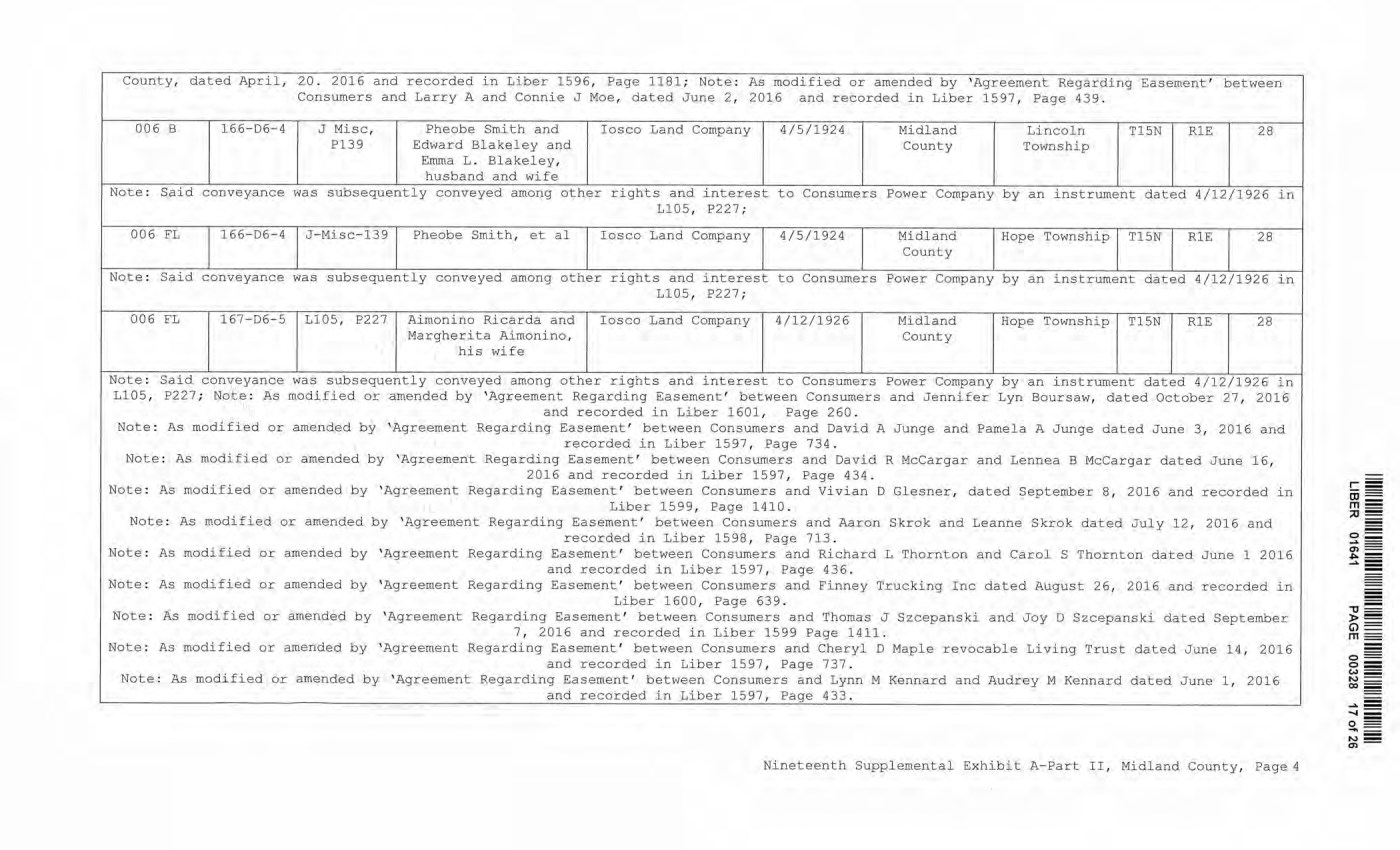
| County, dated April, 20. 2016 and recorded in Liber 1596, Page 1181; Note: As modified or amended by 'Agreement Regarding Easement' between Consumers and Larry A and Connie J Moe, dated June 2, 2016 and recorded in Liber 1597, Page 439. 006 B 166-D6-4 J Misc, P13 9 Pheobe Smith and Edward Blakeley and Emma L. Blakeley, husband and wife Iosco Land Company 4/5/1924 Midland County Lincoln Township T15N R1E 28 Note: Said conveyance was subsequently conveyed among other rights and interest to Consumers Power Company by an instrument dated 4/12/1926 in LI05, P227; 006 FL 166-D6-4 J-Misc-13 9 Pheobe Smith, et al Iosco Land Company 4/5/1924 Midland County Hope Township T15N R1E 28 Note: Said conveyance was subsequently conveyed among other rights and interest to Consumers Power Company by an instrument dated 4/12/1926 in L105, P227; 006 FL 167-D6-5 L105, P227 Aimonino Ricarda and Margherita Aimonino, his wife Iosco Land Company 4/12/1926 Midland County Hope Township T15N R1E 28 Note: Said conveyance was subsequently conveyed among other rights and interest to Consumers Power Company by an instrument dated 4/12/1926 in L105, P227; Note: As modified or amended by 'Agreement Regarding Easement' between Consumers and Jennifer Lyn Boursaw, dated October 27, 2016 and recorded in Liber 1601, Page 260. Note: As modified or amended by 'Agreement Regarding Easement' between Consumers and David A Junge and Pamela A Junge dated June 3, 2016 and recorded in Liber 1597, Page 734. Note: As modified or amended by 'Agreement Regarding Easement' between Consumers and David R McCargar and Lennea B McCargar dated June 16, 2016 and recorded in Liber 1597, Page 434. Note: As modified or amended by 'Agreement Regarding Easement' between Consumers and Vivian D Glesner, dated September 8, 2016 and recorded in Liber 1599, Page 1410. Note: As modified or amended by 'Agreement Regarding Easement' between Consumers and Aaron Skrok and Leanne Skrok dated July 12, 2016 and recorded in Liber 1598, Page 713. Note: As modified or amended by 'Agreement Regarding Easement' between Consumers and Richard L Thornton and Carol S Thornton dated June 1 2016 and recorded in Liber 1597, Page 436. Note: As modified or amended by 'Agreement Regarding Easement' between Consumers and Finney Trucking Inc dated August 26, 2016 and recorded in Liber 1600, Page 639. Note: As modified or amended by 'Agreement Regarding Easement' between Consumers and Thomas J Szcepanski and Joy D Szcepanski dated September 7, 2016 and recorded in Liber 1599 Page 1411. Note: As modified or amended by 'Agreement Regarding Easement' between Consumers and Cheryl D Maple revocable Living Trust dated June 14, 2016 and recorded in Liber 1597, Page 737. Note: As modified or amended by 'Agreement Regarding Easement' between Consumers and Lynn M Kennard and Audrey M Kennard dated June 1, 2016 __________________________ _____________________________ and recorded in Liber 1597, Page 433._________ Nineteenth Supplemental Exhibit A-Part II, Midland County, Page 4 LIBER 01641 PAGE 00328 17 of 26 County, dated April, 20 . 2016 and recorded in Liber 1596, Page 1181; Note: As modifi ed or amended by ' Agreement Regarding Easement' between Consumers and Larry A and Connie J Moe, dated June 2 , 2016 and recorded in Liber 1 597, Page 439 . 006 B 166-06-4 J Misc, Pheobe Smith and Iosco Land Company 4/5/1924 Midland Lincoln TlSN RlE 28 Pl39 Edward Blakeley and County Township Emma L . Bl akeley, husband and wife Note : Said conveyance was subsequently conveye d among other rights and interest to Consumers Power Company by an instrument dated 4/12/1926 in Ll05, P227 ; 006 FL 166-06-4 J - Misc-139 l?heobe Smith, et al Iosco Land Company 4/5/1924 Midland Hope Township TlSN RlE 28 County Note : Said conveyance was subsequently conveyed among other rights and interest to Consumers Power Company by an instrument dated 4/12/1926 in LlOS, 1?227; 006 FL 167-06- 5 Ll05 , P227 Aimonino Ri carda and Iosco Land Company 4/12/1926 Midland Hope Township Tl5N RlE 28 Margherita Ai.monino, County his wife Note : Said conveyance was subsequently conveyed among other rights and interest to Consumers Power Company by an instrument dated 4/12/1926 in L105, P227 ; Note: As modified or amended by 'Agreement Regarding Easement' between Consumers and Jennifer Lyn Boursaw, dated October 27 , 2016 and recorded in Liber 1601, Page 260 . Note : As modified or amended by ' Agr eement Regarding Easement' between Consumers and David A Junge and Pamela A Junge dated June 3, 2016 and recorded in Liber 1597, Page 734 . Note : As modified o r amended by ' Agreement Regarding Easement' between Consumers and David R Mccargar and Lennea B Mccargar dated June 16, 2016 and recorded in Liber 1597, Page 434 . Note: As modified or amended by 'Agreement Regarding Easement' between Consumers and Vivian D Glesner, dated September 8 , 201 6 and recorded in Liber 1599, Page 1410. Note: As modified or amended by 'Agreement Regarding Easement' between Consumers and Aaron Skrok and Leanne Skrok dated July 12, 201 6 and recorded in Liber 1598, Page 713 . Note : As modified or amended by ' Agreement Regarding Easement' between Consumers and Richard L Thornton and Carol S Thornton dated June 1 2016 and recorded in Liber 1597, !?age 436 . Note : As modified or amended by ' Agreement Regarding Easement' between Consumers and Finney Trucking Inc dated August 26, 2016 and recorded in Liber 1600, Page 639 . Note : As modified or amended by 'Agreement Regarding Easement ' between Consumers and Thomas J Sz cepanski and Joy D Szcepanski dated September 7 ' 2016 and record ed in Liber 1599 Page 1411. Note : As modifi ed or amended by ' Agreement Regarding Easement' between Consumers and Cheryl D Maple revocable Living Trust dated June 14 , 2016 and recorded in Liber 1597 , Page 737 . Note : As modified or amended by 'Agreement Regarding Easement' between Consumers and Lynn M Kennard and Audrey M Kennard dated June 1, 2016 and recorded in Liber 1597, Page 433 . Nineteenth Suppl emental Exhibit A- Part II, Midland County, Page4 - = "'0 - ► = 0== m== o== o= w= N = 00 - ...,_ ...... = 0 - ....,_ N = en- |
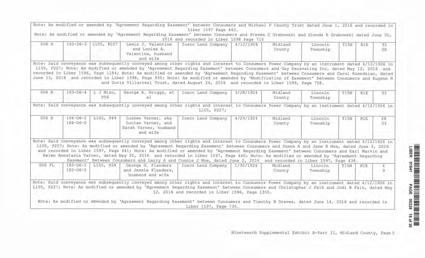
| Note: As modified or amended by 'Agreement Regarding Easement' between Consumers and Michael P Cauchy Trust dated June 1, 2016 and recorded in Liber 1597 Page 442. Note: As modified or amended by 'Agreement Regarding Easement' between Consumers and Steven C Grabowski and Glenda E Grabowski dated June 30, 2016 and recorded in Liber 1598 Page 715 006 B 162-D6-3 L105, P227 Lewis J. Valentine Iosco Land Company 4/12/1926 Midland Lincoln T15N R1E 33 and Louise A. County Township 28 Valentine, husband and wife Note: Said conveyance was subsequently conveyed among other rights and interest to Consumers Power Company by an instrument dated 4/12/1926 in L105, P227; Note: As modified or amended by 'Agreement Regarding Easement' between Consumers and Gay Excavating Inc, dated May 12, 2016 and recorded in Liber 1596, Page 1184; Note: As modified or amended by 'Agreement Regarding Easement' between Consumers and Carol Rzendzian, dated June 13, 2016 and recorded in Liber 1598, Page 930; Note: As modified or amended by 'Modification of Easement' between Consumers and Eugene H and Doris Villarreal Trust, dated August 24, 2016 and recorded in Liber 1599, Page 758. 006 B 163-D6-4 L J Misc, P56 George A. Briggs, et al Iosco Land Company 3/28/1924 Midland County Lincoln Township T15N R1E 33 Note: Said conveyance was subsequently conveyed among other rights and interest to Consumers Power Company by an instrument dated 4/12/1926 in L105, P227; 006 B 164-D6-2 164-D6-5 L105, P49 Lushen Varner, aka Lucian Varner, and Sarah Varner, husband and wife Iosco Land Company 4/29/1924 Midland County Lincoln Township T15N R1E 28 33 Note: Said conveyance was subsequently conveyed among other rights and interest to Consumers Power Company by an instrument dated 4/12/1926 in LI05, P227; Note: As modified or amended by 'Agreement Regarding Easement' between Consumers and Duane A and Jane R Moe, dated June 2, 2016 and recorded in Liber 1597, Page 441; Note: As modified or amended by 'Agreement Regarding Easement' between Consumers and Earl Marvin and Helen Anestasia Varner, dated May 20, 2016 and recorded in Liber 1597, Page 440; Note: As modified or amended by 'Agreement Regarding Easement' between Consumers and Larry A and Connie J Moe, dated June 2, 2016 and recorded in Liber 1597, Page 438. 006 FL 182-D6-1 L105, P28 George G. Flanders Iosco Land Company 1/30/1924 Midland Lincoln T15N R1E 4 182-D6-5 and Jessie Flanders, County Township 9 husband and wife Note: Said conveyance was subsequently conveyed among other rights and interest to Consumers Power Company by an instrument dated 4/12/1926 in L105, P227; Note: As modified or amended by 'Agreement Regarding Easement' between Consumers and Christopher J Falk and Jodi K Falk, dated May 12, 2016 and recorded in Liber 1596, Page 1355. Note: As modified or amended by 'Agreement Regarding Easement' between Consumers and Timothy B Draves, dated June 14, 2016 and recorded in ________________________________________________________________Liber 1597, Page 735. Nineteenth Supplemental Exhibit A-Part II, Midland County, Page 5 LIBER 01641 PAGE 00328 18 of 26 Note : As modified or amended by ' Agreement Regarding Easement ' between Consumer s a nd Michael P Cauchy Trust dated June 1 , 2016 and recorded in Liber 1597 Page 442 . Note : As modified or amended by ' Agreement Regarding Easement' between Consumers a nd Steven C Grabowski and Glenda E Grabowski dated June 30, 2016 and recorded in Liber 1598 Page 715 006 B 162-D6-3 L105, P227 Lewis J . Val entine Iosco Land Company 4 /12/1926 Midl and Lincoln Tl5N RlE 33 and Lo1,1ise A . County Township 28 Valentine, h usband and wife Note : Said conveyance was subsequently conveyed among other rights and interest to Consumers Power Company by an instrument dated 4/12/1926 in LlOS, P227 ; Note: As modified or amended by 'Agreement Regarding Easement' between Consumers and Gay Excavating Inc, dated May 12, 2016 and recorded in Li ber 1596, Page 1184; Note : As modified or amended by 'Agreement Regarding Easement' between Consumers and Carol Rzendzian, dated June 13, 2016 and recorded in Liber 1598, Page 930; Note: As modified or amended by 'Modification of Easement' between Consumers and Eugene H and Doris Villarreal Trust, dated August 24, 2016 and recorded in Liber 1599, Page 758 . 006 B 163- D6- 4 L J Misc, George A. Briggs, et Iosco Land Company 3/28/1924 Midland Lincoln TlSN RlE 33 P56 al County Township Note: Said conveyance was subsequently conveyed among other rights and interest to Consumers Power Company by an i nstrument dated 4/12/1926 in Ll05, P227; 006 B 164- D6- 2 Ll05, P49 Lushen Varner, aka Iosco Land Company 4/29/1924 Midland Lincoln T1 5N RlE 28 1 64-06-5 Lucian Varner, and County 'Township 33 Sarah Varner, husband and wife Note: Said conveyance was subsequently conveyed among other rights and interest to Consumers Power Company by an instrument dated 4/12/1926 in L105, P227 ; Note : As modified or amended by 'Agreement Regarding Easement' between Consumers and Duane A and Jane R Moe, dated June 2 , 2016 and recorded in Liber 1597, Page 441 ; Note : As modified or amended by 'Agreement Regarding Easement' between Consumers and Earl Marvi n and Helen Anestasia Varner, dated May 20, 2 016 and recorded in Liber 1597, Page 440; Note: As modified or amended by 'Agreement Regarding Easement' between Consumers and Larry A and Connie J Moe, dated June 2 , 2016 and recorded i n Liber 1597, Page 438 . 006 FL 182-D6-1 Ll05, P28 George G. Flanders Iosco Land Company 1/30/1924 Midland Lincoln Tl5N RlE 4 182- D6-5 and Jessie Flanders, County Townshi p 9 husband and wife Note: Said conveyance was subsequ ently conveyed among other rights and interest to Consumers Power Company by an instrument dated 4/12/1926 in Ll05, P227; Note: As modified or amended by ' Agreement Regarding Easement' between Consumers and Christopher J Falk and Jodi K Fal k , dated May ].2 I 2016 and recorded i n Liber 1 596, Page 1355. Note : As modified o r amended by ' Agreement Regarding Easement' between Consumers and Timothy B Draves, dated June 14, 2016 and recorded in Liber 1597, Page 735 . Nineteenth Supplemental Exhibit A-Part II, Midland County, Page 5 |
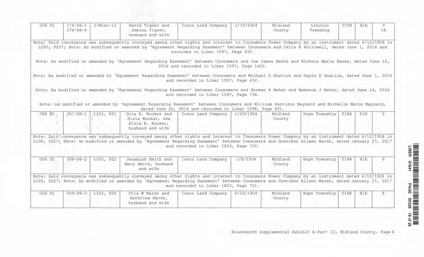
| 006 FL 17 6-D6-1 J-Misc-12 David Tigner and Iosco Land Company 1/10/1924 Midland Lincoln T15N R1E 9 17 6-D6-4 Jemina Tigner, County Township 16 husband and wife Note: Said conveyance was subsequently conveyed among other rights and interest to Consumers Power Company by an instrument dated 4/12/1926 in L105, P227; Note: As modified or amended by Agreement Regarding Easement' between Consumers and Celia R Hollowell, dated June 1, 2016 and recorded in Liber 1597, Page 431. Note: As modified or amended by 'Agreement Regarding Easement' between Consumers and Joe James Banks and Michele Marie Banks, dated June 14, 2016 and recorded in Liber 1597, Page 1403. Note: As modified or amended by 'Agreement Regarding Easement' between Consumers and Michael D Hnatiuk and Gayle E Hnatiuk, dated June 1, 2016 and recorded in Liber 1597, Page 432. Note: As modified or amended by 'Agreement Regarding Easement' between Consumers and Norman A Neher and Rebecca J Neher, dated June 14, 2016 and recorded in Liber 1597, Page 736. Note: As modified or amended by 'Agreement Regarding Easement' between Consumers and William Harrison Maynard and Michelle Marie Maynard, dated June 20, 2016 and recorded in Liber 1598, Page 931. 006 FL 207-D6-1 L105, P21 Orla E. Rooker and Elsie Rooker, aka Elsie R. Rooker, husband and wife Iosco Land Company 1/29/1924 Midland County Hope Township T16N R1E 9 Note: Said conveyance was subsequently conveyed among other rights and interest to Consumers Power Company by an instrument dated 4/12/1926 in L105, P227; Note: As modified or amended by 'Agreement Regarding Easement' between Consumers and Gretchen Alleen Marsh, dated January 27, 2017 and recorded in Liber 1603, Page 750. 006 FL 208-D6-2 L105, P22 Jeramiah Smith and Mary Smith, husband and wife Iosco Land Company 1/8/1924 Midland County Hope Township T16N R1E 9 Note: Said conveyance was subsequently conveyed among other rights and interest to Consumers Power Company by an instrument dated 4/12/1926 in L105, P227; Note: As modified or amended by 'Agreement Regarding Easement' between Consumers and Gretchen Alleen Marsh, dated January 27, 2017 and recorded in Liber 1603, Page 751. 006 FL 209-D6-3 L105, P24 Otis W Marsh and Kathrine Marsh, husband and wife Iosco Land Company 5/12/1924 Midland County Hope Township T16N R1E 9 Nineteenth Supplemental Exhibit A-Part II, Midland County, Page 6 LIBER 01641 PAGE 00328 19 of 26 006 EL 176-D6-1 J-Misc- 12 David Tigner and Iosco Land Company 1/10/1924 Midland Li ncoln Tl5N RlE 9 176- D6- 4 Jemina Tigner, County Township 16 husband and wife Note: Said conveyance was subsequently conveyed among other rights and interest to Consumers Power Company by an instrument dated 4/12/1926 in Ll05, P227 ; Note : As modified or amended by ' Agreement Regarding Easement' between Consumers and Celia R Hollowell, dated J une 1 , 2016 and recorded in Liber 1597, !?age 431 . Note: As modified or amended by ' Agreement Regarding Easement' between Consumers and Joe James Banks and Michele Marie Banks, dated June 14, 2016 and recorded in Liber 1597, Page 1403. Note: As modified or amended by ' Agreement Regarding Easement' between Consumer s and Michael D Hnatiuk and Gayle E Hnatiuk, dated June 1 , 2016 and recorded in Liber 1 597, Page 432 . Note : As modified or amended by ' Agreement Regarding Easement' between Consumers and Norman A Neher and Rebecca J Neher, daced June 14, 2016 and recorded i n Li ber 1597, Page 736 . Note : As modified or amended by 'Agreement Regarding Easement' between Consumers and William Har rison Maynard and Michelle Marie Maynard, dated June 20, 2016 and recorded in Liber 1598, Page 931. 006 FL 207- D6- 1 Ll05, P21 Orla E. Rooker and Iosco Land Company 1/29/1 924 Midland Hope Township Tl6N RlE 9 El s i e Rooker, aka County Elsie R. Rooker, husband and wife Note: Said conveyance was subsequently conveyed among other rights and interest to Consumers Power Company by an instrument dated 4/12/1926 in Ll0S, ~227; Note : As modified or amended by 'Agreement Regarding Easement' between Consumers and Gretchen Alleen Marsh, dated January 27, 2017 and recorded in Liber 1603, Page 750 . 006 FL 208- D6- 2 L105 , P22 Jeraroiah Sm.i. th and Iosco Land Company 1/8/1924 Midland Hope Township Tl6N RlE 9 Mary Smith, husband County and wife Note: Said conveyance was subsequently conveyed among other rights and interest to Consumers Power Company by an instrument dated 4/12/1926 in Ll05, P227; Note : As modified or amended by 'Agreement Regarding Easement' between Consumers and Gretchen Alleen Marsh, dated January 2. 7, 2017 and recorded in Liber 1603, Page 751. 006 FL 209- D6- 3 L105, P24 Otis W Marsh and Iosco Land Company 5/12/1924 Midland Hope Townshi p Tl6N RlE 9 Kathrine Marsh, County husband and wife Nineteenth Supplemental Exhibit A- Part II, Midland County, Page6 |
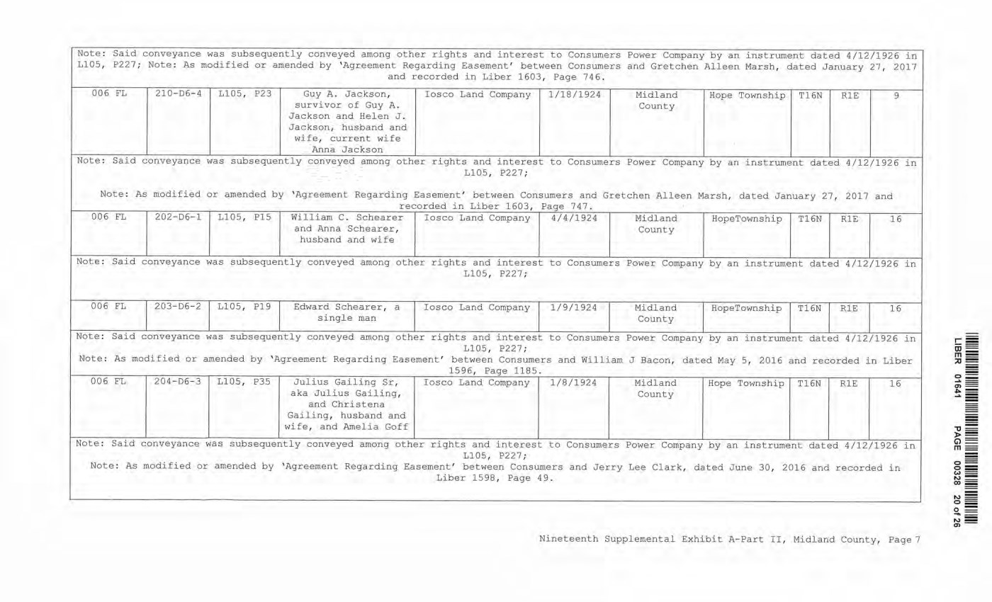
| Note: Said conveyance was subsequently conveyed among other rights and interest to Consumers Power Company by an instrument dated 4/12/1926 in L105, P227; Note: As modified or amended by 'Agreement Regarding Easement' between Consumers and Gretchen Alleen Marsh, dated January 27, 2017 and recorded in Liber 1603, Page 746. 006 FL 210-D6-4 L105, P23 Guy A. Jackson, survivor of Guy A. Jackson and Helen J. Jackson, husband and wife, current wife Anna Jackson Iosco Land Company 1/18/1924 Midland County Hope Township T16N R1E 9 Note: Said conveyance was subsequently conveyed among other rights and interest to Consumers Power Company by an instrument dated 4/12/1926 in L105, P227; Note: As modified or amended by 'Agreement Regarding Easement' between Consumers and Gretchen Alleen Marsh, dated January 27, 2017 and recorded in Liber 1603, Page 747. 006 FL 202-D6-1 L105, P15 William C. Schearer and Anna Schearer, husband and wife Iosco Land Company 4/4/1924 Midland County HopeTownship T16N R1E 16 Note: Said conveyance was subsequently conveyed among other rights and interest to Consumers Power Company by an instrument dated 4/12/1926 in L105, P227; 006 FL 203-D6-2 L105, PI 9 Edward Schearer, a single man Iosco Land Company 1/9/1924 Midland County HopeTownship T16N R1E 16 Note: Said conveyance was subsequently conveyed among other rights and interest to Consumers Power Company by an instrument dated 4/12/1926 in L105, P227; Note: As modified or amended by 'Agreement Regarding Easement' between Consumers and William J Bacon, dated May 5, 2016 and recorded in Liber 1596, Page 1185. 006 FL 204-D6-3 L105, P35 Julius Gailing Sr, aka Julius Gailing, and Christena Gailing, husband and wife, and Amelia Goff Iosco Land Company 1/8/1924 Midland County Hope Township T16N R1E 16 Note: Said conveyance was subsequently conveyed among other rights and interest to Consumers Power Company by an instrument dated 4/12, L105, P227; Note: As modified or amended by 'Agreement Regarding Easement' between Consumers and Jerry Lee Clark, dated June 30, 2016 and record Liber 1598, Page 49. /1926 in led in Nineteenth Supplemental Exhibit A-Part II, Midland County, Page 7 LIBER 01641 PAGE 00328 20 of 26 Note : Sai d conveyance was subsequently conveyed among other rights and interest to Consumers Power Company by an instrument dated 4/12/1926 in Ll05, P227; Note: As modified or amended by ' Agreement Regarding Easement' between Consumers and Gretchen Alleen Marsh, dated January 27, 2017 and recorded in Liber 1603, Page 746 . 006 FL 210- 06-4 LlOS , P23 Guy A . Jackson, Iosco Land Company 1/18/1924 Midland Hope Townshi p T16N RlE 9 survivor of Guy A. County Jackson and Helen J . Jackson, husband and wife, current wife Anna Jackson Note: Said conveyance was subsequently conveyed among other r i ghts and interest to Consumers Power Company by an instrument dated 4/12/1926 in LlOS, P227 ; Note: As modified or amended by 'Agreement Regarding Easement ' between Consumers and Gretchen Alleen Marsh, dated January 27 , 2017 and recorded in Liber 1603, Page 747 . 006 FL 202- D6- 1 LlOS, PlS William C. Schearer I osco Land Company 4/4/1924 Midland HopeTownship T16N RlE 16 and Anna Schearer, County husband and wife Note: Said conveyance was subsequently conveyed among other rights and interest to Consumers Power Company by an i nstrument dated 4/12/1926 in 1105, P227 ; 006 FL 203-D6-2 1105 , P19 Edward Schearer, a Iosco Land Company 1/9/1924 Midland RopeTownship T16N RlE 16 single man County Note : Said conveyance was subsequently conveyed among other rights and interest to Consumers Power Company by an instrument dated 4/12/1926 in L105, P227; Note : As modified or amended by ' Agreement Regarding Easement' between Consumers and William J Bacon, dated May 5, 2016 and recorded in Liber 1596, Page 1185. 006 FL 204-D6-3 1105, P35 Julius Gailing Sr, Iosco Land Company 1/8/1924 Midland Hope Township Tl6N RlE 16 aka Julius Gailing, County and Christena Gaiting, husband and wife, and Amelia Goff Note: Said conveyance was subsequently conveyed among other rights and i nterest to Consumers Power Company by an instrument dated 4/12/1926 in 1105, P227 ; Note : As modified or amended by 'Agreement Regarding Easement' between Consumers and Jerry Lee Clark, dated June 30, 2016 and recorded in Liber 1598, Page 49 . Nineteenth Supplemental Exhibit A-Part II, Midland County, Page 7 |
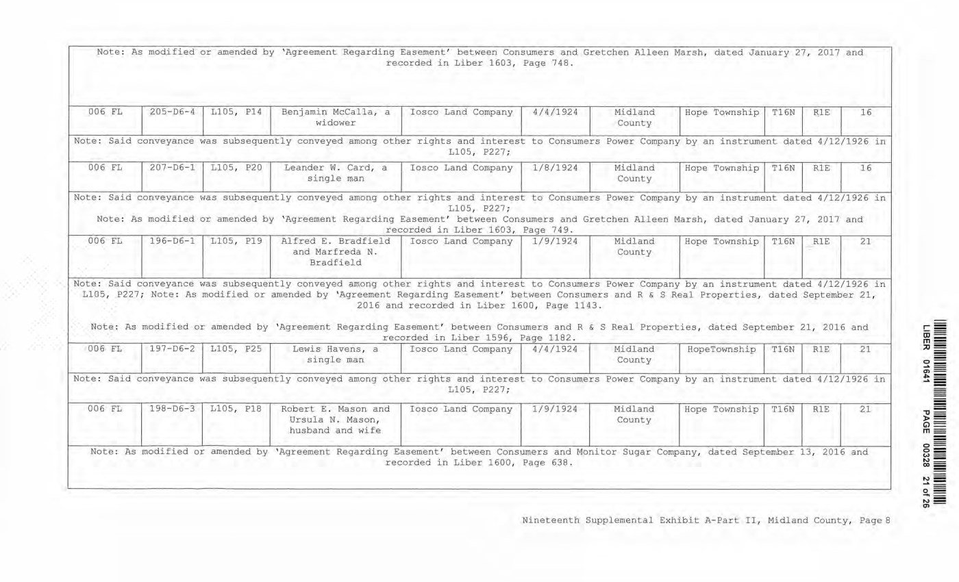
| Note: As modified or amended by 'Agreement Regarding Easement' between Consumers and Gretchen Alleen Marsh, dated January 27, 2017 recorded in Liber 1603, Page 748. and 006 FL 205-D6-4 L105, PI4 Benjamin McCalla, a widower Iosco Land Company 4/4/1924 Midland County Hope Township T16N R1E 16 Note: Said conveyance was subsequently conveyed among other rights and interest to Consumers Power Company L105, P227; ■ by an instrument dated 4/12/1926 in 00 6 FL 2 07-D6-1 L105, P20 Leander W. Card, a single man Iosco Land Company 1/8/1924 Midland County Hope Township T16N R1E 16 Note: Said conveyance was subsequently conveyed among other rights and interest to Consumers Power Company by an instrument dated 4/12/1926 in L105, P227; Note: As modified or amended by 'Agreement Regarding Easement' between Consumers and Gretchen Alleen Marsh, dated January 27, 2017 recorded in Liber 1603, Page 749. and 006 FL 196-D6-1 L105, P19 Alfred E. Bradfield and Marfreda N. Bradfield Iosco Land Company 1/9/1924 Midland County Hope Township T16N R1E 21 Note: Said conveyance was subsequently conveyed among other rights and interest to Consumers Power Company by an instrument dated 4/12/1926 in L105, P227,: Note: As :modified or amended by 'Agreement Regarding Easement' between Consumers and R & S Real Properties, 2016 and recorded in Liber 1600, Page 1143. dated September 21, Note: As modified or amended by 'Agreement Regarding Easement' between Consumers and R recorded in Liber 1596, Page 1182. & S Real Properties, dated September 21, 2016 and 006 FL 197-D6-2 L105, P25 Lewis Havens, a single man Iosco Land Company 4/4/1924 Midland County HopeTownship T16N R1E 21 Note: Said conveyance was subsequently conveyed among other rights and interest to Consumers Power Company by an instrument dated 4/12/1926 in L105, P227; 006 FL 198-D6-3 L105, P18 Robert E. Mason and Ursula N. Mason, husband and wife Iosco Land Company 1/9/1924 Midland County Hope Township T16N R1E 21 Note: As modified or amended by 'Agreement Regarding Easement' between Consumers and Monitor Sugar Company, dated September 13, 2016 and recorded in Liber 1600, Page 638. Nineteenth Supplemental Exhibit A-Part II, Midland County, Page 8 LIBER 01641 PAGE 00328 21 of 26 Note : As modified or amended by 'Agreement Regardi ng Easement' between Consumers and Gretchen Alleen Marsh, dated January 27 , 2017 and recorded in Liber 1603, Page 748. 006 FL 205-D6-4 LlOS, P14 Benjamin Mccall a , a Iosco Land Company 4/4/1924 Midland Hope Township Tl 6N R,lE 1 6 widower County Note: Said conveyance was subsequently conveyed among other rights and interest to Consumers Power Company by an instrument dated 4/12/1926 in LlOS, P227; 006 FL 207-D6-1 LlOS, P20 Leander W . Card, a Iosco Land Company 1/ 8/1924 Midland Hope Township T16N RlE 16 single man County Note : Said conveyance was subsequently conveyed among other rights and interest to Consumers Power Company by an instrument dated 4/12/1926 in LlOS, P227 ; Note: As modified or amended by 'Agreement Regarding Easement' between Consumers and Gretchen Alleen Marsh, dated January 27, 2017 and recorded in Liber 1603, Page 749 . 006 FL 196-D6-1 LlOS, P19 Alfred E . Bradfield Iosco Land Company 1/9/1924 Midland Hope Township T16N RlE 21 and Marfreda N. County Bradfield Note: Said conveyance was subsequently conveyed among other rights and interest to Consumers Power Company by an instrument dated 4/12/1926 in L105, P227 ; Note : As modified or amended by 'Agreement Regarding Easement' between Consumers and R & S Real Properties, dated September 21, 2016 and recorded in Liber 1600, Page 1143. Note: As modified or amended by ' Agreement Regarding Easement' between Consumer s and R & s Real Pr operties, dated September 21, 2016 and recorde d in Liber 1596, Page 1182. 006 FL 1 97-D6-2 LlOS, P25 Lewis Havens, a Iosco Land Company 4/ 4 /1924 Midland Rope Township T16N RlE 21 single man County Note : Said conveyance was subsequently conveyed among other rights and interest to Consumers Power Company by an instrument dated 4/12/1926 in Ll05, P227 ; 006 FL 198- D6-3 LlOS, P18 Robert E . Mason and Iosco Land Company 1/9/1924 Midland Hope Township T16N RlE 2 1 Ursula N. Mason, County husband and wife Note: As modified or amended by ' Agreement Regarding Easement' between Consumers and Monitor Sugar Company, dated September 13, 2016 and recorded in Liber 1 600, Page 638 . Nineteenth Supplemental Exhibit A- Part II, Midland County, Page8 o== o= w= ...., = 00 t-:1 = ...... - o - ...., = a>- |
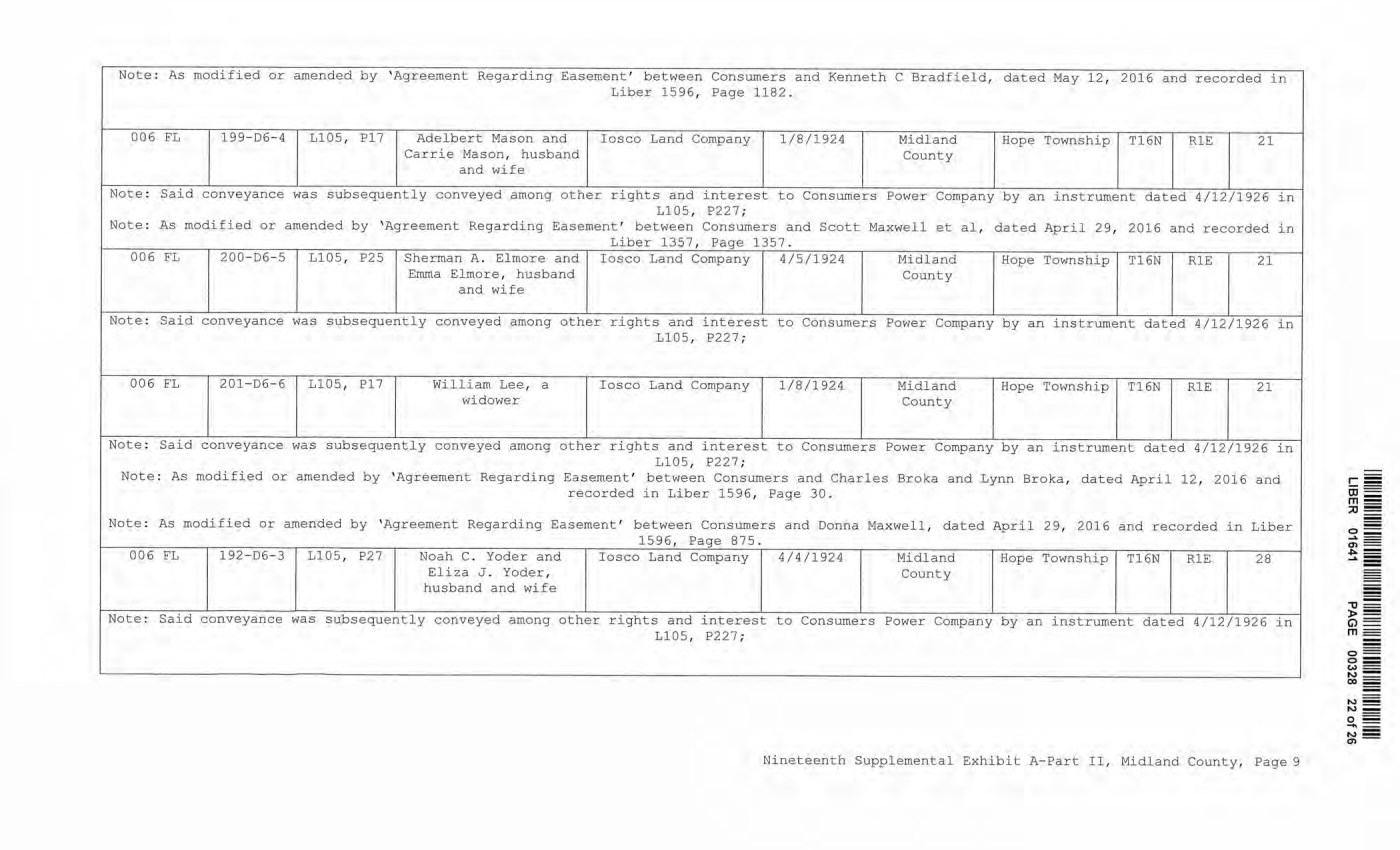
| Note: As modified or amended by 'Agreement Regarding Easement' between Consumers and Kenneth C Bradfield, dated May 12, 2016 and recorded in Liber 1596, Page 1182. 006 FL 199-D6-4 L105, P17 Adelbert Mason and Carrie Mason, husband and wife Iosco Land Company 1/8/1924 Midland County Hope Township T16N R1E 21 Note: Said conveyance was subsequently conveyed among other rights and interest to Consumers Power Company by an instrument dated 4/12/1926 in L105, P227; Note: As modified or amended by 'Agreement Regarding Easement' between Consumers and Scott Maxwell et al, dated April 29, 2016 and recorded in Liber 1357, Page 1357. 006 FL 200-D6-5 L105, P25 Sherman A. Elmore and Emma Elmore, husband and wife Iosco Land Company 4/5/1924 Midland County Hope Township T16N R1E 21 Note: Said conveyance was subsequently conveyed among other rights and interest to Consumers Power Company by an instrument dated 4/12/1926 in L105, P227; 006 FL 201-D6-6 L105, P17 William Lee, a widower Iosco Land Company 1/8/1924 Midland County Hope Township T16N R1E 21 L105, P227; Note: As modified or amended by 'Agreement Regarding Easement' between Consumers and Charles Broka and Lynn Broka, dated April 12, 2016 and recorded in Liber 1596, Page 30. Note: As modified or amended by 'Agreement Regarding Easement' between Consumers and Donna Maxwell, dated April 29, 2016 and recorded in Liber _______________________________________ 1596, Page 875._ 006 FL 192-D6-3 L105, P27 Noah C. Yoder and Iosco Land Company 4/4/1924 Midland Hope Township T16N R1E Eliza J. Yoder, husband and wife County Note: Said conveyance was subsequently conveyed among other rights and interest to Consumers Power Company by an instrument dated 4/12/1926 in L105, P227; Nineteenth Supplemental Exhibit A-Part II, Midland County, Page 9 LIBER 01641 PAGE 00328 22 of 26 Note : As modified or amended by 'Agreement Regarding Easement' between Consumers and Kenneth C Bradfield, dated May 12, 2016 and recorded in Liber 1596, Page 1182. 006 FL 199- D6- 4 Ll05, Pl7 Adelbert Mason and Iosco Land Company 1/8/1924 Midland Hope Township Tl6N RlE 21 Carrie Mason, husband County and wife Note: Said conveyance was subsequently conveyed among other rights and i nterest to Consumers Power Company by an instr ument dated 4/12/1926 in Ll05, P227 ; Note: As modified or amended by ' Agreement Regarding Easement' between Consumers and Scott Maxwell et al, dated April 2 9 / 2016 and recorded in Liber 1357, Page 1357 . 006 FL 200- D6- 5 LlOS, P25 Sherman A. Elmore and Iosco Land Company 4/5/1924 Midland Hope Township T16N RlE 21 Emma Elmore, husband County and wife Note: Said conveyance was subsequently conveyed among other rights and interest to Consumers Power Company by an instrument dated 4/12/1926 in Ll05, P227; 006 FL 201-06-6 LlOS, Pl? William Lee, a Iosco Land Company 1/8/1924. Midland Hope Township Tl6N RlE 21 widower County Note : Said conveyance was subsequently conveyed among other rights and interest to Consumers Power Company by an instrument dated 4/12/1926 in Ll05, P227 ; Note: As modified or amended by 'Agreement Regarding Easement' between Consumers and Charles Broka and Lynn Sroka, dated April 12, 2016 and recorded in Liber 1596, Page 30. Note: As modified or amended by ' Agreement Regarding Easement' between Consumers and Donna Maxwel l , dated April 29, 2016 and recorded in Liber 1596, Page 875 . 006 FL 1 92- D6-3 Ll05, P27 Noah C. Yoder and Iosco Land Company 4/4/1924 Midland Hope Township Tl6N RlE 28 Eliza J . Yoder, County husband and wife Note: Said conveyance was subsequently conveyed among other rights and interest to Consumers Power Company by an instrument dated 4/12/1926 in L105, P227 ; Nineteenth Supplemental Exhibit A-Part II, Midland County, Page 9 - - ,, - ► = G)= m == - o== o= w= N= co _ N = N= 0 == -~ ~~ |
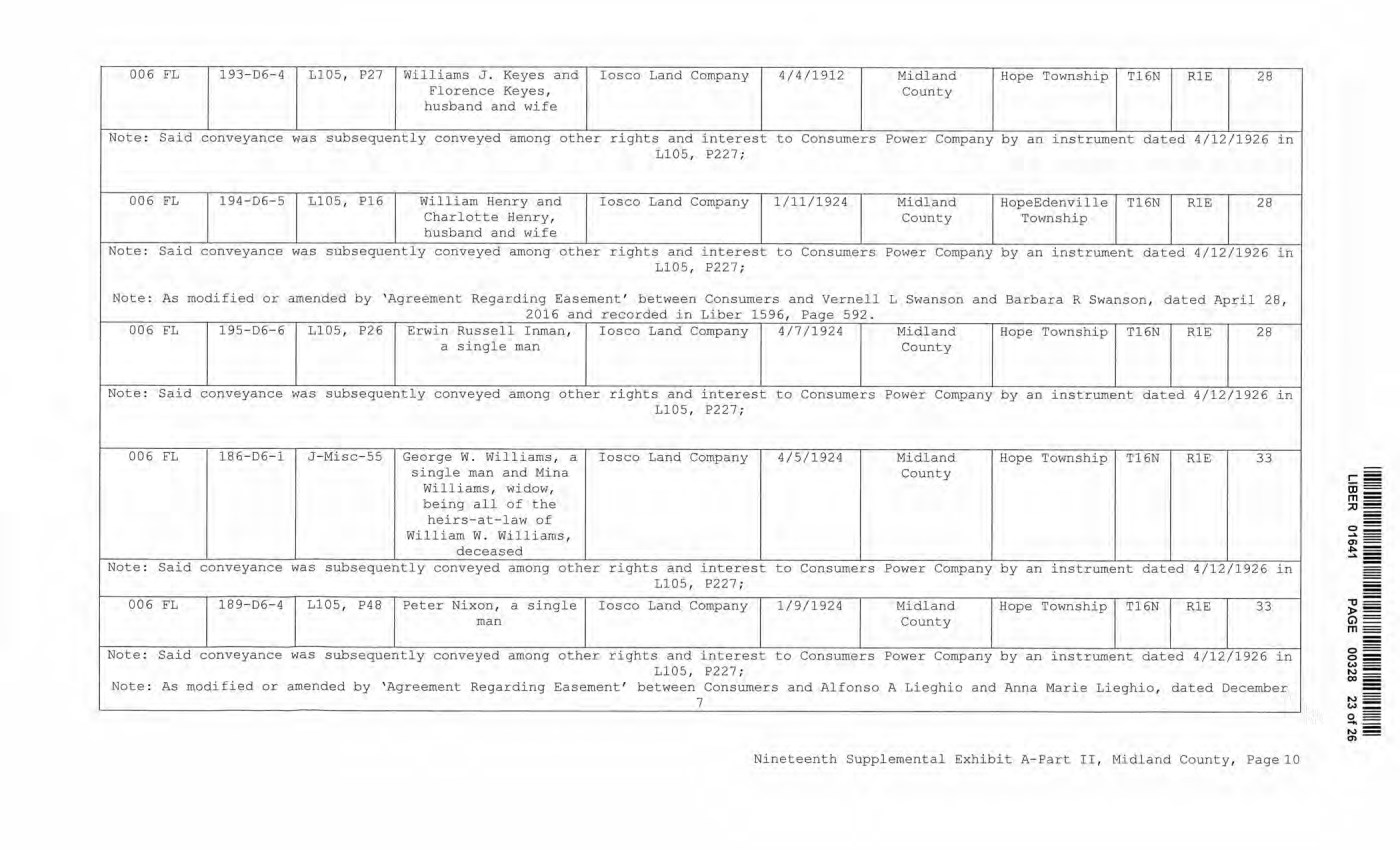
| 006 FL 193-D6-4 L105, P27 Williams J. Keyes and Florence Keyes, husband and wife Iosco Land Company 4/4/1912 Midland County Hope Township T16N R1E 28 Note: Said conveyance was subsequently conveyed among other rights and interest to Consumers Power Company by an instrument dated 4/12/1926 in L105, P227; 006 FL 194-D6-5 L105, PI 6 William Henry and Charlotte Henry, husband and wife Iosco Land Company 1/11/1924 Midland County HopeEdenville Township T16N R1E 28 Note: Said conveyance was subsequently conveyed among other rights and interest to Consumers Power Company by an instrument dated 4/12/1926 in L105, P227; Note: As modified or amended by 'Agreement Regarding Easement' between Consumers and Vernell L Swanson and Barbara R Swanson, dated April 28, 2016 and recorded in Liber 1596, Page 592. 006 FL 195-D6-6 L105, P26 Erwin Russell Inman, a single man Iosco Land Company 4/7/1924 Midland County Hope Township T16N R1E 28 Note: Said conveyance was subsequently conveyed among other rights and interest to Consumers Power Company by an instrument dated 4/12/1926 in L105, P227; 006 FL 186-D6-1 J-Misc-55 George W. Williams, a single man and Mina Williams, widow, being all of the heirs-at-law of William W. Williams, deceased Iosco Land Company 4/5/1924 Midland County Hope Township T16N R1E 33 Note: Said conveyance was subsequently conveyed among other rights and interest to Consumers Power Company by an instrument dated 4/12/1926 in L105, P227; 006 FL 18 9-D6-4 L105, P48 Peter Nixon, a single man Iosco Land Company 1/9/1924 Midland County Hope Township T16N R1E 33 Note: Said conveyance was subsequently conveyed among other rights and interest to Consumers Power Company by an instrument dated 4/12/1926 in L105, P227; Note: As modified or amended by 'Agreement Regarding Easement' between Consumers and Alfonso A Lieghio and Anna Marie Lieghio, dated December 7 Nineteenth Supplemental Exhibit A-Part II, Midland County, Page 10 LIBER 01641 PAGE 00328 23 of 26 006 FL 193-06-4 Ll05, P27 Williams J . Keyes and Iosco Land Company 4/4/1912 Midland Hope Township Tl6N RlE 28 Florence Keyes, County husband and wife Note: Said conveyance was subsequently conveyed among other rights and interest to Consumers Power Company by an instrument dated 4/12/1926 in 1105, P227 ; 006 FL 194- D6-5 LlOS , P16 W i lliam Henry and Iosco Land Company 1/11/1924 Midland HopeEdenvil le T16N RlE 28 Charlotte Henry, County Township husband and wife Note: Said conveyance was subsequentl y conveyed among other rights and interest to Consumers Power Company by an instrument dated 4/12/1926 in 1105, P227; Note: As modified or amended by ' Agreement Regarding Easement' between Consumers and Vernell L Swanson and Barbara R Swanson, dated April 28 t 2016 and recorded in Liber 1596, Page 592 . 006 FL 195-D6-6 LlOS, P26 Erwin Russell Inman, Iosco Land Company 4/7/1924 Midland Hope Townshi p T1 6N RlE 28 a single man County Note : Said conveyance was subsequently conveyed among other rights and interest to Consumers Power Company by an instrument dated 4/12/1926 in 1105, P227; 006 FL 186-D6-1 J-Misc- 55 George W . Williams, a Iosco Land Company 4/5/1924 Midland Hope Township T16N RlE 33 single man and Mina County Williams, widow, being all of the heirs-at- law of William W. W i lliams, deceased Note : Said conveyance was subsequently conveyed among other rights and interest to Consumers Power Company by an instrument dated 4/12/1926 in LlOS, E'227 ; 006 FL 189- D6-4 1105, P48 Peter Nixon, a single Iosco Land Company 1/9/1924 Midland Hope Township Tl 6N RlE 33 man County Note : Said conveyance was subsequently conveyed among other r i ghts and interest to Consumers Power Company by a n instrument dated 4/12/1926 in 1105, P227; Note : As modified or amended by 'Agreement Regardi ng Easement' between Conswners and Alfonso A Lieghio and Anna Marie Lieghio, dated December 7 Ni neteenth Supplemental Exhibit A-Part II, Midland County, PagelO r= ai == m= .::0 - o= .... - en== ~= ...a. 5 |
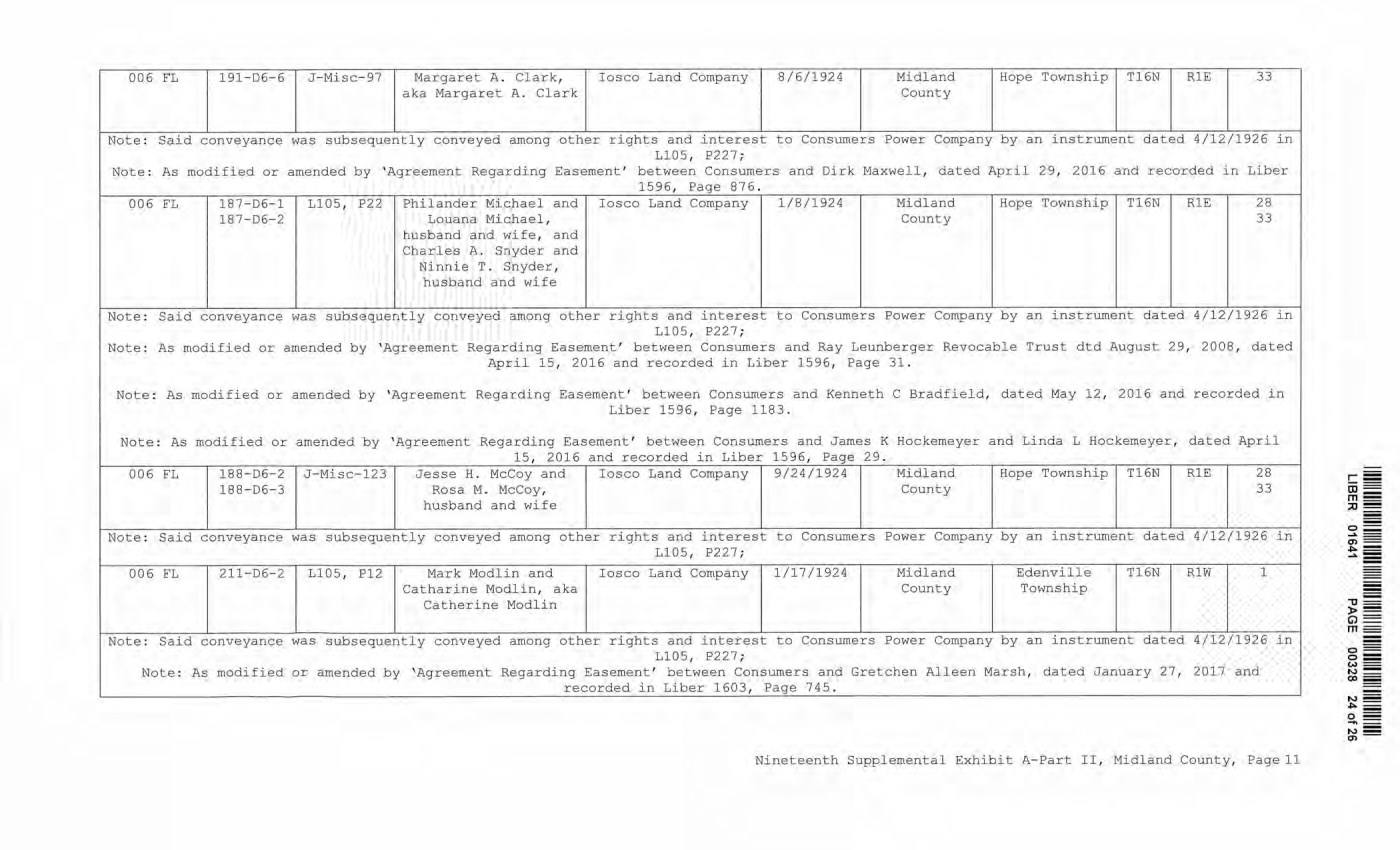
| 006 FL 191-D6-6 J-Misc-97 Margaret A. Clark, Iosco Land Company 8/6/1924 Midland Hope Township T16N R1E 33 aka Margaret A. Clark County Note: Said conveyance was subsequently conveyed among other rights and interest to Consumers Power Company by an instrument dated 4/12/1926 in L105, P227; Note: As modified or amended by 'Agreement Regarding Easement' between Consumers and Dirk Maxwell, dated April 29, 2016 and recorded in Liber _______________________1596, Page 876.___________________________________________________________________ 187-D6-1 L105, P22 Philander Michael and Iosco Land Company 1/8/1924 Midland Hope Township T16N R1E 28 18 7-D6-2 Louana Michael, County 33 husband and wife, and Charles A. Snyder and Ninnie T. Snyder, husband and wife Note: Said conveyance was subsequently conveyed among other rights and interest to Consumers Power Company by an instrument dated 4/12/1926 in L105, P227; Note: As modified or amended by 'Agreement Regarding Easement' between Consumers and Ray Leunberger Revocable Trust dtd August 29, 2008, dated April 15, 2016 and recorded in Liber 1596, Page 31. Note: As modified or amended by 'Agreement Regarding Easement' between Consumers and Kenneth C Bradfield, dated May 12, 2016 and recorded in Liber 1596, Page 1183. Note: As modified or amended by 'Agreement Regarding Easement' between Consumers and James K Hockemeyer and Linda L Hockemeyer, dated April 15, 2016 and recorded in Liber 1596, Page 29.__________________________________________________ 006 FL 188-D6-2 J-Misc-123 Jesse H. McCoy and Iosco Land Company 9/24/1924 Midland Hope Township T16N R1E 28 188-D6-3 Rosa M. McCoy, County 33 husband and wife Note: Said conveyance was subsequently conveyed among other rights and interest to Consumers Power Company by an instrument dated 4/12/1926 in L105, P227; 00 6 FL 211-D6-2 L105, P12 Mark Modlin and Iosco Land Company 1/17/1924 Midland Edenville T16N R1W 1 Catharine Modlin, aka County Township Catherine Modlin Note: Said conveyance was subsequently conveyed among other rights and interest to Consumers Power Company by an instrument dated 4/12/1926 in L105, P227; Note: As modified or amended by 'Agreement Regarding Easement' between Consumers and Gretchen Alleen Marsh, dated January 27, 2017 and ____ recorded in Liber 1603, Page 745._________________________________________________________ Nineteenth Supplemental Exhibit A-Part II, Midland County, Page 11 LIBER 01641 PAGE 00328 24 of 26 006 E'L 191- D6-6 J - Misc- 97 Margaret A. Cl ark, Iosco Land Company 8/6/1924 Midland Hope Township T16N Rl E 33 aka Margaret A. Clark County Note : Said conveyance was subsequently conveyed among other rights and interest to Consumers Power Company by an instrument dated 4/12/1926 in LlOS, P227; Note : As modified or amended by ' Agreement Regarding Easement' between Consumers and Dirk Maxwell, dated April 29, 2016 and recorded in Liber 1596, Page 87 6 . 006 FL 187-D6-1 L105, P22 Philander Michael and I osco Land Company 1/8/1924 Midland Hope Township T16N RlE 28 187- D6- 2 Louana Michael, County 33 husband and wife, and Charles A. Snyder and Ni nnie T . Snyder, husband and wife Note: Said conveyance was subsequently conveyed among other rights and interest to Consumers Power Company by an instrument dated 4/12/1926 in Ll05, P227 ; Note : As modified or amended by ' Agreement Regarding Easement' between Consumers and Ray Leunberger Revocable Trust dtd August 29, 2008, dated April 15, 2016 and recorded in Liber 1596, Page 31. Note : As modified or amended by ' Agreement Regarding Easement ' between Consumers and Kenneth C Bradfield, dated May 12 , 2016 and recorded in Liber 1596, Page 1183. Note : As modified or amended by 'Agreement Regarding Easement' between Consumers and James K Hockemeyer and Linda L Hockemeyer, dated April 15, 2016 and recorded in Liber 1596, Page 29 . 006 FL 188- D6- 2 J - Misc- 123 Jesse H. M cCoy and Iosco Land Company 9/24/1924 Midland Hope Township T16N Rl E 28 1 88-D6-3 Rosa M. McCoy, Count y 33 husband and wife Note: Said conveyance was subsequently conveyed among other rights and interest to Consumers Power Company by an instrument dated 4/12/1926 in L105 , P227 ; 006 FL 211- D6-2 L105, P12 Mark Modlin and I osco Land Company 1 /17/1924 Midland Edenville T16N Rl W 1 Cathari ne Modl in, aka Coun t y Township Catheri ne Modl in Note: Said conveyance was subsequently conveyed among other rights and interest to Consumers Power Company by an instrument dated 4/12/1926 in Ll05, P227; Note : As modified or amended by 'Agreement Regardin g Easement' between Consumers and Gretchen Alleen Marsh, dated January 27, 2017 and recorded in Liber 1603, Page 745 . Nineteenth Supplemental Exhibi t A-Part II, Midland County, Page 11 o== o= <,.>= N= oo - N= "" o= -= N= a,- |
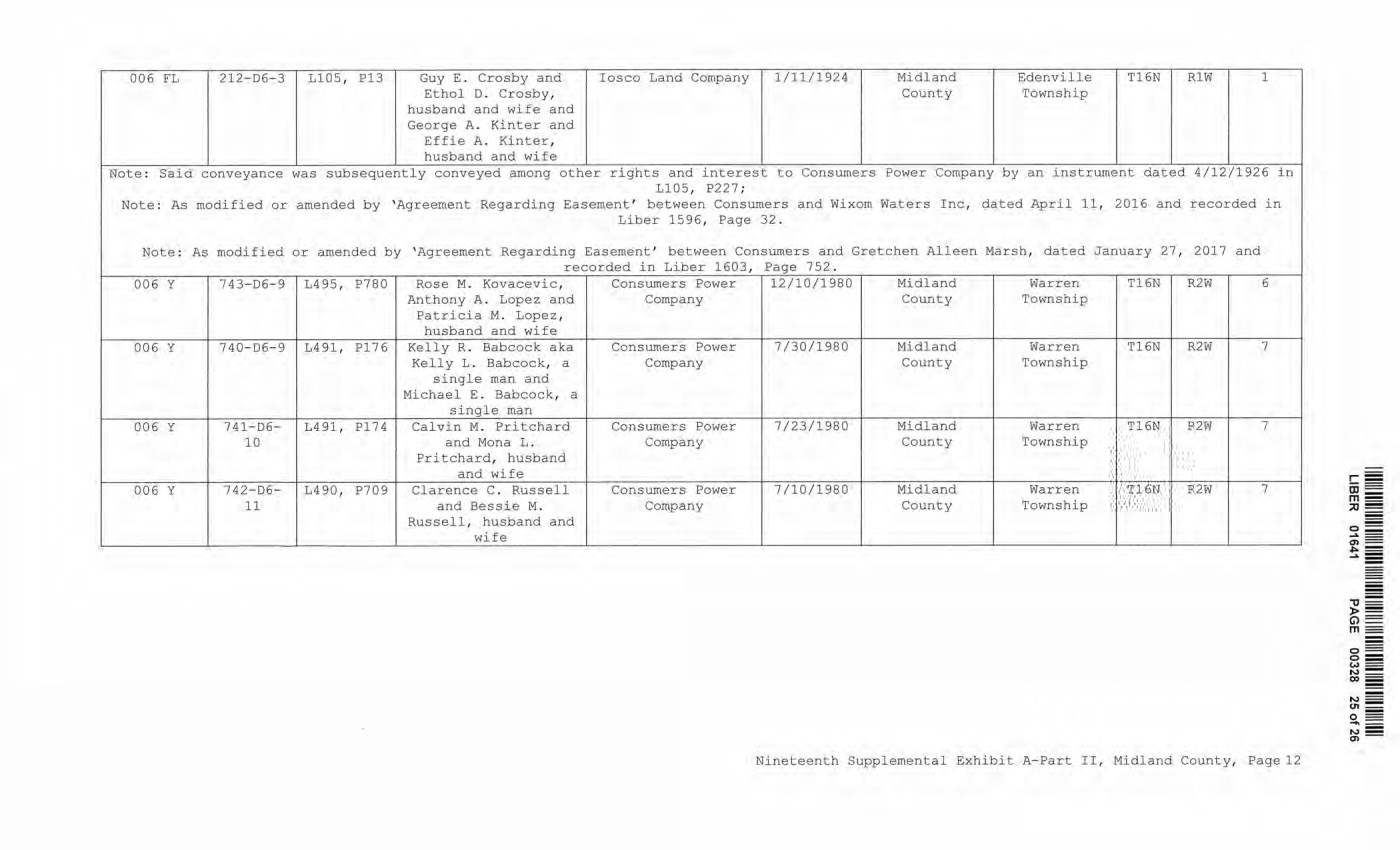
| 006 FL 212-D6-3 L105, P13 Guy E. Crosby and Ethol D. Crosby, husband and wife and George A. Kinter and Effie A. Kinter, husband and wife Iosco Land Company 1/11/1924 Midland County Edenville Township T16N R1W 1 Note: Said conveyance was subsequently conveyed among other rights and interest to Consumers Power Company by an instrument dated 4/12/1926 in L105, P227; Note: As modified or amended by 'Agreement Regarding Easement' between Consumers and Wixom Waters Inc, dated April 11, 2016 and recorded in Liber 1596, Page 32. Note: As modified or amended by 'Agreement Regarding Easement' between Consumers and Gretchen Alleen Marsh, dated January 27, 2017 and recorded in Liber 1603, Page 752. 006 Y 743-D6-9 L495, P780 Rose M. Kovacevic, Anthony A. Lopez and Patricia M. Lopez, husband and wife Consumers Power Company 12/10/1980 Midland County Warren Township T16N R2W 6 006 Y 740-D6-9 L491, P17 6 Kelly R. Babcock aka Kelly L. Babcock, a single man and Michael E. Babcock, a single man Consumers Power Company 7/30/1980 Midland County Warren Township T16N R2W 7 006 Y 741-D6- 10 L491, P17 4 Calvin M. Pritchard and Mona L . Pritchard, husband and wife Consumers Power Company 7/23/1980 Midland County Warren Township T16N R2W 7 006 Y 742-D6- 11 L490, P709 Clarence C. Russell and Bessie M. Russell, husband and wife Consumers Power Company 7/10/1980 Midland County Warren Township T16N R2W 7 Nineteenth Supplemental Exhibit A-Part II Midland County Page 12 LIBER 01641 PAGE 00328 25 of 26 006 FL 212- D6- 3 Ll05, Pl3 Guy E. Crosby and Iosco Land Company 1/11/1924 Midl and Edenville Tl6N RlW 1 Ethol D. Crosby, County •rownship husband and wi fe and Georg·e A. Kinter and Effie A. Kinter, husband and wife Note: Said conveyance was subsequently conveyed among other righi:s and interest co Consumers Power Company by an instrument dated 4/12/1926 in 1105, P227 ; Note: As modified or amended by 'Agreement Regarding Easement' between Consumers and Wixom Waters Inc, dated April 11, 2016 and recorded in Li_ber 1596, Page 32. Note: As modified or amended by 'Agreement Regarding Easement' between Consumers and Gretchen Alleen Marsh, dated January 27, 2017 and recorded in Liber 1603, Page 752 . 006 Y 743-D6- 9 L495, P780 Rose M. Kovacevic, Consumers Power 12/10/1980 Midl and Warren Tl6N R2W 6 Anthony A. Lopez and Company County Township Patricia M . Lopez, husband and wife 006 Y 740-06-9 L491, Pl76 Kelly R. Babcock aka Consumers Power 7/30/1980 Midl and Warren Tl 6N R2W 7 Kelly L. Babcock, a Company County Township single man and Michael E. Babcock, a single man 006 Y 741-D6- L491, Pl74 Calvin M . Pritchard Consumers Power 7/23/1980 Midland Warren T16N R2W 7 10 and Mona L. Company County Township Pritchard, husband and wife 006 Y 742-D6- 1490, P709 Clarence C. Russell Consumers Power 7/10/1980 Midland Warren Tl6N R2W 7 11 and Bessie M. Company County Township Russell, husband and wife Nineteenth Supplemental Exhibit A- Part II, Midland County, Page 12 - - ,:,- )> = (j) = m == 0 == o= w= N= 00- N = (11 = 0 - -= N - cn- |
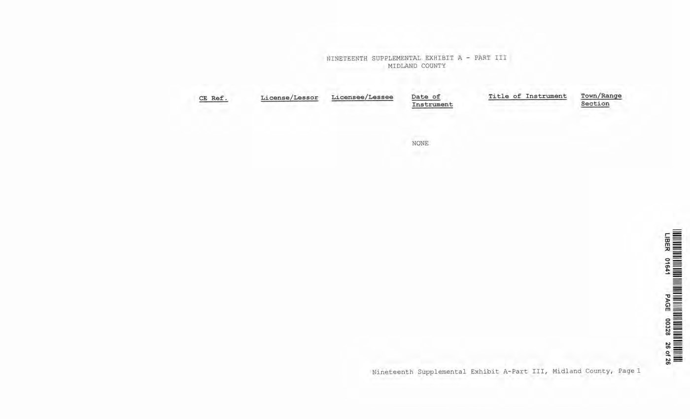
| NINETEENTH SUPPLEMENTAL EXHIBIT A - PART III MIDLAND COUNTY License/Lessor Licensee/Lessee Date of Title of Instrument Instrument NONE Town/Range Section Nineteenth Supplemental Exhibit A-Part III, Midland County, Page 1 CE Ref. License/ Lessor NINETEENTH SUPPLEMENTAL EXHIBI T A - PART III MIDLAND COONTY Licensee/Lessee Date of Instrument NONE Title of Instrument Town/Range Section Nineteenth Supplemental Exhibit A-Part III, Midland County, Pagel - "tJ - ► = G) == m== 0 === o= (,)= N= co == ...., .,, _ 0 - ...... = ...., _ .,,- |
| MONTCALM COUNTY MI 2021R-08388 06/04/2021 10:34 AM SUPPLEMENT NO. 19 TO AMENDED AND RESTATED EASEMENT AGREEMENT THIS SUPPLEMENT NO. 19 TO AMENDED AND RESTATED EASEMENT AGREEMENT ("Supplement No. 19") is made this ~ day of !J,eu,,~ , 2020, between CONSUMERS ENERGY COMPANY (formerly known as Consumers Power Company), a Michigan corporation, (successor by merger to Consumers Power Company, a Maine corporation), One Energy Plaza, Jackson, Michigan 49201 ("Consumers") and MICHIGAN ELECTRIC TRANSMISSION COMPANY, LLC, a Michigan limited liability company (successor by merger to Michigan Electric Transmission Company, a Michigan corporation), 27175 Energy Way, Novi, Michigan 48377 ("METC"). RECITALS: A. Consumers and METC entered into a certain Easement Agreement dated April 1, 2001 whereunder Consumers granted an "Easement" (as therein defined) to METC in respect to certain "Premises" in the State of Michigan for the use set forth therein and on and subject to all of the terms and conditions set forth therein. B. Consumers and METC agreed on certain revisions to the terms and conditions of said Easement Agreement, and for ease of reference, restated said Easement Agreement in its entirety, to include all of said agreed-upon revisions as well as all unchanged provisions, in a certain Amended and Restated Easement Agreement dated as of April 29, 2002 (the "Agreement"). C. The "Premises" under the Agreement are therein defined as (a) the lands identified as "fee lands" in Part "I" of Exhibit A, attached to the Agreement, (b) the lands covered by the easements held by Consumers that are identified in Part "II" of Exhibit A, attached to the Agreement, and ( c) the lands covered by the leases, permits and licenses held by Consumers that are identified in Part "III" of Exhibit A, attached to the Agreement; as said Parts I, II and III of Exhibit A were supplemented or modified in a certain Supplement No. 1 dated April 29, 2002, in a certain Supplement No. 2 dated April 29, 2002, in a certain Supplement No. 3 dated March 3, 2003, in a certain Supplement No. 4 dated October 2, 2006, in a certain Supplement No. 5 dated August 3, 2007, in a certain Supplement No. 6 dated June 18, 2008, in a certain Supplement No. 7 dated September 18, 2008, in a certain Supplement No. 8 dated December 4, 2008, in a certain Supplement No. 9 dated February 22, 2010, in a certain Supplement No. 10 dated March 25, 2010, in a certain Supplement No. 11 dated October 12, 2011, in a certain Supplement No. 12 dated July 20, 2012, in a certain Supplement No. 13 dated August 21, 2012, in a certain Supplement No. 14 dated September 23, 2013, in a certain Supplement No. 15 dated January 13, 2014, in a certain Supplement No. 16 dated January 31, 2017, in a certain Supplement No. 17 dated September 25, 2019, and in a certain Supplement No. 18 dated June 8, 2020, heretofore entered into by Consumers and METC. The parties now desire to further supplement and modify said Exhibit A to the Agreement as set forth herein below. |

| 2 D. References, in regard to historical matters, to "METC" in the foregoing recitals will be deemed to mean METC' s predecessor, Michigan Electric Transmission Company, a Michigan corporation, where relevant. NOW, THEREFORE, for good and valuable consideration, the receipt of which is acknowledged, Consumers and METC agree as follows: 1. Exhibit A to the Agreement, as heretofore supplemented and/or modified, is hereby further supplemented and modified as set forth in "Nineteenth Supplemental Exhibit A", attached hereto. 2. It is expressly understood that any lands, easements, or leases/permits/licenses that are indicated in said attached Nineteenth Supplemental Exhibit A as being added are, on and subject to the terms and conditions of the Agreement (as supplemented and amended by this Supplement No. 19), hereby deemed added to Part I, Part II and Part III, respectively, of Exhibit A to the Agreement. However, it is further expressly understood that in addition to all rights granted to METC by the Agreement, METC shall have the following rights as to the lands identified as "Consumers Energy Equipment/ Joint Asset Area Easement" on the accompanying NINETEENTH Supplemental Exhibit A sheets, inclusive of Parts I, II and III, which rights are also subject to the terms of the Parties' Amended and Restated Transmission Interconnection Agreement (the "□ TIA"): (a) the right to maintain any and all existing components of the Transmission System, as defined in the □ TIA, and wiring or conduit connections for the same that currently exist over, on or under these lands; and (b)the right to connect its currently sited or future approved wiring or conduits for communications, station power, or control, operating at 600 volts or less, and any Jointly Owned Assets, as defined in the □ TIA, over, on or under these lands. It is also expressly understood that, with respect to any lands, easements, or leases/permits/licenses now covered by Part I, Part II or Part III of Exhibit A that are indicated in said attached Nineteenth Supplemental Exhibit A as being deleted, the Easement is hereby deemed RELEASED with respect thereto and the Agreement shall hereafter no longer apply thereto (provided, however, that all rights and obligations under the Agreement with respect to periods prior to the date of this Supplement No. 19 shall remain unaffected). It is expressly understood and agreed Premises represented by the land ( s) , and/ or license ( s) that are added to Exhibit A to the Agreement pursuant "Additional Premises"): that in respect to the additional easement (s), lease (s), permit (s) Part I, Part II and Part III of to this Supplement No. 19 (the (a) All references to "Commencement Date" that are found in Article 1 ( "Grant of Easement"), Article 2 ("Term") , Article 5 ("Additions/Alterations"), Article 6 ("Consumers' Reserved Rights to Use the Premises and Transmission Facilities"), Article 7 ("METC Approval of Compatible Uses"), Article 8 ( "Certain Obligations of Consumers and Authorized Users; Etc.") and Article 14 ("Environmental Matters") of the Agreement shall be deemed to mean the date of this Supplement No. 19 and not the date that is identified in the Agreement as the "Commencement Date". |

| 3 (b) Except as expressly otherwise indicated in the immediately following sentence, all references to "Restated Agreement Date" that are found in Article 1 ("Grant of Easement"), Article 6 ("Consumers' Reserved Rights to Use the Premises and Transmission Facilities"), and Article 12 ("Compliance With Applicable Laws") of the Agreement shall also be deemed to mean the date of this Supplement No. 19 and not the date that .i. s identified in the Agreement as the "Restated Agreement Date". Notwithstanding the foregoing: (i) the preceding sentence does not apply to the purely historical statement in clause "(c)" of Section 1. 2 of the Agreement that Trans-Elect, Inc. is "an affiliate of the entity which has become METC's parent company as of the Restated Agreement Date"; and (ii) the parenthetical in the first sentence of the first paragraph of Section 7.1 of the Agreement reading "(see below regarding a certain period prior to the Restated Agreement Date)", along with the fourth paragraph of said Section 7.1 reading "Consumers shall submit to METC within twenty (20) days of the Restated Agreement Date a list of all material Compatible Uses other than additions or modifications to Distribution Facilities that have been authorized between February 1, 2001 and the Restated Agreement Date for METC's approval per the METC Compatible Use approval process described in this Section 7.1.", both referred to a one-time historical matter and have no application to the Additional Premises or any other further effect or application whatsoever. 3. In addition to the original Transmission Facilities and Additions/Alterations thereto as referred to in Recital "A" of the Agreement, it is understood that such electric Transmission towers, pole structures, poles, crossarms, wires, cables, conduits, guys, anchors, transformers, insulators and/or other fixtures and equipment as may be owned by METC and located on the Additional Premises as of the date of this Supplement No. 19, and future Additions/Alternations made thereto on and subject to the terms and conditions of the Agreement, are included in the "Transmission Facilities" under the Agreement. Note: This Supplement No. 19 will not be recorded in all counties in which the Agreement itself, or Supplements Nos. 1 through 18, may have been recorded. This Supplement No. 19 (as were each of Supplements Nos. 1 through 18), will be recorded only in the county(ies) in which relevant Premises are located; being, in the case of this Supplement No. 19, only the following: |
| Allegan County Antrim County Barry County Bay County Calhoun County Charlevoix County Clinton County Crawford County Emmet County Genesee County Gladwin County Grand Traverse County Gratiot County Ingham County Ionia County Isabella County Jackson County Kalkaska County Kent County Leelanau County Lenawee County Manistee County Midland County Montcalm County Muskegon County Oceana County Ogemaw County Ottawa County Roscommon County Saginaw County Shiawassee County St. Joseph County Washtenaw County Wexford County 4 The fact that this Supplement No. 19 will be recorded only in the particular county(ies) identified above will in no way restrict, limit or otherwise affect the interpretation, application or enforcement of the Agreement; and the terms and conditions of the Agreement shall at all times be read, interpreted and applied in the manner provided for in Section 24.6 of the Agreement. |
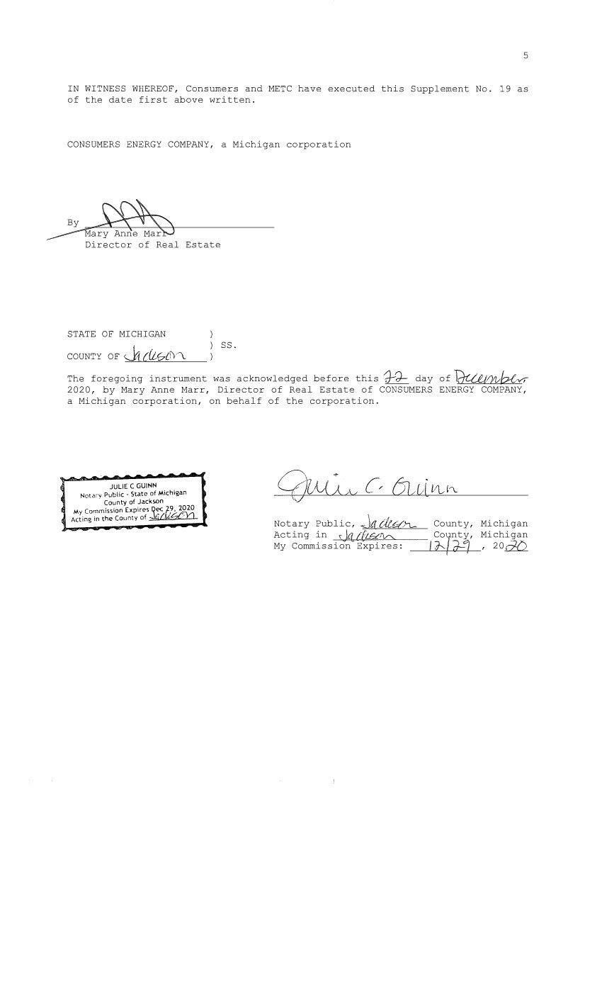
| 5 IN WITNESS WHEREOF, Consumers and METC have executed this Supplement No. 19 as of the date first above written. CONSUMERS ENERGY COMPANY, a Michigan corporation By~ ______-rraryAnneMar Director of Real Estate STATE OF MICHIGAN COUNTY OF J1 [{L,t:7l!'i\. ss. The foregoing instrument was acknowledged before this ".J--d- day of Tuat)1vb!:x, 2020, by Mary Anne Marr, Director of Real Estate of CONSUMERS ENERGY COMPANY, a Michigan corporation, on behalf of the corporation. JULIE C GUINN Notarv Public • State of Michigan , County of Jackson My Commission Expires Qec k'~ Acting in the County of .:::·•l,!!,JC,,.,_/""_e::_:=-"--'- Notary Public, .Ja du:£.'-\_ Acting in dti, i[L5ttY"' My Commission Expires: County, Michigan coynty, Michigan ~l~l---__,_f--J.;__,_ry_, 2 o i:2Z2 |

| 6 MICHIGAN ELECTRIC TRANSMISSION COMPANY, LLC, a Michigan limited liability company By: ITC Holdings Corp., a Michigan corporation, its manager By~~ ~ Jean Kim D'Anna Vice President and Deputy General Counsel - Legal Services STATE OF MICHIGAN COUNTY OF Oakland ss. The forerrni nrr instrument was acknowledged before this I 16 I day of Decemher d020, by Jean Kim D' Anna, Vice President and Deputy General Counsel of ITC Holdings Corp., a Michigan corporation, as manager of MICHIGAN ELECTRIC TRANSMISSION COMPANY, LLC, a Michigan limited liability company, on behalf of the limited liability company. LAURA J. MCCRAY NOTARY PUBLIC, STATE OF Ml COUNTY OF OAKLAND MY COMMISSION EXPIRES Jul 30, 20:1, . l ACTING IN COUNTY OF c.iJlll,IIJ.,W\ Notary PW/';" I Oakl,"d I Acting injL __ O~ak_lan~d__,.l=--;--- My Commission Expires: County, Michigan County, Michigan 7 /30/21 , 2020 Exempt from transfer taxes per MCL §§ 207.505(f) and 207.526(f). Prepared by: Tracy L. Vanwoert Consumers Energy Company EP7-447 One Energy Plaza Jackson, Michigan 49201 Return to: Julie Guinn Consumers Energy Company |

| THE ATTACHED COPY OF THE NINETEENTH SUPPLEMENTAL EXHIBIT A THAT WAS PREPARED FOR RECORDATION IN MONTCALM COUNTY, MICHIGAN, AND CONTAINS THE PORTIONS OF EACH OF PARTS I, II, AND III OF THE NINETEENTH SUPPLEMENT EXHIBIT A THAT RELATE TO PREMISES IN THAT COUNTY ONLY. SEE SECTION 24.6 OF THE AGREEMENT. 7 |

| NINETEENTH SUPPLEMENTAL EXHIBIT A I . Fee Lands : See sheet(s) labeled "NINETEENTH Supplemental Exhibit A-Part I", attached hereto and made a part hereof. Said attached sheet(s) labeled NINETEENTH Supplemental Exhibit A-Part I consist of the following: 3 Pages for Allegan County 6 Pages for Antrim County 2 Pages for Barry County 2 Pages for Bay County 13 Pages for Calhoun County 2 Pages for Charlevoix County 6 Pages for Clinton County 4 Pages for Crawford County 7 Pages for Genesee County 1 Page for Gladwin County 6 Pages for Grand Traverse County 1 Page for Gratiot County 2 Pages for Ingham County 2 Pages for Ionia County l Page for Isabella County 2 Pages for Jackson County 1 Page for Kalkaska County 4 Pages for Kent County 1 Page for Leelanau County 3 Pages for Lenawee County 2 Pages for Manistee County 4 Pages for Midland County 1 Page for Montcalm County 17 Pages for Muskegon County 1 Pages for Oceana County 1 Page for Ogemaw County 4 Pages for Ottawa County 3 Pages for Roscommon County 2 Pages for Saginaw County 3 Pages for Shiawassee County l Page for St. Joseph County 3 Pages for Washtenaw County 2 Pages for Wexford County Nineteenth Supplemental Exhibit A - Introductory Page 1 of 2 |

| II. Easements: See sheet(s) labeled "NINETEENTH Supplemental Exhibit A-Part II", attached hereto and made a part hereof. Said attached sheet(s) labeled NINETEENTH Supplemental Exhibit A-Part II consist of the following: 1 Page for Allegan County 5 Pages for Antrim County 4 Pages for Barry County 1 Pages for Bay County 9 Pages for Calhoun County 4 Pages for Charlevoix County 9 Pages for Clinton County 2 Pages for Crawford County 6 Pages for Emmet County 8 Pages for Genesee County 3 Pages for Gladwin County 1 Page for Grand Traverse County 1 Page for Ingham County 6 Pages for Ionia County 5 Pages for Isabella County 1 Page for Kalkaska County 1 Page for Kent County 2 Pages for Leelanau County 3 Pages for Lenawee County 3 Pages for Manistee County 12 Pages for Midland County 1 Page for Montcalm County 5 Pages for Muskegon County 1 Page for Ogemaw County 4 Pages for Roscommon County 2 Pages for Shiawassee County 1 Page for St. Joseph County 2 Pages for Washtenaw County III. Leases, Permits and Licenses: See sheet(s) labeled "NINETEENTH Supplemental Exhibit A-Part III", attached hereto and made a part hereof. Said attached sheet(s) labeled Nineteenth Supplemental Exhibit A-Part III consist of the following: NA Nothing in this NINETEENTH Supplemental Exhibit A shall be deemed to affect, limit or waive any of the provisions of Sections 1.2 ("Title Limitations") and 1.3 ("No Warranties") of the Agreement. Nineteenth Supplemental Exhibit A - Introductory Page 2 of 2 |
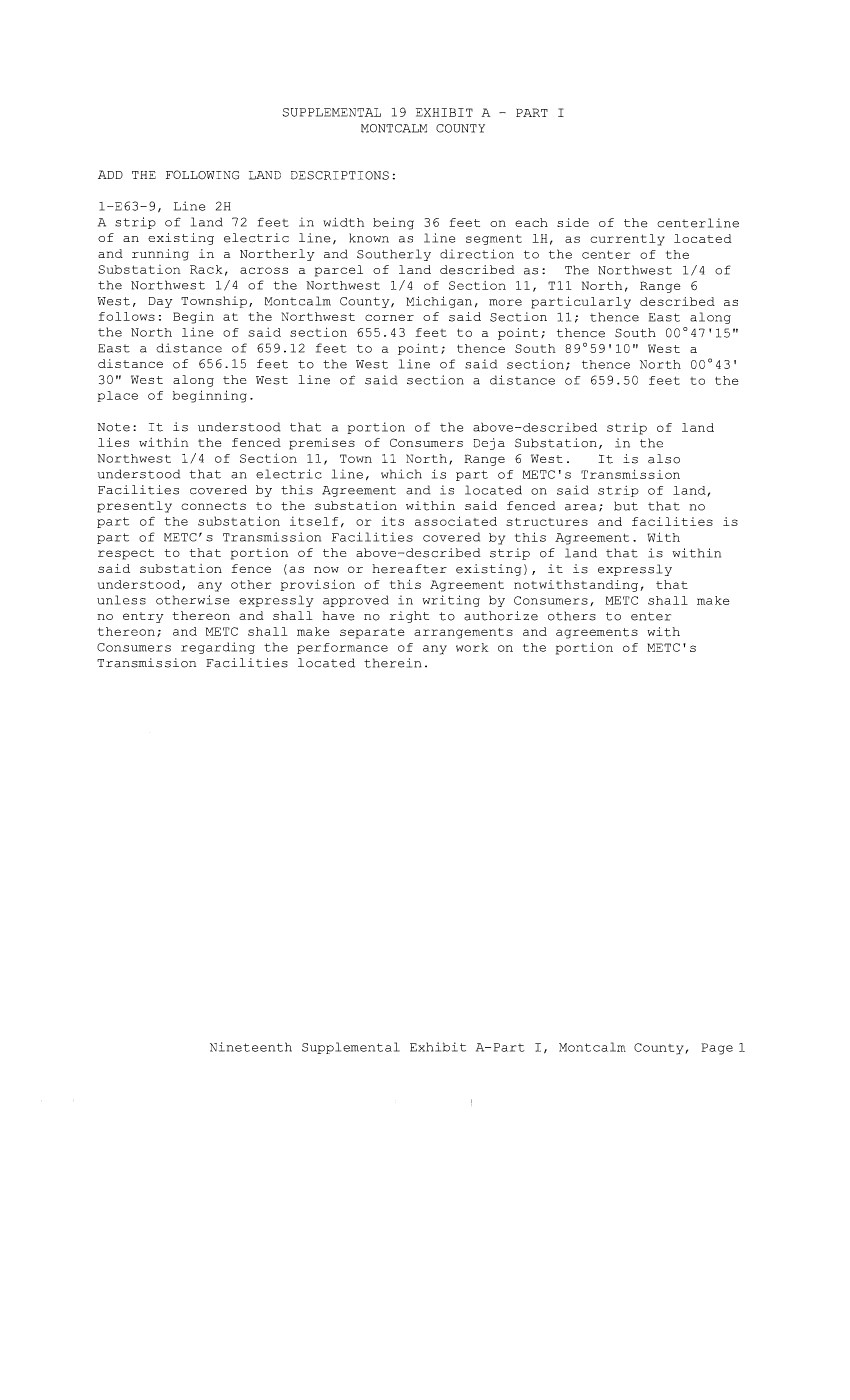
| SUPPLEMENTAL 19 EXHIBIT A - PART I MONTCALM COUNTY ADD THE FOLLOWING LAND DESCRIPTIONS: 1-E63-9, Line 2H A strip of land 72 feet in width being 36 feet on each side of the centerline of an existing electric line, known as line segment lH, as currently located and running in a Northerly and Southerly direction to the center of the Substation Rack, across a parcel of land described as: The Northwest 1/4 of the Northwest 1/4 of the Northwest 1/4 of Section 11, Tll North, Range 6 West, Day Township, Montcalm County, Michigan, more particularly described as follows: Begin at the Northwest corner of said Section 11; thence East along the North line of said section 655.43 feet to a point; thence South 00°47'15" East a distance of 659.12 feet to a point; thence South 89°59'10" West a distance of 656.15 feet to the West line of said section; thence North 00°43' 30" West along the West line of said section a distance of 659.50 feet to the place of beginning. Note: It is understood that a portion of the above-described strip of land lies within the fenced premises of Consumers Deja Substation, in the Northwest 1/4 of Section 11, Town 11 North, Range 6 West. It is also understood that an electric line, which is part of METC's Transmission Facilities covered by this Agreement and is located on said strip of land, presently connects to the substation within said fenced area; but that no part of the substation itself, or its associated structures and facilities is part of METC's Transmission Facilities covered by this Agreement. With respect to that portion of the above-described strip of land that is within said substation fence (as now or hereafter existing), it is expressly understood, any other provision of this Agreement notwithstanding, that unless otherwise expressly approved in writing by Consumers, METC shall make no entry thereon and shall have no right to authorize others to enter thereon; and METC shall make separate arrangements and agreements with Consumers regarding the performance of any work on the portion of METC's Transmission Facilities located therein. Nineteenth Supplemental Exhibit A-Part I, Montcalm County, Page 1 |
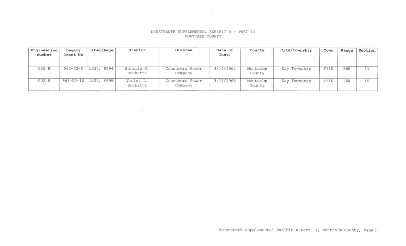
| Engineering Legacy Liber/Page Granter Number Tract No 002 H 562-D2-8 L424, P594 Eulalia H. Hoekstra 002 H 561-D2 10 L424, P595 Violet L. Hoekstra NINETEENTH SUPPLEMENTAL EXHIBIT A PART II MONTCALM COUNTY Grantee Date of County Inst. Consumers Power 4/15/1965 Montcalm Company County Consumers Power 3/12/1965 Montcalm Company County City/Township Town Range Section Day Township TllN R6W ll Day Township TllN R6W 10 Nineteenth Supplemental Exhibit A-Part II, Montcalm County, Page 1 |

| CE Ref. License/"J,essor NINETEENTH SUPPLEMENTAL EXHIBIT A - PART III MONTCALM COUNTY Licensee/Lessee Date of Instrument NONE Title of Instrument Town/Range Section Nineteenth Supplemental Exhibit A-Part III, Montcalm County, Page 1 |
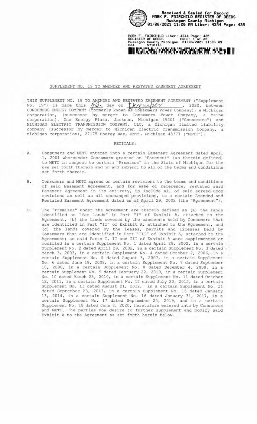
| Received & Sealed for Record MARK F. FAIRCHILD REGISTER OF DEEDS Muskegon County Michigan 01/08/2021 11:06 AM Liber: 4244 Page: 435 HARK F. FAIRCHILD Liber: 4244 Page: 435 REGISTER OF DEEDS PAGE: 1 of 32 Muskegon County Michigan 01/08/2021 11:06 AM 034 5710113 SUPPLEMENT NO. 19 TO AMENDED AND RESTATED EASEMENT AGREEMENT THIS SUPPLEMENT NO. 19 TO AMENDED AND RESTATED EASEMENT AGREEMENT ("Supplement No. 19") is made this day of X^.Ct ' 2020, between CONSUMERS ENERGY COMPANY (formerly known as Consumers Power Company), a Michigan corporation, (successor by merger to Consumers Power Company, a Maine corporation), One Energy Plaza, Jackson, Michigan 49201 ("Consumers") and MICHIGAN ELECTRIC TRANSMISSION COMPANY, LLC, a Michigan limited liability company (successor by merger to Michigan Electric Transmission Company, a Michigan corporation), 27175 Energy Way, Novi, Michigan 48377 ("METC"). RECITALS: A. Consumers and METC entered into a certain Easement Agreement dated April 1, 2001 whereunder Consumers granted an "Easement" (as therein defined) to METC in respect to certain "Premises" in the State of Michigan for the use set forth therein and on and subject to all of the terms and conditions set forth therein. B. Consumers and METC agreed on certain revisions to the terms and conditions of said Easement Agreement, and for ease of reference, restated said Easement Agreement in its entirety, to include all of said agreed-upon revisions as well as all unchanged provisions, in a certain Amended and Restated Easement Agreement dated as of April 29, 2002 (the "Agreement"). C. The "Premises" under the Agreement are therein defined as (a) the lands identified as "fee lands" in Part "I" of Exhibit A, attached to the Agreement, (b) the lands covered by the easements held by Consumers that are identified in Part "II" of Exhibit A, attached to the Agreement, and (c) the lands covered by the leases, permits and licenses held by Consumers that are identified in Part "III" of Exhibit A, attached to the Agreement; as said Parts I, II and III of Exhibit A were supplemented or modified in a certain Supplement No. 1 dated April 29, 2002, in a certain Supplement No. 2 dated April 29, 2002, in a certain Supplement No. 3 dated March 3, 2003, in a certain Supplement No. 4 dated October 2, 2006, in a certain Supplement No. 5 dated August 3, 2007, in a certain Supplement No. 6 dated June 18, 2008, in a certain Supplement No. 7 dated September 18, 2008, in a certain Supplement No. 8 dated December 4, 2008, in a certain Supplement No. 9 dated February 22, 2010, in a certain Supplement No. 10 dated March 25, 2010, in a certain Supplement No. 11 dated October 12, 2011, in a certain Supplement No. 12 dated July 20, 2012, in a certain Supplement No. 13 dated August 21, 2012, in a certain Supplement No. 14 dated September 23, 2013, in a certain Supplement No. 15 dated January 13, 2014, in a certain Supplement No. 16 dated January 31, 2017, in a certain Supplement No. 17 dated September 25, 2019, and in a certain Supplement No. 18 dated June 8, 2020, heretofore entered into by Consumers and METC. The parties now desire to further supplement and modify said Exhibit A to the Agreement as set forth herein below. MARK F . FAIRCHILD Liber: 4244 Page: 435 REGISTER OF DEEDS PAG E: 1 of 32 Muskegon County Michigan 01/08/202 1 11 :06 AM 034 5710113 1 111 ~ r~)l~t~ ~~~(.K,),t'~]~,;~,lt•1~~ li1,,i:' J 11111 SUPPLEMENT NO. 19 TO AMENDED AND RESTATED EASEMENT AGREEMENT THIS SUPPLEMENT NO. 19 TO _ AMENDED AND RESTATED ~JEMENT AGREEMENT ( "Supplement No . 19") is made this ~ day of :Qlce jtld4.?C.-Y , 2020, bet11een CONSUMERS ENERGY COMPANY (formerly known as Consumers Power Company) , a Michigan corporation, ( successor by merger to Consumers Power Company, a Maine corporation) , One Energy Plaza, Jackson, Michigan 49201 ("Consumers") and MICHIGAN ELECTRIC TRANSMISSION COMPANY, LLC, a Michigan limited liability company ( successor by merger to Michigan Electric Transmission Company, a Michigan corporation) , 27175 Energy Way, Novi, Michigan 48377 ( "METC"). RECITALS : A. Consumers and METC entered into a certain Easement Agreement dated April 1 , 2001 whereunder Consumers granted an "Easement" (as therein defined) to METC in respect to certain "Premises" in the State of Michigan for the use set forth therein and on and subject to all of the terms and conditions set forth therein . B. Consumers and METC agreed on certain revisions to the terms and conditions of said Easement Agreement, and for ease of reference, restated said Easement Agreement in its entirety, to include all of said agreed- upon revisions as well as all unchanged provisions, in a certain Amended and Restated E'.asement Agreement dated as of April 29, 2002 (the "Agreement") . C. The "Premises" under the Agreement are therein defined as (a} the lands identified as " fee lands" in Part ''I " of Exhibit A, attached to the Agreement, (b) the lands covered by the easements held by Consumers that are identified in Part "II " of Exhibit A, attached to the Agreement, and (c) the lands covered by the leases, permits and licenses held by Consumers that are identi fied in Part " III" of Exhibit A, attached to the Agreement; as said Parts I , II and III of Exhibit A were supplemented or modified in a certain Supplement No. 1 dated April 29, 2002, in a certain Supplement No. 2 dated April 29, 2002, in a certain Supplement No . 3 dated March 3 , 2003, in a certain Supplement No . 4 dated October 2 , 2006, in a certain Supplement No . 5 dated August 3 , 2007, in a certain Supplement No . 6 dated June 18, 2008, in a certain Supplement No . 7 dated September 18, 2008 , in a certain Supplement No. 8 dated December 4, 2008, in a certain Supplement No . 9 dated February 22, 2010, in a certain Supplement No . 10 dated March 25, 2010, in a certain Supplement No. 11 dated October 12, 2011, in a certain Supplement No . 12 dated July 20, 2012, in a certain Supplement No . 13 dated August 21, 2012, in a certain Supplement No . 14 dated September 23, 2013 , in a certain Supplement No . 15 dated January 13 , 2014 , in a certain Suppl ement No . 16 dated January 31, 2017 , in a certain Supplement No . 17 dated September 25, 2019, and in a certain Supplement No . 18 dated June 8, 2020, heretofore entered into by Consumers and METC . The parties now desire to further supplement and modify said Exhibit A to the Agreement as set forth herein below . |
| 2 D. References, in regard to historical matters, to "METC" in the foregoing recitals will be deemed to mean METC's predecessor, Michigan Electric Transmission Company, a Michigan corporation, where relevant. NOW, THEREFORE, for good and valuable consideration, the receipt of which is acknowledged, Consumers and METC agree as follows: 1. Exhibit A to the Agreement, as heretofore supplemented and/or modified, is hereby further supplemented and modified as set forth in "Nineteenth Supplemental Exhibit A", attached hereto. It is expressly understood that any lands, easements, or leases/permits/licenses that are indicated in said attached Nineteenth Supplemental Exhibit A as being added are, on and subject to the terms and conditions of the Agreement (as supplemented and amended by this Supplement No. 19), hereby deemed added to Part I, Part II and Part III, respectively, of Exhibit A to the Agreement. However, it is further expressly understood that in addition to all rights granted to METC by the Agreement, METC shall have the following rights as to the lands identified as "Consumers Energy Equipment / Joint Asset Area Easement" on the accompanying NINETEENTH Supplemental Exhibit A sheets, inclusive of Parts I, II and III, which rights are also subject to the terms of the Parties' Amended and Restated Transmission Interconnection Agreement (the "DTIA"): (a) the right to maintain any and all existing components of the Transmission System, as defined in the DTIA, and wiring or conduit connections for the same that currently exist over, on or under these lands; and (b)the right to connect its currently sited or future approved wiring or conduits for communications, station power, or control, operating at 600 volts or less, and any Jointly Owned Assets, as defined in the DTIA, over, on or under these lands. It is also expressly understood that, with respect to any lands, easements, or leases/permits/licenses now covered by Part I, Part II or Part III of Exhibit A that are indicated in said attached Nineteenth Supplemental Exhibit A as being deleted, the Easement is hereby deemed RELEASED with respect thereto and the Agreement shall hereafter no longer apply thereto (provided, however, that all rights and obligations under the Agreement with respect to periods prior to the date of this Supplement No. 19 shall remain unaffected). 2. It is expressly understood and agreed that in respect to the additional Premises represented by the land(s), easement(s), lease(s), permit(s) and/or license (s) that are added to Part I, Part II and Part III of Exhibit A to the Agreement pursuant to this Supplement No. 19 (the "Additional Premises"): (a) All references to "Commencement Date" that are found in Article 1 ("Grant of Easement"), Article 2 ("Term"), Article 5 ("Additions/Alterations") , Article 6 ("Consumers' Reserved Rights to Use the Premises and Transmission Facilities"), Article 7 ("METC Approval of Compatible Uses"), Article 8 ("Certain Obligations of Consumers and Authorized Users; Etc.") and Article 14 ("Environmental Matters") of the Agreement shall be deemed to mean the date of this Supplement No. 19 and not the date that is identified in the Agreement as the "Commencement Date". MARK F. FAIRCHILD Liber: REGISTER OF DEEDS lluskegon County Michigan 034 5710113 4244 Page: 435 PAGE: 2 of 32 01/08/2021 11:06 AM 2 D. References, in regard to historical matters, to "METC" in the foregoing recitals will be deemed to mean METC ' s predecessor, Michigan Electric Transmission Company, a Michigan corporation, where relevant. NOW , THEREFORE , for good and valuable consideration, the receipt of which is acknowledged, Consumers and METC agree as follows : 1. Exhibit A to the Agreement, as heretofore supple.mented and/or modified, is hereby further supplemented and modified as set forth in "Nineteenth Supplemental Exhibit A", attached hereto. It is expressly understood that any lands, easements, or leases/permits/licenses that are indicated in said attached Nineteenth Supplemental Exhibit A as being added are, on and subject to the terms and conditions of the Agreement ( as supplemented and amended by this Supplement No. 19) , hereby deemed added to Part I , Part II and Part III, respectively, of Exhibit A to the Agreement . However, it is further expressly understood that in addition to all rights granted to METC by the Agreement, METC shall have the following rights as to the lands identified as "Consumers Energy Equipment/ Joint Asset Area Easement" on the accompanying NINETEENTH Supplemental Exhibit A sheets, inclusive of Parts I , II and III, which rights are also subject to the terms of the Parties' Amended and Restated Transmission Interconnection Agreement (the " DTIA" ) : (a) the right to maintain any and all existing components of the Transmission System, as defi ned in the DTIA, and wiring or conduit connections for t he same that currently exist over, on or under these lands; and (b)the right to connect its currently sited or future approved wiring or conduits for communications, station power, or control, operating a t 600 volts or l ess, and any Jointly Owned Assets, as defined in the DTIA, over, on or under these lands. It is also expressly understood that, with respect to any lands, easements , or leases/permits/licenses now covered by Part I , Part II or Part III of Exhibit A that are indicated in said attached Nineteenth Supplemental Exhibit A as being del eted, the Easement is hereby deemed RELEASED with respect thereto and the Agreement shall hereafter no longer apply thereto (provided, however, that all rights and obligations under the Agreement with respect to periods prior to the date of this Supplement No. 19 shall remain unaffected) . 2 . It is expressly understood and agreed that in respect to the additional Premises represented by the land(s) , easement(s) , lease(s) , permit(s) and/ or license ( s) that are added to Part I , Part II and Part I I I of Exhibit A to the Agreement pursuant to this Supplement No. 19 (the "Additional Premises") : (al All references to "Commencement Date" that are found in Article 1 ( "Grant of Easement") , Article 2 ("Term") , Article 5 ("Additions/Alterations" ) , Article 6 ("Consumers' Reserved R ights to Use the Premises and Transmission Facilitiesn) , Article 7 ("METC Approval of Compatible Uses" ) , Article 8 ("Certain Obligations of Consumers and Authorized Users; Etc. ") and Article 14 ("Environmental Matters" ) of the Agreement shall be deemed to mean the date of this Supplement No . 19 and not the date that is identified in the Agreement as the "Commencement Date". 4244 Page: 435 PAG E: 2 of 32 01/ 08/ 2021 11 :06 AM |
| (b) Except as expressly otherwise indicated in the immediately following sentence, all references to "Restated Agreement Date" that are found in Article 1 ("Grant of Easement"), Article 6 ("Consumers' Reserved Rights to Use the Premises and Transmission Facilities"), and Article 12 ("Compliance With Applicable Laws") of the Agreement shall also be deemed to mean the date of this Supplement No. 19 and not the date that is identified in the Agreement as the "Restated Agreement Date". Notwithstanding the foregoing: (i) the preceding sentence does not apply to the purely historical statement in clause "(c)" of Section 1.2 of the Agreement that Trans-Elect, Inc. is "an affiliate of the entity which has become METC's parent company as of the Restated Agreement Date"; and (ii) the parenthetical in the first sentence of the first paragraph of Section 7.1 of the Agreement reading "(see below regarding a certain period prior to the Restated Agreement Date)", along with the fourth paragraph of said Section 7.1 reading "Consumers shall submit to METC within twenty (20) days of the Restated Agreement Date a list of all material Compatible Uses other than additions or modifications to Distribution Facilities that have been authorized between February 1, 2001 and the Restated Agreement Date for METC's approval per the METC Compatible Use approval process described in this Section 7.1.", both referred to a one-time historical matter and have no application to the Additional Premises or any other further effect or application whatsoever. 3. In addition to the original Transmission Facilities and Additions/Alterations thereto as referred to in Recital "A" of the Agreement, it is understood that such electric Transmission towers, pole structures, poles, crossarms, wires, cables, conduits, guys, anchors, transformers, insulators and/or other fixtures and equipment as may be owned by METC and located on the Additional Premises as of the date of this Supplement No. 19, and future Additions/Alternations made thereto on and subject to the terms and conditions of the Agreement, are included in the "Transmission Facilities" under the Agreement. Note: This Supplement No. 19 will not be recorded in all counties in which the Agreement itself, or Supplements Nos. 1 through 18, may have been recorded. This Supplement No. 19 (as were each of Supplements Nos. 1 through 18), will be recorded only in the county(ies) in which relevant Premises are located; being, in the case of this Supplement No. 19, only the following: MARK F. FAIRCHILD Liber: 4244 Page: 435 REGISTER OF DEEDS PAGE: 3 of 32 Michigan 01/08/2021 11:06 AM Muskegon County I 034 5710113 ..■I in 3 (b) Except as expressly otherwise indicated in the immediately following sentence, all references to "Restated Agreement Date" that are found in Article 1 ("Grant of Easement" ), Article 6 (''Consumers' Reserved Rights to Use the Premises and Transmission Facili t ies"), and Article 12 ("Compliance With Applicable Laws" ) of the Agreement shall also be deemed to mean the date of this Supplement No . 19 and not the date that is identified in t he Agreement as the ''Restated Agreement Date". Notwithstanding the foregoing : (i) the preceding sentence does not apply to the purely historical statement in clause "(c) '' of Section 1 . 2 of the Agreement that Trans- Elect, Inc. is "an affiliate of the enti ty which has become METC ' s parent company as of the Restated Agreement Date"; and (ii) the parenthetical in the first sentence of the first paragraph of Section 7 . 1 of the Agreement reading " (see below regarding a certain period prior to t he Restated Agreement Date) ", along with the fourth paragraph of said Section 7 . 1 readi ng "Consumers shall submit to METC within twenty (20) days of the Restated Agreement Date a list of all material Compatibl e Uses other t han additions or modifications to Distribution Facilities that have been authorized between February 1 , 2001 and the Restated Agreement Date for METC ' s approval per the METC Compatible Use approval process described in this Section 7 .1. " , both referred to a one-time histori cal matter and have no application to the Additional Premises or any other further effect or application whatsoever . 3 . In addition to the original Transmission Facil ities and Additions/Alterations thereto as referred to in Recital "A" of the Agreement, it is understood that such electric Transmission towers, pole structures, poles, cross arms, wires, cables, conduits, guys, anchors, transformers, insulators and/or other fixtures and equipment as may be owned by METC a nd located on the Additional Premi ses as of the date of t his Supplement No . 19, and future . Additions/Alternations made thereto on and subject to the terms and conditions of the Agreement, are included in the "Transmission Facilities" under the Agreement . Note : This Supplement No . 19 will not be recorded in all counties in which the Agreement itself, or Supplements Nos . 1 through 18, may have been recorded. This Supplement No . 19 (as were each of Supplements Nos . 1 through 18) , will be recorded only in the county(ies) in which relevant Premises are located; being, in the case of this Supplement No . 19, only the following : MARK F. FAIRCHILD Liber: 4244 Page: 435 REG ISTER OF DEEDS PAGE : 3 of 32 Muskegon County Michigan 01 /08/2021 11 :06 AM 034 5710113 1 111 I~ r~,ir~;~tfit~~,~ ~?l,~[r.-.\,!l'Al~l~W~~i:, 11111 |
| 4 Allegan County Antrim County Barry County Bay County Calhoun County Charlevoix County Clinton County Crawford County Emmet County Genesee County Gladwin County Grand Traverse County Gratiot County Ingham County Ionia County Isabella County Jackson County Kalkaska County Kent County Leelanau County Lenawee County Manistee County Midland County Montcalm County Muskegon County Oceana County Ogemaw County Ottawa County Roscommon County Saginaw County Shiawassee County St. Joseph County Washtenaw County Wexford County The fact that this Supplement No. 19 will be recorded only in the particular county(ies) identified above will in no way restrict, limit or otherwise affect the interpretation, application or enforcement of the Agreement; and the terms and conditions of the Agreement shall at all times be read, interpreted and applied in the manner provided for in Section 24.6 of the Agreement. MARK F , FAIRCHILD Liber: REGISTER OF DEEDS Muskegon County Michigan 034 5710113 4244 Page: 435 PAGE: 4 of 32 01/08/2021 11:06 AM Allegan County Antrim County Barry County Bay County Calhoun County Charlevoix County Cl inton County Crawford County Emmet County Genesee County Gladwin County Grand Traverse County Gratiot County Ingham County Ionia County Isabella County Jackson County Kalkaska County Kent County Leelanau County Lenawee County Mani stee County M i dland County Montcalm County Muskegon County Oceana County Ogemaw County Ottawa County Roscommon County Saginaw County Shiawassee County St. Joseph County Washtenaw County Wexford County 4 The f act that this Supplement No . 19 will be recorded only in the particular county(ies) identified above will in no way restrict, l i mit or otherwise affect the interpretation, application or enforcement of the Agreement ; and the terms and conditions of the Agreement shall at all times be read, inter preted and applied in the manner provided f or in Section 24.6 of the Agreement . M ARK F. FAIRCHILD Liber : REGISTER OF DEEDS Muskegon County Michigan 034 5710113 4244 Page: 435 PAG E: 4 of 32 01/08/2021 11 :06 AM 1111 tl~ ~'~1 ~.~\~~J~t-;,i1~ tilr.~i"](~?l~l.~1\ !: 111111 |
| 5 IN WITNESS WHEREOF, Consumers and METC have executed this Supplement No. 19 as of the date first above written. CONSUMERS ENERGY COMPANY, a Michigan corporation Mary Ani\e lYlai Director of Real Estate STATE OF MICHIGAN ) I . „ ) ss. COUNTY OF ) day of The foregoing instrument was acknowledged before this 2020, by Mary Anne Marr, Director of Real Estate of CONSUMERS ENERGY COMPANY, a Michigan corporation, on behalf of the corporation. JULIE C GUINN Notary Public - State of Michigan County of Jackson My Commission Expires Acting in the County of _\J fyry <2h L i U. Cd%L V WL Notary Public, O/f, clto Acting in ____ My Commission Expires: _ County, County, Michigan Michigan , 2 0 MARK F. FAIRCHILD Liber REGISTER OF DEEDS Muskegon County Michigan 034 ‘ 4244 Page: 435 PAGE: 5 of 32 01/08/2021 11:06 AM County l 5710113 n r H fflN ffi W( HWMMU1 5 IN WITNESS WHEREOF, Consumers and METC have executed this Supplement No . 19 as of the date first above written. CONSUMERS ENERGY COMPANY , a Michigan corporation STATE Of MICHIGAN COUNTY OF ,Jctdl~l-----. ss. The foregoing i nstrument was acknowledged before this J d-- day of 1Jeahr{Je,,i,;, 2020, by Mary Anne M arr, D i rector of Real Estate of CONSUMERS ENERGY COMPANY , a Michigan corporation, on behalf of the corporation. JULIE C GUIHH Notary Publk - State of Mid 1 1gan County of Jac:kwn My Commissfon E~pires ~ec ?f, • 20'ZO Acting in the County of "- 4tJ D1'.\_ MARK F. FAIRCHILD Liber : 4244 Page: 435 REGISTER OF DEEDS PAGE : 5 of 32 Muskegon County Michigan 01/08/2021 11 :06 AM 034 5710113 1111 I~ ~·\~~A\~f ~~~~ ,J~.~tt•,~f,:~11·t!:J ll ll l Notary Public, ~'1 {/r,&15\,--,._ Acting in dU-x/h Michigan Michigan ---'---''---I-----"--'-- f 2 0 oe> My Commission Expires: |
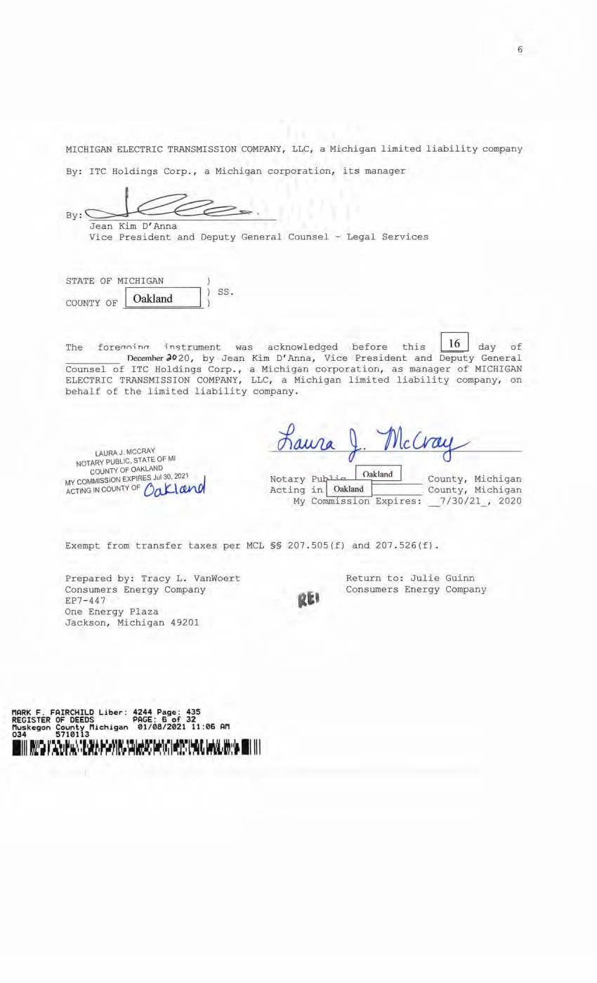
| 6 MICHIGAN ELECTRIC TRANSMISSION COMPANY, LLC, a Michigan limited liability company By: ITC Holdings Corp., a Michigan corporation, its manager Jean Kim D'Anna Vice President and Deputy General Counsel - Legal Services STATE OF MICHIGAN ) COUNTY OF Oakland ) ss. ) The fore^ina instrument was acknowledged before this 16 day of _________ December PO 2 0, by Jean Kim D'Anna, Vice President and Deputy General Counsel of ITC Holdings Corp., a Michigan corporation, as manager of MICHIGAN ELECTRIC TRANSMISSION COMPANY, LLC, a Michigan limited liability company, on behalf of the limited liability company. LAURA J. MCCRAY NOTARY PUBLIC, STATE OF Ml COUNTY OF OAKLAND MY COMMISSION EXPIRES Jul 30 2021 , acting in county of £)0jClcCnW Notary PutjCU^L Acting in Oakland Oakland My Commission Expires: County, Michigan County, Michigan 7/30/21 , 2020 Exempt from transfer taxes per MCL §§ 207.505(f) and 207.526(f). Prepared by: Tracy L. VanWoert Consumers Energy Company EP7-447 One Energy Plaza Jackson, Michigan 49201 Return to: Julie Guinn Consumers Energy Company HARK F. FAIRCHILD Liber: 4244 Page: 435 REGISTER OF DEEDS PAGE: 6 of 32 Muskegon County Michigan 01/08/2021 11:06 AM 034 5710113 6 MICHIGAN ELECTRIC TRANSMISSION COMPANY , LLC, a Michigan limited liability company By: ITC Holdings Corp., a Michigan corporation, its manager By : Jean Kim D'Anna Vice President and Deputy General Counsel - Legal Services STATE OF MICHIGAN cooNTY OF -== O = akl= . an=d===- ss. The forerrn-i nrr -i n5trument was acknowledged before this ~ day of n ecemher J02Q , by Jean Kim D' Anna, Vice President and Deputy General Counsel of ITC Holdings Corp., a Michigan corporation, as manager of MICHIGAN ELECTRIC TRANSMISSION COMPANY , LLC, a Michigan limited liability company, on behalf of the limited liability company. LAURA J. MCCRA'< NOTARY PUBLIC, STATE OF Ml COUNTY OF OAKLAND MY COMMISSION EXPIRES Jul 30. 2021 . l ACTING IN COUNTY OF 6 o):.l£2V\.Of Notary Putr" " I <hllMd I County, Mi chi ga n Acting in l Oakland I County, Michigan My CommL-i~ · s_s_i~ · o-n- .~E-x-p~i-r_e_s_: _7/30/21, 2020 Exempt from transfer taxes per MCL §§ 207 .SOS(f) and 207.526(£) . Prepared by: Tracy L. Vanwoert Consumers Energy Company EP7-447 One Energy Plaza Jackson, Michigan 49201 MARK F. FAIRCHILD Liber: REGISTER OF DEEDS Muskegon County Michigan 034 5710113 4244 Page: 435 PAGE: 6 of 32 01/08/2021 11 :06 AM 11111~ r~,1~~. :l•~1, ~~n~,,~~~r..1, ,~1~l~t ~1:1t 11111 Return to: Julie Guinn Consumers Energy Company |
| THE ATTACHED COPY OF THE NINETEENTH SUPPLEMENTAL EXHIBIT A THAT WAS PREPARED FOR RECORDATION IN MUSKEGON COUNTY, MICHIGAN, AND CONTAINS THE PORTIONS OF EACH OF PARTS I, II, AND III OF THE NINETEENTH SUPPLEMENT EXHIBIT A THAT RELATE TO PREMISES IN THAT COUNTY ONLY. SEE SECTION 24.6 OF THE AGREEMENT. PlflRK F. FAIRCHILD Liber: 4244 Page: 435 REGISTER OF DEEDS PAGE: 7 of 32 lluskegon County Plichigan 01/08/2021 11:06 API 034 5710113 THE ATTACHED COPY OF THE NINETEENTH SUPPLEMENTAL EXHIBIT A THAT WAS PREPARED FOR RECORDATI ON IN MUSKEGON COUNTY , MICHIGAN, AND CONTAINS THE PORTIONS OF EACH OF PARTS I , II, AND III OF THE NINETEENTH SUPPLEMENT EXHIBIT A THAT RELATE TO PREMISES IN THAT COUNTY ONLY . SEE SECTION 24 . 6 OF THE AGREEMENT . MARK F. FAIRCHILD Liber: 4244 Page: 435 REGISTER OF DEEDS PAGE : 7 of 32 Muskegon County Michigan 01/08/2021 11 :06 AM 034 5710113 1111 I~ r .• ~r~~(lifAl~.\:1l1i~[,1(lil 1l~~,..lr,~1:, 11111 7 |
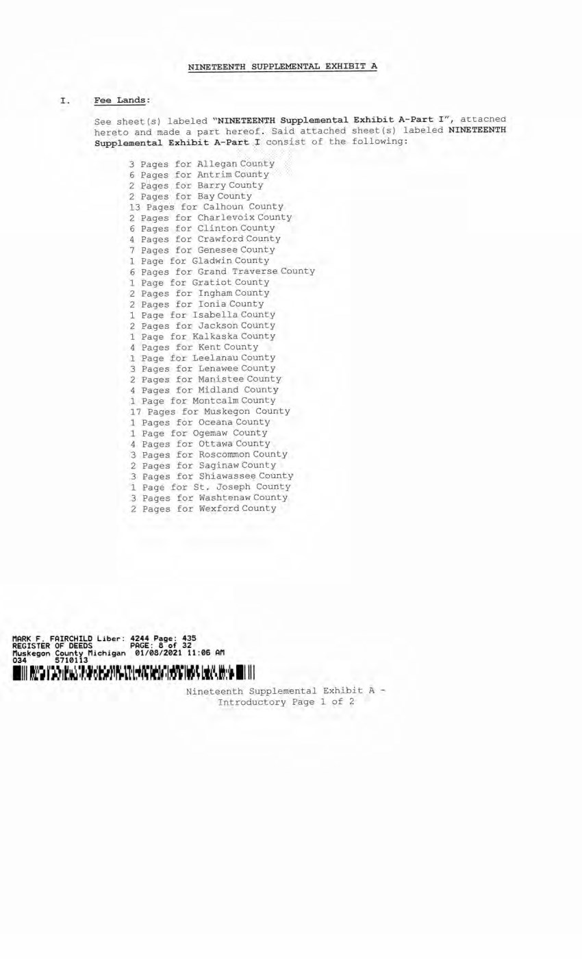
| NINETEENTH SUPPLEMENTAL EXHIBIT A I. Fee Lands: See sheet (s) labeled "NINETEENTH Supplemental Exhibit A-Part I", attached hereto and made a part hereof. Said attached sheet(s) labeled NINETEENTH Supplemental Exhibit A-Part I consist of the following: 3 Pages for Allegan County 6 Pages for Antrim County 2 Pages for Barry County 2 Pages for Bay County 13 Pages for Calhoun County 2 Pages for Charlevoix County 6 Pages for Clinton County 4 Pages for Crawford County 7 Pages for Genesee County 1 Page for Gladwin County 6 Pages for Grand Traverse County 1 Page for Gratiot County 2 Pages for Ingham County 2 Pages for Ionia County 1 Page for Isabella County 2 Pages for Jackson County 1 Page for Kalkaska County 4 Pages for Kent County 1 Page for Leelanau County 3 Pages for Lenawee County 2 Pages for Manistee County 4 Pages for Midland County 1 Page for Montcalm County 17 Pages for Muskegon County 1 Pages for Oceana County 1 Page for Ogemaw County 4 Pages for Ottawa County 3 Pages for Roscommon County 2 Pages for Saginaw County 3 Pages for Shiawassee County 1 Page for St. Joseph County 3 Pages for Washtenaw County 2 Pages for Wexford County MARK F. FAIRCHILD Liber: 4244 Page: 435 REGISTER OF DEEDS PAGE: 8 of 32 Muskegon County Michigan 01/08/2021 11:06 AM 034 5710113 Nineteenth Supplemental Exhibit A - Introductory Page 1 of 2 NINETEENTH SUPPLEMENTAL EXHIBIT A I . Fee Lands : See sheet(s) l abeled "NINETEENTH Supplemental Exhibit A- Part I ", attacned hereto and made a part hereof. Said attached sheet(s) labeled NINETEENTH Supplemental Exhibit A- Part I consist of the following: 3 Pages for Allegan County 6 Pages for Antrim County 2 Pages for Barry County 2 Pages for Bay County 13 Pages for Calhoun County 2 Pages for Charl evoix County 6 Pages for Clinton County 4 Pages for Crawford County 7 Pages for Genesee County 1 Page for Gladwin County 6 Pages for Grand Traverse County 1 Page for Gratiot County 2 Pages for Ingham County 2 Pages for Ionia County 1 Page for Isabella County 2 Pages for Jackson County 1 Page for Kalkaska County 4 Pages for Kent County 1 Page .for Leelanau County 3 Pages for Lenawee County 2 Pages for Manistee County 4 Pages for Midland County 1 Page for Montcalm County 17 Pages for Muskegon County 1 Pages for Oceana County 1 Page for Ogemaw County 4 Pages for Ottawa County 3 Pages for Roscommon County 2 Pages for Saginaw County 3 Pages £or Shiawassee County 1 Page for St . Joseph County 3 Pages for Washtenaw County 2 Pages for Wex ford County MARK F . FAIRCHILD Liber: 4244 Page: 435 REGISTER OF DEEDS PAGE : 8 of 32 Muskegon County Michigan 01/08/2021 11:06 AM 034 5710113 llll tl·~ f Af 1~~ l~~rA1~1l·l,ftiWl~I~\ lit\,!:, 11111 Nineteenth Supplemental Exhibit A - Introductory Page 1 of 2 |
| II. Easements: See sheet(s) labeled "NINETEENTH Supplemental Exhibit A-Part II", attached hereto and made a part hereof. Said attached sheet(s) labeled NINETEENTH Supplemental Exhibit A-Part II consist of the following: 1 Page for Allegan County 5 Pages for Antrim County 4 Pages for Barry County 1 Pages for Bay County 9 Pages for Calhoun County 4 Pages for Charlevoix County 9 Pages for Clinton County 2 Pages for Crawford County 6 Pages for Emmet County 8 Pages for Genesee County 3 Pages for Gladwin County 1 Page for Grand Traverse County 1 Page for Ingham County 6 Pages for Ionia County 5 Pages for Isabella County 1 Page for Kalkaska County 1 Page for Kent County 2 Pages for Leelanau County 3 Pages for Lenawee County 3 Pages for Manistee County 12 Pages for Midland County 1 Page for Montcalm County 5 Pages for Muskegon County 1 Page for Ogemaw County 4 Pages for Roscommon County 2 Pages for Shiawassee County 1 Page for St. Joseph County 2 Pages for Washtenaw County III. Leases, Permits and Licenses: See sheet(s) labeled "NINETEENTH Supplemental Exhibit A-Part III", attached hereto and made a part hereof. Said attached sheet(s) labeled Nineteenth Supplemental Exhibit A-Part III consist of the following: NA Nothing in this NINETEENTH Supplemental Exhibit A shall be deemed to affect, limit or waive any of the provisions of Sections 1.2 ("Title Limitations") and 1.3 ("No Warranties") of the Agreement. MARK F . FAIRCHILD Liber: 4244 Page: 435 REGISTER OF DEEDS PAGE: 9 of 32 Muskegon County Michigan 01/08/2021 11:06 AM 034 5710113 i Nineteenth Supplemental Exhibit A - Introductory Page 2 of 2 II . Easements: See sheet ( s) labeled ''NINETEENTH Supplemental Exhibit A-Part II'', att ached he r eto a nd made a part hereof . Said attached sheet(s) labeled N! NETEENTH Supplemental Exhibit A-Part II consist of the following : 1 Page for Allegan County 5 Pages for Antrim County 4 Pages for Barr y Count y 1 Pages for Bay County 9 Pages for Calhoun Count y 4 Pages for Charlevoix County 9 Pages for Clinton County 2 Pages for Crawford County 6 Pages for Emmet County 8 Pages for Genesee County 3 Pages for Gladwin County 1 Page for Grand Traverse County 1 Page for Ingham County 6 Pages for Ionia County 5 Pages for Isabella County 1 Page for Kalkaska County 1 Page for Kent County 2 Pages for Leelanau County 3 Pages for Lenawee County 3 Pages for Manistee County 12 Pages for Midl and County 1 Page for Montcalm County 5 Pages for M us kegon County 1 Page for Ogemaw County 4 Pages for Roscommon County 2 Pages for Shiawassee County 1 Page for St . Joseph County 2 Pages for Washtenaw County III. Leases, Pennits and Licenses: See sheet ( s) labeled "NINETEENTH Supplemental Exhibit A-Part III" , attached hereto and made a part hereof. Said attached sheet ( s) labeled Nineteenth Supplemental Exhibit A-Part III consist of the following : NA Nothing i n this NINETEENTH Supplemental Exhibit A shall be deemed to affect, limit or waive any of the provi sions of Sections 1.2 (" Title Limitations'' ) and 1 . 3 ( "No Warrantiesu ) of the Agreement . MARK F. FAIRCHILD Liber : 4244 Page: 435 REGISTER OF DEEDS PAGE : 9 of 32 Muskegon County Michigan 01/08/2021 11 :06 An 034 5710113 1111 fl~ l'~,,f ,~ ~wt~~~lJlr.i~~l~M!-~'i,,l: 1 , 11111 Nineteenth Supplemental Exhibit A - Introductory Page 2 of 2 |

| 4244 Page: 435 PAGE: 10 of 32 riuskegon County lliehigan 01/08/2021 11:06 AH 034 -- MARK F. FAIRCHILD Liber REGISTER OF DfeEDS County I SUPPLEMENTAL 19 EXHIBIT A - PART I MUSKEGON COUNTY ADD THE FOLLOWING LAND DESCRIPTIONS: 1-A8-1, Lines 3D and 3C A strip of land 72 feet in width being 36 feet on each side of the centerline of an existing electric transmission line located in part of the West 1/2 of Section 17, Town 10 North, Range 16 West, City of Muskegon, Muskegon County, Michigan, the centerline of said strip being more particularly described as follows: To find the point of beginning, commence at the South 1/4 corner of said Section 17/ thence North 02°04'08" East, along the North-South 1/4 line of said Section 17, 2371.77 feet; thence North 87°55'52" West 1883.05 feet to a point 5.00 feet North of and 5.00 feet East of the corner of a fence around an existing electrical transmission substation; thence South 87°12'06" West, parallel with and 5.00 feet exterior of said fence, 51.95 feet to the centerline of an existing electrical transmission line and the point of beginning; thence along the centerline of said existing electrical transmission line the following two courses: North 02°37'57" East 155.58 feet; North 80°03'04" East 380.85 feet to a point on the property line of a parcel of land as described in Liber 279, Page 479 of the Muskegon County Records and the point of ending of this centerline description. The sidelines of said 72 foot wide strip of land are to be extended or shortened to meet at angle points and to begin 5.00 feet perpendicular to and Northerly of an existing substation fence and to terminate at said recorded property line. 290- D3-1*, Line 3M, 3D, and 3CLand in the City of Muskegon Heights, County of Muskegon and State of Michigan, known and described as follows: Lots 1, 2, 3, 4, 37, 38 and 39 in Block 1; Lots 46, 47, 48 in Block 4; Lots 3, 4, 45, 47, 48 in Block 5; Lots 1, 2, 3, 4, 45 in Block 8; Lots 2, 3 in Block 9; Lots 2, 3, 46, 47, 48 in Block 12; Lots 1, 2, 3, 46, 47, 48 in Block 13; Lots 1, 2, 3, in Block 16; Lots 1, 2, 3, 43, 44, 45 in Block 17, all in Oak Park Addition to Muskegon Heights, being a subdivision of the South 1/2 of the Northeast 1/4 of Section 32, Town 10 North, Range 16 West, according to the recorded plat thereof. ALSO: Land in the City of Muskegon Heights, County of Muskegon and State of Michigan, known and described as follows, Entire Lots 1, 2, 3, 39 and the Northerly half of Lot 38 in Block 1; Lots 46, 47, 48, Block 4; Lots 47, and 48, Block 5; Lots 1, 2, 4 and 45, Block 8; Lots 2 and 48, Block 9; Lots 2, 47 and 48, Block 12; Lots 1, 2, 47 and 48, Block 13; Lots 1 and 2, Block 16; Lots 3, 43 and 45, Block 17, all in Oak Park Addition to Muskegon Heights, according to the recorded Plat thereof. 290.1-D3-30*, Line 3M, 3D, and 3C Land in the City of Muskegon Heights, County of Muskegon and State of Michigan, described as: That part of Keating Avenue lying between the West line of Getty Avenue and East line of the alley in Block 17, Oak Park Addition, to Muskegon Heights. 291- D3-2*, Line 3M, 3D, and 3C Land in the City of Muskegon Heights, County of Muskegon and State of Michigan, and described as follows, to-wit: Lot 4 of Block 17 of Oak Park plat, City of Muskegon Heights, according to the recorded plat thereof. 292- D3-3*, Line 3M, 3D, and 3C Lot 5 Block 17 Oak Park Addition to the City of Muskegon Heights, Muskegon County, State of Michigan. Nineteenth Supplemental Exhibit A-Part I, Muskegon County, Page 1 MARK F. FAIRCHILD Liber: 4244 Page: 435 REGISTER OF D£EDS PAGE : 10 of 32 Muskegon County M i chi gan 0 1/ 08/2021 11 :06 AM 034 5710113 11 111·~ r,,~rw~~ ~,~f.;,i~t.,. ~~~ ~ MJ,~11•:~~ . . 1:· • 11111 SUPPLEMENTAL 19 EXHIBIT A - PART I MUSKEGON COUNTY ADD THE FOLLOWING LAND DESCRIPTIONS : l-A8-l, Lines 3D and 3C A strip of land 72 feet in width being 36 feet on each side of the centerline of an existing electric transmission l ine located in part of the West 1/2 of Section 17, Town 10 North, Range 16 West, City of Muskegon, Muskegon County, Michigan, the centerline of said strip being more particularly described as follows : To £ind the point of beginning, commence at the South 1/4 corner of said Section 17; thence North 02°04' 08u East, a l ong the North-South 1/4 line of said Section 17, 2371 . 77 feet; thence North 87°55' 52'' West 1883. 05 feet to a point 5 . 00 feet North of and 5 . 00 feet East of the corner of a fence around an existing electrical transmission substation; thence South 87°12' 06" West, parallel with and 5 . 00 feet exterior of said fence , 51. 95 feet to the centerline of an existing electrical transmission line and the poi nt of beginning; thence along the centerline of said existing electrical transmission line the following two courses : North 02°37' 57" East 155. 58 feet; North 80°03'04" East 380. 85 feet to a point on the property line of a parcel of land as described in Liber 279, Page 479 of the Muskegon County Records and the point of ending of this centerline description . The sidelines of said 72 foot wide strip of land are to be extended or shortened to meet at angle points and to begin 5 .00 feet perpendicul ar to and Northerly of an existing substation fence and to terminate at said recorded property line. 290-D3-1*, Line 3M, 3D, and 3CLand in the City of Muskegon Heights, County of Muskegon and State of Michigan, known and described as follows : Lots 1 , 2 , 3 , 4, 37 , 38 and 39 in Block 1; Lots 46, 47 , 48 in Block 4; Lots 3 , 4, 45, 47 , 48 in Block 5 ; Lots 1 , 2 , 3, 4, 45 in Block 8 ; Lots 2 , 3 in Block 9 ; Lots 2, 3 , 46, 47 , 48 in Block 12; Lots 1 , 2, 3, 46, 47 , 48 in Block 13; Lots 1 , 2, 3 , in Block 16; Lots 1 , 2 , 3 , 43, 44, 45 in Block 17, all in Oak Park Addition to Muskegon Heights, being a subdivision of the South 1/2 of the Northeast 1/4 of Section 32, Town 10 North, Range 16 West, according to the recorded plat thereof. ALSO : Land in the City of Muskegon Heights, County of Muskegon and State of Mi chigan, known and described as follows , Entire Lots 1 , 2 , 3 , 39 and the Northerly half of Lot 38 in Block l ; Lots 46, 47, 48, Block 4; Lots 47 , and 48 , Block 5 ; Lots 1 , 2 , 4 and 45, Block 8 ; Lots 2 and 48, Block 9; Lots 2 , 47 and 48, Block 12; Lots 1 , 2 , 47 and 48 , Block 13; Lots 1 and 2, Block 16; Lots 3, 43 and 45, Block 17, all in Oak Park Addition to Muskegon Heights, according to the recorded Plat thereof . 290 . 1- D3 - 30*, Line 3M , 3D, and 3C Land in the City of Muskegon Heights, County of Muskegon and State of Michigan, described as : That part of Keating Avenue lying between the West line of Getty Avenue and East line of the alley in Block 17, Oak Park Addition, to Muskegon Heights . 291- D3- 2*, Line 3M, 3D, and 3C Land in the City of Muskegon Heights, County Michigan, and described as follows , to-wit : plat, City of Muskegon Heights, according to 292-D3- 3*, Line 3M, 3D, and 3C of Muskegon and State of Lot 4 of Block 17 of Oak Park the recorded plat thereof . Lot 5 Block 17 Oak Park Addition to t he City of M uskegon Hei ghts, Muskegon County, State of Michigan. Nineteenth Supplemental Exhibit A-Part I , Muskegon County, Page 1 |
| riARK F. FAIRCHILD Liber: « 4 4 Page: 435 S S S S ??:.6 »n i l m m M W M l i n m n m 292.1-D3-35*, Line 3M, 3D, and 3C Land in the City of Muskegon Heights, County of Muskegon and State of Michigan, ad described as follows, to-wit: Lots 6, 7 and the North 1/2 of 8 of Block 17 of the Plat of Oak Park Addition to Muskegon Heights, as recorded in Liber 3 of Plats on page 81 of Muskegon County Records, being a part of Section 32, Town 10 North, Range 16 West. EXCEPT: The North 1/2 Lot 8 of Block 17 of the Plat of Oak Park Addition to Muskegon Heights situated in Section 32, Town 10 North, Range 16 West, according to the recorded Plat thereof. Lot of 293-D3-4*, Line 3M, 3D, and 3C Lots number forty-one (41) and forty-two (42) of Block number seventeen (17), Oak Park Addition to the City of Muskegon Heights, according to the recorded plat thereof, Section 32, Town 10 North, Range 16 West, Muskegon County, Michigan, Section 32, Town 10 North, Range 16 West 293.1-D3-33*, Line 3M, 3D, and 3C Land in the City of Muskegon Heights, County of Muskegon, State of Michigan, and described as follows, to-wit: Lot 6, Block 9 and Lots 39 and 40, Block 17, Oak Park Addition to Muskegon Heights, according to the recorded plat, Section 32, Town 10 North, Range 16 West. 294- D3-5*, Line 3M, 3D, and 3C Land in the City of Muskegon Heights, County of Muskegon and State of Michigan, known and described as follows, to-wit: Entire Lot 4 and the North 1/2 of Lot 5 of Block 16 of Oak Park Addition, to the City of Muskegon Heights, according to the recorded plat thereof. 2 94.1-D3-36*, Line 3M, 3D, and 3C Land in the City of Muskegon Heights, Muskegon County and State of Michigan, and described as follows, to-wit: The South 1/2 of Lot 5 and all of Lot 6 of Block 16 of the Plat of Oak Park Addition to Muskegon Heights, as recorded in Liber 3 of Plats on page 81 of Muskegon County Records, being a part of Section 32, Town 10 North, Range 16 West. 295- D3-6*, Line 3M, 3D, and 3C Land in the Township of Muskegon, County of Muskegon and State of Michigan, and described as follows to-wit: Lots 46, 47 and 48 in Block 16, Oak Park Addition to Muskegon Heights, being a part of the South 1/2 of the Northeast 1/4 of Section 32, according to the recorded Plats thereof. 296- D3-7*, Line 3M, 3D, and 3C Land in the City of Muskegon Heights, County of Muskegon and State of Michigan, and described as follows, to-wit: Lots 43, 44 and 45 of Block 16 of Oak Park Plat, City of Muskegon Heights, according to the recorded plat thereof. 297- D3-8*, Line 3M, 3D, and 3C Lots numbered forty-four (44) and forty-five (45) of Block number thirteen (13) of Oak Park Plat, City of Muskegon Heights, according to the recorded plat thereof, Section 32, Town 10 North, Range 16 West, Muskegon County, Michigan. Nineteenth Supplemental Exhibit A-Part I, Muskegon County, Page 2 MARK F : FAIRCHILD Liber- : 4244 Page: 435 REGISTER OF DEEDS PAGE: 11 of 32 Muskegon County M iehigan 01/08/2021 11 :06 AM 034 5710113 1111 ft~ r..~.~.t~~ i ~t-,J~tl I•~) ~i~~~l~~~l l:t 11111 292 . 1-D3-35*, Line 3M, 3D, and 3C Land in the City of Muskegon Heights, County of Muskegon and State of Michigan, ad described as follows, to-wit : Lots 6, 7 and the North 1/2 of Lot 8 of Block 17 of the Plat of Oak Park Addition to Muskegon Heights, as recorded in Liber 3 of Plats on page 81 of Muskegon County Records, being a part of Section 32, Town 10 North, Range 16 West. EXCEPT : The North 1/2 of Lot 8 of Block 17 of the Plat of Oak Park Addition to Muskegon Heights situated in Section 32, Town 10 North, Range 16 West, according to the recorded Plat thereof . 293- D3- 4*, Line 3M, 30, and 3C Lots number forty- one (41) and forty- two (42) of Block number seventeen (17) , Oak Park Addition to the City of Muskegon Heights, according to the recorded plat thereof, Section 32, Town 10 North, Range 16 West, Muskegon County, Michigan, Section 32, Town 10 North, Range 16 West 293 . 1-D3-33*, Line 3M, 30, and 3C Land in the City of Muskegon Heights, County of Muskegon, State of M i chigan, and described as follows, to-wit : Lot 6, Block 9 and Lots 39 and 40, Block 17, Oak Park Addition to Muskegon Heights, according to the recorded plat, Section 32, Town 10 North, Range 16 West. 294-D3- 5*, Line 3M , 30, and 3C Land in the City of Muskegon Heights, County of Muskegon and State of Michigan, known a.nd described as follows , to- wit : Entire Lot 4 and the North 1/2 of Lot 5 of Block 16 of Oak Park Addition, to the City of Muskegon Heights, according to the recorded plat thereof. 294.1-D3-36*, Line 3M, 30, and 3C Land in the City of Muskegon Heights , Muskegon County and State of Michigan, and described as follows , to-wit: The South 1/2 of Lot 5 and all of Lot 6 of Block 16 of the Plat of Oak Park Addition to Muskegon Heights, as recorded in Liber 3 of Plats on page 81 of Muskegon County Records, being a part of Section 32, Town 10 North, Range 16 West . 295-03-6*, Line 3M , 3D, and 3C Land in the Township of Muskegon, County of Muskegon and State of Michigan, and described as follows to- wit : Lots 46, 47 and 48 in Block 16, Oak Park Addition to Muskegon Heights, being a part of the South 1/2 of the Northeast 1/4 of Section 32, according to the recorded Plats thereof . 296- D3- 7*, Line 3M, 3D, and 3C Land in the City of Muskegon Heights, County of Muskegon and State of Michigan, and described as follows , to-wit : Lots 43, 44 and 45 of Block 16 of Oak Park Plat, City of Muskeg·on Heights, according to the recorded plat thereof . 297- D3 - 8*, Line 3M, 3D, and 3C Lots numbered forty-four (44) and forty-five (45) of Block number thirteen (13) of Oak Park Plat, City of Muskegon Heights, according to the recorded plat thereof, Section 32, Town 10 North, Range 16 West, Muskegon County, Michigan. Nineteenth Supplemental Exhibit A-Part I , Muskegon County, Page2 |
| HARK F. FAIRCHILD Liber: REGISTER OF DEEDS Muskegon County Michigan 5710113 4244 Page: 435 PAGE: 12 of 32 01/08/2021 11:06 AM 034 5710113 2 97.1-D3-37*, Line 3M, 3D, and 3C Land in the City of Muskegon Heights, County of Muskegon and State of Michigan, and described as follows, to-wit: Lots 4, 5, 6 and the North 1/2 of Lot 7 of Block 13 of the Plat Oak Park Addition to Muskegon Heights, as recorded in Liber 3 of Plats on page 81 of Muskegon County Records, being a part of Section 32, Town 10 North, Range 16 West. 297.2-D3-43*, Line 3M, 3D, and 3C Land in the City of Muskegon Heights, County of Muskegon, State of Michigan, to-wit: Lots 42 and 43, Block 13, Oak Park Addition to Muskegon Heights, according to the Plat thereof. Being in Section 32 Town 10 North, Range 16 West. 2 98-D3-9*, Line 3M, 3D, and 3C Land in the City of Muskegon Heights, County of Muskegon and State of Michigan, and described as follows: Lot 1, Block 12, Oak Park Addition to Muskegon Heights, being a part of the South Northeast 1/4 Section 32, Town 10 North, Range 16 West. 2 99-D3-10*, Line 3M, 3D, and 3C Land in the City of Muskegon Heights, County of Muskegon, State of Michigan, known and described as follows, to wit: Lots 4 and 45, Block 12 Oak Park Addition, City of Muskegon Heights. 2 99.1-D3-38*, Line 3M, 3D, and 3C Land in the City of Muskegon Heights, County of Muskegon and State of Michigan, and described as follows, to-wit: Lot 5 and 6 of Block 12 of the Plat of Oak Park Addition to Muskegon Heights as recorded in Liber 3 of Plats on Page 81 of Muskegon County Records, being a part of Section 32, Town 10 North, Range 16 West. 300- D3-11*, Line 3M, 3D, and 3C Land in the City of Muskegon Heights, County of Muskegon and State of Michigan, and described as follows, to-wit: Lot 44 of Block 12 of Oak Park Addition to the City of Muskegon Heights, according to the recorded plat thereof. 301- D3-12*, Line 3M, 3D, and 3C Land in the City of Muskegon Heights, County of Muskegon and State of Michigan, known and described as follows, to-wit: Lot 1, Block 9 of Oak Park Addition to the City of Muskegon Heights, according to the recorded plat thereof. 301.1-D3-31*, Line 3M, 3D, and 3C Land in the City of Muskegon Heights in Muskegon County, and State of Michigan, and described as follows: Lots 43 and 44 of Block 8 of Oak Park Add., City of Muskegon Heights, according to the recorded plat thereof. 302- D3-13*, Line 3M, 3D, and 3C Land in the City of Muskegon Heights, County of Muskegon and State of Michigan, and described as follows, to-wit: Lots 4 and 5 of Block 9 of Oak Park Addition to the City of Muskegon Heights, according to the recorded plat thereof. Nineteenth Supplemental Exhibit A-Part I, Muskegon County, Page 3 MARK F. . FAIRC HILD Libe~: 4244 Page : 435 REGISTER OF DEEDS PAGE: 12 of 32 Muskegon County Michigan 01/08/ 2021 11 :06 AM 034 5710113 1111 JL · ~ r~1jf ~~~l.t~t~~~!M~ ~ H',~'~IW.ft~ l:t 11111 297 . 1- D3- 37*, Line 3M , 301 and 3C Land in the City of Muskegon Heights, County of Muskegon and State of Michigan, and described as follows, to- wit : Lots 4 , 5 , 6 and the North 1/2 of Lot 7 of Block 13 of the Plat Oak Park Addition to Muskegon Heights, as recorded in Liber 3 of Plats on page 81 of M uskegon County Records, being a part of Section 32, Town 10 North, Range 16 West . 297 . 2-03-43*, Line 3M , 3D, and 3C Land in the City of Muskegon Heights, County of Muskegon, State of Michigan, to-wit : Lots 42 and 43, Block 13, Oak Park Addition to Muskegon Heights, according to the Plat thereof. Being in Section 32 Town 10 North, Range 16 West. 298-03-9*, Line 3M, 30, and 3C Land in the City of Muskegon Heights, County of Muskegon and State of Michigan, and described as follows : Lot 1 , Block 12, Oak Park Addition to Muskegon Heights, being a part of the South¼, Northeast l/4 Section 32, Town 10 North, Range 16 West . 299-D3- 10*, Line 3M, 3D, and 3C Land in the City of Muskegon Heights, County of Muskegon, State of Michigan, known and described as £ollows , to wit : Lots 4 and 45, Block 12 Oak Park Addition, City of Muskegon Heights. 299 . 1-D3-38*, Line 3M, 30, and 3C Land in the City of Muskegon Heights, County of Muskegon and State of Michigan, and described as follows , to-wit : Lot 5 and 6 of Block 12 of the Plat of Oak Park Addition to Muskegon Heights as recorded in Liber 3 of Plats on Page 81 of Muskegon County Records, being a part of Section 32, Town 10 North, Range 16 West . 300-03-11* , Line 3M, 30, and 3C Land in the City of Muskegon Heights, County of Muskegon and State of Michigan, and described as fol lows, to-wit: Lot 44 of Block 12 of Oak Park Addition to the City of Muskegon Heights, according to the recorded plat thereof. 301- D3 - 12*, Line 3M, 3D, and 3C Land in the City of Muskegon Heights, County of Muskegon and State of Michigan, known and described as follows , to-wit : Lot 1 , Block 9 of Oak Park Addition to the City of M uskegon Heights, according to the recorded plat thereof . 301 . 1 - D3- 31* , Line 3M, 3D, and 3C Land in the City of Muskegon Heights in M uskegon County, and State of Michigan, and described as follows : Lots 43 and 44 of Block 8 of Oak eark Add., Ci ty of Muskegon Heights, according to the recorded plat thereof . 302- D3- 13*, Line 3M, 30, and 3C Land in the City of Muskegon Heights, County of Muskegon and State of Michigan, and described as follows , to- wit : Lots 4 and 5 of Block 9 of Oak Park Addition t o the City of Muskegon Heights, according to the recorded plat thereof. Nineteenth Supplemental Exhibit A-Part I , Muskegon County, Page 3 |
| HARK F. FAIRCHILD Liber: REGISTER OF DEEDS Muskegon County Michigan 034 5710113 4244 Page: 435 PAGE: 13 of 32 01/08/2021 11:06 AM 303-D3-14*, Line 3M, 3D, and 3C Land in the City of Muskegon Heights, County of Muskegon and State of Michigan, and described as follows, to-wit: Lot 44 of Block 9 of Oak Park Addition to the City of Muskegon Heights, according to the recorded plat thereof. 304- D3-15*, Line 3M, 3D, and 3C Land in the Township of Muskegon in Muskegon County and State of Michigan, known and described as follows: Lot 45, Block 9, Oak Park Addition, City of Muskegon Heights, according to the recorded plat thereof. 305- D3-16*, Line 3M, 3D, and 3C Land in the Township of Muskegon, County of Muskegon and State of Michigan, and described as follows to-wit: Lots 46, 47 and 48, Block 9, Oak Park Addition, City of Muskegon Heights, according to the recorded plat thereof. 306- D3-17*, Line 3M, 3D, and 3C Land in the City of Muskegon Heights, County of Muskegon and State of Michigan, and described as follows, to-wit: Lot 5 of Block 8, Oak Park Addition to Muskegon Heights, according to the Recorded Plat thereof. 306.1-D3-39*, Line 3M, 3D, and 3C Land in the City of Muskegon Heights, County of Muskegon, State of Michigan, and described as follows, to-wit: Lot 6, Block 8, Oak Park Addition, according to the Plat thereof. 307- D3-18*, Line 3M, 3D, and 3C Land in the City of Muskegon Heights, County of Muskegon and State of Michigan, and described as follows, to wit: Lots 46, 47 and 48, Block 8, Oak Park Addition to Muskegon Heights. Being a part of the South h of the Northeast 1/4 of Section 32, Town 10 North, Range 16 West. 308- D3-19*, Line 3M, 3D, and 3C Land in the City of Muskegon Heights, County of Muskegon, State of Michigan, known and described as follows, to-wit: Lot 1, Block 5, Oak Park Plat, City of Muskegon Heights, being a subdivision of the south H of the Northeast H of section 32 Town ION, Range 16W according to the recorded plat thereof. 309- D3-20*, Line 3M, 3D, and 3C Land in the City of Muskegon Heights, County of Muskegon and State of Michigan, known and described as follows, to-wit: Lot 2, Block 5, Oak Park Addition to Muskegon Heights, being a subdivision of the south of the Northeast H of section 32 Town 10N, Range 16W according to the Recorded plat thereof. 310-D3-21*, Line 3M, 3D, and 3C Land in the City of Muskegon Heights, County of Muskegon and State of Michigan, known and described as follows, to wit: Lot 5, Block 5 of Oak Park Addition to the City of Muskegon Heights, being a subdivision of the south ^ of the Northeast H of section 32 Town 10N, Range 16W according to the recorded plat thereof. Nineteenth Supplemental Exhibit A-Part I, Muskegon County, Page 4 MARK F. FAIR~HILD Liber: 4244 Page: 435 REG IST£R OF DEEDS PAGE: 13 of 32 Muskegon Coun ty Michigan 01/08/2021 11 · 06 AM 034 5710113 . 11111,~ r.~,,,.~.;~ -1~ni,~~"·~, ij~~,,. ~~~.1:, 11111 303-D3-14*, Line 3M, 3D, and 3C Land in the City of Mus kegon Heights, County of Muskegon and State of Michigan, and described as follows, to- wit : Lot 44 of Bl ock 9 of Oak Pa rk Addition to the City of Muskegon Heights, according to the recorded plat thereof. 304- D3- 15*, Line 3M, 30~ and 3C Land in the Township of Muskegon in Muskegon County and State of Michi gan, known and described as fol lows : Lot 45, Block 9, Oak Park Addition, City of M uskegon Heights, according to the recorded plat thereof. 305- D3- 16*, Line 3M, 3D, and 3C Land in the Township of Muskegon, County of Muskegon and State of Michigan, and described as follows to-wit : Lots 46, 47 and 48 , Block 9, Oak Par k Addition, City of Muskegon Heights, according to the recorded plat thereof. 306- D3-17*, Line 3M , 3D, and 3C Land i n the City of Muskegon Heights, County of Muskegon and State of Michigan, and described as foll ows , to-wit: Lot 5 of Block 8 , Oak Park Addition to Muskegon Heights, according to the Recorded Plat t hereof . 306. 1-03-39* , Line 3M, 30, and 3C Land in the City of Muskegon Heights, County of Muskegon, State of Michigan, and described as foll ows, to-wit : Lot 6, Bl ock 8 , Oak Park Addi tion, according to the Plat thereof . 307-D3-18*, Line 3M, 30, and 3C Land in t he City of Muskegon Heights, County of Muskegon and State of Michigan, and described as follows, to wit : Lots 46, 47 and 48 , Block 8 , Oak Park Addition to Muskegon Heights . Being a part of the South½ of t he Nor theast 1/4 of Section 32, Town 10 Nor th, Range 16 West . 308-D3-19* , Line 3M , 3D, and 3C Land in the City of Muskegon Heights, County of Muskegon, State of Michigan, known and descr i b ed as fol lows , to- wit: Lot 1 , Block 5, Oak Park Plat, City of Muskegon Heights, being a subdivision of the south½ of the Northeast¼ of section 32 Town lON, Range 16W according to the recorded plat thereof. 309- 03- 20*, Li ne 3M, 30, and 3C Land in the City of Muskegon Heights, County of Muskegon and State 0£ M i chigan, known and described as follows, to- wit : Lot 2, Block 5, Oak Park Additi on to Muskegon Heights, being a subdivision of t h e south½ of the Northeast¼ of section 32 Town lON, Range 16W according to the Recorded plat thereof. 310-D3-21 * , Line 3M , 3D, and 3C Land in the City of Muskegon Heights, County of Muskegon a nd State of Michigan, known and described as foll ows, to wit: Lot 5, Block 5 of Oak Park Addition to the Ci ty of Muskegon Hei ghts, being a subdiv ision of the south½ of the Northeast ¼ of section 32 Town 10N, Range l61i/ according to the recorded plat thereof. Ni neteenth Supplemental Ex hibit A- Part I , Muskegon County, Page 4 |
| HARK F. FAIRCHILD Liber: 4244 Page: 435 REGISTER OF DEEDS PAGE: 14 of 32 duskegon County Michigan 01/08/2021 11:06 AM 034 5710113 311- D3-22*, Line 3M, 3D, and 3C Land in the City of Muskegon Heights, County of Muskegon and State of Michigan, known and described as follows, to-wit: Lot 46, Block 5, Oak Park Addition, City of Muskegon Heights being a subdivision of the south h of the Northeast H of section 32 Town ION, Range 16W according to the Recorded plat thereof. 311.1- D3-40*, Line 3M, 3D, and 3C Land in the City of Muskegon Heights, County of Muskegon and State of Michigan, and described as follows, to-wit: Lots 43 and 44 of Block 5 of the Plat of Oak Park Addition to Muskegon Heights, as recorded in Liber 3 of Plats of page 81 of Muskegon County Records, being a part of Section 32, Town 10 North, Range 16 West. 312- D3-23*, Line 3M, 3D, and 3C Land in the City of Muskegon Heights, County of Muskegon and State of Michigan, and described as follows, to-wit: Lots 1, 2 and 3 of Block 4 of Oak Park Addition to Muskegon heights, being a subdivision of the South 1/2 of the Northeast 1/4 of Section 32, Town 10 North, Range 16 West, according to the recorded plat thereof. 313- D3-24*, Line 3M, 3D, and 3C Land in the City of Muskegon Heights in Muskegon County, and State of Michigan, known and described as follows: Lot 4 of Block 4, Oak Park Addition to the City of Muskegon Heights, Michigan, per recorded plat. 314- D3-25*, Line 3M, 3D, and 3C Land in the City of Muskegon Heights, County of Muskegon, State of Michigan, known and described as follows, to-wit: Lots 5 and 6, Block 4, Oak Park Addition, City of Muskegon Heights, according to plat thereof. 315- D3-26*, Line 3M, 3D, and 3C Lots 43 and 45 in Block 4 of Oak Park Addition to Muskegon Heights, Town 10 North, Range 16 West, according to the recorded plats thereof, City of Muskegon, County Muskegon, Michigan. 316- D3-27*, Line 3M, 3D, and 3C Lot number forty-four (44) of Block four (4) of Oak Park Addition to Muskegon Heights, being a subdivision of the South 1/2 of the Northeast 1/4 of Section 32, Town 10 North, Range 16 West, according to the plat thereof, City of Muskegon Heights Muskegon County, Michigan. 317.1- D3-32*, Line 3M, 3D, and 3C Part of the Southeast 1/4 of the Northwest 1/4 of Section 32, Town 10 North, Range 16 West, more particularly described as Lot 36 of Block 1 of Oak Park Addition to the City of Muskegon Heights as recorded in Liber 3 of Plats on Page 81 Muskegon County Records, Muskegon County, Michigan. 317.2- D3-34*, Line 3M, 3D, and 3C Lot 33 of Block 1 of Oak Park Addition to the City of Muskegon Heights, according to the plat thereof, Section 32, Town 10 North, Range 16 West, Muskegon County, Michigan. 317- D3-28*, Line 3M, 3D, and 3C Lots numbered thirty-four (34) and thirty-five (35), Block one (1), Oak Park Addition, according to the recorded plat thereof, Section 32, Town 10 North, Range 16 West, City of Muskegon Heights, Muskegon County, Michigan. Nineteenth Supplemental Exhibit A-Part I, Muskegon County, Page 5 MARK F . FAIRCHILD Libe~: 4244 Page: 435 REGISTER O F , OEEDS PAGE : 14 of 32 Muskegon County Michigan 01/08/2021 11 : 06 AM 034 5710113 11111~ m , f w.Ll¥t~:~ ~tti1 ~ ~~ttJ,~,J~i•l,t:, 11111 311- D3-22*, Line 3M, 3D, and 3C Land in the City of Muskegon Heights, County of M uskegon and State of Mich igan, known and described as follows , to- wit: Lot 46, Block 5 , Oak Park Addition, City of Muskegon Heights being a subdi vision of the south½ of the Nort heast¼ of section 32 Town lON, Range 16W according to the Recorded p l at thereof. 311. 1- D3- 40* , Line 3M, 3D, and 3C Land i n the City of Muskegon Heights, County of Muskegon and St ate of Michigan, and described as follows , to- wit : Lots 43 and 44 of Block 5 of the Plat of Oak eark Addition to Muskegon Heights, as recorded in Liber 3 of Plats of p age 81 of Muskegon County Records, being a part of Section 32, Town 10 North, Range 16 West. 312-D3-23*, Line 3M , 3D, and JC Land in the City of Muskegon Heights, County of Muskegon and State of Michigan, and described a s follows , to-wit : Lots 1 , 2 and 3 of Block 4 of Oak Park Addit ion to Muskegon heights, bei ng a subdivision of the South 1/2 of the Northeast 1/4 of Section 32, Town 10 North, Range 16 West, according t o the recorded plat t hereof . 313- D3- 24* , Line 3M, 3D, and 3C Land in the City of Muskegon Heights in Muskegon County, and State of Michigan, known and described as follows : Lot 4 of Block 4 , Oak Park Addition to the City of Muskegon Hei ghts, Michigan, per recorded plat . 314-D3- 25*, Line 3M, 3 D, and 3C Land in t he Ci ty of M uskegon Heights, County of Muskegon, State of M i chigan, known and described as follows, to- wit : Lots 5 and 6, Bl ock 4, Oak Park Addition, City of Muskegon Heights, according to plat thereof. 315- D3 - 26*, Line 3M, 3D, and 3C Lots 43 and 45 in Block 4 of Oak Park Addition to Muskegon Heights, Town 10 North, Range 16 West, accor ding to the recorded plats thereof, Ci ty of Muskegon, County Muskegon, Mich igan . 316- D3- 27*r Line 3M, 30, and 3C Lot number forty- four (44) of Block four (4) of Oak Park Addition to Muskegon Heights, being a subdivision of the South 1/2 of the Northeast 1/4 of Secti on 32, Town 10 North, Range 1 6 West, according to the plat thereof, City of Muskegon Heights Muskegon County, Michi gan . 317 . 1-D3-32*, Line 3M, 30 , and 3C Part of the Southeast 1/4 of the Northwest 1/4 of Secti on 32 , Town 10 North, Range 16 W est, more particul arly described as Lo t 36 of Block 1 of Oak Park Addition to the Ci ty of M uskegon He i ghts as recorded in Liber 3 of Plats on Page 81 Muskegon County Recor ds, Muskegon County, Michigan . 317. 2-D3-34*, Line 3M, 3D, and 3C Lot 33 of Block 1 of Oak Park Addition to the City of Muskegon Heights, according to the plat thereof, Section 32, Town 10 North, Range 16 West, Muskegon County, Michigan . 317-D3-28*, Line 3M, 3D, and 3C Lots n umbered thirty-four (34) and thirty-five (35) , Block one (1) , Oak Park Additi on, according to the recorded plat thereof, Section 32, Town 10 North, Range 16 West, City of Muskegon Height s , Muskegon County, Michigan . Nineteenth Supplemental Exhibit A- Part I , Muskegon County, Pages |
| HARK F. FAIRCHILD Liber: 4244 Page: 435 REGISTER OF DEEDS PAGE: 15 of 32 Huskegon County Michigan 01/08/2021 11:06 AM 034 5710113 318.1- D3-41*, Line 3M, 3D, and 3C Lots 5 and 6 of Block 1 of the Plat of Oak Park Addition to Muskegon Heights, as recorded in Liber 3 of Plats on page 81 of Muskegon County Records, being a part of Section 32, Town 10 North, Range 16 West, City of Muskegon Heights, Muskegon County, Michigan. 318-D3-29*, Line 3M, 3D, and 3C Lot forty (40), Block One (1) of Oak Park Addition to Muskegon Heights, according to the recorded Plat thereof, Section 32, Town 10 North, Range 16 West, City of Muskegon Heights, Muskegon County, Michigan. 319.1- 03-9*, Line 3M, 3D, and 3C That portion of Keating Avenue lying between the east line of Hoyt Street and the West line of Riordan Street. That portion of Reynolds Street, lying between Lots 1, 2 and 3 of Block 33 of the City of Muskegon Heights and Lots 22, 23 and 24, of Block 33 of the City of Muskegon Heights, being the North 150 feet more or less of said street; ALSO That portion of Howden Street lying between Lots 1, 2 and 3 of Block 33 of the City of Muskegon Heights and Lots 21, 22 and 23 of Block 31 of the City of Muskegon Heights, being the North 150 feet more or less of said street; City of Muskegon Heights, Muskegon County, Michigan, Section 32, Town 10 North, Range 16 West. That portion of the alley in Block 33 of the City of Muskegon Heights lying between Lots 1, 2 and 3 and Lots 22, 23 and 24, being the North 150 feet more or less of said alley; City of Muskegon Heights, Muskegon County, Michigan, Section 32, Town 10 North, Range 16 West; ALSO That portion of the alley in Block 32 of the City of Muskegon Heights lying between Lots 1, 2 and 3 and Lots 22, 23 and 24, being the North 150 feet more or less of said alley; City of Muskegon Heights, Muskegon County, Michigan, Section 32, Town 10 North, Range 16 West; ALSO That portion of the alley in Block 31 of the City of Muskegon Heights lying between Lots 1 and 2 and Lots 21, 22 and 23, being the North 150 feet more or less of said alley; City of Muskegon Heights, Muskegon County, Michigan, Section 32, Town 10 North, Range 16 West; ALSO That portion of the alley in Block 34 of Maffett's Addition to the City of Muskegon Heights lying between Lot 9 and Lot 16, being the North 50 feet more or less of the South 200 feet more or less of said alley, City of Muskegon Heights, Muskegon County, Michigan, Section 32, Town 10 North, Range 16 West. 319.2- D3-10*, Line 3M, 3D, and 3C Lot 2, Block 31, of the plat of Muskegon Heights, according to the recorded plat thereof, as recorded in Liber 3 of Plats on Page 20, City of Muskegon Heights, Muskegon County, Michigan, Section 32, Town 10 North, Range 16 West. 319.3- D3-11*, Line 3M, 3D, and 3C Lot 21 of Block 31, Plat of Muskegon Heights, according to the recorded plat thereof as recorded in Liber of Plats on Page 20, City of Muskegon Heights, Muskegon County, Michigan, Section 32, Town 10 North, Range 16 West; EXCEPT The South 39 feet of Lots 21 and the South 39 feet of Lot 2 of Block 31 of the Plat of Muskegon Heights together with that part of the vacated 16 feet alley adjoining said South 39 feet lying between said Lot 21 and Lot 2 of Block 31, Village (now city) of Muskegon Heights, Muskegon County, Michigan, Section 32, Town 10 North, Range 16 West. 319.4- D3-12*, Line 3M, 3D, and 3C Lot 3, Block 32, City of Muskegon Heights, according to the recorded plat thereof as recorded in Liber 3 of Plats on Page 20, City of Muskegon Heights, Muskegon County, Michigan, Section 32, Town 10 North, Range 16 West; EXCEPT Nineteenth Supplemental Exhibit A-Part I, Muskegon County, Page 6 MARK F. FAIRCHILD Liber : 4244 Page: 435 REGISTER OF DEEDS PAGE : 15 of 32 Muskegon Counly Michigan 01/08/2021 11 :06 ~M 034 5710113 1111 l\~~~1.~~,~~kM,,~f;'1Jfti~~iW.~• Wiftl\l:·t 11111 318 . 1-03-41*, Line 3M, 3D, and 3C Lots 5 and 6 of Block l of the Plat of Oak Park Addition to Muskegon Heights, as recorded in Liber 3 of Plats on page 81 of Muskegon County Records, being a part of Section 32 , Town 10 North, Range 16 West, City of Muskegon Heights, Muskegon County, Michigan. 318- D3 - 29*, Line 3M , 3D, and 3C Lot forty (40) , Block One (1) of Oak Park Addi tion to Muskegon Heights, according to the recorded Plat thereof, Section 32, Town 10 North, Range 16 West, City of Muskegon Heights, Muskegon County, Michigan . 319. 1-D3-9*, Line 3M, 3D, and 3C That portion of Keating Avenue lying between the east line of Hoyt Street and the West line of Riordan Street. That portion of Reynolds Street, lying between Lots 1 , 2 and 3 of Block 33 of the City of Muskegon Heights and Lots 22, 23 and 24 , of Block 33 of the City of Muskegon Heights, being the North 150 feet more or less of said street; ALSO That portion of Howden Street lying between Lots 1 , 2 and 3 of Block 33 of the City of Muskegon Heights and Lots 21, 22 and 23 of Block 31 of the City of Muskegon Heights, being the North 150 feet more or less of said street; City of Muskegon Heights, Muskegon County, Michigan, Section 32, Town 10 North, Range 16 West . That portion of the alley in Block 33 of the City of Muskegon Heights lying between Lots 1, 2 and 3 and Lots 22, 23 and 24, being the North 150 feet more or less of said alley; City of Muskegon Heights, Muskegon County, Michigan, Section 32, Town 10 North, Range 16 West; ALSO That portion of the alley i n Block 32 of the City of Muskegon Heights lying between Lots 1 , 2 and 3 and Lots 22, 23 and 24 , being the North 150 feet more or l ess of said alley; City of Muskegon Heights , Muskegon County, Michigan, Section 32, Town 10 Nor th, Range 16 West; ALSO That portion of the alley in Block 31 of the City of Muskegon Heights lying between Lots 1 and 2 and Lots 21 , 22 and 23, bei ng the North 150 feet more or less of said alley; City of Muskegon Heights, Muskegon County, Michigan, Section 32, Town 10 North, Range 16 West; ALSO That portion of the alley in Block 34 of Maffett's Addi t i on to t he City of Muskegon Heights lying between Lot 9 and Lot 16, bei ng the North 50 feet more or less of the South 200 feet more or less of said alley, City of Muskegon Heights, M uskegon County, Michigan, Section 32, Town 10 North, Range 16 West. 319.2-D3- 10*, Line 3M, 3D, and 3C Lot 2, Block 31, of the plat of Muskegon Heights, according to the recorded plat thereof, as recorded in Liber 3 of Plats on Page 20, City of Muskegon Heights, Muskegon County, Michigan, Secti on 32, Town 10 North, Range 16 West. 3 19 . 3- D3-ll*, Line 3M, 3D, and 3C Lot 21 of Block 31, Plat of Muskegon Heights, according to the recorded plat thereof as recorded in Liber of Plats on Page 20, City of Muskegon Heights , Muskegon County, Michigan, Section 32, Town 10 North, Range 16 West ; EXCEPT The South 39 feet of Lots 21 qnd the South 39 feet of Lot 2 of Block 31 of the Plat of M uskegon Heights together with that part of the vacated 16 feet alley adjoining said South 39 feet lying between said Lot 21 and Lot 2 of Block 31, Village (now c i ty) of Muskegon Heights, Muskegon County, Michigan, Section 32, Town 10 North, Range 16 West . 319. 4-D3-12*, Line 3M , 3D, and 3C Lot 3 , Block 32 , City of Muskegon Heights, according to the recorded plat thereof as recorded in Liber 3 of Plats on Page 20, City of Muskegon Heights, Muskegon County, Michigan, Section 32, Town 10 North, Range 16 West; EXCEPT Nineteenth Supplemental Exhibit A-Part I , Muskegon County, Page 6 |
| P1ARK F. FAIRCHILD Liber: 4244 Page: 435 REGISTER OF DEEDS PAGE: 16 of 32 Muskegon County Michigan 01/08/2021 11:06 AM 034 5710113 The South 39 feet of Lots 3 and 22 of Block 32 of the Plat of Muskegon Heights together with that part of the vacated 16 feet alley adjoining said South 39 feet lying between said Lot 3 and Lot 22 of Block 32, Village (now city) of Muskegon Heights, Muskegon County, Michigan, Section 32, Town 10 North, Range 16 West. 319.5- D3-13*, Line 3M, 3D, and 3C Lot 22 of Block 32, Plat of Muskegon Heights, according to the recorded plat thereof as recorded in Liber 3 of Plats on Page 20, City of Muskegon Heights, Muskegon County, Michigan, Section 32, Town 10 North, Range 16 West; EXCEPT The South 39 feet of Lots 3 and 22 of Block 32 of the Plat of Muskegon Heights together with that part of the vacated 16 feet alley adjoining said South 39 feet lying between said Lot 3 and Lot 22 of Block 32, Village (now city) of Muskegon Heights, Muskegon County, Michigan, Section 32, Town 10 North, Range 16 West. 319.6- D3-14*, Line 3M, 3D, and 3C Lot 3, Block 33, City of Muskegon Heights, according to the recorded plat thereof as recorded in Liber 3 of Plats on Page 20, Muskegon County Records. City of Muskegon Heights, Muskegon County, Michigan, Section 32, Town 10 North, Range 16 West; EXCEPT The South 39 feet of Lots 3 and 22 of Block 33 of the Plat of Muskegon Heights together with that part of the vacated 16 feet alley adjoining said South 39 feet lying between said Lot 3 and Lot 22 of Block 33, Village (now city) of Muskegon Heights, Muskegon County, Michigan, Section 32, Town 10 North, Range 16 West. 319.7- D3-15*, Line 3M, 3D, and 3C Lot 22 of Block 33, Plat of Muskegon Heights, according to the recorded plat thereof as recorded in Liber 3 of Plats on Page 20, Village (now city) of Muskegon Heights, Muskegon County, Michigan, Section 32, Town 10 North, Range 16 West; EXCEPT The South 39 feet of Lots 3 and 22 of Block 33 of the Plat of Muskegon Heights together with that part of the vacated 16 feet alley adjoining said South 39 feet lying between said Lot 3 and Lot 22 of Block 33, Village (now city) of Muskegon Heights, Muskegon County, Michigan, Section 32, Town 10 North, Range 16 West. 319-D3-6*, Line 3M, 3D, and 3C Lots 1, 22 and 23 of Block number 31, Lots 1, 2, 23 and 24 of Block number 32, and Lots 1, 2, 23 and 24 of Block number 33 of the Village (now city) of Muskegon Heights, according to the record plat of said Village in the office of the Register of Deeds of Muskegon County, Michigan, Section 32, Town 10 North, Range 16 West; ALSO Lot 22 and Southerly 1/2 of Lot 1, Block 31; Lots 2 and 23, Block 32; Lots 2 and 23 and the Southerly 10 feet of the Lots 1 and 24, Block 33 of the Village (now city) of Muskegon Heights, according to the record plat thereof, Muskegon County, Michigan, Section 32, Town 10 North, Range 16 West; Also, Northerly 1/2 of Lot 1 and Lot 23, Block 31, Lots 1 and 24, Block 32; and Lots 1 and 24, except the Southerly 10 feet thereof, Block 33, of the Village (now city) of Muskegon Heights, Muskegon County, Michigan, Section 32, Town 10 North, Range 16 West. 1-H26-1*, Line 3M, 3D, and 3C Land in the City of Muskegon Heights, County of Muskegon and State of Michigan, and described as Lots number 1, 2, 3, 4, 5, 6, 19, 20, 21, 22, 23,and 24, of Block number 34; also Lots number 1, 2, 3, 4, 5, 6, 19, 20, 21, 22, 23, 24 of Block number 35; also Lots number 1, 2, 3, 4, 5, 6, 19, 20, 21, 22, 23, 24 of Block number 36; also Lots number 1, 2, 3, 4, 5, 6, 19, 20, 21, 22, 23, 24 of Block 37, according Nineteenth Supplemental Exhibit A-Part I, Muskegon County, Page 7 MARK .F. FAIRCHILD Liber : 4244 Page: 435 REGISTER OF DEEDS PAGE : 16 of 32 Muskegon County Michigan 0 1/08/ 2021 11 :06 AM 034 5710113 11111'~ ~t1,~,,;~ ti.!~ ).1ffll,~~.t.tMt~~i 1:'f 11111 The South 39 feet of Lots 3 and 22 of Bl ock 32 of the Plat of Muskegon Hei ghts together with that part of the vacated 16 feet alley adjoining said South 39 feet lying between said Lot 3 and Lot 22 of Block 32 , Vill age (now city) of Muskegon Heights, Muskegon County, Michigan, Section 32, Town 10 North, Range lo West. 319. 5 - 03- 13*, Line 3M , 3D, and 3C Lot 22 of Block 32, Plat of Muskegon Heights, according to the recorded plat thereof as recorded in Li ber 3 of Plats on Page 20, City of Muskegon Hei ghts, Muskegon County, Michigan, Section 32, Town 10 North, Range 16 West ; EXCEPT The South 39 feet of Lots 3 and 2 2 of Block 32 of the Plat of Muskegon Hei ghts together with that part 0£ the vacated 16 feet alley adjoining said South 39 feet lying between said Lot 3 and Lot 22 of Block 32, Vill age (now city) of Muskegon Heights, Muskegon County, Michi gan, Section 32, Town 10 North, Range 16 West . 319. 6- 03- 14*, Line 3M , 3D, and 3C Lot 3 , Block 33, City of Muskegon Hei ghts, accordi ng to the recorded plat thereof as recorded in L.iber 3 of Plats on Page 20, Muskegon County Records . Cit y of Muskegon Heights, M uskegon County, Michigan, Section 32, Town 10 North, Range 1 6 West; EXCEPT The South 39 feet of Lots 3 and 22 of Bl ock 33 of the Plat of Muskegon Heights together with that part of the vacated 16 feet alley adjoining said South 39 feet lying between sai d Lot 3 and Lot 22 o f Block 33, Village (now c i ty) of Muskegon Heights, Muskegon County, Michigan, Section 32, Town 10 North, Range 16 West . 319. 7-D3- 15*, Line 3M, 30, a nd 3C Lot 22 of Block 33, Plat of Muskegon Heights, according to the recorded plat thereof as recorded i n Li ber 3 of Plats on Page 20, Village (now city) of Muskegon Heights, Muskegon County, Michigan, Secti on 32, Town 10 North, Range 16 West; EXCEPT The South 39 feet of Lots 3 and 22 of Block 33 of the Plat of M uskegon Heights toget her with that part of the vacated 16 feet alley adjoining said South 39 feet lying between said Lo t 3 and Lot 22 of Block 33, Village (now city) of Muskegon Heights, Muskegon County, Michigan, Section 32, Town 10 North, Range 16 West . 319-D3- 6*, Line 3M, 3D, and 3C Lots 1 , 22 and 23 of Block number 31, Lots 1 , 2 , 23 and 24 of Block number 32, and Lots 1 , 2 , 23 and 24 of Block number 33 of the Vi l l age (now city) of Muskegon Heigh ts, according to the record plat of said Village in the office of t he Register of Deeds of Muskegon County, Michi gan, Section 32, Town 10 North, Range 16 West; ALSO Lot 22 and Southerly 1/2 0£ Lot 1 , Block 31; Lots 2 and 23, Block 32; Lots 2 and 23 and the Southerly 10 feet of the Lots 1 and 2 4, Bl ock 33 of the Vil lage (now city) of Muskegon Heights, according to the record plat thereof, Muskegon County, Michi gan, Section 32 , Town 10 Nort h , Range 16 West; Also, Northerly 1/2 of Lot 1 and Lot 23, Block 3 1, Lots 1 and 24, Bl ock 32; and Lots 1 and 24 , except the Southerly 10 feet thereof, Block 33, of the Vil l a ge (now city) of M uske gon Hei ghts, Muskegon County, Michigan, Section 32, Town 10 North, Range 16 West . 1- H26-l*, Line 3M, 3D, and JC Land in the City of Muskegon Hei ghts, County of Muskegon and State of Michigan, and described as Lots number 1 , 2 , 3 , 4, 5 , 6, 19, 20, 21, 22, 23, and 24, of Block number 34 ; also Lots number 1 , 2 , 3 , 4 , 5 , 6, 19, 20, 21, 22 , 23, 24 of Block number 35; also Lots number l , 2 , 3 , 4 , 5 , 6, 19, 20 , 21, 22, 23, 24 of Block n umber 36; also Lots number 1 , 2, 3 , 4, 5 , 6, 19, 20, 21, 22 , 23, 24 of Block 37, according Nineteenth Suppl e mental Exhib i t A- Part I , Muskegon County, Page7 |
| MARK F. FAIRCHILD Liber: 4244 Page: 435 REGISTER OF DEEDS PAGE: 17 of 32 lluskegon County Michigan 01/08/2021 11:06 AM 034 5710113 to the recorded plat of Muskegon Heights in the office of the Register of Deeds for Muskegon County, Michigan; EXCEPT, land situate and being in the City of Muskegon Heights, County of Muskegon, and State of Michigan, known and described as follows, to-wit: Commencing at the Northeast corner of Lot 6, Block 35 of Plat "B" of the City of Muskegon Heights as recorded; thence South to the Southeast corner of said Lot 6, Block 35; thence Westerly along the South line of said Lot 6 and Lot 19, Block 35, the South line of Lot 6 and Lot 19, Block 36, the South line of Lot 6 and Lot 19, Block 37, all in said Plat "B", and across the intervening streets and alleys, to the Easterly line of Peck Boulevard; thence North along the East line of said Peck Boulevard to the Northwest corner of Lot 19, Block 37; thence East along the North line of said Lot 19 and Lot 6, Block37, the North line of Lot 19 and Lot 6, Block 36, and the North line of Lot 19 and Lot 6, Block 35, crossing the intervening streets and alleys, to the place of beginning, EXCEPTING such portions of said premises as have heretofore been conveyed to said second party. Said premises are hereby conveyed to said second party for street purposes and subject to the condition that in case the same shall ever be vacated or in case that their use for street purposes shall cease then the title hereby conveyed shall immediately reinvest in said first party, its successors and assigns. 1-H26-1*, Line 3M, 3D, and 3C A strip of land 72 feet in width being 36 feet on each side of the centerline of an existing electric line, known as line segment 3M, 3D, and 3C, as currently located and running in a Easterly and Westerly direction to the center of the Substation Rack, across a parcel of land described as: Land in the City of Muskegon Heights, County of Muskegon and State of Michigan, and described as Lots number 1, 2, 3, 4, 5, 6, 19, 20r 21, 22, 23,and 24, of Block number 34; also Lots number 1, 2, 3, 4, 5, 6, 19, 20, 21, 22, 23, 24 of Block number 35; also Lots number 1, 2, 3, 4, 5, 6, 19, 20, 21, 22, 23, 24 of Block number 36; also Lots number 1, 2, 3, 4, 5, 6, 19, 20, 21, 22, 23, 24 of Block 37, according to the recorded plat of Muskegon Heights in the office of the Register of Deeds for Muskegon County, Michigan. Note: It is understood that a portion of the above-described strip of land lies within the fenced premises of Muskegon Heights Substation, in the Northeast 1/4 of Section 32, Town 10 North, Range 16 west. It is also understood that an electric line, which is part of METC’s Transmission Facilities covered by this Agreement and is located on said strip of land, presently connects to the substation within said fenced area; but that no part of the substation itself, or its associated structures and facilities is part of METC's Transmission Facilities covered by this Agreement. With respect to that portion of the above-described strip of land that is within said substation fence (as now or hereafter existing), it is expressly understood, any other provision of this Agreement notwithstanding, that unless otherwise expressly approved in writing by Consumers, METC shall make no entry thereon and shall have no right to authorize others to enter thereon; and METC shall make separate arrangements and agreements with Consumers regarding the performance of any work on the portion of METC’s Transmission Facilities located therein. 2-H26-2*, Line 3M, 3D, and 3C Land located in Plat "B" of the City of Muskegon Heights, County of Muskegon and State of Michigan, and described as: That part of Maffett Street lying North of the South line of Lot 19 Block 36 if extended West across said street, that part of Baker Street lying North of the South line of Lot 6 Block 36 if extended East across said street, that portion of the alley in Block 36 lying North of the South line of said Lot 19 Block 36 if extended Nineteenth Supplemental Exhibit A-Part I, Muskegon County, Page 8 MARK F. FAIRCHILD Liber: 4244 Page: 435 REGISTER OF DEEDS PAGE : 17 of 32 Muskegon County Michigan 01/08/2021 11 :06 AM 034 5710113 11111~ ~,,~J1 \~~ : ~ 1 :r,~~~\l'r~ ~ M~~~,!:111111 to the recorded plat of Muskegon Heights in the office of the Register of Deeds for Muskegon County, Michigan; EXCEPT, land situate and bei ng in the City of Muskegon Heights, County of Muskegon, and State of Michigan, known and described as fol lows, to-wit : Commencing at the Northeast corner of Lot 6, Block 35 of Plat "Bu of the City of Muskegon Heights as recorded; thence South to the Southeast corner of said Lot 6, Block 35; thence Westerly along the South line of said Lot 6 and Lot 19, Block 35, the South line of Lot 6 and Lot 19, Block 36, the South line of Lot 6 and Lot 19, Block 37, all in said Plat "B", and across the intervening streets and alleys, to the Easterly line of Peck Boulevard; thence North along the East line of said Peck Boulevard to the Northwest corner of Lot 19, Block 37; thence East along the North line of said Lot 19 and Lot 6, Block37, the North line of Lot 19 and Lot 6, Block 36, and the North line of Lot 19 and Lot 6, Block 35, crossing the intervening streets and alleys, to the place of beginning, EXCEPTING such portions of said premises as have heretofore been conveyed to said second party. Said premises are hereby conveyed to said second party for street purposes and subject to the conditi on that in case the same s hall ever be vacated or in case that their use for street purposes shall cease then the title her eby conveyed shal l immediately reinvest in said first party, its successors and assigns . l - H26- l*, Line 3M, 30, and 3C A strip of land 72 feet in width being 36 feet on each side of the centerl ine of an existing electric line, known as line segment 3M, 30, and 3C, as curr ently l ocated and running in a Easterly and Westerly direction to the center of the Substation Rack, across a parcel of land described as : Land in the City of Muskegon Heights, County of Muskegon and State of Michigan, a nd described as Lots number 1 , 2 , 3 , 4, 5 , 6, 19, 20, 21, 22 , 23, and 24 , of Block number 34 ; also Lots number 1 , 2 , 3 , 4 , 5 , 6, 19, 20, 21, 22, 23, 24 of Bl ock number 35; also Lots number 1 , 2 , 3 , 4 , 5 , 6, 19, 20, 21, 22, 23, 24 of Block number 36; also Lots number 1 , 2 , 3 , 4, 5 , 6, 19, 20, 21, 22, 23, 24 of Block 37 , according to the recorded plat of Muskegon Heights in the office of the Register of Deeds for Muskegon County, Michigan . Note: It is under stood that a por tion of the above- described strip of land lies within the fenced premises of Muskegon Height s Substation, in the Northeast 1/4 of Sect ion 32, Town 10 North, Range 16 west . It is a l so understood that an electric l ine, whi ch is part of METC ' s Transmission Facilities covered by this Agreement and is located on said strip of land, presently connects to the substation within said fenced area; but that no part of the substation itself, or its associated structures and facilities is part of METC ' s Transmission Facilities covered by this Agreement. With respect to that portion of the above-descri bed strip of land that is within sai d substation fence (as now or hereafter existi ng) , it is expressly understood, any other provision of t his Agreement notwithstanding, that unless otherwise expressly approved in writi ng by Consumers, METC shall raake no entry thereon and shall have no right to authorize others t o enter thereon; and METC shall make separate arrangements and agreements with Consumers regar ding the performance of any work on the portion of METC ' s Transmission Facilities located therein. 2-H26- 2*, Line 3M, 30, and 3C Land located i n Plat "B'' of the City of Muskegon Heights, County of Muskegon and State of Michigan, and described as : Th at part of Maffett Street lying North of the South line of Lot 19 Block 36 if extended West across said street, that part of Baker Street lying North of the South line of Lot 6 Block 36 if extended East across said street, that por tion of the alley in Block 36 lying North of the South line of said Lot 19 Block 36 if extended Nineteenth Supplemental Exhibit A-Part I , Muskegon County, Pages |
| MARK F . FAIRCHILD Liber: 4244 Page: 435 REGISTER OF DEEDS PAGE: 18 of 32 Muskegon County Michigan 01/08/2021 11:06 AM East across said alley, that part of the alley in Block 35 lying North of the South line of Lot 19 of said Block 35 if extended East across said alley. 2- H26-2*, Line 3M, 3D, and 3C A strip of land 72 feet in width being 36 feet on each side of the centerline of an existing electric line, known as line segment 3M, 3D, and 3C, as currently located and running in a Easterly and Westerly direction to the center of the Substation Rack, across a parcel of land described as: Land located in Plat "B" of the City of Muskegon Heights, County of Muskegon and State of Michigan, and described as: That part of Maffett Street lying North of the South line of Lot 19 Block 36 if extended West across said street, that part of Baker Street lying North of the South line of Lot 6 Block 36 if extended East across said street, that portion of the alley in Block 36 lying North of the South line of said Lot 19 Block 36 if extended East across said alley, that part of the alley in Block 35 lying North of the South line of Lot 19 of said Block 35 if extended East across said alley. Note: It is understood that a portion of the above-described strip of land lies within the fenced premises of Muskegon Heights Substation, in the Northeast 1/4 of Section 32,,Town 10 North, Range 16 west. It is also understood that an electric line, which is part of METC’s Transmission Facilities covered by this Agreement and is located on said strip of land, presently connects to the substation within said fenced area; but that no part of the substation itself, or its associated structures and facilities is part of METC's Transmission Facilities covered by this Agreement. With respect to that portion of the above-described strip of land that is within said substation fence (as now or hereafter existing), it is expressly understood, any other provision of this Agreement notwithstanding, that unless otherwise expressly approved in writing by Consumers, METC shall make no entry thereon and shall have no right to authorize others to enter thereon; and METC shall make separate arrangements and agreements with Consumers regarding the performance of any work on the portion of METC’s Transmission Facilities located therein. 3- H26-3*, Line 3M, 3D, and 3C Land in the City of Muskegon Heights, County of Muskegon and State of Michigan, and described as: The South 33 feet of Keating Avenue from the West line of Leahy Street to the East line of Peck Street, according to the map of the City of Muskegon Heights. 3-H26-3*, Line 3M, 3D, and 3C A strip of land 72 feet in width being 36 feet on each side of the centerline of an existing electric line, known as line segment 3M, 3D, and 3C, as currently located and running in a Easterly and Westerly direction to the center of the Substation Rack, across a parcel of land described as: Land in the City of Muskegon Heights, County of Muskegon and State of Michigan, and described as: The South 33 feet of Keating Avenue from the West line of Leahy Street to the East line of Peck Street, according to the map of the City of Muskegon Heights. Note: It is understood that a portion of the above-described strip of land lies within the fenced premises of Muskegon Heights Substation, in the Northeast 1/4 of Section 32, Town 10 North, Range 16 west. It is also understood that an electric line, which is part of METC’s Transmission Facilities covered by this Agreement and is located on said strip of land, presently connects to the substation within said fenced area; but that no part of the substation itself, or its associated structures and facilities is Nineteenth Supplemental Exhibit A-Part I, Muskegon County, Page 9 MARK F. FAI~CHILD Ljber: 4244 Page : 435 REGISTER OF DEEDS PAGE: 18 of 32 Muskegon County Michigan 01/ 08/ 2021 11 :06 AM 034 5710113 11111~ ~t, r t;~i~~~IJ~~~.~~~ M~1~r~.1:, 11111 East across said alley, that part of the a l ley in Block 35 lying North of the South line of Lot 19 of said Block 35 if extended East across said alley. 2~H26-2*, Line 3M, 3D, and 3C A strip of land 72 feet in width being 36 feet on each side of the centerline of an existing e l ectric line, known as line segment 3M, 3D, and 3C, as currently located and running in a Easterly and Westerly direction to the center of the Substation Rack, across a parcel of land described as : Land located in Plat "B" of the City of Muskegon Heights, County of Muskegon and State of Michigan, and described as : That part of Maffett Street lying North of the South line of Lot 19 Block 36 if extended West across said street, that part of Baker Street lying North of the South l i ne of Lot 6 Block 36 if extended East across said street, that portion of the alley in Block 36 lying North of the South line of said Lot 19 Block 36 if extended East across said alley, that part of the alley in Block 35 lying North of the South line of Lot 19 of said Block 35 if extended East across said alley . Note: It is understood that a portion of the above- described strip of land lies within the fenced premises of Muskegon Heights Substation, in the Northeast 1/4 of Section 32, Town 10 North, Range 16 west . It is also understood that an electric line, which is part of METC ' s Transmission Facilities covered by this Agreement and is l ocated on said strip of land, presently connects to the substation within said fenced area; but that no part of the substation itself, or its associated structures and facilities is part of METC ' s Transmission Facilities covered by this Agreement. With respect to that portion of the above- described strip of land that is within sai d substation fence (as now or hereafter existing) , it is expressly understood, any other provision of this Agreement notwithstanding, that unless otherwise expressly approved in writing by Consumers, METC shall make no entry thereon and shall have no right to authorize others to enter thereon; and METC shall make separate arrangements and agreements with Consumers regarding the performance of any work on the portion of METC ' s Transmission Facilities located therein. 3- B26- 3*, Line 3M, 3D, and 3C Land in the City of Muskegon Heights, County of Muskegon and State of Michigan, and described as : The South 33 feet of Keating Avenue from the West line of Leahy Street to the East line of Peck Street, according to the map of the City o f Muskegon Heights . 3-H26- 3*, Line 3M , 3D, and 3C A strip of land 72 feet in width being 36 feet on each side of the centerline of an existing electric line, known as l ine segment 3M, 3D, and 3C, as currently located and running in a Easterly and Westerly direction to the center of the Substation Rack, across a parcel of land described as : Land in the City of Muskegon Heights, County of Muskegon and State of Michigan, and described as : The South 33 feet of Keating Avenue from the West l ine of Leahy Street to the East line of Peck Street, acc ording to the map of the City of Muskegon Heights . Note : It is understood that a portion 0£ the above-described strip of land lies within the fenced premises of Muskegon Heights Substation, in the Northeast 1/4 of Section 32, Town 10 North, Range 16 west . It is also understood. that an electric line, whi ch is part of METC's Transmission Facilities covered by this Agreement and is located on said strip of land, presently connects to the substation within said fenced area; but that no part of the substation itself , or its associated structures and facili ties is Nineteenth Supplemental Exhibit A-Part I , Muskegon County, Page9 |
| HARK F. FAIRCHILD Liber: 4244 Page: 435 REGISTER 6F DEEDS PAGE: 19 of 32 Muskegon County Michigan 01/08/2021 11:06 AH 034 5710113 part of METC's Transmission Facilities covered by this Agreement. With respect to that portion of the above-described strip of land that is within said substation fence (as now or hereafter existing) , it is expressly understood, any other provision of this Agreement notwithstanding, that unless otherwise expressly approved in writing by Consumers, METC shall make no entry thereon and shall have no right to authorize others to enter thereon; and METC shall make separate arrangements and agreements with Consumers regarding the performance of any work on the portion of METC’s Transmission Facilities located therein. 4-H26-4*, Line 3M, 3D, and 3C Land in the City of Muskegon Heights, County of Muskegon and State of Michigan, and described as: That portion of the alley in Block 34 extending from Keating Avenue on the North, to the Southerly lines of Lots 6 and 19 in said Block 34 according to the recorded plat of Muskegon Heights. 5- H26-5*, Line 3M, 3D, and 3C Land in the City of Muskegon Heights, County of Muskegon and State of Michigan, and described as: Keating Avenue between the East line of Leahy Street and the West line of Hoyt Street in the City of Muskegon Heights. 6- H26-1*, Line 3M, 3D, and 3C Land in the City of Muskegon Heights, County of Muskegon and State of Michigan and described as follows, to-wit: Lot 7 of Block 34 of Maffett's Addition to Muskegon Heights, according to the recorded plat thereof. 7-H26-2*, Line 3M, 3D, and 3C Land in the City of Muskegon Heights, County of Muskegon and State of Michigan, described as follows, to-wit: Lot 8 of Block 34 of Maffett's Addition to Muskegon Heights, according to the recorded plat thereof. 8-H26-3*, Line 3M, 3D, and 3C Land in the City of Muskegon Heights, County of Muskegon and State of Michigan, described as follows, to-wit: Lot 17 of Block 34 of Maffett's Addition to Muskegon Heights, according to the recorded plat thereof. 9- H26-4*, Line 3M, 3D, and 3C Land in the City of Muskegon Heights, County of Muskegon and State of Michigan, described as follows, to-wit: Lot 18 of Block 34 of Maffett's Addition to Muskegon Heights, according to the recorded plat thereof. 10- H26-6*, Line 3M, 3D, and 3C Land in the City of Muskegon Heights, County of Muskegon and State of Michigan, described as: North 100 feet of the alley in Block 34, Maffett's Addition to the City of Muskegon Heights, being that portion of the alley immediately in the rear of Lots 7 and 8, 17 and 18, Block 34, Maffett's Addition. 11-H26-7*, Line 3M, 3D, and 3C Land in the City of Muskegon Heights, County of Muskegon and State of Michigan, and described as follows, to-wit: Lot Number 16 of Block Number 34 of Maffett's Addition to the City of Muskegon Heights, according to the recorded plat thereof, being a part of the Nineteenth Supplemental Exhibit A-Part I, Muskegon County, Page 10 MARK F. FijIRCHILD Liber: 4244 Page: 435 REGISTER OF DEEDS PAGE: 19 of 32 Muskegon County Michigan 01/08/2021 11 :06 AM 034 5710113 1111 !· ~ f~,~~~,~~~N ,~t~·~~t~lit-.\rlti! .M.~ tr,Srr'~t:, 11 ll I part of METC' s Transmission Facilities covered by this Agreement . With respect to that portion of the above-described strip of land that is within said substation fence (as now or hereafter existi ng) , it is expressly understood, any other provision of this Agreement notwithstanding, that unless otherwise expressly approved in writing by Consumers, METC shall make no entry thereon and shall have no r i ght to authorize others to enter thereon; and METC shall make separate arrangements and agreements with Consumers regarding the performance of any work on t he portion of METC ' s Transmission Facilities located therein. 4- H26- 4k, Line 3M, 3D, and 3C Land i n the City of Muskegon Heights, County of Muskeg·on and State of Michigan, and described as : That portion of the all ey i n Bl ock 34 extending from Keating Avenue on the North, t o the Southerly lines of Lots 6 and 19 in said Block 34 according to the recorded plat of Muskegon Heights . 5- H26- 5* , Line 3M, 30, and 3C Land in the City of Muskegon Heights, County of Muskegon and State of Michigan, and described as : Keating Avenue between the East line of Leahy Street and the West line of Hoyt Street in the City of Muskegon Height s . 6-H26-l*, Line 3M, 30, and JC Land in the City of Muskegon Heights, County of Muskegon and State of Michigan and described as follows , to-wit : Lot 7 of Block 34 of Maffett' s Addition to Muskegon Heights, according to the recorded p l at thereof . 7-H26-2*, Line 3M , 3D, and 3C Land in the City of Muskegon Heights, County of Muskegon and State of Michigan, described as follows , to-wit : Lot 8 of Block 34 of Maffett' s Addition to Muskegon Heights, according to the recorded plat thereof. 8-H26-3*, Line 3M, 3D, and 3C Land in the City of Muskegon Heights, County of Muskegon and State of Michigan, described as follows , to-wit: Lot 17 of Block 34 of Maffett' s Addition to Muskegon Heights, according to the recorded plat thereof . 9- H26- 4*, Line 3M, 3D, and 3C Land in the City of Muskegon Heights, County of Muskegon and State of Michigan, described as follows , to- wit : Lot 18 of Block 34 of Maffett' s Addition to Muskegon Heights , according to the recorded plat thereof. 10- H26- 6*, Line 3M, 3D, and 3C Land in the City of Muskegon Heights, County of Muskegon and State of Michigan, described as : North 100 feet of the alley in Block 34 , Maffett' s Addition to the City of Muskegon Heights, being that portion of the a l ley immediately in the rear of Lots 7 and 8 , 17 and 18 , Block 34, Maffett' s Addition . 11- H26- 7*, Line 3M , 3D, and 3C Land in the City of Muskegon Heights , County of Muskegon and State of Michigan, and described as foll ows, to-wit : Lot Number 16 of Block Number 34 of Maffett' s Addition to the City of Muskegon Heights, according to the recorded plat thereof, being a part of the Nineteenth Supplemental Exhibit A-Part I, Muskegon County, Page 10 |
| MARK r. FAIRCHILD Liber: REGISTER OF DEEDS Pluskegon County flichigan 034 5710113 4244 Page: 435 PAGE: 20 of 32 01/08/2021 11:06 AM Southwest 1/4 of the Northwest 1/4 of Section 32, Town 10 North, Range 16 West. 12-H26-8*, Line 3M, 3D, and 3C Land in the City of Muskegon Heights, County of Muskegon and State of Michigan, and described as follows, to-wit: Lot 9 of Block 34 of Maffett's Addition to the City of Muskegon Heights, Section 32, Town 10 North, Range 16 West, according to the Plat of record in the office of the Register of Deeds for the County of Muskegon. 282.1-D3-16, Line 3C Land in the City of Muskegon and Township of Muskegon, County of Muskegon and State of Michigan, known and described as follows, to wit: A strip of land 100 feet in width lying Southerly of and along and adjoining the Southerly line of the Pennsylvania Railroad right of way across all that part of the Northeast 1/4 of the Southeast 1/4 of Section 33, Town 10 North, Range 16 West, lying Westerly of the new relocation of the Chesapeake and Ohio Railroad Company; ALSO a strip of land 100 feet in width lying Southerly of and along and adjoining the Southerly line of the Pennsylvania Railroad right of way across the following described land: All that part of the East 1/2 of the Southeast 1/4 of Section 33, Town 10 North, Range 16 West, which lies Southerly of the Southerly right of way line of the Pennsylvania Railroad, and Westerly of a line described as: beginning at a point on the South line of said Section 33, which is North 89°52'04" West, a distance of 193.97 feet from the Southeast corner of said Section 33, thence North 0°07'56" East, a distance of 626.58 feet to the point of curvature of 22,793.3 foot radius curve to the left, thence Northerly along the arc of said curve (chord bearing North 0°28'15.33" West), a distance of 479.89 feet to the point of tangency of said curve, thence North 1°04'26.66" West, a distance of 354.01 feet, thence North 48° West, a distance of 150 feet, thence North 21°04'37" East, a distance of 173.92 feet to a point on the arc of a 34,547.5 foot radius curve to the right (chord bearing North 0°13'20.66" West), thence Northerly along the arc of said curve 500 feet to a point of ending, and lying Northeasterly of a line described as: beginning at a point on the East line of said Section 33, which is North 1°09'32" East, a distance of 695.95 feet from the Southeast corner of said Section 33; thence North 49°40'04" West, a distance of 221.20 feet to the point of curvature of a 1860.08 foot radius curve to the right; thence Northwesterly along the arc of said curve (chord bearing North 41°16'05" West), a distance of 545.32 feet, thence North 57°07'54" East, a distance of 25.00 feet to a point on the arc of a 1835.08 foot radius curve to the right, thence Northwesterly along the arc of said curve (chord bearing North 25°40'05" West), a distance of 461.17 feet to the point of tangency of said curve, thence North 18°28'04" West, a distance of 519.98 feet, thence South 71°31'56" West, a distance of 25.00 feet; thence North 18°28'04" West, a distance of 300 feet to a point of ending. 2 8 6-D3-3, Line 3C Land in the Township of Muskegon, County of Muskegon, State of Michigan, known and described as follows, to-wit: That part of the Southwest 1/4 of the Southwest 1/4 of the Northeast 1/4 of Section 33, Town 10 North, Range 16 West, lying South of the Grand Rapids and Indiana Railway right of way, being 2.6 acres, more or less. (Being all the property owned by the Muskegon Truck Corporation, lying South of the Grand Rapids and Indiana Railway right of way); EXCEPT: Land in the Township of Muskegon, County of Muskegon and State of Michigan, known and described as follows: All that part of the Southwest 1/4 of the Southwest 1/4 of the Northeast 1/4 of Section 33, Town Nineteenth Supplemental Exhibit A-Part I, Muskegon County, Page 11 MARK F. FAIRCHILD Liber : 4244 Page: 435 REGISTER OF •OEEOS PAGE : 20 ?f 32 Mus kegon County Michigan 01/ 08/ 2021 11·06 AM 034 5710113 . IIJI flr~~.\~J6'Jl-~f',,J:M ~~~ ~IL[Hlj~~Wtt: , 11111 Southwest 1/4 of the Northwest 1/4 of Section 32, Town 10 North, Range 16 West. 12-H26-8*, Line 3M, 3D, and JC Land in the City of Muskegon Heighcs, Councy of Muskegon and Seate of Michigan, and described as follows , to-wit : Lot 9 of Block 34 of Maffett' s Addition to the City of Muskegon Heights, Section 32, Town 10 North, Range 16 West, according to the Plat of record in the office of the Register of Deeds for the County of Muskegon. 282 . 1- 03- 16, Line 3C Land in the City of Muskegon and Township of Muskegon, County of Muskegon and State of Michigan, known and described as follows, to wit: A strip of land 100 feet in width lying Southerly of and along and adjoining the Southerly line of the Pennsylvania Railroad right of way across all that part of the Northeast 1/4 of the Southeast 1/4 of Section 33, Town 10 North, Range 16 West, lying Westerl y of the new relocation of the Chesapeake and Ohio Railroad Company; ALSO a strip of land 100 feet in width lying Southerly of and along and adjoining the Southerly line of the Pennsylvania Railroad right of way across the following described land: All that part of the East 1/2 of the Southeast 1/4 of Section 33, Town 10 North, Range 16 West, which lies Southerly of the Southerly right of way line of the Pennsylvania Railroad, and Westerly of a line described as : beginning at a point on the South l ine of said Section 33, which is North 89°52 ' 04 ;, West, a distance of 193. 97 feet from the Southeast corner of said Section 33, thence North 0°07' 56" East, a distance of 626. 58 feet to the point of curvature of 22, 793 . 3 foot radius curve to the left, thence Northerly a l ong the arc of said curve (chord bearing North 0°28 ' 15.33" West) , a distance of 479 . 89 feet to the point of tangency of said curve, thence North 1°04' 26 . 66" West, a distance of 354. 01 feet , thence North 48° West, a distance of 150 feet, thence North 21°04 ' 37" East, a distance of 173. 92 feet to a point on the arc of a 34,547 . 5 foot radius curve to the right (chord bearing North 0°13'20 . 66u West) , thence Northerly along the arc of said curve 500 feet to a point of endi ng, and lying Northeasterly of a line described as : beginning at a point on the East line of said Section 33, which is North 1°09'32" East , a distance of 695 . 95 feet from the Southeast corner of said Section 33; thence North 49°40' 04" West, a distance of 221 . 20 feet to the point of curvature of a 1860 . 08 foot radius curve to the right; thence Northwesterly along the arc of said curve (chord bearing North 41°16' 05" West) , a distance of 545 . 32 feet , thence North 57°07 ' 54" East, a distance of 25 . 00 feet to a point on the arc of a 1835. 08 foot radius curve to the right, thence Northwesterly along the arc of said curve (chord bearing North 25°40'05" West) , a distance of 461 . 17 feet to the point of tangency of said curve, thence North 18°28' 04" West, a distance of 519. 98 feet, thence South 71°31' 56" West, a distance of 25 . 00 feet; thence North 18°28' 04" West, a distance of 300 feet to a point of ending. 286-D3-3, Line 3C Land in the Township of Muskegon, County of Muskegon, State of Michigan, known and described as follows, to- wit: That part of the Southwest 1/4 of the Southwest 1/4 of the Northeast 1/4 of Section 33, Town 10 North, Range 16 West, lying South of the Grand Rapids and Indiana Railway right of way, being 2 . 6 acres, more or less . (Being all the property owned by the Muskegon Truck Corporation, lying South of the Grand Rapi ds and Indiana Railway right of way); EXCEPT : Land in the Township of Muskegon, County of Muskegon and State of Michigan, known and described as follows : All that part of the Southwest 1/4 of the Southwest 1/4 of the Northeast 1/4 of Section 33, Town Nineteenth Supplemental Exhibit A- Part I , Muskegon County, Page 11 |
| NARK F . FAIRCHILD Liber: 4244 Page: 435 REGISTER OF DEEDS PAGE: 21 of 32 Nuskegon County Nichigan 01/08/2021 11:06 AN 034 5710113 10 North, Range 16 West, lying Southerly of a line parallel with and 100 feet Southerly (measured at right angles) from the Southerly line of the former Grand Rapids and Indiana Railway right of way, except the West 33 feet thereof (measured at right angles to the North & South 1/4 line of said Section 33); ALSO EXCEPT: Land in the City of Muskegon, County of Muskegon and State of Michigan, known and described as follows: The Westerly 33 feet of all that part of the Southwest 1/4 of the Southwest 1/4 of the Northeast 1/4 of Section 33, Town 10 North, Range 16 West, lying Southerly of the Southerly line of the former Grand Rapids and Indiana Railway (now Pennsylvania Railroad) right of way. Excepting and reserving to first party, its successors and assigns FOREVER, the easement and right to erect, lay and maintain lines consisting of poles, wires, cables, conduits and other fixtures and appurtenances for the purpose of transmitting and distributing electricity and/or conducting a communication business on, over, under and across the premises herein conveyed including all public highways upon or adjacent to said parcel of land. The route to be taken by said lines of poles, wires, cables and conduits on, over, under and across said land being more specifically described as follows: Generally, in an Easterly and Westerly direction, on over, under and across said above described land. 287-D3-4, Line 3C All that parcel of land situated in the in the Township of Muskegon, County of Muskegon and State of Michigan, being part of the North 1/2 of the Southeast 1/4 of Section 33, Town 10 North, Range 16 West, bounded and described as follows, viz: Beginning at an interior point distant 25 feet Northwardly at right angles from the center line of the main track of railroad of the Penndel Company known as the Muskegon Branch, said beginning point being 10 feet Westwardly at right angles from the Westerly line of the parcel of land containing 46,099.00 square feet, more or less, which has been conveyed by said Penndel Company to Charles M. Zeigler, as State Highway Commissioner of the State of Michigan, by Deed dated June 28, 1954; Extending from said beginning point the following four courses and distances: (1) North 71°08'04" West, by remaining land of said Penndel Company, parallel with and 25 feet Northwardly at right angles from said center line of main track, 654.76 feet to the North line of said Southeast 1/4 of Section 33; (2) due East, along the same by land of other owners, 538.50 feet to a point distant 1,238.47 feet Westwardly along said North line of Southeast 1/4 of Section 33 from the Northeast corner of said Southeast 1/4 of Section 33; the following two courses and distances being by remaining land of said Penndel Company, parallel with and 10 feet Westwardly, radially and at right angles from said Westerly line of the parcel of land conveyed as aforesaid: (3) Southwardly, on a curve to the right having a radius of 1,850.08 feet, the chord of which bears South 21°23'24" East for a length of 192.83 feet, an arc distance of 192.91 feet to a point of tangent; and (4) South 18°28'04" East, 34.39 feet to the place of beginning. 288-D3-5, Line 3C Land in the Township of Muskegon, County of Muskegon and State of Michigan, and described as follows, to-wit: A strip of land 100 feet in width lying Southerly of and along and adjoining the Southerly line of the Grand Rapids and Indiana Railway right of way across the following described land. The Southeast 1/4 of the Northwest 1/4 of Section 33, Town 10 North, Range 16 West. Reserving to the party of the first part the right of ingress and egress across said strip of land at such points where crossings are now maintained or may be installed over the Grand Rapids and Indiana Railway and also reserving to first party, its successors Nineteenth Supplemental Exhibit A-Part I, Muskegon County, Page 12 MARK. F. FAlRCHILD Liber- : 4244 Page: 435 REGISTER OF DEEDS PAGE : 21 of 32 Muskegon County Michigan 01/ 08/ 2021 11 :06 AM 034 5710113 1111 ~ ~~l.•~WL:~ '·"~~,I~~ I•~)~~~~ ~,~,J , !:1 f 11111 10 North, Range 16 West, lying Southerly of a line parallel with and 100 feet Southerly (measured at right angles) from the Southerly line 0£ the former Grand Rapids and Indiana Railway right of way, except the West 33 feet thereof (measured at right angles to the North & South 1/4 line of said Section 33); ALSO EXCEPT : Land in the City of Muskegon, County of Muskegon and State of Michigan, known and described as follows : The Westerly 33 feet of all that part of the Southwest 1/4 of the Southwest 1/4 of the Northeast 1/4 of Section 33, Town 10 North, Range 16 West, lying Southerly of the Southerly l i ne of the former Grand Rapids and Indiana Railway (now Pennsylvania Railroad) right of way. Excepting and reserving to first party, its successors and assi gns FOREVER, the easement and right to erect, lay and maintain lines consisting of poles, wires, cables, conduits and other fixtures and appurtenances for the purpose of transmitting and distributing electricity and/or conducting a communi cation business on, over, under and across the premises herein conveyed including all public highways upon or adjacent to sai d parcel of land. The route to be taken by said lines of poles, wires, cables and conduits on, over, under and across said land being more specifically described as fol lows : Generally, in an Easterly and Westerly direction, on over, under and across said above described land. 287-D3- 4, Line 3C All that parcel of land situated in the in the Township of Muskegon, County of Muskegon and State of Michigan, being part of the North 1/2 of the Southeast 1 /4 of Section 33, Town 10 North, Range 16 West, bounded and described as follows, viz : Beginning at an interior point d istant 25 feet Northwardly at right angles from the center l ine of the mai n track of rail road of the Pennde l Company known as the Muskegon Branch, said beginning point being 10 feet Westwardly at right angles from the Westerly line of the parcel of land containing 46, 099.00 square feet, more or less, which has been conveyed by said Penndel Company to Charles M. Zeigler, as State Highway Commissioner of the State of Michigan, by Deed dated June 28, 1954; Extending from said beginning point the following four courses and d i stances: (1 ) North 71°08' 04u West, by remaining land of said Penndel Company, parallel with and 25 feet Northwardly at right angles from said center line of main track, 654 . 76 feet to the North line of said Southeast 1/4 of Section 33; (2) due East, along the same by land of other owners, 538 . 50 feet to a point distant 1 , 238 . 47 feet Westwardly along said North line of Southeast 1/4 of Section 33 from the Northeast corner of said Southeast 1 /4 of Section 33; the following two courses and distances being by remaining land of said Penndel Company, parallel with and 10 feet Westwardly, radially and at right angles from said Westerly line of the parcel of land conveyed as aforesaid: (3) Southwardly, on a curve to the right having a radius of 1 , 850 . 08 feet, the chord of which bears South 21°23' 24" East for a length of 192 . 83 feet, an arc distance of 192 . 91 feet to a point of tangent; and (4) Sout h 18°28' 04" East, 34 . 39 feet to the place of beginning. 288-D3-5, Line 3C Land in the Township of Muskegon, County of Muskegon and State of Michigan, and described as fallows , to-wit: A strip of land 100 feet in width lying Southerly of and along and adjoining the Southerly line of the Grand Rapids and I ndiana Railway right of way across the followi ng described land. The Southeast 1/4 of the Northwest 1/4 of Section 33, Town 10 North, Range 16 West . Reserving to the party of the first part the right of ingress and egress across said stri p of l and at such points where crossings are now maintained or may be installed over the Grand Rapids and Indiana Railway and also reserving to first party, its s uccessors Nineteenth Suppl emental Exhi b i t A-Part I , Muskegon County, Page12 |
| Ei™ 1Sw 3&3&1L . i i u and assigns the right to extend Railroad side tracks over and across said strip of land not interfering with second party's use of said land. 289.2-D3-20, Line 3C A parcel of land in the Southwest 1/4 of the Northwest 1/4 of Section 33, Town 10 North, Range 16 West, City of Muskegon, Muskegon County, Michigan, described as: Commence on the West line of said section at a point 701.33 feet North 1° East of the 1/4 post on the West side of said section, thence South 89°50' East 698.74 feet to the place of beginning of this description, thence continuing South 89°50' East 452.6 feet, thence North 32°23' West 153.5 feet to the Southerly right of way line of the Grand Rapids and Indiana Railroad (now the Pennsylvania Railroad), thence North 71°04' West 385.8 feet along the Southerly line of said railroad right of way, thence South 1°12' West 255.5 feet to the place of beginning, subject to the recorded water line easement to the City of Muskegon. 283-D3-3, Line 3C Land in the Township of Muskegon, County of Muskegon and State of Michigan, and described as follows, to-wit: A strip of land 100 feet in width lying Southerly of and along and adjoining the Southerly line of the Grand Rapids and Indiana Railway right of way across the Northwest 1/4 of the Southwest 1/4 of Section 34, Town 10 North, Range 16 West. 284-D3-4, Line 3D Land in the Township of Muskegon, County of Muskegon and State of Michigan, and described as follows, to-wit: The Northwest 1/4 of the Southwest 1/4 of Section 34, Town 10 North, Range 16 West, except the right of way granted to the Muskegon, Grand Rapids and Indiana Railroad Company by Deed dated October 4, 1886 and recorded in the Office of the Register of Deeds for the County of Muskegon, Michigan, October 11, 1886 in Liber 64 on Page 244, and except the parcel of land conveyed by Benjamin G. Elser and Margaret Elser, to the Iosco Land Company, by Warranty Deed, dated March 13, 1928 and recorded in the Office of said Register of Deeds, April 20, 1928 in Liber 280, of Deeds on Page 49; EXCEPT: Land in the Township of Muskegon, County of Muskegon and State of Michigan, known and described as follows, to-wit: That part of the Northwest 1/4 of the Southwest 1/4 of Section 34, Town 10 North, Range 16 West, lying Southerly of a line which is 132 feet Southerly of and parallel with the Southerly line of the Pennsylvania Railroad right of way running in a Northwesterly and Southeasterly direction across said land; ALSO EXCEPT Land in the Township of Muskegon, County of Muskegon and State of Michigan, described as: The East 20 feet of all that part of the Northwest 1/4 of the Southwest 1/4 of Section 34, Town 10 North, Range 16 West, lying Northerly of the Northerly line of the Pennsylvania railroad right of way, excepting therefrom the Northerly 66 feet thereof; ALSO EXCEPT: Land in the Township of Muskegon, County of Muskegon and State of Michigan, described as follows: All that part of the Northwest 1/4 of the Southwest 1/4 of Section 34, Town 10 North, Range 16 West, lying Northerly of the Northerly line of the railroad right of way of the Penn Central Corp, excepting therefrom the North 66 feet thereof, also excepting therefrom the East 20 feet thereof. Also conveying to second party, its successors and assigns, the easement and right of ingress to and egress from said above described land on, over and across the East 66 feet of the West 321 feet of the South 66 feet of the Southwest 1/4 of the Northwest 1/4 and the East 66 feet of the West 321 feet of the North 66 feet of the Northwest 1/4 of the Southwest 1/4, all being in Section 34, Town 10 North, Range 16 West. Nineteenth Supplemental Exhibit A-Part I, Muskegon County, Page 13 and assigns the right to extend Railroad side tracks over and across said strip of land not interfering with second party' s use of said land. 289 . 2-D3-20, Line 3C A parcel of land in the Southwest 1/4 of the Northwest 1/4 of Section 33, Town 10 North, Range 16 West, City of Muskegon, Muskegon County, Michigan, described as : Commence on the West line of said section at a point 701 . 33 feet North 1° East of the 1/4 post on the West side of said section, thence South 89°50' East 698 . 74 feet to the place of beginning of this description, thence continuing South 89°50' East 452 . 6 feet , thence North 32°23' West 153. 5 feet to the Southerly right of way line of the Grand Rapids and Indiana Railroad (now the Pennsylvania Railroad) , thence North 71°04 ' West 385. 8 feet along the Southerly line of said railroad right of way, thence South 1°12' West 255 . 5 feet to the plaoe of beginning, subject to the recorded water line easement to the City of Muskegon. 283-D3-3 , Line 3C Land in the Township of Muskegon, County of Muskegon and State of Michigan, and described as follows , to-wit : A strip of land 100 feet in width lying Southerly of and along and adjoining the Southerly line of the Grand Rapids and Indiana Railway right of wey across the Northwest 1 /4 of the Southwest 1/4 of Section 34 , Town 10 North, Range 16 West . 284- D3 - 4, Line 3D Land in the Township of Muskegon, County of Muskegon and State of Michigan, and described as follows , to- wit : The Northwest 1/4 of the Southwest 1/4 of Section 34 , Town 10 North, Range 16 West, except the right of way granted to the Muskegon, Grand Rapids and Indiana Rail road Company by Deed dated October 4, 1886 and recorded in the Office of the Register of Deeds for the County of Muskegon, Michigan, October 11, 1886 in Liber 64 on Page 244 , and except the parcel of land conveyed by Benjamin G. Elser and Margaret Elser, to the Iosco Land Company, by Warranty Deed, dated March 13, 1928 and recorded in t he Office of said Register of Deeds, April 20, 1928 in Liber 280, of Deeds on Page 49; EXCEPT : Land in the Township of Muskegon, County of Muskegon and State of M i chigan, known and described as follows, to-wit: That part of the Northwest 1/4 of the Southwest 1/4 of Section 34 , Town 10 North, Range 16 West, lying Southerly of a line which is 132 feet Southerly of and parallel with the Southerl y l i ne of the Pennsylvania Railroad right of way running in a Northwesterly and Southeasterly direction across said land; ALSO EXCEE'T Land in the Township of Muskegon, County of Muskegon and State 0£ Michigan, described as : The East 20 feet of all that part of the Northwest 1/4 of the Southwest 1/4 of Section 34 , Town 10 North, Range 16 West, lying Northerl y of the Northerly line of the Pennsylvania railroad right of way, excepting therefrom the Northerly 66 feet thereof; ALSO EXCEPT : Land in the Township of Muskegon, County of Muskegon and State of Michigan, described as foll ows : All that part of the Northwest 1/4 of the Southwest 1/4 of Section 34 , Town 10 North, Range 16 West, lying Northerly of the Northerly line of the railroad right of way of the Penn Central Corp, excepting therefrom the North 66 feet thereof, also excepting therefrom the East 20 feet thereof. Also conveying to second party, its successors and assigns, the easement and right of ingress to and egress from said above described land on, over and across the East 66 feet of the West 321 feet of the South 66 feet of t he Southwest 1/4 of the Northwest 1/4 and the East 66 feet of the West 321 feet of the North 66 feet of the Northwest 1/4 of the Southwest 1/4, all being in Section 34, Town 10 North, Range 16 West. Nineteenth Supplemental Exhibit A- Part I , Muskegon County, Page13 |
| 325* F ■ FAIRCHILD Liber: 4244 Page: 435 REGISTER OF DEEDS PAGE: 23 of 32 Muskegon ^ g ^ 3nichi9an 01/08/2021 11:06 AH 285-D3-5, Line 3D Land in the Township of Muskegon, County of Muskegon, and State of Michigan, and described as follows, to-wit: A strip of land 66 feet wide off the East side of the East 1/2 of the Northwest 1/4 and a strip 66 feet wide off the South side of the East 1/2 of the Northwest 1/4, except so much of said strip of land as is included in the strip of land first above described and also a parcel of land described as beginning at the angle formed by the West line of the strip first above described and the North line of the strip last above described; running thence North along the West line of the strip first above described 200 feet to. a point; thence Southwesterly to the North line of the strip last above described at a point 200 feet, West of the place of beginning; thence East 200 feet to the place of beginning, all in Section 34, Town 10 North, Range 16 West; EXCEPT, a strip of land 66 feet wide off the East side of the Northeast 1/4 of the Northwest 1/4 of Section 34, Town 10 North, Range 16 West, Muskegon Township, Muskegon County, Michigan; ALSO EXCEPT, a strip of land 66 feet wide off the East side of the Southeast 1/4 of the Northwest 1/4 of Section 34, Town 10 North, Range 16 West, except the South 66 feet thereof. Also a triangular parcel of land in the Southeast 1/4 of the Northwest 1/4 of said Section 34 described as beginning at the Southwest corner of the land above described, running thence West 66 feet North of and parallel with the East and West 1/4 line of said Section 200 feet; thence Northeasterly to the West line of the land above described at a point 200 feet North from the place of beginning of this description; thence South along the West line of said land above described to the place of beginning. 320.1-D3-23, Line 3D Land in the City of Muskegon, County of Muskegon and State of Michigan, and described as follows, to-wit: A parcel of land in the Southeast 1/4 of Section 34, Town 10 North, Range 16 West, described as follows: To find the place of beginning of this description commence at the East 1/4 corner of said Section, run thence South 00°37'25" West along the East line of said Section 66 feet to the South line of a 66-foot strip of land now owned by Consumers Power Company, thence West along the South line of said strip of land now owned by Consumers Power Company 33 feet to the place of beginning of this description, thence continuing West along the South line of said strip of land now owned by Consumers Power Company 1452.09 feet, thence South 8 7 ° 3 0'06", East 825.78 feet, thence North 87°30'16" East, 627.60 feet, thence North 00°37'25" East parallel with and 33 feet distant Westerly of the East line of said Section 8.67 feet to the place of beginning. 321-D3-12, Line 3D and 3C Land in the Township of Muskegon, County of Muskegon and State of Michigan, described as: The South 4 rods of the North 6 rods in width North and South of the North 3/4 of the East 1/2 of the Northeast 1/4 of the Southeast 1/4 of Section 35, Town 10 North, Range 16 West; ALSO: The North 3/4 of the East 1/2 of the Northeast 1/4 of the Southeast 1/4 of Section 35, Town 10 North, Range 16 West, except the South 4 rods of the North 6 rods conveyed by Eastern Michigan Power Company to AuSable Electric Company in Liber 153, page 550; EXCEPT The North 99 feet of the East 165 feet of the Southeast 1/4 of Section 35, Town 10 North, Range 16 West; ALSO EXCEPT: The North 3/4 of the East 1/2 of the Northeast 1/4 of the Southeast 1/4 of Section 35, Town 10 North, Range 16, West, excepting the North 99 feet thereof. Nineteenth Supplemental Exhibit A-Part I, Muskegon County, Page 14 MAR~ F. FRIRCHILD. Liber ; 4244 Page: 435 REGISTER OF DEEDS PAGE : 23 of 32 Muskegon County Michigan 01/ 08/ 2021 11 ·06 AM 034 5710113 . 1111 t~r.,.~1 t11 .~~,1~~. ~ , ~~,1 ~ r~~.rv,~,i~:t(~t:,11111 285-D3-5, Line 3D Land in the Township of Muskegon, County of Muskegon, and State of Michigan, and described as follows , to-wit : A strip of land 66 feet wide off the East side of the East 1 /2 of the Northwest 1/4 and a strip 66 £eet wide off the South side of the East 1 /2 of the Northwest 1/4, except so much of said strip of land as is included in the strip of land first above described and also a parcel of land described as beginning at the angle formed by the West line of the strip first above described and the North l ine of the strip last above described; running thence North along the West line of the strip first above described 200 feet to a poi nt; thence Southwesterly to the North line of the strip last above described at a point 200 feet, West of the place of beginning; thence East 200 feet to the place of beginning, all in Section 34, Town 10 North, Range 16 West ; EXCEPT, a strip of land 66 feet wide off the East side of the Northeast 1/4 of the Northwest 1/4 of Section 34, Town 10 North, Range 16 West, Muskegon Township, Muskegon County, Michigan; ALSO EXCEPT, a s trip of land 66 feet wide off the East side of the Southeast 1/4 of the Northwest 1/4 of Section 34 , Town 10 North, Range 16 West, except the South 66 feet thereof . Also a triangular parcel of land in the Southeast 1/4 of the Northwest 1/4 of said Section 34 described as beginning at the Southwest corner of the land above described, running thence West 66 feet North of and parallel with the East and West 1/4 line of said Section 200 feet; thence Northeasterl y to the West line of the land above described at a point 200 feet North from the place of beginning of this description; thence South along the West line of said land above descri bed to the place of beginning. 320. 1-D3-23, Line 3D Land in the City of Muskegon, County of Muskegon and State of Michigan, and described as follows, to-wit: A parcel of land in the Southeast 1/4 of Section 34 , Town 10 North, Range 16 West, described as follows: To find the place of beginning of this description commence at the East 1/4 corner of said Section, run thence South 00°37 ' 25" West along the East l ine of said Section 66 feet to the South l ine of a 66- foot strip of land now owned by Consumers Power Company, thence West along the South line of said strip of land now owned by Consumers Power Company 33 feet to the place of beginning of this description, thence continuing West along the South line of said strip of land now owned by Consumers Power Company 1452. 09 feet , thence South 87°30' 06", East 825 . 78 feet , thence North 87°30' 16" East, 627 . 60 feet , thence North 00°37' 25" East parallel with and 33 feet distant Westerly of the East line of said Secti on 8 . 67 feet to the place of beginning. 321- 03- 12, Line 30 and 3C Land in the Township of Muskegon, County of Muskegon and State of Michigan, descri bed as : The South 4 rods of the North 6 rods in width North and South of the North 3/4 of the East 1/2 of the Northeast 1/4 of the Southeast 1/4 of Section 35, Town 10 North, Range 16 West; ALSO : The North 3/4 of the East 1/2 of the Northeast 1/4 of the Southeast 1/4 of Section 35, Town 10 North, Range 16 West, except the South 4 rods of the North 6 rods conveyed by Eastern Michigan Power Company to AuSable Electric Company in Liber 153, page 550; EXCEPT The North 99 feet of the East 1 65 feet of the Southeast 1/4 of Section 35, Town 10 North, Range 16 West; ALSO EXCEPT : The North 3/4 of the East 1/2 of the No~theast 1/4 of the Southeast 1/4 of Section 35, Town 10 North, Range 16, West, excepting the North 99 feet thereof . Nineteenth Supplemental Exhibit A-Part I, Muskegon County, Page 14 |
| MARK F. FAIRCHILD Liber: 4244 Page: 435 REGISTER OF DEEDS PAGE: 24 of 32 Muskegon County Michigan 01/08/2021 11:06 AM 034 5710113 282-D3-1 and 282-D3-2, Line 3C Land in the Township of Muskegon County of Muskegon and State of Michigan, and described as follows, to-wit: A strip of land 100 feet in width lying Southerly of and along and adjoining the Southerly line of the Grand Rapids and Indiana Railway right of way across the following described land, the Northwest 1/4 of the Southeast 1/4 of Section 33, and the South 1/2 of the Southwest 1/4 of Section 34, Town 10 North, Range 16 West. 285-D3-2 and 285-D3-5, Line 3D and 3M Land in the Township of Muskegon, County of Muskegon and State of Michigan, and described as follows, to-wit: The South 4 rods of the Southwest 1/4 of the Northwest 1/4 of Section 34, Town 10 North, Range 16 West; and a strip of land 4 rods in width North and South across Section 33, Town 10 North, Range 16 West, as follows: immediately North of and adjoining the East and West 1/ 4 line of said Section from the East line of said Section West to the right of way of the Muskegon, Grand Rapids & Indiana Railroad Company; thence West and North immediately North of and adjoining said Railroad Company's right of way to the West line of said Section 33; EXCEPT All that part of the South 4 rods of the Southeast 1/4 of the Northeast 1/4 of Section 33, Town 10 North, Range 16 West, bounded on the East by the present Westerly property line of the Chesapeake and Ohio Railway Company's right of way and bounded on the West by a line described as follows: To find the point of beginning of this line, commence at the intersection of the East and West 1/4 line of said Section with the present Westerly line of the right of way of the Chesapeake and Ohio Railway Company, said point of intersection being 1101.32 feet West of the East 1/4 post of said Section, thence Southeasterly along said Westerly right of way line 345.8 feet more or less to a point on the Northerly property line of the Pennsylvania Railroad Company's right of way and thence Northwesterly along said Northerly property line of the Pennsylvania Railroad Company 279.9 feet to the point of beginning of the above line; thence North 18°28'4" West 7.7 feet to a point; thence to the left on the arc of a 3°4'16" curve which is tangent to the last described line course at the last described point 823.42 feet more or less to a point on the Westerly property line of the Chesapeake and Ohio Railway right of way and a point of ending of said line, said point of ending being Northwesterly 706.43 feet measured along said present Chesapeake and Ohio Railway Company's Westerly right of way line from the East and West 1/4 line of said Section 33; ALSO EXCEPT Land in the Township of Muskegon, County of Muskegon and State of Michigan, known and described as follows, to-wit: The West 268 feet of the East 338 feet of the South 66 feet of the Southeast 1/4 of the Northeast 1/4 of Section 33, Town 10 North, Range 16 West; ALSO EXCEPT: Land in the Township of Muskegon, County of Muskegon and State of Michigan, described as follows: All that part of the Northwest 1/4 of the Southwest 1/4 of Section 34, Town 10 North, Range 16 West, lying Northerly of the Northerly line of the railroad right of way of the Penn Central Corporation, excepting therefrom the North 66 feet thereof, and also excepting therefrom the East 20 feet thereof. Also, the easement and right of ingress to and egress from the above-described land on, over and across the East 66 feet of the West 321 feet of the South 66 feet of the Southwest 1/4 of the Northwest 1/4 and the East 66 feet of the West 321 feet of the North 66 feet of the Northwest 1/4 of the Southwest 1/4, all being in Section 34, Town 10 North, Range 16 West; ALSO EXCEPT: Land in the City of Muskegon, County of Muskegon, and State of Michigan, known and described as follows: All that part of the following described parcel of land which lies Westerly of the West right of way line of Continental Street as extended South to the Northerly railroad right of way line Nineteenth Supplemental Exhibit A-Part I, Muskegon County, Page 15 MARK F . FAIRCHILD Liber : 4244 Page: 435 REGISTER OF DEEDS PAG E: 24 of 32 Muskegon C ounty Michigan 01/08/2021 11:06 AM 034 5710113 1111 tl1 ~ ~~, 11 ~~~. :~ X i~ ~~J~·~~~J ~\, [~~ ~WJ l:1 t 11111 282- D3- 1 and 282- D3- 2, Line 3C Land in the Township of Muskegon County of Muskegon and State of M i chigan, and described as follows, to- wit : A strip of land 100 feet in width lying Southerly of and along and adjoining the Southerly line of the Grand Rapids and Indiana Railway right of way across the following described land, the Northwest 1/4 of the Southeast 1/4 of Section 33, and the South 1 /2 of the Southwest 1/4 of Section 34 , Town 10 North, Range 16 West . 285-D3-2 and 285-D3-5, Line 3D and 3M Land in the Township of Muskegon, County of Muskegon and State of Michigan, and described as follows , to-wit : The South 4 rods of the Southwest 1/4 of the Northwest 1/4 of Section 34 , Town 10 North, Range 16 West; and a s trip of land 4 rods in width North and South across Section 33, Town 10 North, Range 16 West, as follows : immediately North of and adjoining the East and West 1/ 4 line of said Section from the East line of said Section West to the right of way of the Muskegon, Grand Rapids & Indiana Railroad Company; thence West and North immediately North of and adjoining said Railroad Company' s right of way to the West line of said Section 33; EXCEPT All that part of the South 4 rods of the Southeast 1/4 of the Northeast 1/4 of Section 33, Town 10 North, Range 16 West, bounded on the East by the present Westerly property line of the Chesapeake and Ohio Railway Company' s right of way and bounded on the West by a line described as follows : To find the point of beginning of this line, commence at the intersection of the East and West 1/4 l ine of said Section with the present Westerly line of the right of way of the Chesapeake and Ohio Railway Company, said point of intersection being 1101. 32 feet West of the East 1/4 post of said Section, thence Southeasterly along sai d Westerly right of way line 345 . 8 feet more or less to a point on the Northerly property line of the Pennsylvania Railroad Company' s right of way and thence Northwesterly along said Northerly property line of the Pennsylvania Railroad Company 279 . 9 feet to the point of beginning of the above line; thence North 18°28' 4" West 7 . 7 feet to a point; thence to the left on the arc of a 3°4' 16u curve which is tangent to the last described line course at the last described point 823 . 42 feet more or less to a point on the Westerly property line of the Chesapeake and Ohio Railway right of way and a point of ending of said line, said point of ending being Northwesterly 706. 43 feet measured along said present Chesapeake and Ohio Railway Company' s Westerly right of way line from the East and West 1/4 line of said Section 33; ALSO EXCEPT Land in the Township of Muskegon, County of Muskegon and State of Michigan, known and described as follows, to-wit : The West 268 feet of the East 338 feet of the South 66 feet of the Southeast 1 /4 of the Northeast 1/4 of Section 33, Town 10 North, Range 16 West; ALSO EXCEPT : Land in the Township of Muskegon, County of Muskegon and State of Michigan, described as follows : All that part of the Northwest 1/4 of the Southwest 1/4 of Section 34 , Town 10 North, Range 16 West, lying Northerly of the Northerly line of the railroad right of way of the Penn Central Corporation, excepting therefrom the North 66 feet thereof, and also excepting therefrom the East 20 feet thereof . Also, the easement and right of ingress to and egress from the above-described land on, over and across the East 66 feet of the West 321 feet of the South 66 feet of the Southwest 1/4 of the Northwest 1/4 and the East 66 feet of the West 321 feet of the North 66 feet of the Northwest 1/4 of the Southwest 1 /4 , all being in Secti on 34 , Town 10 North, Range 16 West; ALSO EXCEPT : Land in the City of Muskegon, County of Muskegon, and State of Michigan, known and described as follows : All that part of the following described parcel of land whi ch lies Westerly of the West right of way line of Continental Street as extended South to the Northerly railroad right of way line Nineteenth Supplemental Exhibi t A-Part I , Muskegon County, Page 15 |
| MARK F. FAIRCHILD Liber: REGISTER OF DEEDS Muskegon County Michigan 5710113 4244 Page: 435 PAGE: 25 of 32 01/08/2021 11:06 AM ill IW M OTiW i) KW, M M fll III of ConRail Corporation; A strip of land 4 rods in width located in the Northwest 1/4 of Section 33, Town 10 North, Range 16 West, and lying Northerly of and adjacent to the railroad right of way of ConRail Corporation. 320-D3-11 and 320-D3-6, Line 3D Land in the Township of Muskegon, County of Muskegon and State of Michigan, and described as follows, to-wit: The North 4 rods of the Northeast 1/4 of the Southeast 1/4 of Section 34, and the North 4 rods of the Southwest 1/4 of Section 35, Town 10 North, Range 16 West; EXCEPT The East 33 feet of the North 4 rods of the Northeast 1/4 of the Southeast 1/4 of Section 34, Town 10 North, Range 16 West, and the West 66 feet of the North 4 rods of the Northwest 1/4 of the Southwest 1/4 of Section 35, Town 10 North, Range 16 West, City of Muskegon, Muskegon County, Michigan. 323-D3-7, Line 3D Land in the Township of Muskegon in Muskegon County, and State of Michigan, known and described as follows: The North 4 rods in width North and South, of the West 1/2 of the Southeast 1/4 of Section 34 and also the North 4 rods in width North and South of the Northeast 1/4 of Southwest 1/4 of Section 34, Town 10 North, Range 16 West. 157-D3-3, Line 3C Land in the Township of Fruitport, County of Muskegon and State of Michigan, and described as follows, to-wit: All that part of the West 15 rods of the East 31 rods of the East 1/2 of the Southeast 1/4 of the Northeast 1/4 of Section 2, Town 9 North, Range 16 West, lying Northerly of the G. R. & I. Railroad right of way. 281-D3-10, Line 3C Land in the Township of Fruitport in Muskegon County and State of Michigan, known and described as follows: West 3/4 of Northwest 1/4 of Northwest 1/4 of Section 2, Town 9 North, Range 16 West. Containing 20 acres of land more or less . 1-E217-16, Line 87L A strip of land 72 feet in widthbeing 36 feet on each side of the centerline of an existing electric line, known as line segment 87L, as currently located and running in a Westerly direction to the center of the Substation Rack, across a parcel of land described as: Part of the Southwest 1/4 of Section 13, Town 9 North, Range 16 West, Fruitport Township, Muskegon County, and State of Michigan, described as beginning at the Southwest corner of said Section 13; thence North 00o17T41" West 662.71 feet along the West line of said section; thence North 89°57’37" East 1320.56 feet along the North line of the South 1/2 of the Southwest 1/4 of the Southwest 1/4 of said section; thence South 00°02’35" East 662.39 feet along the East line of the Southwest 1/4 of the Southwest 1/4 of said section; thence South 89°56T49" West 1317.65 feet along the South line of said section to the point of beginning. Note: It is understood that a portion of the above-described strip of land lies within the fenced premises of Consumers Ellis Substation, in the Southwest 1/4 of Section 13, Town 9 North, Range 16 West. It is also understood that an electric line, which is part of METC1s Transmission Facilities covered by this Agreement and is located on said strip of land, presently connects to the substation within said fenced area; but that no Nineteenth Supplemental Exhibit A-Part I, Muskegon County, Page 16 MARK F FAIRCHILD Libe~: 4244 Page: 435 REGISTER OF DEEDS PAGE : 25 of 32_ Muskegon County Michigan 01/08/2021 11 .06 AM 034 5710113 . I 1111 1111 !~r.,\~~,l~G~1 11MM~.~ l't,\WI. l~•,r,j., !:t I of ConRail Corporation; A strip of land 4 rods in width located in the Northwest 1/4 of Section 33, Town 10 North, Range 16 West, and lying Northerly of and adjacent to the railroad right of way of ConRail Corporation. 320-D3-11 and 320-D3-6, Line 3D Land in the Township of Muskegon, County of Mus kegon and State of Michigan, and described as follows , to-wit : The North 4 rods of the Northeast 1/4 of the Southeast 1/4 of Section 34, and the North 4 rods of the Southwest 1/4 of Section 35, Town 10 North, Range 16 West; EXCEPT The East 33 feet of the Nort h 4 rods of the Northeast 1/4 of the South east 1/4 of Section 34 , Town 10 North, Range 16 West, and the West 66 feet of the North 4 rods of the Northwest 1/4 of the Southwest 1/4 of Section 35, Town 10 North, Range 16 West, City of Muskegon, Muskegon County, Michigan. 323-D3-7, Line 30 Land in the Township of Muskegon in Muskegon County, and State of Michigan, known and described as foll ows: The North 4 rods in width North and South, of the West 1/2 of the Southeast 1/4 of Section 34 and also the Nort h 4 r ods in width North and South of the Northeast 1/4 of Southwest 1/4 of Section 34 , Town 10 North, Range 16 West . 157-D3- 3 , Line 3C Land in the Township of Fruitport, County of Muskegon and State of Michigan, and described as follows , to- wit: All that part of the West 15 rods of the East 31 r ods of the East 1/2 of the Southeast 1/4 of the Northeast 1/4 of Section 2 , Town 9 North, Range 16 West, lying Northerly of t h e G. R. & I . Railroad r ight of way. 281- D3- 10, Line 3C Land in t he Townshi p of Frui tport in Muskegon County and State of Michigan, known and described as follows : West 3/4 of Northwest 1 /4 of Northwest 1/4 of Section 2 , Town 9 North, Range 16 West . Containing 20 acres of land more or less . 1-£217-16, Line 87L A s t rip of land 72 feet in width being 36 feet on each side of the centerline of an existing electric l ine, knownas line segment 87L, as currently l ocated and running ina Westerl y direction to t he center of the Substation Rack, across a parcel of land descri bed as: Part of the Southwest 1 /4 of Section 13, Town 9 North, Range 16 West, Fruitport Township, M u skegon County, and State of Michigan, described as beginning at the Southwest corner of said Section 13; thence North 00°17 ' 41" West 662 . 71 feet a l ong the West l ine of said section; thence North 89°57 ' 37 " East 1320. 56 feet along the North line of the South 1/2 of the Southwest 1 /4 of the Southwest 1/4 of said section; thence South 00°02 ' 35" East 662 . 39 feet along the East line of the Southwest 1/4 of the Southwest 1/4 of said section; thence South 89°56 ' 49" West 1317 . 65 £eet along the South line of sai d section to the point of beginning. Note : It is understood that a portion of the above- described strip of land lies within the fenced premises of Consumers Ellis Substati on, in the Southwest 1/4 of Section 13, Town 9 North, Range 16 West . It is also understood that an electric l i ne, which is part of METC ' s Transmission Facilities covered by this Agreement and is located o n said strip of land, presently connects to the substation within said fenced area; but that no Ni neteenth Supplemental Exhibit A-Part I , Muskegon County, Page 1 6 |
| part of the substation itself, or its associated structures and facilities is part of METC's Transmission Facilities covered by this Agreement. With respect to that portion of the above-described strip of land that is within said substation fence (as now or hereafter existing), it is expressly understood, any other provision of this Agreement notwithstanding, that unless otherwise expressly approved in writing by Consumers, METC shall make no entry thereon and shall have no right to authorize others to enter thereon; and METC shall make separate arrangements and agreements with Consumers regarding the performance of any work on the portion of METC1s Transmission Facilities located therein. HARK F. FAIRCHILD Liber: ^ 4 Page: 435 ■ IfW M flM WM MMflW M l >11 Nineteenth Supplemental Exhibit A-Part I, Muskegon County, Page 17 part of the substation itself, or its associated structures and facilities is part of METC ' s Transmission Facilities covered by this Agreement . W ith respect to that porti on of t he above-described strip of land that is within said substation fence (as now or hereafter existing) , it is expressly understood, any other provision of this Agreement notwithstanding, that unless otherwise expressly approved in writing by Consumers, METC shall make no entry thereon and shall have no right to authorize others to enter thereon; and METC shall make separate arrangements and agreements with Consumers regarding the performance of any work on the por tion of METC ' s Transmission Facilities located therein . MARK F. FAIRCHILD Liber: 4244 Page: 435 REGISTER OF DEEDS PAGE : 26 of 32_ Muskegon County M i chigan 01/08/2021 11.06 AM 034 5710113 1111 ~ t.1',~WJ ~~ Xti,~}1~~ ui~~.~l~(i,fl l:1 t 1111 l Nineteenth Supplemental Exhibit A- Part I , Muskegon County, Pagel7 |
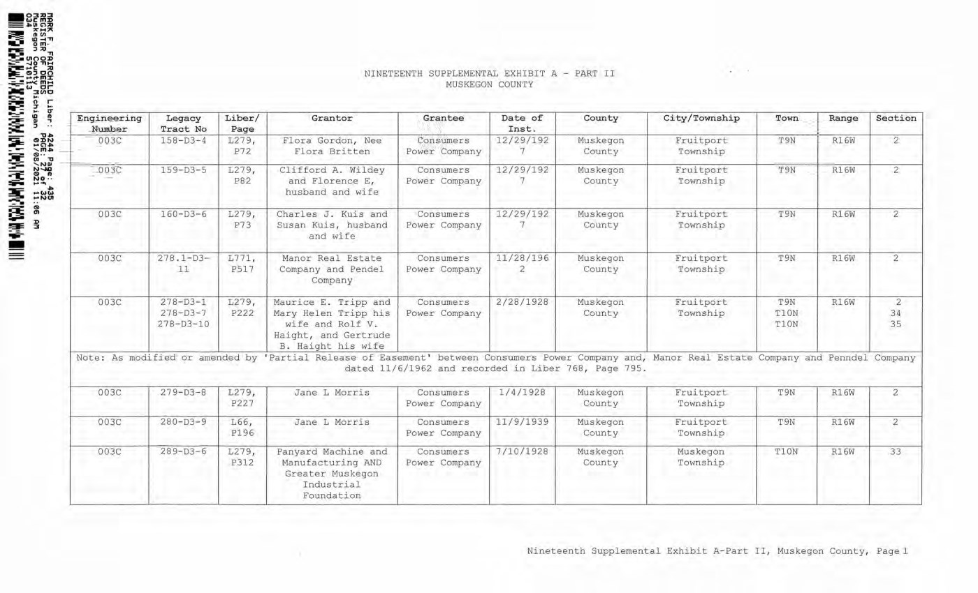
| RCHILD Liber: 4244 Page: 435 DEEDS PAGE: 27 of 32 unty Michigan 01/08/2021 11:06 AM NINETEENTH SUPPLEMENTAL EXHIBIT A - PART II MUSKEGON COUNTY Engineering Number Legacy Tract No Liber/ Page Grantor Grantee Date of Inst. County City/Township Town Range Section 003C 158-D3-4 L27 9, P72 Flora Gordon, Nee Flora Britten Consumers Power Company 12/29/192 7 Muskegon County Fruitport Township T9N R16W 2 003C 15 9-D3-5 L27 9, P82 Clifford A. Wildey and Florence E, husband and wife Consumers Power Company 12/29/192 7 Muskegon County Fruitport Township T9N R16W 2 003C 160-D3-6 L27 9, P73 Charles J. Kuis and Susan Kuis, husband and wife Consumers Power Company 12/29/192 7 Muskegon County Fruitport Township T9N R16W 2 003C 278.1-D3- 11 L771, P517 Manor Real Estate Company and Pendel Company Consumers Power Company 11/28/196 2 Muskegon County Fruitport Township T9N R16W 2 003C 27 8-D3-1 27 8-D3-7 27 8-D3-10 L27 9, P222 Maurice E. Tripp and Mary Helen Tripp his wife and Rolf V. Haight, and Gertrude B. Haight his wife Consumers Power Company 2/28/1928 Muskegon County Fruitport Township T9N T10N T10N R16W 2 34 35 Note: As modified or amended by ’Partial Release of Easement’ between Consumers Power Company and, Manor Real Estate Company and Penndel Company dated 11/6/1962 and recorded in Liber 768, Page 795. 003C 27 9-D3-8 L27 9, P227 Jane L Morris Consumers Power Company 1/4/1928 Muskegon County Fruitport Township T9N R16W 2 003C 280-D3-9 L66, P196 Jane L Morris Consumers Power Company 11/9/1939 Muskegon County Fruitport Township T9N R16W 2 003C 2 8 9-D3-6 L27 9, P312 Panyard Machine and Manufacturing AND Greater Muskegon Industrial Foundation Consumers Power Company 7/10/1928 Muskegon County Muskegon Township T10N R16W 33 Nineteenth Supplemental Exhibit A-Part II, Muskegon County, Page 1 E n ginee ri ng Le g acy Liber/ Nwnb er Tract N o Pa g e 003C 158 - 03 - 4 L279 , P72 003C 159-D3-5 L279 , P82 003C 160 - D3 - 6 L279 , P73 003C 278 .. 1 -03 - L771 , 11 P517 003C 278-03-1 L279 , 278 - 03 - 7 P222 278-D3-10 Note : As modified or amended by 003C 279-D3-8 L279 , P227 003C 280 - D3-9 L66, P196 003C 289 - D3-6 L279, P312 NINETEENTH SUPP L EMENTAL EXHIBIT A - PAR T II MUSKEGON COUNTY G ra n ter G ra nt ee D ate of County Ins t. F l ora Gordon , Nee Consumers 12/29/ 1 92 Muskegon Flora Britten Power Company 7 County Clifford A .. Wildey Consumers 12 /29/192 Muskegon and Florence E , Power Company 7 County husband and wife Charles J .. Kuis and Consumers 12/29/192 Muskegon Susan Kuis , husband Power Company 7 County and wife Manor Real Estate Consumers 11/28/ 1 96 Muskegon Company and Pende l Power Company 2 County Company Maurice E .. Tripp and Consumers 2/28/1928 Muskegon Mary Helen Tripp his Power Company County wife and Rolf V .. Haight , and Gertrude B .. Haight his wife ' Partial Release of Easement ' becween Consumers Power Company dated 11/6/1962 and recorded in Liber 768 , Page Jane L Morris Consumers 1/4/1928 Muskegon Power Company County Jane L Morr i s Consumers 11/9/1939 Muskegon Power Company County Panyard Machine and Consumers 7/10/1928 Muskegon Manufacturing AND Power Company County Greater Muskegon Industrial Foundation City/ T ownship Town Ra n ge Section Fruitport T9N Rl6W 2 Township Fruitport T9N Rl6W 2 Township Fruitport T9N R16W 2 Townsh i p Fru i tport T9N Rl6W 2 Township Fruitport T9N Rl6W 2 Township TlON 34 TlON 35 and, Manor Real Estate Company and Penndel Company 795 .. Fruitport T9N Rl6W 2 Township Fruitport T9N Rl6W 2 Township Muskegon TlON Rl6W 33 Township Nineteenth Supplemental Exhibit A - Part II , Muskegon County , Pagel |
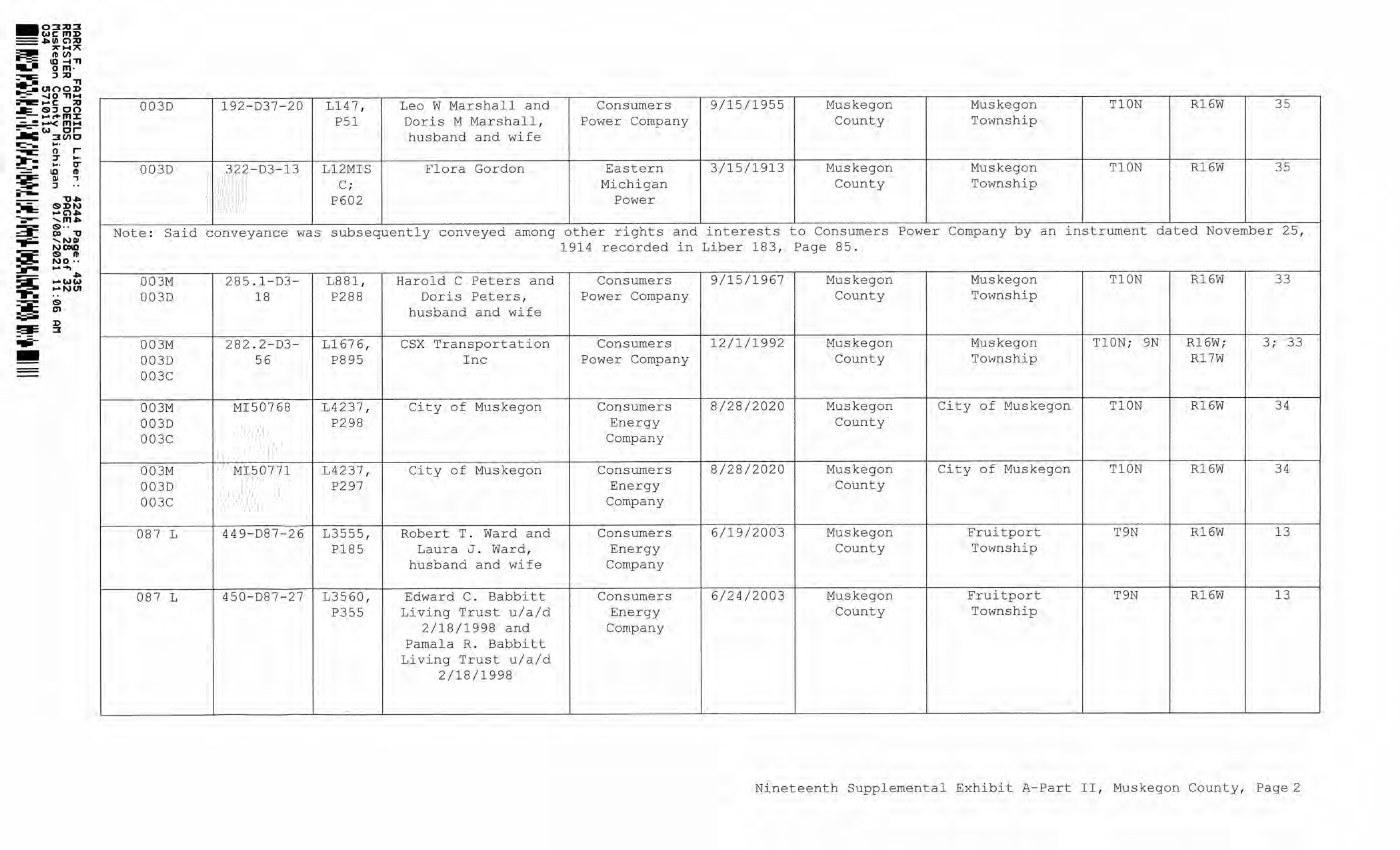
| 0 & 0 CP O -H O -H to p to p 0 0 0 0 P 0 P 0 0 £ 0 £ 0 0 0 0 S Eh S Eh 0 0 O >i O >1 to p to P 0 0 0 0 P 0 P 0 0 0 0 O 0 O 0 O s s > 1 0 0 rd in a 3 O c n Td C! T CD fd □ p "(0 “ T) m £ § U rn <0 & .2 4 ? I> rH Kt1 LO \—i Cu i—l /—0 I S g, n (D ^ (D ■ p "d 5 ^ o 0 fd ^ w S CD H CM S •- o CM O CD T—1 P-I P PI fd >i P >i a rd a g o o P CD £ O Pu CO P CU g 0 co a o o o p CO p CO CD P 0 P Pi -H p 0 0 w a> -y -S rrH L j H O M 0 H 0 p h 0 _ p p _]_) O 5 LO CO 0 to 0 P-J Td 0 > 1 0 > o o > 1 I—1 p a 0 p tr 0 0 p p 0 0 0 £ 0 o 0 0 > 1 0 > 0 O O Td •H 0 CD 0 CP O -H to p 0 0 P 0 0 £ 0 O S Eh 0 O >i to p 0 0 P 0 0 O 0 O >i 0 0 0 0 O 0 Td 0 0 0 0 P P 0 0 p p 0 0 P-I IP O 0 -H O Q P 0 OP 0 P *H £ Td 0 0 Td 0 0 P 0 0 P 00 00 CM P^ S P 0 0 0 0 o o o o pc; is r- x—i P 0 a, O -H to p 0 0 P 0 0 £ 0 O S Eh 0 O >i to P 0 0 P 0 0 O 0 U >i 0 0 0 p CP 0 U 0 0 P O 0 o £ o P-I CD UO r- CO CD 00 \—I P-i P S Q O 0 0 0 0 0 0 o o o o o o 0 o to 0 p 0 0 p o !>i p -H u 0 O > 1 to p 0 0 P 0 0 o 0 O s >1 0 0 0 o o 0 o to 0 p 0 0 s p o >1 p -H O l> 00 00 CO) CM CM "vf1 P-i P S Q U 0 0 0 0 0 0 o o o o o o 0 o to 0 p 0 0 p u 0 O >1 to P 0 0 P 0 0 o 0 O !>i 0 0 0 o o 0 0 to 0 p 0 0 s p o >1 p ■H o r~ r- 00 CO) CM CM P-i P S Q U 0 0 0 0 0 0 o o o o o o Q a p p 0 p CP ^ p 0 0 £ o E h 0 O >i to p 0 0 P 0 0 O 0 U 0 P 0 0 0 0 o w o CJ > 1 £ S’- 2 % o 0 p Td 0 0 Td -H Td p ^ P 0 0 ts Td IS 0 • 0 • 0 ) Td 0 0 P P 0 P 0 P 0 0 0 p p 0 P IT) LO LO 00 LO P 00 P-I P CP -H p 0 0 £ O E h 0 0 >i tO P 0 0 P 0 0 O 0 O 0 P *>.. K5*"1 g S g 0 Cj 0 CP 0 0 0 S g 0 S ° o w u o p 5 p \ *H ^ P -H ^ p ^ 0 p 5 p p 0 p p 00 0 m 0 ■_> ® ra ® « m 0 • 2 : 2 ^ O H 0 ^ 0 Td J-y CO 0 i-y ' - P ?CM 0 b \ 0 0 s ^ CM g '£ 3 -H 3 -H O LO CD LO LO 00' P-i 00 p HARK F. FAIRCHILD Liber: 4244 Page: 435 REGISTER OF DEEDS PAGE: 28 of 32 Muskegon County Michigan 01/08/2021 11:06 AM 034 5710113 Nineteenth Supplemental Exhibit A-Part II, Muskegon County, Page 2 - 0::u u ::1 WC III J> ==• 111 (;'):0 ,.. ..... ,.. ~ ..a~ "" 0 111 · =--= :, ;u "fl ~ UIO O J> - ...., 0 ""'"' --c ;u Je.. 151~00 - _,. 111 :t: - • .....-< f'1M ~ w or ..ac ::JCllO ---.. to- • ~ o r - :7 ... , ,,,_ • ~ - IT -== • IQ ID ~ ~ , -; -- ·-- -u ... -...: 151 :D N •--= .... (;').,. ~ , m .., ~ 151 ... ::::JI_ 0, -u ~ , N Iii NO>ID ~ 15) ~ ~ NO· · :...- ..... ...., ~ ..,. =I: .... ww ,..NUI • - ~ IS> ~ (JI ;;;;;. D !gt: :I ..ii - - 003D 192-D37 - 20 1147 , Leo W Marshall and Consumers 9/15/1955 M u skegon Muskegon TlON R16W 35 P51 Doris M Ma r shall , Power Company County Township husband and wife 0030 322-D3-13 Ll2MIS Flora Gordon Eastern 3/15/1913 Muskegon Muskegon TlON R16W 35 C ; Michigan County Tow n ship P602 Power Note : Said c o nveyance was subsequently conveyed among other rights and inte r ests to Consumers Power Company by an instrument dated November 25 , 1914 recorded in Liber 183 , Page 85. 003M 285 ..1 -D3- 1881 , Harold C Pete r s and Consumers 9/15/ 1 967 Muskegon Muskegon TlON R 1 6W 33 003D 18 P288 Doris Peters, Power Company County Township husband and wife 003M 282 .. 2 - D3- Ll67 6 , CS X Transportation Consumers 12/1/1992 Muskegon Muskegon TlON ; 9N R 1 6W ; 3 : 33 0030 56 P895 Inc Power Company County Township Rl7W 003C 003M MI50768 L4237 , Ci t y of Muskegon Co n sumers 8/28/2020 Muskegon City of Muskegon TlON Rl6W 34 003D P298 Energy Cou n ty 003C Company 003M MI50 7 71 L4237 , City of Muskegon Consumers 8/28/2020 Muskegon City of Muskegon T l ON Rl6W 34 003D P297 Energy County 003C Company 08 7 L 449-D87 - 26 L3555 , Robert T .. Ward and Consumers 6/19/2003 Mus k egon Fruitport T9N R l 6W 13 Pl85 Laura J .. Ward , Energy County Towns hi p husband and wife Company 087 L 450 - D87-27 13560 , Edward C .. Babbitt Consumers 6/2 4 /2003 Muskegon Fruitport T9N Rl6W 13 P3 _ 55 L i ving Tr u st u/a/d Energy County Townsh i p 2/18/1998 and Company Pamala R .. Babbitt L i vin g Tru s t u/a/d 2/18/1998 - N i neteenth Supplemental Exhibit A - Part II , Muskegon County , Page2 |
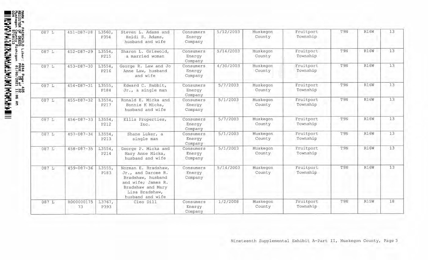
| cd \—1 p 02 E h 0 £ ° P P E h Q, P 0 o 2 3 ° fa H t l ft ° f a ? 8 3 S S o fa H fa -H X! 1 m fa u .s* ° fa fa g •H p 3 0 IP £ o Eh -P IP P 0 O CQ ' P H 0 0 | P 1 P ■H M f t ° fa ^ 0 £ 0 * ° P £ g -H 6 s | p ^ p p a O > 1 tn p CD C M 0 0 o 0 O a o >i tn P (D a p 0 CO O 0 o s a O >1 tn P cd a p 0 CO o 0 o s a O > 1 tn p cd a P 3 CO O 3 U S a O >i P P 0 0 p 0 CO o 3 U S a o >i P p 0 a p 0 w o 3 u a o >i p p 0 0 p 0 CO o 3 O a o >i p p 0 a p 0 0 o 3 u s a o >i p p 0 0 p 2 0 o 0 o s a o >i p p 0 0 P 0 0 o 0 O CO o o CM 0 0 0 & 0 0 a o o & S 0 p p w o 0 0 0 0 0 0 0 rTi 'H o w u o > 1 p 0 0 u 0 e 0 0 C h M ^ o w u o > 1 p 0 0 >, * P 0 Q g e « 8 0 0 0 0 3 0 o w o > 1 p c 0 G o u 0 >i! 0 2 & 1 M w g /-I U o w u p w p o 0 !>i ^ 0 ^ § w g 0 a j§ o o w u o >1 >1 p w p o 0 0 0 o w o p CJ> P 0 0 0 0 0 fd 0 X5 "0 < 0 0 > 0 P CO 0 ■ 44 P a 0 P a 0 p 0 0 P P 0 0 0 o £ o £ 0 •H 0 O P 0 • -H P 0 0 0 0 O 0 0 0 0 P CO p 0 0 P 0 0 P P & g M 0 ^ a p 0 0 - 0 P 0 •H 0 P P 0 0 i—I PQ P 0 • -H U 0 P 0 0 0 ^ £ • P 0 W p p 0 , 0 P ^ P U 0 -H •H S s fa PI 0 ■0 P 0 1 -1 0 0 O 0 PQ O P P P 0 0 P 0 0 P w - 0 0 0 0 0 P 0 0 P 0 0 0 0 P CO - 0 0 40 P 0 -0 ■0 £ P 0 0 s * a (D « ® M o 2 & M ' 0 ^ 4 m 5 S ■■ 0 ^ 0 0 ^ P 0 0 P f? 0 0 >i P 0 0 0 0 S P W n P 0 0 0 0 0 0 P 0 0 /b! 0 PQ 0 P p [g p 0 0 0 <s •> 0 0 0 PQ P 44 2 0 H p 0 0 S -2 CO fa u -0 0 o PQ P 0 P o ^ CD LO LO CO CO PLj p 00 CM I oo Q P 00 o ^ LO LO \—I LO CM CO PL| P CD LO t —I LO CM CO PQ P LO ^ LO 00 LO \—I CO cu p ^ r- LO \—I LO CM CO PQ P ^ CM LO *—I LO CM CO PQ P ^ CO lO x—I LO CM CO Plj P lO \—I LO CM CO PQ P LO CO LO 00 LO \—I CO PQ P r- co CD 02 r~ co co PQ P MARK F. FAIRCHILD Liber: 4244 Page: 435 REGISTER OF DEEDS PAGE: 29 of 32 Muskegon County Michigan 01/08/2021 11:06 AM Nineteenth Supplemental Exhibit A-Part II, Muskegon County, Page 3 - 03:Q:I wcmD =•111C'l:Q -- ,.. .... ,.. =- ft (n ~ ID-◄ TI -- o m , -ilE ::, ,o ~()1 00 ~ ..::,- ....JO~M -----c :Q ~$:JO O ..- ...,.c+mX - • ~fflM ...:::-- w or ,ac 3tn0 -~ llllf n · r --- ':J' ' "' ..,.-: ... , CJ' ~ ID ft ~ ~ .., ...- 11• §'e'"" SDN -=-= .... C'). 11,...- , m.,. ~ ~- - 11 - - - ~r;:: ~ IS) ft ;_ ~ NO • • _ .... ..., -- ..,. ~ ~~~ ...... ... ~ g •- D ~ ::J ~ - 087 L 087 L 087 L 087 L 087 L 087 L 087 L 087 L 087 L 087 L 451-087-28 L3560, P354 452-D87-29 L3554 , P215 453-D87-30 L355 4 , P216 454-D87 - 31 L3555 , P184 455 - D87-32 L3554 , P217 456-087-33 L3554, P212 457-D87-34 L3554 , P213 458 - D87 - 35 L3554, P214 459 - D87-36 L3555 , P183 R000000175 L3767 , 73 P393 Steven L .. Adams and He i di S .. Adams , husband and wife Sharon L .. Griswold, a married woman George R .. Law and Jo Anne Law .. , husband and wife Edward C. Babbit , Jr. , a single man Ronald E .. Micka and Bonnie K Micka , husband and wife Ellis Properties , Inc .. Shane Luker , a s i ngle man George P .. Micka and Mary Anne Micka , husband and wife Norman E .. Bradshaw, Jr • I and Darcee R .. Bradshaw , husband and wife ; James R .. Bradshaw and Mary Lisa Bradshaw , husband and wife Cleo Dill Consumers 5/12/2003 Muskegon Fruitport T9N R16W 13 Energy County Township Company Consumers 5/14/2003 Muskegon Fruitport T9N Rl6W 13 Energy County Township Company Consumers 4/30/2003 Muskegon Fru i tport T9N R16W 13 Energy County Township Company Consumers 5/7/2003 Muskegon Fruitport T9N Rl6W 13 Energy County Township Company Consumers 5/1/2003 Muskegon Fruitport T9N Rl6W 13 Energy County Township Company Consumers 5/7/2003 Muskegon Fruitport T9N R16W 13 Energy County Township Company Consumers 5/1/2003 Muskegon Fruitport T9N Rl6W 13 Energy County Township Company Consumers 5/1/2003 Muskegon Fruitport T9N Rl6W 13 Energy County Township Company Consumers 5/14/2003 Muskegon Fruitport T9N Rl6W 13 Energy County Township Company Consumers 1/2/ 2008 Muskegon Fruitport T9N RlSW 18 Energy County Township Company Nineteenth Supplemental Exhibit A - Part II , Muskegon County, Page 3 |
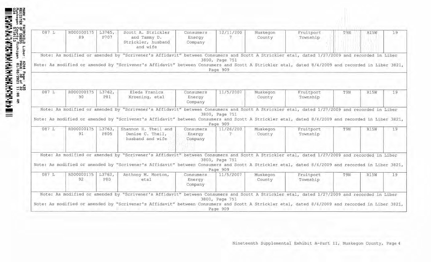
| 0 OP tn P 0 0 P 0 0 0 0 O S a -H P 0 0 £ o E h !>i a fd a. s o a 0 p 0 0 i — 1 0 P . p 0 Q 0 "0 0 0 0 >i P P P H ■0 CO § s . £ 0 0 E h 0 P < i — 1 0 P P 0 p 0 0 p 0 "0 o 0 o P CO CO lo r- cd o r- r- oo P P s ® 5 % 6 nj g P CO a o 0 o u ^ ^ 00 a (D CD £ -P 0 P oo 0 0 ,0 P 0 P 0 O O 0 0 P C 0 CO o o C\] P 0 P 0 P 0 P 0 u 0 I—1 M O -H 0 -P CO < -P P O o CO P 0 0 0 0 0 0 P 0 0 O O 0 0 0 <C p 0 P >i P P 0 P 0 0 0 0 0 o P 0 P -H > 0 P *H P P < 0 0 0 0 > -0 0 a co P P P 0 P 0 0 0 0 0 O P 0 -H P •H P O 0 0 < 0 P O Q a ■H P 0 0 £ 0 E h 0 O >t Cn p 0 0 M 0 0 O 0 U 0 0 •> g £ 5 U w 2 § H o >1 0 0 0 0 o tn 0 ■H 0 0 O 0 P LO r- \—i o o o o p o o o P £ 0 P P 0 P 0 0 0 0 0 O P 0 -H P -H P O 0 0 < CM 00 0 0 0 0 P 0 -H P 0 P 0 O a 0 0 p 0 0 CO) o o Cs] P 0 P 0 P 0 P 0 0 0 i—I P U *H 0 P 0 0 < P P o o o o \—1CO CM LO \ 0 p CD r- 0 P CM 0 0 O \ tn OO \—1 0 0 \—1 P 0 0 0 tn 0 0 o 0 Oa o 0 0 CO 0 oo O H 0 CJ tn 0 0 0 (—* 0 0 0 0 £ P 0 o W 0 P > 0 P -H P P < 0 0 0 0 > -H 0 U CO P P 0 P 0 0 0 O P 0 P o 0 0 < 0 P o p Qa •H P 0 0 £ O E h 0 O >i tn p 0 0 P 0 0 0 0 U S 0 P 0 0 u P 0 0 < 0 i—1 P i—I -H -H -H 0 £ 0 P P E h P E h 0 • 0 • O P P 0 0 0 0 0 O -H P 0 0 0 0 0 0 0 Q P P CO 00 LO CD O O 00 00 Ola P P 0 * o Qa ' P P 0 0 £ O E h 0 O >i tn p 0 0 P 0 0 0 0 O S 0 0 0 0 o • 0 S p 0 >1 0 O P P 0 < LO o o cm o p o o o P 0 0 p 0 ■H P 0 P 0 o o 0 0 P 0 0 P O .. o C\) o CM P 0 P 0 P 0 P 0 0 0 i—I P a -H 0 P 00 C o o CO p 0 0 P •H > 0 P •H P P < 0 0 0 0 > -H 0 a co >i P P 0 P 0 0 0 0 0 O P 0 -H P -H P O CM 00 0 0 0 0 P 0 •H P 0 P 0 O o 0 0 p 0 0 CO O O CM P 0 P 0 P 0 P 0 0 0 i I P o -0 0 P 0 0 < P P o o CO p 0 0 i 0 0 0 0 0 0 0 O U 0 0 0 £ P 0 P p o O'} 0 tn 0 Pn 0 c 0 p o P p -0 > 0 P -0 P P < 0 0 0 0 > -0 0 O CO P P 0 P 0 0 0 0 0 O P 0 ■0 P ■0 P o 0 0 < 0 P o p MARK F. FAIRCHILD Liber: 4244 Page: 435 REGISTER OF DEEDS PAGE: 30 of 32 Muskegon County Michigan 01/08/2021 11:06 API Nineteenth Supplemental Exhibit A-Part II, Muskegon County, Page - 03:.Q:::l c,.,cmD =• 111 C') ;Q - - ,.. .... :,,; ~ ~ ~ "Tl om - """'IIIE" :, ;Q ~ IJI OO~ _ -.,0 "TIM ~-c ;Q :--,- ($1:::J co ~ .... ... m::c - -- '" .... --=- c,., or ~ 3 (1) 0 - = --- ~ - r ~ -:r ... .. ... .. 0- -===- ID ftJ -= QI ..., ~ :, ... - "1:J.fo --=- SDN ~ .... C') .. - ' '""" ::-= cs ... =-::: 00 "1J =- ,w 11 - --- NSID ~ (SI ftJ NO • · ....... --- .... ---- .... c,.,w ~ ..,.NIJI ....... ... i;i; g --:-,., D !al= 3 -- - 087 L R000000175 13765 , Scott A .. Strickler Consumers 12/11/200 Muskegon Fruitport T9N RlSW 19 89 P707 and Tammy D .. Energy 7 County Township Strickler , husband Company and wife Note : As modified or amended by "Scrivener ' s Affidavit" between Consumers and Scott A Strickler etal , dated 1/27/2009 and recorded in Liber 3800, Page 751 Note : As modified or amended by "Scrivener ' s Affidavit " between Consumers and Scott A Strickler etal , dated 8/4/2009 and recorded in Liber 3821 , Page 909 087 L R000000175 13762 , Eleda Franics Consumers 11/5/2007 Muskegon Fruitport T9N RlSW 19 90 P81 Kroening , etal Energy County Township Company Note : As modified or amended by "Scrivener ' s Affidavit" between Consumers and Scott A Str i ckler etal , dated 1/27/2009 and recorded in Liber 3800 , Page 751 Note : As modified or amended by ' 'Scrivener ' s Affidavit" between Consumers and Scott A Strickler etal , dated 8/4/2009 and recorded in Liber 3821 , Page 909 087 L R000000175 L3763 , Shannon H. Theil and Consumers 11/26/200 Muskegon E'ruitport T9N RlSW 19 91 P805 Denise C .. Theil , Energy 7 County Township husband and wife Company Note : As modif i ed or amended by "Scrivener ' s Affidavit " between Consumers and Scott A Strickler etal , dated 1/27/2009 and recorded in Liber 3800 , Page 751 Note : As modified or amended by "Scrivener ' s A£fidavit " between Consumers and Scott A Strickler etal , dated 8/4/2009 and recorded in Liber 3821 , Page 909 087 L R000000175 L37 62 , Anthony M .. Morton , Consumers 11/5/2007 Muskegon Fruitport T9N Rl5W 19 92 P80 etal Energy County Township Company Note : As modif i ed or amended by "Scrivener ' s Affidavit " between Consumers and Scott A Strickler etal , dated 1/27/2009 and recorded in Liber 3800 , Page 751 Note : As modified or amended by "Scrivener ' s Affidavit " between Consumers and Scott A Strickler etal , dated 8/4/2009 and recorded in Liber 3821 , P age 909 Nineteenth Supplemental Exhib i t A-Part II, Muskegon County , Page4 |
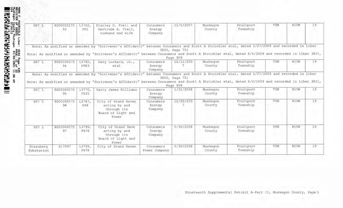
| 0 0 >i Co P 0 0 P 0 0 0 0 O S CL* -H P 0 a £ o E h >i a fd Qa 0 o o P 0 0 i—10 i—1p i—1 0 ■H i — I 0 £ 0 P 0 P P 0 < 0 Q 0 P P 0 0 0 0 0 p i—1P 0 0 0 0 0 0 P P o CO CM ^ CD p >1 p P (D P a CD 0 cd 0 o P 0 ■H p •H P O 0 0 P ■H P ■H P 0 p 0 O o 0 0 id fd 0 oo o o CM P 0 -P 0 p o 0 0 0 £ p 0 p p -H > 0 P -H P P 0 0 0 0 > -H 0 U 00 !>i P P 0 P 0 0 0 O P 0 P O 0 0 < O 2 ti % o d 0 £ 0 F h 1—1 0 p 0 0 0 0 i—1 O >i P Co p o 0 0 -H P 0 0 0 O P 0 O CO S < P P o o o o \—100 CM LO \ r- p 5 -1r- 0 OO \ -1 0 0 o \ Co oo CM 0 0 i—1 P 0 0 0 Co V.0 0 o 0 p o 0 0 0 m CO 00 0 O Co 0 0 0 0 0 o M u u p 0 i—I 0 0 M P 0 0 O P >i 0 0 O LO 00 CD 00 [-- OO 00 P P 0 0 P ■H P P 0 P 0 O O 0 0 P 0 0 oo o o CM P 0 P 0 P 0 p 0 0 0 i—I P o -H 0 P 0 0 C P P o a 00 s& g R Qi 0 W 0 o g CO ^ w oo 0 0 >1 p p 0 p 0 0 0 0 0 O P 0 -H P -H P O 0 0 0 0 O U 0 0 0 5 P 0 P P •H > 0 P ■H P P < 0 0 0 0 > ■H 0 a 0 0 >1 p p 0 p 0 0 0 0 0 O P 0 -H P •H P O 0 0 0 P O P 0 $ o H Qa ' p p 0 0 £ o E h 0 O >i Co P 0 0 P 0 0 O 0 U S 0 0 0 0 P >1 0 0 0 dd < O LO p P CM CD ["- LO P 00 P 00 P p LO 1-0 P r- \—1 \—1 o o O LO o O OO o o o o o o o Pd Pd Pu •H P 0 0 £ O E h 0 O >i Co p 0 0 P 0 0 O 0 O s o o CM o o- CM 0 0 1> I ° § M w S § « a >1 0 0 PU 0 O o 0 0 > 0 P dd 0 0 0 P P -H 0 >i 0 P P 0 CO 0 Co 0 0 0 P -H O P a >1 0 p -H O 0 P P LQ ;—1 OS a CT> E h M £ g d 5* 2 m % Q. Jj m 0 5 O Eh 0 0 >i Co P 0 0 P 0 0 O 0 O 0 O >i Co P 0 0 P 0 0 0 0 U 00 o o CM o 0 0 0 0 0 0 0 0 o w o >1 0 0 Pu 0 ^ G o o p 0 0 P P Co Co 0 O P 0 P P 0 P 0 to* 0 P o p 0 0 o PO 0 0 > 0 dd P 0 0 0 o p o > 1 p •H O CTl 00 g o r- cd 00 P P O0 00 coi r- ["- CD oo P P r- oo LO r- \—i Pd Co 0 0 P 0 0 0 P 00 HARK F. FAIRCHILD Liber: 4244 Page: 435 REGISTER OF DEEDS PAGE: 31 of 32 Muskegon County Michigan 01/08/2021 11:06 AM 034 5710113 Nineteenth Supplemental Exhibit A-Part II, Muskegon County, Page 5 - 0:::ll::U::l WC 111:D =•111 c:,;a -- ,.. .... ~ ~ ~~,, ~· 0 111 • ~ :, ;a ..-:;UI OO~ -=- -..10 ,,.., -- c ;a ~~~g2 - - ~ m ..... ---=-w or- ~ 3(1)0 -=-- :; · r- - :,- ... .. -;ft"- ... .. 0- =--- i0 ID 111:iiF' Ill -, ~ :, ...,... -o• ::a: ~~~ --- ' "'· ~ S· · ~ 0, "O --=:: ,w111 - N-10 ~ & ID ~ NO · • ...... _.., =i-.: -we ~ -NUI ..... ~ ~ ~ D !!'al= 3 ~- - 087 L R000000175 L3762 , Stanley D .. Prel l and Consumers 11/5/2007 Muskegon Fruitport T9N Rl5W 19 93 P82 Gertrude A. Prell , Energy County Township husband and wife Company Note : As modified or amended by " Scrivener ' s Affidavit " between Consumers and Scott A Strickler etal , dated 1/27/2009 and recorded in Liber 3800 , Page 751 Note : As modified or amended by "Sc rivener ' s Affidavit " between Consumers and Scott A Strickler etal , dated 8/4/2009 and recorded in Liber 3821 , Page 909 087 L R000000175 L3765 , Gary Lockard , Jr .., Consumers 12/11/200 Muskegon Fruitport T9N Rl5W 19 94 P983 etal Energy 7 County Township Company Note : As modified or amended by "Scr ivener ' s Affidav i t' ' between Consumers and Scott A Stric k ler etal , dated 1/27/2009 and recorded in Liber 3800 , Page 751 Note : As modified or amended by " Scrivener ' s Affidavit " between Consumers and Scott A Strickler etal , dated 8/4/2009 and recorded in Liber 3821 , Page 909 087 L R000000 175 13770 , Harry James Williams Consume r s 1/31/2008 Muskegon Fruitport T9N R15W 19 95 P525 Energy County Township Company 087 L R000000175 13767 , City of Grand Haven Consume rs 12/20/200 Muskegon Fru i tport T9N RlSW 19 96 P46 acting by and Energy 7 County Township t h rough its Company Board of Light and Power 087 L R000000175 L3799 , City of Grand Have ConsuJners 5/30/2008 Muskegon Fruitport T 9N R15W 19 97 P678 acting by and E n ergy County Township through its Company Board of Light and Power Sternberg R l 759 7 L3799, City of Grand Haven Consumers 5/30/2008 Musk egon Fruitport T9N R l 5W 19 Substation P678 Power Company County Township Nineteenth Supplemental Exhibit A-Part II , Muskegon County , PageS |
| 01003> iz= -4 0 “Hu — — C X) =fc OD OO ^F- mx - - i-^c mH cj o r *fcE= 3 000 O’ ft o T i— IQ QJ 3 -O-* 0 D W ©-- 00 "O WftJ K)KKQ © ft W O ■■ CE Ref. i-^OJOJ ►^MOI © <J» NINETEENTH SUPPLEMENTAL EXHIBIT A - PART III MUSKEGON COUNTY License/Lessor Licensee/Lessee Date of Instrument Title of Instrument NONE Town/Range Section Nineteenth Supplemental Exhibit A-Part III, Muskegon County, Page 1 CE Ref. License/Lessor N~NETEENTR SUPPLEM ENTAL EXHIBIT A - PART II: MUSKEGON COUNTY Licensee/Lessee Date of Instrument NONE Title of Instrument Town/Range Section N i neteenth Supplemental Exhibit A-Part III, Muskegon County, Page 1 |
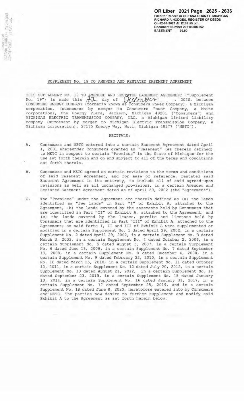
| E _,.._"' ~::a --=- -:, •' ! ,-, -~-~ 0,1 __ , ~ r:~ --, -,.z --:'1-1 l ,-::1.,..•-4 ~', ,_::, '-, ,:;;:1 -~ ,..i .- j•J -; :~~ r:' OR Uber 2021 Page 2625 - 2636 Filed for Record in OCEANA COUNTY, MICHIGAN RICHARD A HODGES, REGISTER OF DEEDS On 02-01-2021 At 12:08:-55 pm. Document Number 202100000662 EASEMENT 30.00 SUPPLEMENT NO. 19 TO AMENDED AND RESTATED EASEMENT AGREEMENT THIS SUPPLEMENT NO. 19 TO ~NDED AND RESPfTED EASE AGREEMENT ("Supplement No . 19") is made this ~ day of (j'jVJ,~ , 2020, between CONSUMERS ENERGY COMPANY { fomerly known as onsumers Power Company) , a Michig·an corporation, (successor by merger to Consumers Power Company, a Maine corporation), One Energy Plaza, Jackson, Michigan 49201 (''Consumers") and MICHIGAN ELECTRIC TRANSMISSION COMPANY, LLC, a Michigan limited liability company (successor by merger to Michigan Electric Transmission Company, a Michigan corporation) , 27175 Energy Way , Novi, Michigan 48377 ("METC"). RECITALS : A. Consumers and METC entered into a certain Easement Agreement dated April 1 , 2001 whereunder Consumers granted an "Easement" (as therein defined) to METC in respect to certain "Premises" in the State of Michigan for the use set forth therein and on and subject to all of the terms and conditions set forth therein. B. Consumers and METC agreed on certain revisions to the terms and conditions of said Easement Agreement, and for ease of reference, restated said Easement Agreement in its entirety, to include all of said agreed-upon revisions as well as all unchanged provisions, in a certain Amended and Restated Easement Agreement dated as of April 29, 2002 {the "Agreement") . C. The "Premises" under t he Agreement are therein defined as (a) the lands identified as "fee land s" in Part "I" of Exhibit A, attached to the Agreement, (b) the lands covered by the easements held by Consumers that are identified in Part "II" of Exhibit A, attached to the Agreement, and ( c) the lands covered by the leases, permits and licenses held by Consumers that are identified in Part "III" of Exhibit A, attached to the Agreement; as said Parts I , II and III of Exhibit A were supplemented or modified in a certain Supplement No. 1 dated April 29, 2002, in a certain Supplement No . 2 dated April 29, 2002, in a certain Supplement No . 3 dated March 3 , 2003, in a certain Supplement No. 4 dated October 2, 2006, in a certain Supplement No . 5 dated August 3 , 2007 , in a certain Supplement No. 6 dated June 18, 2008, in a certain Supplement No . 7 dated September 18, 2008 , in a certain Supplement No. B dated December 4, 2008 ; in a certain Supplement No. 9 dated February 22 , 2010, i n a certain Supplement No . 10 dated March 25, 2010, in a certain Supplement No. 11 dated October 12, 2011 , in a certain Supplement No . 12 dated July 20, 2012, in a certain Supplement No . 13 dated August 21, 2012, in a certain Supplement No. 14 dated September 23, 2013, in a certain Supplement No . 15 dated January 13, 2014 , in a certain Supplement No . 16 dated January 31, 2017, in a certain Supplement No . 17 dated September 25, 2019, and in a certain Supplement No . 1B dated June 8, 2020, heretofore entered into by Consumers and METC . The parties now desire to further supplement and modify said Exhibit A to the Agreement as set forth herein below. |

| 2 D. References, in regar,d to historical matters, to "METC" in the foregoing recitals will be deemed to mean METC ' s predecessor, M i chigan Electri c Transmission Company, a Mi.chigan corporation, where relevant. NOW, THEREFORE, for good and valuable consideration, the receipt of which is acknowledged, Consumers and METC agree as follows : l . Exhibit A to the Agreement, as heretofore supplemented and/or modified, is hereby further supplemented and modified as set forth in "Nineteenth Supplemental Exhibit A", attached hereto. It is expressl y understood that any lands, easements, or l eases/permi ts/licenses that are indicated in said attached Nineteenth Supplemental Exhi bit A as being added are, on and subject to the terms and conditions of the Agreement ( as supplemented and amended by this Supplement No . 19) , hereby deemed added to Part I, Part II and Part III, respectively, of Exhibit A to the Agreement . However, it is further expressly understood that in addition to all rights granted to METC by the Agreement, METC shall have the following rights as to the lands identified as "Consumers Energy Equipment/ Joint Asset Area Easement" on the accompanying NINETEENTH Supplemental Exhibit A sheets, inclusive of Parts I , II and III, which rights are also subject to the terms of the Parties' Amended and Restated Transmission Interconnection Agreement (the "DTIA") : (a) the right to maintain any and all existing components of the Transmission System, as defined in the DTIA, and wiring or conduit connections for the same that currently exist over, on or under these lands; and (b)the right to connect its currently sited or future approved wiring or conduits for communications, station power, or contr ol, operating at 600 volts or less, and any Jointly Owned Assets, as defined in the DTIA, over, on or under these lands. It is also expressly understood that, with respect to any lands, easements, or leases/permits/licenses now covered by Part I , Part II or Part III of Exhibit A that are i ndicated in said attached Nineteenth Supplemental Exhibit A as being deleted, the Easement is hereby deemed RELEASED with respect thereto and the Agreement shall hereafter no longer appiy thereto (provided, however, that all rights and obligations under the Agreement with respect to periods prior to the date of this Supplement No . 19 shall remain unaffected) . 2. It is expressly understood and agreed that in respect to t he additional Premises represented by the land(s), easement(s), lease(s), permit(s) and/or license (s) that are added to Part I, Part 11 and Part III of Exhibit A to the Agreement pursuant to this Supplement No. 19 (the "Additional Premises") : (a) All references to "Commencement Date" that are found in Article 1 ("Grant of Easement"), Article 2 ("Term") , Article 5 ("Additions/Alterations") , Article 6 ("Consumers' Reserved Rights to Dse the Premises and Transmission Facilities") , Article 7 ("METC Approval of Compatible Uses"), Article 8 (''Certain Obligations of Consumers and Authorized Users; Etc. ") and Article 14 ("Environmental Matters") of the Agreement shall be deemed to mean the date of this Supplement No. 19 and not the date that is i dentified in the Agreement as the "Commencement Date". |
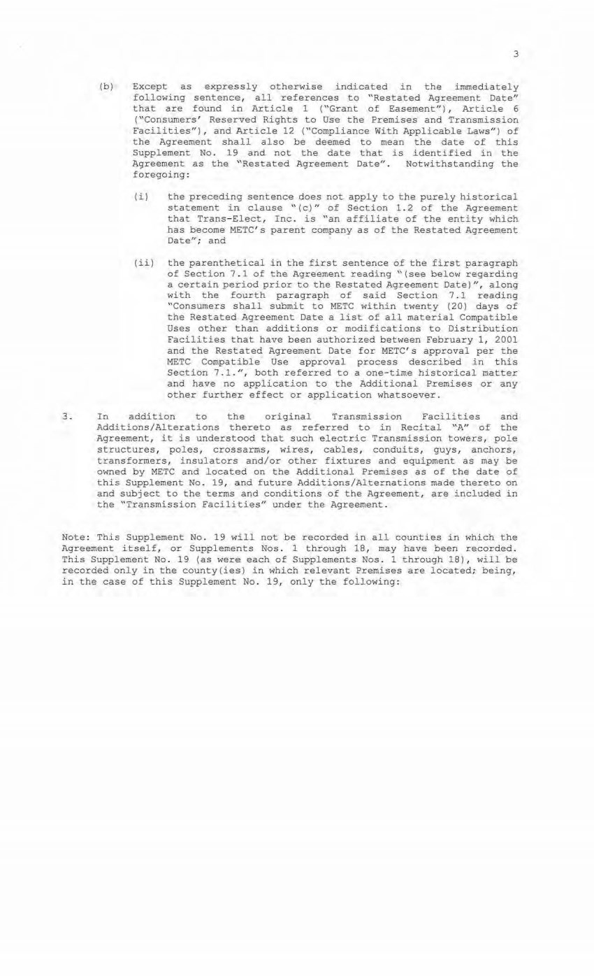
| 3 (b) Except as expressly otherwise indicated in the immediately following sentence, all references to "Restated Agreement Date'' that are found in Article 1 ("Grant of Easement"), Article 6 ( "Consumers' Reserved Rights to Use the Premises and 'Transmission Facilities") , and Article 12 ("Compliance With Applicable Laws") of the Agreement shall also be deemed to mean the date of this Supplement No. 19 and not the date that is identified in the Agreement as the "Restated Agreement Date". Notwithstanding the foregoing: ( i) the preceding sentence does not apply to the purely historical statement in clause " ( c)" of Section 1. 2 of the Agreement that Trans-Elect, Inc. is "an affiliate of the entity which has become METC ' s parent company as of the Restated Agreement Date'~; and (ii) the parenthetical in the first sentence of the first paragraph of Section 7 . 1 of the Agreement reading ''(see below regarding a certain period prior to the Restated Agreement Date)", along with the fourth paragraph of said Section 7.1 reading ''Consumers shall submit to METC within twenty (20) days of the Restated Agreement Date a list of all material Compatible Uses other than additions or modifications to Distribution Facilities that have been authorized between February 1, 2001 and the Restated Agreement Date for METC's approval per the METC Compatibl e Use approval process described in this Section 7.1.", both referred to a one-time historical matter and have no application to the Additional Premises or any other further effect or application whatsoever. 3. In addition to the original Transmission Facilities and Additions/Alterations thereto as referred to in Recital "A" of the Agreement, it is understood that such electric Transmission towers, pole structures, poles, crossarms, wires, cables, conduits, guys, anchors, transformers, insul ators and/or other fixtures and equipment as may be owned by METC and located on the Additional Premises as of the date of this Supplement No . 19, and future Additions/Alternations made the:?:"eto on and subject to the terms and conditions of the Agreement, are included in the ''Transmission Facilities" under the Agreement. Note: This Supplement No. 19 will not be recorded in all counties in which the Agreement itself, or Suppl ements Nos . 1 through 18, may have been recorded. This Supplement No. 19 {as were each of Supplements Nos . 1 through 18), will be recorded only in the county(ies) in which relevant Premises are located; being, in the case of this Supplement No. 19, only the following : |

| Allegan County Antrim County Barry County Bay County Calhoun County Charlevoix County Clinton County Crawford County Emmet County Genesee County Gladwin County Grand Traverse County Gratiot County Ingham County Ionia County Isabella County Jackson County Kalkaska County Kent County Leelanau County Lenawee County Manistee County Midland County Montcalm County Muskegon County Oceana County Ogemaw County Ottawa County Roscommon County Saginaw County Shiawassee County St. Joseph County Washtenaw County Wexford County 4 The fact that this Supplement No. 19 will be recorded only in the particular county{ies) identifie- d above wi.11 in no way restrict, limit or otherwise affect the interpretation, application or enforcement of the Agreement; and the terms and conditions of the Agreement shall at all times be read, interpreted and applied in the manner provided £or in Section 24.6 of the Agreement. |
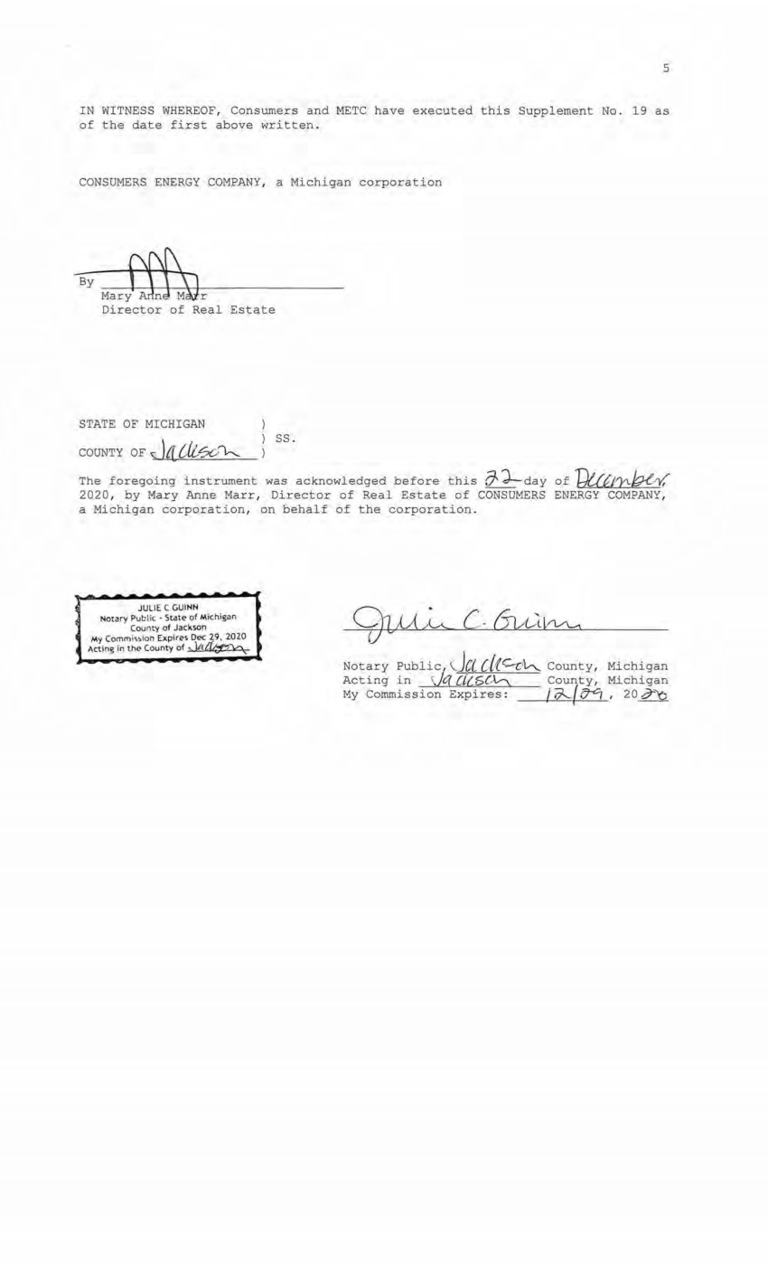
| 5 IN WITNESS WHEREOF, Consumers and METC have executed this Supplement No. 19 as of the date first above written . CONSUMERS ENERGY COMPANY , a Michigan corporation By Director of Real Estate STATE OF MICHIGAN COUNTY OF '\; )t[ Cil?C,,;\,...__ ss. The foregoing instrument was acknowledged before this (7'd--day of T;)t,aJ'.1\b{ ,,✓ ," 2020, by Mary Anne Marr, Director of Real Estate of CONSUMERS ENERGY COMPANY , a Michigan corporation, on behalf of the corporation. JULIE C GUINN Notary Put:li c • St-,te of Michisan County of Jackson My Commi,~lon Exp\re~ Dec 29, 2020 Acting in th<' County of .., )/ltf ¢f1\c\ Notary Public, , JCC [ {(.C-r: J l,-...,_ County, Michigan Acting i n )q r;i(,5C½ County, Michigan My Commission Expires : i d---..{ttCi , 20 i7''Y::, |
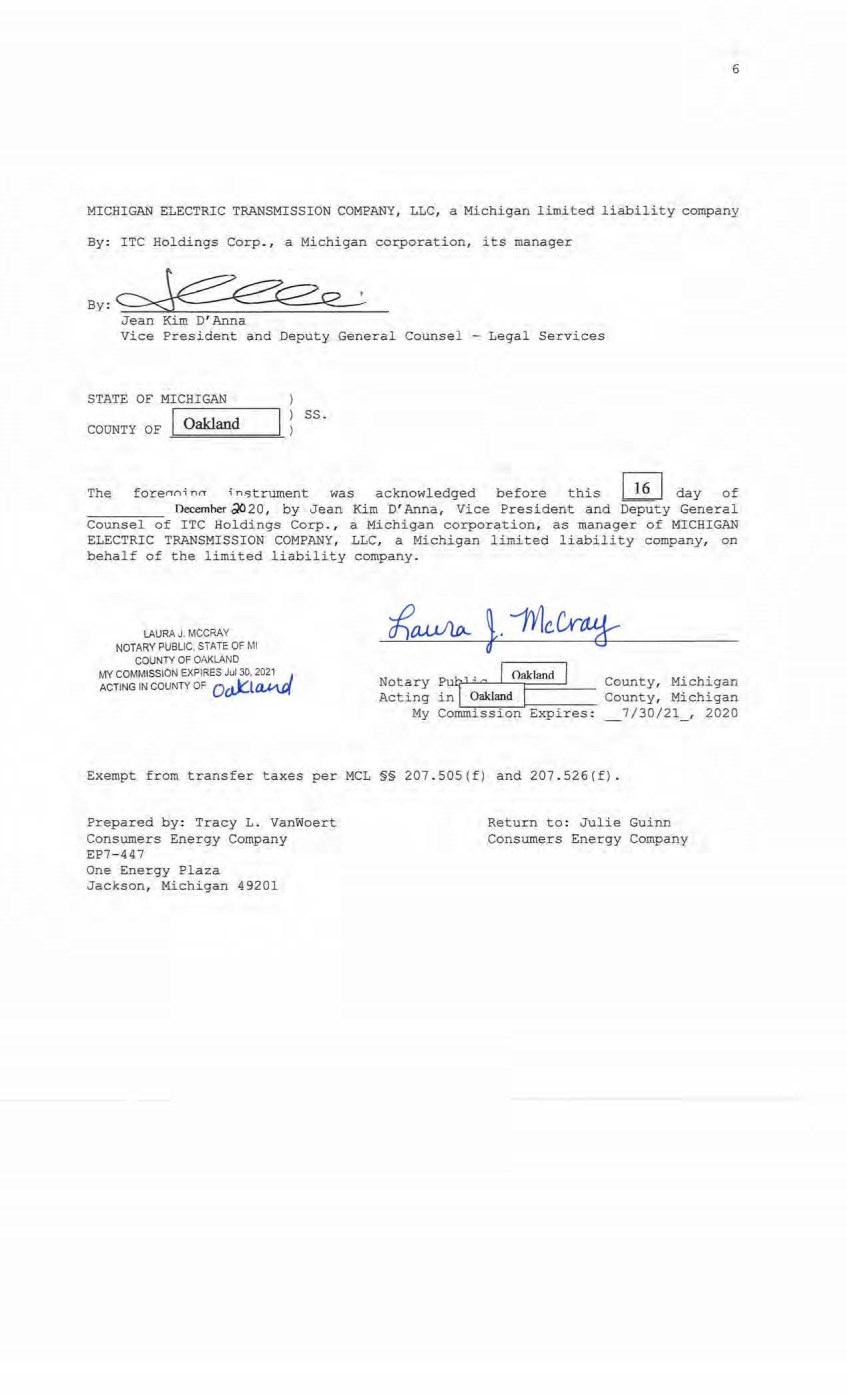
| 6 MICHIGAN ELECTRIC TRANSMISSION COMPANY, LLC, a Michigan limited liability company By: ITC Holdings Corp., a Michigan corporation, its manager By ,~.Q_'.. Jean Kim D' Anna Vice President and Deputy General Counsel - Legal Services STATE OF MICHIGAN COUNTY OF 1...--- 0-akl -,- an - d--~ ss. The forenni nn i n. 5trument was acknowledged before this ~ day of necemher .;!020, by Jean Kim D' Anna, Vice President and Deputy General Counsel of ITC Holdings Corp., a Michigan corporation, as manager of MICHIGAN ELECTRIC TRANSMISSION COMPANY, LLC, a Michigan limited liability company, on behalf of the limited liabil ity company. LAURA J. MCCRAY NOTARY PUBUC, STATE OF Ml COUNTY OF OAKLAND MY COMMISSION EXPIRES Jul 30, 2~2_ 1 .J ACTING IN couNTY oF oo.k:L~ Notary Pu!/ H c J o.kl=d I Conn t y, Michigan Acting inl~ __ O_akl_-_an_ct_J-1-=---:--- County, Michigan My Commission Expires: _7/30/21 , 2020 Exempt from transfer taxes per MCL §§ 207. 505(f) and 207 . 526(£) . Prepared by: Tracy L . Vanwoert Consumers Energy Company EP7-447 One Energy Plaza Jackson, Michigan 49201 Return to: Julie Guinn Consumers Energy Company |

| 7 THE ATTACHED COPY OF THE NINETEENTH SUPPLEMENTAL EXHIBIT A THAT WAS PREPARED FOR RECORDATION I N OCEANA COUNTY , MICHIGAN , AND CONTAINS TAE PORTIONS OF EACH OF PARTS I, II, AND III OF THE NINETEENTH SUPPLEMENT EXHIBIT A THAT RELATE TO PREMISES IN THAT COUNTY ONLY. SEE SECTION 24.6 OF THE AGREEMENT . |
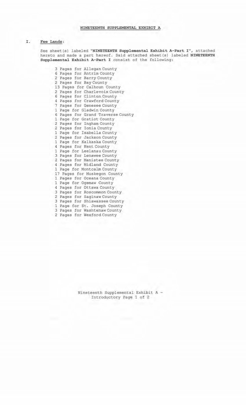
| NINETEENTH SUPPLEMENTAL EXHIBIT A I. Fee Lands: See sheet (s) labeled " NINETEENTH Supplemental Exhibit A-Part I '', attached hereto and made a part hereof. Said attached sheet(s) labeled NINETEENTH Supplemental Exhibit A- Pa rt I consist of the following : 3 Pages £or Allegan County 6 Pages for Antrim County 2 Pages for Barry County 2 Pages for Bay County 13 Pages for Calhoun County 2 Pages for Charlevoix County 6 Pages for Clinton County 4 Pages for Crawford County 7 Pages for Genesee County 1 Page for Gladwi.n County 6 Pages for Grand Traverse County 1 Page for Gratiot County 2 Pages for Ingham County 2 Pages for Ionia County 1 Page for Isabella County 2 Pages for Jackson County 1 Page for Kalkaska County 4 Pages for Kent Count_y 1 Page for Leelanau County 3 Pages for Lenawee County 2 Pages for Manistee County 4 Pages for Midland County 1 Page for Montcalm County 17 Pages for Muskegon County 1 Pages for Oceana County 1 Page for Ogemaw County 4 Pages for Ottawa County 3 Pages for Roscommon County 2 Pages for Saginaw County 3 Pages for ShiawasseeCounty 1 Page for St. Joseph County 3 Pages for Washtenaw County 2 Pages for Wexford County Nineteenth Supplemental Exhibit A - Introductory Page 1 of 2 |
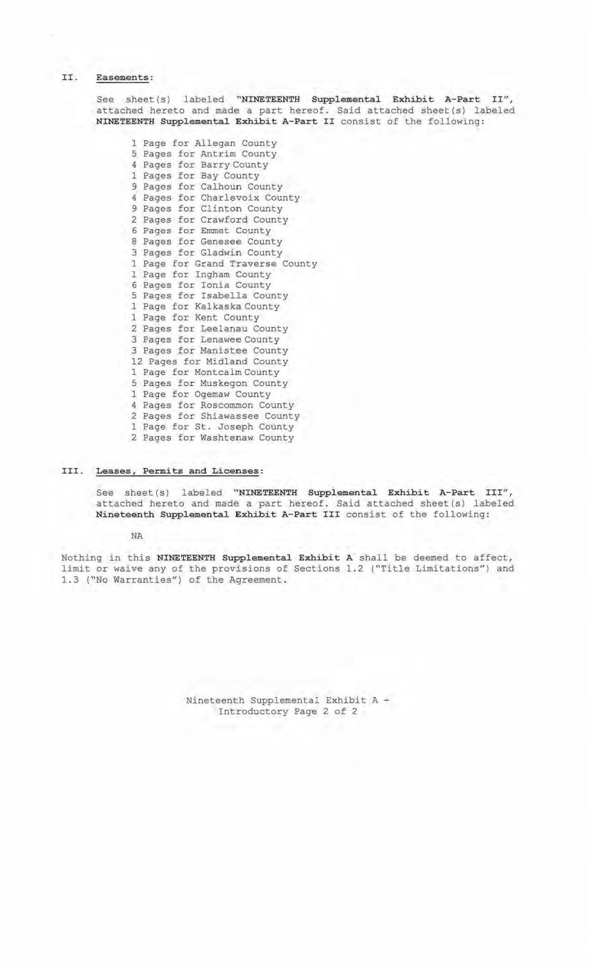
| II. Easements: See sheet(s) labeled " NINETEENTH Supplemental Exhibit A-Part II", attached hereto and made a part hereof. Said attached sheet(s) labeled NINETEENTH Supplemental Exhibit A-Part II consist of the following: 1 Page for All egan County 5 Pages for Antrim County 4 Pages for Barry County 1 Pages for Bay County 9 Pages for Calhoun County 4 Pages for Charlevoix County 9 Pages for Clinton County 2 Pages for Crawford County 6 Pages for Emmet County 8 Pages for Genesee County 3 Pages for Gladwin County 1 Page for Grand Traverse County 1 Page for Ingham County 6 Pages for Ionia County 5 Pages for Isabella County 1 Page for Kalkaska County 1 Page for Kent County 2 Pages for Leelanau County 3 Pages for Lenawee County 3 Pages for Manistee County 12 Pages for Midland County 1 Page for Montcalm County 5 Pages for Muskegon County 1 Page for Ogemaw County 4 Pages for Roscommon County 2 Pages for Shiawassee County 1 Page for St. Joseph County 2 Pages for Washtenaw County III. Leases, Pe=its and Licenses: See sheet (s) labeled "NINETEENTH Supplemental Exhibit A-Part III", attached hereto and made a part hereof. Said attached sheet(s) labeled Nineteenth Supplemental Exhibit A-Part III consist of the following: NA Nothing in this NINETEENTH Supplemental Exhibit A shall be deemed to affect, limit or waive any of the provisions of Sections 1.2 ("Title Limitations") and 1.3 ("No Warranties") of the Agreement . Nineteenth Supplemental Exhibit A - Introductory Page 2 of 2 |
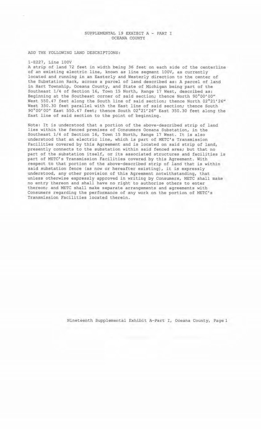
| SUPPLEMENTAL 19 EXHIBIT A - PART I OCEANA COUNTY ADD THE FOLLOWING LAND DESCRIPTIONS; 1 - E227, Line lOOV A strip of land 72 feet in width being 36 feet on each side of the centerline of an existing electric line, known as line segment 100V, as currently located and running in an Easterly and Westerly direction to the center of the Substation Rack, across a parcel of land described as: A parcel of land in Hart Township, Oceana County, and State of Michigan being part of the Southeast 1/4 of Section 16, Town 15 North, Range 17 West, described as: Beginning at t he Southeast co~ner of said section; thence North 90-000'00" West 550.47 feet along the South line of said section; thence North 02°21'26" West 350 . 30 feet parallel with the East line of said section; t hence South 90°00'00" East 550 . 47 feet; thence South 02°21' 26" East 350.30 feet along the East l ine of said section to the point of beginning. Note : It is understood that a portion of the above- described strip of land lies within the fenced premises of Consumers Oceana Substation, in the Southeast 1/4 of Section 16, Town 15 North, Range 17 West. It is also understood that an electric line, which is part of METC ' s Transmission Facilities covered by this Agreement and is located on said strip of land1 presently connects to the substation within said fenced area; but that no part of the substation itself, or its associated structures and facilities is part of METC's Transmission Facilities covered by this Agreement. With respect to that portion of the above-described strip of land that is within said substation fence (as now or hereafter existing), it is expressly understood, any other provision of this Agreement notwithstanding, that unless otherwise expressly apµroved in writing by Consumers, METC shall make no entry thereon and shall have no right to authorize others to enter thereon; and METC shall make separate arrangements and agreements with Consumers regarding the performance of any work on the portion of METC's Transmission Facilities located therein. Nineteenth Supplemental Exhibit A-Part I , Oceana County, Pagel |
| File Ref. Granter Grantee NINETEENTH SUPPLEMENTAL EXHIBI T A - · PART II OCEANA COUNTY Date of Inst. Liber/Page Doc Series NONE Town/Range/Section Plat Nineteenth Supplemental Exhi bit A-eart II, Oceana County, Pagel |
| CE Ref. License/Lessor NTNEtEENTH SUPPLEMENTAL EXHIBIT A - PART III OCEANA COUNTY Licensee/Lessee Date of ..Instrument NONE Ti tle of Instrument Town/Range Section Nineteenth Supplemental Exhibit A-Part II I , Oceana County, Page 1 |
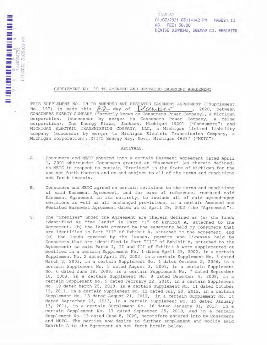
| III III lllllllllllllllllllllllII ° 0 0 9 6 6 1 PAGES: 12 K» i n r-~ •■D o o r t cl .. O o j n K» C--I o C ' - l r - ~ 3163162 01/07/2021 03:14:42 PM AG FEE: 30.00 DENISE SIMMONS, OGEMAW CO. REGISTER SUPPLEMENT NO. T9 TO AMENDED AND RESTATED EASEMENT AGREEMENT THIS SUPPLEMENT NO. 19 TO AMENDED AND RESTATED EASEMENT AGREEMENT ("Supplement No. 19") is made this day of QlU , 2020, between CONSUMERS ENERGY COMPANY (formerly known as Consumers Power Company), a Michigan corporation, (successor by merger to Consumers Power Company, a Maine corporation), One Energy Plaza, Jackson, Michigan 49201 ("Consumers") and MICHIGAN ELECTRIC TRANSMISSION COMPANY, LLC, a Michigan limited liability company (successor by merger to Michigan Electric Transmission Company, a Michigan corporation), 27175 Energy Way, Novi, Michigan 48377 ("METC"). RECITALS: A. Consumers and METC entered into a certain Easement Agreement dated April 1, 2001 whereunder Consumers granted an "Easement" (as therein defined) to METC in respect to certain "Premises" in the State of Michigan for the use set forth therein and on and subject to all of the terms and conditions set forth therein. B. Consumers and METC agreed on certain revisions to the terms and conditions of said Easement Agreement, and for ease of reference, restated said Easement Agreement in its entirety, to include all of said agreed-upon revisions as well as all unchanged provisions, in a certain Amended and Restated Easement Agreement dated as of April 29, 2002 (the "Agreement"). C. The "Premises" under the Agreement are therein defined as (a) the lands identified as "fee lands" in Part "I" of Exhibit A, attached to the Agreement, (b) the lands covered by the easements held by Consumers that are identified in Part "II" of Exhibit A, attached to the Agreement, and (c) the lands covered by the leases, permits and licenses held by Consumers that are identified in Part "III" of Exhibit A, attached to the Agreement; as said Parts I, II and III of Exhibit A were supplemented or modified in a certain Supplement No. 1 dated April 29, 2002, in a certain Supplement No. 2 dated April 29, 2002, in a certain Supplement No. 3 dated March 3, 2003, in a certain Supplement No. 4 dated October 2, 2006, in a certain Supplement No. 5 dated August 3, 2007, in a certain Supplement No. 6 dated June 18, 2008, in a certain Supplement No. 7 dated September 18, 2008, in a certain Supplement No. 8 dated December 4, 2008, in a certain Supplement No. 9 dated February 22, 2010, in a certain Supplement No. 10 dated March 25, 2010, in a certain Supplement No. 11 dated October 12, 2011, in a certain Supplement No. 12 dated July 20, 2012, in a certain Supplement No. 13 dated August 21, 2012, in a certain Supplement No. 14 dated September 23, 2013, in a certain Supplement No. 15 dated January 13, 2014, in a certain Supplement No. 16 dated January 31, 2017, in a certain Supplement No. 17 dated September 25, 2019, and in a certain Supplement No. 18 dated June 8, 2020, heretofore entered into by Consumers and METC. The parties now desire to further supplement and modify said Exhibit A to the Agreement as set forth herein below. - - - !! ·" - - - "-· - - _ _, - - a: 01/07/2021 0;;:14:42 PM PAGES: 11 AG FEE: 30 .. 00 DENISE SIMMOMS, OGEMAW C O. REGISTER SUPPLEMENT NO .. ~. c:' TO 1-,MENDED AND RESTATED EASEMENT AGREEMEN T THIS SUPPLEMENT NO .. 19 TO AMENDE D AND RESrATED EASEMENT AGRE E MENT ( ' 'Supplement No .. 19 " ) is made this !)...?- day 0£ Qeu1V\.JQ.-e.v , 2020 , between CONSUMERS EN E RGY COMPANY (formerly known as Cons um ers Power Company), a Mich i gan corporation , ( successor by merger to Consumers Power Company , a Maine corporation) , One Energy Plaza , Jackson , Michigan 4 9201 ("Consumers " ) and MICHIGAN ELECTRIC TRANSMISSION COMPANY , LLC , a Michigan limited liabi l ity company ( successor by merger to Michigan Elec t ric Transmission Company , a Michigan corporation) , 27175 Energy Way , Nov i, Michigan 48377 ( " METC " ) .. RECITALS : A .. Consumers and METC entered into a certain Easement Agreement dated April 1 , 2001 whereunder Consumers granted an " Easement " (as therein de fi ned) to ME T C in respect to certain "Premises " in the State of Michigan for the use set forth therein and on and subject to all of the t erms an d conditions set forth there in. B .. Consumers and METC agreed on certain revisions to the ter ms and cond i t i ons of said Easement Agreement , and for ease of reference , restated said Easement Agreement in its entirety , to include all of said agreed-upo n revisions as well as all unchanged provisions , i n a certai n Amended and Restated Easement Agreement dated as of April 29 , 2002 (the " Agreement " ) .. C .. The "Premises " under the Agreement are therein defined as (a) the lands ident i fied as " fee l ands " in Part "I " of Exhibit A , attached to the Agreement , (b) the lands covered by the easeme n ts held by Consumers that are identi f ied in Part "II" of Exhibit A , a t tached to the Agreement, and ( c) the lands covered by the leases , permits and licenses held by Consumers that are identified in Part " III " of Exhib i t A , attached to the Agreement ; as said Par t s I , II and I II of Exhibit A were supplemented or modified in a certai n Supplement No .. 1 dated April 29 , 2002, in a certain Supplement No .. 2 dated Apr i l 29 , 2002 , in a certain Supplement No .. 3 dated March 3 , 2003 , in a certain Supplement No .. 4 dated October 2 , 2006 , in a certain Supplement No .. 5 dated August 3 , 2007 , in a certain Supplement No .. 6 dated June 18 , 2008 , in a certain Supplement No .. 7 dated September 18 , 2008 , in a certain Supplement No .. 8 dated December 4 , 2008 , in a certain Supplement No .. 9 dated february 22 , 20 1 0 , in a certa i n Supple m ent No .. 10 dated March 25 , 2010 , in a certain Supplement No .. 11 dated October 12 , 2011 , in a certain Supplement No .. 12 dated July 20 , 2012 , in a certain Supplement No .. 1 3 dated August 2 1, 2012 , in a certain Suppleme n t No .. 14 dated September 23 , 2013 , in a certa i n Supplement No .. 15 dated January 13 , 2014 , in a certain Supplement No .. 16 dated January 31 , 2017 , in a certain Supplement No .. 1 7 dated September 25 , 2019 , and in a certain Supplement No .. 18 dated June 8 , 2020 , he r e t ofore entered into by Consumers and METC .. The parties now desire to further supplement and modify said Exh i bit A to the Agreement as set forth herein below .. |
| D. References, in regard to historical matters, to "METC" in the foregoing recitals will be deemed to mean METC's predecessor, Michigan Electric Transmission Company, a Michigan corporation, where relevant. NOW, THEREFORE, for good and valuable consideration, the receipt of which is acknowledged, Consumers and METC agree as follows: 1. Exhibit A to the Agreement, as heretofore supplemented and/or modified, is hereby further supplemented and modified as set forth in "Nineteenth Supplemental Exhibit A", attached hereto. It is expressly understood that any lands, easements, or leases/permits/licenses that are indicated in said attached Nineteenth Supplemental Exhibit A as being added are, on and subject to the terms and conditions of the Agreement (as supplemented and amended by this Supplement No. 19), hereby deemed added to Part I, Part II and Part III, respectively, of Exhibit A to the Agreement. However, it is further expressly understood that in addition to all rights granted to METC by the Agreement, METC shall have the following rights as to the lands identified as "Consumers Energy Equipment / Joint Asset Area Easement" on the accompanying NINETEENTH Supplemental Exhibit A sheets, inclusive of Parts I, II and III, which rights are also subject to the terms of the Parties' Amended and Restated Transmission Interconnection Agreement (the "DTIA"): (a) the right to maintain any and all existing components of the Transmission System, as defined in the DTIA, and wiring or conduit connections for the same that currently exist over, on or under these lands; and (b)the right to connect its currently sited or future approved wiring or conduits for communications, station power, or control, operating at 600 volts or less, and any Jointly Owned Assets, as defined in the DTIA, over, on or under these lands. It is also expressly understood that, with respect to any lands, easements, or leases/permits/licenses now covered by Part I, Part II or Part III of Exhibit A that are indicated in said attached Nineteenth Supplemental Exhibit A as being deleted, the Easement is hereby deemed RELEASED with respect thereto and the Agreement shall hereafter no longer apply thereto (provided, however, that all rights and obligations under the Agreement with respect to periods prior to the date of this Supplement No. 19 shall remain unaffected). 2. It is expressly understood and agreed that in respect to the additional Premises represented by the land(s), easement(s), lease(s), permit(s) and/or license (s) that are added to Part I, Part II and Part III of Exhibit A to the Agreement pursuant to this Supplement No. 19 (the "Additional Premises"): (a) All references to "Commencement Date" that are found in Article 1 ("Grant of Easement"), Article 2 ("Term"), Article 5 ("Additions/Alterations"), Article 6 ("Consumers' Reserved Rights to Use the Premises and Transmission Facilities"), Article 7 ("METC Approval of Compatible Uses"), Article 8 ("Certain Obligations of Consumers and Authorized Users; Etc.") and Article 14 ("Environmental Matters") of the Agreement shall be deemed to mean the date of this Supplement No. 19 and not the date that is identified in the Agreement as the "Commencement Date". 2 D- References, in regard to historical matters, to "METC" in the foregoing recitals wi ll be deemed to mean METC ' s predecessor, Michigan Electric Transmission Company, a Michigan corporation, where relevant . NOW, THEREFORE , for good and valuable consideration, the receipt of which is acknowledged, Consumers and METC agree as follows : 1 . Exhibit A to the Agreement, as heretofore supplemented and/or modified, is hereby further supplemented and modified as set forth in "Nineteenth Supplemental Exhibit A" , attached hereto. 2 . It is expressly understood that any lands, easements, or leases/permits/licenses that are indicated in said attached Nineteenth Supplemental Exhibit A as being added are, on and subject to the terms and conditions of the Agreement (as supplemented and amended by this Supplement No . 19) , hereby deemed added to Part I , Part I I and Part III, respectively, of Exhibit A to the Agreement . However, it is further expressly understood that in addition to all rights granted to METC by the Agreement, METC shall have the following rights as to the lands identified as "Consumers Energy Equipment/ Joint Asset Area Easement" on the accompanying NINETEENTH Supplemental Exhibit A sheets, inclusive of Parts I , I I and III, which rights are also subject to the terms of the Parties' Amended and Restated Transmission Interconnection Agreement (the "DTIA" } : (a) the right to maintain any and all existing components of the Transmission System, as defined in the DTIA, and wiring or conduit connections for the same that currently exist over, on or under these lands; and (b)the right to connect its currently sited or future approved wiring or conduits for communications, station power, or control, operating at 600 volts or less, and any Jointly Owned Assets, as defined in the OTIA, over, on or under these lands. It is also expressly understood that , with respect to any lands, easements, or leases/permits/l icenses now covered by Part I, Part II or Part III of Exhibit A that are indicated in said attached Nineteenth Supplemental Exhibit A as being deleted, the Easement is hereby deemed RELEASED with respect thereto and the Agreement shall hereafter no longer apply thereto (provided, however, that all rights and obligations under the Agreement with respect to periods prior to the date of this Supplement No . 19 shall remain unaffected) . It is expressly understood and agreed Premises represented by the land ( s) , and/or license(s) that are added to Exhibit A to the Agreement pursuant "Additional Premises" ): that in respect to the additional easement(s) , lease(s} , permit(s) Part I , Part II and Part III of to this Supplement No . 19 ( the (a) All references to "Commencement Date" that are found in Article 1 ("Grant of E:asement") , Article 2 ("Term") , Article 5 ("Additions/Alterations"), Article 6 ("Consumers' Reserved Rights to Use the Premises and Transmission Facilities" }, Article 7 ("METC Approval of Compatible Uses" ), Article 8 ( "Certain Obligations of Consumers and Authorized Users; Etc. ") and Article 14 (" Environmental .Matters" ) of the Agreement shall be deemed to mean the date of this Suppl ement No . 19 and not the date that is identified in the Agreement as the "Commencement Date". |
| 3 (b) Except as expressly otherwise indicated in the immediately following sentence, all references to "Restated Agreement Date" that are found in Article 1 ("Grant of Easement"), Article 6 ("Consumers' Reserved Rights to Use the Premises and Transmission Facilities"), and Article 12 ("Compliance With Applicable Laws") of the Agreement shall also be deemed to mean the date of this Supplement No. 19 and not the date that is identified in the Agreement as the "Restated Agreement Date". Notwithstanding the foregoing: (i) the preceding sentence does not apply to the purely historical statement in clause "(c)" of Section 1.2 of the Agreement that Trans-Elect, Inc. is "an affiliate of the entity which has become METC's parent company as of the Restated Agreement Date"; and (ii) the parenthetical in the first sentence of the first paragraph of Section 7.1 of the Agreement reading "(see below regarding a certain period prior to the Restated Agreement Date)", along with the fourth paragraph of said Section 7.1 reading "Consumers shall submit to METC within twenty (20) days of the Restated Agreement Date a list of all material Compatible Uses other than additions or modifications to Distribution Facilities that have been authorized between February 1, 2001 and the Restated Agreement Date for METC's approval per the METC Compatible Use approval process described in this Section 7.1.", both referred to a one-time historical matter and have no application to the Additional Premises or any other further effect or application whatsoever. 3. In addition to the original Transmission Facilities and Additions/Alterations thereto as referred to in Recital "A" of the Agreement, it is understood that such electric Transmission towers, pole structures, poles, crossarms, wires, cables, conduits, guys, anchors, transformers, insulators and/or other fixtures and equipment as may be owned by METC and located on the Additional Premises as of the date of this Supplement No. 19, and future Additions/Alternations made thereto on and subject to the terms and conditions of the Agreement, are included in the "Transmission Facilities" under the Agreement. Note: This Supplement No. 19 will not be recorded in all counties in which the Agreement itself, or Supplements Nos. 1 through 18, may have been recorded. This Supplement No. 19 (as were each of Supplements Nos. 1 through 18), will be recorded only in the county(ies) in which relevant Premises are located; being, in the case of this Supplement No. 19, only the following: 3 (b) Except as expressly otherwise indicated in the immediately following sentence, all references to "Restated Agreement Date" that are found in Article l ( "Grant of Easement") , Article 6 ("Consumers ' Reserved Rights to Use the Premises and 'Transmission f acilities"), and Article 12 ("Compliance With Applicable Laws") of the Agreement shall also be deemed to mean the date of this Supplement No . 19 and not the date that is identified in the Agreement as the "Restated Agreement Date". Notwithstanding the foregoing: ( i) the preceding sentence does not apply to the purely historical statement in clause "(c) 11 of Section 1 . 2 of the Agreement that Trans- Elect, Inc. is "an affiliate of the entity which has become METC's parent company as of the Restated Agreement Date"; and (ii) the parenthetical in the first sentence of the first paragraph of Section 7 . 1 of the Agreement reading "(see below regarding a certain period prior to the Restated Agreement Date)", along with the fourth paragraph of said Section 7 .1 reading ''Consumers shall submit to METC within twenty (20) days of the Restated Agreement Date a list of all material Compatible Uses other than additions or modifications to Distribution Facilities that have been authorized between February 1 , 2001 and the Restated Agreement Date for METC ' s approval per the METC Compatible Use approval process described in this Section 7 . 1 . '', both referred to a one-time historical matte.r: and have no application to the Additional Premises or any other further effect or application whatsoever . 3. In addition to the original Transmission Facilities and Additions/Alterations thereto as referred to in Recital "A" of the Agreement, it is understood that such electric Transmission towers, pole structures, poles, crossarms, wires, cables, conduits, guys, anchors, transformers, insulators and/or other fixtures and equipment as may be owned by METC and located on the Additional Premises as of the date of this Supplement No . 19, and future Additions/Alternations made thereto on and subject to the terms and conditions of the Agreement, are included in the ''Transmission Facilities" under the Agreement. Note : This Supplement No. 19 will not be recorded in all counties in which the Agreement itself, or Supplements Nos . 1 through 18, may have been recorded. This Supplement No . 19 (as were each of Supplements Nos . 1 through 18) , will be recorded only in the county(ies) in which relevant Premises are located; being, in the case of this Supplement No . 19, only the following : |

| 4 Allegan County Antrim County Barry County Bay County Calhoun County Charlevoix County Clinton County Crawford County Emmet County Genesee County Gladwin County Grand Traverse County Gratiot County Ingham County Ionia County Isabella County Jackson County Kalkaska County Kent County Leelanau County Lenawee County Manistee County Midland County Montcalm County Muskegon County Oceana County Ogemaw County Ottawa County Roscommon County Saginaw County Shiawassee County St. Joseph County Washtenaw County Wexford County The fact that this Supplement No. 19 will be recorded only in the particular county(ies) identified above will in no way restrict, limit or otherwise affect the interpretation, application or enforcement of the Agreement; and the terms and conditions of the Agreement shall at all times be read, interpreted and applied in the manner provided for in Section 24.6 of the Agreement. Allegan County Antrim County Barry County Bay County Calhoun County Charlevoix County Clinton County Crawford County Emmet County Genesee County Gladwin County Grand Traverse County Gratiot County Ingham County Ionia County Isabella County Jackson County Kalkaska County Kent County Leelanau County Lenawee County Manistee County Midland County Montcalm County Muskegon County Oceana County Ogemaw County Ottawa County Roscommon County Saginaw County Shiawassee County St. Joseph County Washtenaw County Wexford County 4 The fact that this Supplement No . 19 will be recorded only in the particular county(ies) identified above will in no way restrict, limit or otherwise affect the interpretation, appl ication or enforcement of the Agreement; and the terms and conditions of the Agreement shall at all times be read, interpreted and applied in the manner provided for in Section 24 . 6 of the Agreement . |
| 5 IN WITNESS WHEREOF, Consumers and METC have executed this Supplement No. 19 as of the date first above written. CONSUMERS ENERGY COMPANY, a Michigan corporation Director of Real Estate STATE OF MICHIGAN ) COUNTY OF \ ) SS. rjct-day of t C i/ The foregoing instrument was acknowledged before this 2020, by Mary Anne Marr, Director of Real Estate of CONSUMERS ENERGY COMPANY, a Michigan corporation, on behalf of the corporation. ..... . i JUUE C GUINN .. Notary Public - State of Michigan County of Jackson §, My Commission Expires Dec 29, 2020 A Acting in the County of ^ ) t l j*wwa> w « m m r • m -m m /UU/v Cl 3l ilS'W Notary Public, s j a Acting in \ Vi My Commission Expires: __ County, County, ) ( C p ^ Michigan Michigan / 20 ,Ve;> 5 IN WITNESS WHEREOF, Consumers and METC have executed this Supplement No . 19 as of the date f irst above written. CONSUMERS ENERGY COMPANY , a Michigan corporation By ~ ~~ Director of Real Estate STATE OF MICHIGAN couNTY oF \ \a r,,{IL?OV' ..,;-. ss. The foregoing instrument was acknowledged before this ~day of ld(uh11..b 9V 2020, by Mary Anne Marr, Director of Real Estate of CONSUMERS ENERGY COMPANY , a Michigan corporation, on behalf of the corporation. JUI-IE C GUINN No:ary PubHc • State of Michigan County of Jackson MV r:ommission E~pires ~ec 29, 202 0 t,,tlng in the County ot--JI t//GQlc, Notary Public, Ja [/t.f;.{~ County, Acting in , kr.dlG(1\,-"\ c7nty, My Commission Expires: )t '7-- M l Michigan Michigan / 20~ |
| 6 MICHIGAN ELECTRIC TRANSMISSION COMPANY, LLC, a Michigan limited liability company By: ITC Holdings Corp., a Michigan corporation, its manager JeatHKim D'Anna Vice President and Deputy General Counsel - Legal Services STATE OF MICHIGAN ) COUNTY OF Oakland ) ss. The foren-n-incr -instrument was acknowledged before this 16 day of December 9*020, by Jean Kim D'Anna, Vice President and Deputy General Counsel of ITC Holdings Corp., a Michigan corporation, as manager of MICHIGAN ELECTRIC TRANSMISSION COMPANY, LLC, a Michigan limited liability company, on behalf of the limited liability company. LAURA J. MCCRAY notary public, state o f mi COUNTY OF OAKLAND MY COMMISSION EXPIRES Jul 30, 2021 ACTING IN COUNTY OF I Notary Pub1 Oakland Oakland Acting in My Commission Expires: County, Michigan County, Michigan _7 /30/21 , 2020 Exempt from transfer taxes per MCL §§ 207.505(f) and 207.526(f). Prepared by: Tracy L. VanWoert Return to: Julie Guinn Consumers Energy Company Consumers Energy Company EP7-447 One Energy Plaza Jackson, Michigan 49201 6 MICHIGAN ELECTRIC TRANSMISSION COMPANY, LLC, a M ichigan limited liability company By : ITC Holdings Corp., a Michigan corporation, its manager Bye 's~ Je~ KimD'Anna Vice Presiden t and Depu ty General Couns el - Legal Se rvi ces STATE OF MICHIGAN COUNTY OF Oakland ss. The forenn; nn ; n5trument was acknowledged before thi s ~ day of Oecemher ;).020, by Jean Kim D' Anna, Vice President and Deputy General Counsel of ITC Holdings Corp., a Michigan corporation, as manager of MICHIGAN ELECTRIC TRANSMISSION COMPANY, LLC, a Michigan limited liability company, on behalf of the limited liability company. LAURA J. MCCRAY NOTARY PUBLIC, STATE OF Ml COUNTY OF OAKLAND MY COMMISSION EXPIRES Ju\ 30, 2021 ACTING IN COUNTY OF Do.. \l \ O,V\d Notary Pu,11~ I Oakland I C t M' h' -- --• . oun y , 11.c 1.gan Acting in'- O ~akl _ an ~·- d_.1-=--;--- County, Michigan My Commission Expires : _7/30/21_, 2020 Exempt from tran sfer taxes per MCL §§ 207 . S0S(f) and 207 . 526(f) . Prepared by: Tracy L. Va nwoert Consumers Energy Company EP?- 447 One Energy Plaza Jackson, M i chi gan 4 9201 Return to : Julie Guinn Consumers Ener gy Company |

| 7 THE ATTACHED COPY OF THE NINETEENTH SUPPLEMENTAL EXHIBIT A THAT WAS PREPARED FOR RECORDATION IN OGEMAW COUNTY, MICHIGAN, AND CONTAINS THE PORTIONS OF EACH OF PARTS I, II, AND III OF THE NINETEENTH SUPPLEMENT EXHIBIT A THAT RELATE TO PREMISES IN THAT COUNTY ONLY. SEE SECTION 24.6 OF THE AGREEMENT. THE ATTACHED COPY OF THE NINETEENTH SUPPLEMENTAL EXHIBIT A THAT WAS PREPARED FOR RECORDATION IN OGEMAW COUNTY, MICHIGAN, AND CONTAINS THE PORTIONS OF EACH OF PARTS I , II, AND III OF THE NINETEENTH SUPPLEMENT EXHIBIT A THAT RELATE TO PREMISES IN THAT COUNTY ONLY . SEE SECTION 24 . 6 OF THE AGREEMENT . 7 |
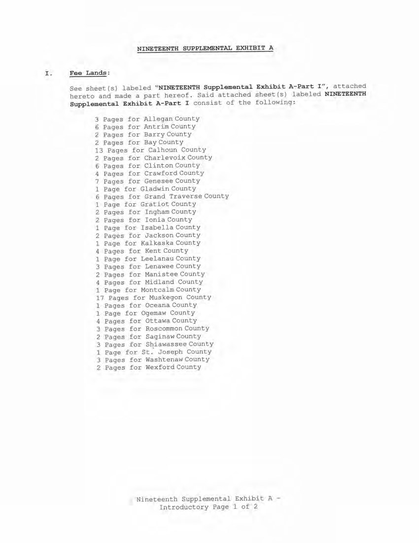
| NINETEENTH SUPPLEMENTAL EXHIBIT A Fee Lands: See sheet(s) labeled "NINETEENTH Supplemental Exhibit A-Part I", attached hereto and made a part hereof. Said attached sheet(s) labeled NINETEENTH Supplemental Exhibit A-Part I consist of the following: 3 Pages for Allegan County 6 Pages for Antrim County 2 Pages for Barry County 2 Pages for Bay County 13 Pages for Calhoun County 2 Pages for Charlevoix County 6 Pages for Clinton County 4 Pages for Crawford County 7 Pages for Genesee County 1 Page for Gladwin County 6 Pages for Grand Traverse County 1 Page for Gratiot County 2 Pages for Ingham County 2 Pages for Ionia County 1 Page for Isabella County 2 Pages for Jackson County 1 Page for Kalkaska County 4 Pages for Kent County 1 Page for Leelanau County 3 Pages for Lenawee County 2 Pages for Manistee County 4 Pages for Midland County 1 Page for Montcalm County 17 Pages for Muskegon County 1 Pages for Oceana County 1 Page for Ogemaw County 4 Pages for Ottawa County 3 Pages for Roscommon County 2 Pages for Saginaw County 3 Pages for Shiawassee County 1 Page for St.' Joseph County 3 Pages for Washtenaw County 2 Pages for Wexford County Nineteenth Supplemental Exhibit A - Introductory Page 1 of 2 NINETEENTH SUPPLEMENTAL EXHIBIT A I . Fee Lands : See sheet (s) labeled '' NINETEENTH Supplemental Exhib i t A - Part I ", attached hereto and made a part hereof . Said attached sheet(s) labeled NINETEENTH Supplemental E.xhibit A- P art I consist of the following : 3 Pages for Allegan County 6 Pages for Antrim County 2 Pages for Barry County 2 Pages for Bay County 13 Pages for Calhoun County 2 Pages for Charlevoix County 6 Pages for Clinton County 4 Pages for Crawford County 7 Pages for Genesee County 1 Page for Gladwin County 6 Pages £or Grand Traverse County 1 Page for Gratiot County 2 Pages for Ingham County 2 Pages for Ionia County 1 Page for Isabella County 2 Pages for Jackson County 1 Page for Kalkaska County 4 Pages for Kent County 1 Page for Leelanau County 3 !?ages for Lenawee County 2 Pages for Manistee Coun ty 4 Pages for Midland County 1 Page for Montcalm County 17 Pages for Muskegon County 1 Pages for Oceana County 1 Page £or Ogemaw County 4 Pages for Ottawa County 3 Pages for Roscommon County 2 Pages for Sagina w County 3 Pages £or S1:iawassee County 1 Page for St . Joseph County 3 Pages for WashtenawCounty 2 Pages £or Wexford County Nineteenth Supplemental Exhibit A - Introductory Pagel of 2 |
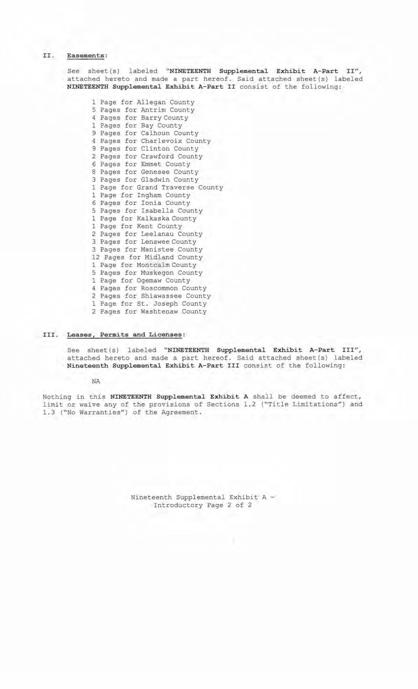
| II. Easements: See sheet(s) labeled "NINETEENTH Supplemental Exhibit A-Part II", attached hereto and made a part hereof. Said attached sheet (s) labeled NINETEENTH Supplemental Exhibit A-Part II consist of the following: 1 Page for Allegan County 5 Pages for Antrim County 4 Pages for Barry County 1 Pages for Bay County 9 Pages for Calhoun County 4 Pages for Charlevoix County 9 Pages for Clinton County 2 Pages for Crawford County 6 Pages for Emmet County 8 Pages for Genesee County 3 Pages for Gladwin County 1 Page for Grand Traverse County 1 Page for Ingham County 6 Pages for Ionia County 5 Pages for Isabella County 1 Page for Kalkaska County 1 Page for Kent County 2 Pages for Leelanau County 3 Pages for Lenawee County 3 Pages for Manistee County 12 Pages for Midland County 1 Page for Montcalm County 5 Pages for Muskegon County 1 Page for Ogemaw County 4 Pages for Roscommon County 2 Pages for Shiawassee County 1 Page for St. Joseph County 2 Pages for Washtenaw County III. Leases, Permits and Licenses: See sheet (s) labeled "NINETEENTH Supplemental Exhibit A-Part III", attached hereto and made a part hereof. Said attached sheet(s) labeled Nineteenth Supplemental Exhibit A-Part III consist of the following: NA Nothing in this NINETEENTH Supplemental Exhibit A shall be deemed to affect, limit or waive any of the provisions of Sections 1.2 ("Title Limitations") and 1.3 ("No Warranties") of the Agreement. Nineteenth Supplemental Exhibit A - Introductory Page 2 of 2 II_ Easement s : See sheet ( s) labeled ''NINETEENTH Supplemental Exhibi t A- Part I I", attached hereto and made a part hereof. Said attached sheet(s) labeled NINETEENTH Supplemental Exhibit A-Part II consist of the following: 1 Page for Allegan County 5 Pages for Antrim County 4 Pages for Barry County 1 Pages for Bay County 9 Pages for Calhoun County 4 Pages for Charlevoix County 9 Pages for Clinton Count y 2 Pages for Crawford County 6 Pages for Emmet County 8 Pages for Genesee County 3 Pages for Gladwin County 1 Page for Grand Traverse County 1 Page for Ingham County 6 Pages for Ionia County 5 Pages for Isabella County 1 Page for Kalkaska County 1 Page for Kent County 2 Pages for Leelanau County 3 Pages for Lenawee County 3 Pages for Manistee County 12 Pages for Midland County 1 Page for Montcalm County 5 Pages for Muskegon County 1 Page for Ogemaw County 4 Pages for Roscommon County 2 Pages for Shiawassee County 1 Page for St. Joseph County 2 Pages for Washtenaw County III_ Leases, Permi ts and Licen ses: See sheet(s) labeled "NINETEENTH Supplemental. Exhibit A- Part III", attached hereto and made a part hereof_ Said attached sheet(s) labeled Nineteenth Supplemental Exhibit A- Part III consist of the following: NA Nothing in this NINETEENTH Supplementa l Exhibit A shall be deemed to affect, limit or waive any of the provisions of Sections 1 . 2 ("Title Limitations") and 1.3 ("No Warranties") of the Agreement . Nineteenth Supplemental Exhibit A - Introductory Page 2 of 2 |
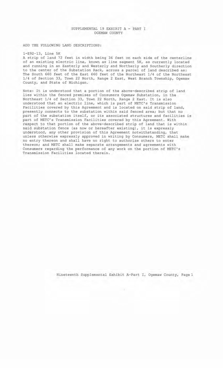
| SUPPLEMENTAL 19 EXHIBIT A - PART I OGEMAW COUNTY ADD THE FOLLOWING LAND DESCRIPTIONS: 1-E92-13, Line 5K A strip of land 72 feet in width being 36 feet on each side of the centerline of an existing electric line, known as line segment 5K, as currently located and running in an Easterly and Westerly and Northerly and Southerly direction to the center of the Substation Rack, across a parcel of land described as: The South 660 feet of the East 660 feet of the Northeast 1/4 of the Northeast 1/4 of Section 33, Town 22 North, Range 2 East, West Branch Township, Ogemaw County, and State of Michigan. Note: It is understood that a portion of the above-described strip of land lies within the fenced premises of Consumers Ogemaw Substation, in the Northeast 1/4 of Section 33, Town 22 North, Range 2 East. It is also understood that an electric line, which is part of METC's Transmission Facilities covered by this Agreement and is located on said strip of land, presently connects to the substation within said fenced area; but that no part of the substation itself, or its associated structures and facilities is part of METC's Transmission Facilities covered by this Agreement. With respect to that portion of the above-described strip of land that is within said substation fence (as now or hereafter existing), it is expressly understood, any other provision of this Agreement notwithstanding, that unless otherwise expressly approved in writing by Consumers, METC shall make no entry thereon and shall have no right to authorize others to enter thereon; and METC shall make separate arrangements and agreements with Consumers regarding the performance of any work on the portion of METC's Transmission Facilities located therein. Nineteenth Supplemental Exhibit A-Part I Ogemaw County, Page 1 SUPPLEMENTAL 19 EXHIBIT A - PART I OGEMAW COUNTY ADD THE FOLLOWING LAND DESCRIPTIONS·: l - E92-13, Line SK A strip of land 72 feet in width being 36 feet on each side of the centerline of an existing electric line, known as line segment 5K, as currently located and running in an Easterly and Westerly and Northerl y and Southerly direction to the center of the Substati on Rack, across a parcel of land described as : The South 660 feet of the East 660 feet of the Northeast 1/4 of the Northeast 1/4 of Section 33, Town 22 North, Range 2 East, West Branch Township, Ogemaw County, and State of Michigan. Note : It is understood that a portion of the above- described strip of land lies within the fenced premises of Consumers Ogemaw Substation, in the Northeast 1/4 of Secti on 33, To wn 22 North, Range 2 East . It is also understood that an electric line, which is part of METC ' s Transmission Facilities covered by this Agreement and is located on said strip of land, presently connects to the substation within said fenced area; but that no part of the substation itself, or its associated structures and facilities is part of METC's Transmission Facilities covered by this Agreement . With respect to that portion of the above- described strip of land that i s within said substation fence (as now or hereafter existing)r it is expressly understood, any other provision of this Agreement notwithstanding, that unless otherwi se expressl y approved in writing by Consumers, METC shall make no entry thereon and shall have no right to authorize others to enter thereon; and METC shall make separate arrangements and agreements with Consumers r e garding the performance of any work on the portion of METC ' s Transmission Facilities located t herein. Nineteenth Supplemental Exhibit A-Part I , Ogemaw County, Pagel |
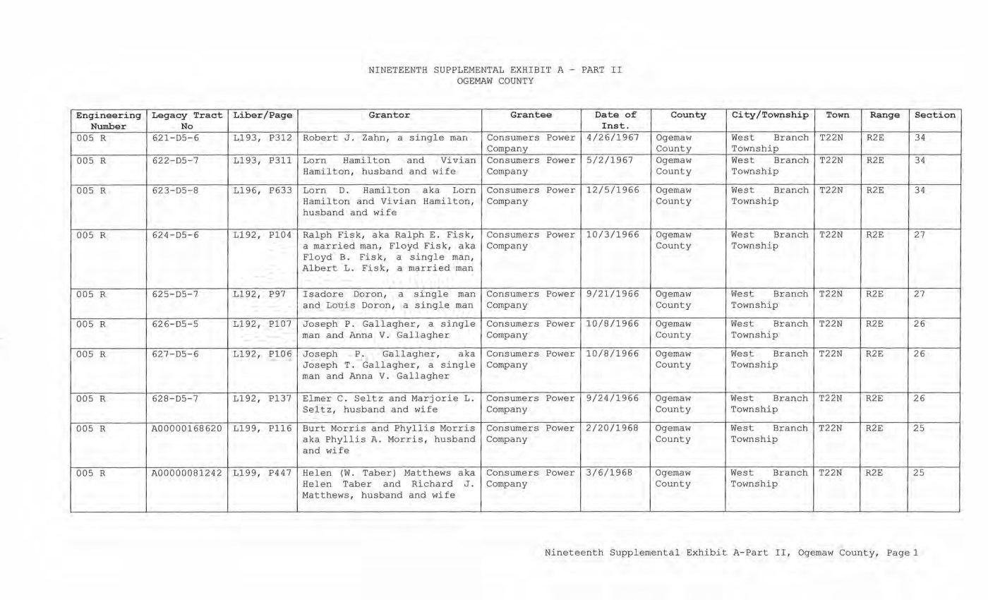
| NINETEENTH SUPPLEMENTAL EXHIBIT A - PART II OGEMAW COUNTY Engineering Number Legacy Tract No Liber/Page Grantor Grantee Date of Inst. County City/Township Town Range Section 005 R 621-D5-6 L193, P312 Robert J. Zahn, a single man Consumers Power Company 4/26/1967 Ogemaw County West Branch Township T22N R2E 34 005 R 622-D5-7 L193, P311 Lorn Hamilton and Vivian Hamilton, husband and wife Consumers Power Company 5/2/1967 Ogemaw County West Branch Township T22N R2E 34 005 R 623-D5-8 L196, P633 Lorn D. Hamilton aka Lorn Hamilton and Vivian Hamilton, husband and wife Consumers Power Company 12/5/1966 Ogemaw County West Branch Township T22N R2E 34 005 R 624-D5-6 L192, P104 Ralph Fisk, aka Ralph E. Fisk, a married man, Floyd Fisk, aka Floyd B. Fisk, a single man, Albert L. Fisk, a married man Consumers Power Company 10/3/1966 Ogemaw County West Branch Township T22N R2E 27 005 R S25-D5-7 L192, P97 Isadore Doron, a single man and Louis Doron, a single man Consumers Power Company 9/21/1966 Ogemaw County West Branch Township T22N R2E 27 005 R 62 6-D5-5 L192, P107 Joseph P. Gallagher, a single man and Anna V. Gallagher Consumers Power Company 10/8/1966 Ogemaw County West Branch Township T22N R2E 26 005 R 627-D5-6 L192, P106 Joseph P. Gallagher, aka Joseph T. Gallagher, a single man and Anna V. Gallagher Consumers Power Company 10/8/1966 Ogemaw County West Branch Township T22N R2E 26 005 R 628-D5-7 L192, P137 Elmer C. Seitz and Marjorie L. Seitz, husband and wife Consumers Power Company 9/24/1966 Ogemaw County West Branch Township T22N R2E 26 005 R A00000168620 L199, P116 Burt Morris and Phyllis Morris aka Phyllis A. Morris, husband and wife Consumers Power Company 2/20/1968 Ogemaw County West Branch Township T22N R2E 25 005 R A00000081242 L199, P447 Helen (W. Taber) Matthews aka Helen Taber and Richard J. Matthews, husband and wife Consumers Power Company 3/6/1968 Ogemaw County West Branch Township T22N R2E 25 Nineteenth Supplemental Exhibit A-Part II, Ogemaw County, Page 1 Engineering Legacy Tract Liber/Page Number No 005 R 621-D5-6 Ll93, P312 005 R 622-D5- 7 L193, P311 005 R 623-D5- 8 L196, P633 005 R 624-D5-6 L192, Pl04 005 R 625-D5-7 Ll 92, 1?97 005 R 626-D5-5 Ll92, Pl07 005 R 627-D5-6 Ll92, P106 005 R 628- D5- 7 Ll92, Pl37 005 R A00000168620 L199, P116 005 R A00000081242 L199, P447 NINETEENTH SUPPLEMENTAL EXHIBIT A - PART II OGEMAW COUNTY Granter Grantee Date of Inst. Robert J . Zahn, a single man Consumers Power 4/26/1967 Company Lor n Hami lton and Vivian Consumers Power 5/2/1967 Hamilt on, husband and wife Company Lorn D. Hamilton aka Lorn Consumers Power 12/5/1966 Hamilton and Vivi an H amil ton, Company husband and wife Ralph Fisk, aka Ralph E . Fisk, Consumers Power 10/3/1966 a married man, Floyd Fisk, aka Company Floyd B. Fisk, a single man, Albert L. Fisk, a mar ried man Isadore Doran, a single man Consumers Power 9/21/1966 and Louis Daron, a single man Company Joseph P. Gallagher, a single Consumers Power 10/8/1966 man and Anna V. Gallagher Company Joseph P. Gallagher, aka Consumers Power 10/8/1966 Joseph T. Gallagher, a single Company man and Anna V. Gallagher Elmer C. Sel tz and Marjorie L. Consumers Power 9/24/1966 Seltz, husband and wife Company Burt Morris and Phyllis Morri s Consumers Power 2/20/ 1968 aka Phyllis A. Morri s , husband Company and wife Helen (W. Taber) Matthews aka Consumers Power 3/6/1968 Helen Taber and Richar d J . Company M att hews, husband and wife County City/Township Town Range Section Ogemaw West Branch T22N R2E 34 County Township Ogemaw West Branch T22N R2E 34 County Township Ogemaw West Branch T22N R2E 34 County Township Ogemaw West Branch T22N R2E 27 County Townshi p Ogemaw West Branch T22N R2E 27 County Township Ogem aw West Branch T22N R2E 26 County Township Ogemaw West Branch T22N R2E 26 County Township Ogemaw West Branch T22N R2E 26 County Township Ogemaw West Branch T22N R2E 25 County Township Ogemaw West Br a nch T2 2N R2E 25 County Township Nineteenth Supplemental Exhibit A-Part II, Ogemaw County, Page 1 |
| PART h i NINETEENTH supplemental exhibit OGEMAW COUNTY A Date of Instrument Tovm/ReBS^ Section non e CE Ref . License/Lessor NINETEENTH SUPPLEMENTAL EXHIBIT 8 - PART III OGEMAW COUNTY Licensee/Lessee Date of Instrument Title of Instrument To'iln/Range Section Nineteenth Supplemental Exhibit A-Part III, Ogemaw CounLy, Pagel |
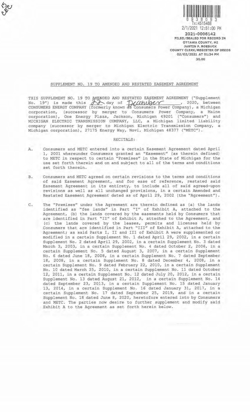
| 11 1 111111111111 11111 111 1 1111111 8 9 3 8 0 9 3 Tx:4515468 2/i/2021 12:51 :00 PM 20 21-0006142 FILED/SEALED FOR RECORD lN OTTAWA COUNTY, MI JVSTIN F. ROEBUCK COUNTY Cl-ERK/REGISTER OF DEEDS 02/02/2021 AT 01:34 PM 30.00 SUPPLEMENT NO. 19 TO AMENDED AND RESTATED EASEMENT AGREEMENT THIS SUPPLEMENT NO. 19 TO AMENDED AND RESTATED EASEMENT AGREEMENT ("Supplement No . 19" ) is made this ,:J--,7)-.... day of TuCtbll)auc , 2020, between CONSUMERS ENERGY COMPANY (formerly known H'consumers Power Company) , a Michigan corporation, (successor by merger to Consumers Power Company, a Maine corporati on) , One Energy Plaza, Jackson, Michigan 49201 ("Consumers") and MICHIGAN ELECTRIC TRANSMISSION COMPANY, LLC, a Michigan limited liability company ( successor by merger to Michigan Electric Transmission Company, a Michigan corporation) , 27175 Energy Way, Novi, Michi gan 48377 (''METC'' ). RECITALS : A. Consumers and METC entered into a certain Easement Agreement dated April 1, 2001 whereunder Consumers granted an "Easement" (as therein defined) to METC in respect to certain "Premises" in the State of Michigan for the use set forth therein and on and subject to all of the terms and conditions set forth therein. B. Consumers and METC agreed on certain revisions to the terms and conditions of said Easement Agreement, and for ease of reference, restated said Easement Agreement in its entirety, to include all of said agreed- upon revisions as well as all unchanged provisions, in a certain Amended and Restated Easement Agreement dated as of April 29, 2002 (the "Agreement"). C. The "Premises" under the Agreement are therein defined as (a) the lands identified as "fee lands" in Part "I" of Exhibit A, attached to t he Agreement, (bl the lands covered by the easements held by Consumers that are identified in Part "II" of Exhibit A, attached to the Agreement, and (c) the lands covered by the leases, permits and licenses held by Consumers that are identified in Part "III" of Exhibit A, attached to the Agreement; as said Parts I , II and III of Exhibit A were supplemented or modified in a certai n Supplement No. 1 dated April 29, 2002, in a certain Supplement No. 2 dated April 29, 2002, in a certain Supplement No . 3 dated March 3 , 2003, in a certain Supplement No . 4 dated October 2, 2006, in a certain Supplement No. 5 dated August 3, 2007, in a certain Supplement No. 6 dated June 18, 2008, in a certain Supplement No . 7 dated September 1 8, 2008, in a certain Supplement No. 8 dated December 4, 2008 , in a certain Suppl ement No. 9 dated February 22, 2010, in a certain Supplement No. 10 dated March 25, 2010, in a certain Supplement No. 11 dated October 12, 2011, in a certain Supplement No . 12 dated July 20, 2012, in a certain Suppl ement No. 13 dated August 21, 2012, in a certain Supplement No. 14 dated September 23, 2013, in a certain Supplement No. 15 dated January 13, 2014, in a certain Supplement No. 16 dated January 31, 2017, in a certain Supplement No . 17 dated September 25, 2019, and in a certain Supplement No. 18 dated June 8, 2D20, heretofore entered into by Consumers and M ETC. The parties now desire to further supplement and modify said Exhibit A to the Agreement as set. forth herein below. |
| 2 0. References, in regard to historical matters, to nMETC" in the foregoing reci tals will be deemed to mean METC ' s predecessor, Michigan Electric Transmission Company, a Michigan corporation, where relevant. NOW, THEREFORE, for good and valuable consideration, the receipt of which is acknowledged, Consumers and METC agree as foll ows: 1 . Exhibit A to the Agreement, as heretofore supplemented and/or modified, is hereby further supplemented and modified as set forth in ''Nineteenth Supplemental Exhibit A", attached hereto. It is expressly understood that any lands, easements, or leases/permits/licenses that are indicated in said attached Nineteenth Supplemental Exhibit A as being added are, on and subject to the terms and conditi ons of the Agreement (as supplemented and amended by this Supplement No. 19) , hereby deemed added to Part I, Par t II and Part III, respectively, of Exhibit A to the Agreement. However, it is further expressly understood that in addition to all rights granted to METC by the Agreement, METC shall have the following rights as to the lands identified as "Consumers Energy Equipment/ Joint Asset Area Easement" on the accompanying NINETEENTH Supplemental Exhibit A sheets, inclusive of Parts I, I I and III, which rights are a lso subject to the terms of the Parties' Amended and Restated Transmission Interconnection Agreement (the "DTIA"): (a) t he right to maintain any and all existing components of the Transmission System, as def:Lned in t he DTIA, a,nd wiring or conduit connections for the same that currently exist over, on or under these lands; and (b)the right to connect its currently sited or future approved wir;ing or conduits for communications, station power, or control, operating at 600 volts or less, and any Jointly Owned Assets, as defined in the DTIA, over, on or under these l ands. It is also expressly understood that, with respect to any lands, easements , or leases/permits/licenses now covered by Part I, Part II or Part III of Exhibit A that are indicated in said attached Nineteenth Supplemental Exhibit A as being deleted, the Easement is hereby deemed RELEASED with respect thereto and the Agreement shall hereafter no longer apply thereto (provided, however, that all rights and obligations under the Agreement with respect to periods prior to the date of this Supplement No. 19 shall remain unarfected) . 2 . It is expressly understood and agreed that in respect to the additional Premises represented by the land(s) , easement(s), lease(s) , permit(s) and/or l i cense {s) that are added to Part I , Part II and Pan: III of Exhibit A to the Agreement pursuant to this Supplement No. 19 (the "Additional Premises"): (al All references to "Commencement Date" that are found in Article 1 ("Grant of Easement") , Articl e 2 ("Term") , Article 5 ("Additions/Alterations'') , Article 6 ("Consumers' Reserved Rights to Use the Premises and Transmission Facilities") , Article 7 ("METC Approval of Compatible Uses") , Article 8 ("Certain Obligations of Consumers and Authorized Users; Etc.") and Article 14 ("Environmental Matters") of the Agreement shall be deemed to mean the date of this Supplement No . 19 and not the date that is identified in the Agreement as the ''Commencement Date" . |
| 3 (b) Except as expressly otherwise indicated in the immediately following sentence, all references to "Restated Agreement Date" that are found in Article 1 ("Grant of Easement"), Article 6 {"Consumers' Reserved Rights t o Use the Premises and Transmission Facili ties"), and Article 12 ("Compliance With Applicable Laws'r) of the Agreement shall also be deemed to mean the date of this Supplement No. 19 and not the date that is identified in the Agreement as the "Restated Agreement Date". Notwithstanding the foregoing: (i) tbe preceding sentence does not apply to the purely historical statement in clause "{c)" of Section 1 . 2 of the Agreement that Trans- Elect, Inc. is "an affiliate of the entity which has become METC ' s parent company as of the Restated Agreement Date"; and {ii) the parenthetical in the first sentence of the first paragraph of Section 7 . 1 of the Agreement reading "{see below regarding a certain period prior to the Restated Agreement Date) ", along with the fourth paragraph of said Section 7.1 reading "Consumers shall submit to METC within twenty (20) days of the Restated Agreement Date a list of all material Compatible Uses other than additions or modifications to Distribution Facilities that have been authorized between February 1 , 2001 and the Restated Agreement Date for METC's approval per the METC Compatible Ose approval process described in this Section 7 . l. ", both r . eferred to a one-t ime historical matter and have no application to the Additional Premises or any other further effect or application whatsoever . 3. In addition to the original Transmissi on Facilities and Additions/Alter<1tions thereto as referred to in Recital "A" of the Agreement, it is understood that such electric Transmission towers, pole structures, poles, crossarms, wires, cables, conduits, guys, anchors, transformers, insulators and/or other fixtures and equipment as may be owned by METC and located on the Additional Premises as of the date of this Supplement No . 19, and future Additions/Alternations made thereto on and subject to the terms and conditions of the Agreement, are included in the "Transmission Facilities" under the Agreement. Note: This Supplement No. 19 will not be recorded in all counties in which the Agreement itself, or Suppl ements Nos. 1 through 18, may have been recorded. This Supplement No . 19 (as were each of Supplements Nos . 1 through 18), wi ll be recorded only in t he county(ies) in which relevant Premises are located; being, in the case of this Supplement No . 19, only the following: |
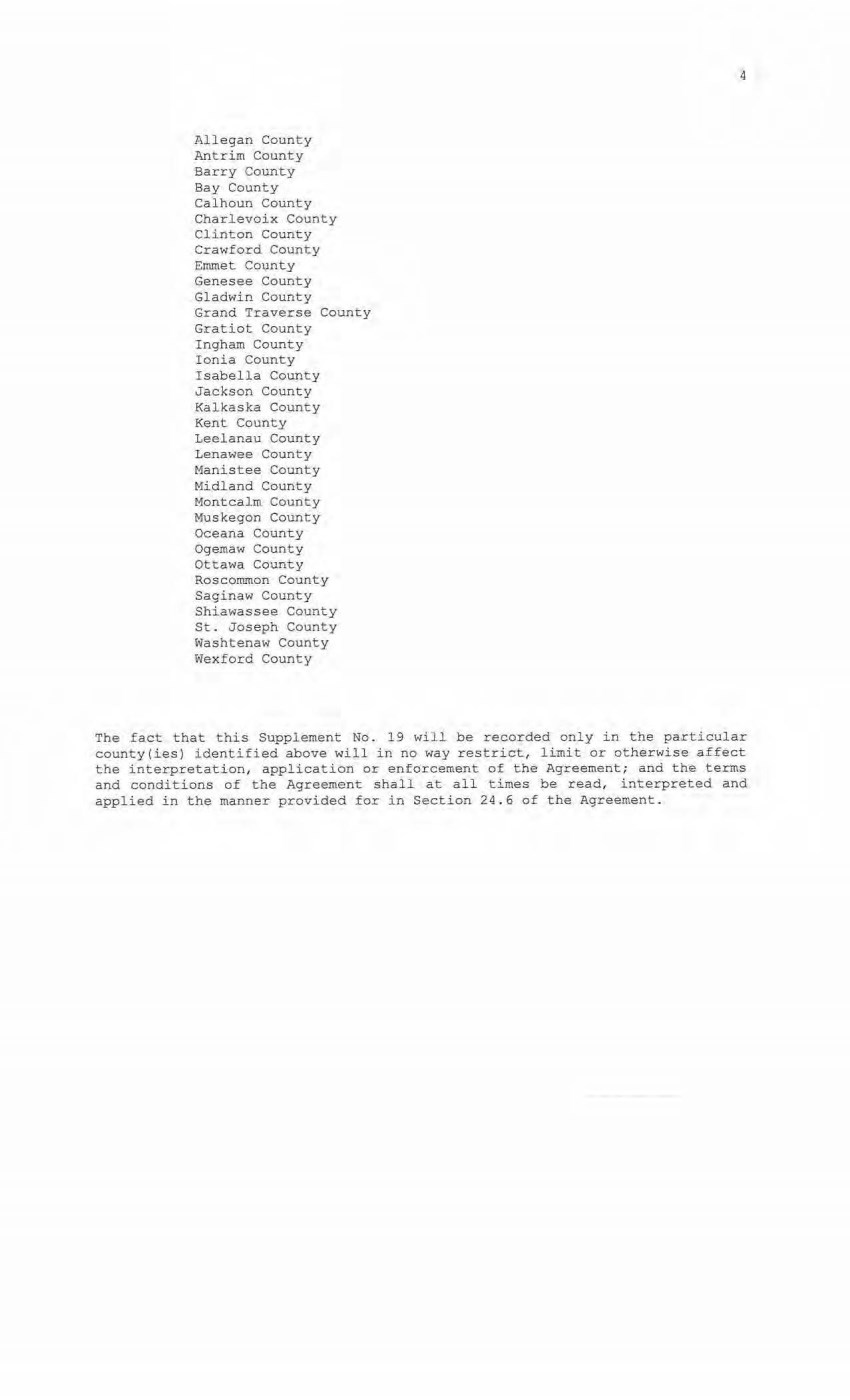
| Allegan County Antrim County Barry County Bay County Calhoun County Charlevoix County Clinton County Crawford County Emmet County Genesee County Gladwin County Grand Traverse County Gratiot County Ingham County Ionia County Isabella County Jackson County Kalkaska County Kent County Leelanau County Lenawee County Manistee County Midland County Montcalm County Muskegon County Oceana County Ogemaw County Ottawa County Roscommon County Saginaw County Shiawassee County St. Joseph County Washtenaw County Wexford County 4 The fact that this Supplement No. 19 will be recorded only in the particular county(ies) identified above will in no way restrict, limit or otherwise affect the interpretation, application or enforcement of the Agreement; and the terms and conditions of the Agreement shal l at all times be read, interpreted and applied in the manner provided for in Section 24.6 of the Agreement. |
| 5 IN WITNESS WHEREOF , Consumers and METC have executed this Supplemeht No . 19 as of the date first above written . CONSUMERS ENERGY COMPANY , a Michigan corporation ~ Direc :::: Redl Es1:ate STATE OF MICHIGAN coONTY oF , ja d ll'::xl1r-. ss. The £oregoing instrument was acknowledge d before this ~ day ot 12{_Utuf)UV, 2020, by Mary Anne Marr, Director of Real Estate of CONSUMERS ENERGY COMPANY , a Michigan corporation, on beh alf of the corporation . JULIE C GUINN Notary Public· Sti!lte of Michigan County of Jackson My C:ommi~sion Ei1pires ~ec J9, 2020 /\cling In the County of < 4 l~O)n Notary Public, , )tldU,1}:-\ County, Michigan Acting in , /f(__ {ll§C~ Coynty, Michigan My Commission Expires: IJZ:::la:::-5 , 20 ::i,.,. I ~ |
| 6 MICHIGAN ELECTRIC TRANSMISSI ON COMPANY, LLC, a Michigan limited l iability company By: ITC Holdings Corp., a Michigan corpor ation, its manager By: Jean Kim O' Anna Vice President and Deputy General Counsel - Legal Services STATE OF MICHIGAN COUNTY OF -=O =akl =an =d==~ ss. The forenni nn i n,;trument was acknowledged before this ~ day of necemher J.020, by Jean Kim D' Anna, Vice President and Deputy General Counsel of ITC Holdings Corp., a Michigan corporation, as manager of MICHIGAN ELECTRIC TRANSMISSION COMPANY, LLC, a Michigan limited liability company, on behalf of the limited liability company. LAIJRA.J. MCCRAY NOTARY PUBLIC. STATE OF Ml COUNTY OF OAKLAND MY COMMISSION EXPIRES Jul 30, 2021 • I -1.CTINO IN COUNTY OF O o.. k\ o.,v\"1 Notary PWj'' 0 J Oakhmrl I County, Michigan Acting inl Oakland j County, Michigan My Co!IIItll.l-,.-s-s...,.i_o_n~E_x_p-:-i-r_e_s_ : _7 /30/21_, 2020 Exempt from transfer taxes per MCL §§ 207 . SOS(f) and 207. 526(f) . Prepared by: Tracy L. Vanwoert Consumers Energy Company EP7-447 One Energy Plaza Jackson, Michigan 49201 Return to: Julie Guinn Consumers Energy Company |

| THE ATTACHED COPY OF THE NINETEENTH SUPPLEMENTAL EXHIBIT A THAT WAS PREPARED FOR RECORDATION IN OTTAWA COUNTY , MICHIGAN, AND CONTAINS THE PORTIONS OF EACH OF PARTS I, II, AND III OF THE NINETEENTH SUPPLEMENT EXHIBIT A THAT RELATE TO PREMISES IN THAT COONTY ONLY . SEE SECTION 24 . 6 OF THE AGREEMENT. 7 |
| NINETEENTH SUPPLEMENTAL EXHIBIT A I . Fee Lands : See sheet (s) labeled "NINETEENTH Supplemental Exhibit A-Part I", attached hereto and made a part hereof . Said attached sheet(s) labeled NINETEENTH Supplemental Exhibit A-Part I consist of the fol lowing: 3 Pages for Allegan County 6 Pages for Antrim County 2 Pages for Barry County 2 Pages for Bay County 13 Pages for Calhoun County 2 Pages for Charlevoix County 6 Pages for Clinton County 4 Pages for Crawford County 7 Pages for Genesee County 1 Page for Gladwin County 6 Pages for Grand Traverse County 1 Page £or Gratiot County 2 Pages for I ngham County 2 Pages for Ionia County 1 Page for Isabella County 2 Pages for JacksonCounty l Page for Kal kaska County 4 Pages for Kent County l Page for Leelanau County 3 Pages for Lenawee County 2 Pages for Manistee County 4 Pages f or Midland County 1 Page for Montcalm County 17 Pages for Muskegon County 1 Pages fo:i: Oceana County 1 Page £or Ogemaw County 4 Pages for Ottawa County 3 Pages fo.r Roscommon County 2 Pages for Saginaw County 3 Pages for Shiawassee County 1 Page for St. Joseph County 3 Pages for Washtenaw County 2 Pages for Wexford County Nineteenth Suppl emental Exhibit A - Introductory Page 1 of 2 |

| II. Easements: See sheet(s) labeled "NINETEENTH Supplemental Exhibit A-Part II", attached hereto and made a part hereof. Said attached s heet(s) l abeled NINETEENTH Supplemental Exhibit A- Part II consist of the following: 1 Page for Allegan County 5 Pages for Antrim County 4 Pages for Barry County 1 Pages for Bay County 9 Pages for Cal houn County 4 Pages for Charlevoix County 9 Pages for Clinton Comity 2 Pages for Crawford County 6 Pages for Emmet County 8 Pages for Genesee County 3 Pages for Gladwin County 1 Page for Grand Traverse County l Page for Ingham County 6 Pages for I onia County 5 Pages for Isabella County 1 Page for Kalkaska County l Page for Kent County 2 Pages for Leelanau County 3 Pages for Lenawee County 3 Pages for Manistee County 12 Pages for Midland County 1 Page for Montcalm County 5 Pages for Muskegon County 1 Page for Ogemaw County 4 Pages for Roscommon County 2 Pages for Shiawassee County 1 Page for St. Joseph County 2 Pages for Washtenaw County III. Leases, Permits and Licenses: See sheet(s) label ed "NINETEENTH Supplemental Exhibit A-Part III", attached hereto and made a part hereof. Said attached sheet(s) labeled Nineteenth Suppiemental Exhi,bit A-Part III consist of the following: NA Nothing in this NINETEENTH Supplemental Exhibit A shall be deemed to affect, li.mi t or waive any of the provisions of Sections l. 2 ("Title Limitations") and 1.3 ('"No Warranties") of the Agreement . Nineteenth Supplemental Exhibit A - Introductory Page 2 of 2 |
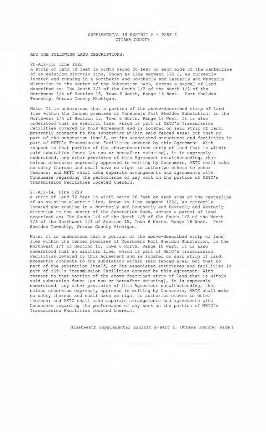
| SUPPLEMENTAL 19 EXHIBIT A - PART I OTTAWA COUNTY ADD THE FOLLOW1NG LAND DESCRIPTIONS: 20-A12-13, Line 122J A s trip of land 72 feet in width being 36 feet on each s i de of the centerline of an existing electric line, known as line segment 122 J , as currently located and running in a Northerly and Southerly and Easterly and Westerly direction to the center of the Substation Rack, across a parcel of land described as: The South 1/5 of the Sout h 1/2 of the North 1/2 of the Northwest 1/4 of Section 15, Town 6 North, Range 16 West. Port Sheldon Township, Ottawa County Michigan. Note: It is understood that a portion of the above-described strip of land l ies wi thin the fenced premises of Consumers Port Sheldon Substation, in the Northwest 1/4 of Section 15, Town 6 North, Range 16 West. It is also understood that an electric line, which is part of METC ' s Transmission Faci lities covered by this Agreement and is located on said strip of land, presentl y connects to the substation within said fenced area; but that no part of the substation itself, or its associated structures and facilities is part of METC ' s Transmission Facilities covered by this Agreement. With respect to that portion of the above-described strip of land that is within said substation fence (as now or hereafter existing), it is expressly understood, any other provision of this Agreement notwithstanding, that unl ess otherwise expressl y approved in writing by Consumers, METC shall make no entry thereon and s hall have no right to authorize others to enter thereon; and METC shall make separate arrangements and agreements with Consumers regarding the performance of any work on the portion of METC's Transmission Facil ities l ocated therein. 21- Al2- 14, Line 122J A strip of land 72 feet in width being 36 feet on each side of the centerline of an existing electric line, known as line segment 122J, as currently located and r unning in a Northerly and Southerly and Easterly and Westerly direction to the center of the Substation Rack, across a parcel pf land described as: The South 1/4 0£ the North 4/5 of the South 1/2 of the North 1/2 of the Northwest 1/4 of Section 15, Town 6 North, Range 16 West . Port Sheldon Townshi p , Ottawa County Michigan. Note: It is understood that a portion of the above-described strip of land lies within the fenced premises of Consumers Port Sheldon Substation, in the Northwest 1/4 of Section 15, Town 6 North, Range 16 West. It is also understood that an electric line, which is part of METC ' s Transmission facilities covered by this Agreement and is located on said strip of land, present l y connects to the substation within said fenced area; but that no part of the substation itself, or its associated structures and facilities is part of METC's Transmission Facilities covered by this Agreement. With respect to that portion of the above- described strip of land that is within said substation fence (as now or hereafter existing), it is expressly understood, any other provision of this Agreement notwithstanding, that unless otherwise expressly approved in writing by Consumers, METC shall make no entry thereon and shall have no right to authorize others to enter thereon; and METC shall make separate arrangements and agreements with Consumers regarding the performance of any work on the portion of METC's Transmission Facilities located therein. Nineteenth Supplemental Exhibit A-Part I, Ottawa County, Pagel |
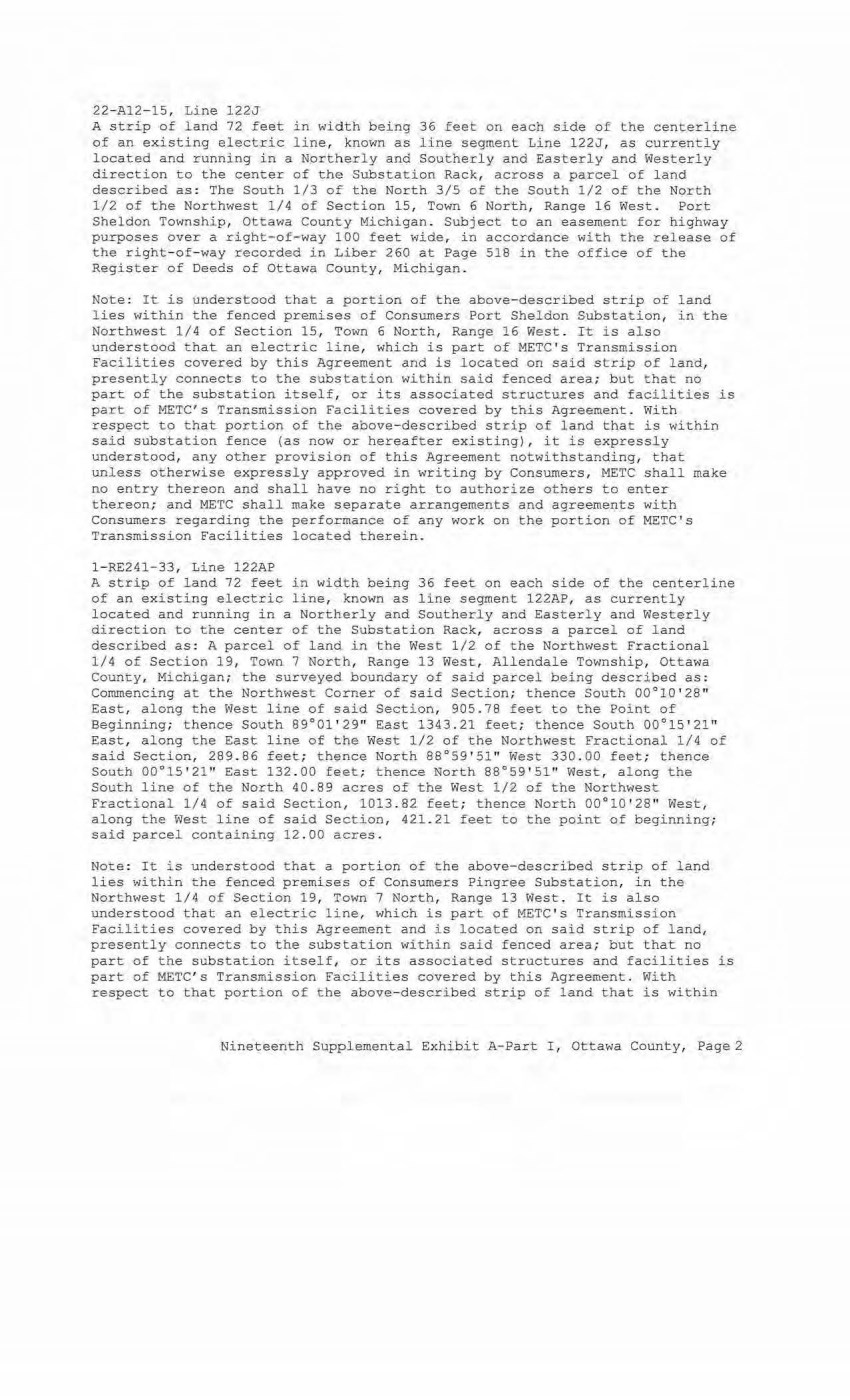
| 22-Al2- 15, Line 122J A strip of land 72 feet in width being 36 feet on each side of the centerline of an existing electric line, known as line segment Line 122J, as currently located and running i.n a Northerly and Southerly and Easterly and Westerly direction to the center of the Substation Rack, across a parcel of l and described as : The South 1/3 of the North 3/5 of the South 1/2 of the North 1/2 of the Northwest 1/4 of Section 15, Town 6 North, Range 16 West . Port Sheldon Township, Ottawa County M i chigan. Subject to an easement for highway purposes bver a right- of- way 100 feet wide, in accordance with the release of the right-of-way recorded in Liber 260 at Page 518 in the office of the Register of Deeds of Ottawa County, Michigan . Note: I t is understood that a portion of the above-described strip of l and lies within the fenced premises of Consumers Port Sheldon Substation, :i.n the Northwest 1/4 of Section 15, Town 6 North, Range 16 West . I t i s also understood that an electric line, which is part of METC ' s Transmission Facilities covered by this Agreement and is located on said strip of land, presently connects to the substation within said fenced area; but that no part of the substation i t self, or its associated structures and faci lities is part of METC's Transmission Facilities covered by this Agreement . With respect to that portion of the above-described strip of land that is within said substati on fence (as now or hereafter existing), it is expressly understood, any other provision of this Agreement notwithstanding, that unless ot herwise expressly approved in writing by Consumers, METC shall make no entry thereon and shall have no right to aut horize others to enter thereon; and METC shall make separate arrangements and agreements with Consumers regarding the performance of any work on the portion of METC's Transmission Facilities located therein. l-RE241- 33, Line 122AP A s t rip of land 72 feet in wi dth being 36 feet on each side of the centerline of an existing electric line, known as line segment 122AP, as currently located and running in a Northerly and Southerly and Easterly and Westerly direction to the center of the Substation Rack, across a parcel of l and described as : A parcel of land in the West 1/2 of the Northwest Fractional 1/4 of Section 19, Town 7 North, Range 13 West, Allendale Township, Ottawa County, Michigan; the surveyed boundary of said parcel being described as: Commencing at the Northwest Corner of said Section; thence South 00°10 ' 28" East, along the West line of said Section, 905 . 78 feet to the Point of Beginning; thence South 89°01' 29" East 1343. 21 feet; thence South 00°15 ' 21" East, along the East line of the West 1/2 of the Northwest Fracti onal 1/4 of said Section, 289 . B6 feet; thence North 88°59'51" West 330. 00 feet; thence South 00°15'21'' East 132. 00 feet; t hence North 88°59 ' 51" West, along t he South line of the North 40 . 89 acres of the West 1/2 of the Northwest Fractional 1/4 of said Section, 1013 . 82 feet; thence North 00°10 ' 28" West, along t he West line of said Section, 421.21 feet to the point of beginning; said parcel containi.ng 12 . 00 acres. Note: It is understood that a portion of the above-described strip of land lies within the fenced premises of Consumers Pingree Substation, in the Northwest 1/4 of Section 19, Town 7 North, Range 13 West . It is also understood that an electric line, which is part of METC ' s Transmission Faciliti es co~ered by thi s Agreement and is l ocated on said strip of land, presently connects to the substation within said fenced area; but that no part of t he substation itself, or its associated structures and facilities is part of METC' s Transmission Facilities covered by this Agreement. W:i.th respect to that portion of t he above-descri bed strip of land that is within Nineteenth Supplemental Exhibi t A-Part I, Ottawa County, Page2 |
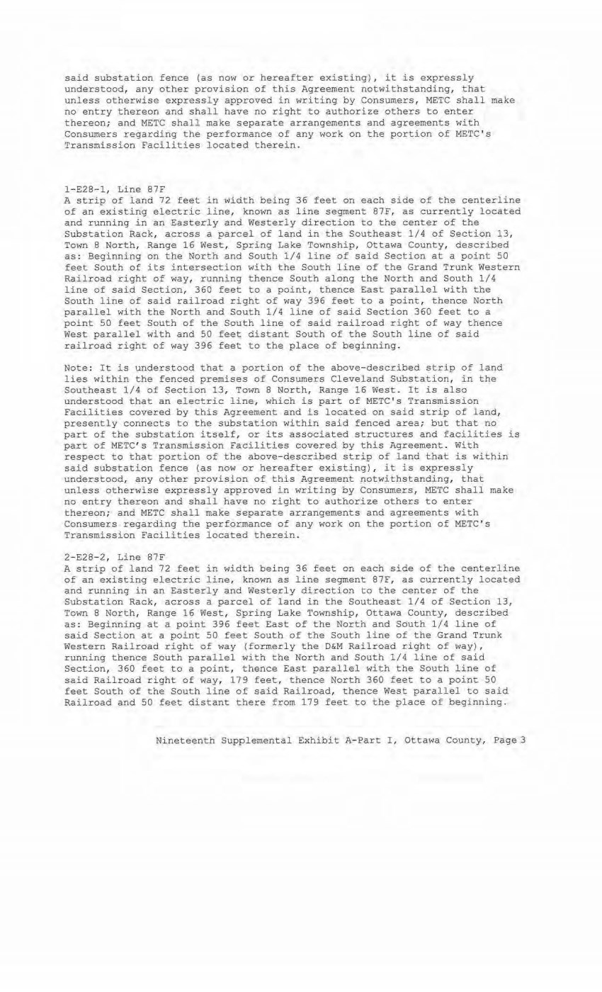
| said substation fence (as now or hereafter existing), it is expressly understood, any other provision of this Agreement notwithstanding, that unless otherwise expressly approved in writing by Consumers, METC shall make no entry thereon and shall have no right to authorize others to enter thereon; and METC shall make separate arrangements and agreements with Consumers regarding the performance of any work on the portion of METC ' s Transmission Facilities located therein. l-E28-l, Line 87F A strip of land 72 feet in widt h being 36 feet on each side of the centerline of an existing e l ectric line, known as line segment 87F, as currently located and running in an Easterly and Westerly direction to the center of the Substation Rack, across a parcel of land in the Southeast 1/4 of Section 13, Town 8 North, Range 16 West, Spring Lake Township, Ottawa County, described, as: Beginning on the North and South 1/4 line of said Section at a point 50 feet South of its intersection with the South line of the Grand Trunk Western Railroad right of way, running thence South along the North and South 1/4 l ine of said Section, 360 feet to a point, thence :East parallel with the South line of said railroad right of way 396 feet to a point, thence North parallel with the North and South 1/4 line of said Section 360 feet to a point 50 feet South of the South line of said railroad right of way thence West parallel with and 50 feet distant South of the South line of said railroad right of way 396 feet to the place of beginning. Note : It is understood that a portion of the above-described strip of land lies within the fenced premises of Consumers Cleveland Substation, in the Southeast 1/4 of Secti on 13, Town 8 North, Range 16 West. It is also understood that an electric line, which is part of METC ' s Transmission Facilit ies covered by this Agreement and is located on said strip of land, presently connects to the substation within said fenced area; but that no part of the substation itself, or its associated structures and facilities is part of METC's Transmission Facilities covered by this Agreement . With respect to that portion of the above- described strip of land that is within said substation fence (as now or hereafter existing) , it is expressly understood, any other provision of this Agreement notwithstanding, that unless otherwise expressly approved in writing by Consumers, METC shall make no entry thereon and shall have no right to authorize others to enter thereon; and METC shall make separate arrangements and agreements with Consumers regarding the performance of any work on the portion of METC ' s Transmission Facilities located therein. 2- E28- 2, Line 87F A strip of land 72 feet in width being 36 feet on each side of the centerline of an existing electric line, known as line segment 87F, as currentl y located and running in .;i.n Easterly and Westerl y direction to the center of the Substation Rack, across a parcel of land in the Southeast 1/4 of Section 13, 'I'own 8 North, Range 16 West, Spring Lake Township, Ottawa County, described as : Beginni ng at a point 396 feet East of the North and South 1/4 line of said Section at a point 50 feet South of the South line of the Grand Trunk Western Railroad right of way (formerl y the D&M Rai lroad right of way), running thence South parallel with the North and South 1/4 line of said Section, 360 feet to a point, thence East parallel with the South line of said Railroad right of way, 1 79 feet, thence North 360 feet to a point 50 feet South of the South line of said Railroad, thence West parallel to said Railroad and 50 feet distant there from 1 79 feet to the p l ace 0£ beginning. Ni neteenth Supplemental Exhibit A-Part I, Otta~a County, Page3 |
| Note: It is understood that a portion of the above-described strip of land lies within the fenced premises of Consumers Cleveland Substation, in the Southeast 1 /4 of Section 13, Town 8 North, Range 16 West. It is also understood that an electric line, which is part of METC ' s Transmission Facilities covered by this Agreement and is located on said strip of land, presently connects to the substation within said fenced area; but that no part of the substation itself, or i ts associated structures and facilities is part of METC's Transmission Facilities covered by this Agreement. With respect to that portion of the above-described strip of land that is within said substation fence (as now or hereafter existing), it is expressly understood, any other provision of this Agreement notwithstandi ng, that unless otherwise expressly approved in writing by Consumers, METC shall make no entry thereon and shall have no right to authorize others to enter thereon; and METC shall make separate arrangements and agreements with Consumers regarding the performance of any work o~ the portion of METC ' s Transmission facilities located therein. Nineteenth Supplemental Exhibit A-Part I, Ottawa County, Page4 |
| File Ref. Granter Grant-ee NI NETEENTI{ SUPPLEMENTAL EXHIBI'l' A - PART II OTTAWA COUNTY Date of Inst. Liber/Page Doc Series NONE Town/Range/Section Plat Nineteenth Suppl emental Exhibit A-Part II, Otta wa County, Page 1 |

| CE Ref . Li.cense/Lessor NINETEENTH SUPPLEME~TAL EXHIBIT A - PART III OTTAWA COUNTY Licensee/Lessee Date of Instrument NONE Title of Instrument Town/Range Section Nineteenth Supplemental Exhibit A-Part III, Ottawa County~ Page 1 |
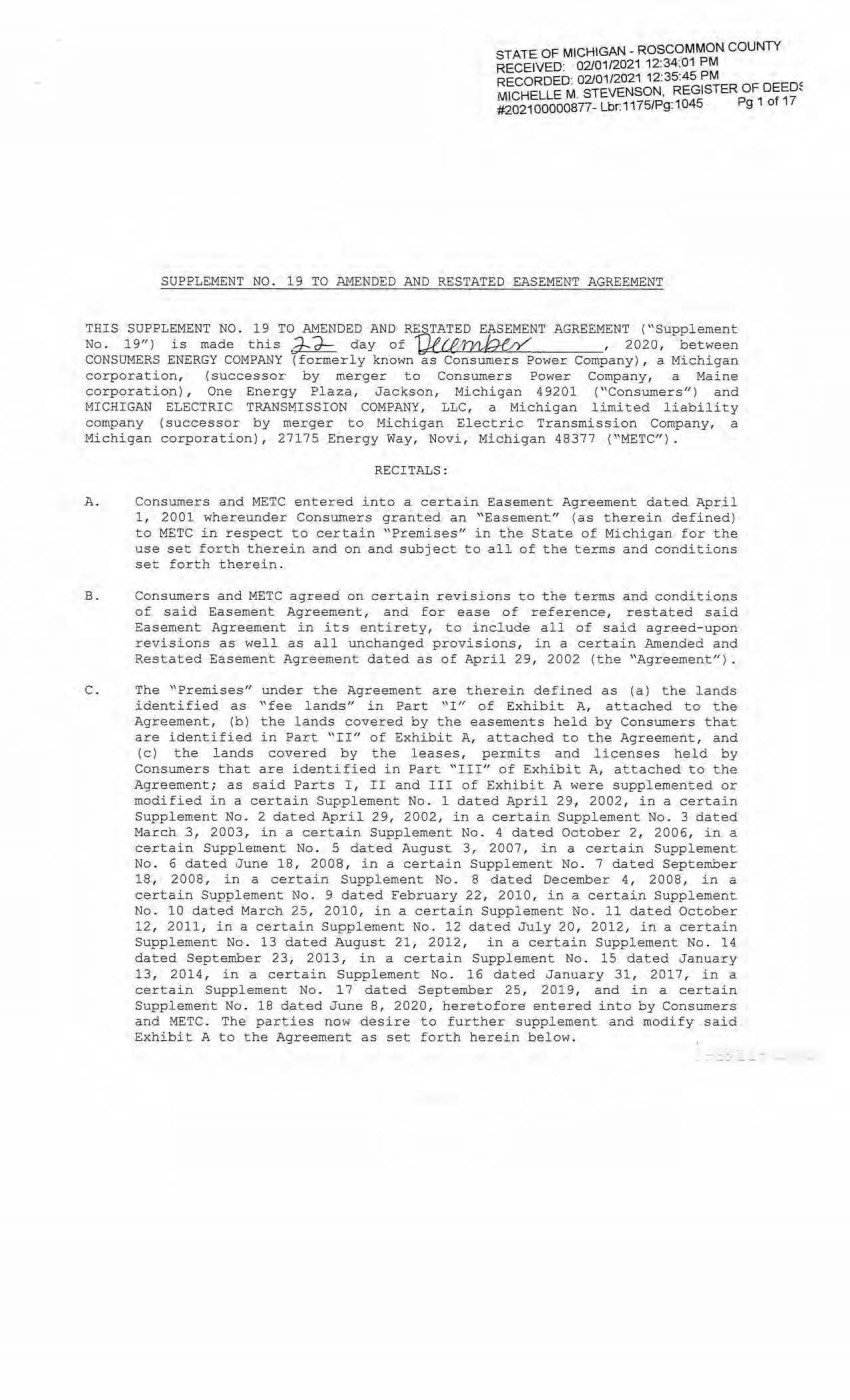
| STATE OF MICHIGAN- ROSCOMMON COUNTY RECEIVED: 02/01/2021 12:34:01 PM RECORDED· 02/01/2021 12:35:45 PM MICHELLE M . STEVENSON, REGISTER OF OEEm #202100000877- Lbr.1175/Pg:1045 Pg 1 of 17 SUPPLEMENT NO. 19 TO AMENDED AND RESTATED EASEMENT AGREEMENT TRI S SUPPLEMENT NO . 19 TO AMENDED AND RESTATED EASEMENT AGREEMENT ("Supplement No. 19") is made thls ~ day of '0£1'..fJJ~ , 2020, between CONSUMERS ENERGY COMPANY (formerly known as Consumers Power Company) , a Michigan corporation, (successor by merger to Consumer s Power Company, a Maine corporation) , One Energy Plaza, Jackson, Michigan 49201 ("Consumers") and MICHIGAN ELECTRIC TRANSMISSION COMPANY , LLC, a Michigan limited liability company (successor by merger to Michigan Electric Transmission Company, a Michigan corporation), 27175 Energy Way, Novi, Michi gan 48377 ("METC") . RECITALS: A . Consumers and METC entered into a certain Easement Agreement dated April 1 , 2001 whereunder Consumers granted an "Basement" ( as thei:ein defined) to METC in respect to certain " Premises" in t h e State of Mic higan for the use set forth t herei n and on and subject to all of the terms and conditions set forth therein. B. Consumers and ~.tETC agreed on certain revisions to the ~erms and conditions of said Easement Agreement, and for ease of refe.rence, restated said Easement Agreement in its entirety, to include all of said agreed- upon revisions as well as all unchanged provisions, in a certain Amended and Restated Easement Agreement dated as of April 29, 2002 (the "Agreement"). C. The "Premises" under the Agreement are therein defined as (a) the lands identified as "fee lands" in Part "I'' of Exhibit A, attached to the Agreement, (b) the lands covered by the easements held by Consumers that are identified in Part ''II" of Exhibit A, attached to the Agreement, and (c) the lands covered by the l e a ses, permits a nd l i censes held by Consumers that are identified in Part " III'' of Ex hibit A, attached to the Agreement; as said Parts I , II and III of Exhibit A were supplemented or modified in a certain Supplement No . 1 dated April 29, 2002, in a certain Supplement No. 2 dated April 29, 2002, in a certain Supplement No. 3 dated March 3 , 2003, in a certc,1.in Supplement No . 4. dated October 2 , 2006, in a certain Supplement No. 5 dated August 3, 2007 , ~n a certain Supplement No. 6 da ted June 18, 2008 , in a certain Supplement No. 7 dated September 18, 2008 , in a certain Supplement No. 8 dated December 4, 2008, in a certain Supplement No. 9 dated February 22, 2010, in a certain Supplement No. 10 dated March 25, 2010, in a cert ain Supplement No. 11 dated October 12, 2011, in a certain Supplement No. 12 dated July 20, 2012, in a certain Supplement No . 13 dated August 21, 2012, in a certain Supplement No . 14 dated September 23, 2013 , in a certain Supplement No . 15 dated January 13, 2014, in a certain Supplement No . 16 dated J anuary 31, 2017, i n a certain Supplement No. 17 dated September 25, 2019, and in a certain Supplement No . 18 dated June 8 , 2020, heretofore entere d into by Consumers and METC . The parties now desire to further supplement and modify said Exhibit A to the Agreement as set forth herein bel ow. |
| 2 D. References, in regard to historical matters, to ''METC" in the foregoing recitals will be deemed to mean METC's predecessor, Michigan Electric Transmission Company, a Michigan corporation, where relevant. NOW, THEREFORE , for good and valuable consideration, the receipt of which is acknowledged, Consumers and METC agree as follows: 1. Exhibit A to the Agreement, as heretofore supplemented and/or modified, is hereby further supplemented and modified as set forth in "Nineteenth Suppl emental Exhibit A", attached hereto. It is expressl y understood that any lands, easements, or leases/permits/licenses that are indicated in said attached Nineteenth Supplemental Exhibit A as being added are, on and subj ect to the terms and conditions of the Agreement (as supplemented and amended by this Supplement No . 19), hereby deemed added to Part I, Part II and Part III, ..respectively, of Exhibit A to the Agreement . However, it is further expressly understood that in addition to all rights granted t o METC by the Agreement, METC shall have the following rights as t o the lands identified as "Consumers Energy Equipment / Joint Asset Area Easement" on the accompanying NINETEENTH Supplemental Exhibit A sheets, inclusive of Parts I , II and III, which rights are also subject to the terms of the Parties' Amended and Restated Transmission Interconnection Agreement (the "DTIA"): (a) the right to maintain any and a l l existing components 0£ the Transmission System, as defined in the DTIA, and wiring or conduit connections for the same that currently exist over, on or under these lands; and (b)the right to connect its currently sited or future approved wiring or conduits for communications, station power, or control., operating at 600 volts or l ess, and any Jointly Owned Assets, as defined in the DTIA, over, on or under these lands . It is also expressly understood that, with respect to any l ands, easements, or leases/permi ts/l icenses now covered by Part I, Part I I or Part III of Exhibit A that are indicated i n said attached Nineteenth Supplemental Exhibit A as being deleted, the Easement is hereby deemed RELEASED with respect t hereto and the Agreement shall hereafter no longer apply thereto (provided, however, that all rights and obligations under tbe Agreement with respect to periods pri or to the da.te of this Supplement No. 1 9 shall remain unaffected) . 2. It is expressly underst ood and agreed that in respect to the additional Pi:emises represented by the land(s), easement(s), lease(s), permit(s) and/or license (s) that are added to Part I, Part II and Part III of Exhibit A to the Agreement pursuant to this Supplement No . 19 (the "Additional Premises"): (a) All references to "Commencement Date" that are found in Article 1 ( "Grant of Easement") , Article 2 ("Term"), Article 5 ("Additions/Alterations"), Article 6 ("Consumers' Reserved Rights to Use the Premises and Transmission Facili ties"), Article 7 ("METC Approval of Compatible Uses" ) , Articl e 8 ("Certain Obligations of Consumers and Authorized Users; Etc.") and Article 14 ("Environmental Matters'') of t he Agreement shall be deemed to mean t he date of this Supplement No . 19 and not the dat e that is identified in the Agreement as the "Commencement Date0 • |
| 3 (b) Except as expressl y otherwise indicated in the immediately following sentence, all references to "Restated Agreement Date" that are found in Article 1 ("Grant of Easement" ) , Article 6 ("Consumers' Reserved Rights to Use the Premises and Transmission Facilities" ), and Article 12 ("Compliance With Applicable Laws") of the Agreement shall also be deemed to mean the date of this Supplement No. 19 and not the date that is identified in the Agreement as the "Restated Agreement Date". Notwi thstanding the foregoing: (i) the preceding sentence does not apply to the purely historical statement in clause "(c) " of Section 1. 2 of the Agreement that Trans- Elect, Inc. is "an affiliate of the entity which has become METC's parent company as of the Restated Agreement Date"; and (ii) the parenthetical in the first sentence of the first paragraph of Section 7.1 of t he Agr eement reading "(see below regarding a certain period prior to the Restated Agreement Date)", along with the fourth paragraph of s a id Section 7 . 1 reading "Consumers shall submit to METC within twenty (20) days of t he Re stated Agreement Da te a list of all material Compatible Uses other than addi tions or modifications to Distribution Facilities t hat have been authorized between February 1 , 2001 and the Restated Agreement Date for METC ' s approval per the METC Compat:ible Use approval process described in this Sect ion 7 . 1 .", both referred to a one- time historical matter and have no application to the Addi tional Premises or any other further effect or application whatsoever. 3. In addition to t he o r i ginal Transmission Facil ities and Additions/Alterations thereto as referred to in Recital "A" of the Agreement, it is underst ood that such electric Transmission towers, pole structures, poles, crossarms, wires, cables, conduits, guys, anchors, transformers, ins ulators and/or other: fixtures and equipment as may be owned by M ETC and located on the Additiona l Premises as of the date of this Supplement No . 19, and future Addit ions/Alterna t i o ns made thereto on and subject t o the terms and conditions of the Agreement, are included in the "Transmission Facilities" under the Agreement. Note: This Supplement No. 19 will not be recorded in all counties in which the Agreement itself, or Supplements Nos . 1 through 18, may have been recorded. This Supplement No. 19 (as were each of Supplements Nos. 1 through 18) , wi l l be recorded only in the county(ies) in which relevant Premises are located; being, in the case of this Supplement No. 19, only t he following: |

| Allegan County Antrim County Barry County Bay County Calhoun County Charl evoix County Clinton County Crawford County Emmet County Genesee County Gladwin County Grand Traverse County Gratiot County Ingham County Ionia County Isabella County Jackson County Kalkaska County Kent County Leelanau County Lenawee County Manistee County Midland County Montcalm County Muskegon County Oceana County Ogemaw County Ottawa County Roscommon County Saginaw County Shiawassee County St. Joseph County Washtenaw County Wexford County 4 The fact that this Supplement No. 19 will be recorded only in the particular county(ies) identified above will in no way restrict, l imit or otherwise affect the interpretation, application or enforcement of the Agreement; and the t erms and conditions of the Agreement shall at all times be read, interpreted and applied in the manner provided for in Section 24.6 of the Agreement. |
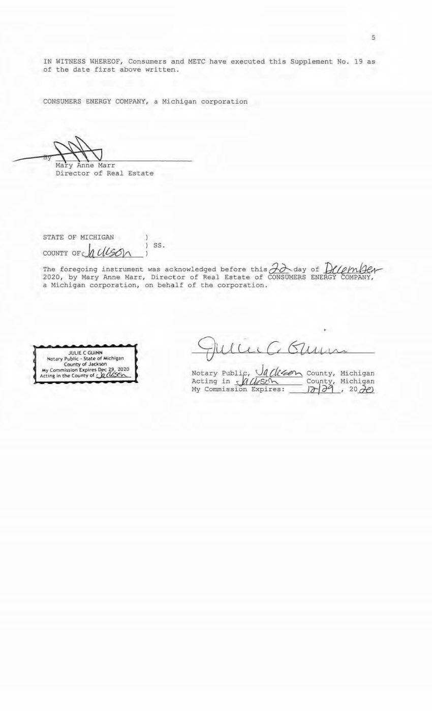
| --- 5 IN WITNESS WHEREOF, Conswners and METC have executed thi s Supplement No. 19 as of the date first above written. CONSUMERS ENERGY COMPANY, a Michigan corporation oy~~SJ Mary Anne Marr Director of Real Estate STATE OF MICHIGAN COUNTY OFJa Ul--561/\ ss. The foregoing instrument was acknowledged before thisd:c1'---day of fd((e/lY\,,,/~ 2020, by Mary Anne Marr, Director of Real Estate of CONSUMERS ENERGY COMPANY, a Michigan corporation, on behalf 0£ the corporation. JULI£ C GUINN No:ary Public • State of Michigan County of Jackson My Commission Expires Dec 2!J. 2020 Acting in the County of r lq {£4::¢:h. Notary Publi,c, ~)4 ck~ Acting i n ~ t::f f}tS6\----. My Comrnissi;;i.; Expires: County, Michigan County, Michigan _ __,1 ...... 7t:-+-./-'-o4 _._, 2 O ~ |
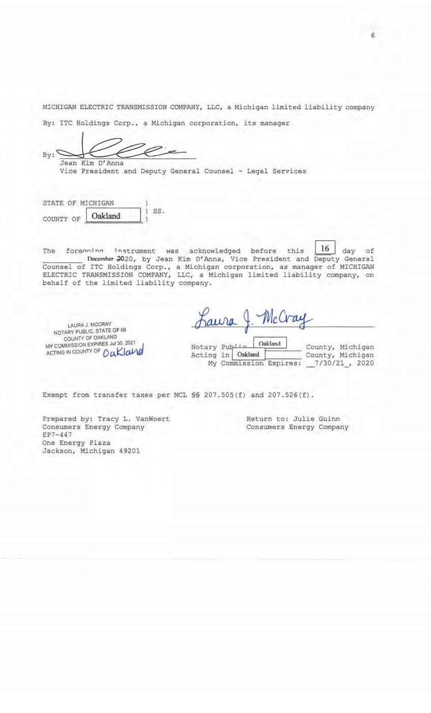
| 6 MICHIGAN ELECTRIC TRANSMISSION COMPANY, LLC, a Michigan limited liability company By: ITC Holdings Corp. , a Michigan corporation, its manager By: Jean Kim D'Anna Vice President and Deputy General Counsel - Legal Services STATE OF MICHIGAN COUNTY OF I Oakland ss. The for:enni nn i n,c,trument was acknowledged before this ~ day of Oecemher .;)020, by Jean Kim D' Anna, Vice President and Deputy General Counsel of ITC Holdings Corp. , a Michigan corporation, as manager of MICHIGAN ELECTRIC TRANSMISSION COMPANY, LLC, a Michigan limited liability company, on behalf of the limited liability company. LAURA J, MCCRAY NOTARY PUBLIC. STATE OF Ml COUNTY OF OAKLAND MY COMMISSION EXPIRES Jul :JO, 2021. J ACTING 1 N couNTV oF D 0J (l ll,V\l.i¥ Notary PWJ>;c I O""lmrl I County, Michigan Acting in lL __ O~akl_ ·_an~a_,1-=----:---- County, Michigan My Commission E&pires: _7/30/21_, 2020 Exempt from transfer taxes per MCL §§ 207 . SOS(f) and 207.526(f) . Prepared by: Tracy L. Vanwoert Consumers Energy Company EP7-447 One Energy Plaza Jackson, Michigan 49201 Return to: Julie Guinn Consumers Energy Company |

| THE ATTACHED COPY OF THE NINETEENTH SUPPLEMENTAL EXHIBIT A THAT WAS PREPARED FOR RECORDATION IN ROSCOMMON COUNTY, MICHIGAN, AND CONTAINS THE PORTIONS OF EACH OF PARTS I, II, AND III OF THE NINETEENTH SUPPLEMENT EXHIBIT A THAT RELATE TO PREMISES IN THAT COONTY ONLY . SEE SECTION 24.6 OF THE AGREEMENT. 7 |
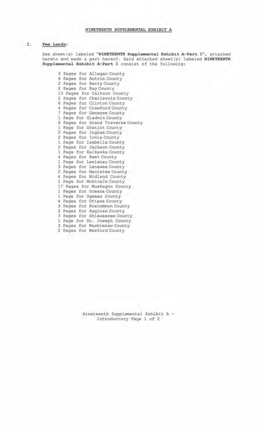
| NINETEENTH SUPPLEMENTAL EXHIBIT A I _ Fee Lands : See sheet(s) labeled "NINETEENTH Supplemental Exhib:it A-Part I ", attached hereto and made a part hereof. Said attached sheet(s) labeled NINETEENTH Supplemental Exhibit A-Part I consist of the fol lowing: 3 Pages for Allegan County 6 Pages for Antrim County 2 Pages for Barry County 2 Pages f or Bay Count y 13 Pages for Calhoun County 2 Pages for Cha rlevoix County 6 Pages for Clinton County 4 Pages for Crawford County 7 Pages for Genesee Count y 1 Page for GladwinCounty 6 Pages for Grand TraverseCounty 1 Page for Gratiot County 2 Pages for Ingham County 2 Pages for Ionia County 1 Page for Isabella County 2 Pages for Jackson County l Page for Kal ka ska.County 4 Pa ges for Kent County 1 Page for Leelanau County 3 Pages for Lenawee County 2 Pages for M ani stee Count y 4 Pages for M i d l and County 1 Page for Montcal m County 17 Pages for Muskegon County 1 Pages for Oceana County 1 Page for Ogemaw County 4 Pages for Ottawa County 3 Pages for Ros common County 2 Page s for Sc;J.gi naw County 3 Pages for Shiawassee County 1 Page for St . Joseph County 3 Pages for Washtenaw County 2 Pages for Wexford County Nineteenth Su ppl emental Exhibit A - Intr oduct ory Page 1 of 2 |
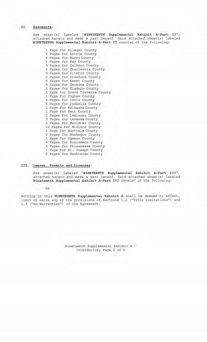
| II. Easements: See sheet(s) labeled " NINETEENTH Supplemental Exhibi t A-Part II", attached hereto and made a part h ereof. Said attached sheet(s) labeled NINETEENTH Supplemental Exhibit A-Part II consist of the following: 1 Page for Allegan County 5 Pages for Antrim County 4 Pages for Barry County 1 Pages for Bay County 9 Pages for Calhoun County 4 Pages for Charlevoix County 9 Pages for Clinton County 2 Pages for Crawford County 6 Pages for Emmet County 8 Pages for Genesee County 3 Pages for Gladwin County 1 Page for Grand Traverse County 1 Page for Ingham County 6 Pages for Ionia County 5 Pages for Isabella County 1 Page for Kalkaska County 1 Page for Kent County 2 Pages for Leel anau County 3 Pages for Lenawee County 3 Pages for Manistee County 12 Pages for Midland County 1 Page for Montcalm County 5 Pages for Muskegon County l Page for Ogemaw County 4 Pages for Roscommon County 2 Pages for Shiawassee County 1 Page for St. Joseph County 2 Pages for Washtenaw County III. Leases, Permits and Licenses: See sheet ( s) labeled "NINETEENTH Supplemental Exhibit A-Part III", attached hereto and made a part hereof. Said attached sheet(s) labeled Nineteenth Supplemental Exhibit A-Part III consist of the following: NA Nothing in this NINETEENTH Supplemental Exhibit A shall be deemed to affect, limit or waive any of the provisions of Sections 1.2 ("Title Limitations") and l . 3 ("No Warranties'') of the Agreement. Nineteenth Supplemental Exhibit A - Introductory Page 2 of 2 |
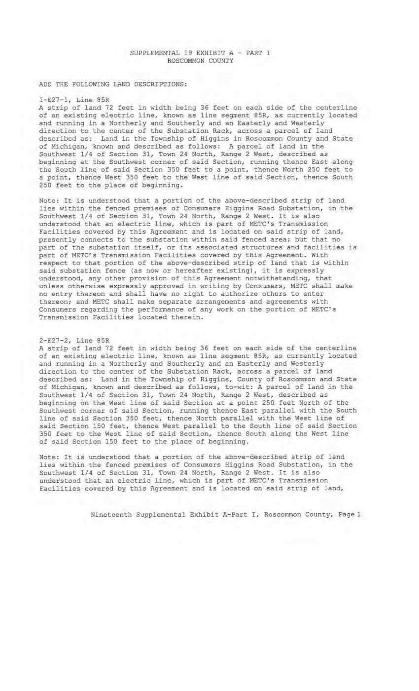
| SUPPLEMENTAL 19 EXHIBIT A - PART I ROSCOMMON COUNTY ADD THE FOLLOWING LAND DESCRIPTIONS : l~E27- l , Line 85R A strip of land 72 feet in width being 36 feet on each side of the centerline of an existing electric line, kpown as line segment 85R, as currently located and running in a Northerly and Southerly and an Easterl y and Westerly direction to the center of the Substation Rack, across a parcel of land described as: Land in the Township of Higgins in Roscommon County and State of Michigan, known and described as follows: A parcel of land in the Southwest 1/4 of Section 31, Town 24 North, Range 2 West, described as begi nning at the Southwest corner of said Section, running thence East along the South line of said Section 350 feet to a point, thence North 250 feet to a point, thence West 350 feet to the West line of said Section, thence South 250 feet to the place of beginning. Note: It is understood that a portion of the above- described strip of land lies within the fenced premises of Consumers Higgins Road Substation, in the Southwest 1/4 of Section 31, Town 24 North, Range 2 West. It is a l so understood that an electric line, which is part of METC ' s Transmission Facilities covered by this Agreement and is located on said strip of land, presently connects to the substation within said fenced area; but t hat no part of the substation itself, or i ts associated structures and facilities is part of METC's Transmission Facilities covered by this Agreement. With respect to that portion of the above-described strip of land that is within said substation fence (as now OI hereafter existing), it is expressly understood, any other provision of this Agreement notwithstanding, that unless otherwise expressly approved in writing by Consumers, METC shall make no entry thereon and shall have no right to authorize others to enter thereon; and METC shall make separate arrangements and agreements with Consumers regarding the performance of any work on the portion of METC's Transmission Facilities located therein. 2-E27-2, Line 85R A strip of land 72 feet in width being 36 feet on each side of the centerline of an existing electric l ine, known as l ine segment 85R, as currently located and running in a Northerly and Southerly and an Easterly and Westerly direction to the center of the Substation Rack, across a parcel of land described as: Land in the Township of Higgins, County of Roscommon and State of Michigan, known and described as follows, to-wit: A parcel of land in the Southwest 1/4 of Section 31, Town 24 North, Range 2 West, described as beginning on the West line of said Section at a point 250 feet North of the Southwest corner of said Section, running thence East parallel with the South line of said Section 350 feet, thence North parallei with the West line of said Section 150 feet, thence West parallel to the South line of said Section 350 feet to the West line of said Section, thence South along the West line of said Section 150 feet to the place of beginning. Note: It is understood that a portion of the above- described strip of land lies within the fenced premises of Consumers Higgins Road Substation, in the Southwest 1/4 of Section 31, Town 24 North, Range 2 West. It is also understood that an electric line, which is part of METC's Transmission facilities covered by this Agreement and is located on said strip of land, Nineteenth Supplemental Exhibit A-Part I, Roscommon County, Pagel |
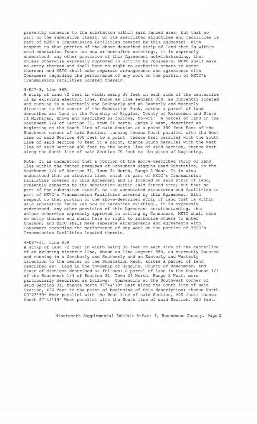
| presently connects to the substation within said fenced area; but that no part of the substation itself, or its associated structures and facilities is part of METC ' s Transmission Facilities covered by this Agreement. With respect to that portion of the above-described strip of land that is within said substation fence (as now or hereafter existing), i t is expressly understood, any other provision of this Agreement notwithstanding, that unless otherwise expressly approved in writing by Consumers , METC shall make no entry thereon and shall have no right to authorize others to enter thereon; and METC shall make separate arrangements and agr eements with Consumers regar ding the performance of any work on the portion of METC's Transmission Facilities located therein. 3-E27-3, Line 85R A strip of land 72 feet in width being 36 feet on each side of the centerline of an existing electric line, known as line segment 85R, as currently located and running in a Northerly and Southerly and an Easterly and Westerly direction to the center of the Substation Rack, across a parcel of land described as: Land in the Township of Higgins, County of Roscommon and State of Michigan, known and described as follows, to- wit: A parcel of land in the Southwest 1/4 of Section 31, Town 24 North, Range 2 West, described as beginn ing on t he South line of said Section at a point 350 feet East of the Southwest corner of sai d Section, running thence North paral lel with the West line of said Section 400 feet to a point, thence East parallel with the South line of said Se ction 70 feet to a point, thence South parall el with the West line of said Section 400 feet to the South line of said Section, thence West along the South line of said Section 70 feet to the place of beginning. Note: It is under stood that a portion of the above-described strip of land lies within the fenced premises of Consumers Higgins Road Substation, in the Southwest 1/4 of Section 31, Town 24 North, Range 2 West . It is also understood that an electric line, which is part of METC's Transmission Faci lities covered by this Agreement and is located on said strip of land, presently connects to the substation within said fenced area; but that no part of the substa t i on itself, or i t s associated structures and facilities is part of METC ' s Transmission Facilities covered by this Agreement . With respect to that portion of the above-descr ibed strip of land that is within said substation fence (as now or hereafter existing), it is expressly understood, any other provision of this Agreement notwithstanding, that unless otherwise expressl y approved in writing by Consumers, METC shal l make no entry thereon and shall have no r i ght to authorize others to enter thereon; and METC shall make separate arrangements and agreements with Consumers regarding the performance of any work on the portion of METC ' s Transmission Facilities located therein. 4- E27-11, Line 85R A strip of land 72 feet in width being 36 feet on each side of the centerline of an existing electric line, known as l ine segment 85R, as currently located and running in a Northerly and Southerly and an Easterly and Westerly direction to the center of the Substation Rack, across a parcel of land described as: Land in the Township of Higgins, County of Roscommon, and State of Michigan described as follows : A parcel of land in the Southwest 1/4 of the Southwest 1/4 of Section 31, Town 24 North, Range 2 West, more particularly described as follows : Commencing at the Southwest corner of said Section 31; thence North 87°44 ' 19" East along the South line of said Section, 420 feet to t he point of beginning of this description; thence North 00°23' 53" West parallel with the West line of said Section, 400 feet ; thence South 87°44'19u West parallel with the South line of said Section, 320 feet; Nineteenth Supplemental Ex.hibi t A- Part I , Roscormnon County, Page 2 |
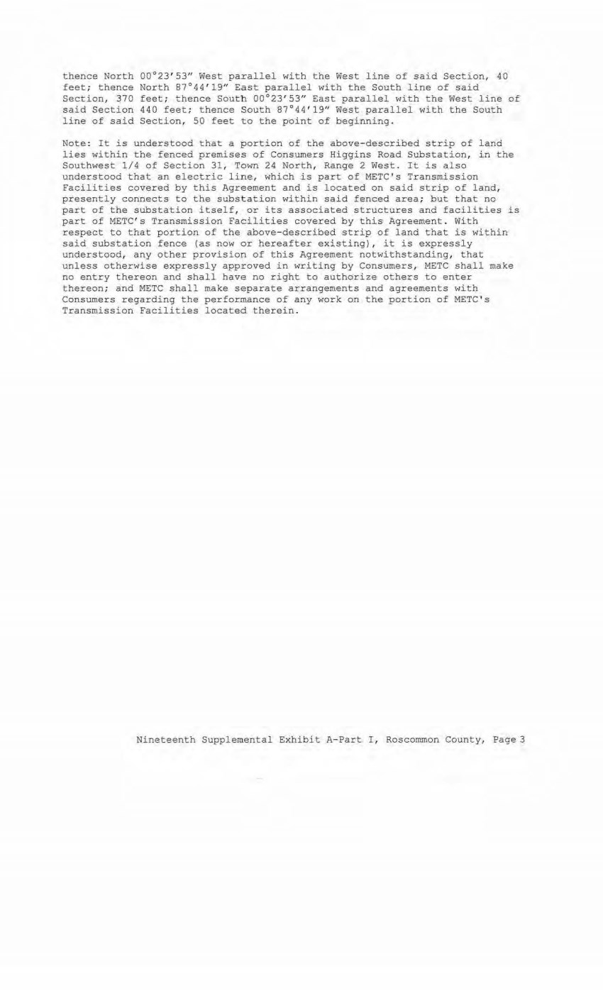
| thence North 00°23' 53" West parallel with the West line of said Section, 40 feet; thence North 87°44'1911 East parallel with the South line of said Section, 370 feet ; thence South 00°23'53" East parallel with the West line of said Section 440 feet; thence South 87°44 ' 19" West parallel with the South line of said Section, 50 feet to the point of beginning. Note: It is understood that a portion of the above-described strip of land lies within the fenced premises of Consumers Higgins Road Substation, in the Southwest 1/4 of Section 31, Town 24 North, Range 2 West. It is also understood that an electric line, which is part of METC ' s Transmission Facilities covered by this Agreement and is located on said strip of land, presently connects to the substation within said fenced area; but that no part of the substation itself, or its associated structures and facilities is part of METC ' s Transmission Facilities covered by this Agreement. With respect to that portion of the above-described strip of land that is within said substation fence (as now or hereafter existing), i t is expressly understood, any other provision of this Agreement notwithstanding, that unless otherwise expressly approved in writing by Consumersr METC shall make no entry thereon and shall have no right to authorize others to enter thereon; and METC shall make separate arrangements and agreements with Consumers regarding the performance of any work on the porti on of METC's Transmission Facilities located therein. Nineteenth Supplemental Exhibit A-Part I , Roscommon County, Page 3 |
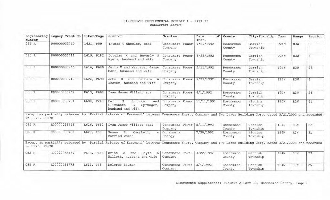
| Engineering Legacy Tract No Liber/Page Number 085 R R00000033710 L621, P59 085 R R00000033711 L619, Pl82 085 R R00000033766 L616, P680 085 R R00000033712 L624, P698 085 R R00000033767 P613, P668 085 R R00000033701 L608, P248 Except as partially released by 'Partial in L976, P2578 085 R R00000033768 L616, P682 085 R R00000033702 L627, PS0 Except as partially released by 'Partial in L976, P2578 085 R R00000033769 P613, P666 085 R R00000033773 L613, P48 NINETEENTH SUPPLEMENTAL EXHIBIT A - PART II ROSCOMMON COUNTY Granter Grantee Date of County City/Township Town Range Section Inst. Thomas T Wheeler, etal Consumers Power 7/29/1992 Roscommon Gerrish T24N R3W 3 Company County Township Douglas K and Beverly J Consumers Power 6/25/1992 Roscommon Gerrish T24N R3W 3 Myers, husband and wife Company County Township Jerry V and M argaret Jayne Consumers Power 5/11/1992 Roscommon Gerrish T24N R3W 23 Manz, husband and wife Company County Township John H and Barbara A Consumers Power 7/29/1992 Roscommon Gerrish T24N R3W 4 Jester, husband and wife Company County Township Ivan James Willett eta Consumers Power 4/1/1992 Roscommon Gerrish T24N R3W 23 Company County Township Earl M. Sprunger and Consumers Power 11/11/1991 Roscommon Higgins T24N R2W 31 Elizabeth B. Sprunger, Company County Township husband and wife Release of Easement' between Consumers Energy Company and Two Lakes Building Corp, dated 3/21/2003 and recorded I van James Willett etal Consumers Power 5/11/1992 Roscommon Gerrish T24N R3W 23 Company County Township Susan E. Campbell, a Consumers 7/30/1992 Roscommon Higgins T24N R2W 31 married woman Energy County Township Release of Easement' bet ween Consumers Energy Company and Two Lakes Building Corp, dated 3/21/2003 and recorded Brian A and Gayle L Consumers Power 3/22/1992 Roscommon Gerrish T24N R3W 23 Willett, husband and wife Company County Township Dolores Bauman Consumers Power 3/4/1992 Roscommon Gerrish T24N R3W 25 Company County Township Nineteenth Supplemental Exhibit A-Part II, Roscommon County, Pagel |
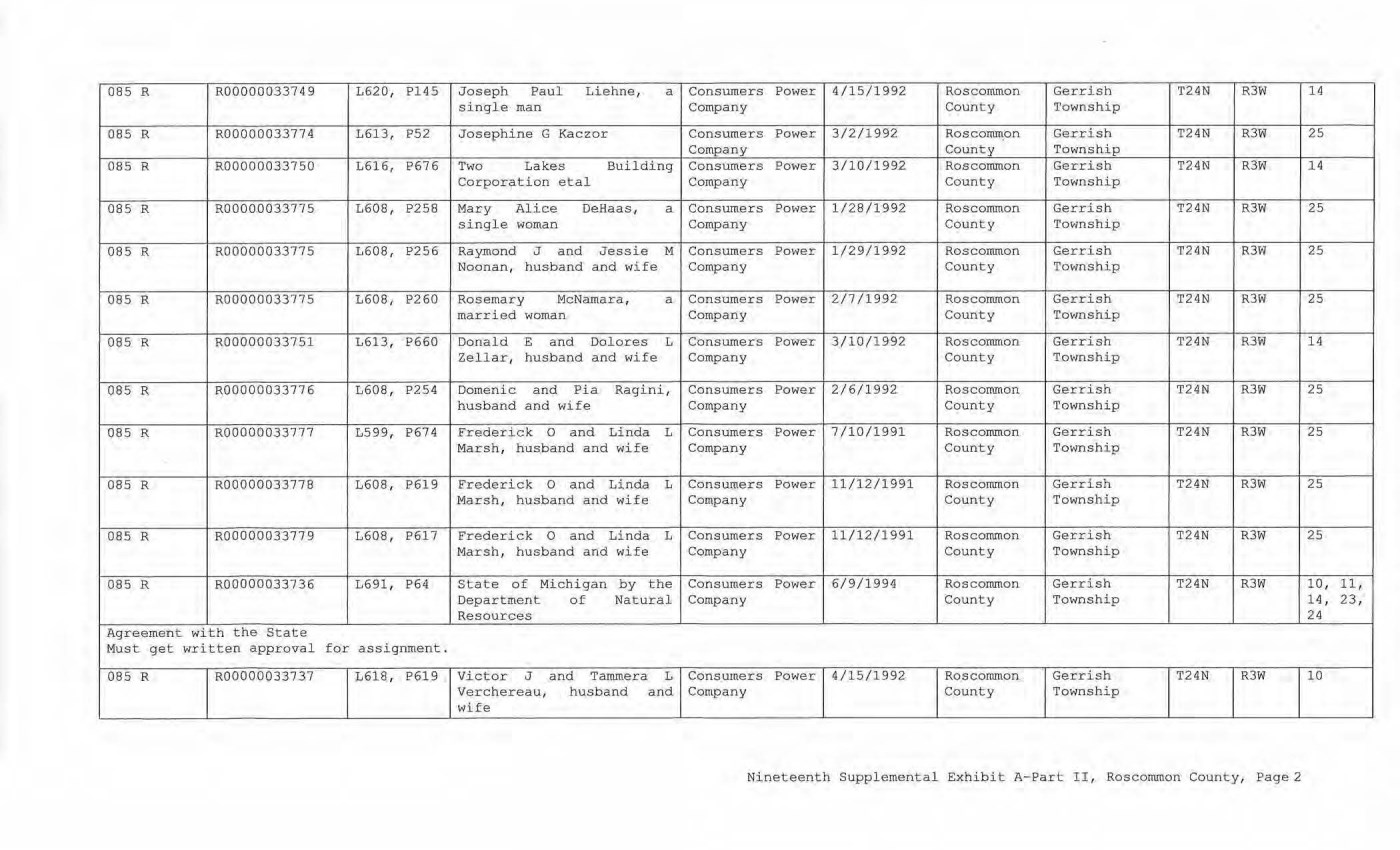
| 085 R R00000033749 L620, Pl45 Joseph Paul Liehne, a Consumers Power 4/15/1992 Roscommon Gerrish T24N R3W 14 single man Company County Township 085 R R00000033774 L613, P52 Josephine G Kaczor Consumers Power 3/2/1992 Roscommon Gerrish T24N R3W 25 Company Count y Townshi p 085 R R00000033750 L616, P676 Two Lakes Bui lding Consumers Powe r 3/10/1992 Roscommon Gerrish T24N R3W 14 Corporation e t al Company Count y Township 085 R R0 0000033775 L608 , P258 M ary Al ice DeHaas, a Consumers Power 1/28/1992 Roscommon Gerri sh T24N R3W 25 s i ngle woman Company County Town shi p 085 R R00000033775 L608 , P256 Raymond J and J essie M Consumers Power 1/29/1992 Roscommon Gerrish T24N R3W 25 Noonan, h usband and wife Company County Township 085 R R00000033775 L608, P260 Rosemary McNamara, a Con sumers Power 2/7/1992 Roscommon Gerrish T24N R3W 25 married woman Company County Township 085 R R00000033751 L613, P660 Donald E and Dol ores L Con sumers Power 3/10/1992 Roscommon Gerrish T24N R3W 14 Zellar1 husband a nd wi fe Com pany County Township 085 R R0 0000033776 L608, P254 Domenic and Pia Ragini, Consumers Power 2/6/1992 Roscommon Gerrish T24N R3W 25 husband and wife Com pany County Township 085 R R0 0000033777 L599, P674 Frederick 0 and Linda L Consumers Power 7/10/1 991 Roscommon Gerrish T24N R3W 25 Marsh, hu s band and wife Company County Township 085 R R0 0000033778 L608, P619 Frederick 0 and Linda L Consumers Power 11/12/1991 Roscommon Gerrish T24N R3W 25 Marsh, husband a nd wife Com pany County Township 085 R R0 0000033779 L608, P617 Frederick 0 and Linda L Consumers Power 11/ 12 / 1991 Roscommon Gerrish T24N R3W 25 Marsh, husband and wife Company County Townshi p 085 R R00000033736 L691, P64 State of Michigan by the Consumers Power 6/9/1994 Roscommon Gerrish T24N R3W 10, 11, Departme nt of Natural Company County Townshi p 14, 23, Resources 24 Agreement with the State Must get writ ten appr oval for assignment. 085 R ROOO OQ033737 L618 , P619 Victor J and Tammera L Consumers Power 4/1 5/1992 Roscommon Gerrish T24N R3W 10 Verchereau, hus band a nd Com pany County Townshi p wife Nineteenth Suppl emental Exhibit A-Part II, Roscommon County, Page2 |
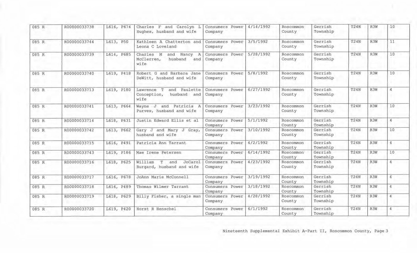
| 085 R R00000033738 L616, P674 Charles F and Carolyn L Consumers Power 4/14/1992 Roscommon Gerrish T24N R3W 10 Hughes, husband and wife Company County Township 085 R R00000033744 L613, P50 Kathleen A Chatterton and Consumers Power 3/5/1992 Roscommon Gerrish T24N R3W 11 Leona C Loveland Company County Township 085 R R00000033739 1614, P685 Charles M and Nancy A Consumers Power 5/28/1992 Roscommon Gerrish T24N R3W 10 McClerren, husband and Company County Township wife 085 R R00000033740 1619, P418 Robert. G and Barbara Jane Consumers Power 5/8/1992 Roscommon Gerrish T24N R3W 10 DeWitt, husband and wife Company County Township 085 R R00000033713 L619, Pl80 Lawrence T and Paulette Consumers Power 6/27/1992 Roscommon Gerrish T24N R3W 4 Conception, husband and Company . County Township wife 085 R R00000033741 1613, P664 Wayne J and Patricia A Consumers Power 3/23/1992 Roscommon Gerrish T24N R3W 10 Purves, husband a nd wife Company County Township 085 R R00000033714 1618, P631 Justin Edward Ellis et al Consumers Power 5/1/1992 Roscommon Gerrish T24N R3W 4 Company County Township 085 R R00000033742 1613, P662 Gary J and Mary J Gray, Consumers Power 3/10/1992 Roscommon Gerrish T24N R3W 10 husband and wife Company County Township 085 R R00000033715 1616, P491 Patricia Ann Tarrant Consumers Power 4/2/1992 Roscommon Gerrish T24N R3W 4 Company County Township 085 R R00000033743 1619, P186 Mae Irene E'etersen Consumers Power 6/14/l992 Roscommon Gerrish T24N R3W 10 Company County Township 085 R B:00000033716 1618, P625 William T and JoCarol Consumers Power 4 ./23/1992 Roscommon Gerrish T24N R3W 4 Burgard, husband and wife Company County Township 085 R R00000033717 L616, P678 JoAnn Marie M cConnell Consumers Power 3/19/1992 Roscorronon Gerrish T24N R3W 4 . Company County Township 085 R R00000033718 L616, P489 Thomas Wilmer Tarrant Consumers Power 3/18/1992 Roscommon Gerrish T24N R3W 4 Company County Township 085 R R00000033719 L618, P629 Billy Fisher, a single man Consumers Power 4/28/1992 Roscommon Gerrish T24N R3W 4 Company County Township 085 R R00000033720 L619, P420 Horst R Henschel Consumers Power 6/1/1992 Roscommon Gerrish T24N R3W 4 Company County Township Nineteenth Supplemental Exhibit A-Part II, Roscommon County, Page 3 |
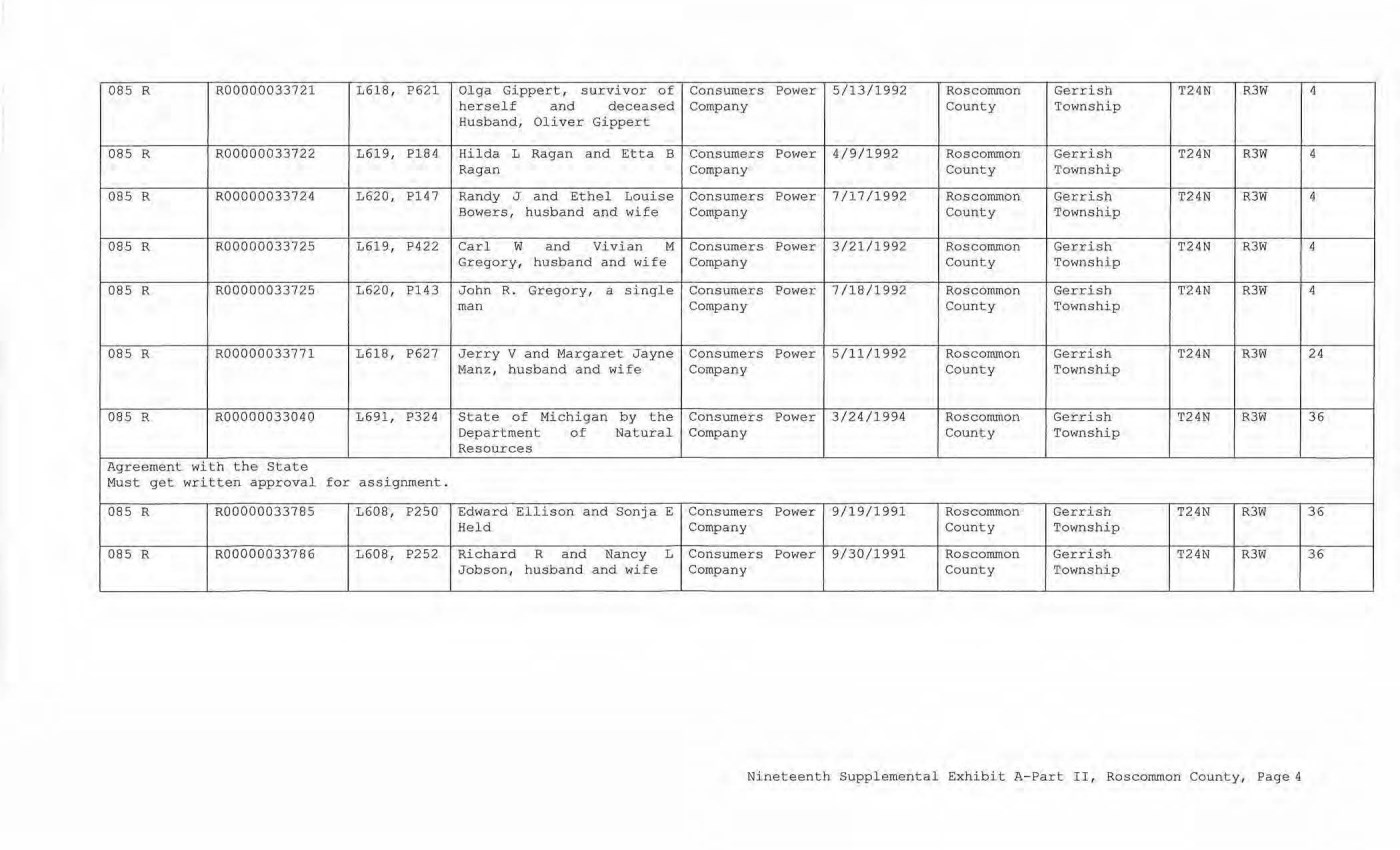
| 085 R R00000033721 L618 1 P621 Olga Gippert, survivor of Consumers Power 5/13/1 992 Roscommon Gerrish T24N R3W 4 herself and deceased Company County Township Husband, Oliver Gippert 085 R R00000033722 1619, Pl84 Hilda L Ragan and Etta B Consumers Power 4/9/1992 Roscommo n Gerrish T24N R3W 4 Ragan Company County Township 085 R R00000033724 1620, P147 Randy J and Ethel Louise Consumers Power 7/17/1992 Roscommon Gerrish T24N R3W 4 Bowers, husband and wife Company County Township OBS R R00000033725 L619, P422 Carl w and Vivian M Consumers Power 3/21/1992 Roscommon Gerrish T24N R3W 4 Gregory, husband and wife Company County Township 085 R R00000033725 1620, Pl 43 John R . Gregory, a single Consumers Power 7/18/1 992 Roscommon Gerrish T24N R3W 4 man Company County Townshi p 085 R R00000033771 L618 , P627 Jerry V and Margaret Jayne Consumers Power 5/11/1 992 Roscommon Gerrish T24N R3W 2 4 Manz, hu sband and wife Company County Townshi p 085 R R00000033040 L691, P324 State of Michigan by the Consumers Power 3/24/1994 Roscommon Gerrish T24N R3W 36 Department of Natural Company County Township Resources Agreement with the State Must get written approval for assignment. 085 R R00000033785 L608, P250 Edward Ellison and Sonja E Consumers Power 9/19/1991 Roscommon Gerrish T24N R3W 36 Hel d Company County Township 085 R R00000033786 L608, P252 Richard R and Nancy L Consumers Power 9/30/1991 Roscommon Gerrish T24N R3W 36 Jobson, h usband and wife Company County Township Nineteenth Supplemental Exhibit A- Part I I, Roscommon County, Page 4 |
| CE Ref. License/Lessor NINETEENTH SOPPLBME~TAL EXHIBIT A - PART III ROSCOMMON COUNTY Licensee/Lessee Date of Instrument NONE Title of Instrument Town/Range Section Nineteenth Supplemental Exhibit A-Part III, Roscommon County, Pagel |
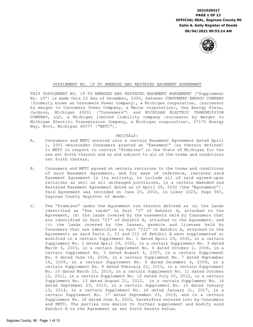
| 2021020417 PAGE 1 OF 13 OFFICIAL SEAL, Saginaw County MI Katie A. Kelly Register of Deeds 06/04/2021 09:53:14 AM SUPPLEMENT NO. 19 TO AMENDED AND RESTATED EASEMENT AGREEMENT THIS SUPPLEMENT NO. 19 TO AMENDED AND RESTATED EASEMENT AGREEMENT ("Supplement No. 19") is made this 22 day of December, 2 020, between CONSUMERS ENERGY COMPANY (formerly known as Consumers Power Company), a Michigan corporation, (successor by merger to Consumers Power Company, a Maine corporation), One Energy Plaza, Jackson, Michigan 49201 ("Consumers") and MICHIGAN ELECTRIC TRANSMISSION COMPANY, LLC, a Michigan limited liability company ( successor by merger to Michigan Electric Transmission Company, a Michigan corporation), 27175 Energy Way, Novi, Michigan 48377 ("METC"). RECITALS: A. Consumers and METC entered into a certain Easement Agreement dated April 1, 2001 whereunder Consumers granted an "Easement" (as therein defined) to METC in respect to certain "Premises" in the State of Michigan for the use set forth therein and on and subject to all of the terms and conditions set forth therein. B. Consumers and METC agreed on certain revisions to the terms and conditions of said Easement Agreement, and for ease of reference, restated said Easement Agreement in its entirety, to include all of said agreed-upon revisions as well as all unchanged provisions, in a certain Amended and Restated Easement Agreement dated as of April 29, 2002 (the "Agreement"). Said Agreement was recorded on June 20, 2002, in Liber 2225, Page 583, Saginaw County Register of deeds. C. The "Premises" under the Agreement are therein defined as (a) the lands identified as "fee lands" in Part "I" of Exhibit A, attached to the Agreement, (b) the lands covered by the easements held by Consumers that are identified in Part "II" of Exhibit A, attached to the Agreement, and ( c) the lands covered by the leases, permits and licenses held by Consumers that are identified in Part "III" of Exhibit A, attached to the Agreement; as said Parts I, II and III of Exhibit A were supplemented or modified in a certain Supplement No. 1 dated April 29, 2002, in a certain Supplement No. 2 dated April 29, 2002, in a certain Supplement No. 3 dated March 3, 2003, in a certain Supplement No. 4 dated October 2, 2006, in a certain Supplement No. 5 dated August 3, 2007, in a certain Supplement No. 6 dated June 18, 2008, in a certain Supplement No. 7 dated September 18, 2008, in a certain Supplement No. 8 dated December 4, 2008, in a certain Supplement No. 9 dated February 22, 2010, in a certain Supplement No. 10 dated March 25, 2010, in a certain Supplement No. 11 dated October 12, 2011, in a certain Supplement No. 12 dated July 20, 2012, in a certain Supplement No. 13 dated August 21, 2012, in a certain Supplement No. 14 dated September 23, 2013, in a certain Supplement No. 15 dated January 13, 2014, in a certain Supplement No. 16 dated January 31, 2017, in a certain Supplement No. 17 dated September 25, 2019, and in a certain Supplement No. 18 dated June 8, 2020, heretofore entered into by Consumers and METC. The parties now desire to further supplement and modify said Exhibit A to the Agreement as set forth herein below. Saginaw County, Ml Page: 1 of 13 |
| 2 D. References, in regard to historical matters, to "METC" in the foregoing recitals will be deemed to mean METC' s predecessor, Michigan Electric Transmission Company, a Michigan corporation, where relevant. NOW, THEREFORE, for good and valuable consideration, the receipt of which is acknowledged, Consumers and METC agree as follows: 1. Exhibit A to the Agreement, as heretofore supplemented and/or modified, is hereby further supplemented and modified as set forth in "Nineteenth Supplemental Exhibit A", attached hereto. 2. It is expressly understood that any lands, easements, or leases/permits/licenses that are indicated in said attached Nineteenth Supplemental Exhibit A as being added are, on and subject to the terms and conditions of the Agreement (as supplemented and amended by this Supplement No. 19), hereby deemed added to Part I, Part II and Part III, respectively, of Exhibit A to the Agreement. However, it is further expressly understood that in addition to all rights granted to METC by the Agreement, METC shall have the following rights as to the lands identified as "Consumers Energy Equipment/ Joint Asset Area Easement" on the accompanying NINETEENTH Supplemental Exhibit A sheets, inclusive of Parts I, II and III, which rights are also subject to the terms of the Parties' Amended and Restated Transmission Interconnection Agreement (the "DTIA"): (a) the right to maintain any and all existing components of the Transmission System, as defined in the DTIA, and wiring or conduit connections for the same that currently exist over, on or under these lands; and (b)the right to connect its currently sited or future approved wiring or conduits for communications, station power, or control, operating at 600 volts or less, and any Jointly Owned Assets, as defined in the DTIA, over, on or under these lands. It is also expressly understood that, with respect to any lands, easements, or leases/permits/licenses now covered by Part I, Part II or Part III of Exhibit A that are indicated in said attached Nineteenth Supplemental Exhibit A as being deleted, the Easement is hereby deemed RELEASED with respect thereto and the Agreement shall hereafter no longer apply thereto (provided, however, that all rights and obligations under the Agreement with respect to periods prior to the date of this Supplement No. 19 shall remain unaffected). It is expressly understood and agreed Premises represented by the land ( s), and/or license (s) that are added to Exhibit A to the Agreement pursuant "Additional Premises"): that in respect to the additional easement (s), lease (s), permit (s) Part I, Part II and Part III of to this Supplement No. 19 (the (a) All references to "Commencement Date" that are found in Article 1 ("Grant of Easement"), Article 2 ("Term"), Article 5 ("Additions/Alterations"), Article 6 ("Consumers' Reserved Rights to Use the Premises and Transmission Facilities"), Article 7 ("METC Approval of Compatible Uses"), Article 8 ("Certain Obligations of Consumers and Authorized Users; Etc.") and Article 14 ("Environmental Matters") of the Agreement shall be deemed to mean the date of this Supplement No. 19 and not the date that is identified in the Agreement as the "Commencement Date". Saginaw County, Ml Page: 2 of 13 |
| 3 (b) Except as expressly otherwise indicated in the immediately following sentence, all references to "Restated Agreement Date" that are found in Article 1 ("Grant of Easement"), Article 6 ("Consumers' Reserved Rights to Use the Premises and Transmission Facilities"), and Article 12 ("Compliance With Applicable Laws") of the Agreement shall also be deemed to mean the date of this Supplement No. 19 and not the date that is identified in the Agreement as the "Restated Agreement Date". Notwithstanding the foregoing: (i) the preceding sentence does not apply to the purely historical statement in clause "(c)" of Section 1. 2 of the Agreement that Trans-Elect, Inc. is "an affiliate of the entity which has become METC's parent company as of the Restated Agreement Date"; and (ii) the parenthetical in the first sentence of the first paragraph of Section 7.1 of the Agreement reading "(see below regarding a certain period prior to the Restated Agreement Date)", along with the fourth paragraph of said Section 7.1 reading "Consumers shall submit to METC within twenty (20) days of the Restated Agreement Date a list of all material Compatible Uses other than additions or modifications to Distribution Facilities that have been authorized between February 1, 2001 and the Restated Agreement Date for METC's approval per the METC Compatible Use approval process described in this Section 7.1.", both referred to a one-time historical matter and have no application to the Additional Premises or any other further effect or application whatsoever. 3. In addition to the original Transmission Facilities and Additions/Alterations thereto as referred to in Recital "A" of the Agreement, it is understood that such electric Transmission towers, pole structures, poles, crossarms, wires, cables, conduits, guys, anchors, transformers, insulators and/or other fixtures and equipment as may be owned by METC and located on the Additional Premises as of the date of this Supplement No. 19, and future Additions/Alternations made thereto on and subject to the terms and conditions of the Agreement, are included in the "Transmission Facilities" under the Agreement. Note: This Supplement No. 19 will not be recorded in all counties in which the Agreement itself, or Supplements Nos. 1 through 18, may have been recorded. This Supplement No. 19 (as were each of Supplements Nos. l through 18), will be recorded only in the county(ies) in which relevant Premises are located; being, in the case of this Supplement No. 19, only the following: Saginaw County, Ml Page: 3 of 13 |

| Allegan County Antrim County Barry County Bay County Calhoun County Charlevoix County Clinton County Crawford County Emmet County Genesee County Gladwin County Grand Traverse County Gratiot County Ingham County Ionia County Isabella County Jackson County Kalkaska County Kent County Leelanau County Lenawee County Manistee County Midland County Montcalm County Muskegon County Oceana County Ogemaw County Ottawa County Roscommon County Saginaw County Shiawassee County St. Joseph County Washtenaw County Wexford County 4 The fact that this Supplement No. 19 will be recorded only in the particular county(ies) identified above will in no way restrict, limit or otherwise affect the interpretation, application or enforcement of the Agreement; and the terms and conditions of the Agreement shall at all times be read, interpreted and applied in the manner provided for in Section 24.6 of the Agreement. Saginaw County, Ml Page: 4 of 13 |
| 5 IN WITNESS WHEREOF, Consumers and METC have executed this Supplement No. 19 as of the date first above written. CONSUMERS ENERGY COMPANY, a Michigan corporation £~Marr --,.,. Director of Real Estate STATE OF MICHIGAN couNTY oF Jc( l(ZGc'Y\ ss. The foregoing instrument was acknowledged before this :}°'day of Dcu?fpLbt,...,.--- 2020, by Mary Anne Marr, Director of Real Estate of CONSUMERS ENERGY COMPANY, a Michigan corporation, on behalf of the corporation. JULIE C GUINN No:ary Pcit:lic - State of Michigan County of Jackson My C:o•:irn,ssion Expires [)ec 2,9,)020 Acting in the County of -J(/_ (N~b Saginaw County, Ml Page: 5 of 13 Notary Public,. ( Y,U;::/{':?tO:-, Acting in s,)tteiizl51CI My Commission Expires: County, Michigan County, Michigan __ I ?---__,l_ff:61 __ , 2 o ;}-D I |
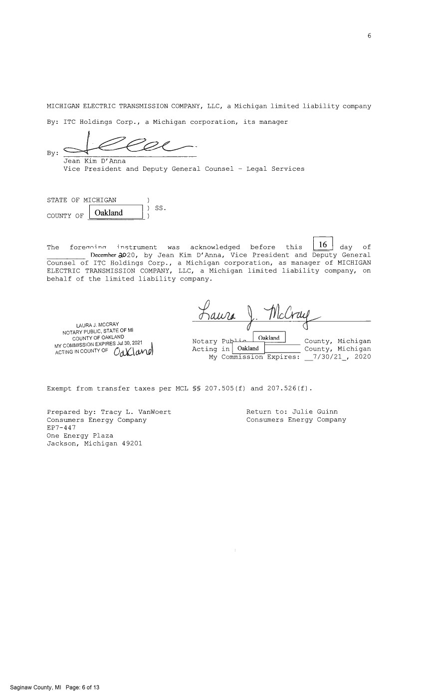
| 6 MICHIGAN ELECTRIC TRANSMISSION COMPANY, LLC, a Michigan limited liability company By: ITC Holdings Corp., a Michigan corporation, its manager By: Jean Kim D'Anna Vice President and Deputy General Counsel - Legal Services STATE OF MICHIGAN COUNTY OF Oakland ss. The forenni nn instrument was acknowledged before this I 16 I day of Decemher c).020, by Jean Kim D' Anna, Vice President and Deputy General Counsel of ITC Holdings Corp., a Michigan corporation, as manager of MICHIGAN ELECTRIC TRANSMISSION COMPANY, LLC, a Michigan limited liability company, on behalf of the limited liability company. LAURA J. MCCRAY NOTARY PUBLIC, STATE OF Ml COUNTY OF OAKLAND MY COMMISSION EXPIRES Jul 30, 2021 l ACTING IN COUNTY OF oa\<J.Al\0'1 Notary Acting My Pl" 0 [ Oruklwd [ in Oakland I Commission Expires: County, Michigan County, Michigan 7 /30/21 , 2020 Exempt from transfer taxes per MCL §§ 207.505(f) and 207.526(f). Prepared by: Tracy L. Vanwoert Consumers Energy Company EP7-447 One Energy Plaza Jackson, Michigan 49201 Saginaw County, Ml Page: 6 of 13 Return to: Julie Guinn Consumers Energy Company |

| THE ATTACHED COPY OF THE NINETEENTH SUPPLEMENTAL EXHIBIT A THAT WAS PREPARED FOR RECORDATION IN SAGINAW COUNTY, MICHIGAN, AND CONTAINS THE PORTIONS OF EACH OF PARTS I, II, AND III OF THE NINETEENTH SUPPLEMENT EXHIBIT A THAT RELATE TO PREMISES IN THAT COUNTY ONLY. SEE SECTION 24.6 OF THE AGREEMENT. Saginaw County, Ml Page: 7 of 13 7 |
| NINETEENTH SUPPLEMENTAL EXHIBIT A I . Fee Lands: See sheet(s) labeled "NINETEENTH Supplemental Exhibit A-Part I", attached hereto and made a part hereof. Said attached sheet(s) labeled NINETEENTH Supplemental Exhibit A-Part I consist of the following: 3 Pages for Allegan County 6 Pages for Antrim County 2 Pages for Barry County 2 Pages for Bay County 13 Pages for Calhoun County 2 Pages for Charlevoix County 6 Pages for Clinton County 4 Pages for Crawford County 7 Pages for Genesee County 1 Page for Gladwin County 6 Pages for Grand Traverse County 1 Page for Gratiot County 2 Pages for Ingham County 2 Pages for Ionia County l Page for Isabella County 2 Pages for Jackson County 1 Page for Kalkaska County 4 Pages for Kent County 1 Page for Leelanau County 3 Pages for Lenawee County 2 Pages for Manistee County 4 Pages for Midland County 1 Page for Montcalm County 17 Pages for Muskegon County 1 Pages for Oceana County 1 Page for Ogemaw County 4 Pages for Ottawa County 3 Pages for Roscommon County 2 Pages for Saginaw County 3 Pages for Shiawassee County 1 Page for St. Joseph County 3 Pages for Washtenaw County 2 Pages for Wexford County Saginaw County, Ml Page: 8 of 13 Nineteenth Supplemental Exhibit A - Introductory Page 1 of 2 |
| II. Easements: See sheet(s) labeled "NINETEENTH Supplemental Exhibit A-Part II", attached hereto and made a part hereof. Said attached sheet(s) labeled NINETEENTH Supplemental Exhibit A-Part II consist of the following: 1 Page for Allegan County 5 Pages for Antrim County 4 Pages for Barry County 1 Pages for Bay County 9 Pages for Calhoun County 4 Pages for Charlevoix County 9 Pages for Clinton County 2 Pages for Crawford County 6 Pages for Emmet County 8 Pages for Genesee County 3 Pages for Gladwin County 1 Page for Grand Traverse County 1 Page for Ingham County 6 Pages for Ionia County 5 Pages for Isabella County 1 Page for Kalkaska County 1 Page for Kent County 2 Pages for Leelanau County 3 Pages for Lenawee County 3 Pages for Manistee County 12 Pages for Midland County 1 Page for Montcalm County 5 Pages for Muskegon County 1 Page for Ogemaw County 4 Pages for Roscommon County 2 Pages for Shiawassee County 1 Page for St. Joseph County 2 Pages for Washtenaw County III. Leases, Permits and Licenses: See sheet(s) labeled "NINETEENTH Supplemental Exhibit A-Part III", attached hereto and made a part hereof. Said attached sheet(s) labeled Nineteenth Supplemental Exhibit A-Part III consist of the following: NA Nothing in this NINETEENTH Supplemental Exhibit A shall be deemed to affect, limit or waive any of the provisions of Sections 1.2 ("Title Limitations") and 1.3 ("No Warranties") of the Agreement. Saginaw County, Ml Page: 9 of 13 Nineteenth Supplemental Exhibit A - Introductory Page 2 of 2 |
| SUPPLEMENTAL 19 EXHIBIT A - PART I SAGINAW COUNTY ADD THE FOLLOWING LAND DESCRIPTIONS: 1-E86-8, Line 6J A strip of land 72 feet in width being 36 feet on each side of the centerline of an existing electric line, known as line segment 6J, as currently located and running in an Easterly and Westerly direction to the center of the Substation Rack, across a parcel of land described as: Land in the Township of Tittabawassee, County of Saginaw and State of Michigan, described as follows, to-wit: The Southerly 1000 feet of all that part of the East 1/2 of the Southeast 1/4 of Section 30, Town 13 North, Range 3 East, lying Northeasterly of the Indian Reserve line through said Southeast 1/4 of said Section and being more particularly described as follows: To find the place of beginning of this description commence at the Southeast corner of said Section; run thence North 00°00'50" East along the East line of said Section 649.84 feet to the Indian Reserve line and the place of beginning of this description; thence continuing along said East line of said Section North 00°00'50"East, 1000 feet; thence North 89°39'50" West, 772.37 feet to the Indian Reserve line; thence South 37°32'49" East along said Indian Reserve line 1266.98 feet to the place of beginning. Note: It is understood that a portion of the above-described strip of land lies within the fenced premises of Consumers Gleaner Substation, in the Southeast 1/4 of Section 30, Town 13 North, Range] East. It is also understood that an electric line, which is part of METC's Transmission Facilities covered by this Agreement and is located on said strip of land, presently connects to the substation within said fenced area; but that no part of the substation itself, or its associated structures and facilities is part of METC's Transmission Facilities covered by this Agreement. With respect to that portion of the above-described strip of land that is within said substation fence (as now or hereafter existing), it is expressly understood, any other provision of this Agreement notwithstanding, that unless otherwise expressly approved in writing by Consumers, METC shall make no entry thereon and shall have no right to authorize others to enter thereon; and METC shall make separate arrangements and agreements with Consumers regarding the performance of any work on the portion of METC's Transmission Facilities located therein. Nineteenth Supplemental Exhibit A-Part I, Saginaw County, Page 1 Saginaw County, Ml Page: 10 of 13 |
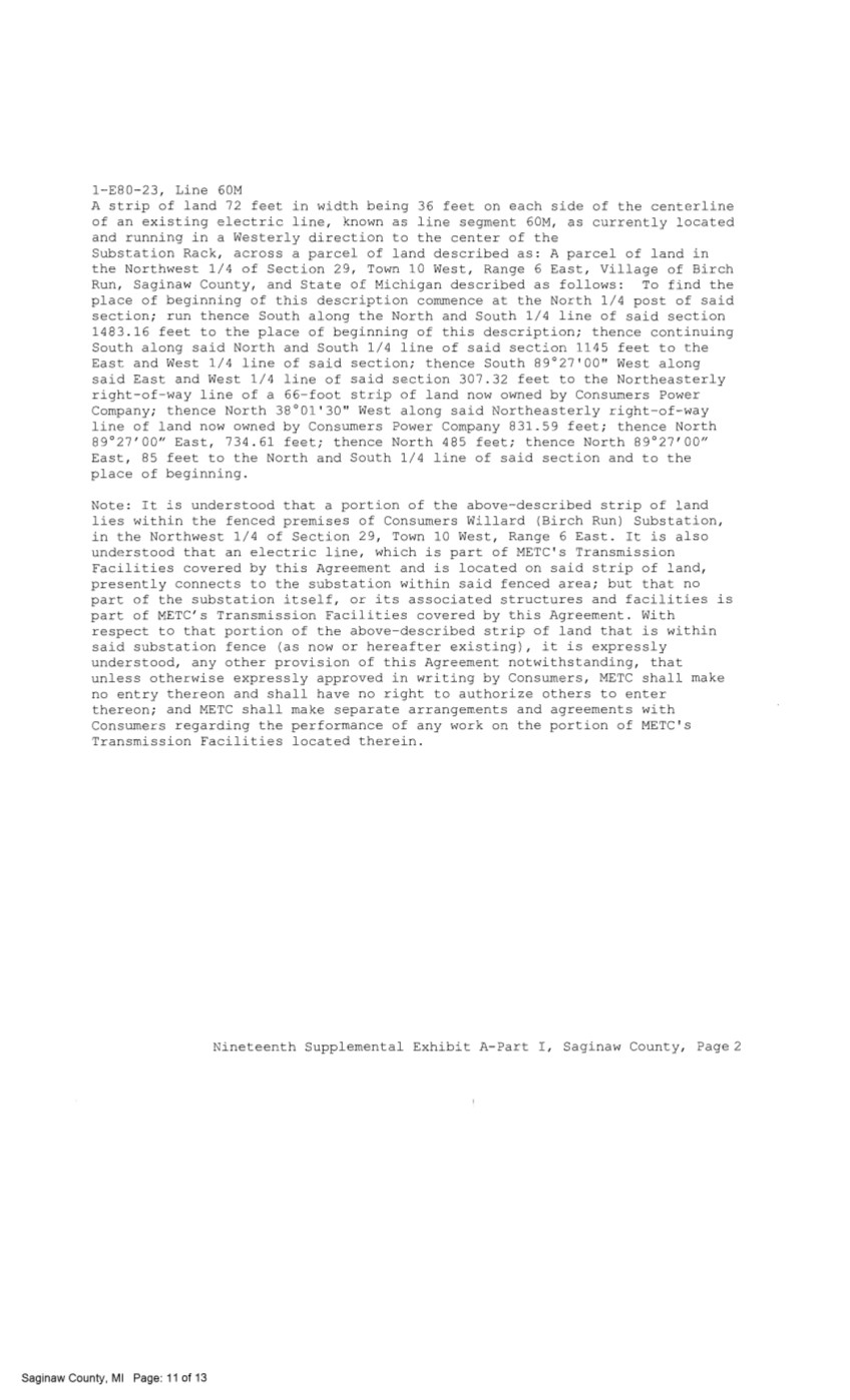
| 1-E80-23, Line 60M A strip of land 72 feet in width being 36 feet on each side of the centerline of an existing electric line, known as line segment 60M, as currently located and running in a Westerly direction to the center of the Substation Rack, across a parcel of land described as: A parcel of land in the Northwest 1/4 of Section 29, Town 10 West, Range 6 East, Village of Birch Run, Saginaw County, and State of Michigan described as follows: To find the place of beginning of this description commence at the North 1/4 post of said section; run thence South along the North and South 1/4 line of said section 1483.16 feet to the place of beginning of this description; thence continuing South along said North and South 1/4 line of said section 1145 feet to the East and West 1/4 line of said section; thence South 89°27'00" West along said East and West 1/4 line of said section 307.32 feet to the Northeasterly right-of-way line of a 66-foot strip of land now owned by Consumers Power Company; thence North 38°01'30" West along said Northeasterly right-of-way line of land now owned by Consumers Power Company 831.59 feet; thence North 89°27'00" East, 734.61 feet; thence North 485 feet; thence North 89°27'00" East, 85 feet to the North and South 1/4 line of said section and to the place of beginning. Note: It is understood that a portion of the above-described strip of land lies within the fenced premises of Consumers Willard (Birch Run) Substation, in the Northwest 1/4 of Section 29, Town 10 West, Range 6 East. It is also understood that an electric line, which is part of METC's Transmission Facilities covered by this Agreement and is located on said strip of land, presently connects to the substation within said fenced area; but that no part of the substation itself, or its associated structures and facilities is part of METC's Transmission Facilities covered by this Agreement. With respect to that portion of the above-described strip of land that is within said substation fence (as now or hereafter existing), it is expressly understood, any other provision of this Agreement notwithstanding, that unless otherwise expressly approved in writing by Consumers, METC shall make no entry thereon and shall have no right to authorize others to enter thereon; and METC shall make separate arrangements and agreements with Consumers regarding the performance of any work on the portion of METC's Transmission Facilities located therein. Nineteenth Supplemental Exhibit A-Part I, Saginaw County, Page2 Saginaw County, Ml Page: 11 of 13 |
| File Ref. Granter Grantee NINETEENTH SUPPLEMENTAL EXHIBIT A - PART II SAGINAW COUNTY Date of Inst. Liber/Page Doc Series NONE Town/Range/Section Plat Nineteenth Supplemental Exhibit A-Part II, Saginaw County, Page 1 C') ~ 0 (\J ~ Q) 0) co 0... ~ :i, C ::::, 0 0 ~ co C 0) co Cf) |
| CE Ref. LicenseLLessor NINETEENTH SUPPLEMENTAL EXHIBIT A - PART III SAGINAW COUNTY Licensee/Lessee Date of Instrument NONE Title of Instrument Town/Range Section Nineteenth Supplemental Exhibit A-Part III, Saginaw County, Page 1 C') ~ 0 C') ~ Q) 0) co 0... ~ :i, C ::::, 0 0 ~ co C 0) co Cf) |
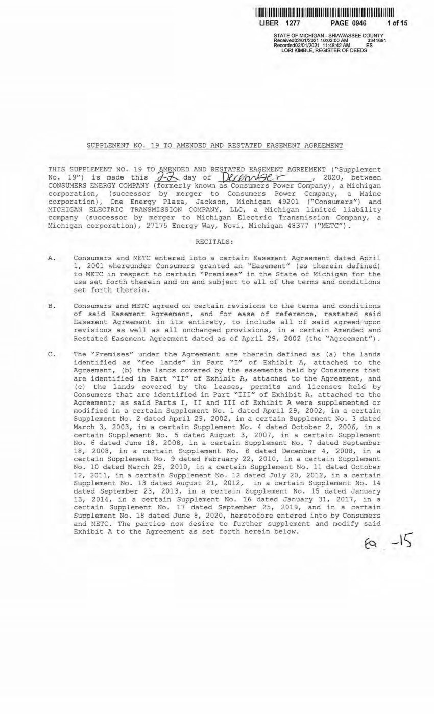
| 111111111111111111111111111 1111111111111111 111111111 1111111111'1111111111111 UBER 1277 PAGE 0946 STATE OF MICHIGAN · SHIAWASSEE COUNTY Received02/01/2021 10:03:00 AM 3341691 Recorded02/01/2021 11 :48;42 AM ES LORI KIMBLE, REGISTER OF DEEDS SUPPLEMENT NO . 19 TO AMENDED AND RESTATED EASEMENT AGREEMENT THIS SUPPLEMENT NO. 19 TO_AM~DED AND RESTATED EASEMENT AGREEMENT ("Supplement No. 19") is made this ~ day of J)u-,6tvJ.ge_, Y- , 2020, between CONSUMERS ENERGY COMPANY (formerly known as Consumers Power Company) , a Michigan corporation, (successor by merger to Consumers Power Company, a Maine corporation), One Energy Plaza, Jackson, Michigan 49201 (''Consumers") and MICHIGAN ELECTRIC TRANSMISSION COMPANY , LLC, a Michigan limited liability company (successor by merger to Michigan Electric Transmission Company, a Michigan corporation) , 27175 Energy Way, Novi, Michigan 48377 ("METC") . RECITALS : A. Consumers and METC entered into a certain Easement Agreement dated April 1, 2001 whereunder Consumers granted an "Easement" (as therein defined) to METC in respect to certain "Premises" in the State of Michigan for the use set forth therein and on and subject to all of the terms and conditions set forth therein. B. Consumers and METC agreed on certain revisions to the terms and conditions of said Easement Agreement, and for ease of reference, restated said Easement Aqreement in its entirety, to include all of said agreed-upon revisions as well as all unchanged provisions, in a certain Amended and Restated Easement Agreement dated as of April 29, 2002 (the "Agreement"). C. The "Premises" under the Agreement are therein defined as (a) the lands identified as "fee lands" in Part "I" of Exhibit A, attached to the Agreement, (b) the lands covered by the easements hel d by Consumers that are .identified in Part ''II" of Exhibit A, attached to the Agreement, and (c) the lands· covered by the leases, permits and licenses held by Consumers that are identified in Part "III" of EY.hibit A, attached to the Agreement; as said Parts I, II and III of Exhibit A were supplemented or modifi ed in a certain Supplement No. l dated April 29, 2002, in a certain Supplement No. 2 dated April 29, 2002, in a certain Supplement No . 3 dated March 3, 2003, in a certain Supplement No . 4 dated October 2 , 2006, in a certai n Supplement No. 5 dated August 3, 2007 , in a certain Supplement No. 6 dated June 18, 2008, in a certain Supplement No. 7 dated September 18, 2008, i n a certain Supplement No . 8 dated December 4 , 2008, in a certain Supplement No. 9 dated February 22, 2010, in a certain Supplement No. 10 dated March 25 , 2010, in a certain Supplement No. 11 dated October 12, 2011, in a certain Supplement No. 12 dated July 20, 2012, in a certain Supplement No. 13 dated August 21, 2012, in a certain Supplement No . 14 dated September 23, 2013, in a certain Supplement No . 15 dated January 13, 2014, in a certain Supplement No . 16 dated January 31, 2017, in a certain Supplement No. 17 dated September 25, 2019, and in a certain Supplement No. 18 dated June 8, 2020, heretofor e entered into by Consumers and METC. The parties now desire to further supplement and modify said Exhibit A to the Agreement as set forth herein below. 1 of 15 |
| 1111111 111111111111111 1111111111111111111 11111111111 11111 lll11 1 111111111111 LIBER 1277 PAGE 0946 2 D. References, in regard to historical matters, to ''METC" in the foregoing recitals will be deemed to mean METC ' s predecessor, Michigan Electric Transmission Companyr a Michigan corporation, where relevant. NOW, THEREFORE, for good and valuable consideration, the receipt of which is acknowledged, Consumers and METC agree as follows : 1 . Exhibit A to the Agreement, as heretofore supplemented and/or modified, is hereby further supplemented and modified as set forth in "Nineteenth Supplemental Exhibit A'', attached hereto. 2. I t is expressly understood that any lands, easements, or leases/permits/licenses that are indicated in said attached Nineteenth Supplemental Exhibit A as being added are, on and subject to the terms and conditions of the Agreement (as supplemented and amended by this Supplement No. 19), hereby deemed added to Part I , Part II and Part III, respectively, of Exhibit A to the Agreement. However, it is further expressly understood that in addition to all rights granted to METC by the Agreement, METC shall have the following rights as to the lands identified as "Consumers Energy Equipment/ Joint Asset Area Easement" on the accompanying NINETEENTH Supplemental Exhibit A sheets, inclusive of Parts Ir II and III, which rights are also subject t o the terms of the Parties' Amended and Restated Transmission Interconnection Agreement (the "DTIA"): (a) t he right to maintain any and all existing components_ of the Transmission System, as defined in the DTIA, and wiring or conduit connections for the same that currently exist over, on or under these l ands; and (b)the right to connect its currently sited or future approved wiring or conduits for communications, station power, or control, operating at 600 volts or less, and any -Jointl y Owned Assets, as defined in the DTIA, over, on or under these lands. It is also expressly understood that, with respect to any lands, easements, or leases/permits/licenses now covered by Part I , Part II or Part III of Exhibit A that are indicated in said attached Nineteenth Supplemental Exhibit A as being deleted, the Easement is hereby deemed RELEASED with respect thereto and the Agreement shall hereafter no longer apply thereto (provided, ho~ever, that all rights and obligations under the Agreement with respect to periods prior to the date of this Supplement No . 19 shall remain unaffected). It is expressly understood and agreed Premises represented by the land ( s) , and/or license(s) that are added to Ezhibit A to the Agreement pursuant "Additional Premises"): that in respect to the additional easement(s) , l ease(s), permit(s) Part Ir Part II and Part. III of to this Supplement No. 19 (the (a) All references to "Commencement Date" that are found in Article 1 ("Grant of Easement") , Article 2 ("Term"), Article 5 ("Additions/Alterations") , Article 6 (''Consumers' Reserved Rights to Use the Premises and Transmission Faciliti es" ), Article 7 ( "METC Approval of Compa.tible Oses"), Article 8 ("Certain Obl igations of Consumers and Aut horized Osers; Etc.") and Article 14 ('' Environmental Matters") of the Agreement shall be deemed to mean the date of this Supplement No . 1 9 and not the date that is identified in the Agreement as the "Commencement Date". 2 of 15 |
| 1 11111111111111111111111111111111111111111111111111111111 ll1111111111111111 LIBER 1277 PAGE 0946 3 (b) Except as expressly otherwise indicated in the immediately following sentence, all references to "Restated Agreement Date" that are found in Article 1 ( "Grant of Easement"} , Article 6 ( "Consumers' Rese.rved Rights to Use the Premises and Transmission Facilities") , and Article 12 ("Compliance With Applicable Laws") of the Agreement shall also be deemed to mean the date of this Supplement No . 19 and not the date that is identified in the Agreement as the "Restated Agreement Date''. Notwithstanding the foregoing: ( i) the preceding sentence does not apply to the purely historical statement in clause " ( c) " of Section 1 . 2 of the Agreement that Trans-Elect, Inc. is "an affiliate 0£ the entity which has become METC's parent company as of the Restated Agreement Date"; and (ii) the parenthetical in the first sentence of the first paragraph of Section 7 . 1 of the Agreement reading "(see below regarding a certain period prior to the Restated Agreement Date)", along with the fourth paragraph of said Section 7 .1 reading "Consumers shall submit to METC within twenty ( 20) days of the Restated Agreement Date a list of all material Compatible Uses other than additions or modifications to Distribution Facilities that have been authorized between February 1, 2001 and the Res~ated Agreement Date for METC's approval per the METC Compatible Use approval process described in this Section 7 .1. '', both referred to a one- time historical matter and have no appli cation to the Additional Premises or any other further effect or application whatsoever. 3. In addition to the original Transmission Facilities and Additions/Alterations thereto as referred to in Recital "A" of the Agreement, it is understood that such electric Transmission towers, pole structures, poles, crossarms, wires, cables, conduits, guys, anchors, transformers, insulators and/or other fixtures and equipment as may be owned by METC and located on the Additional Premises as of the date of this Suppl ement No . 19, and future Additions/Alternations made t hereto on and subject to the terms and conditions of the Agreement , are included in the ''Transmission Facilities" under the Agreement . Note: This Supplement No. 19 will not be recorded in all counties in which the Agreement itself, or Supplements Nos. 1 through 18, may have been recorded . This Supplement No. 19 (as were each of Supplements Nos . 1 through 18) , will be recorded only in the county(ies} in which relevant Premises are located; being, in the case of this Supplement No . 19, only the following: 3 of 15 |

| 111111111111111111111111111111111111111111111111111111111111111111111111111 Allegan Count y Antrim County Barry County Bay County Calhoun County Charlevoix County Clinton County Crawford County Emmet County Genesee County Gladwin County Grand Traverse County Gratiot County Ingham County Ionia County Isabella County Jackson County Kalkaska County Kent County Leelanau County Lenawee County Manistee County Midland County Montcalm County Muskegon County Oceana County Ogemaw County Ottawa County Roscommon County Saginaw County Shiawassee County St. Joseph County Washtenaw County Wexford County UBER 1277 PAGE 0946 4 The fact that this Supplement No . 19 will be recorded only in the particular county( i es) identified above will in no way restrict, limit or otherwise affect the interpretation, application or enforcement of the Agreement; and the terms and conditions of the Agreement shall at all times be read, interpreted and applied in the manner provided for in Section 24 . 6 of the Agreement . 4 of 15 |
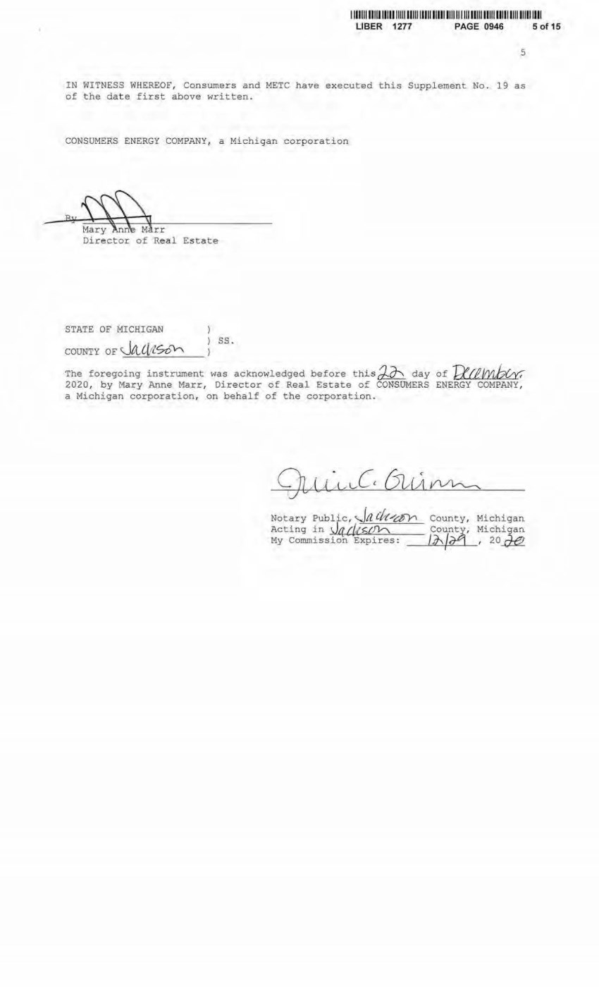
| I 111 11111111111111111111111 1 1111111111111111111 1111111111 111111111 1 11111111 UBER 1277 PAGE 0946 5 IN WITNESS WHEREOF, Consumers and METC have executed this Supplement No. 19 as of the dat e first above written . CONSUMERS ENERGY COMPANY , a Michigan corporation Director of Real Es tat~ STATE OF MICHIGAN COUNTY OF Ja_l[tlSo'h ss. The foregoing instrument was acknowledged before th~sJO"s day of Ra~ 2020, by M ary Anne Marr, Director of Real Estate of CONSUMERS ENERGY COMPANY , a Michigan corporation, on behalf of the corporation. Notary Public, '-'fa C/r(/df"r'i Acting in d4 dt.z-J/v-\. My Commission Expires: County, Michigan County, M ichigan /,1' /izPI I 20 ..a£!. , 5 of 15 |
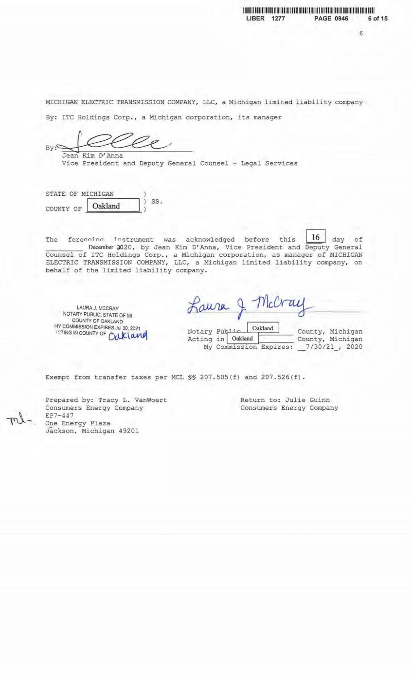
| 111111111111111111111111111111111111111111111111111111111111111111111111111 UBER 1277 PAGE 0946 6 MICHIGAN ELECTRIC TRANSMISSION COMPANY, LLC, a Michigan limited liability company By: ITC Holdings Corp., a Michigan corporation, its manager By,~ ' Jean Kim D' Anna Vice President and Deputy General Counsel - Legal Services STATE OF MICHIGAN Oakland COUNTY OF~=======- ss. The forenninn in~trument was acknowledged .l::>efore this I 16 I day of necemher d,() 20, by Jean Kim D' Anna, Vice President and Deputy General Counsel of ITC Holdings Corp., a M i chigan corporation, as manager of MICHIGAN ELECTRIC TRANSMISSION COM PANY, LLC, a Michigan l i mited l i ability company, on behalf of the limited liabi lity company. LAURA J. MCCRAY NOTARY PUBLIC. STATE OF Ml COUNTY OF OAKLAND MY COMMISSION EXPIRES Jul 30 2021 '' t:'f1N~ IN COUNTY OF 0~ \ ~ Notary PW7 1 · c I Oakland I County, Michigan Acting in i ?akland I County, Michigan My Comrn.__,i~s-s-i~·o-nJ-~E- xp --;- i-r_ e_ s_: _7/30/21_, 2020 Exempt from transfer taxes per MCL §§ 207. 505(f) and 207. 526(f) . Prepared by: Tracy L. Vanwoert Consumers Energy Company EP7-447 One Energy Plaza Jackson, Michigan 49201 Return to: Julie Guinn Consumers Energy Company 6 of 15 |

| 111111111111111111111111111 111111111111111111111111111111111111111111111111 LIBER 1277 PAGE 0946 THE ATTACHED COPY OF THE NINETEENTH SUPPLEMENTAL EXHIBIT A TRAT WAS PREPARED FOR RECORDATI ON IN SHI AWASEE COONTY , MICHIGAN, AND CONTAINS THE PORTIONS OF EACH OF PARTS I , II, AND III OF THE NINETEENTH SUPPLEMENT EXHIBIT A THAT RELATE TO PREMI SES IN THAT COUNTY ONLY. SEE SECTION 24 . 6 OF THE AGREEMENT . 7 of 15 7 |
| 1 1 111111111111111 1111111111 11111ll111 1111111 1 1111111 11111 111111111111111111 UBER 1277 PAGE 0946 NI.NETEENTH SUPPLEl1ENTAL EXHIBIT A I. Fee Lands : See sheet (s) labeled ''NINETEENTH Supplemental Exhibit A-Part I", attached hereto and made a part hereof. Said attached sheet(s) labeled NINETEENTH Supplemental Exhibit A- Part I consist of the followi ng: 3 Pages for Allegan County 6 Pages £or Antrim County 2 Pages £or Barry County 2 Pages for Bay County 13 Pages for Calhoun County 2 Pages for Charlevoix County 6 Pages for Clinton County 4 Pages for Crawford County 7 Pages for Genesee County 1 Page for Gladwin County 6 Pages for Grand Traverse County 1 Page for Gratiot County 2 Pages for Ingham County 2 Pages for Ionia County 1 Page for Isabella County 2 Pages for Jackson County 1 Page for Kalkaska Count y 4 Pages for Kent County l Page for Leelanau County 3 Pages for Lenawee, County 2 Pages for Manistee County 4 Pages for Midland County 1 Page for Montcalm County 17 Pages for Muskegon County 1 Pages for Oceana County 1 Page for Ogemaw County 4 Pages for Ottawa County 3 Pages for Roscommon County 2 Pages f or Saginaw County 3 Pages for Shiawassee County 1 Page for St. Joseph County 3 Pages for Washtenaw County 2 Pages for Wexford County Ninet eenth Supplemental Exhibit A - I ntroductory Page 1 of 2 8 of 15 |
| 1 1 11111111111111111111 1111111111 111111111111 111 11111 11111111111111 11111 1111 LIBER 1277 PAGE 0946 9 of 15 II. Easements: See sheet(s) label ed "NINETEENTH Supplemental Exhibit A-Part II", attached hereto and made a part hereof. Said attached sheet(s} labeled NINETEENTH Supplemental Exhibi t A- Part II consist of the following: 1 Page for Allegan County 5 Pages for Antrim County 4 Pages for Barry County 1 Pages for Bay County 9 Pages for Calhoun County 4 Pages for Charlevoix County 9 Pages for Clinton County 2 Pages for Crawford County 6 Pages for Emmet County 8 Pages for Genesee County 3 Pages for Gladwin County 1 Page for Grand Traverse County 1 Page for Ingham County 6 Pages for Ionia County 5 Pages for Isabella County 1 Page for Kalkaska County 1 Page for Kent County 2 Pages for Leelanau County 3 Pages for Lenawee County 3 Pages for Manistee County 12 Pages for Midland County 1 Page for Montcalm County 5 Pages for Muskeg. on County 1 Page for Ogemaw County 4 Pages for Roscommon County 2 Pages for Shiawassee County 1 Page for St. Joseph County 2 Pages for Washtenaw County III. Leases, Permits and Licenses: See sheet ( s) labeled "NINETEENTH Supplemental Exhibit A- Part III" , attached hereto and made a part hereof. Said attached sheet(s) labeled Nineteenth Supplemental Exhibit A-Part III consist of the following: NA Nothing in this NINETEENTH Supplemental Exhibit A shall be deemed to affect, limit or waive any of the pro'i7isions of Sections 1.2 ("Title Limitations") and 1 . 3 {"No Warranties") of the Agreement. Nineteenth Supplemental Exhibit A - Introductory Page 2 of 2 |
| I 11111111111111111111111111111111111111111111111111111111 ll1111111111111111 UBER 1277 PAGE 0946 10 of15 SUPPLEMENTAL 19 EXHIBIT A - PART I SHIAWASSEE COUNTY ADD THE FOLLOWING LAND DESCRIPTIONS : 193-D77-1, Li ne 77C A parcel of land described as the North 40 acres of the Northeast l/4 of Section 30, Town 7 North, Range 3 East, Caledonia Township, Shiawassee County, Michigan; except 3 acres in the Northwesterly corner of said land; containing in all 37 acre s , more or less; ALSO a parcel of land described as commencing 42 . 38 rods West of the Southeast corner of Section 1 9, Town 7 North, Range 3 East, Shi awassee County, Michigan; thence North 45 . 44 rods; thence Northwesterly along Railroad to the East 1/8 l ine; thence South to the South line of said secti on; thence East 40 rods to place of beginning, containing 13 acres, more or l ess. 195- D77- 1* A strip of land 66 feet wide off the Northerly side of Blocks 10, 11, 12, 13 and 14 of the Plat of George T . Abrey's Woodlawn Park Addition to the Ci ty of Owosso, according to the recorded plat thereof, together with so mu ch of Abrey, McMillan, Edgewater and Oakdale Avenues as now laid out in said plat as lie contiguous to said above descri bed strip of land, Section 19, Town 7 North, Range 3 East, City of Owosso, Shiawassee Count y , Michigan; EXCEPT : A strip of land 25 feet in width off t he Northerl y s i de of Blocks 10 , 11 , 12, 13 and 14 of the plat of George T . Abrey' s Woodlawn Park Addition to the City of Owosso, according to the recorded plat thereof, together wi th all of fir st party' s interest in that part of vacated Cleveland (Abrey) , Edgewater and Oakdale Avenues, and the vacated alleys within said blocks are included within said 25 foot strip of land extended across sai d streets and all eys . Sai d 25 foot stri p of land being measured at right angles to t he Northerl y line of the aforesaid blocks. 195 . 1-D77-1 9* , Line 77C A strip of land 25 feet in width off the Southwesterly side of a str ip of land 91 feet in width off the Northeasterly side of Blocks 10 and 11 of the plant of George T . Abrey' s Woodl awn Park Addition to the Ci ty of Owos so, according to the recorded plat thereof, also so much of vacated Cleveland (Abrey) Avenue and the vacated alleys within said Blocks 10 and 1 1 as are included withi n s aid 25-foot strip of land extended across said streets and alleys. Said 25 foot and 91 foot measurements to be taken at right angles to the Northeasterly line of said blocks, Section 191 Town 7 Nor t h, Range 3 East, City of Owosso, Shiawassee County, Michigan. 195. 2-D77- 20* , Line 77C A str ip of l and 25 fee t i n width off the Southwesterly side of a strip of land 91 feet in width off the Northeasterly side of Blocks 12, 13 and 14of the plat of George T . Abrey' s Woodlawn Park Addi tion to t he City of Owosso, according to the recor ded plat t h ereof, a l so so much of vacated Oakdale Avenue, Edgewater Avenue and the vacated alleys within said Blocks 12, 13 and 14 as are included within said 25 f oot s tri p of land extended across said streets and alleys. Said 25 foot and 91 foot measurements to be taken at right angles to the Northeasterly line of said blocks, Section 19, Town 7 North, Range 3 East, Ci ty of Owosso, Shiawassee County, M ichigan. Nineteenth Supplemental Exhibi t A- Part I , Shiawasse e County, Page 1 |
| 111111111111111111111111111111111111111111111111111111111111111111111111111 UBER 1277 PAGE 0946 197-077-2*, Line 77C The West 18 feet of Lots number 9, 10 and 11 of Block number 19, of the re subdivision of Blocks numbered 19, 20 and 21 of George T - Abrey's Woodlawn Park Addition to the City of Owosso, according to the recorded p l at thereof in Section 19, Town 7 North, Range 3 East, and also commencing on West line of said Block 19, at a point 10 feet North of the Northwest corner of Lot number 9 , of said Block 19, tbence West 25 feet. Thence South to the l ine Ann Arbor Railroad Right of Way, thence Easter l y along said Railroad Right of Way to the West line of said Block number 19, t hence North along the West line of said Block number 19 to the place of beginning. Being the south part Edmund Avenue, City of Owosso, Shiawassee County, Michigan . 198- 077- 3 , Line 77C A parcel of land 60 feet wiae off the Southerly side of the following descri bed parcel of land: The East 1/2 of a parcel of l and in the East 1/2 of the West 1/2 of Section 19, Town 7 North, Range 3 East, City of Owosso, Shiawassee County, and State of Michi gan, described as beginning on the Southerl y line of Corunna Avenue as now laid out in the City of Owosso, at a point South 71° East 11 . 24 chains from the intersection of the Southerly line of said Corunna Avenue with the West line of the East 1/2 of the West 1/2 of said Section 19, running thence South 19° West at right angles to said Corunna Avenue to the Northerly line of the Ann Arbor Railroad right of way( thence Easterly along the Northerly line of said railroad right of way 1.53 chains, thence North 19° East to the Southerly line of said Corunna Avenue, thence North 7 1 ° West to t he place of beginning 207-077- 12, Line 77C A parcel of land in t he East 1/2 of the West½ of Section 19, Town 7 North, Range 3 East, City of Owosso, Shiawassee County, Michigan, described as commencing on the Southerly line of Corunna Avenue as now laid out in the City of Owosso at a point South 71° East 4 .4 6 chains from its intersection with the West line of the East 1/2 of the West 1/2 of said Section 19, running thence South 19° West at right angles to said Corunna Avenue along the Easterly line of Woodlawn Street as now laid out, being a street 66 feet wide in the City of Owosso, to a point 90 feet Northerly, measured along the Easterly line of said Woodlawn Street from its intersection with the Northerly line of the Ann Arbor Railroad Right of Way, which said point is a place of beginning of this description, running thence Southerly along the Easterly line of said Woodlawn Street 90 feet to the Northerly line of the Ann Arbor Railroad Right of Way, thence Easterly along the Northerly line of said railroad right of way 61.05 feet, thence Northerly parallel with the easterly line of said Woodlawn Street to a point where a line drawn at right angles to the Easterly line of said Woodlawn Street and 90 feet Northerly of the Northerly line of said railroad right of way (measured along said Woodlawn Street) would intersect same, running thence Westerly at right angles to the Easterly line of said Woodlawn Street to t he place of beginning. Also intending to convey herewith all right, title and interest the granters herein may own or claim to own by use and occupation in and to the Easterly 8 feet of Woodlawn Street adjoining said above described land, together with any other rights they may now have in said street appurtenant to said above described land . 208-077-13, Line 77C A parcel of land in the West 1/2 of Section 19, Town 7 North, Range 3 East, City of Owosso, Shiawassee County, Michigan, described as beginning on the Northerly line of the Ann Arbor Railroad Right of Way at its intersection with the Easterly line of the Plat of Maple Ridge Park, a Re-Subdivision of Nineteenth Supplemental Exhibit A-Part I , Shiawassee County, Page2 11 of 15 |
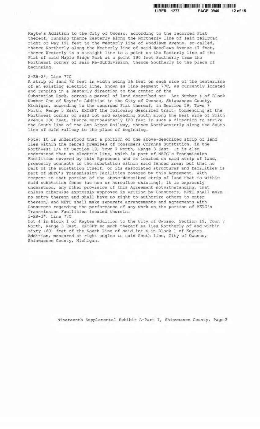
| 11111111111111111 11111 111111111111111 1111111111111111111111lll 1111111111111 UBER 1277 PAGE 0946 Keyte' s Addition to the City of Owosso, according to the recorded Plat thereof, running thence Easterl y along the Northerly line of said railroad right of way 151 feet to the Westerly line of Woodlawn Avenue, so- called, thence Northerly along the Westerly l ine of said Woodl awn Avenue 47 feet, thence Westerly in a straight line to a point on the Easterly line of the Pl at of said Maple Ridge Park at a point 190 feet Southerly from the Northeast corner of said Re-Subdi visi on, thence Southerly to the place of beginning. 2-EB- 2*, Line 77C A strip of l and 72 feet in width being 36 feet on each side of the centerline of an existing electric l ine , known as line segment 77C, as cur rently l ocated and running in a Easterly direction to the center of the Substation Rack, across a parcel of land described as: Lot N umber 4 of Block Number One of Keyte's Addition to the City of Owosso, Shiawassee County, Michigan, according to the recorded Pla~ thereof, in Section 19, Town 7 North, Range 3 East, EXCEPT the following described tract: Commencing at the Northwest corner of said lot and extending South along the East side of Smith Avenue 100 feet, thence Northeasterly 120 feet in such a direction to strike the South line of the Ann Arbor Railway, thence Northwest e rly along the South line of said railway to the place of beginning. Note: It is understood that a portion of the above-described strip of land l ies within the fenced premises of Consumers Corunna Substation, in the Northwest 1/4 of Section 19, Town 7 North, Range 3 East. It is also understood that an electric l ine, which is part of METC's Transmission Facilities covered by this Agreement and is located on said strip of land, presently connects to t he subst ation within said fenced area; but that no part of the substation itself, or its associated structures and facilities is part of METC' s Transmission Facilities covered by this Agreement . With respect to that portion of the above-described strip of land that is within said substation fence (as now or hereafter existing), i t is expr essly understood, any other provision of this Agreement notwithstanding, that unless otherwise expressly approved in writing by Consumer s , METC shall make no entry thereon and shall have no right to authorize others to enter thereon; and METC shall make separate arrangements and agreements with Consumers regarding t he performance of any work on the portion of METC ' s Transmission Facilities located therein. 3-EB- 3*, Line 77C Lot 4 in Block 1 of Keytes Addition to the City of Owosso, Section 19, Town 7 North, Range 3 East . EXCEPT so much thereof as lies Northerly of and within sixty (60) feet of the South line of said lot 4 in Block 1 of Keytes Addition, rneasured at right angles to said South line, City of Owosso, Shiawassee County, Michigan. Nineteenth Supplemental Exhibit A- Part I , Shiawassee County, Page 3 12 of 15 |
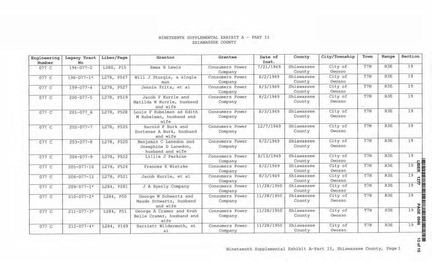
| Engineering Legacy Tract Liber/Page Number No 077 C 194-077-2 L280, PlS 077 C 196- D77 - 1* L278, P547 077 C 199-077-4 L278, P527 077 C 200-077-5 L278, P519 077 C 201- 077 - 6 L278, P528 077 C 202-077- 7 L278 , P525 077 C 203- 077 - 8 L278, P520 077 C 204-D77-9 L278, P522 077 C 205- 077-10 L278 , P524 077 C 206-077- 11 L278 , P521 077 C 209-D77-1* L284 , P281 077 C 210-D77- 2* L284 , PS0 077 C 211-D77-3* L284 , P51 077 C 212-D77-4* L284 , P169 NINETEENTH SUPPLEMENTAL EXHIBIT A - PART II SHIAWASSSE COUNTY Granter Grantee Date of Inst. Emma B Lewis Consumers Power 7/21/1949 Com pany Will J Sturgis, a single Consumers Power 8/2/1949 man Company Jennie Fri tz, et a l Consumers Power 8/3/1949 Company Jacob F Kurrle and Consumers Power 8/2/1949 Matilda W Kurrle, husband Company and wife Loui s F Rubelman ad Edith Consumers Power 8/3/1949 M Rubelman, husband and Company wife Harold P Burk and Consumers Power 12/7/1949 Hortense A Burk, husband Company a nd wife Benjamin C Lanedon and Consumers Power 8/2/1949 Josephine D Lanedon, Company husband and wife Lillie J Perkins Consumers Power 9/13/1949 Company Frances E W i etzke Consumers Power 8/2/1949 Company Jacob Kurrle, et al Consumers Power 8/3/1949 Company J A Byerly Company Consumers Power 11/28/1950 Company George W Schwartz a nd Consumers Power 11/28/1950 Maude Schwartz, husband Company and wife George A Cramer and Evah Consumers Power 11/28/1950 Belle Cramer, husband and Company wife Harriett Wildermuth, et Consumers Power 11/28/1950 al Company County City/Township Town Range Shiawassee City of T7N R3E County Owosso Shiawassee City of T7N R3E County Owosso Shiawassee City of T7N R3E County Owosso Shiawassee City of T7N R3E County Owosso Shiawassee City of T7N R3E County Owosso Shiawassee Ci ty of T7N R3E County Owosso Shiawassee City of T7N R3E County Owosso Sh iawassee City of T7N R3E County Owosso Shiawassee City of T7N R3E County Owosso Shiawassee City of T7N R3E County Owosso Shiawassee City of T7N R3E County Owosso Shiawassee City of T7N R3E County Owosso Shiawassee City of T7N R3E County Owosso Shiawassee City of T7N R3E County Owosso Nineteenth Supplemental Exhibit A- Part II, Shiawassee County, Page 1 Section 19 19 19 19 19 19 19 19 19 19 1 9 19 19 19 ..... I m m ;;o ..... : !:-1 ""' I :_o C) i m 0 'e O'I = - .... - w = 0 .... .... <.11 |
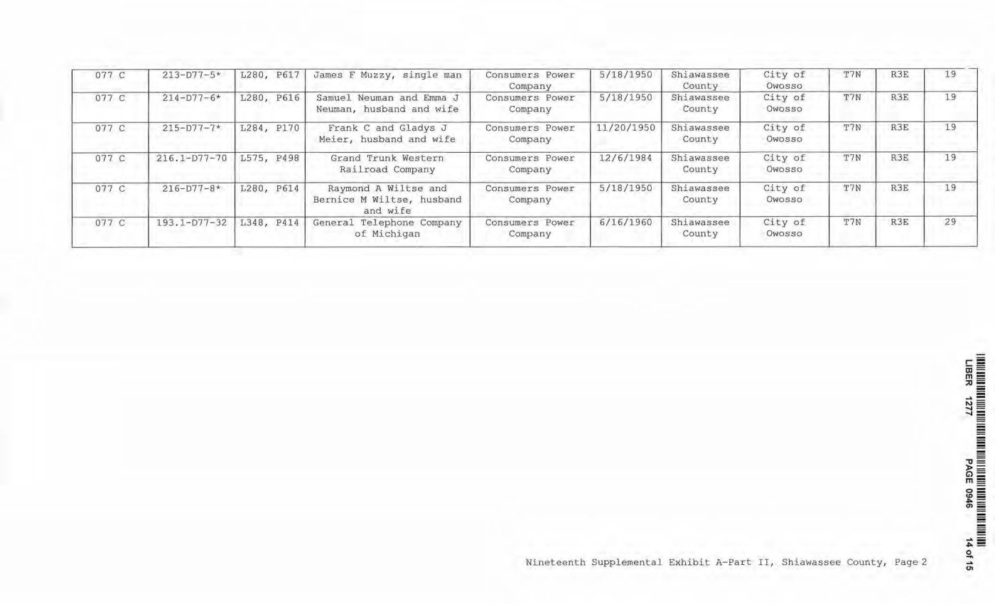
| 077 C 213- 077- 5* L280, P617 James F M uzzy, s i ngle man 077 C 214-077-6* L280, P616 Samuel Neuman and Emma J Neuman, husband and wife 077 C 215-077-7* L284 , Pl70 Frank C and Gladys J Meier, husband and wife 077 C 216. 1- 077- 70 L575, P498 Grand Trunk Western Railroad Company 077 C 216-D77-8* L280, P614 Raymond A W iltse and Bernice M W iltse, husband and wife 077 C 193.1-077-32 L348, P414 General Telephone Company of Michigan Consumers Power 5/18/1950 Shiawassee City of T7N R3E Company County Owosso Consumers Power 5/18/1950 Shiawassee City of T7N R3E Company County Owosso Consumers Power 11/20/1950 Shiawassee City of T7N R3E Company County Owosso Con sumers Power 12/6/1984 Shiawassee City of T7N R3E Company County Owosso Consumers Power 5/18/1950 Shiawassee City of T7N R3E Company County Owosso Consumers Power 6/16/1960 Shiawassee City of T7N R3 E Company County Owosso Nineteenth Supplemental Exhibit A-Par t II, Shiawassee County, Page2 19 19 19 19 19 29 - - - - '1J = >= G> m- o= u,_; ""= a, _ - .... _ ""~ 0 - .... <11 |
| CE Re.f. License/Lessor NINETEENTH SUPPLEMENTAL EXHIBIT A - PART III SHIAWASSEE COUNTY Licensee/Lessee Date of Instrument NONE Title of Instrument Town/Range Section Nineteenth Supplemental Exhibit A-Part III., Shiawassee County, Page 1 - - - -0 = ~- m- o= co- ""'= (1) - ..... _ 0\ == 0 .... .... 0, |

| II I II I I II I I II I11I11I1111I1111I1 8 0 2 4 8 8 7 TxA02i4i3 2'/8/2021 9 ; ;)[ 1 :OD AM 2021001261 FILE[) FOR REC01':D It-l ST JOSEPH COUt-ffY MlCHIGAt-1 LI t·JDSA'i' O::MAL[, 02 /08 /202 i 09 : 13 : 18 AM PAGES : 12 SUPPLEMENT NO. 1 9 TO AMENDED AND RESTATED EASEMENT AGREEMENT THIS SUPPLEMENT NO. 19 TO AMENDED AND RESTATED EASEMENT AGREEMENT ("Supplement No . 19") is made this :)...'J- day of 'L){?e10'\...~ , 2020, between CONSUMERS ENERGY COMPANY (formerly known as Consumers Power Company) , a Michigan corporation, (successor by merger to Consumers Power Company, a Maine corporation), One Energy Plaza, J ackson, Michigan 49201 ("Consu.mers") and MICHIGAN ELECTRIC TRANSMISSION COMPANY , LLC, a Michigan limited liability company ( successor by merger to Michigan Electric Transmission Company, a Michigan corporation), 27175 Energy Way, Novi, Michigan 48377 ("METC"). RECITALS: A. Consumers and METC entered into a certain Easement Agreement dated Apri l 1, 2001 whereunder Consumers granted an "Easement'' (as therein defined) to METC in respect to certain "Premises" in the State of M i chigan for the use set forth therein and on and subject to all of the terms and conditions set forth therein. B. Consumers and METC agreed on certain revisions t o t he terms and conditions of said Easement Agreement, and for ease of reference, restated said Easement Agreement in its entirety, to include all of said agreed- upon revisions as well as all unchanged provisions, in a certain Amended and Restated Easement Agreement dat.ed as of April 29, 2002 (the "Agreement "). C. The "Premises" under the Agreement are therein defi ned as (a) the lands identified as "fee lands" in Part "I" of Exhibit A, attached to the Agr eement, (b) the lands covered by the easements held by Consumers that are identified in Part "II" of Exhibit A, attached to the Agreement, and (c) the lands covered by the leases, permits and licenses hel d by Consumers t hat are i dentified i n Part "II.I " of Exhibit A1 attached to the Agreement; as said Parts I , II and III of Exhibit A were supplemented or modified in a certain Supplement No. 1 dated April 29, 2002, in a certain Supplement No . 2 dated April 29, 2002, in a certai n Supplement No. 3 dated March 3 , 2003, in a certain Supplement No. 4 dated October 2, 2006, in a certain Supplement No . 5 dat ed August 3, 2007, in a certain Supplement No. 6 dated June 18, 2008, in a certain Supplement No . 7 dated September 18, 2008, in a certain Supplement No . 8 dated December 4., 2008, .in a certain Supplement No . 9 dated February 22 , 2010, in a certain Suppl ement No. 10 dated March 25, 2010, in a certain Supplement No. 11 dated October 12, 2011, in a certain Suppl ement No. 12 dated July 20, 2012, in a certain Supplement No . 13 dated August 21, 2012, in a certain Suppl ement No. 14 dated September 23, 2013, in a certain Suppl ement No. 15 dated January 13, 2014, in a certain Supplement No. 16 dated January 31 , 2017, in a cert ain Supplement No. 17 dated September 25, 2019, and in a cert ain Supplement No. 18 dated June 8, 2020, heretofore entered into by Consumers and METC. The parties now desire to further supplement and modify said Exhibit A to the Agreement as set forth herein below. |

| D. References, in regard to historical matters, to "METC" in the foregoing recitals will be deemed to mean METC' s predecessor, Michigan Electric Transmission Company, a Michigan corporation, where relevant. NOW, THEREFORE , for good and val uable consideration, the receipt of which is acknowledged, Consumers and METC agree as follows: l . Exh~bit A to the Agreement, as heretofore supplemented and/or modified, is hereby further supplemented and modifi ed as set forth in "Nineteenth Supplemental Exhibit A", attached hereto. It is expressly understood that any lands, easements, or leases/permits/licenses that are indicated in said attached Nineteenth Supplemental Ex.hibit A as being added are, on and subject to the terms and conditions of the Agreement (as supplemented and amended by this Supplement No . 19) , hereby deemed added to Part I , Part II and Part III, respectively, of Exhibit A to the Agr eement. However, it is further expressly understood that in addition to all rights granted to METC by the Agreement, METC shall have the following rights as to the lands identified as "Consumers Energy Equipment/ Joint Asset Area Easement" on the accompanying NINETEENTH Supplemental Exhibit A sheets, inclusive of Parts I , II and III, which rights are also subjec t to the terms of the Parties' Amended and Res tated Transmission Interconnection Agreement (the "DTIA") : (a) the right to maintain any and all existing components of the Transmission System, as defined in t he D TIA, and wiring or condui_t connections for the same that currently exist over, on or under these lands; and (b)the right to conn ect its currently sited or f u ture approved wiring or conduits for communications, station power, or control, oper ati ng at 600 vol ts or l ess, and any Jointl y Owned Assets, as defi ned in the DTIA, over, on or under these lands . It is also expressly understood that, with respect to a ny lands, easements, or leases/permits/licenses now covered by Part I , Part II or Part III of Exhibit A t hat are i ndicated i n said attached Ninet eenth Supplemental Exhi bit A as b e ing del et ed, the Easement is hereby deemed RELEASED with respect thereto and the Agreement shall hereafter no longer apply thereto (provided, however, that all rights and obligations under the Agreement with respect to periods prior to the date of this Supplement No . 19 shall remain unaffected) . 2. It is expressly understood and agreed that in respect to the additional Premises represented by the land ( s) , easement ( s) , lease ( s) , permit ( s) and/or license(s) that are added to Part I , Par t II and Part III of Exhibit A to the Agreement pursuant to this Supplement No. 19 (the "Additional Premises") : (a) All references to "Commencement Date" that are found in Article 1 ( "Grant of Easement"), Article 2 ("Term" ) , Article 5 (''Additions/Al tera tions"), Arti c l e 6 ("Consumers' Reserved Rights to Use the Premises and Transmission Facilities") , Article 7 ("METC Approval of Compatible Uses") , Article 8 ("Certai n Obligations of Consumers and Authorized Users; Etc. " ) and Article 14 ("Environmental Matters") of the Agreement shall be deemed to mean the date of this Suppl ement No- 19 and not the date that is identified in the Agreement as the " Commencement Date". |

| 3 (b) Except as expressly otherwise indicated in the immediately following sentence, all references to "Restated Agreement Date" that are found in Article 1 ( "Grant of Easement"), Article 6 (''Consumers' Reserved Rights to Use the Premises and Transmission Facilities"), and Article 12 ("Compliance With Applicable Laws") of the Agreement shall also be deemed to mean the date of this Supplement No . 19 and not the date that is identified in the Agreement as the "Restated Agreement Date". Notwithstanding the foregoing: ( i) the preceding sentence does not apply to the purely historical statement in c lause "(c}" of Section 1 . 2 of the Agreement that Trans-Elect, Inc. is "an affiliate of the entity which has become METC's parent company as of the Restated Agreement Date"; and (ii) the parenthetical in the first sentence of the first paragraph of Section 7.1 of the Agreement reading "(see below regarding a certain period prior to the Restated Agreement Date) ", along with the fourth paragraph of said Section 7 . 1 reading "Consumers shall submit to METC within twenty (20) days of the Restated Agreement Date a list of all material Compatible Uses other than additions or modifications to Distribution Facilities that have been authorized between February 1 , 2001 and the Restated Agreement Date for METC' s approval per the METC Compatible Use approval process described i n this Section 7.1.", both referred to a one-time historical matter and have no application to the Additional Premises or any other further effect or application whatsoever. 3. In addition to the original Transmission Facilities and Additions/Alterations thereto as referred to in Recital "A" of the Agreement, it is understood that such electric Transmission towers, pole structures, poles, crossarms, wires, cables, conduits, guys, anchors, t ransformers, insulators and/or other fixtures and equipment as may be owned by METC and J.ocated on the ·Additional Premises as 0£ the date of this Supplement No. 19, and future Additions/Alternations made thereto on and subject to the terms and conditions of the Agreement, are included in the "Transmission Facilities" under the Agreement. Note: This Supplement No . 19 will not be recorded in all counties in which t he Agreement itself, or Supplements Nos. 1 through 18, may have been recorded. This Supplement No . 19 (as were each of Supplements Nos. 1 through lB), will be recorded only in the county(ies} in which relevant Premises are located; being, in the case of this Supplement No. 19, only the following: |

| Allegan County Antrim County Barry County Bay County Calhoun County Charlevoix County Clinton County Crawford County Emmet County Genesee County Gladwin County Grand Traverse County Gratiot County Ingham County Ionia County Isabell a County Jackson County Kalkaska County Kent County Leelanau County Lenawee County Manistee Coun ty Midland County Montcalm County Muskegon County Oceana County Ogemaw County Ottawa County Roscommon County Saginaw County Shiawassee County St . Joseph County Washtenaw County Wexford County 4 The fact that this Supplement No. 19 will be recorded only in the particular county(ies) identified above will in no way restrict, limit or otherwise affect the interpretation, appl ication or enforcement of the Agreement; and the ter ms and conditions of the Agreement shall at all times be read, interpreted and appl ied in the manner provided for in Section 24.6 of the Agreement . |
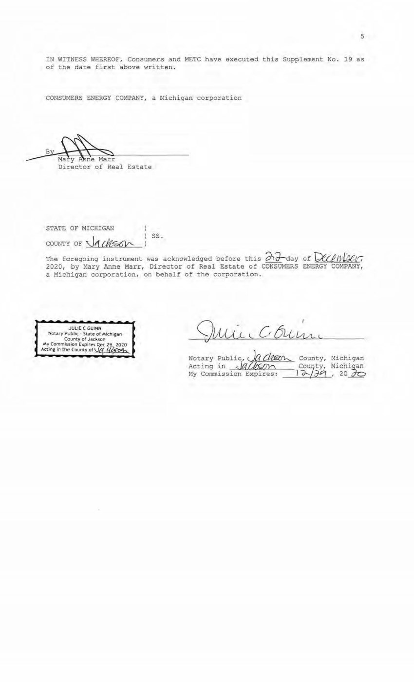
| 5 IN WITNESS WBEREOF, Consumers and METC have executed this Supplement No. 19 as of the date first above written. CONSUMERS ENERGY COMPANY, a Michigan corporation ~ y neMarr Director of Real Estate STATE OF MICHIGAN COUNTY OF ~1 (11.fi:£11' ss. The foregoing instrument was acknowledged before this d°)Hay of I)e.c/J1'Wer, 2020, by Mary Anne Marr, Director of Real Estate of CONSUMERS ENERGY COMPANY, a Michigan corporation, on behalf of the corporation. JULIE C GUINN Not,:1ry Public • SU!te Of Michiglln County of J,:1ckson My Commis51on cxpire'.jec 2J· 20ZO Acting in the County of~ CL~ Notary Public, J@;C~ Acting in s.Jt{C-b. l,ly-\ My Commission Expires: County, Michigan Cou~ty, Michi~ I ~IJ--°I , 20 · • |
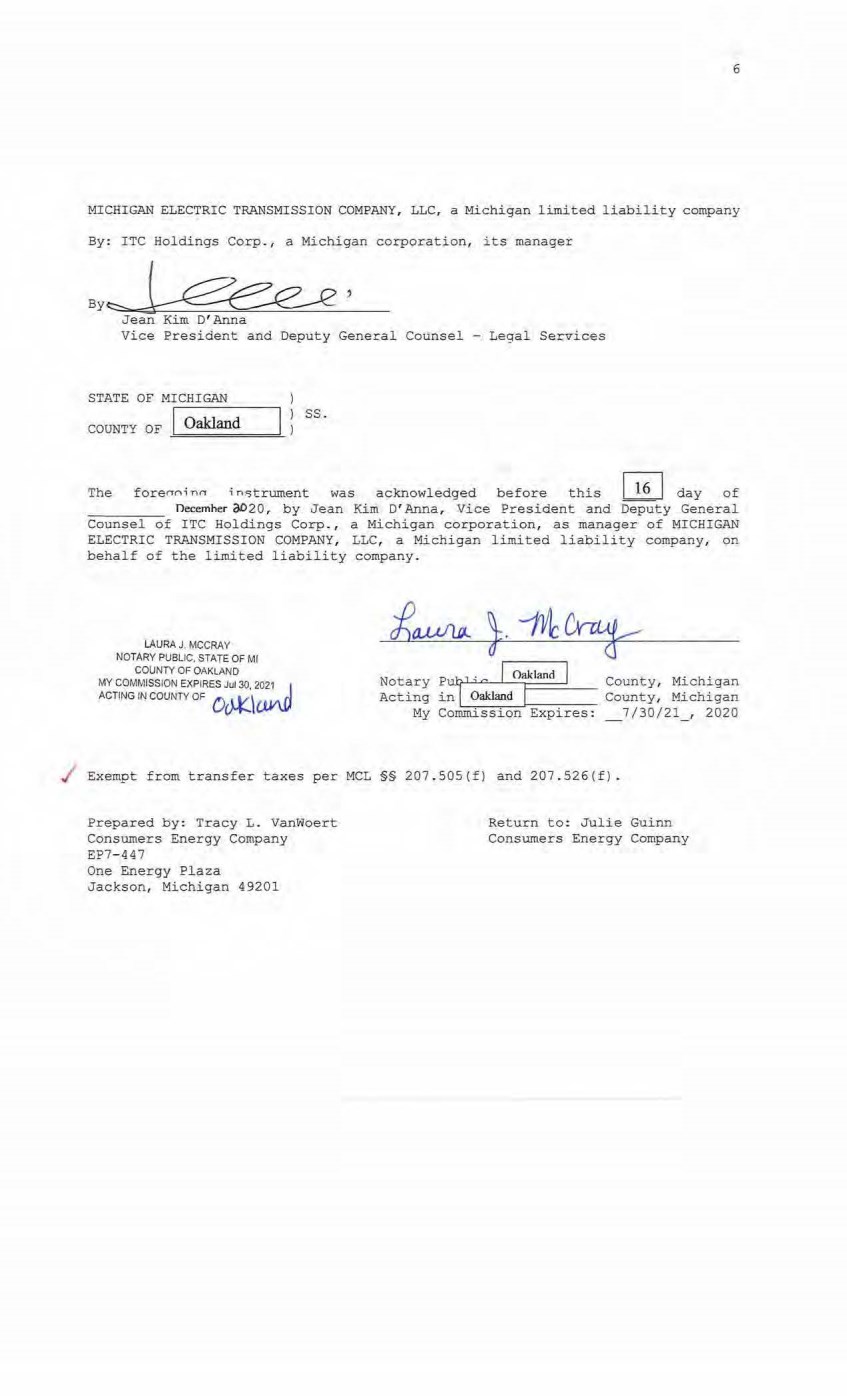
| 6 MICHIGAN ELECTRIC TRANSMISSION COMPANY, LLC, a Michigan limited liability company By: ITC Holdings Corp., a Michigan corporation, its manager By~' Jean Kim D' Anna Vice President and Deputy General Counsel - Legal Services STATE OF MICHIGAN COUNTY OF Oakland ss. The forerrni nrr i n15trument was acknowledged before this I 16 I day of necemher oD20 , by Jean Kim 0' Anna, Vice President and Deputy General Counsel of ITC Holdings Corp., a Michigan corporation, as manager of MICHIGAN ELECTRIC TRANSMISSION COMPANY , LLC, a Michigan limited liability company, on behalf of the limited liability company. LAURA J. MCCRAY NOTARY PUBLIC, STATE OF Ml COUNTY OF OAKLAND MY COMMISSION EXPIRES Jul 30, 2021 _I ACTING IN COUNTY OF Oc>,.l(.\C,tV\Ll Notary Pu!/" 0 I o.klMd I Cormt y, Mi ohigan Acting inl ~--Oa~_k_ la~o_d_l=--:--- County, Michigan My Commission Expires: _7/30/21, 2020 / Exempt from transfer taxes per MCL §§ 207.505(f) and 207.526(f). Prepared by: Tracy L. Vanwoert Consumers Energy Company EP7-447 One Energy Plaza Jackson, Michigan 49201 Return to: Julie Guinn Consumers Energy Company |

| THE ATTACHED COPY OF THE NINETEENTH SUPPLEMENTAL EXHIBIT A THAT WAS PREPARED FOR RECORDATION IN ST. JOSEPH COUNTY, MICHIGAN, AND CONTAINS THE PORTIONS OF EACH OF PARTS I , II, AND III OF THE NINETEENTH SUPPLEMENT EXHIBIT A THAT RELATE TO PREMISES IN THAT COUNTY ONLY. SEE SECTION 24.6 OF THE AGREEMENT. 7 |

| NINETEENTH SUPPLEMENTAL EXHIBIT A I . Fee Lands : See sheet: (s) labeled " NINETEENTH Suppl emental. Exhibit A- Part I'' , attached hereto and made a part hereof . Said attached sheet(s) labeled NINETEENTH Supplemental Exhibit A-Part I consist of tbe following: 3 Pages for Allegan County 6 Pages for Antrim County 2 Pages for Barry County 2 Pages for Bay County 13 Pages for Calhoun County 2 Pages for Charlevoix County 6 Pages for Cl inton County 4 Pages for Crawford County 7 Pages for Genesee County 1 Page for Gladwin County 6 Pages for Grand '.I'raverse County 1 Page for Gratiot County 2 Pages for Ingham County 2 Pages for Ionia county 1 Page for Isabel la County 2 Pages for Jackson County 1 Page for Kalkaska County 4 Pages for Kent County 1 Page for Leelanau County 3 Pages for Lenawee County 2 Pages for M anistee County 4 Pages for Midl and County 1 Page for Montcalm County 17 Pages for Muskegon County 1 Pages for Oceana County 1 Page for Ogemaw County 4 Pages for Ottawa County 3 Pages for Roscommon County 2 Pages for Saginaw County 3 Pages for Shia,·,assee County 1 Page for St. Joseph County 3 Pages for Washtenaw County 2 Pages for Wexford County Nineteenth Supplemental Exhibit A - Introductory Page 1 of 2 |
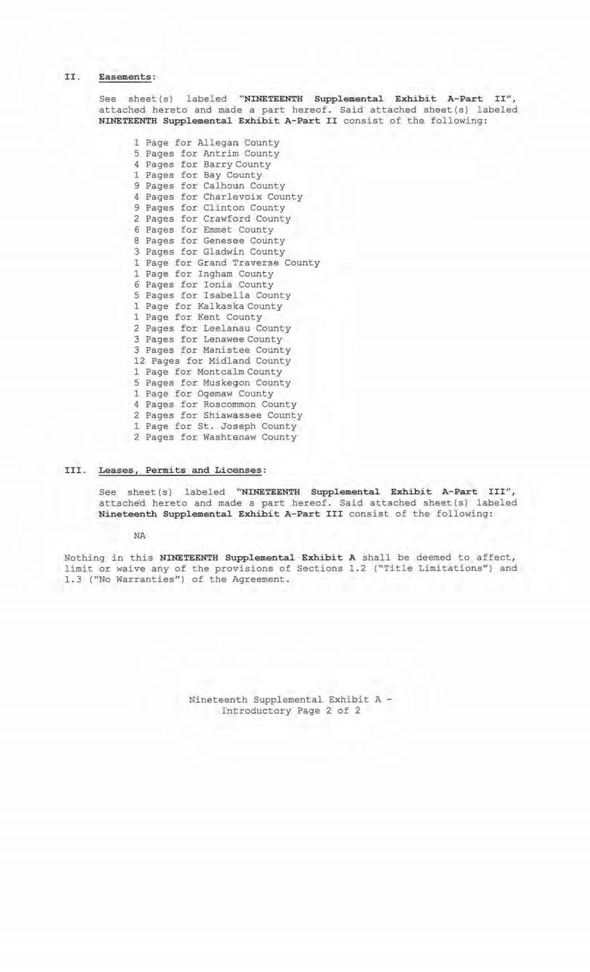
| II. Eas ements : See sheet(s) labeled "NINETEENTH Supplemental Exhibit A- Part II" , attached hereto and made a part hereof. Said attached sheet(s) labeled NINETEENTH Supplemental Exhibit A-Part II consist of the following: 1 Page £or Allegan County S Pages for Antrim County 4 Pages for Barry County 1 Pages for Bay County 9 Pages for Calhoun County 4 Pages for Charlevoix Count y 9 Pages for Clinton County 2 Pages for Crawford County 6 Pages £or Emmet County 8 Pages for Genesee County 3 Pages for Gladwin County 1 Page for Grand Traverse County 1 Page for Ingham County 6 Pages £or Ionia County 5 Pages for Isabella County 1 Page for Kalkaska County 1 Page for Kent County 2 Pages for Leelanau Coun ty 3 Pages for Lenawee County 3 Pages for Manistee County 12 Pages for Midland County 1 Page for Montcalm County 5 Pages for Muskegon County 1 Page for Ogemaw County 4 Pages for Roscommon County 2 Pages for Shi awassee County 1 Page for St. Joseph County 2 Pages for Washtenaw County III. Leases, Permits and Licenses: See sheet (s) labeled "NINETEENTH Supplemental Exhibit A-Part III'', attached hereto and made a part hereof. Said attached sheet(s) labeled Nineteenth Supplemental Exhibit A-Part III consist of the following: NA Nothing in this NINETEENTH Supplemental Exhibit A shall be deemed to affect, limit or waive any of the provisions of Sections 1. 2 ("Title Limitations") and 1 . 3 ("No Warranties" ) of the Agreement . Nineteenth Supplemental Exhibit A - Introductory Page 2 of 2 |
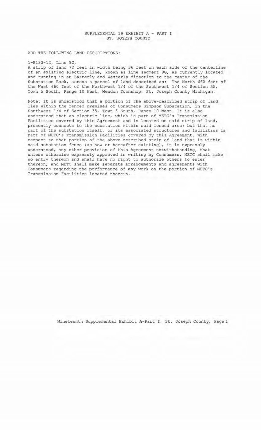
| SUPPLEMENTAL 19 EXHIBIT A - PART I ST. JOSEPH COUNTY ADD THE FOLLOWING LAND DESCRIPTIONS : l - El33-12, Line 8G, A strip of land 72 feet in width being 36 feet on each side of t he centerline of an existing electric l ine, known as line segment 8G, as currently located and running in an Easterly and Westerly direction to the center of the Substation Rack, across a parcel of land described as : The Nor th 660 feet of the West 660 feet of the Northwest 1/4 of the Southwest 1/4 of Section 35, Town 5 South, Range 10 West, Mendon Township, St. Joseph County Michi gan . Note: It is understood that a portion of the above- described strip of l and l i es wi thin the fenced premises of Consumers Simpson Substation, in the Southwest 1/4 of Section 35, Town 5 South, Range 10 West. It is also understood that an electric line, which i s part of METC ' s Transmission Facilities covered by this Agreement and is located on said strip of land, presently connects to the substation within said fenced area; but that no part of the substation itself, or its associated structures and facilities is part of METC ' s Transmission Facilities covered by this Agreement . With respect to that portion of the above- descri bed strip of l and that is within said substation fence (as now or hereafter existi ng) , it is expressl y understoodr any other provisi on of this Agreement notwithstanding, that unless otherwise expressly approved in wri t i ng by Consumers, METC shall make no entry thereon and shall have no right to authorize others to enter thereon; and METC shall make separate arrangements and agreements with Consumer s regarding the performance of any work on the portion of METC ' s Transmission Facilities located therein . Nineteent h Supplemental Exhibit A-Part I , St. Joseph County, Pagel |
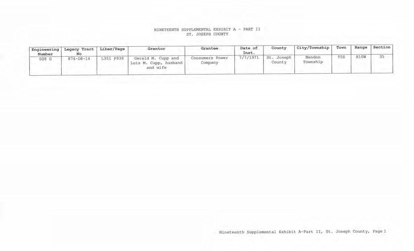
| Enginee, ring Legacy Tract Liber/Page Number No 008 G 87 4-D8-14 L351 P939 NINETEENTH SUPPLEMENTAL EXHIBIT A - PART II ST . JOSEPH COUN TY Granter Grantee Date of Inst. Gerald M . Cupp and Consumers Power 7/7/1971 Lois M. Cupp, husband Company and wife County City/Township Town Range Section St . Joseph Mendon TSS Rl0W 35 County Township Nineteenth Supplemental Exhibit A- Part II, St . Joseph County, Pagel |
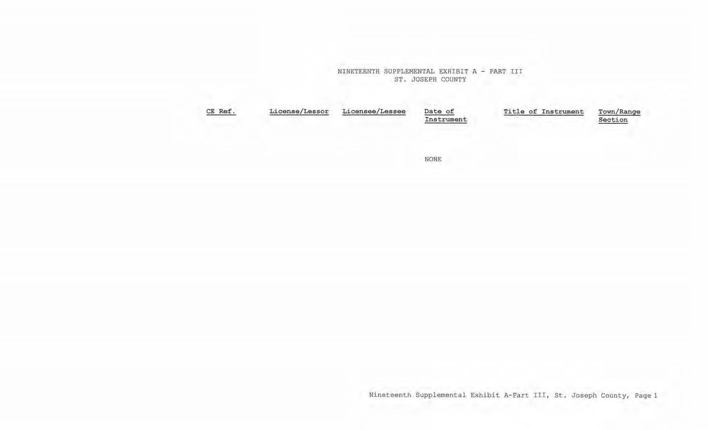
| CE Ref. License/Lessor NINETEENTH SUPPLEMENTAL EXHIBIT A - PAR'l' I.II ST . JOSEPH COUNTY Licensee/Lessee Date of Instrument NONE Ti tie of Instrument Town/Range Section Nineteenth Supplemental Exhibit A-Part III, St. Joseph County, Page 1 |

| Th)lf ~ubmlUlw Recrt!f/J. Date-4>-2--- 20 Time '11/11 Lawrence eslenbaum Washtenaw County Clerk/Register SUPPLEMENT NO. 19 TO AMENDED AND RESTATED EASEMENT AGREEMENT THIS SUPPLEMENT NO. 19 TO ~NDED AND RES~ED E"9EMENT AGREEMENT ("Supplement No. 19") is made this 2,b. day of Y({f;tn,bJK , 2020, between CONSUMERS ENERGY COMPANY (formerly known as Consumers Power Company), a Michigan corporation, (successor by merger to Consumers Power Company, a Maine corporation), One Energy Plaza, Jackson, Michigan 49201 ("Consumers") and MICHIGAN ELECTRIC TRANSMISSION COMPANY, LLC, a Michigan limited liability company (successor by merger to Michigan Electric Transmission Company, a Michigan corporation), 27175 Energy Way, Novi, Michigan 48377 ("METC"). RECITALS: A. Consumers and METC entered into a certain Easement Agreement dated April 1, 2001 whereunder Consumers granted an "Easement" (as therein defined) to METC in respect to certain "Premises" in the State of Michigan for the use set forth therein and on and subject to all of the terms and conditions set forth therein. B. Consumers and METC agreed on certain revisions to the terms and conditions of said Easement Agreement, and for ease of reference, restated said Easement Agreement in its entirety, to include all of .said agreed-upon revisions as well as all unchanged provisions, in a certain Amended and Restated Easement Agreement dated as of April 29, 2002 (the "Agreement"). C. The "Premises" under the Agreement are therein defined as (a) the lands identified as "fee lands" in Part "I" of Exhibit A, attached to the Agreement, (b) the lands covered by the easements held by Consumers that are identified in Part "II" of Exhibit A, attached to the Agreement, and (c) the lands covered by the leases, permits and licenses held by Consumers.that are identified in Part "III" of Exhibit A, attached to the Agreement; as said Parts I, II and III of Exhibit A were supplemented or modified in a certain Supplement No. 1 dated April 29, 2002, in a certain Supplement No. 2 dated April 29, 2002, in a certain Supplement No. 3 dated March 3, 2003, in a certain Supplement No. 4 dated October 2, 2006, in a certain Supplement No. 5 dated August 3, 2007, in a certain Supplement No. 6 dated June 18, 2008, in a certain Supplement No. 7 dated September 18, 2008, in a certain Supplement No. 8 dated December 4, 2008, in a certain Supplement No. 9 dated February 22, 2010, in a certain Supplement No. 10 dated March 25, 2010, in a certain Supplement No. 11 dated October 12, 2011, in a certain Supplement No. 12 dated July 20, 2012, in a certain Supplement No. 13 dated August 21, 2012, in a certain Supplement No. 14 dated September 23, 2013, in a certain Supplement No. 15 dated January 13, 2014, in a certain Supplement No. 16 dated January 31, 2017, in a certain Supplement No. 17 dated September 25, 2019, and in a certain Supplement No. 18 dated June 8, 2020, heretofore entered into by Consumers and METC. The parties now desire to further supplement and modify said Exhibit A to the Agreement as set forth herein below. |
| 6569708 L: 5402 P: 877 EAS 02/03/2021 02:26 PM Page 2 of 15 2 D. References, in regard to historical matters, to "METC" in the foregoing recitals will be deemed to mean METC' s predecessor, Michigan Electric Transmission Company, a Michigan corporation, where relevant. NOW, THEREFORE, for good and valuable consideration, the receipt of which is acknowledged, Consumers and METC agree as follows: 1. Exhibit A to the Agreement, as heretofore supplemented and/or modified, is hereby further supplemented and modified as set forth in "Nineteenth Supplemental Exhibit A", attached hereto. 2. It is expressly understood that any lands, easements, or leases/permits/licenses that are indicated in said attached Nineteenth Supplemental Exhibit A as being added are, on and subject to the terms and conditions of the Agreement (as supplemented and amended by this Supplement No. 19), hereby deemed added to Part I, Part II and Part III, respectively, of Exhibit A to the Agreement. However, it is further expressly understood that in addition to all rights granted to METC by the Agreement, METC shall have the following rights as to the lands identified as "Consumers Energy Equipment/ Joint Asset Area Easement" on the accompanying NINETEENTH Supplemental Exhibit A sheets, inclusive of Parts I, II and III, which rights are also subject to the terms of the Parties' Amended and Restated Transmission Interconnection Agreement (the "DTIA"): (a) the right to maintain any and all existing components of the Transmission System, as defined in the DTIA, and wiring or conduit connections for the same that currently exist over, on or under these lands; and (b)the right to connect its currently sited or future approved wiring or conduits for communications, station power, or control, operating at 600 volts or less, and any Jointly Owned Assets, as defined in the DTIA, over, on or under these lands. It is also expressly understood that, with respect to any lands, easements, or leases/permits/licenses now covered by Part I, Part II or Part III of Exhibit A that are indicated in said attached Nineteenth Supplemental Exhibit A as being deleted, the Easement is hereby deemed RELEASED with respect thereto and the Agreement shall hereafter no longer apply thereto (provided, however, that all rights and obligations under the Agreement with respect to periods prior to the date of this Supplement No. 19 shall remain unaffected). It is expressly understood and agreed Premises represented by the land(s), and/or license (s) that are added to Exhibit A to the Agreement pursuant "Additional Premises,,): that in respect to the additional easement (s), lease (s), permit (s) Part I, Part II and Part III of to this Supplement No. 19 (the (a) All references to "Commencement Date" that are found in Article 1 ("Grant of Easement"), Article 2 ("Term"), Article 5 ("Additions/Alterations"), Article 6 ("Consumers' Reserved Rights to Use the Premises and Transmission Facilities"), Article 7 ("METC Approval of Compatible Uses"), Article 8 ("Certain Obligations of Consumers and Authorized Users; Etc.") and Article 14 ("Environmental Matters") of the Agreement shall be deemed to mean the date of this Supplement No. 19 and not the date that is identified in the Agreement as the "Commencement Date". |
| I 6569708 L: 5402 P: 877 EAS 02/03/2021 02:26 PM Page 3 of 15 3 (b) Except as expressly otherwise indicated in the immediately following sentence, all references to "Restated Agreement Date" that are found in Article 1 ("Grant of Easement"), Article 6 (''Consumers' Reserved Rights to Use the Premises and Transmission Facilities"), and Article 12 ("Compliance With Applicable Laws") of the Agreement shall also be deemed to mean the date of this Supplement No. 19 and not the date that is identified in the Agreement as the "Restated Agreement Date". Notwithstanding the foregoing: (i) the preceding sentence does not apply to the purely historical statement in clause "(c)" of Section 1. 2 of the Agreement that Trans-Elect, Inc. is "an affiliate of the entity which has become METC's parent company as of the Restated Agreement Date"; and (ii) the parenthetical in the first sentence of the first paragraph of Section 7.1 of the Agreement reading "(see below regarding a certain period prior to the Restated Agreement Date)", along with the fourth paragraph of said Section 7.1 reading "Consumers shall submit to METC within twenty (20) days of the Restated Agreement Date a list of all material Compatible Uses other than additions or modifications to Distribution Facilities that have been authorized between February 1, 2001 and the Restated Agreement Date for METC's approval per the METC Compatible Use approval process described in this Section 7.1.", both referred to a one-time historical matter and have no application to the Additional Premises or any other further effect or application whatsoever. 3. In addition to the original Transmission Facilities and Additions/Alterations thereto as referred to in Recital "A" of the Agreement, it is understood that such electric Transmission towers, pole structures, poles, crossarms, wires, cables, conduits, guys, anchors, transformers, insulators and/or other fixtures and equipment as may be owned by METC and located on the Additional Premises as of the date of this Supplement No. 19, and future Additions/Alternations made thereto on and subject to the terms and conditions of the Agreement, are included in the "Transmission Facilities" under the Agreement. Note: This Supplement No. 19 will not be recorded in all counties in which the Agreement itself, or Supplements Nos. 1 through 18, may have been recorded. This Supplement No. 19 (as were each of Supplements Nos. 1 through 18), will be recorded only in the county(ies) in which relevant Premises are located; being, in the case of this Supplement No. 19, only the following: |

| 6569708 L: 5402 P: 877 EAS 02/03/2021 02:26 PM Page 4 of 15 Allegan County Antrim County Barry County Bay County Calhoun County Charlevoix County Clinton County Crawford County Emmet County Genesee County Gladwin County Grand Traverse County Gratiot County Ingham County Ionia County Isabella County Jackson County Kalkaska County Kent County Leelanau County Lenawee County Manistee County Midland County Montcalm County Muskegon County Oceana County Ogemaw County Ottawa County Roscommon County Saginaw County Shiawassee County St. Joseph County Washtenaw County Wexford County 4 The fact that this Supplement No. 19 will be recorded only in the particular county(ies) identified above will in no way restrict, limit or otherwise affect the interpretation, application or enforcement of the Agreement; and the terms and conditions of the Agreement shall at all times be read, interpreted and applied in the manner provided for in Section 24.6 of the Agreement. |
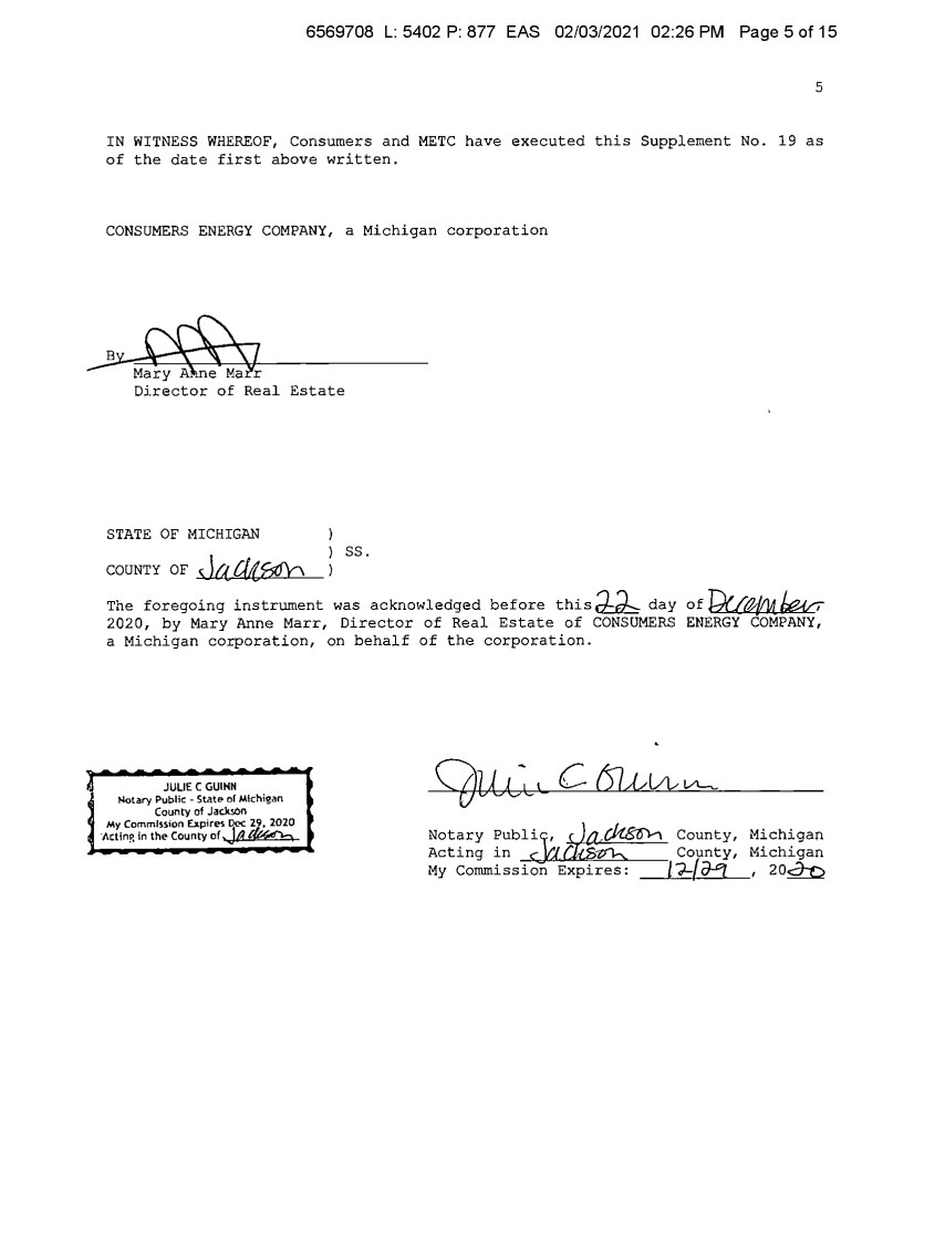
| 6569708 L: 5402 P: 877 EAS 02/03/2021 02:26 PM Page 5 of 15 5 IN WITNESS WHEREOF, Consumers and METC have executed this Supplement No. 19 as of the date first above written. CONSUMERS ENERGY COMPANY, a Michigan corporation _.3--~-7 MaryeMalr Director of Real Estate STATE OF MICHIGAN couNTY oF s la 4i.f5db ss. The foregoing instrument was acknowledged before this~ day of Wa,/IM.w 2020, by Mary Anne Marr, Director of Real Estate of CONSUMERS ENERGY COMPANY, a Michigan corporation, on behalf of the corporation. JULIE C GUINN Notary Public - Statt!> or Michigan County of Jack50n My Commission U.pir~ Dec~ ·Act In?, in the County of ,J,q Not~ry :ubli] ~ County, Acting in c 'J County, My Commission Expires: /?-{o-'] Michigan Michigan , 20~ |
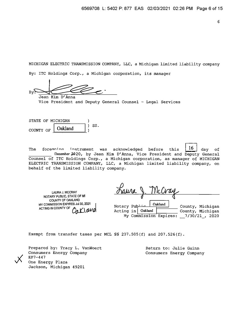
| 6569708 L: 5402 P: 877 EAS 02/03/2021 02:26 PM Page 6 of 15 6 MICHIGAN ELECTRIC TRANSMISSION COMPANY, LLC, a Michigan limited liability company By: ITC Holdings Corp., a Michigan corporation, its manager By. ~ • Jean Kim D'Anna Vice President and Deputy General Counsel - Legal Services STATE OF MICHIGAN coONTY OF I Oakland ss. The forenni nn i n,;trument was acknowledged before this ~ day of Oecemher J.020, by Jean Kim D' Anna, Vice President and Deputy General Counsel of ITC Holdings Corp., a Michigan corporation, as manager of MICHIGAN ELECTRIC TRANSMISSION COMPANY, LLC, a Michigan limited liability company, on behalf of the limited liability company. LAURAJ. MCCRAY NOTARY PUBLIC, STA1E OF Ml COUNlY OF OAKLAND MY COMMISSION EXPIRES Jul 30, 2021 I ACTING IN COUNTY OF Do-.(.\ £V,!\l)\ Notary~,·~ I Oakland I C t M' h' .. : - . oun y, 1c igan Acting inLO_;ak_Ian_d_J.1--c-- County, Michigan My Commission Expires: _7/30/21, 2020 Exempt from transfer taxes per MCL §§ 207.SOS(f) and 207.526(f). Prepared by: Tracy L. Vanwoert Consumers Energy Company EP7-447 One Energy Plaza Jackson, Michigan 49201 Return to: Julie Guinn Consumers Energy Company |

| 6569708 L: 5402 P: 877 EAS 02/03/2021 02:26 PM Page 7 of 15 THE ATTACHED COPY OF THE NINETEENTH SUPPLEMENTAL EXHIBIT A THAT WAS PREPARED FOR RECORDATION IN WASHTENAW COUNTY, MICHIGAN, AND CONTAINS THE PORTIONS OF EACH OF PARTS I, II, AND III OF THE NINETEENTH SUPPLEMENT EXHIBIT A THAT RELATE TO PREMISES IN THAT COUNTY ONLY. SEE SECTION 24.6 OF THE AGREEMENT. 7 |
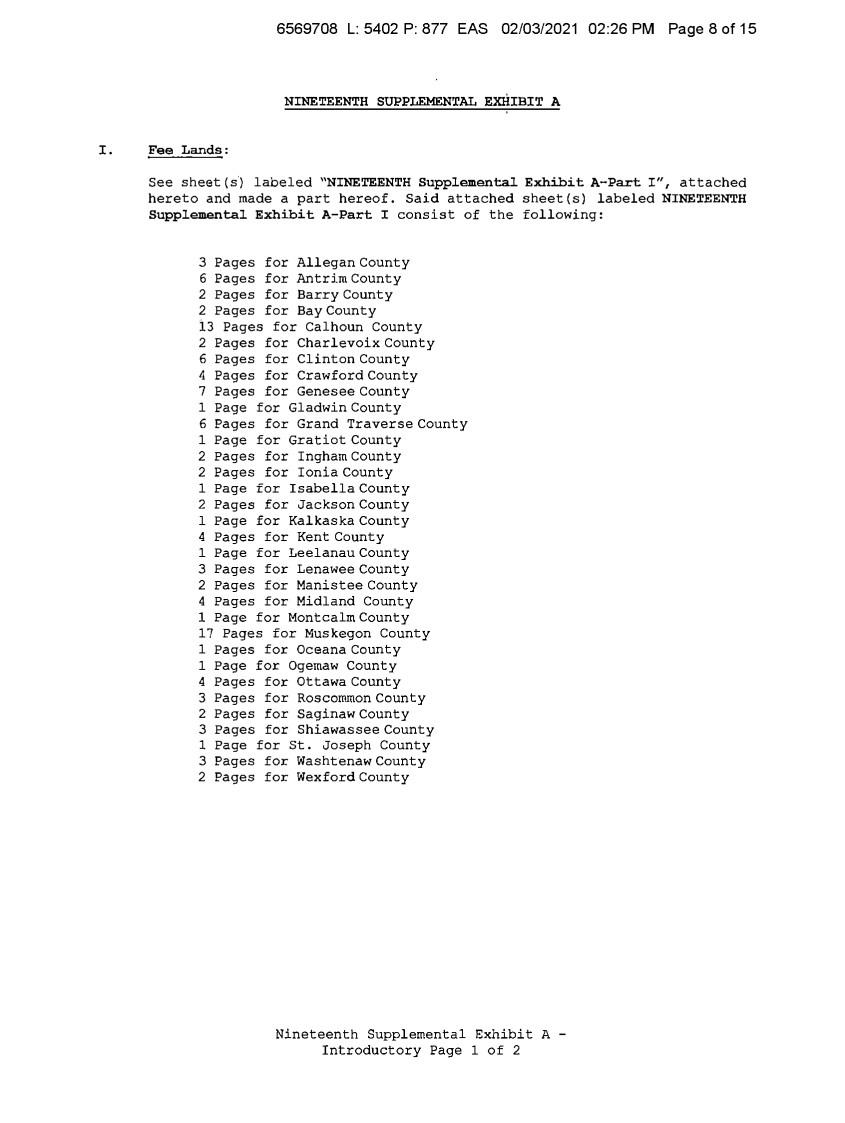
| 6569708 L: 5402 P: 877 EAS 02/03/2021 02:26 PM Page 8 of 15 NINETEENTH SUPPLEMENTAL EXHIBIT A I. Fee Lands: See sheet (s) labeled "NINETEENTH Supplemental Exhibit A-Part I", attached hereto and made a part hereof. Said attached sheet(s) labeled NINETEENTH Supplemental Exhibit A-Part I consist of the following: 3 Pages for Allegan County 6 Pages for Antrim County 2 Pages for Barry County 2 Pages for Bay County 13 Pages for Calhoun County 2 Pages for Charlevoix County 6 Pages for Clinton County 4 Pages for Crawford County 7 Pages for Genesee County 1 Page for Gladwin County 6 Pages for Grand Traverse County 1 Page for Gratiot County 2 Pages for Ingham County 2 Pages for Ionia County 1 Page for Isabella County 2 Pages for Jackson County 1 Page for Kalkaska County 4 Pages for Kent County 1 Page for Leelanau County 3 Pages for Lenawee County 2 Pages for Manistee County 4 Pages for Midland County 1 Page for Montcalm County 17 Pages for Muskegon County 1 Pages for Oceana County 1 Page for Ogemaw County 4 Pages for Ottawa County 3 Pages for Roscommon County 2 Pages for Saginaw County 3 Pages for Shiawassee County 1 Page for St. Joseph County 3 Pages for Washtenaw County 2 Pages for Wexford County Nineteenth Supplemental Exhibit A - Introductory Page 1 of 2 |
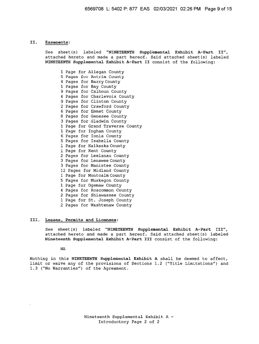
| 6569708 L: 5402 P: 877 EAS 02/03/2021 02:26 PM Page 9 of 15 II. Easements: III. See sheet(s) labeled "NINETEENTH Suppl'emental Exhibit A-Part II", attached hereto and made a part hereof. Said attached sheet(s) labeled NINETEENTH Supplemental Exhibit A-Part II consist of the following: 1 Page for Allegan County 5 Pages for Antrim County 4 Pages for Barry County 1 Pages for Bay County 9 Pages for Calhoun County 4 Pages for Charlevoix County 9 Pages for Clinton County 2 Pages for Crawford County 6 Pages for Emmet County 8 Pages for Genesee County 3 Pages for Gladwin County 1 Page for Grand Traverse County 1 Page for Ingham County 6 Pages for Ionia County 5 Pages for Isabella County 1 Page for Kalkaska County 1 Page for Kent County 2 Pages for Leelanau County 3 Pages for Lenawee County 3 Pages for Manistee County 12 Pages for Midland County 1 Page for Montcalm County 5 Pages for Muskegon County 1 Page for Ogemaw County 4 Pag·es for Roscommon County 2 Pages for Shiawassee County 1 Page for St. Joseph County 2 Pages for Washtenaw County Leasesf Permits and Licenses: See sheet(s) labeled "NINETEENTH Supplemental Exhibit A-Part III", attached hereto and made a part hereof. Said attached sheet(s) labeled Nineteenth Supplemental Exhibit A-Part III consist of the following: NA Nothing in this NINETEENTH Supplemental Exhibit A shall be deemed to affect, limit or waive any of the provisions of Sections 1.2 ("Title Limitations") and 1.3 ("No Warranties") of the Agreement. Nineteenth Supplemental Exhibit A - Introductory Page 2 of 2 |
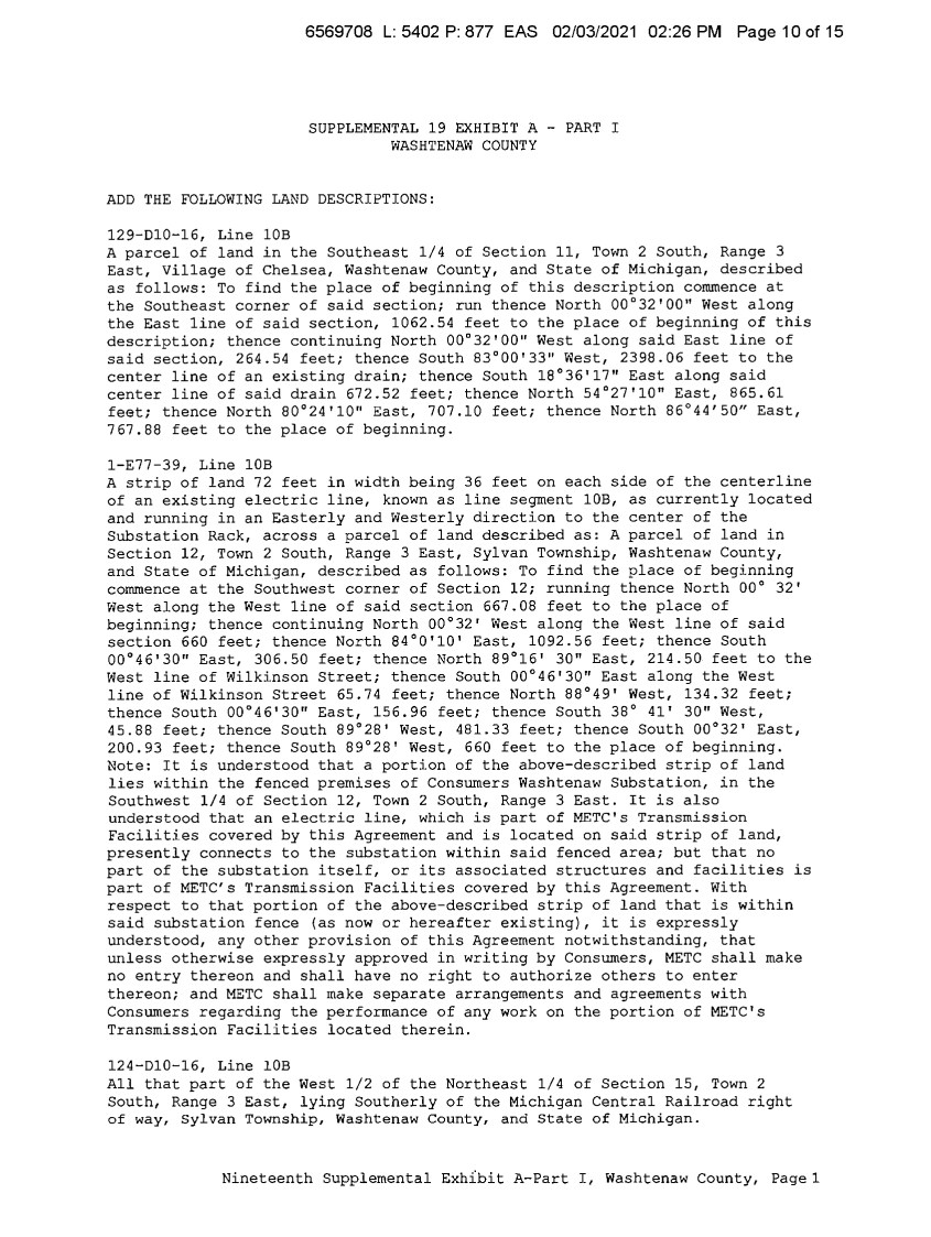
| 6569708 L: 5402 P: 877 EAS 02/03/2021 02:26 PM Page 10 of 15 SUPPLEMENTAL 19 EXHIBIT A - PART I WASHTENAW COUNTY ADD THE FOLLOWING LAND DESCRIPTIONS: 129-Dl0-16, Line 10B A parcel of land in the Southeast 1/4 of Section 11, Town 2 South, Range 3 East, Village of Chelsea, Washtenaw County, and State of Michigan, described as follows: To find the place of beginning of this description commence at the Southeast corner of said section; run thence North 00°32'00 11 West along the East line of said section, 1062.54 feet to the place of beginning of this description; thence continuing North 00°32'00 11 West along said East line of said section, 264.54 feet; thence South 83°00'33'' West, 2398.06 feet to the center line of an existing drain; thence South 18°36'17" East along said center line of said drain 672.52 feet; thence North 54°27'10" East, 865.61 feet; thence North 80°24'10" East, 707.10 feet; thence North 86°44'50" East, 767.88 feet to the place of beginning. 1-E77-39, Line 10B A strip of land 72 feet in width being 36 feet on each side of the centerline of an existing electric line, known as line segment 10B, as currently located and running in an Easterly and Westerly direction to the center of the Substation Rack, across a parcel of land described as: A parcel of land in Section 12, Town 2 South, Range 3 East, Sylvan Township, Washtenaw County, and State of Michigan, described as follows: To find the place of beginning commence at the Southwest corner of Section 12; running thence North 00° 32' West along the West line of said section 667.08 feet to the place of beginning; thence continuing North 00°32' West along the West line of said section 660 feet; thence North 84°0'10' East, 1092.56 feet; thence South 00°46'30" East, 306.50 feet; thence North 89°16' 30" East, 214.50 feet to the West line of Wilkinson Street; thence South 00°46'30" East along the West line of Wilkinson Street 65.74 feet; thence North 88°49' West, 134.32 feet; thence South 00'46'30" East, 156.96 feet; thence South 38° 41' 30" West, 45.88 feet; thence South 89°28' West, 481.33 feet; thence South 00°32' East, 200.93 feet; thence South 89°28' West, 660 feet to the place of beginning. Note: It is understood that a portion of the above-described strip of land lies within the fenced premises of Consumers Washtenaw Substation, in the Southwest 1/4 of Section 12, Town 2 South, Range 3 East. It is also understood that an electric line, which is part of METC's Transmission Facilities covered by this Agreement and is located on said strip of land, presently connects to the substation within said fenced area; but that no part of the substation itself, or its associated structures and facilities is part of METC's Transmission Facilities covered by this Agreement. With respect to that portion of the above-described strip of land that is within said substation fence (as now or hereafter existing), it is expressly understood, any other provision of this Agreement notwithstanding, that unless otherwise expressly approved in writing by Consumers, METC shall make no entry thereon and shall have no right to authorize others to enter thereon; and METC shall make separate arrangements and agreements with Consumers regarding the performance of any work on the portion of METC's Transmission Facilities located therein. 124-Dl0-16, Line 10B All that part of the West 1/2 of the Northeast 1/4 of Section 15, Town 2 South, Range 3 East, lying Southerly of the Michigan Central Railroad right of way, Sylvan Township, Washtenaw County, and State of Michigan. Nineteenth Supplemental Exh1bit A-Part I, Washtenaw County, Pagel |
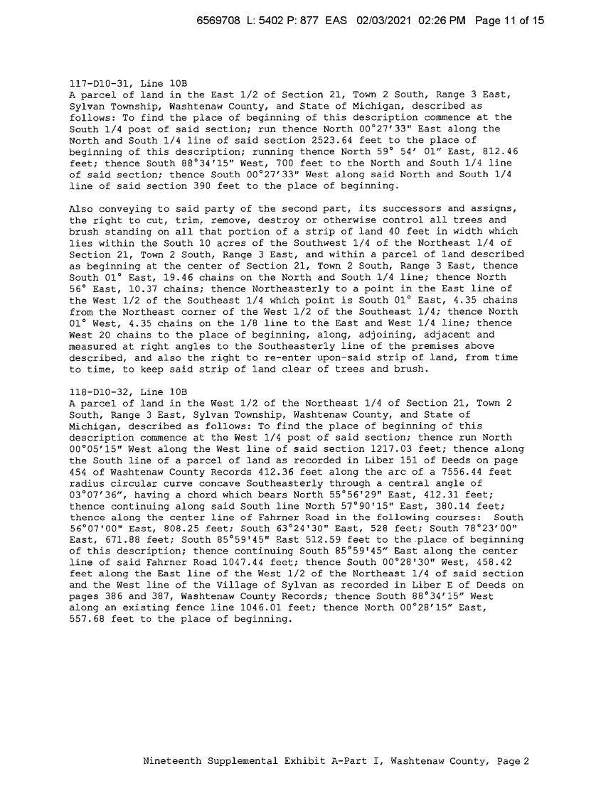
| 6569708 L: 5402 P: 877 EAS 02/03/2021 02:26 PM Page 11 of 15 117-Dl0-31, Line 10B A parcel of land in the East 1/2 of Section 21, Town 2 South, Range 3 East, Sylvan Township, Washtenaw County, and State of Michigan, described as follows: To find the place of beginning of this description commence at the South 1/4 post of said section; run thence North 00°27'33" East along the North and South 1/4 line of said section 2523.64 feet to the place of beginning of this description; running thence North 59° 54' 01" East, 812.46 feet; thence South 88°34'15" West, 700 feet to the North and South 1/4 line of said section; thence South 00°27'33" West along said North and South 1/4 line of said section 390 feet to the place of beginning. Also conveying to said party of the second part, its successors and assigns, the right to cut, trim, remove, destroy or otherwise control all trees and brush standing on all that portion of a strip of land 40 feet in width which lies within the South 10 acres of the Southwest 1/4 of the Northeast 1/4 of Section 21, Town 2 South, Range 3 East, and within a parcel of land described as beginning at the center of Section 21, Town 2 South, Range 3 East, thence South 01° East, 19.46 chains on the North and South 1/4 line; thence North 56° East, 10.37 chains; thence Northeasterly to a point in the East line of the West 1/2 of the Southeast 1/4 which point is South 01° East, 4.35 chains from the Northeast corner of the West 1/2 of the Southeast 1/4; thence North 01° West, 4.35 chains on the 1/8 line to the East and West 1/4 line; thence West 20 chains to the place of beginning, along, adjoining, adjacent and measured at right angles to the Southeasterly line of the premises above described, and also the right to re-enter upon-said strip of land, from time to time, to keep said strip of land clear of trees and brush. 118-Dl0-32, Line 10B A parcel of land in the West 1/2 of the Northeast 1/4 of Section 21, Town 2 South, Range 3 East, Sylvan Township, Washtenaw County, and State of Michigan, described as follows: To find the place of beginning of this description commence at the West 1/4 post of said section; thence run North 00°05'15" West along the West line of said section 1217.03 feet; thence along the South line of a parcel of land as recorded in Liber 151 of Deeds on page 454 of Washtenaw County Records 412.36 feet along the arc of a 7556.44 feet radius circular curve concave Southeasterly through a central angle of 03°07'36", having a chord which bears North 55°56'29" East, 412.31 feet; thence continuing along said South line North 57°90'15" East, 380.14 feet; thence along the center line of Fahrner Road in the following courses: South 56°07'00" East, 808.25 feet; South 63°24'30" East, 528 feet; South 78°23'00" East, 671.88 feet; South 85°59'45" East 512.59 feet to the.place of beginning of this description; thence continuing South 85��59'45" East along the center line of said Fahrner Road 1047.44 feet; thence South 00°28'30" West, 458.42 feet along the East line of the West 1/2 of the Northeast 1/4 of said section and the West line of the Village of Sylvan as recorded in Liber E of Deeds on pages 386 and 387, Washtenaw County Records; thence South 88°34'15" West along an existing fence line 1046.01 feet; thence North 00°28'15" East, 557.68 feet to the place of beginning. Nineteenth Supplemental Exhibit A-Part I, Washtenaw County, Page2 |
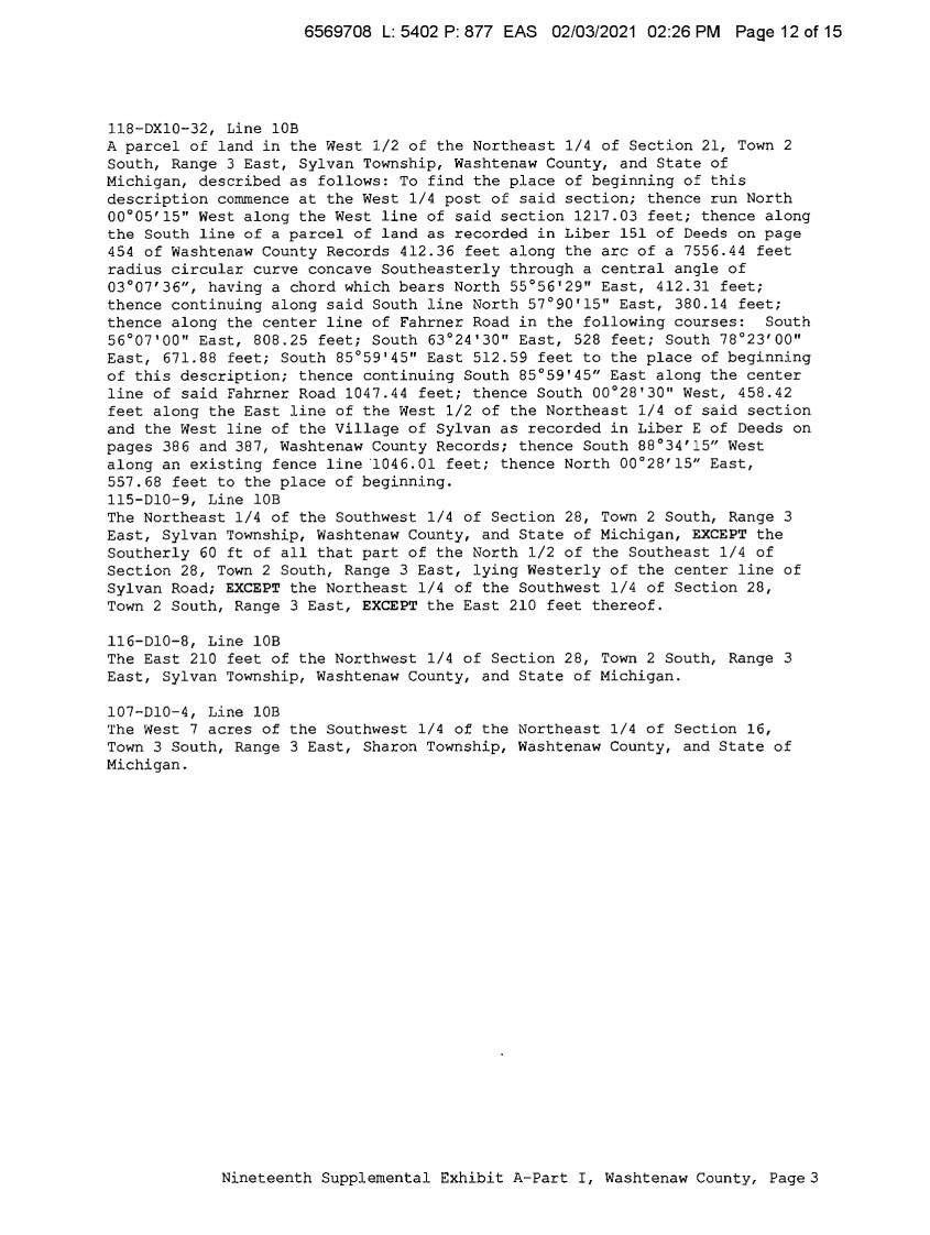
| 6569708 L: 5402 P: 877 EAS 02/03/2021 02:26 PM Page 12 of 15 118-DXl0-32, Line 10B A parcel of land in the West 1/2 of the Northeast 1/4 of Section 21, Town 2 South, Range 3 East, Sylvan Township, Washtenaw County, and State of Michigan, described as follows: To find the place of beginning of this description commence at the West 1/4 post of said section; thence run North 00°05'15" West along the West line of said section 1217.03 feet; thence along the South line of a parcel of land as recorded in Liber 151 of Deeds on page 454 of Washtenaw County Records 412.36 feet along the arc of a 7556.44 feet radius circular curve concave Southeasterly through a central angle of 03°07'36", having a chord which bears North 55°56'29" East, 412.31 feet; thence continuing along said South line North 57°90'15" East, 380.14 feet; thence along the center line of Fahrner Road in the following courses: South 56°07'00" East, 808.25 feet; South 63°24'30" East, 528 feet; South 78°23'00" East, 671.88 feet; South 85°59'45" East 512.59 feet to the place of beginning of this description; thence continuing South 85°59'45n East along the center line of said Fahrner Road 1047.44 feet; thence South 00°28'30" West, 458.42 feet along the East line of the West 1/2 of the Northeast 1/4 of said section and the West line of the Village of Sylvan as recorded in Liber E of Deeds on pages 386 and 387, Washtenaw County Records; thence South 88°34'15" West along an existing fence line ·1046.01 feet; thence North 00°28'15" East, 557.68 feet to the place of beginning. 115-D10-9, Line 10B The Northeast 1/4 of the Southwest 1/4 of Section 28, Town 2 South, Range 3 East, Sylvan Township, Washtenaw County, and State of Michigan, EXCEPT the Southerly 60 ft of all that part of the North 1/2 of the Southeast 1/4 of Section 28, Town 2 South, Range 3 East, lying Westerly of the center line of Sylvan Road; EXCEPT the Northeast 1/4 of the Southwest 1/4 of Section 28, Town 2 South, Range 3 East, EXCEPT the East 210 feet thereof. 116-D10-8, Line 10B The East 210 feet of the Northwest 1/4 of Section 28, Town 2 South, Range 3 East, Sylvan Township, Washtenaw County, and State of Michigan. 107-D10-4, Line 10B The West 7 acres of the Southwest 1/4 of the Northeast 1/4 of Section 16, Town 3 South, Range 3 East, Sharon Township, Washtenaw County, and State of Michigan. Nineteenth Supplemental Exhibit A-Part I, Washtenaw County, Page3 |
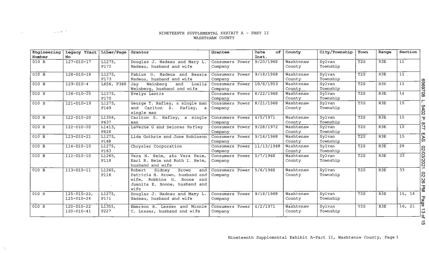
| Engineering Legacy Tract Li.bar/Page Number No 010 B 127-D10-17 L1275, P172 010 B 128-D10-18 L1275, P173 010 B 129-D10-4 L656, P368 010 B 126-D10-25 L1275, P170 010 B 121-D10-19 L1275, P169 010 B 122-D10-20 L1358, P637 010 B 122-D10-20 Ll413, P828 010 B 123-D10-21 L127 5, Pl68 010 B 114-D10-10 L1275, Pl63 010 B 112-D10-10 L1265, P118 010 B 113-D10-11 L1265, P116 010 B 125-D10-22, L1275, 125-D10-24 Pl 71 010 B 120-D10-22 L1355, 120-D10-41 P227 NINETEENTH SUPPLEMENTAL EXHIBIT A - PART II WASHTENAW COUNTY Grantor Grantee Data of Inst. Douglas J. Nadeau and Mary L. Consumers Power 9/20/1968 Nadeau, husband and wife Company Fabius 0. Nadeua and Bessie Consumers Power 9/18/1968 Nadeua, husband and wife Company Jay Weinberg and Luella Consumers Power 10/8/1953 Weinberg, husband and wife Company Evelyn Lantis Consumers Power 8/22/1968 Company George T. Hafley, a single man Consumers Power 8/21/1968 and Carlton s. Hafley, a Company single man Carlton s. Hafley, a single Consumers Power 4/5/1971 man Company Laverne G and Delores Hafley Consumers Power 9/28/1972 Company Lida Guthrie and June Robinson Consumers Power 9/16/1968 Company Chrysler Corporation Consumers Power 11/13/1968 Company Vera N. Heim, aka Vera Heim, Consumers Power 5/7/1968 Earl R. Heim and Ruth I. Heim, Company husband and wife Robert Sidney Brown and Consumers Power 5/6/1968 Patricia H. Brown, husband and Company wife, Robbins G. Boone and Juanita E. Boone, husband and wife Douglas J. Nadeau and Mary L. Consumers Power 9/18/1968 Nadeau, husband and wife Company Emerson H. Lesser and Minnie Consumers Power 4/2/1971 C. Lesser, husband and wife Company County City /Township Town Range Washtenaw Sylvan T2S R3E County Township Washtenaw Sylvan T2S R3E County Township Washtenaw Sylvan T2S R3E County Township Washtenaw Sylvan T2S R3E County Township Washtenaw Sylvan T2S R3E County Township Washtenaw Sylvan T2S R3E County Township Washtenaw Sylvan T2S R3E County Township Washtenaw Sylvan T2S R3E County Township Washtenaw Sylvan T2S R3E County Township Washtenaw Sylvan T2S R3E County Township Washtenaw Sylvan T2S R3E County Township Washtenaw Sylvan T2S R3E County Township Washtenaw Sylvan T2S R3E County Township Nineteenth Supplemental Exhibit A-Part II, Washtenaw County, Page 1 Section 11 11 11 14 15 15 15 15 28 33 33 15, 14 16, 21 a, u, a, (0 -..J 0 OJ r u, .,,. 0 "' "U OJ -..J -..J rn ~ 0 "' 0 ~ "' 0 "' ~ 0 "' "' a, "U s: "U "' (0 I CD ~ (,) 0 - ~ u, |
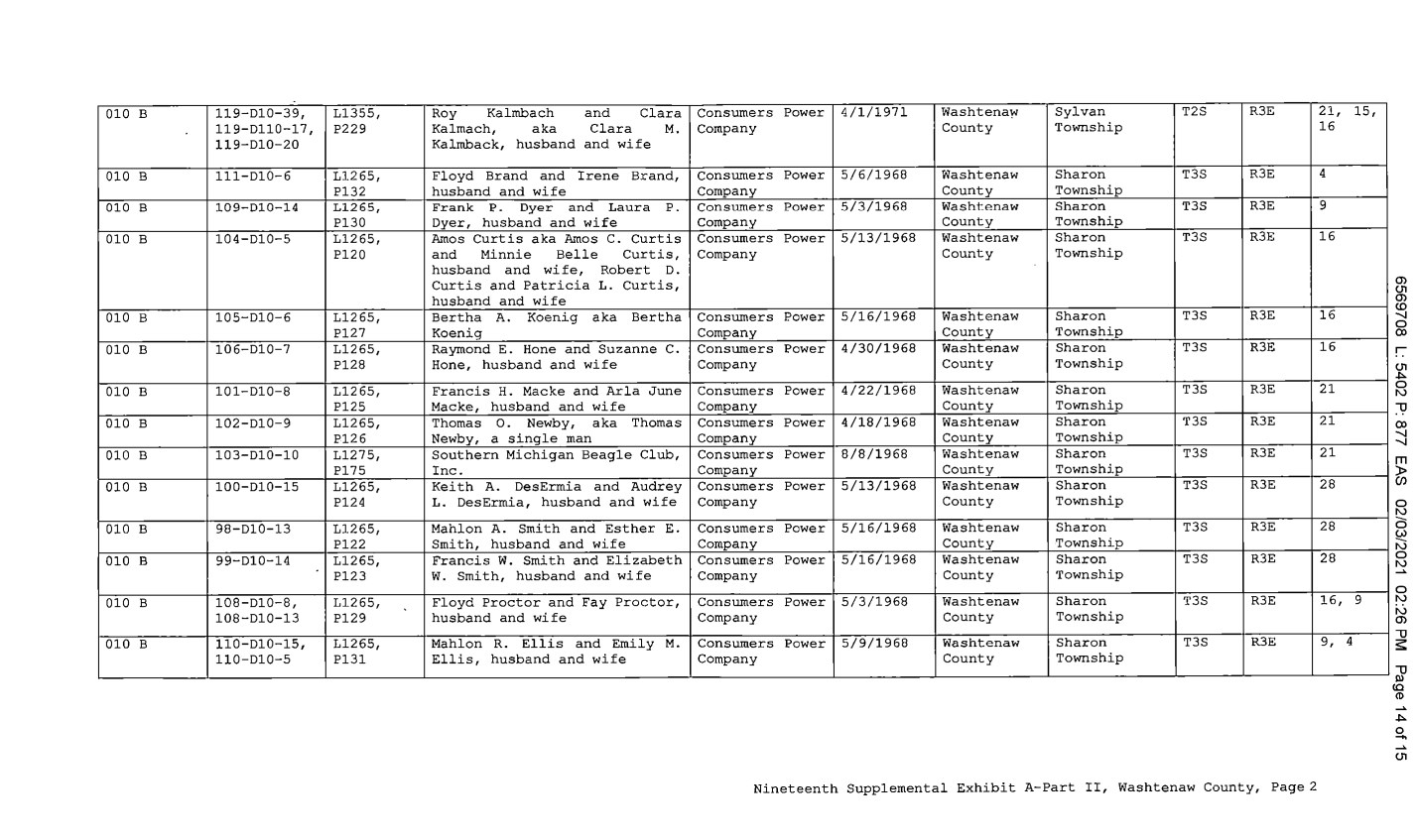
| 010 B 119-D10-39, L1355, Roy Kalmbach and Clara 119-D110-17, P229 Kalmach, aka Clara M. 119-D10-20 Kalmback, husband and wife 010 B 111-D10-6 L1265, Floyd Brand and Irene Brand, P132 husband and wife 010 B 109-D10-14 L1265, Frank P. Dyer and Laura P. P130 Dyer, husband and wife 010 B 104-D10-5 L1265, Amos Curtis aka Amos C. Curtis P120 and Minnie Belle Curtis, husband and wife, Robert D. Curtis and Patricia L. Curtis, husband and wife 010 B 105-D10-6 Ll265, Bertha A. Koenig aka Bertha P127 Koenig 010 B 106-D10-7 L1265, Raymond E. Hone and Suzanne C. P128 Hone, husband and wife 010 B 101-D10-8 L1265, Francis H. Macke and Arla June P125 Macke, husband and wife 010 B 102-D10-9 L1265, Thomas 0. Newby, aka Thomas P126 Newby, a single man 010 B 103-D10-10 L1275, Southern Michigan Beagle Club, P175 Inc. 010 B 100-D10-15 Ll265, Keith A. DesErrnia and Audrey P124 L. DesErrnia, husband and wife 010 B 98-D10-13 L1265, Mahlon A. Smith and Esther E. P122 Smith, husband and wife 010 B 99-D10-14 L1265, Francis W. Smith and Elizabeth P123 w. Smith, husband and wife 010 B 108-D10-8, L1265, Floyd Proctor and Fay Proctor, 108-D10-13 P129 husband and wife 010 B 110-D10-15, Ll265, Mahlon R. Ellis and Emily M. 110-D10-5 P131 Ellis, husband and wife Consumers Power 4/1/1971 Washtena~ Sylvan T2S R3E Company County Township Consumers Power 5/6/1968 Washtenaw Sharon T3S R3E Company County Township Consumers Power 5/3/1968 Washtenaw Sharon T3S R3E Company County Township Consumers Power 5/13/1968 Washtenaw Sharon T3S R3E Company County Township Consumers Power 5/16/1968 Washtenaw Sharon T3S R3E Company County Township Consumers Power 4/30/1968 Washtenaw Sharon T3S R3E Company County Township Consumers Power 4/22/1968 Washtenaw Sharon T3S R3E Company County Township Consumers Power 4/18/1968 Washtenaw Sharon T3S R3E Company County Township Consumers Power 8/8/1968 Washtenaw Sharon T3S R3E Company County Township Consumers Power 5/13/1968 Washtenaw Sharon T3S R3E Company County Township Consumers Power 5/16/1968 Washtenaw Sharon T3S R3E Company County Township Consumers Power 5/16/1968 Washtenaw Sharon T3S R3E Company County Township Consumers Power 5/3/1968 Washtenaw Sharon T3S R3E Company County Township Consumers Power 5/9/1968 Washtenaw Sharon T3S R3E Company County Township Nineteenth Supplemental Exhibit A-Part II, Washtenaw County, Page2 21, 16 4 9 16 16 16 21 21 21 28 28 28 16, 9, 15, 9 4 a, u, a, (0 -..J 0 OJ r u, .,,. 0 "' -0 OJ -..J -..J rn ~ 0 "' 0 ~ "' 0 "' ~ 0 "' "' a, -0 s: -0 "' (0 CD ~ .,,. 0 - ~ u, |
| CE Ref. LicenseLLessor ..,...__ NINETEENTH SUPPLEMENTAL EXHIBIT A - PART III WASHTENAW COUNTY LicenseeLLessee Date of Instrument NONE Title of Instrument Town/Range Section Nineteenth Supplemental Exhibit A-Part III, Washtenaw County, Page 1 a, u, a, (0 -..J 0 OJ r u, .,,. 0 "' -0 OJ -..J -..J rn )> CJ) 0 "' - 0 (,) - "' 0 "' ~ 0 "' "' a, -0 s: -0 "' (0 CD ~ u, 0 - ~ u, |
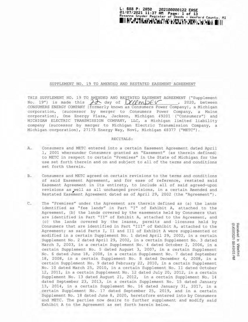
| ■nmiMwiiauvKDwwIii Jr: /£5?J!!i,..2850 202100000122 EASE 01/07/2021 11:37 AM Page: 1 of 13 Rcxanne Snyder Register of Deeds - Uexford Countv/ pit SUPPLEMENT NO. 19 TO AMENDED AND RESTATED EASEMENT AGREEMENT THIS SUPPLEMENT NO. 19 TO AMENDED AND RESTATED EASEMENT AGREEMENT ("Supplement No. 19") is made this day of , 2020, between CONSUMERS ENERGY COMPANY (formerly known as Consumers Power Company), a Michigan corporation, (successor by merger to Consumers Power Company, a Maine corporation), One Energy Plaza, Jackson, Michigan 49201 ("Consumers") and MICHIGAN ELECTRIC TRANSMISSION COMPANY, LLC, a Michigan limited liability company (successor by merger to Michigan Electric Transmission Company, a Michigan corporation), 27175 Energy Way, Novi, Michigan 48377 ("METC"). RECITALS: A. Consumers and METC entered into a certain Easement Agreement dated April 1, 2001 whereunder Consumers granted an "Easement" (as therein defined) to METC in respect to certain "Premises" in the State of Michigan for the use set forth therein and on and subject to all of the terms and conditions set forth therein. B. Consumers and METC agreed on certain revisions to the terms and conditions of said Easement Agreement, and for ease of reference, restated said Easement Agreement in its entirety, to include all of said agreed-upon revisions as ^well as all unchanged provisions, in a certain Amended and Restated Easement Agreement dated as of April 29, 2002 (the "Agreement"). C. The "Premises" under the Agreement are therein defined as (a) the lands identified as "fee lands" in Part "I" of Exhibit A, attached to the Agreement, (b) the lands covered by the easements held by Consumers that are identified in Part "II" of Exhibit A, attached to the Agreement, and (c) the lands covered by the leases, permits and licenses held by Consumers that are identified in Part "III" of Exhibit A, attached to the Agreement; as said Parts I, II and III of Exhibit A were supplemented or modified in a certain Supplement No. 1 dated April 29, 2002, in a certain Supplement No. 2 dated April 29, 2002, in a certain Supplement No. 3 dated March 3, 2003, in a certain Supplement No. 4 dated October 2, 2006, in a certain Supplement No. 5 dated August 3, 2007, in a certain Supplement No. 6 dated June 18, 2008, in a certain Supplement No. 7 dated September 18, 2008, in a certain Supplement No. 8 dated December 4, 2008, in a certain Supplement No. 9 dated February 22, 2010, in a certain Supplement No. 10 dated March 25, 2010, in a certain Supplement No. 11 dated October 12, 2011, in a certain Supplement No. 12 dated July 20, 2012, in a certain Supplement No. 13 dated August 21, 2012, in a certain Supplement No. 14 dated September 23, 2013, in a certain Supplement No. 15 dated January 13, 2014, in a certain Supplement No. 16 dated January 31, 2017, in a certain Supplement No. 17 dated September 25, 2019, and in a certain Supplement No. 18 dated June 8, 2020, heretofore entered into by Consumers and METC. The parties now desire to further supplement and modify said Exhibit A to the Agreement as set forth herein below. Received in Wexford 01/07/2021 09:49:03 AM SUPPLEMENT NO . 19 TO AMENDED AND RESTATED EASEMENT AGREEMENT THIS SUPPLEMENT NO . 19 TO AMENDED AND RESTATED E:.S~MENT AGREEMENT ( " Suppl ement No. 19" ) is made this ~ day of TJf!/lJIVl../;Jf <r , 2020, between CONSUMERS ENERGY COMPANY (formerly known as Con sumers Power Company) , a Michigan corporation, (successor by merger to Consumers Power Company, a Maine corporation) , One Energy Plaza, Jackson, Michigan 49201 ("Consumers" ) and MICHIGAN ELECTRIC TRANSMISSI ON COMPANY , LLC, a Michigan limited liability company (successor by merger to Mi chigan Ele ctric Transmission Company, a Michigan corporation) , 27175 Energy vlay, Novi, Michigan 48377 (''METC") . RECITALS : A. Consumers and METC entered into a certain Easement Agreement dated April 1 , 2001 whereunder Consumers granted an " Easement" (as therein defined) to METC in respect to certain " Premises" in the State of Michigan for the use set forth therein and on and subject to all of the terms and conditions set forth therein. B. Consumers and METC agreed on certain revisions to the terms and conditions of said Easemen t Agreement, and for ease of reference, r estat ed said Easement Agreement in i ts entirety, to include all of said agreed- upon revisions as , well as all unchanged provisions, in a certain Amended and Restated Easement Agreement dated as of April 29, 2002 (the "Agr eement" ) . C. The '' Premises" under the Agreement are therein defined as (a) the lands identified as " fee lands" in Part " I " of Exhibit A, attached to the Agreement, (b) the lands covered by the easements held by Consumers that are identified in Part "II" of Exhibit A, attached to the Ag.ceement, and (c) the lands covered by the leases, permits and l i censes held by Consumers that are identified in Part " III" of Exhi b i t A, attached to the Agreement; as said Parts I , II and III of Exhibit A were supplemented or modified in a certain Supplement No. 1 dated April 29, 2002, in a certain Supplement No . 2 dated April 29, 2002, in a certain Supplement No . 3 dated March 3 , 2003, in a cer tain Supplement No . 4 dated October 2 , 2006, in a certain Supplement No . 5 dated August 3 , 2007, in a certain Supplement No . 6 dated June 18, 2008, in a certain Supplement No . 7 dated September 18, 2008, in a certain Supplement No . 8 dated December 4, 2008, in a certain Supplement No . 9 dated February 22, 2010, in a certai n Supplement No . 10 dated March 25, 2010, in a certai n Sup pl ement No. 11 dated October 12, 2011, in a certain Supplement No . 12 dated Jul y 20, 2012, in a certain Supplement No . 13 dated August 21, 2012, in a certain Supplement No . 14 dated September 23, 2013, in a certain Supplement No . 15 dated January 13, 2014 , in a certain Supplement No . 16 dated January 31, 2017, in a certain Supplement No. 1 7 dated September 25, 2019, and in a certain Supplement No . 18 dated June 8 1 2020, heretofore entered into by Consumers and METC . The parties now desire to further supplement and modify said Exhibit A to the Agreement as set forth herein below. |
| III i O T M IW W f t W ' M I W H i a O ' i t II III L: 688 P: 2850 202100000122 EASE 01/07/2021 11:37 AM Page: 2 of 13 Roxanne Snyder Register of Deeds - Uexford County, HI D. References, in regard to historical matters, to "METC" in the foregoing recitals will be deemed to mean METC's predecessor, Michigan Electric Transmission Company, a Michigan corporation, where relevant. NOW, THEREFORE, for good and valuable consideration, the receipt of which is acknowledged, Consumers and METC agree as follows: 1. Exhibit A to the Agreement, as heretofore supplemented and/or modified, is hereby further supplemented and modified as set forth in "Nineteenth Supplemental Exhibit A", attached hereto. It is expressly understood that any lands, easements, or leases/permits/licenses that are indicated in said attached Nineteenth Supplemental Exhibit A as being added are, on and subject to the terms and conditions of the Agreement (as supplemented and amended by this Supplement No. 19), hereby deemed added to Part I, Part II and Part III, respectively, of Exhibit A to the Agreement. However, it is further expressly understood that in addition to all rights granted to METC by the Agreement, METC shall have the following rights as to the lands identified as "Consumers Energy Equipment / Joint Asset Area Easement" on the accompanying NINETEENTH Supplemental Exhibit A sheets, inclusive of Parts I, II and III, which rights are also subject to the terms of the Parties' Amended and Restated Transmission Interconnection Agreement (the "DTIA"): (a) the right to maintain any and all existing components of the Transmission System, as defined in the DTIA, and wiring or conduit connections for the same that currently exist over, on or under these lands; and (b)the right to connect its currently sited or future approved wiring or conduits for communications, station power, or control, operating at 600 volts or less, and any Jointly Owned Assets, as defined in the DTIA, over, on or under these lands. It is also expressly understood that, with respect to any lands, easements, or leases/permits/licenses now covered by Part I, Part II or Part III of Exhibit A that are indicated in said attached Nineteenth Supplemental Exhibit A as being deleted, the Easement is hereby deemed RELEASED with respect thereto and the Agreement shall hereafter no longer apply thereto (provided, however, that all rights and obligations under the Agreement with respect to periods prior to the date of this Supplement No. 19 shall remain unaffected). 2. It is expressly understood and agreed that in respect to the additional Premises represented by the land(s), easement(s), lease (s), permit(s) and/or license (s) that are added to Part I, Part II and Part III of Exhibit A to the Agreement pursuant to this Supplement No. 19 (the "Additional Premises"): (a) All references to "Commencement Date" that are found in Article 1 ("Grant of Easement"), Article 2 ("Term"), Article 5 ("Additions/Alterations"), Article 6 ("Consumers' Reserved Rights to Use the Premises and Transmission Facilities"), Article 7 ("METC Approval of Compatible Uses"), Article 8 ("Certain Obligations of Consumers and Authorized Users; Etc.") and Article 14 ("Environmental Matters") of the Agreement shall be deemed to mean the date of this Supplement No. 19 and not the date that is identified in the Agreement as the "Commencement Date". L: 688 P: 2850 202100000122 EASE 01/07/ 2021 11:37 AM Page : 2 of 13 Roxanne Snyder Register of Deeds - Wexford County, MI 1 111 ~ , 1~ .. ,~,,, f ,rUl"~llt• ~ : H~1 -l.l ~ , ,r ill-Jn~~.~ ~ : 11 i 1 ii, 1 ~1 11111 2 D. References, in regard to historical matters, to "METC" in the foregoing recitals will be deemed to mean METC ' s predecessor, Michigan El ectric Transmission Company, a Michigan corporation, where relevant . NOW , THEREFORE, for good a nd valuable consideration, the receipt of which is acknowledged, Consumers and METC agree as follows : 1 . Exhibit A to the Agreement, as heretofore supplemented and/or modified, is hereby further supplemented and modified as set forth in ''Nineteenth Suppl emental Exhibit A", attached hereto . 2 . It is expressly understood that any lands, easements, or leases/permits/licenses t hat are indicated in said attached Nineteenth Supplemental Exhibit A as bei ng added are, on and subject to the terms and conditions of the Agreement ( as supplemented and amended by this Supplement No . 19) , hereby deemed added to Part I , Part II and Part III, respectively, of Exhibit A to the Agreement. However, it is further expressl y understood that in addition to a l l rights granted t o METC by the Agreement, METC shall have the following rights as to the lands identified as "Consumers Energy Equi pment/ Joint Asset Area Easement" on the accompanying NINETEENTH Supplemental Exhibit A sheets, incl usive of Parts I , II and III, which rights are also subject to the terms of the Parti es' Amended and Restated Transmission Interconnection Agreement (the " DTIA" ) : (a) the right to maintain any and a l l existing components of the Transmi ssion System, as defined in the DTIA, and wiring or conduit connections for the same that currently exist over, on or under these lands; and (b)the right to connect i ts currently sited or future approved wiring or condui ts for communicati ons, station power, or control, operating at 600 volts or less, and any Jointly Owned Asset s , as defined in the DTIA, over, on or under t hese l ands . It is also expressly understood that, with respect to any lands, easements, or leases/permits/licenses now covered by Part I , Part II or Part III of Exhibit A that are indicated in said attached Nineteenth Supplemental Exhibit A as being deleted, the Easemen t is hereby deemed RELEASED with respect thereto and the Agreement shall hereafter no longer apply thereto (provided, however, that all right s and obligations under the Agreement with respect to periods prior to the date of thi s Supplement No . 19 shall remain unaffected) . It is expressly understood and agreed Premises represented by t he land(s), and/or license (s) that are added to Exhibit A to the Agreement pursuant " Addi t i onal Premises" ) : that in respect to the additional easement(s) , lease(s) , permit(s) Part I , Part II and Part III of to this supplement No . 19 (the (a) All references to "Commencement Date" t hat are found in Article 1 ("Grant of Easement" ) , Article 2 ( " Term" ) , Article 5 (" Additions/Altera tions" ) , Article 6 ("Consumers' Reserved Rights to llse the Premises and Transmission Facilities" ) , Article 7 ("METC Approval of Compatible Uses" ) , Articl e 8 ("Certain Obligations of Consumers and Authorized Users; Etc.") and Article 14 (" Environmental Matters" ) of the Agreement shall be deemed to mean the date of this Supplement No . 19 and not. the date that is identified in the Agreement as the " Commencement Date". |
| m il L: 688 P: 2850 202100000122 EASE 01/07/2021 11:37 AM Page: 3 of 13 Roxanne Snyder Register of Deeds - Wexford County III (b) Except as expressly otherwise indicated in the immediately following sentence, all references to "Restated Agreement Date" that are found in Article 1 ("Grant of Easement"), Article 6 ("Consumers' Reserved Rights to Use the Premises and Transmission Facilities"), and Article 12 ("Compliance With Applicable Laws") of the Agreement shall also be deemed to mean the date of this Supplement No. 19 and not the date that is identified in the Agreement as the "Restated Agreement Date". Notwithstanding the foregoing: (i) the preceding sentence does not apply to the purely historical statement in clause "(c)" of Section 1.2 of the Agreement that Trans-Elect, Inc. is "an affiliate of the entity which has become METC's parent company as of the Restated Agreement Date"; and (ii) the parenthetical in the first sentence of the first paragraph of Section 7.1 of the Agreement reading "(see below regarding a certain period prior to the Restated Agreement Date)", along with the fourth paragraph of said Section 7.1 reading "Consumers shall submit to METC within twenty (20) days of the Restated Agreement Date a list of all material Compatible Uses other than additions or modifications to Distribution Facilities that have been authorized between February 1, 2001 and the Restated Agreement Date for METC's approval per the METC Compatible Use approval process described in this Section 7.1.", both referred to a one-time historical matter and have no application to the Additional Premises or any other further effect or application whatsoever. 3. In addition to the original Transmission Facilities and Additions/Alterations thereto as referred to in Recital "A" of the Agreement, it is understood that such electric Transmission towers, pole structures, poles, crossarms, wires, cables, conduits, guys, anchors, transformers, insulators and/or other fixtures and equipment as may be owned by METC and located on the Additional Premises as of the date of this Supplement No. 19, and future Additions/Alternations made thereto on and subject to the terms and conditions of the Agreement, are included in the "Transmission Facilities" under the Agreement. Note: This Supplement No. 19 will not be recorded in all counties in which the Agreement itself, or Supplements Nos. 1 through 18, may have been recorded. This Supplement No. 19 (as were each of Supplements Nos. 1 through 18), will be recorded only in the county(ies) in which relevant Premises are located; being, in the case of this Supplement No. 19, only the following: 3 (b) Except as expressly otherwise indicated in the immediately following sentence, all references to "Restated Agreement Date" that are found in Article 1 ( "Grant of Easement" ), Article 6 ("Consumers ' Reserved Rights to Use the Premises and Transmission Facilities") , and Article 12 ("Compliance With Applicable Laws") of the Agreement shall also be deemed to mean the date of this Supplement No . 19 and not the date that is identified in the Agreement as the ''Restated Agreement Date". Notwithstanding the foregoing : (i) the preceding sentence does not apply to the purely historical statement in clause "(c)" of Section 1. 2 of the Agreement that Trans-Elect, Inc. is "an affiliate of the entity which has become METC ' s parent company as of the Restated Agreement Date"; and (ii) the parenthetical in the first sentence of the first paragraph cf Section 7.1 of the Agreement reading "(see below regarding a certain period prior to the Restated Agreement Date) '' , along with the fourth paragraph of said Section 7 . 1 reading "Consumers shall submit to METC within twenty (20) days of the Restated Agreement Date a list of all material Compatible Uses other than additions or modifications to Distribution Facil ities that have been authorized between February 1, 2001 and the Restated Agreement Date for METC ' s approval per the METC Compatible Use approval process described i n this Section 7 . 1 . " , both .referred to a one-time historical matter and have no application to the Additional Premises or any other further effect or application whatsoever . 3 . In addition to the original Transmission Facilities and Additions/Alterations thereto as referred to in Recital "A" of the Agreement, it is understood that such electric Transmission towers, pole structures, poles, cross arms, wires, cables, conduits, guys, anchors, transformers, insulators and/or other fixtures and equipment as may be owned by METC and located on t he Additional Premises as of the date of this Supplement No . 19, and future Additions/Alternations made theret o on and subject to t he terms and conditions of t he Agreement, are included in the " Transmission Facilities" under the Agreement . Note: This Supplement No . 19 will not be recorded in all counties in which the Agreement itself, or Supplements Nos. 1 through 18, may have been recorded. This Supplement No . 19 (as were each of Supplements Nos . l through 18) , will be recorded only in the county(ies} in which relevant Premises are located; being, in the case 0£ this Supplement No . 19, only the £allowing: |
| ■iii p,jRm«ifflhim‘Kiru!ty m u w ■ m L: 688 P: 2850 202100000122 EASE 01/07/2021 11:37 AM Page: 4 of 13 Roxanne Snyder Register of Deeds - Uexford County, I'll Allegan County Antrim County Barry County Bay County Calhoun County Charlevoix County Clinton County Crawford County Emmet County Genesee County Gladwin County Grand Traverse County Gratiot County Ingham County Ionia County Isabella County Jackson County Kalkaska County Kent County Leelanau County Lenawee County Manistee County Midland County Montcalm County Muskegon County Oceana County Ogemaw County Ottawa County Roscommon County Saginaw County Shiawassee County St. Joseph County Washtenaw County Wexford County The fact that this Supplement No. 19 will be recorded only in the particular county(ies) identified above will in no way restrict, limit or otherwise affect the interpretation, application or enforcement of the Agreement; and the terms and conditions of the Agreement shall at all times be read, interpreted and applied in the manner provided for in Section 24.6 of the Agreement. Allegan County Antrim County Barry County Bay County Calhoun County Charlevoix County Clinton County Crawford County Emmet County Genesee County Gladwin County Grand Traverse County Gratiot County Ingham County Ionia County Isabella County Jackson County Kalkaska County Kent County Leelanau County Lenawee County Manistee County Midland County Montcalm County Muskegon County Oceana County Ogemaw County Ottawa County Roscommon County Saginaw County Shiawassee County St . Joseph County Washtenaw County Wexford County The fact that this Supplement No . 19 will be recorded only in the particular county(ies) identified above will in no way restrict, limit or otherwise affect the interpretati on, application or enforcement of the Agreement ; and the terms and conditions of the Agreement shall at all times be read, interpreted and applied in the manner provided for in Section 24 . 6 of the Agreement . |
| 01/07/2021 11:37 AM Page: 5 of 13 Roxanne Snyder Register of Deeds - Uexford County, P1I L: 688 P: 2850 202100000122 EASE III! II III 5 IN WITNESS WHEREOF, Consumers and METC have executed this Supplement No. 19 as of the date first above written. CONSUMERS ENERGY COMPANY, a Michigan corporation Mary Anne Marr Director of Real Estate STATE OF MICHIGAN ) •i ) ss. COUNTY OF ^ U'l ) The foregoing instrument was acknowledged before this day °f Jiiruniztv' 2020, by Mary Anne Marr, Director of Real Estate of CONSUMERS ENERGY COMPANY, a Michigan corporation, on behalf of the corporation. JULIE C GUINN Notary Public - State of Michigan County of Jackson My Commission Expires Dec 29, 2020 Acting in the County ofi j f l f . ( XA\ j C - Notary Public, ^ County, Michigan Acting in - jg CM^J±V± County,^ Michigan My Commission Expires: ____ 1 flk./ , 20 L: 688 P: 2850 202100000122 EASE 01/07/2021 11 :37 AM Page: 5 of 13 Roxanne Snyde r Register of Deeds - Wexford County, MI 1111 WJrJ~~~1rlll~~ if,~•~,~ 1'"11 ,~~~:(~~ I~ P i l 1 ~i1 .'~1 11 111 5 IN WITNESS WHEREOF , Consumers and METC have executed this Supplement No . 19 as of the date first above written. CONSUMERS ENERGY COMPANY , a Michigan corporation -~ Director of Real Estate STATE OF MICHIGAN COUNTY OF j(i£ ({1 [,,?c'.!)A ss. The foregoing instrument was acknowledged before this~ day of ~ ct?nc1be"V 2020, by Mary Anne Marr, Director of Real Estate of CONSUMERS ENEY COMPANY, a Michigan corporation, on behalf of the corporation . .. \'-------------~ \ JULIE C GUINN , Notarv Public • Stale of Michigan County of Jackson My Commission [Jlpires Dec 29, 2020 fletine in the County ollj0£(flsd}A Notary Public, t: )t£.t /(~ Acting in "" )4Clq:;1~ My Commission Expires: County, Michigan Coun,y, Michigan l d---. J- q , 2 o ;;.o |
| ■lllilimni'WIMTJhMaUfMKIilW Hill' L: 688 P: 2850 202100000122 EASE 01/07/2021 11:37 AM Page: 6 of 13 Roxanne Snyder Register of Deeds - Uexford Countv I1T MICHIGAN ELECTRIC TRANSMISSION COMPANY, LLC, a Michigan limited liability company By: ITC Holdings Corp., a Michigan corporation, its manager Jean Kim D'Anna Vice President and Deputy General Counsel - Legal Services STATE OF MICHIGAN ) COUNTY OF Oakland ) ss. The fore^ninn -instrument was acknowledged before this 16 day of _____________ December ©1020, by Jean Kim D'Anna, Vice President and Deputy General Counsel of ITC Holdings Corp., a Michigan corporation, as manager of MICHIGAN ELECTRIC TRANSMISSION COMPANY, LLC, a Michigan limited liability company, on behalf of the limited liability company. LAURA J. MCCRAY NOIARY PUBLIC, STA1E OF Ml COUN1Y OF OAKLAND MY COMMISSION EXPIRES Jul 30, 2021 ACTING IN COUNTY OF Ilu JUI OU, I I Vilk(jrdM Notary Pul^in Acting in Oakland Oakland County, Michigan County, Michigan My Commission Expires: __7/30/21_, 2020 Exempt from transfer taxes per MCL §§ 207.505(f) and 207.526(f). Prepared by: Tracy L. VanWoert Return to: Julie Guinn Consumers Energy Company Consumers Energy Company EP7-447 One Energy Plaza Jackson, Michigan 49201 L: 688 P: 2850 202100000122 EASE 01/07/ 2021 11: 37 AM Page : 6 of 13 Roxanne Snyder Reg jster of Deeds - Wexford County Ml 1 111 N Jr_.~~~~n1 iHa' r,tjJ'(' ~~,, j~Mf Cl-il'#it1'11 !1t.l ~\ li\i If 11 1 6 MICHIGAN ELECTRIC TRANSMISSION COMPANY, LLC, a Michi gan limited liabili ty company By: ITC Holdings Cor p ., a Michi gan corporation, its manager By: Jean Kim D' Anna Vice Pres ident and Deputy General Counsel - Lega l Services STATE OF MICHIGAN COUNTY OF _\::O =akl = an =d===- ss. The forenni -nn i -nstrument was acknowledged before this ~ day of Oecemher J,0 20, by Jean Kim D' Anna, Vice President and Deputy General Counsel of ITC Hold ings Corp. , a M ichigan corporation, as manager of MICHIGAN ELECTRIC TRANSM ISSION COMPANY , LLC, a Michigan limited l i abil ity company, on behalf of the limited liability company. LAURA J. MCCRAY NOTARY PUBLIC, STATE OF Ml COUNTY OF OAKLAND MY COMMISSION EXPIRES JIJI 30, 20~1 j ACTING IN COUNTY OF Oc,..k'._\ct,V\LI) Notary Acting My Pl' . C I OaklAAd in ? akland I Commission Expires: County, Michigan Coun ty, Michigan _ 7/30/21_ , 2020 Exempt from transfer taxes per MCL §§ 207 . 505(£) and 207 . 526(£) . Prepared by: Tracy L . Vanwoert Consumers Energy Company EP7- 447 One Energy Plaza Jackson, M i chigan 49201 Return to: Julie Guinn Consumers Energy Company |

| 01/07/2021 11:37 AM Page: 7 of 13 Roxanne Snyder Register of Deeds - Uexford County, L: 688 P: 2850 202100000122 ERSE ■III M l N M ' M a V i W W L ' M W K M i V I’ll r THE ATTACHED COPY OF THE NINETEENTH SUPPLEMENTAL EXHIBIT A THAT WAS PREPARED FOR RECORDATION IN WEXFORD COUNTY, MICHIGAN, AND CONTAINS THE PORTIONS OF EACH OF PARTS I, II, AND III OF THE NINETEENTH SUPPLEMENT EXHIBIT A THAT RELATE TO PREMISES IN THAT COUNTY ONLY. SEE SECTION 24.6 OF THE AGREEMENT. L: 688 P: 2850 202100000122 EASE 01/ 07/2021 11 :37 AM Page: 7 of 13 R oxanne Snyder Register of Deeds - Wexford C o~nty, MI t 1 111 ~1r"1~~1~, ,~flil 1 'ift1 ~~~.·,• ~l1 .:A'.f,i,'J~ 11\liWk'y~i1 1~ 11 111 THE ATTACHED COPY OF THE NINETEENTH SUPPLEMENTAL EXHIBIT A THAT WAS PREPARED FOR RECORDATION IN WEXFORD COUNTY , MICHIGAN, AND CONTAINS THE PORTIONS OF EACH OF PARTS I , II, AND III OF THE NINETEENTH SUPPLEMENT EXHIBIT A THAT RELATE TO PREMJSES IN THAT COUNTY ONLY . SEE SECTION 24 . 6 OF TtfE AGREEMENT. 7 |
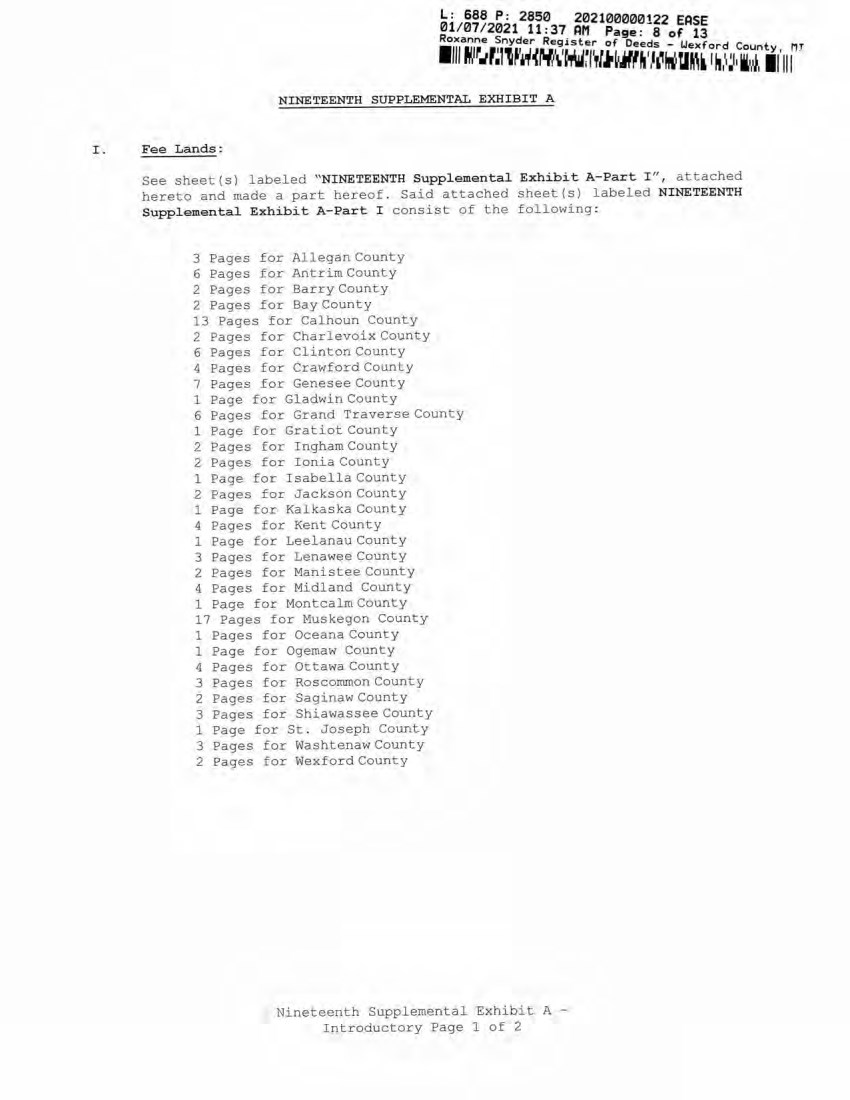
| 01/07/2021 11:37 AM Page: 8 of l! Roxanne Snyder Register of Deeds - UexforH w mt I 'm NINETEENTH SUPPLEMENTAL EXHIBIT A Fee Lands: See sheet(s) labeled "NINETEENTH Supplemental Exhibit A-Part I", attached hereto and made a part hereof. Said attached sheet(s) labeled NINETEENTH Supplemental Exhibit A-Part I consist of the following: 3 Pages for Allegan County 6 Pages for Antrim County 2 Pages for Barry County 2 Pages for Bay County 13 Pages for Calhoun County 2 Pages for Charlevoix County 6 Pages for Clinton County 4 Pages for Crawford County 7 Pages for Genesee County 1 Page for Gladwin County 6 Pages for Grand Traverse County 1 Page for Gratiot County 2 Pages for Ingham County 2 Pages for Ionia County 1 Page for Isabella County 2 Pages for Jackson County 1 Page for Kalkaska County 4 Pages for Kent County 1 Page for Leelanau County 3 Pages for Lenawee County 2 Pages for Manistee County 4 Pages for Midland County 1 Page for Montcalm County 17 Pages for Muskegon County 1 Pages for Oceana County 1 Page for Ogemaw County 4 Pages for Ottawa County 3 Pages for Roscommon County 2 Pages for Saginaw County 3 Pages for Shiawassee County 1 Page for St. Joseph County 3 Pages for Washtenaw County 2 Pages for Wexford County Nineteenth Supplemental Exhibit A - Introductory Page 1 of 2 L: 688 P: 2850 202100000!22 EASE 01/07/2021 11:37 AM Page: 8 of 13 Roxanne ~nyder Register of Deeds - Wexford County MT 1111 ~ , r_.r.11~, ~~~' \' tlfW~l',lJitiMf ~ ' ,,,WU~" 'N,\! I, ii,~, Ii' 111 NINETEENTH SUPPLEMENTAL EXHIBIT A I . Fee Lands : See sheet(s) labeled "NINETEENTH Supplemental Exhibit A-Part I ", attached hereto and ntade a part hereof. Said attached sheet ( s} labeled NINETEENTH Supplemental Exhibit A-Part I consist of the following: 3 Pages for Allegan County 6 Pages for Antrim County 2 Pages for Barry County 2 Pages £or Bay County 13 Pages for Calhoun County 2 Pages for CharlevoixCounty 6 Pages for Clinton County 4 Pages for Crawford County 7 Pages for Genesee County 1 Page for Gladwin County 6 Pages for Grand Traverse County 1 Page for Gratiot County 2 Pages for Ingham County 2 Pages for Ionia County 1 Page for Isabella County 2 Pages for Jackson Coonty 1 Page for Kalkaska County 4 Pages for Kent County 1 Page for Leelanau County 3 Pages for Lenawee County 2 Pages for Manistee County 4 Pages for Midland County 1 Page for Montcalm County 17 Pages for Muskegon County 1 Pages for Oceana County 1 Page for Ogemaw County 4 Pages for Ottawa County 3 Pages for Roscommon County 2 Pages for Saginaw County 3 Pages for Shiawassee County 1 Page for St. Joseph County 3 Pages for Washtenaw County 2 Pages for Wexford County Nineteenth Supplemental Exhibit A - Introductory Page 1 of 2 |
| ■III M T M H W i ' M m m J T H M I i M A II III L: 688 P: 2850 202100000122 ERSE 01/07/2021 11:37 PM Page: 9 of 13 Roxanne Snyder Register of Deeds - Uexford County, III II. Easements : See sheet (s) labeled ''NINETEENTH Supplemental Exhibit A-Part II", attached hereto and made a part hereof. Said attached sheet (s) labeled NINETEENTH Supplemental Exhibit A-Part II consist of the following: 1 Page for Allegan County 5 Pages for Antrim County 4 Pages for Barry County 1 Pages for Bay County 9 Pages for Calhoun County 4 Pages for Charlevoix County 9 Pages for Clinton County 2 Pages for Crawford County 6 Pages for Emmet County 8 Pages for Genesee County 3 Pages for Gladwin County 1 Page for Grand Traverse County 1 Page for Ingham County 6 Pages for Ionia County 5 Pages for Isabella County 1 Page for Kalkaska County 1 Page for Kent County 2 Pages for Leelanau County 3 Pages for Lenawee County 3 Pages for Manistee County 12 Pages for Midland County 1 Page for Montcalm County 5 Pages for Muskegon County 1 Page for Ogemaw County 4 Pages for Roscommon County 2 Pages for Shiawassee County 1 Page for St. Joseph County 2 Pages for Washtenaw County III. Leases, Permits and Licenses: See sheet(s) labeled "NINETEENTH Supplemental Exhibit A-Part III", attached hereto and made a part hereof. Said attached sheet(s) labeled Nineteenth Supplemental Exhibit A-Part III consist of the following: NA Nothing in this NINETEENTH Supplemental Exhibit A shall be deemed to affect, limit or waive any of the provisions of Sections 1.2 ("Title Limitations") and 1.3 ("No Warranties") of the Agreement. Nineteenth Supplemental Exhibit A - Introductory Page 2 of 2 L : 688 P : 2850 202100000122 EASE 01 / 07 / 2021 11 : 37 AM Page: 9 of 13 Rox anne Snyder Regi s ter of Deeds - Wexford Count y , MT 1 111 w , ~_.1;, , T 1 hWt-l.i~.r.1j~w~ ~lfA..,~ ~ '"'~ ll:• 1 ~ 1 , i 1 ~ 1 1111 II . Ea se ments: III. See sheet(s) labeled " NINETEENTH Suppl eme ntal Exhibit A-Part II " , attached hereto and made a part hereof . Said attached sheet(s) labeled N I NETEENTH Supplemental Exhibit A -P art II consist of the following : 1 Page for Allegan County 5 Pages for Antrim County 4 Pages for Barry County 1 Pages for Bay County 9 Pages for Calhoun County 4 Pages for Charlevoix County 9 Pages for Clinton County 2 Pages for Crawford County 6 Pages for Emmet County 8 Pages for Genesee County J Pages for Gladwin County 1 Page for Grand Traverse County 1 Page for Ingham County 6 Pages for Ionia County 5 Pages for Isabella County l Page fo r Kalkaska County 1 Page for Kent County 2 Pages for Leelanau County 3 Pages for Lenawee County 3 Pages for Manistee County 12 Pages for Midland Cou n ty l Page for Montcalm County 5 Pages £or Muskegon County 1 Page for Ogemaw County 4 Pages for Roscommon County 2 Pages for Shiawassee County 1 Page for St . Joseph County 2 Pages for Washtenaw County L e ases, Permits and Licens es : See sheet (s) labeled " NINETEENTH Supplemental Exhibit A -P art III " , attached hereto and m a d e a part hereof . Said attached sheet(s) labeled Nin e teenth Supplemental Exh ib it A - Part II I consist of the following : NA Nothing in this NINETEENTH Supplemental Exhibit A shall be deemed to affect , limit or waive any of the provisions of Sections 1.2 ("Title Limilations " ) and 1 . 3 ("No Warranties " ) of the Agreement . Nineteenth Supplemental Exhibit A - Introductory Page 2 of 2 |
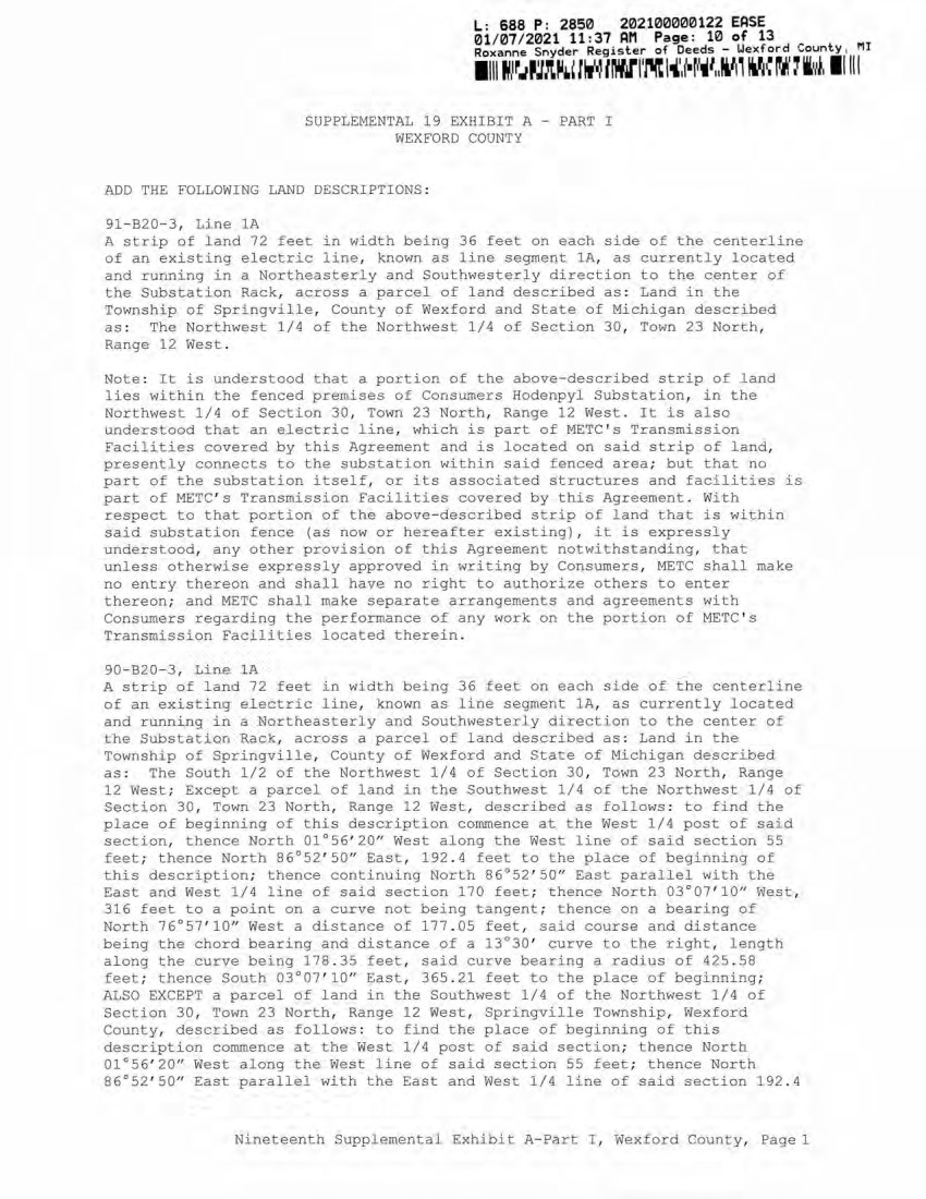
| ty, m iiiii SUPPLEMENTAL 19 EXHIBIT A - PART I WEXFORD COUNTY ADD THE FOLLOWING LAND DESCRIPTIONS: 91-B20-3, Line 1A A strip of land 72 feet in width being 36 feet on each side of the centerline of an existing electric line, known as line segment 1A, as currently located and running in a Northeasterly and Southwesterly direction to the center of the Substation Rack, across a parcel of land described as: Land in the Township of Springville, County of Wexford and State of Michigan described as: The Northwest 1/4 of the Northwest 1/4 of Section 30, Town 23 North, Range 12 West. Note: It is understood that a portion of the above-described strip of land lies within the fenced premises of Consumers Hodenpyl Substation, in the Northwest 1/4 of Section 30, Town 23 North, Range 12 West. It is also understood that an electric line, which is part of METC1s Transmission Facilities covered by this Agreement and is located on said strip of land, presently connects to the substation within said fenced area; but that no part of the substation itself, or its associated structures and facilities is part of METC's Transmission Facilities covered by this Agreement. With respect to that portion of the above-described strip of land that is within said substation fence (as now or hereafter existing), it is expressly understood, any other provision of this Agreement notwithstanding, that unless otherwise expressly approved in writing by Consumers, METC shall make no entry thereon and shall have no right to authorize others to enter thereon; and METC shall make separate arrangements and agreements with Consumers regarding the performance of any work on the portion of METC’s Transmission Facilities located therein. 90-B20-3, Line 1A A strip of land 72 feet in width being 36 feet on each side of the centerline of an existing electric line, known as line segment 1A, as currently located and running in a Northeasterly and Southwesterly direction to the center of the Substation Rack, across a parcel of land described as: Land in the Township of Springville, County of Wexford and State of Michigan described as: The South 1/2 of the Northwest 1/4 of Section 30, Town 23 North, Range 12 West; Except a parcel of land in the Southwest 1/4 of the Northwest 1/4 of Section 30, Town 23 North, Range 12 West, described as follows: to find the place of beginning of this description commence at the West 1/4 post of said section, thence North 01°56'20" West along the West line of said section 55 feet; thence North 86°52'50" East, 192.4 feet to the place of beginning of this description; thence continuing North 86°52'50" East parallel with the East and West 1/4 line of said section 170 feet; thence North 03°07'10" West, 316 feet to a point on a curve not being tangent; thence on a bearing of North 76°57'10" West a distance of 177.05 feet, said course and distance being the chord bearing and distance of a 13°30' curve to the right, length along the curve being 178.35 feet, said curve bearing a radius of 425.58 feet; thence South 03°07'10" East, 365.21 feet to the place of beginning; ALSO EXCEPT a parcel of land in the Southwest 1/4 of the Northwest 1/4 of Section 30, Town 23 North, Range 12 West, Springville Township, Wexford County, described as follows: to find the place of beginning of this description commence at the West 1/4 post of said section; thence North 01°56'20" West along the West line of said section 55 feet; thence North 86°52'50" East parallel with the East and West 1/4 line of said section 192.4 ■iii w m u L: 688 P: 2850 202100000122 EASE 01/07/2021 11:37 AM Page: 10 of 13 Roxanne Snyder Register of Deeds - Uexford Coun Nineteenth Supplemental Exhibit A-Part I, Wexford County, Page 1 L: 688 P: 2850 202100000122 EASE 01/07/2021 11 :37 AM Page: 10 of 13 Roxanne Snyder Register of Deeds - Wexford County, MJ 11111,1r.,~,t~.~ l"" IWl' fll't l "'.( •!"11 111'1i '"~ ~,: 'J ii,~ . I I II I SUPPLEMENTAL 19 EXHIBIT A - PART I WEXFORD COUNTY ADD THE FOLLOWING LAND DESCRIPTIONS : 91- 820- 3 , Line lA A strip of land 72 feet in width being 36 feet on each side of the centerline of an existing e l ectric line, known as line segment lA, as currently located and running i n a Northea.stei:-ly and Southwesterl y d i rection to the center of the Substation Rack, across a parcel of land described as : Land in the Township of Springville, County of Wexford and State of Michigan described as : The Northwest 1/4 of the Northwest 1/4 of Section 30, Town 23 North, Range 12 West. Note : It is understood that a portion of the above- described strip of land lies within the fenced p reTIL ises of Consumers Hodenpyl Substation, in the Northwest 1/4 of Section 30, Town 23 North, Range 12 West . It is also understood that an electric line, which is part of METC ' s Transmission Facilities covered by this Agreement and is located on said strip of land, presently connects to the substation within said fenced area; but that no part of the substation itself, or its asso ciated structures and facilities is part of METC ' s Transmission Facil ities covered by this Agreement . With respect to that portion of the above- described strip of land that is within said substation fence (as now or hereafter existing) , it is expressly understood, any other provision of thi s Agreement notwithstanding, that unless otherwise e xpressly approved in writing by Consumers, METC shall make no entry thereon and shall have no right to authorize others to enter t hereon; and M ETC shall make separate arrangements and agreements with Consumers regarding the performance of any work on the portion of METC ' s Transmission Facilities located ther ein. 90-B20-3, Line lA A strip of land 72 feet in width being 36 feet on each side of t h e centerline of an existi ng electric line, known as l ine segment lA, as currently located and running in a Northeasterly and Southwesterly direction to t h e center of the Substati on Rack, across a parcel of land described as : Land in the Township of Springville, County of Wexford and State of Michigan described as : The South 1/2 of the Northwest 1/4 of Section 30, Town 23 North, Range 12 West; Except a parcel of land in the Southwest 1/4 0£ the Northwest 1/4 of Section 30, Town 23 North, Range 12 West, described as foll ows : to find the place of beginning of this description commence at the West 1/4 post of said section, then ce North 01°56' 20" West along the West line of said section 55 feet ; t hence North 86°52' 50'' East, 192 . 4 feet to the place of beginning of this description; thence cont inuing North 86°52' 50" East parallel with the East and West 1/4 line of said section 170 feet ; t h e nce North 03°07' 10" West , 3 16 feet to a point on a curve not being tangent; thence on a bearing of North 76°57' 10" West a distance of 177 . 05 feet , sa~d course and distance bei ng t he chord bearing and distance of a 13°30' curve to the right, length along the curve being 178. 35 feet , sai d curve bearing a radius of 425 . 58 feet ; thence South 03°07 ' 10" East, 365. 21 feet to the place of beginning; ALSO EXCEPT a parcel of land in the Southwest 1/4 of the Northwest 1/4 of Section 30, Town 23 North, Range 12 W est, Springvil le Township, Wexf ord County, described as follows : to find the place of beginning of this description commence at the West 1/4 post of said section; thence North 01 °56' 20" West along the West line of sai d section 55 feet; thence North 86°52' 50" East parallel with the East and West 1/4 line of said sect ion 192 .4 Nineteenth Suppl emental Exhibit A-Part I , Wexf ord County, Page 1 |
| ■iMiiKummiwmKwwiiiii L: 688 P: 2850 202100000122 EASE 01/07/2021 11:37 AM Page: 11 of 13 -£,na.r)£e _?.nyder Re9ister of Deeds - Wexford County, I’ll feet to the place of beginning of this description; thence North 03°07'10" West 365.21 feet to a point on a curve not being tangent; thence on a bearing of North 53°44'30" West, a distance of 165.41 feet, said course and distance being the chord bearing and distance of 13°30'00" curve to the right, length along the curve being 166.47 feet, said curve bearing a radius of 425.58 feet; thence South 86°52'50" West. 54.65 feet to the West lines of said section; thence South 01°56'20" East along the West line of said section 252.54 feet to a point which said point is 272.7 feet Northerly of the West 1/4 post of said section as measured along the West line of said section; thence South 14°04'40" East, 153.83 feet; thence South 46°21'40" East, 91.46 feet, thence North 86°52'50" East parallel with the East and West 1/4 line of said section 96 feet to the place of beginning. Note: It is understood that a portion of the above-described strip of land lies within the fenced premises of Consumers Hodenpyl Substation, in the Northwest 1/4 of Section 30, Town 23 North, Range 12 West. It is also understood that an electric line, which is part of METC1s Transmission Facilities covered by this Agreement and is located on said strip of land, presently connects to the substation within said fenced area; but that no part of the substation itself, or its associated structures and facilities is part of METC's Transmission Facilities covered by this Agreement. With respect to that portion of the above-described strip of land that is within said substation fence (as now or hereafter existing), it is expressly understood, any other provision of this Agreement notwithstanding, that unless otherwise expressly approved in writing by Consumers, METC shall make no entry thereon and shall have no right to authorize others to enter thereon; and METC shall make separate arrangements and agreements with Consumers regarding the performance of any work on the portion of METCTs Transmission Facilities located therein. Nineteenth Supplemental Exhibit A-Part I Wexford County, Page 2 L: 688 P: 2850 202100000122 EASE 01/ 07/ 2021 11 :37 AM Page: 11 of 13 Rox~nne Snyder Register of Deeds - Wexford Count y M I 1 111 ~ l r.11r1 ~1 ( J~Wt'tir.lMit1,~'f1 ~ 1 { , t ~ 1 f.•lf•~~li1 1 ~ , If 111 feet to the place of beginning of this description; thence North 03°07 ' 10" West 365. 21 feet to a point on a curve not being tangent; thence on a bearing of North 53°44 ' 30" West, a distance of 165 . 41 feet , said course and distance being the chord bearing and distance of 13°30' 00" curve to the right, length along the curve being 166.47 feet, said curve bearing a radius of 425 . 58 feet; thence South 86°52' 50" West . 54 . 65 f eet to the West lines of said section; thence South 01 °56' 20" East along the West line of said section 252 . 54 feet to a point which said point is 272 . 7 feet Northerly of the West 1/4 post of said section as rReasured along the West line of said section; thence South 14°04' 40,, East, 153. 83 feet; thence South 46°21' 40" East, 91 . 46 feet , thence North 86°52' 50" East parallel with the East and West 1/4 line of said section 96 feet to the place of beginning. Note : It is understood that a portion of the above-described strip of iand lies within the fenced premises of Consumers Hodenpyl Substation, in the Northwest 1/4 of Section 30, Town 23 North, Range 12 West . It is also understood that an electric line, which is part of METC ' s Transmission Facilities covered by this Agreement and is located on said strip of land, presently connects to the substation within said fenced area; but that no part of the substation itself, or its associated structures and facilities is part of METC ' s Transmission Facilities covered by this Agreement . With respect to that portion of the above- described strip of land that is within said substation fence (as now or hereafter existing) , it is expressly understood, any other provision of this Agreement notwithstanding, that unless otherwise expressly approved in writing by Consumers, METC shall make no entry thereon and shall have no right to authorize others to enter thereon; and METC shall make separate arrangements and agreements with Consumers regarding the performance of any work on the portion of METC ' s Transmission Facilities located therein . Nineteenth Supplemental Exhibit A-Part I , Wexford County, Page2 |
| NINETEENTH SUPPLEMENTAL EXHIBIT A - PART II WEXFORD COUNTY Grantee Date of Inst. Liber/Page Doc Series NONE Town/Range/Section Plat Nineteenth Supplemental Exhibit A-Part II, Wexford County Page 1 L: 688 P: 2850 202100000122 EASE 01/07/2021 11:37 AM Page: 12 of 13 Roxanne Snyder Register of Deeds - Uexford County, P ■in r j K w w m i i m b i i A m u M i r i t i i i t ■ m Grantee NINETEENTH SUPPLEMENTAL EXHIBIT A - PART II WEXFORD COUNTY Date of In.st. Liber/Page Doc Series NONE Town/Range/Section Plat Nineteenth Supplemental Exhibit A-Part II, Wexf ord County, Page 1 -3 ... |
| NINETEENTH SUPPLEMENTAL EXHIBIT A - PART III WEFDORD COUNTY CE Ref. License/Lessor Licensee/Lessee Date of Instrument Title of Instrument Town/Range Section NONE id " j : (D o co .. o : O C D I l< Nineteenth Supplemental Exhibit A-Part III Wexford County, Page 1 : 688 P: 2850 202100000122 EASE CE Ref. License/Lessor NINETEENTH SUPPLEMENTAL EXHIBIT A - PART III WEFDORD COUNTY Licensee/Lessee Date of Instrument NONE Title of Instrument Town/Range Section Nineteench Supplemental &xhibic A-Part III, Wexford County, Page 1 |
Exhibit B
SUBORDINATION TERMS
The unsecured permitted indebtedness evidenced by this instrument is subordinated and subject in right of payment to the prior payment in full of all Senior Debt Obligations (as hereinafter defined) of Michigan Electric Transmission Company, LLC, a limited liability company formed under the laws of the State of Michigan (the “Company”). Each holder of this instrument, by its acceptance hereof, agrees to and shall be bound by all the provisions hereof.
All capitalized terms used herein and not otherwise defined herein shall have the meanings attributed to them in the Eleventh Supplemental Indenture, dated as of July 19, 2021 (as in effect on the date hereof, the “Supplemental Indenture”), between the Company and The Bank of New York Mellon Trust Company, N.A. (as successor to JPMorgan Chase Bank, N.A.), as trustee (the “Trustee”).
The term “Senior Debt Obligations”, as used herein, shall include all, loans, advances, debts, liabilities and obligations, howsoever arising (whether or not evidenced by any note or instrument and whether or not for the payment of money), direct or indirect, absolute or contingent, due or to become due, now existing or hereafter arising (collectively, as used herein, “Obligations”) of the Company now or hereafter existing in respect of Senior Debt (as defined herein) and any amendments, modifications, deferrals, renewals or extensions of any such Senior Debt, or of any notes or evidences of indebtedness heretofore or hereafter issued in evidence of or in exchange for any such Obligation, whether for principal, interest (including interest payable in respect of any such Obligations subsequent to the commencement of any proceeding against or with respect to the Company under any chapter of the Bankruptcy Code, 11 U.S.C. § 101 et seq. (the “Bankruptcy Code”), or any provision of corresponding bankruptcy, insolvency or commercial reorganization legislation of any other jurisdiction, whether or not such interest is an allowed claim enforceable against the debtor, and whether or not the holder of such obligation would be otherwise entitled to receive dividends or payments with respect to any such interest or any such proceeding), premium (including Make-Whole Amount), if any, fees, expenses or otherwise.
The term “Senior Debt”, as used herein, shall mean (i) all Senior Secured Debt and (ii) all unsecured Debt of the Company permitted to be incurred by the Company pursuant to the Mortgage Indenture or the Supplemental Indenture which is not subject to any subordination terms whether or not similar to those set forth in this instrument.
The term “Subordinated Debt”, as used herein, shall mean all Obligations of the Company evidenced by this instrument owing to any Person now or hereafter existing hereunder (whether created directly or acquired by assignment or otherwise), whether for principal, interest (including, without limitation, interest accruing after the filing of a petition initiating any bankruptcy proceeding described in the definition of Senior Debt Obligations, whether or not such interest accrues after the filing of such petition for purposes of the Bankruptcy Code or is an allowed claim in such proceeding), fees, expenses or otherwise.
On and after the Series A Closing Date, no payment on account of principal, interest, fees, premium, expenses or otherwise on this Subordinated Debt shall be made by the Company in cash or otherwise unless (a) full payment of all amounts then due and payable on all Senior Debt Obligations has been made, (b) such payment would be permitted by the Indenture and any Senior Debt Document (as defined below) and (c) immediately after giving effect to such payment, there shall not exist any Default or Event of Default. Any such payment permitted pursuant to this paragraph is hereinafter referred to as a “Permitted Payment”. For the purposes of these provisions, no Senior Debt Obligations shall be deemed to have been paid in full until the obligee of such Senior Debt Obligations shall have received payment in full in cash.
Upon any payment or distribution of assets of the Company of any kind or character, whether in cash, property or securities, to creditors upon any dissolution or winding up or total or partial liquidation or reorganization of the Company, whether voluntary or involuntary or in bankruptcy, insolvency, receivership or other proceedings, then and in any such event all principal, premium and interest and all other amounts due or to become due upon all Senior Debt Obligations shall first be paid in full before the holders of the Subordinated Debt shall be entitled to retain any assets so paid or distributed in respect of the Subordinated Debt (whether for principal, premium, interest or otherwise), and upon any such dissolution or winding up or liquidation or reorganization, any payment or distribution of assets of the Company of any kind or character, whether in cash, property or securities, to which the holders of the Subordinated Debt would be entitled, except as otherwise provided herein, shall be paid pro rata among the holders of Senior Debt Obligations by the Company or by any receiver, trustee in bankruptcy, liquidating trustee, agent or other Person making such payment or distribution, or by the holders of the Subordinated Debt if received by them. So long as any Senior Debt Obligations are outstanding, the holder of this instrument shall not commence, or join with any creditor other than the Trustee or the Senior Debt Parties (as hereinafter defined) in commencing, or directly or indirectly causing the Company to commence, or assist the Company in commencing, any proceeding referred to in the preceding sentence.
The holder of this instrument hereby irrevocably authorizes and empowers (without imposing any obligation on) each Person (each such Person a “Senior Debt Party” and collectively, the “Senior Debt Parties ”) that has entered into an agreement, instrument, or other document evidencing or relating to any Senior Debt Obligation (each such agreement, instrument or other document, a “Senior Debt Document”) as a lender or creditor and such Senior Debt Party’s representatives, under the circumstances set forth in the immediately preceding paragraph, to demand, sue for, collect and receive every such payment or distribution described therein and give acquittance therefor, to file claims and proofs of claims in any statutory or nonstatutory proceeding, to vote such Senior Debt Party’s ratable share of the full amount of the Subordinated Debt evidenced by this instrument in its sole discretion in connection with any resolution, arrangement, plan of reorganization, compromise, settlement or extension and to take all such other action (including, without limitation, the right to participate in any composition of creditors and the right to vote such Senior Debt Party’s ratable share of the full amount of the Subordinated Debt at creditors’ meetings for the election of trustees, acceptances of plans and otherwise), in the name of the holder of the Subordinated Debt evidenced by this instrument or otherwise, as such Senior Debt Party’s representatives may deem necessary or desirable for the enforcement of the subordination provisions of this instrument. The holder of this instrument shall execute and deliver to each Senior Debt Party and such holder’s representatives all such further instruments confirming the foregoing authorization, and all such powers of attorney, proofs of claim, assignments of claim and other instruments, and shall take all such other action as may be reasonably requested by such holder or such holder’s representatives in order to enable such holder to enforce all claims upon or in respect of such holder’s ratable share of the Subordinated Debt evidenced by this instrument.
The holder of this instrument shall not, without the prior written consent of the Senior Debt Parties, have any right to accelerate payment of, or institute any proceeding to enforce, the Subordinated Debt so long as any Senior Debt Obligations are outstanding, unless and until all Senior Debt Parties have accelerated payment thereof and commenced proceedings to enforce such Senior Debt Obligations.
After the payment in full of all amounts due in respect of Senior Debt Obligations, the holder or holders of the Subordinated Debt shall be subrogated to the rights of the Senior Debt Parties to receive payments or distributions of cash, property or securities of the Company applicable to Senior Debt Obligations until the principal of, premium on, interest on and all other amounts due or to become due with respect to the Subordinated Debt shall be paid in full subject to the terms and conditions of the Subordinated Debt or of any agreement among the holders of the Subordinated Debt and other Subordinated Debt of the Company.
If any payment (other than a Permitted Payment) or distribution of assets of the Company of any kind or character, whether in cash, property or securities, shall be received by the holder of the Subordinated Debt in such capacity before all Senior Debt Obligations are paid in full, such payment or distribution will be held in trust for the benefit of, and shall be immediately paid over pro rata among the Senior Debt Parties, for application to the payment in full of Senior Debt Obligations, until all Senior Debt Obligations shall have been paid in full.
Nothing contained in this instrument is intended to or shall impair as between the Company, its creditors (other than the Senior Debt Parties) and the holders of the Subordinated Debt, the obligations of the Company to pay to the holders of the Subordinated Debt, as and when the same shall become due and payable in accordance with their terms, or to affect the relative rights of the holders of the Subordinated Debt and creditors of the Company (other than the Senior Debt Parties).
The Senior Debt Parties shall not be prejudiced in their rights to enforce the subordination contained herein in accordance with the terms hereof by any act or failure to act on the part of the Company.
The holder of this instrument agrees to execute and deliver such further documents and to do such other acts and things as the Senior Debt Parties may reasonably request in order fully to effect the purposes of these subordination provisions. Each holder of this instrument by its acceptance hereof authorizes and directs the trustee or other representative, if any, of the Subordinated Debt represented by this instrument on its behalf to take such further action as may be necessary to effectuate the subordination as provided herein and appoints such trustee or other representative, if any, as its attorney-in-fact for any and all such purposes.
The subordination effected by these provisions, and the rights of the Senior Debt Parties, shall not be affected by (i) any amendment of, or addition or supplement to, the Financing Agreements, any other Senior Debt Document, or any other document evidencing or securing Senior Debt Obligations, (ii) any exercise or non-exercise of any right, power or remedy under or in respect to the Financing Agreements, any other Senior Debt Document, or any other document evidencing or securing Senior Debt Obligations or (iii) any waiver, consent, release, indulgence, extension, renewal, modification, delay, or other action, inaction or omission, in respect of the Financing Agreements, any other Senior Debt Document, or any other document evidencing or securing Senior Debt Obligations; whether or not any holder of any Subordinated Debt shall have had notice or knowledge of any of the foregoing.
No failure on the part of any Senior Debt Party to exercise, and no delay in exercising, any right hereunder shall operate as a waiver thereof; nor all any single or partial exercise of any right hereunder preclude any other or further exercise thereof or the exercise of any other right. The remedies herein provided are cumulative and not exclusive of any remedies provided by Law.
The holder of this instrument and the Company each hereby waive promptness, diligence, notice of acceptance and any other notice with respect to any of the Senior Debt Obligations and these terms of subordination and any requirement that the Trustee or any Senior Debt Party protect, secure, perfect or insure any Lien or any property subject thereto or exhaust any right to take any action against the Company or any other Person or any Mortgaged Property.
These terms of subordination shall continue to be effective or be reinstated, as the case may be, if at any time any payment of any of the Senior Debt Obligations is rescinded or must otherwise be returned by the Trustee or any Senior Debt Party upon the insolvency, bankruptcy or reorganization of the Company or otherwise, all as though such payment had not been made.
The provisions of these terms of subordination constitute a continuing agreement and shall (i) remain in full force and effect until the indefeasible payment in full of the Senior Debt Obligations and the termination or expiration of all obligations to extend credit under the Senior Debt Documents, (ii) be binding upon the holder of this instrument, the Company and its successors, transferees and assignees and (iii) inure to the benefit of, and be enforceable by, the Trustee and each Senior Debt Party. Without limiting the generality of the foregoing clause (iii), each Senior Debt Party may assign or otherwise transfer all or any portion of its rights and obligations under all or any of the Senior Debt Documents to any other Person (to the extent permitted by the Senior Debt Documents), and such other Person shall thereupon become vested with all the rights in respect thereof granted to such Senior Debt Party herein or otherwise.
This instrument shall be governed by and construed in accordance with, the laws of the State of New York.
Exhibit C
THIS NOTE HAS NOT BEEN REGISTERED PURSUANT TO THE SECURITIES ACT OF 1933, AS AMENDED (THE “SECURITIES ACT”), OR PURSUANT TO THE SECURITIES LAWS OF ANY STATE. ACCORDINGLY, THIS NOTE MAY NOT BE OFFERED, SOLD OR OTHERWISE TRANSFERRED (1) EXCEPT IN ACCORDANCE WITH AN APPLICABLE EXEMPTION FROM THE REGISTRATION REQUIREMENTS OF THE SECURITIES ACT AND ANY APPLICABLE STATE SECURITIES LAWS OR (2) UNLESS THIS NOTE IS REGISTERED UNDER THE SECURITIES ACT AND ANY APPLICABLE STATE SECURITIES LAWS.
MICHIGAN ELECTRIC TRANSMISSION COMPANY, LLC
2.90% Series A Senior Secured Note due 2051
Original Interest Accrual Date: August 3, 2021
Stated Maturity: August 3, 2051
Interest Rate: 2.90% per annum
Interest Payment Dates: February 3 and August 3
Regular Record Dates: January 19 and July 19
This Note is not an Original Issue Discount Security
within the meaning of the within-mentioned Indenture.
This Note is a Debt Security within the
meaning of the within-mentioned Indenture.
| Registered No. A-[____] | August 3, 2021 |
| $[ ]1 | | PPN [______ ___] |
| | | |
MICHIGAN ELECTRIC TRANSMISSION COMPANY, LLC, a limited liability company duly organized and existing under the laws of the State of Michigan (herein called the “Company”, which term includes any Successor Corporation under the Indenture referred to below), for value received, hereby promises to pay to [ ], or its registered assigns, the principal sum of [ ] DOLLARS ($_____) on the Stated Maturity specified above, and to pay interest (a) thereon from the Original Interest Accrual Date specified above or from the most recent Interest Payment Date to which interest has been paid or duly provided for, semi-annually in arrears on the Interest Payment Dates specified above in each year, commencing on February 3, 2022 and at Maturity, at the Interest Rate per annum specified above, until the principal hereof is paid or duly provided for and (b) to the extent permitted by law, on any overdue payment (including any overdue prepayment) of principal, any overdue payment of interest and any overdue payment of any Make-Whole Amount, at a rate per annum from time to time equal to the greater of (i) 4.90% and (ii) 2.00% over the rate of interest publicly announced by JPMorgan Chase Bank, N.A. from time to time in New York, New York as its “base” or “prime” rate. The interest so payable, and punctually paid or duly provided for, on any Interest Payment Date shall, as provided in such Indenture, be paid to the Person in whose name this Note (or one or more Predecessor Securities) is registered at the close of business on the Regular Record Date specified above (whether or not a Business Day) next preceding such Interest Payment Date. Notwithstanding the foregoing, interest payable at Maturity shall be paid to the Person to whom principal shall be paid. Except as otherwise provided in said Indenture, any such interest not so timely paid or duly provided for shall forthwith cease to be payable to the Noteholder on such Regular Record Date and may either be paid to the Person in whose name this Note (or one or more Predecessor Securities) is registered at the close of business on a Special Record Date for the payment of such Defaulted Interest to be fixed by the Trustee, notice of which shall be given to the Noteholders not less than 10 days prior to such Special Record Date, or be paid at any time in any other lawful manner not inconsistent with the requirements of any securities exchange or automated quotation system on which the Securities of this series may be listed, and upon such notice as may be required by such exchange or automated quotation system, all as more fully provided in said Indenture.
1 Reference is made to Schedule A attached hereto with respect to the amount of principal paid hereon and the last date to which interest has been paid hereon.
CERTIFICATE OF AUTHENTICATION
This is one of the Securities of the series designated therein referred to in the within-mentioned Indenture. Date of Authentication: ___________________
| | The Bank of New York Mellon Trust Company, N.A. as Trustee |
| | |
| | By: | |
| | | Authorized Signatory |
Capitalized terms used in this Note and not otherwise defined herein shall have the meaning assigned to such term in the Indenture.
Subject to the home office payment obligation set forth in Section 2.02(b) of the Supplemental Indenture (referred to below), payment of the principal of and Make-Whole Amount, if any, on this Note and interest hereon at Maturity shall be made upon presentation of this Note at the office or agency of the Trustee at c/o The Bank of New York Mellon, 111 Sanders Creek Parkway, East Syracuse, NY 13057, Attention: Corporate Trust Operations, or at such other office or agency as may be designated for such purpose by the Company from time to time in accordance with the Indenture. Subject to the home office payment obligation set forth in Section 2.02(b) of the Supplemental Indenture, payment of interest on this Note (other than interest at Maturity) shall be made as set forth in Section 307 of the Original Indenture (as defined below). Payment of the principal of and Make-Whole Amount, if any, and interest on this Note, as aforesaid, shall be made in such coin or currency of the United States of America as at the time of payment shall be legal tender for the payment of public and private debts.
This Note is one of a duly authorized issue of securities of the Company (all such series of securities herein called the “Securities”) issued and issuable in one or more series under and equally secured by a First Mortgage Indenture, dated as of December 10, 2003 (such indenture as originally executed and delivered herein called the “Original Indenture” and as supplemented and modified by any and all indentures supplemental thereto, including the Supplemental Indenture referred to below, being herein called the “Indenture”), and has been issued pursuant to that certain Eleventh Supplemental Indenture, dated as of July 19, 2021 (the “Supplemental Indenture”), each of the Indenture and the Eleventh Supplemental Indenture being between the Company and The Bank of New York Mellon Trust Company, N.A. (as successor to JPMorgan Chase Bank, N.A.), as trustee (herein called the “Trustee,” which term includes any successor trustee under the Indenture), to which Indenture reference is hereby made for a description of the property mortgaged, pledged and held in trust as security for payment of all amounts due under this Note, the nature and extent of the security and the respective rights, limitations of rights, duties and immunities of the Company, the Trustee and the Holders of the Securities thereunder and of the terms and conditions upon which the Securities (including the Securities of this series) are, and are to be, authenticated and delivered and secured. The acceptance of this Note shall be deemed to constitute the consent and agreement by the Holder hereof to all of the terms and provisions of the Indenture. This Note is one of the series of Securities designated above.
Notwithstanding anything to the contrary in Section 113 of the Original Indenture, in the Supplemental Indenture or in this Note, if the Stated Maturity or any Redemption Date of this Note shall not be a Business Day at any Place of Payment, then (notwithstanding any other provision of the Original Indenture or the Supplemental Indenture or this Note) payment of interest on or principal (and premium, if any) of this Note due at the Stated Maturity or on any Redemption Date thereof need not be made at such Place of Payment on such date, but may be made on the next succeeding Business Day at such Place of Payment with the same force and effect as if made on the Stated Maturity or on any Redemption Date thereof, provided that interest shall accrue on the Outstanding principal amount of this Note due at the Stated Maturity or on any Redemption Date thereof until the date of actual payment. Interest hereon will be computed on the basis of a 360-day year of twelve 30-day months.
This Note is subject to mandatory redemption under the circumstances set forth in Section 501(a) of the Original Indenture and as set forth in Section 2.03 of the Supplemental Indenture. This Note is subject to redemption at the option of the Company, in whole or in part, as set forth in Section 2.04 of the Supplemental Indenture.
If an Event of Default, as defined in the Indenture, occurs and is continuing, the principal of this Note may be declared or otherwise become due and payable in the manner, at the price (including any applicable Make-Whole Amount) and with the effect provided in the Indenture.
The Original Indenture permits, with certain exceptions as therein provided, the Trustee to enter into one or more supplemental indentures for the purpose of adding any provisions to, or changing in any manner or eliminating any of the provisions of, the Indenture with the consent of the Holders of a majority in aggregate principal amount of the Securities of all series then Outstanding under the Indenture, considered as one class; provided, however, that if there shall be Securities of more than one series Outstanding under the Indenture and if a proposed supplemental indenture shall directly affect the rights of the Holders of Securities of one or more, but less than all, of such series, then the consent only of the Holders of a majority in aggregate principal amount of the Outstanding Securities of each series so directly affected, considered as separate classes, shall be required; and provided, further, that if the Securities of any series shall have been issued in more than one Tranche and if a proposed supplemental indenture shall directly affect the rights of the Holders of Securities of one or more, but less than all, of such Tranches, then the consent only of the Holders of a majority in aggregate principal amount of the Outstanding Securities of all Tranches so directly affected, considered as one class, shall be required; and provided, further, that the Original Indenture permits the Trustee to enter into one or more supplemental indentures for limited purposes without the consent of any Holders of Securities and for certain other purposes with the consent of all Holders of affected Securities. The Original Indenture also contains provisions permitting the Holders of specified percentages in principal amount of the Securities then Outstanding, to waive compliance by the Company with certain provisions of the Indenture and certain past defaults under the Indenture and their consequences. Any such consent or waiver by the Holder of this Note shall be conclusive and binding upon such Holder and upon all future Holders of this Note and of any Note issued upon the registration of transfer hereof or in exchange therefor or in lieu hereof, whether or not notation of such consent or waiver is made upon this Note.
No reference herein to the Indenture and no provision of this Note or of the Indenture shall alter or impair the obligation of the Company, which is absolute and unconditional, to pay the principal and interest and any Make-Whole Amount on this Note at the times, place and rate, and in the coin or currency, herein prescribed.
As provided in the Indenture and subject to certain limitations therein set forth, the transfer of this Note is registrable in the Security Register, upon surrender of this Note for registration of transfer at the office or agency of the Trustee, which as of the date hereof is located at c/o The Bank of New York Mellon, 111 Sanders Creek Parkway, East Syracuse, NY 13057, Attention: Corporate Trust Operations, or such other office or agency as may be designated by the Company from time to time in accordance with the Indenture, duly endorsed by, or accompanied by a written instrument of transfer in the form attached hereto as Annex A duly executed by the Holder hereof, or his attorney duly authorized in writing, and thereupon one or more new Securities of this series of authorized denominations and of like tenor and aggregate principal amount, will be issued to the designated transferee or transferees.
The Securities of this series are issuable only as registered Securities, without coupons, and in denominations of $250,000 or any integral multiple thereof. As provided in the Indenture and subject to certain limitations therein set forth, Securities of this series are exchangeable for a like aggregate principal amount of Securities of the same series, of any authorized denominations, as requested by the Holder surrendering the same, and of like tenor upon surrender of the Note or Notes to be exchanged at the office or agency of the Trustee at c/o The Bank of New York Mellon, 111 Sanders Creek Parkway, East Syracuse, NY 13057, Attention: Corporate Trust Operations, or such other office or agency as may be designated by the Company from time to time in accordance with the Indenture.
No service charge shall be made for any such registration of transfer or exchange, but the Company may require payment of a sum sufficient to cover any tax or other governmental charge payable in connection therewith in accordance with the Indenture.
The Company, the Trustee and any agent of the Company or the Trustee may treat the Person in whose name this Note is registered as the absolute owner hereof for all purposes, whether or not this Note be overdue, and neither the Company, the Trustee nor any such agent shall be affected by notice to the contrary.
The Securities of this series are not entitled to the benefit of any sinking fund.
As provided in Section 2.05 of the Supplemental Indenture, except as may be agreed to by the Holder hereof in connection with an offer made to all Holders of the Securities of this series on the same terms and conditions, the Company shall not and shall not permit any Affiliate of the Company to purchase, redeem or otherwise acquire, directly or indirectly, this Note, except upon the payment or redemption of this Note in accordance with the terms of the Indenture. The Company will promptly cause the Trustee to cancel this Note once acquired by it or any Affiliate of the Company pursuant to any payment, redemption or purchase of this Note pursuant to any provision of the Indenture and no Notes may be issued in substitution or exchange for this Note.
As provided in Section 1401 of the Original Indenture, no recourse shall be had for the payment of the principal of or Make-Whole Amount, if any, or interest on any Securities, or any part thereof, or for any claim based thereon or otherwise in respect thereof, or of the indebtedness represented thereby, or upon any obligation, covenant or agreement under the Indenture, against, and no personal liability whatsoever shall attach to, or be incurred by, any incorporator, member, manager, stockholder, officer, director or employee, as such, past, present or future, of the Company or any predecessor or successor corporation or company, either directly or through the Company or any predecessor or successor corporation or company or any Successor Corporation, whether by virtue of any constitutional provision, statute or rule of law, or by the enforcement of any assessment or penalty or otherwise; it being expressly agreed and understood that the Indenture and all the Securities (including the Notes) are solely corporate obligations of the Company and that any such personal liability is hereby expressly waived and released as a condition of, and as part of the consideration for, the execution of the Indenture and the issuance of the Securities (including the Notes).
Demand, presentment, protest and notice of non-payment and protest are hereby waived by the Company.
This Note shall be governed by and construed in accordance with the law of the State of New York, except that (i) to the extent that the Trust Indenture Act shall be applicable, this Note shall be governed by and construed in accordance with the Trust Indenture Act and (ii) if the law of any jurisdiction wherein any portion of the Mortgaged Property that is Real Property is located shall govern the creation of a mortgage lien on and security interest in, or perfection, priority or enforcement of the Lien of the Indenture or exercise of remedies with respect to, such portion of the Mortgaged Property, this Note shall be governed by and construed in accordance with the law of such jurisdiction to the extent mandatory.
Unless the certificate of authentication hereon has been executed by the Trustee or an Authenticating Agent by manual or electronic signature, this Note shall not be entitled to any benefit as a Security under the Indenture or be valid or obligatory for any purpose.
[The remainder of this page is intentionally left blank.]
IN WITNESS WHEREOF, the Company has caused this instrument to be duly executed.
| | MICHIGAN ELECTRIC TRANSMISSION COMPANY, LLC, a |
| | Michigan limited liability company |
| | |
| | By: | ITC Holdings Corp., its sole manager |
| | |
| | By: | |
| | Name: |
| | Title: |
| | |
| Date: ________ __, 2021 | |
SCHEDULE A
SCHEDULE OF NOTATIONS
The notations on the following table have been made by the holder of the within Note in connection with the transfer thereof in accordance with Section 2.02(b) of the Supplemental Indenture.
| | Amount of principal paid | Last date to which interest has | |
| Date of Notation | on the within Note | been paid on the within Note | Notation by Holder |
| | | | |
| | | | |
| | | | |
| | | | |
| | | | |
ANNEX A
FORM OF ASSIGNMENT
FOR VALUE RECEIVED the undersigned hereby sell(s), assign(s) and transfer(s) unto
| PLEASE | INSERT | SOCIAL | SECURITY |
| OR OTHER IDENTIFYING NUMBER | | |
Please print or typewrite name and address, including postal zip code of assignee
the within Note and all rights thereunder, hereby irrevocably constituting and appointing
to transfer said Note on the Security Register, upon surrender of said Note at the office or agency of the Trustee in New York, New York, or such other office or agency as may be designated by the Company from time to time in accordance with the Indenture, with full power of substitution in the premises.
Dated: __________________
| | [NAME OF TRANSFEROR] |
| | |
| | By: | |
| | | Name: |
| | |
| | NOTICE: The signature to this assignment must correspond with the name as written upon the face of the within Note in every particular, without alteration or enlargement or any change whatever. |
SIGNATURE GUARANTEE
Signatures must be guaranteed by an “eligible guarantor institution” meeting the requirements of the Security Registrar, which requirements include membership or participation in the Security Transfer Agent Medallion Program (“STAMP”) or such other “signature guarantee program” as may be determined by the Security Registrar in addition to, or in substitution for, STAMP, all in accordance with the Securities Exchange Act of 1934, as amended.
Exhibit D
THIS NOTE HAS NOT BEEN REGISTERED PURSUANT TO THE SECURITIES ACT OF 1933, AS AMENDED (THE “SECURITIES ACT”), OR PURSUANT TO THE SECURITIES LAWS OF ANY STATE. ACCORDINGLY, THIS NOTE MAY NOT BE OFFERED, SOLD OR OTHERWISE TRANSFERRED (1) EXCEPT IN ACCORDANCE WITH AN APPLICABLE EXEMPTION FROM THE REGISTRATION REQUIREMENTS OF THE SECURITIES ACT AND ANY APPLICABLE STATE SECURITIES LAWS OR (2) UNLESS THIS NOTE IS REGISTERED UNDER THE SECURITIES ACT AND ANY APPLICABLE STATE SECURITIES LAWS.
MICHIGAN ELECTRIC TRANSMISSION COMPANY, LLC
3.05% Series B Senior Secured Note due 2052
Original Interest Accrual Date: May 10, 2022
Stated Maturity: May 10, 2052
Interest Rate: 3.05% per annum
Interest Payment Dates: May 10 and November 10
Regular Record Dates: April 25 and October 26
This Note is not an Original Issue Discount Security
within the meaning of the within-mentioned Indenture.
This Note is a Debt Security within the
meaning of the within-mentioned Indenture.
| Registered No. B-[____] | May 10, 2021 |
| $[ | ]2 | PPN [______ ___] |
| | | |
MICHIGAN ELECTRIC TRANSMISSION COMPANY, LLC, a limited liability company duly organized and existing under the laws of the State of Michigan (herein called the “Company”, which term includes any Successor Corporation under the Indenture referred to below), for value received, hereby promises to pay to [ ], or its registered assigns, the principal sum of [ ] DOLLARS ($ _____) on the Stated Maturity specified above, and to pay interest (a) thereon from the Original Interest Accrual Date specified above or from the most recent Interest Payment Date to which interest has been paid or duly provided for, semi-annually in arrears on the Interest Payment Dates specified above in each year, commencing on November 10, 2022 and at Maturity, at the Interest Rate per annum specified above, until the principal hereof is paid or duly provided for and (b) to the extent permitted by law, on any overdue payment (including any overdue prepayment) of principal, any overdue payment of interest and any overdue payment of any Make-Whole Amount, at a rate per annum from time to time equal to the greater of (i) 5.05% and (ii) 2.00% over the rate of interest publicly announced by JPMorgan Chase Bank, N.A. from time to time in New York, New York as its “base” or “prime” rate. The interest so payable, and punctually paid or duly provided for, on any Interest Payment Date shall, as provided in such Indenture, be paid to the Person in whose name this Note (or one or more Predecessor Securities) is registered at the close of business on the Regular Record Date specified above (whether or not a Business Day) next preceding such Interest Payment Date. Notwithstanding the foregoing, interest payable at Maturity shall be paid to the Person to whom principal shall be paid. Except as otherwise provided in said Indenture, any such interest not so timely paid or duly provided for shall forthwith cease to be payable to the Noteholder on such Regular Record Date and may either be paid to the Person in whose name this Note (or one or more Predecessor Securities) is registered at the close of business on a Special Record Date for the payment of such Defaulted Interest to be fixed by the Trustee, notice of which shall be given to the Noteholders not less than 10 days prior to such Special Record Date, or be paid at any time in any other lawful manner not inconsistent with the requirements of any securities exchange or automated quotation system on which the Securities of this series may be listed, and upon such notice as may be required by such exchange or automated quotation system, all as more fully provided in said Indenture.
2 Reference is made to Schedule A attached hereto with respect to the amount of principal paid hereon and the last date to which interest has been paid hereon.
CERTIFICATE OF AUTHENTICATION
This is one of the Securities of the series designated therein referred to in the within-mentioned Indenture.
Date of Authentication: ___________________
| | The Bank of New York Mellon Trust Company, N.A. as Trustee |
| | |
| | By: | |
| | | Authorized Signatory |
Capitalized terms used in this Note and not otherwise defined herein shall have the meaning assigned to such term in the Indenture.
Subject to the home office payment obligation set forth in Section 2.02(b) of the Supplemental Indenture (referred to below), payment of the principal of and Make-Whole Amount, if any, on this Note and interest hereon at Maturity shall be made upon presentation of this Note at the office or agency of the Trustee at c/o The Bank of New York Mellon, 111 Sanders Creek Parkway, East Syracuse, NY 13057, Attention: Corporate Trust Operations, or at such other office or agency as may be designated for such purpose by the Company from time to time in accordance with the Indenture. Subject to the home office payment obligation set forth in Section 2.02(b) of the Supplemental Indenture, payment of interest on this Note (other than interest at Maturity) shall be made as set forth in Section 307 of the Original Indenture (as defined below). Payment of the principal of and Make-Whole Amount, if any, and interest on this Note, as aforesaid, shall be made in such coin or currency of the United States of America as at the time of payment shall be legal tender for the payment of public and private debts.
This Note is one of a duly authorized issue of securities of the Company (all such series of securities herein called the “Securities”) issued and issuable in one or more series under and equally secured by a First Mortgage Indenture, dated as of December 10, 2003 (such indenture as originally executed and delivered herein called the “Original Indenture” and as supplemented and modified by any and all indentures supplemental thereto, including the Supplemental Indenture referred to below, being herein called the “Indenture”), and has been issued pursuant to that certain Eleventh Supplemental Indenture, dated as of July 19, 2021 (the “Supplemental Indenture”), each of the Indenture and the Eleventh Supplemental Indenture being between the Company and The Bank of New York Mellon Trust Company, N.A. (as successor to JPMorgan Chase Bank, N.A.), as trustee (herein called the “Trustee,” which term includes any successor trustee under the Indenture), to which Indenture reference is hereby made for a description of the property mortgaged, pledged and held in trust as security for payment of all amounts due under this Note, the nature and extent of the security and the respective rights, limitations of rights, duties and immunities of the Company, the Trustee and the Holders of the Securities thereunder and of the terms and conditions upon which the Securities (including the Securities of this series) are, and are to be, authenticated and delivered and secured. The acceptance of this Note shall be deemed to constitute the consent and agreement by the Holder hereof to all of the terms and provisions of the Indenture. This Note is one of the series of Securities designated above.
Notwithstanding anything to the contrary in Section 113 of the Original Indenture, in the Supplemental Indenture or in this Note, if the Stated Maturity or any Redemption Date of this Note shall not be a Business Day at any Place of Payment, then (notwithstanding any other provision of the Original Indenture or the Supplemental Indenture or this Note) payment of interest on or principal (and premium, if any) of this Note due at the Stated Maturity or on any Redemption Date thereof need not be made at such Place of Payment on such date, but may be made on the next succeeding Business Day at such Place of Payment with the same force and effect as if made on the Stated Maturity or on any Redemption Date thereof, provided that interest shall accrue on the Outstanding principal amount of this Note due at the Stated Maturity or on any Redemption Date thereof until the date of actual payment. Interest hereon will be computed on the basis of a 360-day year of twelve 30-day months.
This Note is subject to mandatory redemption under the circumstances set forth in Section 501(a) of the Original Indenture and as set forth in Section 2.03 of the Supplemental Indenture. This Note is subject to redemption at the option of the Company, in whole or in part, as set forth in Section 2.04 of the Supplemental Indenture.
If an Event of Default, as defined in the Indenture, occurs and is continuing, the principal of this Note may be declared or otherwise become due and payable in the manner, at the price (including any applicable Make-Whole Amount) and with the effect provided in the Indenture.
The Original Indenture permits, with certain exceptions as therein provided, the Trustee to enter into one or more supplemental indentures for the purpose of adding any provisions to, or changing in any manner or eliminating any of the provisions of, the Indenture with the consent of the Holders of a majority in aggregate principal amount of the Securities of all series then Outstanding under the Indenture, considered as one class; provided, however, that if there shall be Securities of more than one series Outstanding under the Indenture and if a proposed supplemental indenture shall directly affect the rights of the Holders of Securities of one or more, but less than all, of such series, then the consent only of the Holders of a majority in aggregate principal amount of the Outstanding Securities of each series so directly affected, considered as separate classes, shall be required; and provided, further, that if the Securities of any series shall have been issued in more than one Tranche and if a proposed supplemental indenture shall directly affect the rights of the Holders of Securities of one or more, but less than all, of such Tranches, then the consent only of the Holders of a majority in aggregate principal amount of the Outstanding Securities of all Tranches so directly affected, considered as one class, shall be required; and provided, further, that the Original Indenture permits the Trustee to enter into one or more supplemental indentures for limited purposes without the consent of any Holders of Securities and for certain other purposes with the consent of all Holders of affected Securities. The Original Indenture also contains provisions permitting the Holders of specified percentages in principal amount of the Securities then Outstanding, to waive compliance by the Company with certain provisions of the Indenture and certain past defaults under the Indenture and their consequences. Any such consent or waiver by the Holder of this Note shall be conclusive and binding upon such Holder and upon all future Holders of this Note and of any Note issued upon the registration of transfer hereof or in exchange therefor or in lieu hereof, whether or not notation of such consent or waiver is made upon this Note.
No reference herein to the Indenture and no provision of this Note or of the Indenture shall alter or impair the obligation of the Company, which is absolute and unconditional, to pay the principal and interest and any Make-Whole Amount on this Note at the times, place and rate, and in the coin or currency, herein prescribed.
As provided in the Indenture and subject to certain limitations therein set forth, the transfer of this Note is registrable in the Security Register, upon surrender of this Note for registration of transfer at the office or agency of the Trustee, which as of the date hereof is located at c/o The Bank of New York Mellon, 111 Sanders Creek Parkway, East Syracuse, NY 13057, Attention: Corporate Trust Operations, or such other office or agency as may be designated by the Company from time to time in accordance with the Indenture, duly endorsed by, or accompanied by a written instrument of transfer in the form attached hereto as Annex A duly executed by the Holder hereof, or his attorney duly authorized in writing, and thereupon one or more new Securities of this series of authorized denominations and of like tenor and aggregate principal amount, will be issued to the designated transferee or transferees.
The Securities of this series are issuable only as registered Securities, without coupons, and in denominations of $250,000 or any integral multiple thereof. As provided in the Indenture and subject to certain limitations therein set forth, Securities of this series are exchangeable for a like aggregate principal amount of Securities of the same series, of any authorized denominations, as requested by the Holder surrendering the same, and of like tenor upon surrender of the Note or Notes to be exchanged at the office or agency of the Trustee at c/o The Bank of New York Mellon, 111 Sanders Creek Parkway, East Syracuse, NY 13057, Attention: Corporate Trust Operations, or such other office or agency as may be designated by the Company from time to time in accordance with the Indenture.
No service charge shall be made for any such registration of transfer or exchange, but the Company may require payment of a sum sufficient to cover any tax or other governmental charge payable in connection therewith in accordance with the Indenture.
The Company, the Trustee and any agent of the Company or the Trustee may treat the Person in whose name this Note is registered as the absolute owner hereof for all purposes, whether or not this Note be overdue, and neither the Company, the Trustee nor any such agent shall be affected by notice to the contrary.
The Securities of this series are not entitled to the benefit of any sinking fund.
As provided in Section 2.05 of the Supplemental Indenture, except as may be agreed to by the Holder hereof in connection with an offer made to all Holders of the Securities of this series on the same terms and conditions, the Company shall not and shall not permit any Affiliate of the Company to purchase, redeem or otherwise acquire, directly or indirectly, this Note, except upon the payment or redemption of this Note in accordance with the terms of the Indenture. The Company will promptly cause the Trustee to cancel this Note once acquired by it or any Affiliate of the Company pursuant to any payment, redemption or purchase of this Note pursuant to any provision of the Indenture and no Notes may be issued in substitution or exchange for this Note.
As provided in Section 1401 of the Original Indenture, no recourse shall be had for the payment of the principal of or Make-Whole Amount, if any, or interest on any Securities, or any part thereof, or for any claim based thereon or otherwise in respect thereof, or of the indebtedness represented thereby, or upon any obligation, covenant or agreement under the Indenture, against, and no personal liability whatsoever shall attach to, or be incurred by, any incorporator, member, manager, stockholder, officer, director or employee, as such, past, present or future, of the Company or any predecessor or successor corporation or company, either directly or through the Company or any predecessor or successor corporation or company or any Successor Corporation, whether by virtue of any constitutional provision, statute or rule of law, or by the enforcement of any assessment or penalty or otherwise; it being expressly agreed and understood that the Indenture and all the Securities (including the Notes) are solely corporate obligations of the Company and that any such personal liability is hereby expressly waived and released as a condition of, and as part of the consideration for, the execution of the Indenture and the issuance of the Securities (including the Notes).
Demand, presentment, protest and notice of non-payment and protest are hereby waived by the Company.
This Note shall be governed by and construed in accordance with the law of the State of New York, except that (i) to the extent that the Trust Indenture Act shall be applicable, this Note shall be governed by and construed in accordance with the Trust Indenture Act and (ii) if the law of any jurisdiction wherein any portion of the Mortgaged Property that is Real Property is located shall govern the creation of a mortgage lien on and security interest in, or perfection, priority or enforcement of the Lien of the Indenture or exercise of remedies with respect to, such portion of the Mortgaged Property, this Note shall be governed by and construed in accordance with the law of such jurisdiction to the extent mandatory.
Unless the certificate of authentication hereon has been executed by the Trustee or an Authenticating Agent by manual or electronic signature, this Note shall not be entitled to any benefit as a Security under the Indenture or be valid or obligatory for any purpose.
[The remainder of this page is intentionally left blank.]
IN WITNESS WHEREOF, the Company has caused this instrument to be duly executed.
| | MICHIGAN ELECTRIC TRANSMISSION COMPANY, LLC, a Michigan limited liability company |
| | |
| | By: ITC Holdings Corp., its sole manager |
| | |
| | By: | |
| | Name: |
| | Title: |
Date: ________ __, 2021
SCHEDULE A
SCHEDULE OF NOTATIONS
The notations on the following table have been made by the holder of the within Note in connection with the transfer thereof in accordance with Section 2.02(b) of the Supplemental Indenture.
| | Amount of principal paid | Last date to which interest has | |
| Date of Notation | on the within Note | been paid on the within Note | Notation by Holder |
| | | | |
| | | | |
| | | | |
| | | | |
| | | | |
ANNEX A
FORM OF ASSIGNMENT
FOR VALUE RECEIVED the undersigned hereby sell(s), assign(s) and transfer(s) unto
| PLEASE | INSERT | SOCIAL | SECURITY |
| OR OTHER IDENTIFYING NUMBER | | |
Please print or typewrite name and address, including postal zip code of assignee
the within Note and all rights thereunder, hereby irrevocably constituting and appointing
to transfer said Note on the Security Register, upon surrender of said Note at the office or agency of the Trustee in New York, New York, or such other office or agency as may be designated by the Company from time to time in accordance with the Indenture, with full power of substitution in the premises.
Dated: __________________
| | [NAME OF TRANSFEROR] |
| | |
| | By: | |
| | | Name: |
| | |
| | NOTICE: The signature to this assignment must correspond with the name as written upon the face of the within Note in every particular, without alteration or enlargement or any change whatever. |
SIGNATURE GUARANTEE
Signatures must be guaranteed by an “eligible guarantor institution” meeting the requirements of the Security Registrar, which requirements include membership or participation in the Security Transfer Agent Medallion Program (“STAMP”) or such other “signature guarantee program” as may be determined by the Security Registrar in addition to, or in substitution for, STAMP, all in accordance with the Securities Exchange Act of 1934, as amended.