EXHIBIT A
LOAN NO. 1018484
DESCRIPTION OF PROPERTY
EXHIBIT A to Subordination Agreement; Acknowledgment of Lease Assignment, Estoppel, Attornment andNon-Disturbance Agreement dated as of , 2020, executed by TENNYSON CAMPUS OWNER, LP, a Delaware limited partnership, as “Mortgagor”, DIRTT ENVIRONMENTAL SOLUTIONS, INC., a Colorado corporation, as “Tenant”, and WELLS FARGO BANK, NATIONAL ASSOCIATION, as “Lender”.
All that certain real property located in the City of Plano, County of Collin, State of Texas, and more particularly described as follows:
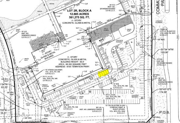
TRACT 1 (FEE SIMPLE):
BEING a tract of land situated in the Henry Cook Survey, Abstract No. 183, City of Plano, Collin County, Texas and being all of Lot 2R, Block A of ERICSSON VILLAGE ADDITION, LOTS 2R AND 3, BLOCK A, an addition to the City of Plano, Texas, according to the plat thereof recorded in Instrument No. 20150623010002250, Cabinet 2015, Page 346, Official Public Records of Collin County, Texas, and being part of a tract of land described in Warranty Deed to Ericsson Inc. recorded in Instrument No. 20150610000691140, Official Public Records of Collin County, Texas, and being more particularly described as follows:
BEGINNING at a 5/8” iron rod with “KHA” cap set at the northeast corner of aright-of-way corner clip at the intersection of the northright-of-way line of Tennyson Parkway (a variable widthright-of-way) and the westright-of-way line of Communications Parkway (a variable widthright-of-way);
THENCE with saidright-of-way corner clip, South 44°27’49” West, a distance of 35.24 feet to a 5/8” iron rod with “KHA” cap set in the said northright-of-way line of Tennyson Parkway;
THENCE with said northright-of-way line of Tennyson Parkway, the following courses and distances:
South 89°38’50” West, a distance of 175.00 feet to a 1/2” iron rod with “Pacheco Koch” cap found for corner;
South 88°01’19” West, a distance of 150.06 feet to a 1/2” iron rod with “Halff” cap found for corner;
South 89°38’50” West, a distance of 8.53 feet to a 5/8” iron rod with “KHA” cap set for corner; from which a 1/2” iron rod with “Halff” cap found for reference bears South 82°27’ East, a distance of 0.5 feet;
North 84°38’33” West, a distance of 110.55 feet to a standard City of Plano concrete monument found for corner;
South 89°38’48” West, a distance of 78.96 feet to a 5/8” iron rod with “KHA” cap set at the beginning of a tangent curve to the left having a central angle of 1°13’29”, a radius of 1121.75 feet, a chord bearing and distance of South 89°02’03” West, 23.98 feet;
In a southwesterly direction, with said curve to the left, an arc distance of 23.98 feet to an “X” cut in concrete found for corner in the east line of Lot 1, Block A of Ericsson Village, Lot 1, Block A, an addition to the City of Plano, Texas, according to the plat recorded in Instrument No. 20081202010004190, Official Public Records of Collin County, Texas and being the southwest corner of said Lot 2R;
THENCE departing said northright-of-way line of Tennyson Parkway and with said east line of Lot 1, the following courses and distances:
| | | | |
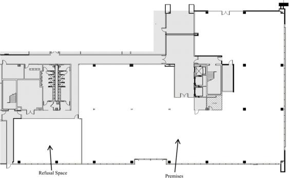
| | K-8 | | 6105 TENNYSON PARKWAY – SOUTH BUILDING PLANO, TX 75024 4812-0074-7958.V2 |