Coronado Global Resources Inc.
Statement of Coal Resources and Reserves for
the
Logan County Complex in Accordance with
the JORC Code and United States SEC Regulation
S-K 1300 as
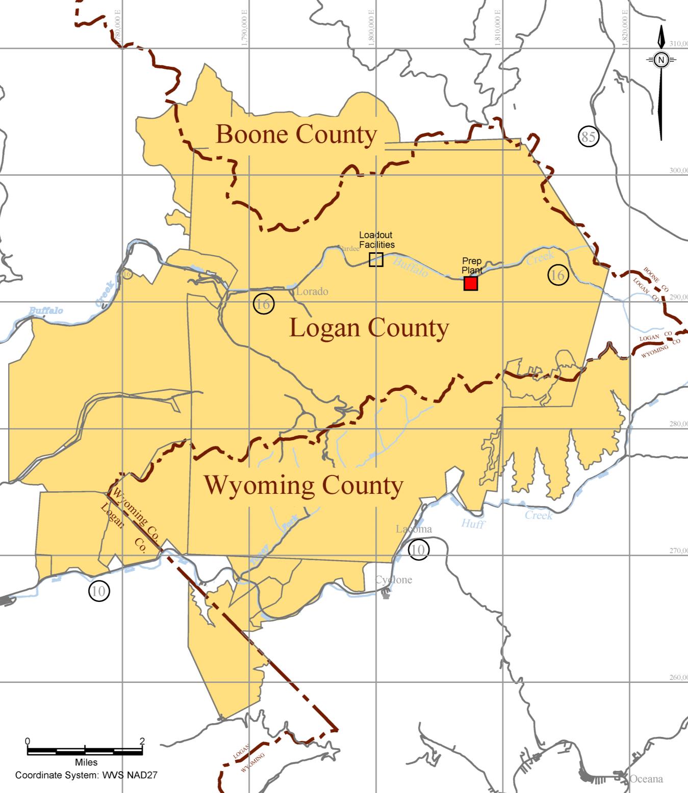
Central Appalachian Coal Basin
West Virginia, USA
M
ARSHALL
M
ILLER
&
A
SSOCIATES
,
I
NC
.
26
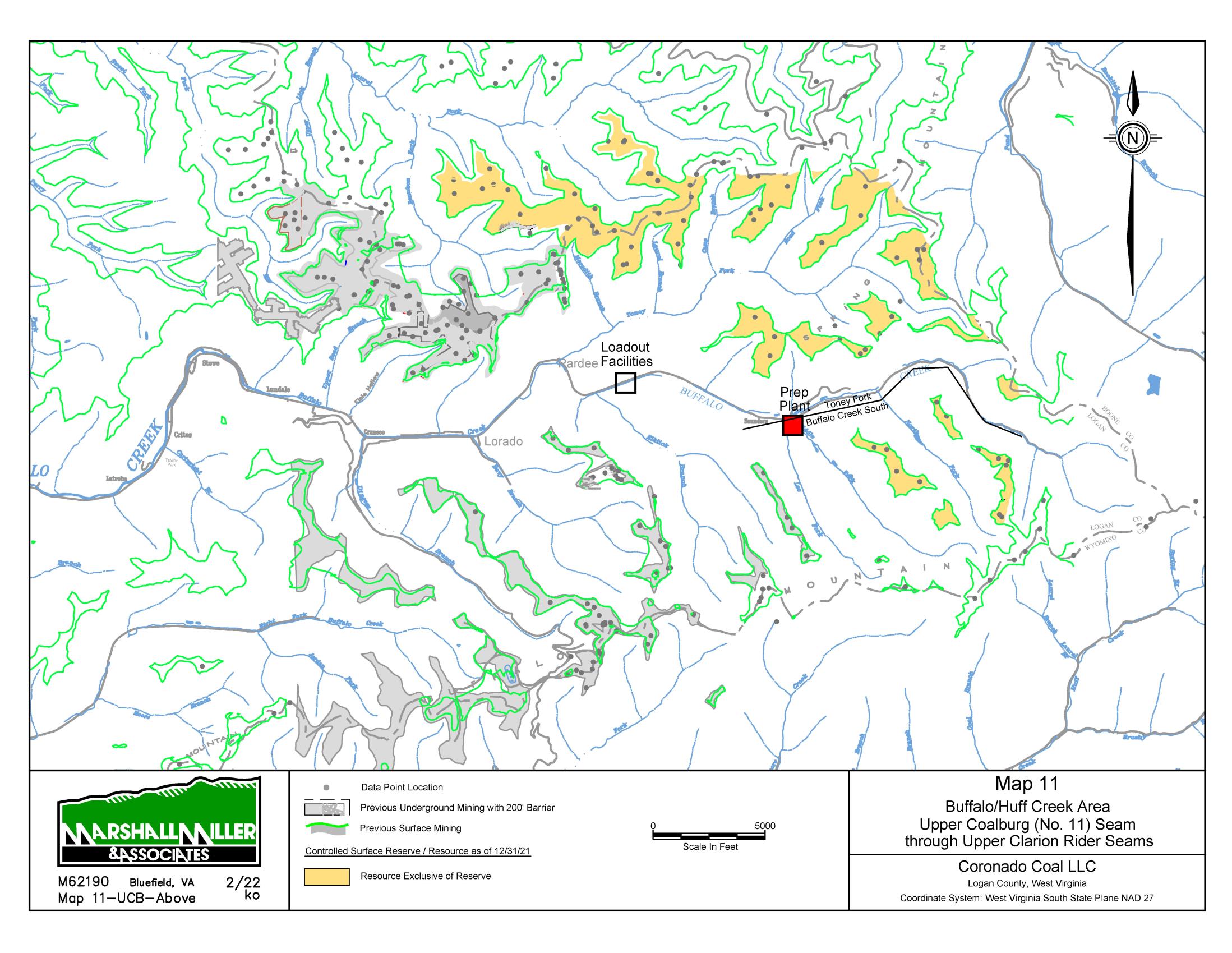
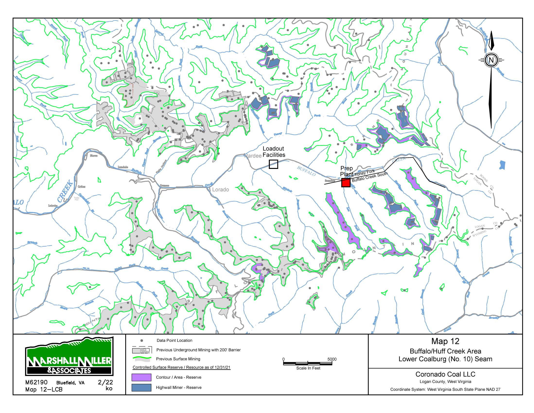
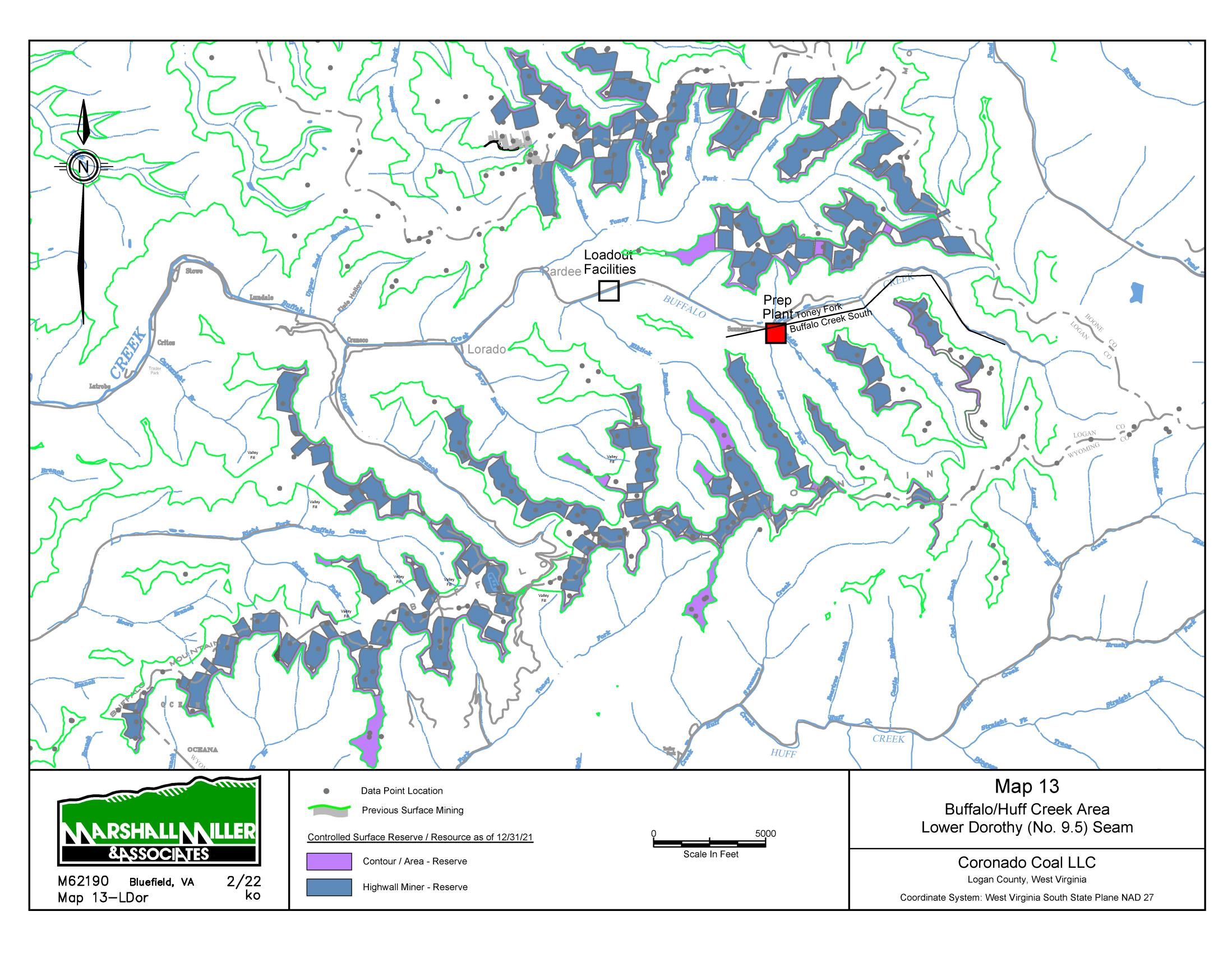
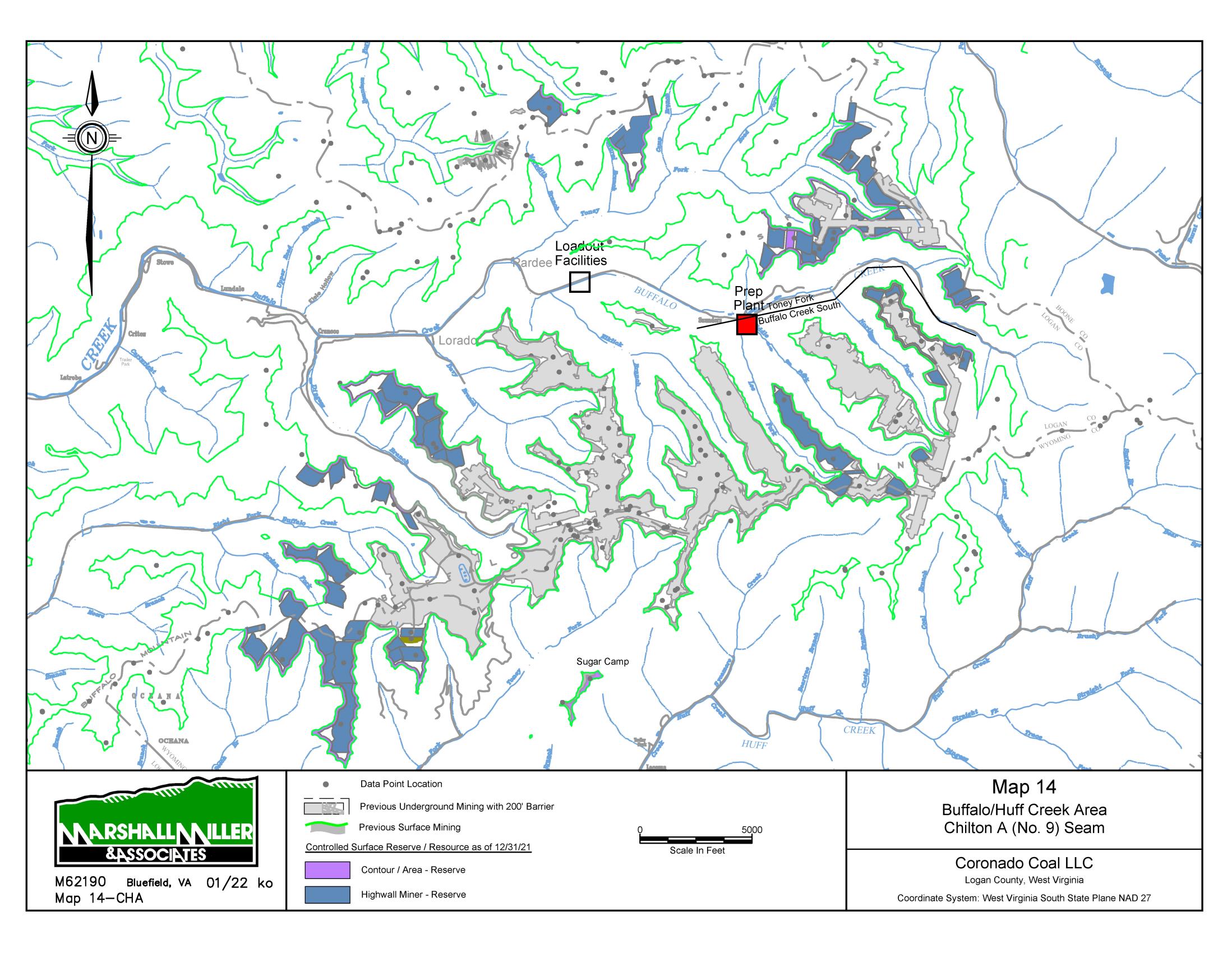
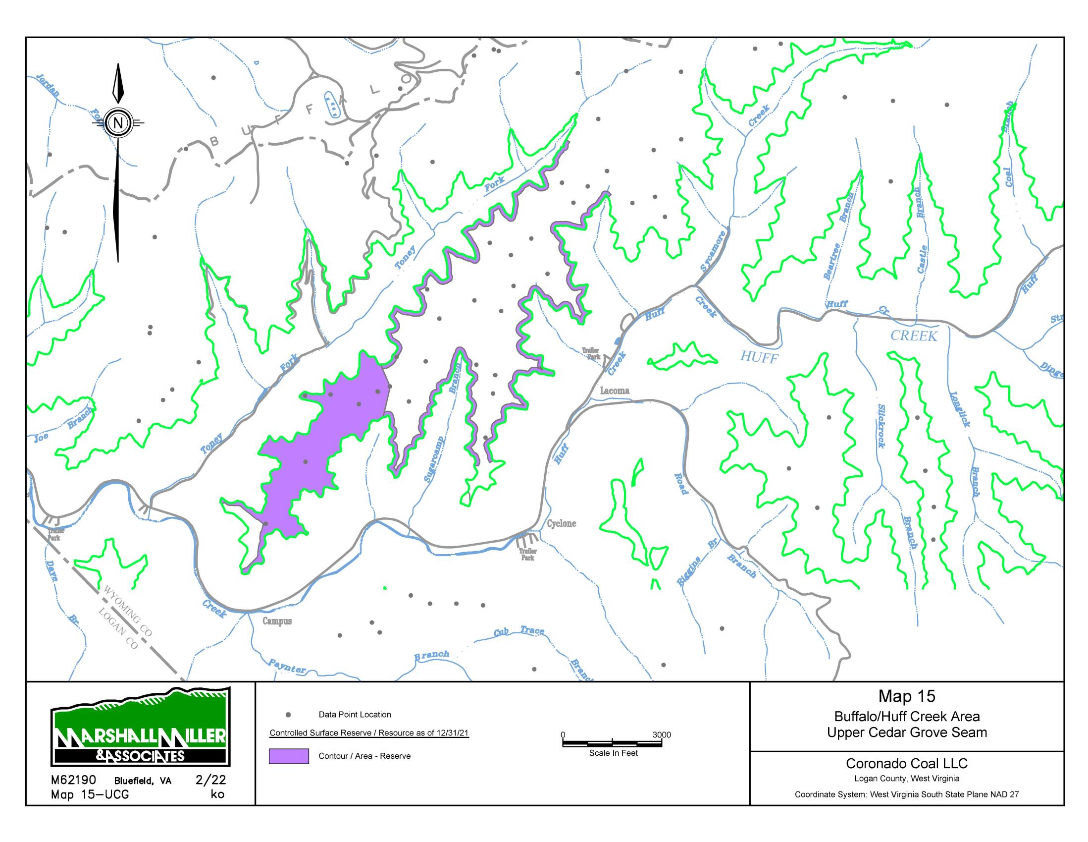
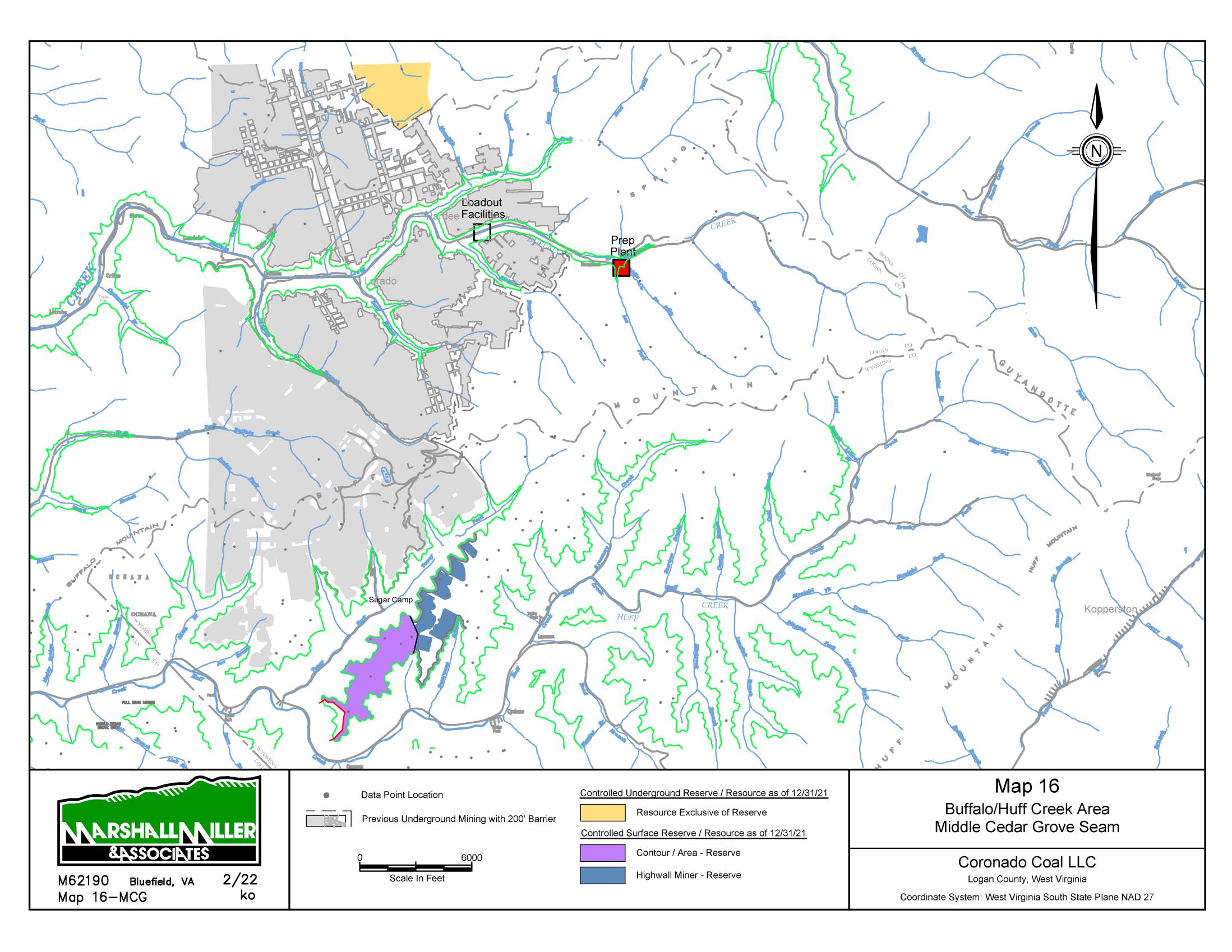
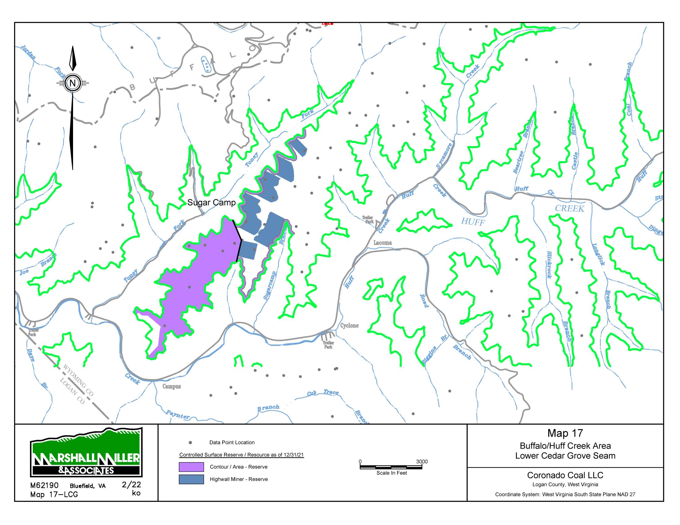
Table 11
-1:
General Reserve & Resource Criteria
Item
Parameters
Technical Notes & Exceptions*
•
General Reserve Criteria
Reserve Classification
Reserve and Resource
Coal resources as reported are inclusive of coal reserves.
Reliability Categories
Reserve (Proven and Probable)
Resource (Measured, Indicated & Inferred)
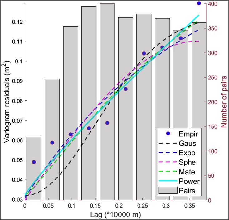
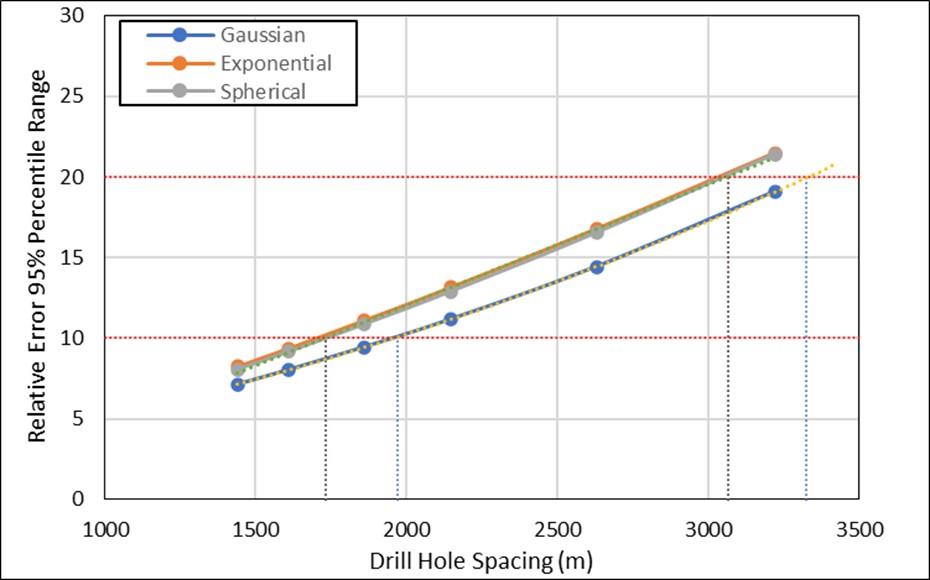
To better reflect
geological conditions of the coal deposits,
distance between points of observation is standard USGS
(in meters), respectively, for measured
and indicated and
inferred.
Effective Date of Resource Estimate
December 31, 2021
Coal resources were updated for depletion and non-material
resource additions based on information from Coronado.
Effective date for coal resources is as of December
31,
2021.
Effective Date of Reserve Estimate
December 31, 2021
Coal reserves were updated for depletion and non-material
reserve additions based on information from Coronado.
Effective date for coal reserves is as of December
31, 2021.
Seam Density
Variable, dependent upon seam characteristics
(based on available drill hole quality).
In the
absence of laboratory data, estimated by (1)
assuming specific gravity of 1.30 for coal and 2.25 to
2.5 for rock parting, or (2) 1280 kg/m
3
to 1324 kg/m
3
for a "clean" seam)
•
Underground-Mineable Criteria
Map Thickness
Total seam thickness
Minimum Seam Thickness
0.76 meters (thermal coal); 0.68 meters
Minimum Mining Thickness
1.4 to 1.8 meters
Minimum Total Coal
Thickness
0.76 meters (thermal coal); 0.68 meters
Minimum In-Seam Wash Recovery
50 percent; 40 percent where coal is belted directly
to preparation plant
Wash Recovery Applied to Coal
Reserves
Based on average yield for drill holes within reserve
area, or in the absence of laboratory washability
data, based on estimated visual recovery using
specific gravities noted above and 95 percent yield
on "clean" coal
•
Underground-Mineable Criteria
Out-of-Seam Dilution Thickness for
Run-of-Mine Tonnes
Applied to Coal
Reserves
0.05 meters minimum
2243 kg/m³ density used for dilution tonnage estimate
Mine Barrier
60.96-meter distance from abandoned mines and
sealed or pillared areas; 100-foot distance from
planned highwall miner panels
Minimum Reserve Tonnage
226,796 recoverable tonnes for individual area
(logical mining unit)
Minimum Overburden Depth
30.48 meters
Minimum Interval to Rider Coal
Considered on a case-by-case basis, depending on
interval lithology, etc.
<1.5 meters are resource
Minimum Interval to Overlying or
Underlying Reserves
Considered on a case-by-case basis, depending on
interval lithology, extent and
type of extraction, etc.
Minimum Interval to Overlying or
Underlying Mined Areas
Considered on a case-by-case basis, depending on
interval lithology, extent and
type of extraction, etc.
Adjustments Applied to Coal Reserves
6 percent moisture increase; 5 percent preparation
plant inefficiency
Surface Mineable Criteria
Topographic Map Source
Reserves estimated based on aerial topography,
where available, and best available aerial
topography for other areas.
Pre-law highwalls also
based on aerial topography, where
available
Map Thickness
Total mineable seam
thickness (excluding removal
partings)
Mine Recovery Applied to Coal
Reserves
90 percent; 25 percent for previously underground